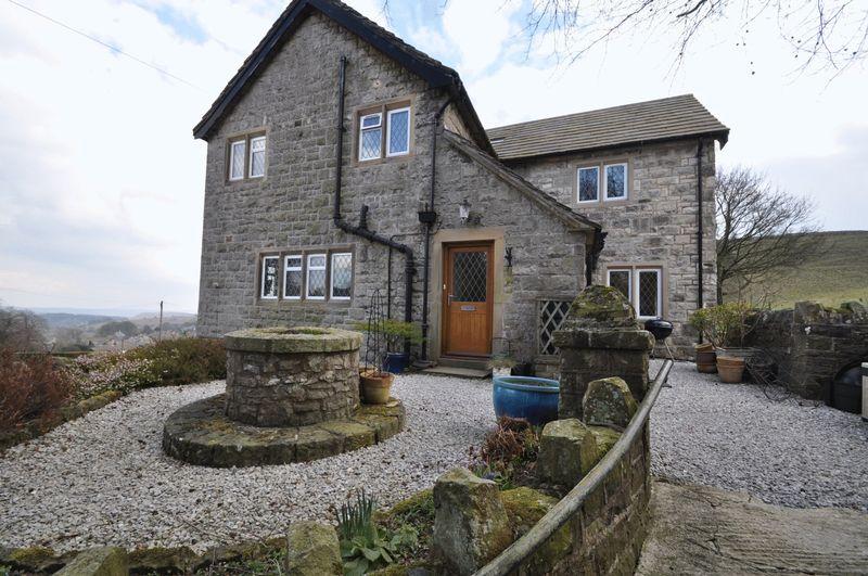
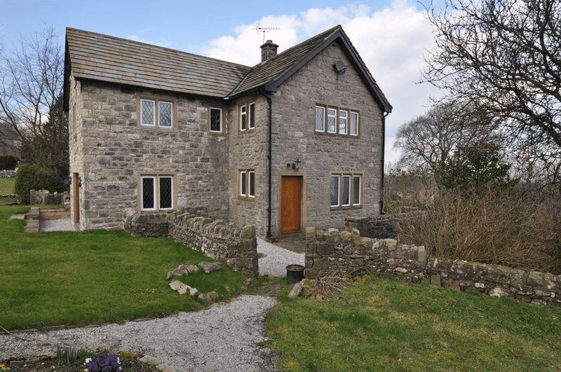
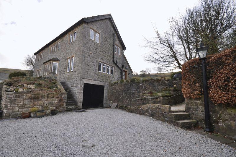
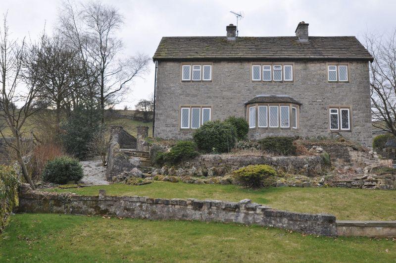
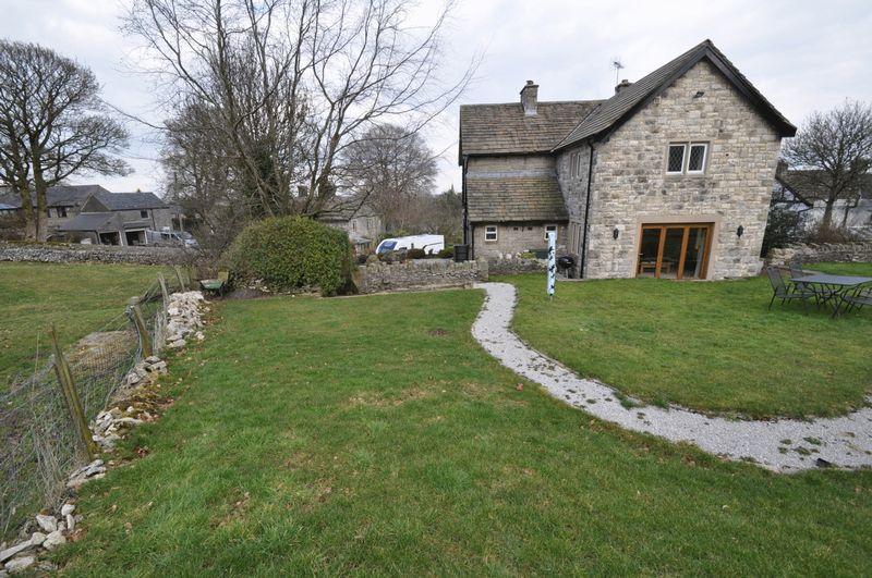
Priestdale House
SCHOOL LANE, BUXTON, TADDINGTON, DERBYSHIRE SK17 9TW
£499,950
Property details
Floor area
178 m²
Year built
England and Wales: 1983-1990
Last sold
£491,100 Sep 2015
Price per m²
£2,809/m²
Local average
£444,400 (+12.5%)
Deprivation
Decile 5 (14,553 of 33,755)
Street crime
1 incident within 1 mile (Apr 2026)
Additional details
- Parking
- Yes
Description
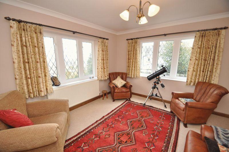
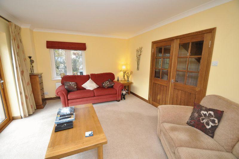
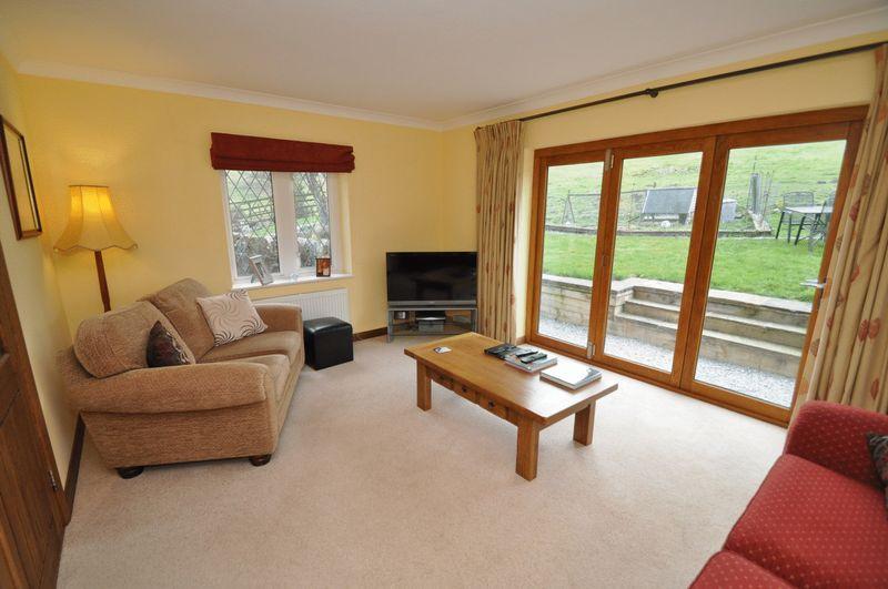
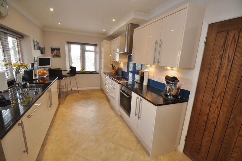
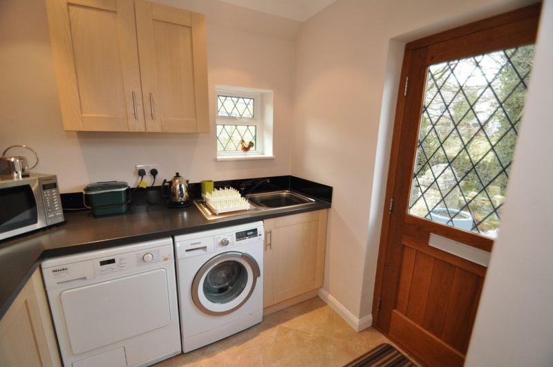
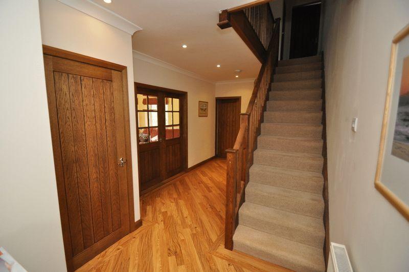
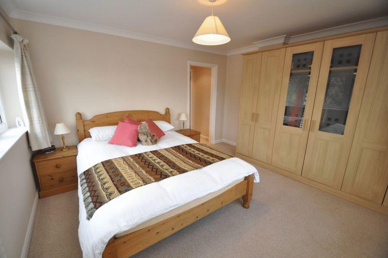
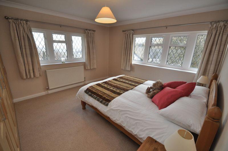
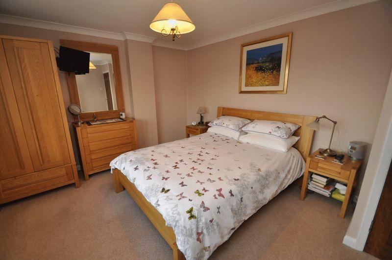
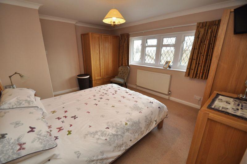
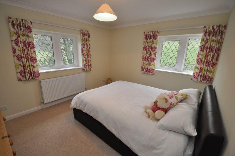
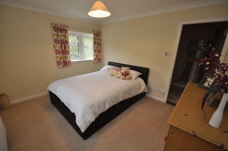
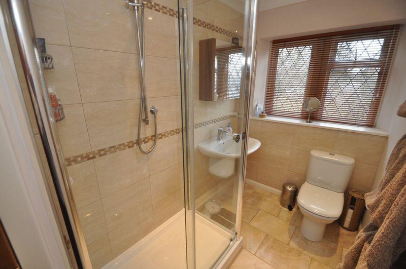
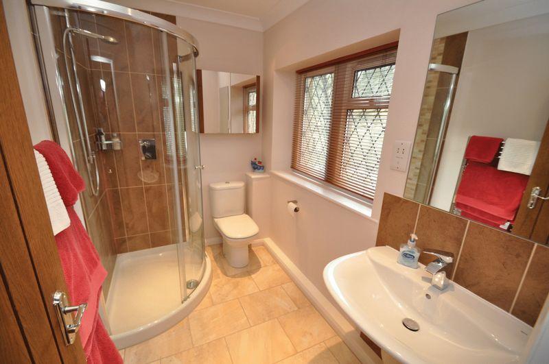
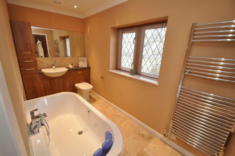
The impressive accommodation is well presented and of a good size and comprises ample living space and well appointed bedrooms.
Please see the many photographs that accompany this listing and the indicative floor plan for further detail. The best way to appreciate this property is to arrange a viewing appointment which you can do seven days a week by calling the number above or clicking on the contact link provided.
Please quote property reference number: 00008252
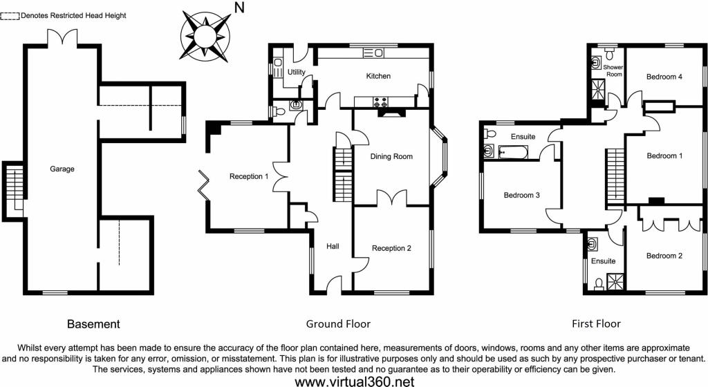
Basement
Approximate Floor Area
633.67 sq. ft.
(58.87 sq. m)
11'0" x 7'10"
(3.36m x 2.38m)
12'10" x 8'2"
(3.90m x 2.50m)
Garage
37'9" x 10'10"
(11.50m x 3.31m)
Ground Floor
Approximate Floor Area
1032.90 sq. ft.
(95.96 sq. m)
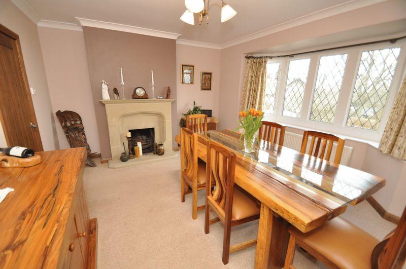
Reception 2
13'1" x 11'9"
(3.98m x 3.57m)
Reception 1
16'2" x 12'1"
(4.92m x 3.68m)
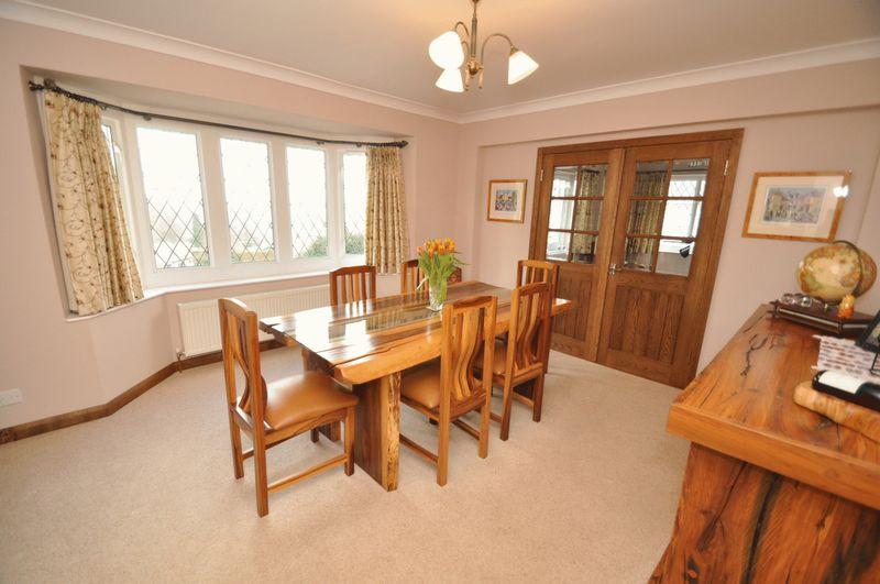
Dining Room
14'10" x 11'9"
(4.52m x 3.57m)
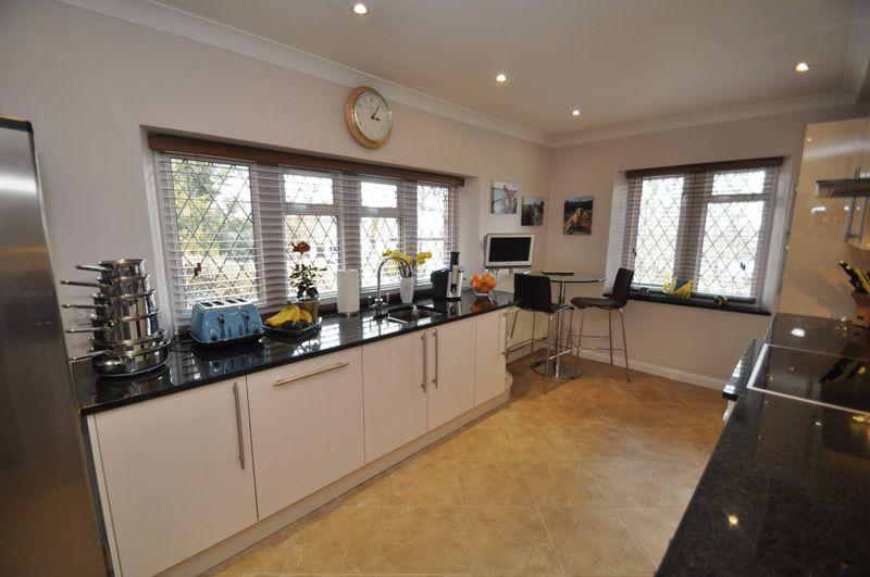
Kitchen
17'5" x 9'3"
(5.30m x 2.83m)
Utility
7'10" x 6'4"
(2.40m x 1.93m)
First Floor
Approximate Floor Area
933.98 sq. ft.
(86.77 sq. m)
Ensuite
8'1" x 5'1"
(2.47m x 1.56m)
Bedroom 2
13'3" x 11'11"
(4.03m x 3.63m)
Bedroom 1
14'11" x 11'11"
(4.55m x 3.63m)
Bedroom 3
11'10" x 10'6"
(3.61m x 3.19m)
Ensuite
11'11" x 5'4"
(3.62m x 1.62m)
Shower Room
7'1" x 5'0"
(2.15m x 1.52m)
Bedroom 4
12'0" x 7'1"
(3.65m x 2.15m)
Listed by
National
emoov.co.uk
Reference: 34839927
EPC ratings on this postcode
We don't have a matched EPC for this property yet. Below are efficiency scores and details for other addresses on this postcode.
| Address | Current | Potential | Floor area | Age band | Type |
|---|---|---|---|---|---|
| 1 Hillside Croft, School Lane, TADDINGTON | 87 | 98 | 98 m² | — | Detached |
| 10, School Lane, Taddington, BUXTON | 32 | 75 | 88 m² | England and Wales: 1950-1966 | Detached |
| 11 School Lane, Taddington, BUXTON | 31 | 63 | 88 m² | England and Wales: 1930-1949 | Detached |
| 12, School Lane, Taddington, BUXTON | 38 | 66 | 89 m² | England and Wales: 1930-1949 | Detached |
| 2 Hillside Croft, School Lane, TADDINGTON | 87 | 98 | 98 m² | — | Detached |
| 7 School Lane, Taddington, BUXTON | 50 | 86 | 81 m² | England and Wales: 1950-1966 | Terraced |
| 7, School Lane, Taddington, BUXTON | 26 | 68 | 88 m² | England and Wales: 1950-1966 | Detached |
| Ashfield House, School Lane, Taddington, BUXTON | 66 | 74 | 244 m² | England and Wales: 1983-1990 | Detached |
| Priestdale House, School Lane, Taddington, BUXTON | 67 | 90 | 178 m² | England and Wales: 1983-1990 | Detached |
| Priestdale House, School Lane, Taddington, BUXTON | 63 | 88 | 174 m² | England and Wales: 1950-1966 | Detached |
| Priestdale House, School Lane, Taddington, BUXTON | 64 | 81 | 179 m² | England and Wales: 1950-1966 | Detached |
| Priestdale House, School Lane, Taddington, BUXTON | 66 | 83 | 147 m² | England and Wales: 1950-1966 | Detached |
| The Gables, School Lane, Taddington, BUXTON | 44 | 66 | 161 m² | England and Wales: 1930-1949 | Detached |
| The Old Parsonage, School Lane, Taddington, BUXTON | 50 | 69 | 260 m² | England and Wales: before 1900 | Detached |
| The Old Parsonage, School Lane, Taddington, BUXTON | 54 | 78 | 277 m² | England and Wales: before 1900 | Detached |
Flood risk
Zone: 1
Risk: Low
Job (default Low)
Floorplans
Floorplan 1
EPC Graphs

EPC 1
Price history
7% since 2007
| Event | Date | Price | % change |
|---|---|---|---|
| Sold | 23/09/2015 (10 years ago) | £491,100 | +6.8% |
| Sold | 23/08/2007 (18 years ago) | £460,000 | — |
Source: HM Land Registry Price Paid Data. Crown copyright.
Sold Comparables
Same street and nearby sales within 0.25 miles (last 5 years). Data from Land Registry Price Paid.
| Address | Price | Date | Type |
|---|---|---|---|
| SYCAMORE FARM MAIN STREET, TADDINGTON, BUXTON, DERBYSHIRE DALES, DERBYSHIRE, SK17 9TY | £645,000 | 23/10/2025 | Detached |
| THE NOOK MAIN STREET, TADDINGTON, BUXTON, DERBYSHIRE DALES, DERBYSHIRE, SK17 9TU | £300,000 | 16/09/2022 | Detached |
| Same street 11 SCHOOL LANE, TADDINGTON, BUXTON, DERBYSHIRE DALES, DERBYSHIRE, SK17 9TW | £302,500 | 26/08/2022 | Semi-detached |
| CROSSE CHANCE COTTAGE MAIN ROAD, TADDINGTON, BUXTON, DERBYSHIRE DALES, DERBYSHIRE, SK17 9TR | £251,500 | 29/07/2022 | Detached |
| MARLBOROUGH HOUSE MAIN STREET, TADDINGTON, BUXTON, DERBYSHIRE DALES, DERBYSHIRE, SK17 9TU | £445,000 | 20/04/2022 | Detached |
| LANE HEAD COTTAGE HUMPHREY GATE, TADDINGTON, BUXTON, DERBYSHIRE DALES, DERBYSHIRE, SK17 9TS | £330,000 | 11/03/2022 | Detached |
| Same street ASHFIELD HOUSE SCHOOL LANE, TADDINGTON, BUXTON, DERBYSHIRE DALES, DERBYSHIRE, SK17 9TW | £678,000 | 30/09/2021 | Detached |
Street average: £490,250 (2 sales)
Area average: £394,300 (5 sales)
Capital growth trend
Land Registry outcode average: last 12 months vs 5y and 10y ago (from sold prices).
House Price Index (HM Land Registry — official index, not sold-price averages): Derbyshire Dales. Series: Detached. As of March 2026.
Rental Range
Estimated market rent for Derbyshire Dales. Low = conservative, Realistic = average, Optimistic = best case.
Based on Local Authority from postcode lookup → Derbyshire Dales.
LHA (30th percentile) floor for Peaks & Dales: £898/mo (Apr 2025 – Mar 2026)
Location
Address
School Lane
Nearby
Nearest stations, universities and amenities (distance from property).
| Type | Name | Distance |
|---|---|---|
| Bus stop | Main Road | 0.0 miles |
| Shop | The Tech Division | 2.6 miles |
| Shop | NT Gibbs | 2.9 miles |
| Hospital | Buxton Hospital & Corbar Birth Centre | 4.8 miles |
| Train station | Buxton | 5.2 miles |
| University | University of Derby, Buxton | 5.3 miles |
| Train station | Buxton Miniature Railway | 5.3 miles |
| Hospital | Corbar hall | 5.5 miles |
| University | University of Derby | 11.1 miles |
Street-level crime
| Category | Count |
|---|---|
| Violence and sexual offences | 1 |
| Total incidents | 1 |
Within 1 mile during Apr 2026. Source: data.police.uk (England & Wales).
Schools nearby
Nearest open schools with Ofsted ratings (England). Closed schools are not shown. Data from Get Information about Schools and Ofsted.
| Name | Type | Distance | Ofsted |
|---|---|---|---|
| Taddington and Priestcliffe School | Primary | 0.1 miles | Good — 10 Sep 2024 |
| Flagg Nursery School | Nursery | 1.8 miles | Outstanding — 8 Jul 2015 |
| Litton CofE Primary School | Primary | 3.0 miles | Outstanding — 28 May 2012 |
| Monyash CofE Primary School | Primary | 3.0 miles | Good — 22 Mar 2017 |
| Bishop Pursglove CofE (A) Primary School | Primary | 3.1 miles | Good — 15 Jun 2015 |
Rental Comparables
Loading rental comparables for this postcode. Refresh in a few minutes.
Rent-driven metrics
Based on Area rent estimate.
- Rent ratio — Monthly rent ÷ purchase price (1% rule). 1%+ = strong, 0.8–1% = okay, <0.8% = weak for cashflow.
- Max investor price — Rent ÷ 0.8%; the price at which rent would be 0.8% of price (Stoke-style target).
- Target investor price — Rent ÷ 1%; the price at which rent would be 1% of price (strong cashflow band).
- Gross yield — Annual rent as % of purchase price (no costs).
Enter House Number
Enter the house number to help us retrieve more accurate pricing history and property data.
Please log in to submit or correct the house number for this listing.
Log in to continue