Stone Road
Trent Vale, ST4 6SN
£700 pcm
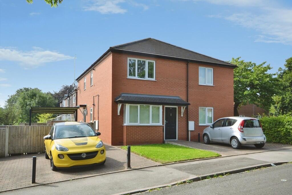
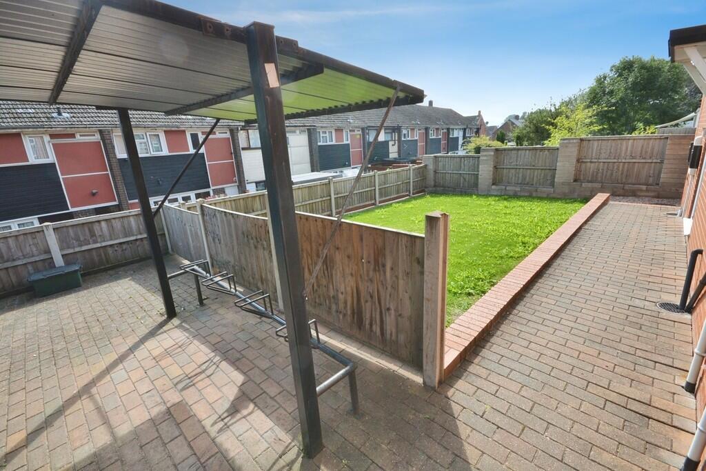
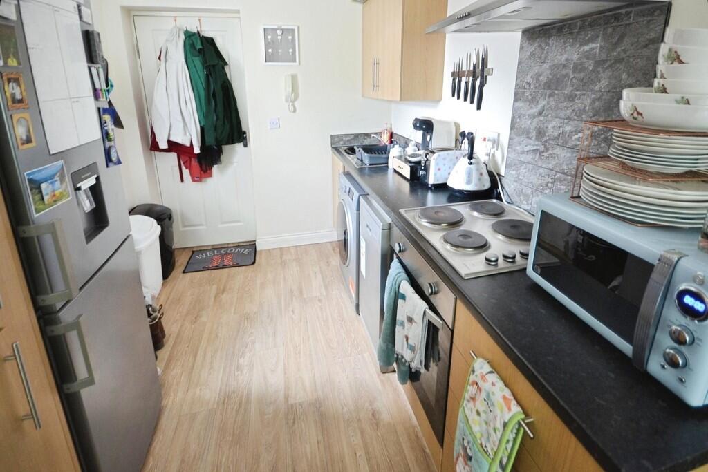
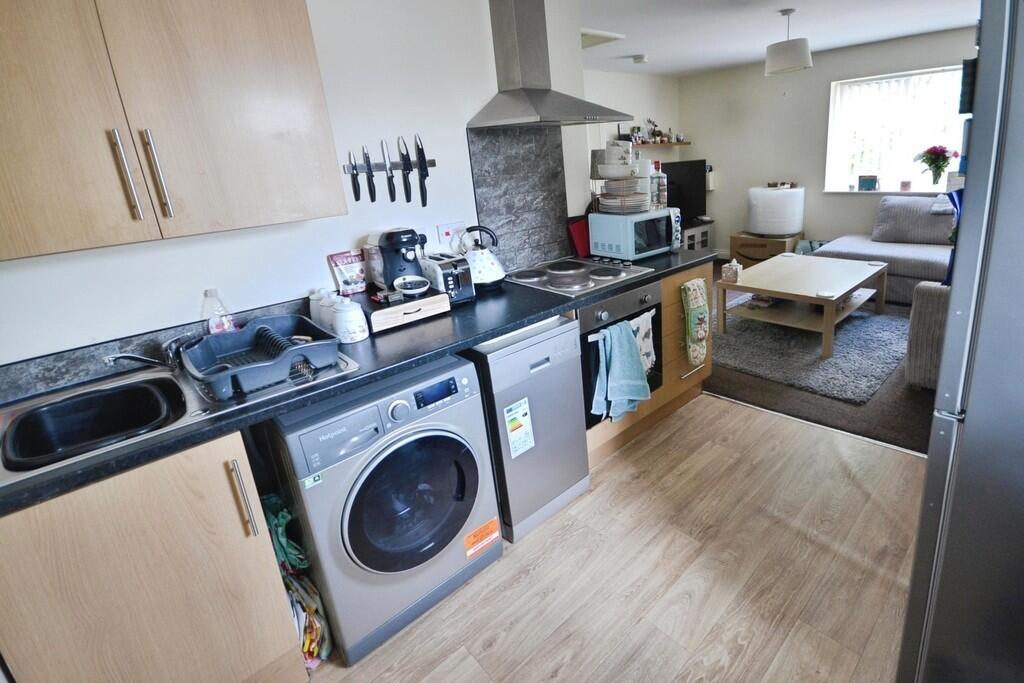
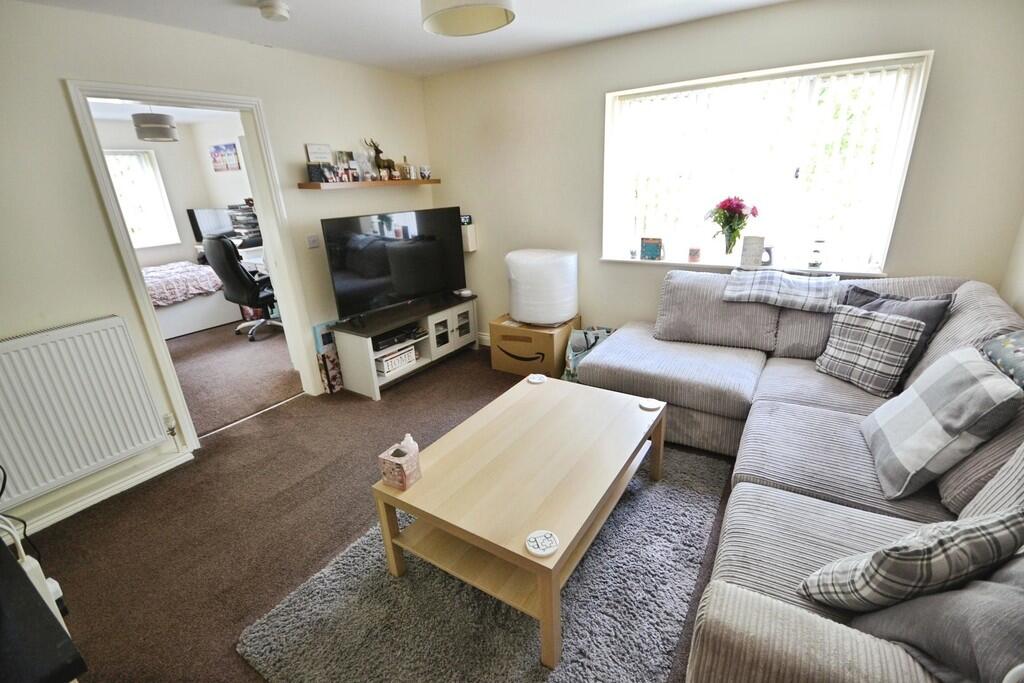
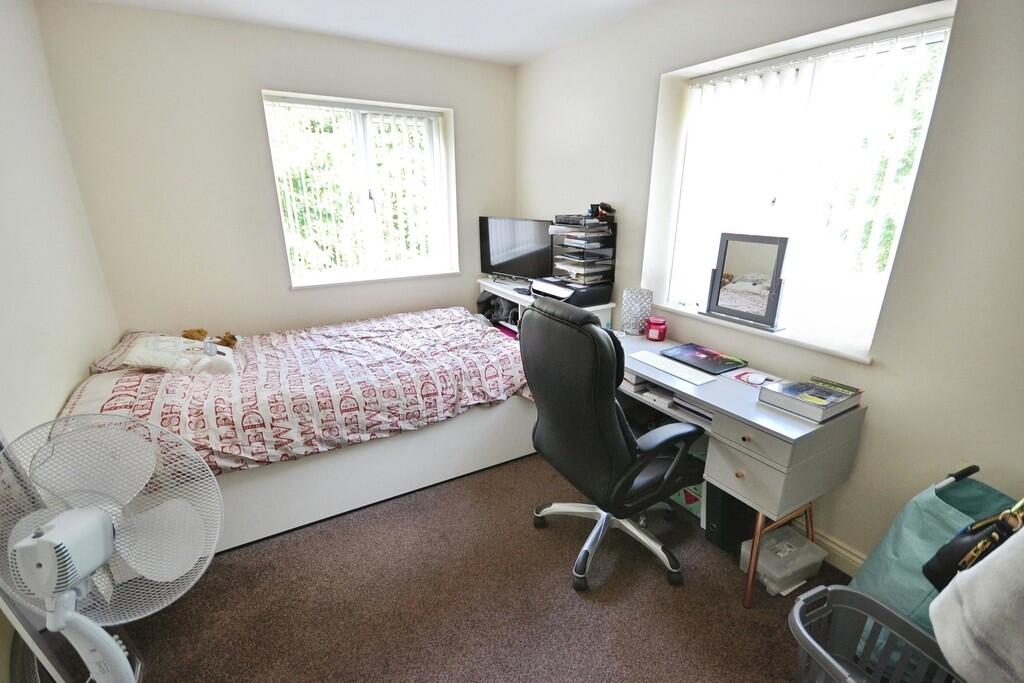
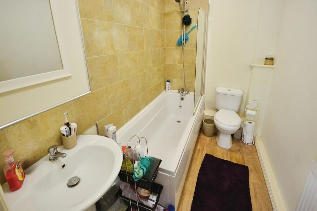
Photo 1 Photo 2 Photo 3 Photo 4 Photo 5 Photo 6 Photo 7
/ 7
Property details
Council tax band
A
Deprivation
Decile 4 (10,611 of 33,755)
Street crime
145 incidents within 1 mile (Mar 2026)
Key features
- First Floor Apartment
- One Bedroom
- Lounge/Diner
- Kitchen
- Off Road Parking
- Modern Built Apartment
- Convenient Location
- Under Cover Bicycle Store
- Council tax band A
Additional details
- Parking
- Off street, Allocated
- Garden
- Yes
Description
COMMUNAL ENTRANCE LANDING Double glazed window to side elevation, doors to apartments.
KITCHEN/ LOUNGE DINER
KITCHEN AREA 8' 5" x 7' 7" (2.578m x 2.336m) Door to rear elevation, double glazed window to side elevation, comprising arrange of wall, base and drawer units with roll top work surface over, incorporating stainless steel sink and drainer with mixer tap, tiled splash back, stainless steel hob with stainless steel extractor fan over, built-in stainless steel oven, recess for washing machine and fridge, spotlights to ceiling.
LOUNGE/DINER 13' 1" x 12' 0" (4.004m x 3.663m) Double glazed window to front elevation, TV and phone point, cupboard housing gas boiler, radiator.
BEDROOM 12' 9" x 8' 6" (3.911m x 2.609m) Double glazed window to front and side elevation, TV point, radiator.
BATHROOM 7' 11" x 5' 1" (2.433m x 1.572m) Double glazed window to side elevation, comprising low level WC, pedestal wash hand basin with tiled splash back, panelled bath with shower mixer tap and shower screen, part tiled walls, radiator.
EXTERNALLY To the front of the property is an allocated parking space for the apartment, whilst to the side of the property is a communal garden area being laid to lawn, also a communal cycle shed.
PARKING AREA One allocated parking space to front of the property.
CYCLE SHED ** Communal cycle shed.
Listed by
Stoke On Trent
The Property Franchise Group
Reference: 173634014
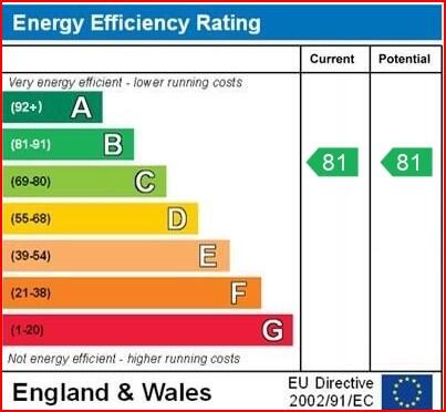
EPC ratings on this postcode
We don't have a matched EPC for this property yet. Below are efficiency scores and details for other addresses on this postcode.
| Address | Current | Potential | Floor area | Age band | Type |
|---|---|---|---|---|---|
| 24 Stone Road, STOKE-ON-TRENT | 81 | 81 | 36 m² | — | Flat |
| 26 Stone Road, STOKE-ON-TRENT | 81 | 81 | 36 m² | England and Wales: 2007-2011 | Flat |
| 26 Stone Road, STOKE-ON-TRENT | 81 | 81 | 36 m² | — | Flat |
| 28 Stone Road, STOKE-ON-TRENT | 80 | 80 | 36 m² | England and Wales: 2007-2011 | Flat |
| 28 Stone Road, STOKE-ON-TRENT | 1 | 96 | 70 m² | England and Wales: before 1900 | Terraced |
| 28 Stone Road, STOKE-ON-TRENT | 81 | 81 | 36 m² | — | Flat |
| 52a Stone Road, Stoke-on-Trent | 58 | 87 | 68 m² | England and Wales: 1950-1966 | Detached |
| Flat, 50a, Stone Road, STOKE-ON-TRENT | 42 | 57 | 81 m² | England and Wales: 1950-1966 | Flat |
Flood risk
Zone: 1
Risk: Low
Job (default Low)
EPC Graphs
FLAT 3 26 Stone R...
Rental Range
Estimated market rent for Stoke-on-Trent. Low = conservative, Realistic = average, Optimistic = best case.
Based on Local Authority from postcode lookup → Stoke-on-Trent.
LHA (30th percentile) floor for Staffordshire North: £424/mo (Apr 2025 – Mar 2026)
Location
Address
Stone Road
Nearby
Nearest stations, universities and amenities (distance from property).
| Type | Name | Distance |
|---|---|---|
| Shop | Bargain Booze | 0.0 miles |
| Shop | Trent Vale News | 0.1 miles |
| Bus stop | Unknown | 0.3 miles |
| Hospital | North Staffordshire Nuffield Hospital | 0.9 miles |
| Hospital | Harplands Hospital | 1.2 miles |
| Train station | Trentham Leisure | 1.7 miles |
| Train station | Stoke-on-Trent | 1.9 miles |
| University | University of Staffordshire Stoke Campus | 2.0 miles |
Street-level crime
| Category | Count |
|---|---|
| Violence and sexual offences | 61 |
| Anti-social behaviour | 20 |
| Shoplifting | 15 |
| Criminal damage and arson | 13 |
| Public order | 10 |
| Other theft | 7 |
| Other crime | 5 |
| Burglary | 4 |
| Vehicle crime | 4 |
| Drugs | 2 |
| Possession of weapons | 2 |
| Bicycle theft | 1 |
| Robbery | 1 |
| Total incidents | 145 |
Within 1 mile during Mar 2026. Source: data.police.uk (England & Wales).
Schools nearby
Nearest open schools with Ofsted ratings (England). Closed schools are not shown. Data from Get Information about Schools and Ofsted.
| Name | Type | Distance | Ofsted |
|---|---|---|---|
| St Teresa's Catholic (A) Primary School | Primary | 0.2 miles | Good — 5 May 2017 |
| St Joseph's Preparatory School | Other | 0.3 miles | — (No rating) |
| St Joseph's College | Secondary | 0.3 miles | Outstanding — 6 Mar 2014 |
| Oakhill Primary School | Primary | 0.4 miles | Good — 4 Dec 2023 |
| Clayton Hall Academy | Secondary | 0.8 miles | Good — 18 Mar 2024 |
Rental Comparables
Residential lets from OpenRent and Rightmove for the area (same bedroom count). Use to validate rent estimates. Student lets are excluded.
Average rent: £610/mo (45 listings)
Enter House Number
Enter the house number to help us retrieve more accurate pricing history and property data.
Please log in to submit or correct the house number for this listing.
Log in to continue