5 PALMERS ROAD
EMSWORTH, HAMPSHIRE PO10 7DL
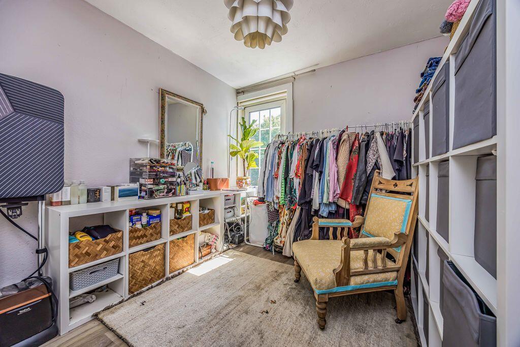
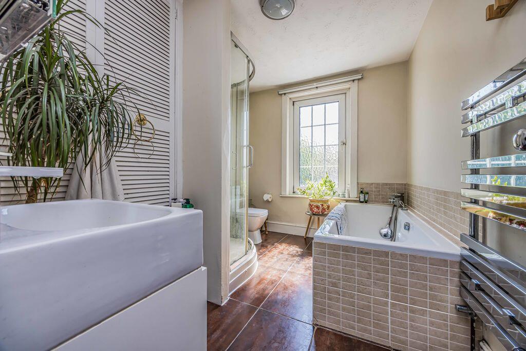
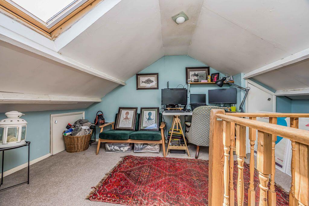
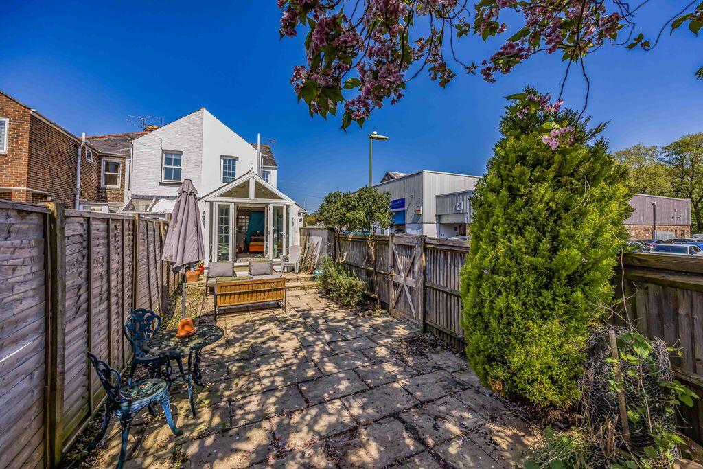
Property details
Tenure
FREEHOLD
Floor area
121 m²
Council tax band
C
Last sold
£275,000 Oct 2020
Local average
£393,766 (-17.5%)
Deprivation
Decile 8 (25,012 of 33,755)
Street crime
65 incidents within 1 mile (May 2026)
Key features
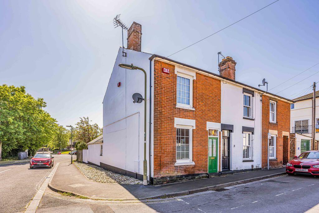
- Charming end of terrace home
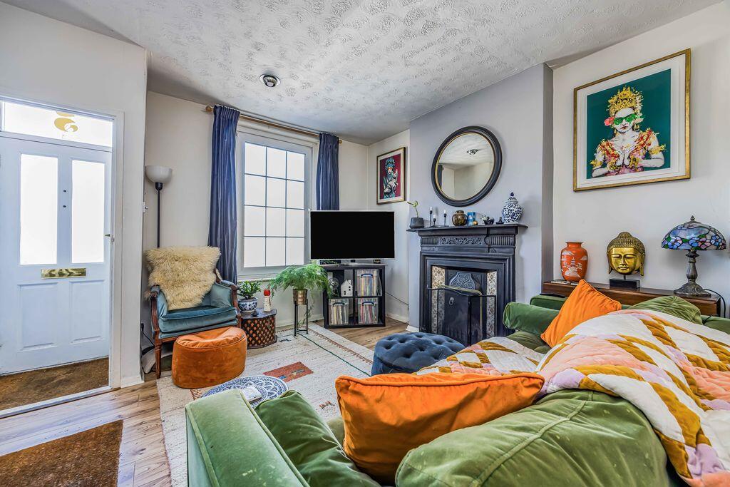
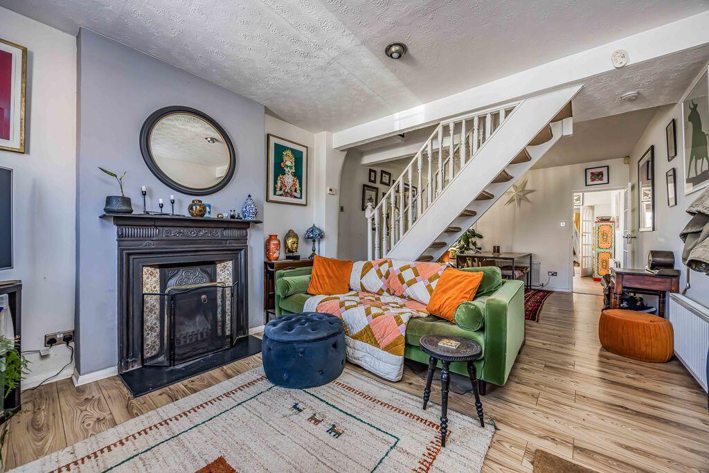
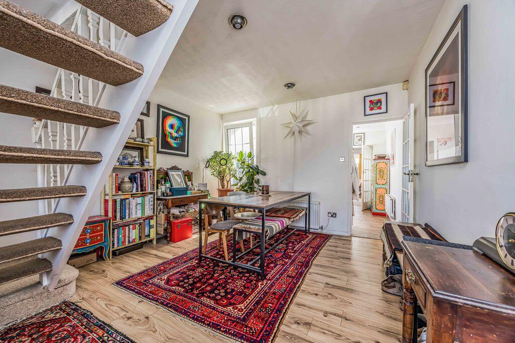
- Spacious sitting room
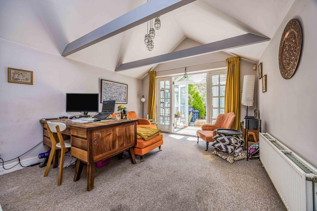
- Separate dining room
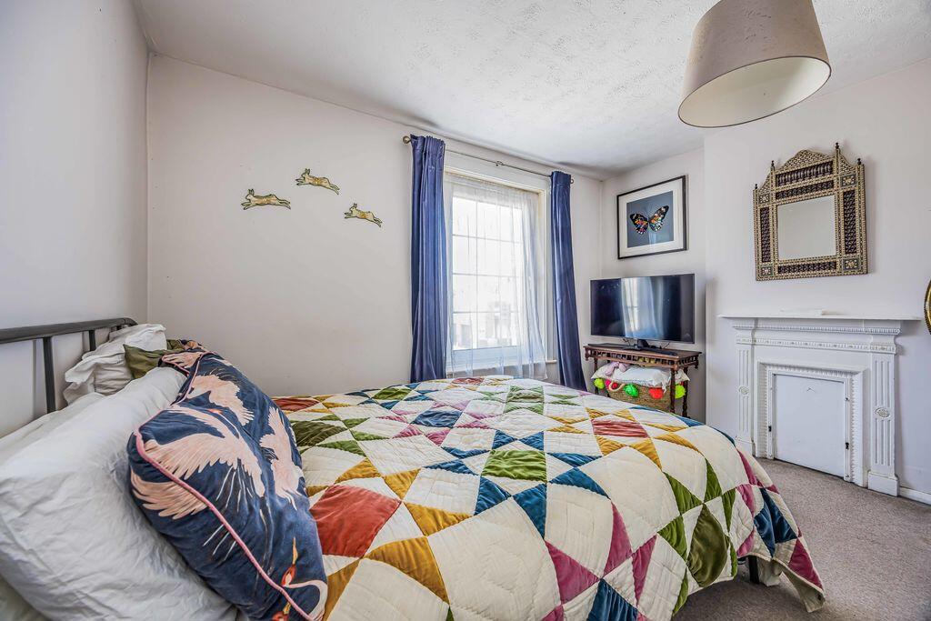
- Two double bedrooms
- First floor bathroom
- Loft room
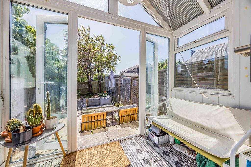
- Double glazed conservatory
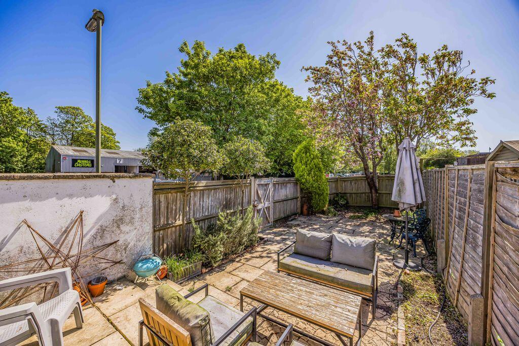
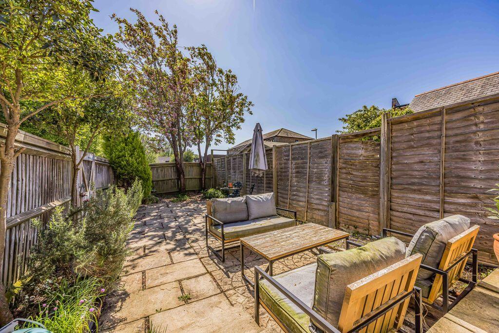
- South facing rear garden
- Convenient central Emsworth location
Additional details
- Garden
- Yes
Description
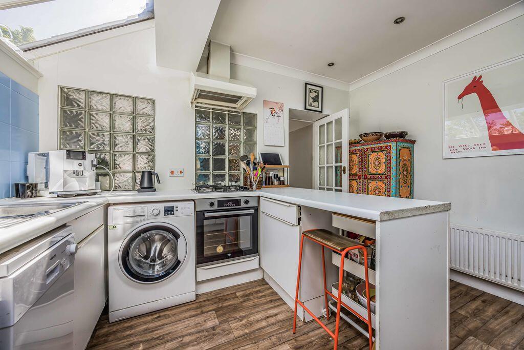
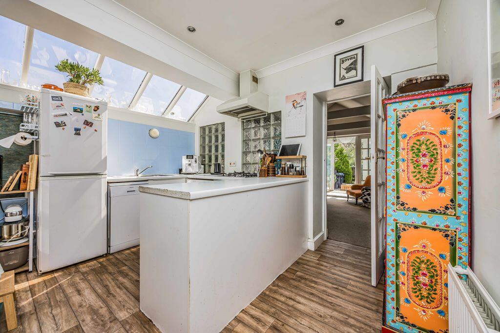
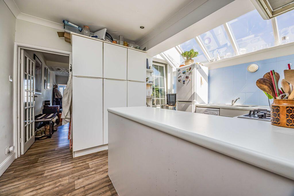
The front door opens into the porch with inner door opening into the spacious sitting room with feature fireplace and central staircase leading to the first floor. A doorway opens into the kitchen which is fitted with a range of units with planned appliance space, and has a door into the dining room which has a vaulted ceiling with exposed beams. Completing the ground floor layout is the conservatory which overlooks the rear garden with doors opening out.
On the first floor there are two double bedrooms, served by a bathroom featuring a bath and separate shower cubicle. From the landing, stairs lead to a loft room, which has a Velux window and useful eaves storage cupboards.
Outside
The rear garden enjoys a southerly aspect and is planned with ease of maintenance in mind being predominantly paved with brick edged borders.
Area
The town of Emsworth is at the head of Chichester Harbour, an area of outstanding natural beauty. An excellent range of amenities are in Emsworth, including local shops, pubs and restaurants, churches, doctors' surgery, and two sailing clubs. The town has primary schools, and secondary schools are in neighbouring Warblington and Southbourne. There is a railway station in Emsworth with links to London, Portsmouth, and further afield, and good bus links to the South Coast. The cathedral city of Chichester is approximately seven miles to the east with its famous Festival Theatre and nearby Goodwood Estate, and the South Downs National Park is just a short drive away.
Listed by
Emsworth
Treagust & Co
Reference: 87789252
EPC Rating & Upgrade Cost
Fetching EPC data… Refresh this page in a moment.
Flood risk
Zone: 1
Risk: Low
Job (default Low)
Floorplans
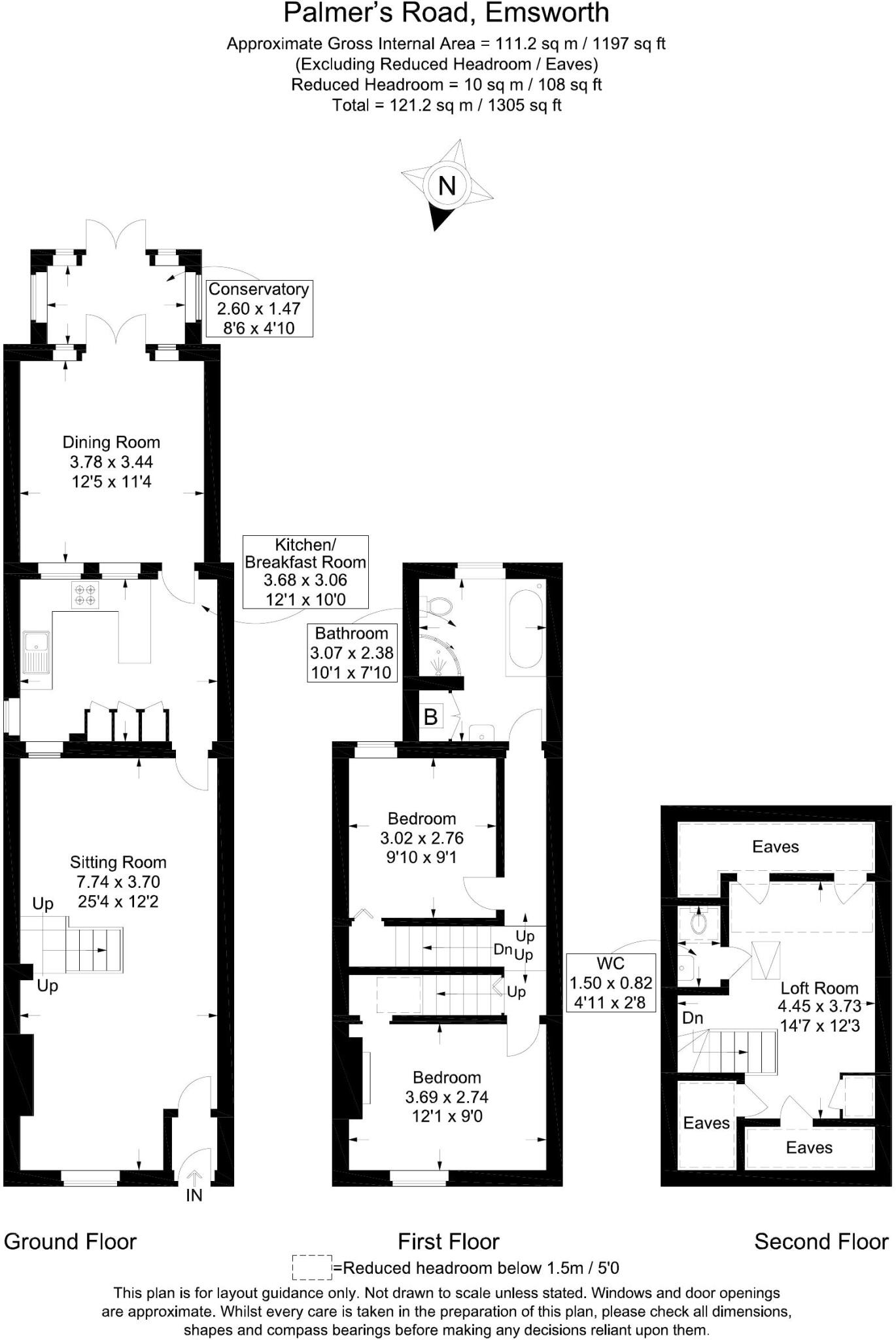
Floorplan 1
EPC Graphs

Energy Performance Certificate
Price history
15% since 2016
| Event | Date | Price | % change |
|---|---|---|---|
| Sold | 26/10/2020 (5 years ago) | £275,000 | +14.6% |
| Sold | 15/01/2016 (10 years ago) | £240,000 | — |
Source: HM Land Registry Price Paid Data. Crown copyright.
Sold Comparables
Same street and nearby sales within 0.25 miles (last 5 years). Data from Land Registry Price Paid.
| Address | Price | Date | Type |
|---|---|---|---|
| Same street 16C PALMERS ROAD, EMSWORTH, HAVANT, HAMPSHIRE, PO10 7DL | £425,000 | 03/11/2023 | Terraced |
| Same street 9 PALMERS ROAD, EMSWORTH, HAVANT, HAMPSHIRE, PO10 7DL | £245,000 | 10/12/2021 | Terraced |
Street average: £335,000 (2 sales)
Capital growth trend
Land Registry outcode average: last 12 months vs 5y and 10y ago (from sold prices).
House Price Index (HM Land Registry — official index, not sold-price averages): Havant. Series: Terraced. As of April 2026.
Rental Range
Estimated market rent for Havant. Low = conservative, Realistic = average, Optimistic = best case.
Based on Local Authority from postcode lookup → Havant.
LHA (30th percentile) floor for Chichester: £947/mo (Apr 2025 – Mar 2026)
Location
Nearby
Nearest stations, universities and amenities (distance from property).
| Type | Name | Distance |
|---|---|---|
| Shop | Tesco Express | 0.0 miles |
| Shop | Emsworth Cycles | 0.1 miles |
| Bus stop | Emsworth Hospital | 0.1 miles |
| Train station | Emsworth | 0.2 miles |
| Train station | Southbourne | 1.3 miles |
| Hospital | Elmleigh Hospital | 1.8 miles |
| University | Fishbourne Hall | 6.2 miles |
| Hospital | Connolly House | 7.0 miles |
| University | University of Chichester | 7.1 miles |
Street-level crime
| Category | Count |
|---|---|
| Violence and sexual offences | 21 |
| Anti-social behaviour | 11 |
| Other theft | 10 |
| Shoplifting | 8 |
| Public order | 5 |
| Criminal damage and arson | 3 |
| Burglary | 2 |
| Drugs | 2 |
| Vehicle crime | 2 |
| Possession of weapons | 1 |
| Total incidents | 65 |
Within 1 mile during May 2026. Source: data.police.uk (England & Wales).
Schools nearby
Nearest open schools with Ofsted ratings (England). Closed schools are not shown. Data from Get Information about Schools and Ofsted.
| Name | Type | Distance | Ofsted |
|---|---|---|---|
| Glenwood School | Other | 0.3 miles | Good — 6 Dec 2023 |
| Emsworth Primary School | Primary | 0.5 miles | Good — 4 Mar 2013 |
| St James Church of England Controlled Primary School | Primary | 0.6 miles | Good — 2 May 2017 |
| Bourne Community College | Secondary | 1.0 miles | Good — 13 Dec 2021 |
| Westbourne Primary School | Primary | 1.3 miles | Requires improvement — 23 May 2023 |
Rental Comparables
Residential lets from OpenRent and Rightmove for the area (same bedroom count). Use to validate rent estimates. Student lets are excluded.
| Title | Rent | Beds | Distance | As seen on |
|---|---|---|---|---|
| 2 Bed Penthouse, High Street, PO10 | £1,400/mo | 2 | 0.16 miles | OpenRent |
| 2 Bed Terraced House, Brook Gardens, PO10 | £1,400/mo | 2 | 0.7 miles | OpenRent |
Average rent: £1,400/mo (2 listings)
Rent-driven metrics
Based on OpenRent comparables.
- Rent ratio — Monthly rent ÷ purchase price (1% rule). 1%+ = strong, 0.8–1% = okay, <0.8% = weak for cashflow.
- Max investor price — Rent ÷ 0.8%; the price at which rent would be 0.8% of price (Stoke-style target).
- Target investor price — Rent ÷ 1%; the price at which rent would be 1% of price (strong cashflow band).
- Gross yield — Annual rent as % of purchase price (no costs).
- Cost-to-rent — Price ÷ annual rent (from OpenRent comparables). Under 14× = strong, 14–16× = acceptable, 17×+ = compressed.
- Cashflow — Rent minus mortgage, 10% maintenance, £25/mo compliance. Assumes 75% LTV, 3.95% APR (5yr fixed), 25yr term.
- ROI — Annual profit ÷ cash in (deposit + 4% purchase costs).