Nunsfield Road
Buxton, Derbyshire, SK17, SK17 7BW
£170,000
Property details
Tenure
FREEHOLD
Council tax band
B
Local average
£240,822 (-29.4%)
Deprivation
Decile 2 (5,943 of 33,755)
Street crime
161 incidents within 1 mile (Apr 2026)
Key features
- Ideal for first-time buyers or small families
- Good overall condition with scope for modernisation
- Access to nearby walks and outdoor spaces
- Walking distance to town centre and train station
Additional details
- Garden
- Yes
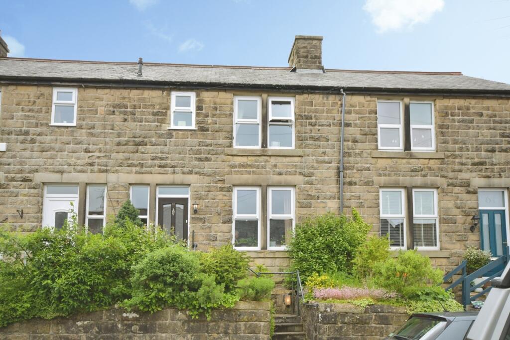
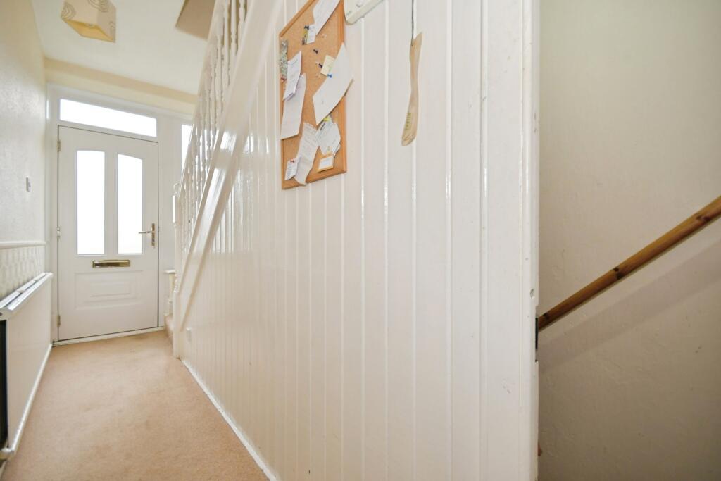
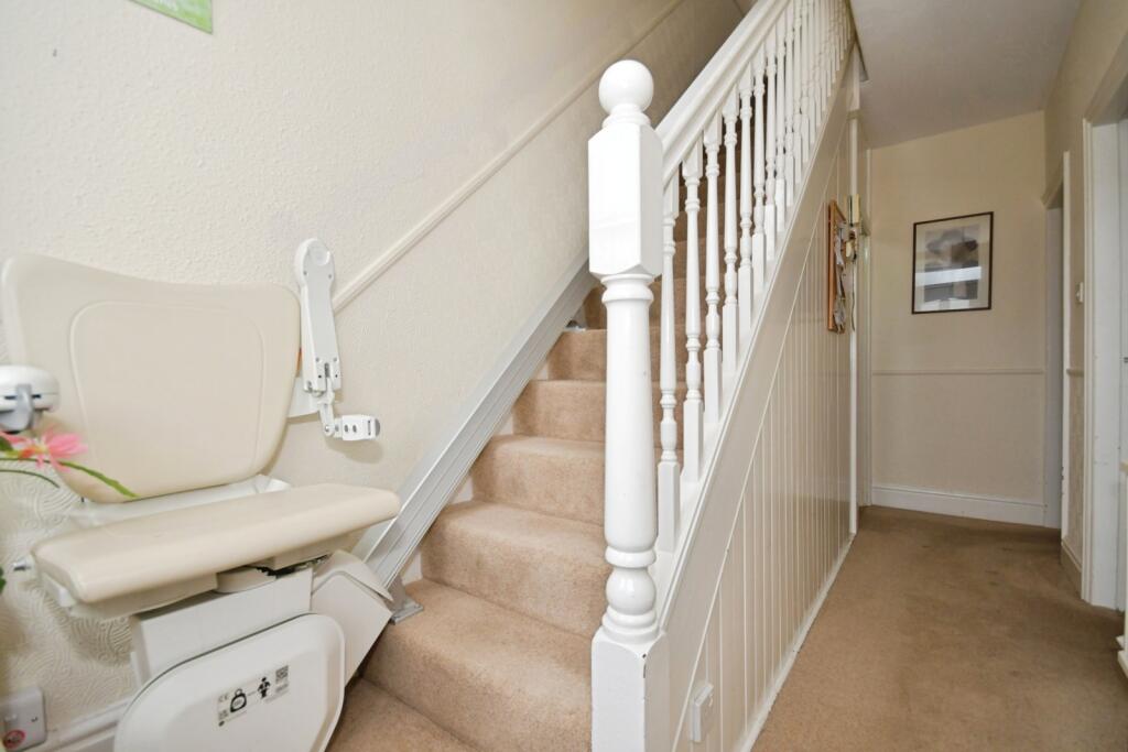
Description
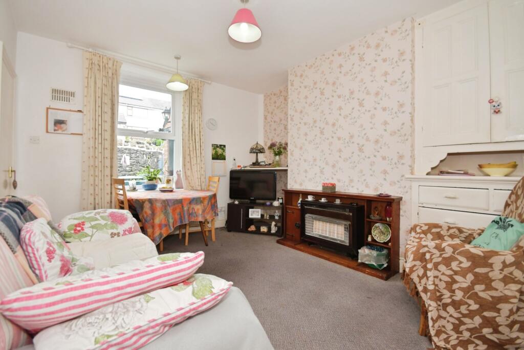
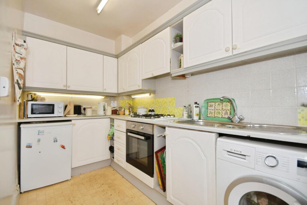
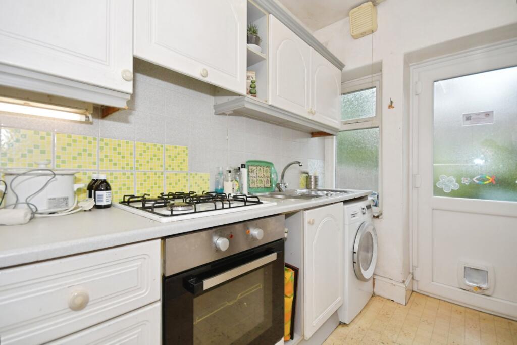
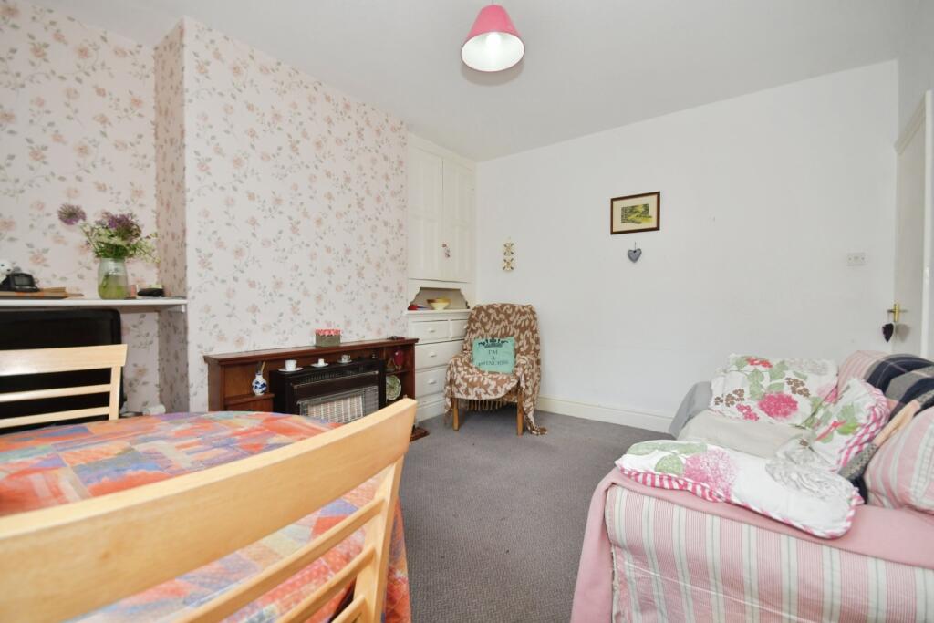
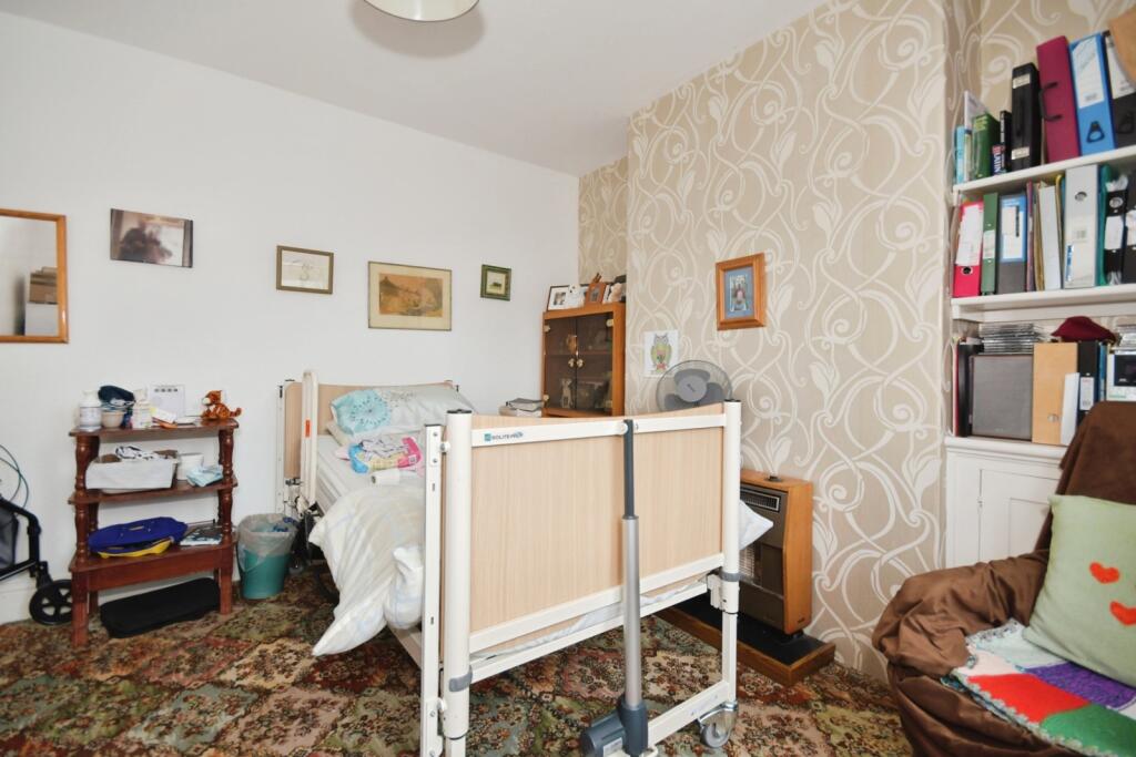
Upon entering the property, you are welcomed into a long hallway with stairs rising to the first floor on your left. The first door to the right leads into a reception room currently utilised as a bedroom, though it would equally serve as a comfortable space to relax and unwind. Continuing along the hallway, you access the second reception area, currently set out as a dining/living space. This is a large, open and sociable room, perfect for entertaining guests or enjoying family time. The kitchen is located just off this room to the left.
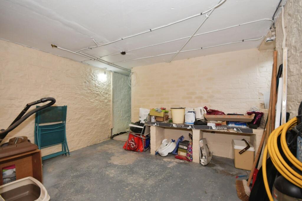
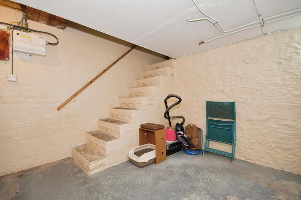
In addition to the ground floor accommodation, the property also benefits from a cellar comprising two chambers, offering highly useful additional space with potential for a home gym, playroom, or storage.
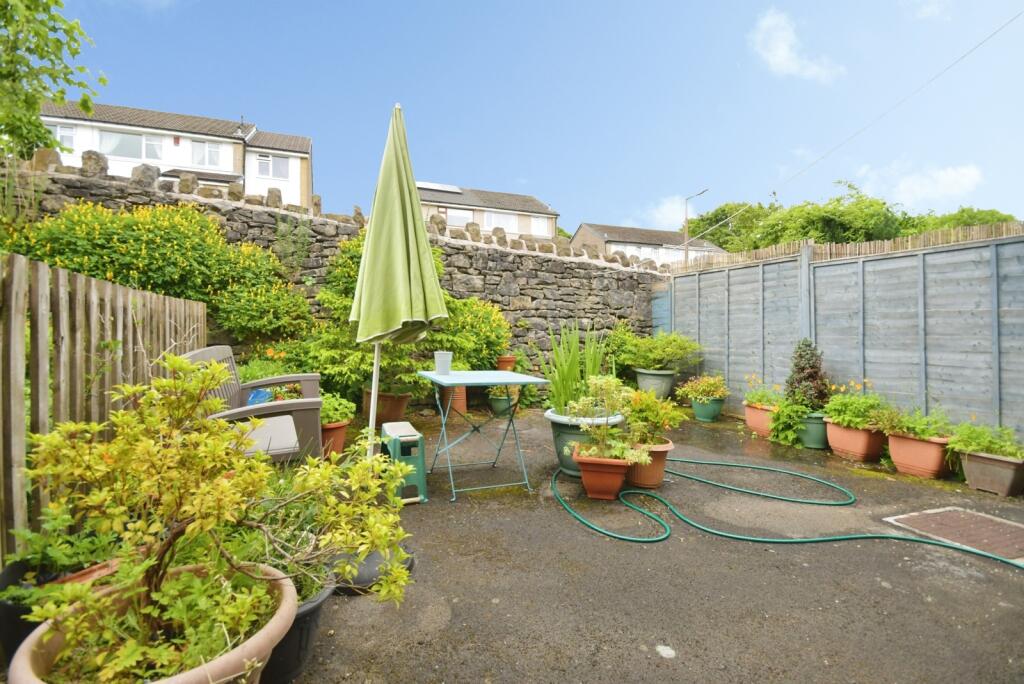
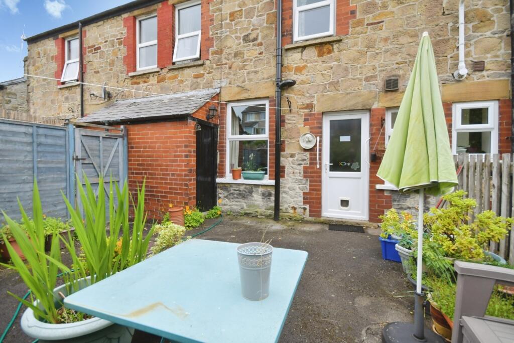
To the rear, there is a fully enclosed, low-maintenance garden, which enjoys a sunny aspect, making it a pleasant and private outdoor area.
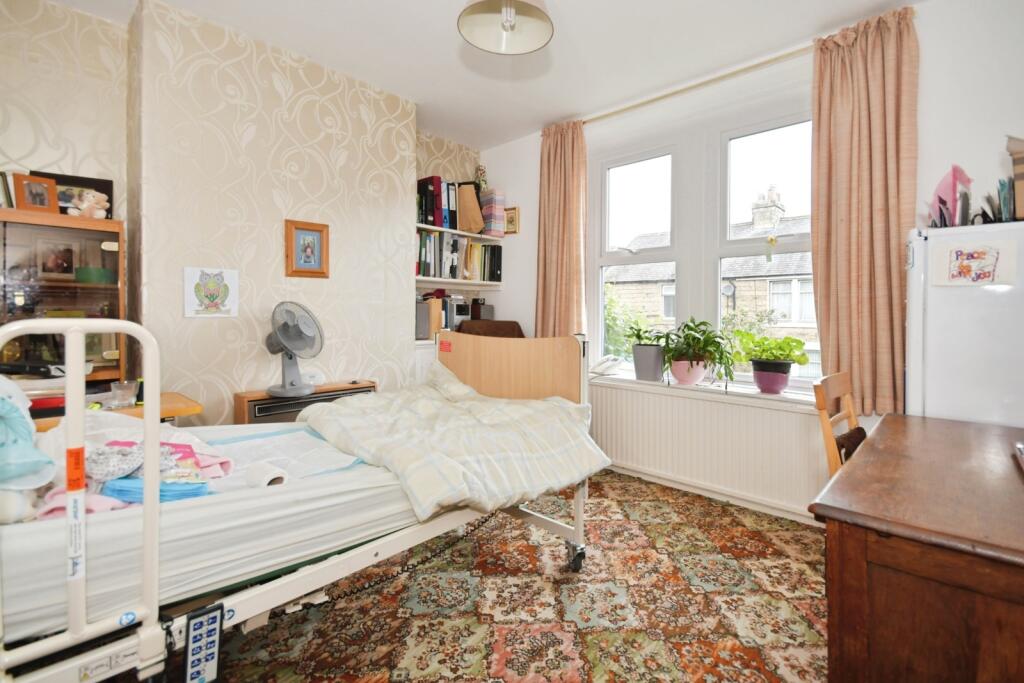
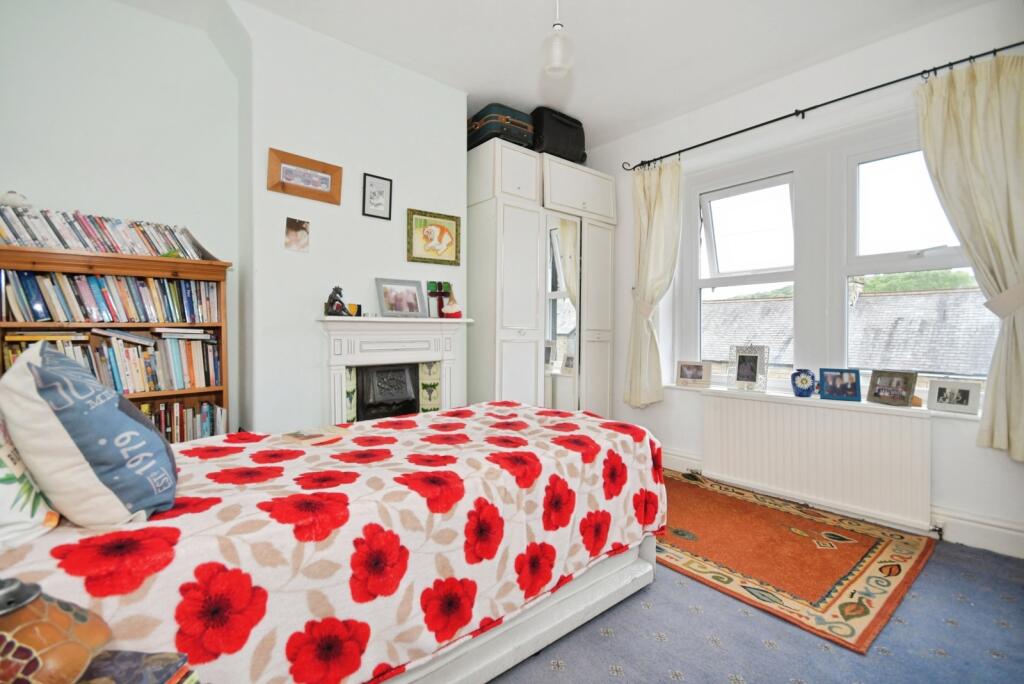
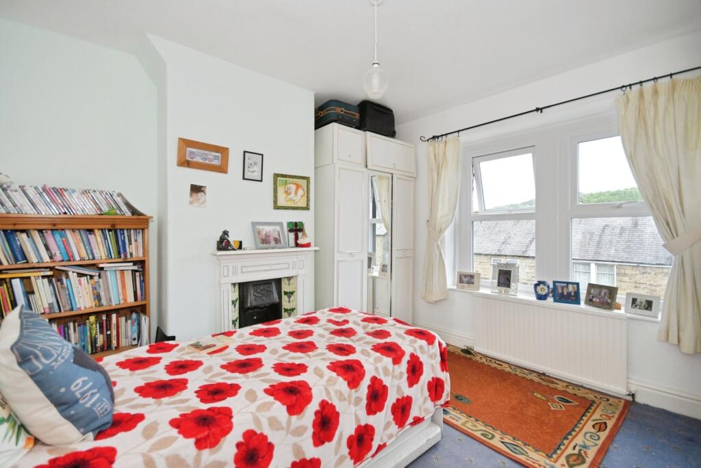
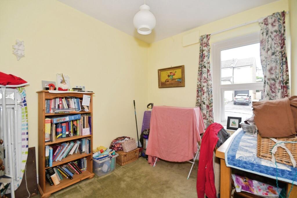
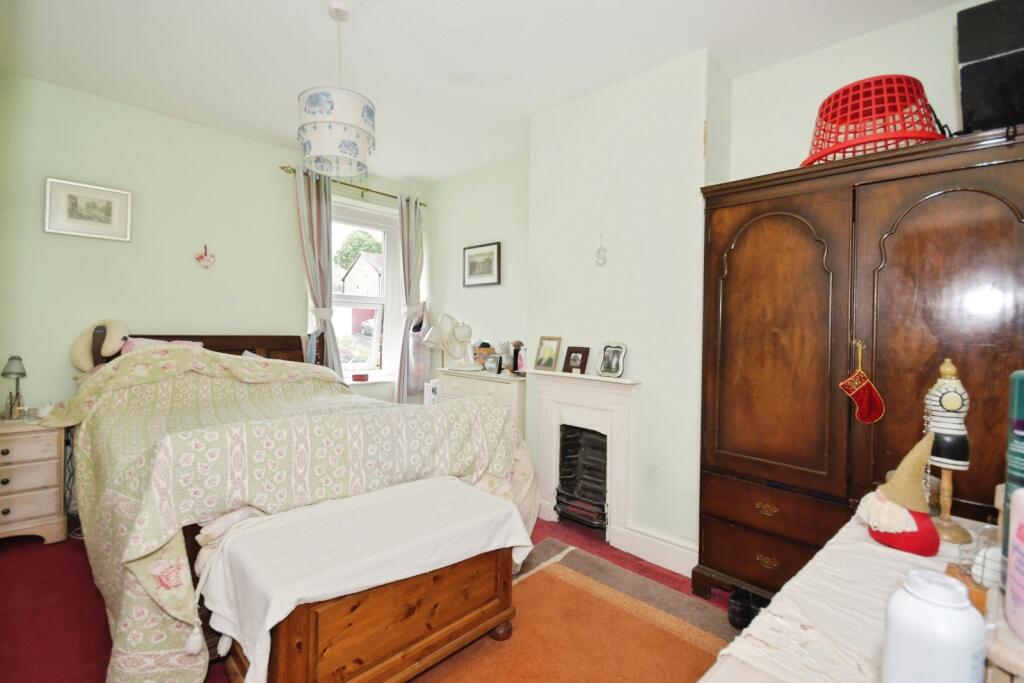
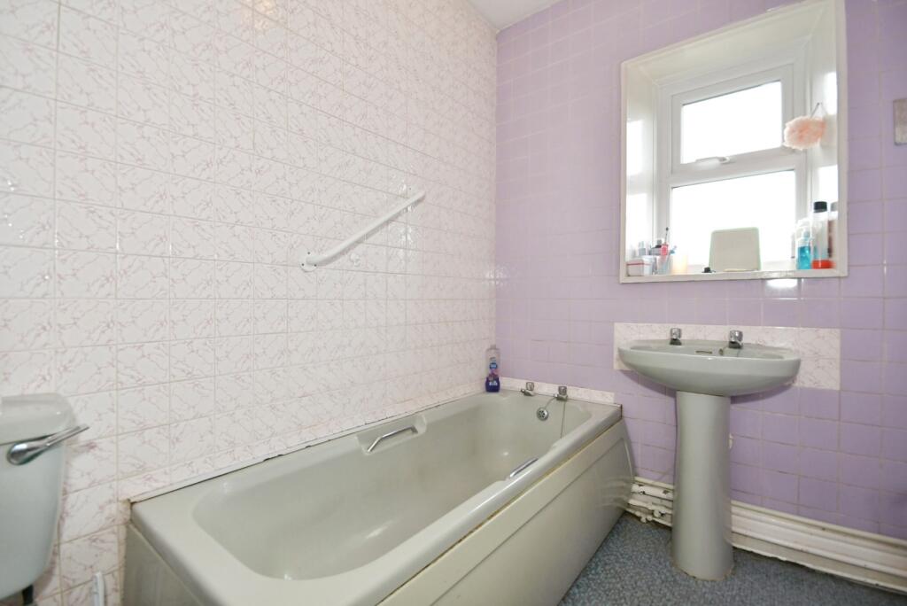
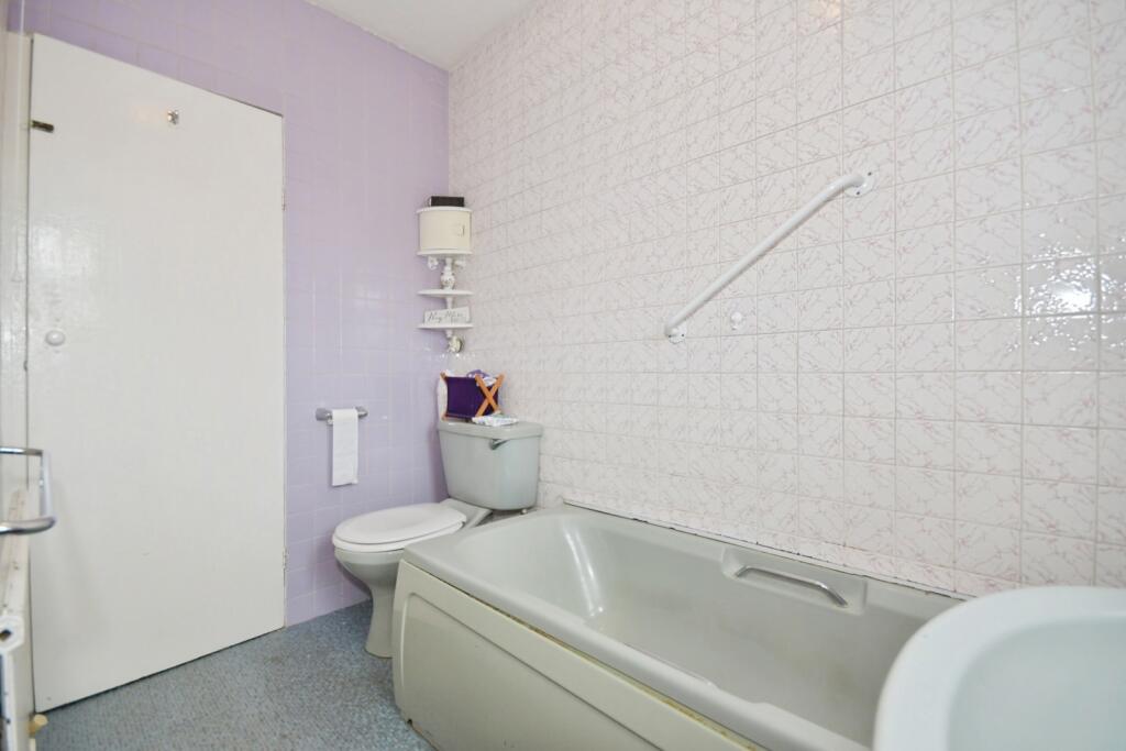
Upstairs, the property comprises three bedrooms — two comfortable doubles and a single room — along with a family bathroom.
The property is in good overall condition, though some internal modernisation would allow a buyer to personalise the home to their own taste and style.
Ideally located within walking distance of the town centre and train station, this home offers excellent convenience. The surrounding area provides access to scenic walks for outdoor enthusiasts, as well as local pubs and nearby schools, making it a well-rounded location for everyday living.
A fantastic opportunity to purchase a home in a highly accessible area — early viewing is highly recommended.
Listed by
Buxton
Countrywide UK Sales - Connells
Reference: 89481240
EPC ratings on this postcode
We don't have a matched EPC for this property yet. Below are efficiency scores and details for other addresses on this postcode.
| Address | Current | Potential | Floor area | Age band | Type |
|---|---|---|---|---|---|
| 37 Nunsfield Road, BUXTON | 61 | 75 | 83 m² | England and Wales: before 1900 | Terraced |
| 39 Nunsfield Road, BUXTON | 90 | 98 | 83 m² | England and Wales: 1900-1929 | Terraced |
| 52a Nunsfield Road, BUXTON | 65 | 92 | 49 m² | England and Wales: 1991-1995 | Terraced |
| 52b, Nunsfield Road, BUXTON | 72 | 94 | 49 m² | England and Wales: 1983-1990 | Terraced |
| 55, Nunsfield Road, BUXTON | 68 | 88 | 84 m² | England and Wales: 1900-1929 | Terraced |
| 56 Nunsfield Road, BUXTON | 69 | 90 | 48 m² | England and Wales: 1976-1982 | Terraced |
| 58 Nunsfield Road, BUXTON | 65 | 77 | 115 m² | England and Wales: 1983-1990 | Detached |
| 61, Nunsfield Road, BUXTON | 55 | 83 | 89 m² | England and Wales: 1900-1929 | Terraced |
| 63 Nunsfield Road, BUXTON | 71 | 88 | 83 m² | England and Wales: 1900-1929 | Terraced |
| 64 NUNSFIELD ROAD, BUXTON, BUXTON | 58 | 84 | 95 m² | England and Wales: 1900-1929 | Detached |
| 67 Nunsfield Road, BUXTON | 64 | 88 | 80 m² | England and Wales: 1900-1929 | Terraced |
| 69, Nunsfield Road, BUXTON | 60 | 85 | 80 m² | England and Wales: 1900-1929 | Terraced |
| 76 NUNSFIELD ROAD, BUXTON, BUXTON | 55 | 87 | 83 m² | England and Wales: before 1900 | Detached |
| 77 Nunsfield Road, BUXTON | 58 | 85 | 85 m² | England and Wales: 1900-1929 | Terraced |
| 79 Nunsfield Road, BUXTON | 66 | 87 | 81 m² | England and Wales: 1900-1929 | Terraced |
Flood risk
Zone: 1
Risk: Low
Job (default Low)
Floorplans
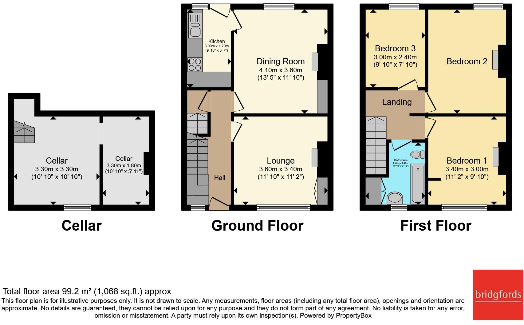
Floorplan
EPC Graphs
EPC Rating Graph
Price history
| Event | Date | Price | % change |
|---|---|---|---|
| Listed for sale | — | £170,000 | — |
Source: HM Land Registry Price Paid Data. Crown copyright.
Sold Comparables
Same street and nearby sales within 0.25 miles (last 5 years). Data from Land Registry Price Paid.
| Address | Price | Date | Type |
|---|---|---|---|
| 17 WINDSOR ROAD, BUXTON, HIGH PEAK, DERBYSHIRE, SK17 7NS | £249,950 | 23/01/2026 | Terraced |
| 16 ALMA STREET, BUXTON, HIGH PEAK, DERBYSHIRE, SK17 7DY | £210,000 | 05/01/2026 | Terraced |
| 43 WINDSOR ROAD, BUXTON, HIGH PEAK, DERBYSHIRE, SK17 7NS | £180,000 | 17/12/2025 | Terraced |
| Same street 39 NUNSFIELD ROAD, BUXTON, HIGH PEAK, DERBYSHIRE, SK17 7BW | £215,000 | 01/12/2025 | Terraced |
| 22 ALMA STREET, BUXTON, HIGH PEAK, DERBYSHIRE, SK17 7DY | £172,000 | 20/06/2025 | Terraced |
| BROOKLANDS 6 NUNSFIELD ROAD, BUXTON, HIGH PEAK, DERBYSHIRE, SK17 7BQ | £218,000 | 14/02/2025 | Terraced |
| Same street 39 NUNSFIELD ROAD, BUXTON, HIGH PEAK, DERBYSHIRE, SK17 7BW | £180,000 | 13/10/2023 | Terraced |
| 52 FAIRFIELD ROAD, BUXTON, HIGH PEAK, DERBYSHIRE, SK17 7DW | £165,000 | 21/12/2022 | Terraced |
| 3A QUEENS ROAD, BUXTON, HIGH PEAK, DERBYSHIRE, SK17 7EY | £230,000 | 20/12/2022 | Terraced |
| BROOKLANDS 14 NUNSFIELD ROAD, BUXTON, HIGH PEAK, DERBYSHIRE, SK17 7BQ | £222,500 | 12/12/2022 | Terraced |
| 25 FAIRFIELD ROAD, BUXTON, HIGH PEAK, DERBYSHIRE, SK17 7DN | £115,000 | 02/11/2022 | Terraced |
| 31 ALMA STREET, BUXTON, HIGH PEAK, DERBYSHIRE, SK17 7DY | £148,250 | 28/10/2022 | Terraced |
| 2 CHARLES STREET, BUXTON, HIGH PEAK, DERBYSHIRE, SK17 7BD | £131,000 | 14/10/2022 | Terraced |
| 43 LIGHTWOOD ROAD, BUXTON, HIGH PEAK, DERBYSHIRE, SK17 7BB | £120,000 | 23/09/2022 | Terraced |
| Same street 88 NUNSFIELD ROAD, BUXTON, HIGH PEAK, DERBYSHIRE, SK17 7BW | £185,000 | 20/09/2022 | Semi-detached |
| 28 NUNSFIELD ROAD, BUXTON, HIGH PEAK, DERBYSHIRE, SK17 7BN | £208,200 | 16/09/2022 | Terraced |
| 22 FAIRFIELD ROAD, BUXTON, HIGH PEAK, DERBYSHIRE, SK17 7DW | £215,000 | 26/08/2022 | Terraced |
| 21 HOGSHAW VILLAS ROAD, BUXTON, HIGH PEAK, DERBYSHIRE, SK17 7AR | £275,000 | 25/08/2022 | Terraced |
| 16 ALMA STREET, BUXTON, HIGH PEAK, DERBYSHIRE, SK17 7DY | £157,500 | 05/08/2022 | Terraced |
| 11 QUEENS AVENUE, BUXTON, HIGH PEAK, DERBYSHIRE, SK17 7HD | £149,995 | 22/07/2022 | Terraced |
| 9 CHARLES STREET, BUXTON, HIGH PEAK, DERBYSHIRE, SK17 7BD | £149,950 | 29/06/2022 | Terraced |
| 13 ALMA STREET, BUXTON, HIGH PEAK, DERBYSHIRE, SK17 7DY | £115,000 | 27/06/2022 | Terraced |
| 33 NUNSFIELD ROAD, BUXTON, HIGH PEAK, DERBYSHIRE, SK17 7BN | £229,995 | 17/06/2022 | Terraced |
| Same street 80 NUNSFIELD ROAD, BUXTON, HIGH PEAK, DERBYSHIRE, SK17 7BW | £170,000 | 18/05/2022 | Semi-detached |
| Same street 81 NUNSFIELD ROAD, BUXTON, HIGH PEAK, DERBYSHIRE, SK17 7BW | £160,000 | 24/09/2021 | Terraced |
| Same street 95 NUNSFIELD ROAD, BUXTON, HIGH PEAK, DERBYSHIRE, SK17 7BW | £175,000 | 13/08/2021 | Terraced |
Street average: £180,833 (6 sales)
Area average: £183,117 (20 sales)
Capital growth trend
Land Registry outcode average: last 12 months vs 5y and 10y ago (from sold prices).
House Price Index (HM Land Registry — official index, not sold-price averages): High Peak. Series: Terraced. As of March 2026.
Rental Range
Estimated market rent for High Peak. Low = conservative, Realistic = average, Optimistic = best case.
Based on Local Authority from postcode lookup → High Peak.
LHA (30th percentile) floor for Peaks & Dales: £693/mo (Apr 2025 – Mar 2026)
Location
Address
Nunsfield Road
Nearby
Nearest stations, universities and amenities (distance from property).
| Type | Name | Distance |
|---|---|---|
| Bus stop | Fairfield, Queens Road / opposite Windsor Road | 0.1 miles |
| Bus stop | Fairfield, Fairfield Road / adjacent Church | 0.1 miles |
| Shop | NDA Motors | 0.3 miles |
| Shop | GT Motor Spares | 0.3 miles |
| Train station | Buxton | 0.4 miles |
| University | University of Derby, Buxton | 0.6 miles |
| Hospital | Corbar hall | 0.7 miles |
| Train station | Buxton Miniature Railway | 0.8 miles |
| Hospital | Buxton Hospital & Corbar Birth Centre | 1.1 miles |
| University | Tovell Building, Buxton & Leek College | 11.8 miles |
Street-level crime
| Category | Count |
|---|---|
| Violence and sexual offences | 78 |
| Anti-social behaviour | 19 |
| Public order | 13 |
| Shoplifting | 13 |
| Criminal damage and arson | 10 |
| Drugs | 9 |
| Other theft | 8 |
| Burglary | 5 |
| Other crime | 3 |
| Vehicle crime | 2 |
| Bicycle theft | 1 |
| Total incidents | 161 |
Within 1 mile during Apr 2026. Source: data.police.uk (England & Wales).
Schools nearby
Nearest open schools with Ofsted ratings (England). Closed schools are not shown. Data from Get Information about Schools and Ofsted.
| Name | Type | Distance | Ofsted |
|---|---|---|---|
| St Anne's Catholic Voluntary Academy | Primary | 0.3 miles | Good — 7 Feb 2023 |
| Fairfield Infant and Nursery School | Primary | 0.3 miles | Good — 14 Nov 2018 |
| St Thomas More Catholic Voluntary Academy | Secondary | 0.4 miles | Requires improvement — 9 Feb 2023 |
| Fairfield Endowed CofE (C) Junior School | Primary | 0.5 miles | Good — 16 Jun 2019 |
| Buxton Infant School | Primary | 0.5 miles | Good — 30 Jan 2024 |
Rental Comparables
Loading rental comparables for this postcode. Refresh in a few minutes.
Rent-driven metrics
Based on Area rent estimate.
- Rent ratio — Monthly rent ÷ purchase price (1% rule). 1%+ = strong, 0.8–1% = okay, <0.8% = weak for cashflow.
- Max investor price — Rent ÷ 0.8%; the price at which rent would be 0.8% of price (Stoke-style target).
- Target investor price — Rent ÷ 1%; the price at which rent would be 1% of price (strong cashflow band).
- Gross yield — Annual rent as % of purchase price (no costs).
Enter House Number
Enter the house number to help us retrieve more accurate pricing history and property data.
Please log in to submit or correct the house number for this listing.
Log in to continue