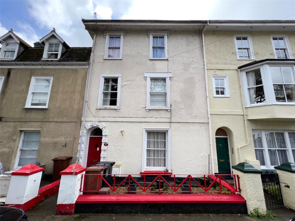
FLAT 1
81 VICTORIA ROAD, DARTMOUTH, DEVON TQ6 9RX
Listing type
Property details
Listing category
Auction
Tenure
SHARE_OF_FREEHOLD
Floor area
55 m²
Council tax band
TBC
Year built
England and Wales: before 1900
Last sold
£132,500 Jul 2023
Price per m²
£2,545/m²
Local average
£395,400 (-64.6%)
Deprivation
Decile 5 (14,619 of 33,755)
Street crime
34 incidents within 1 mile (Apr 2026)
Description
A spacious and well-presented Grade II listed ground floor apartment in the centre of Dartmouth that is being sold with the share of freehold.
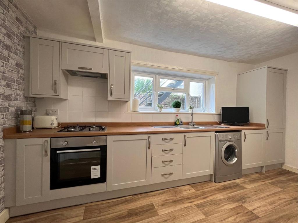
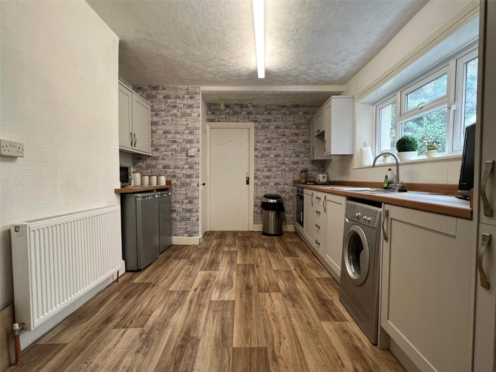
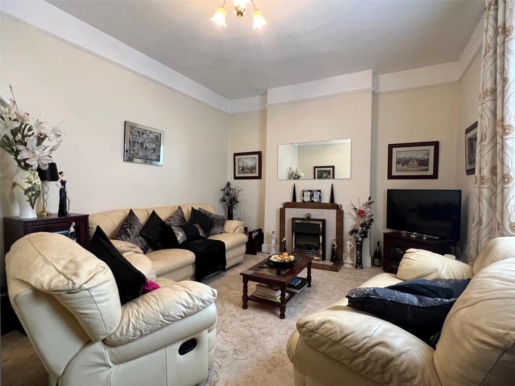
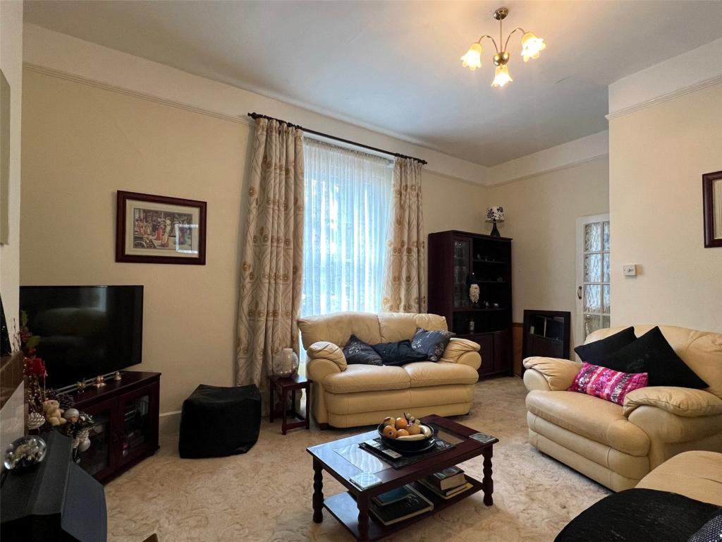
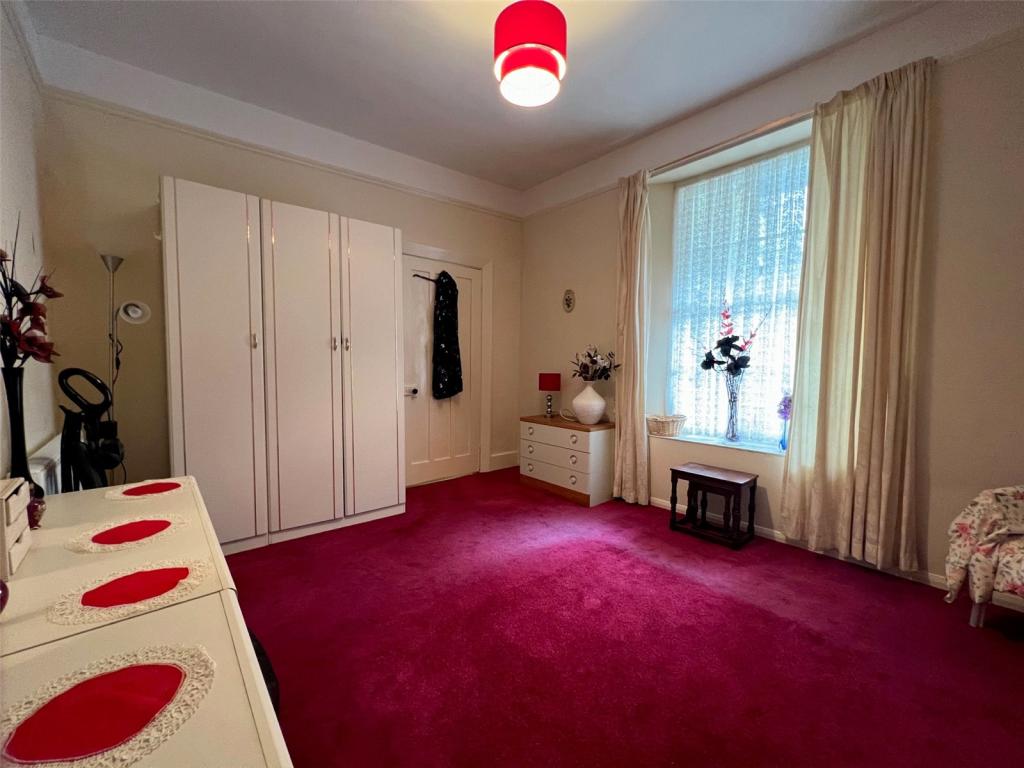
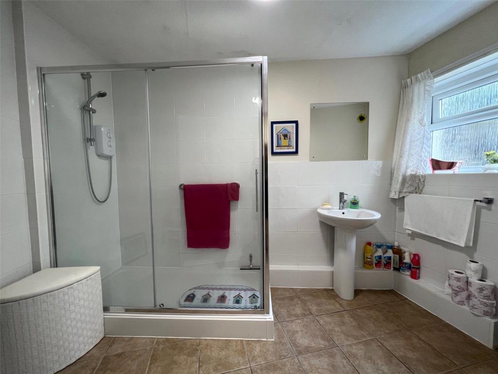
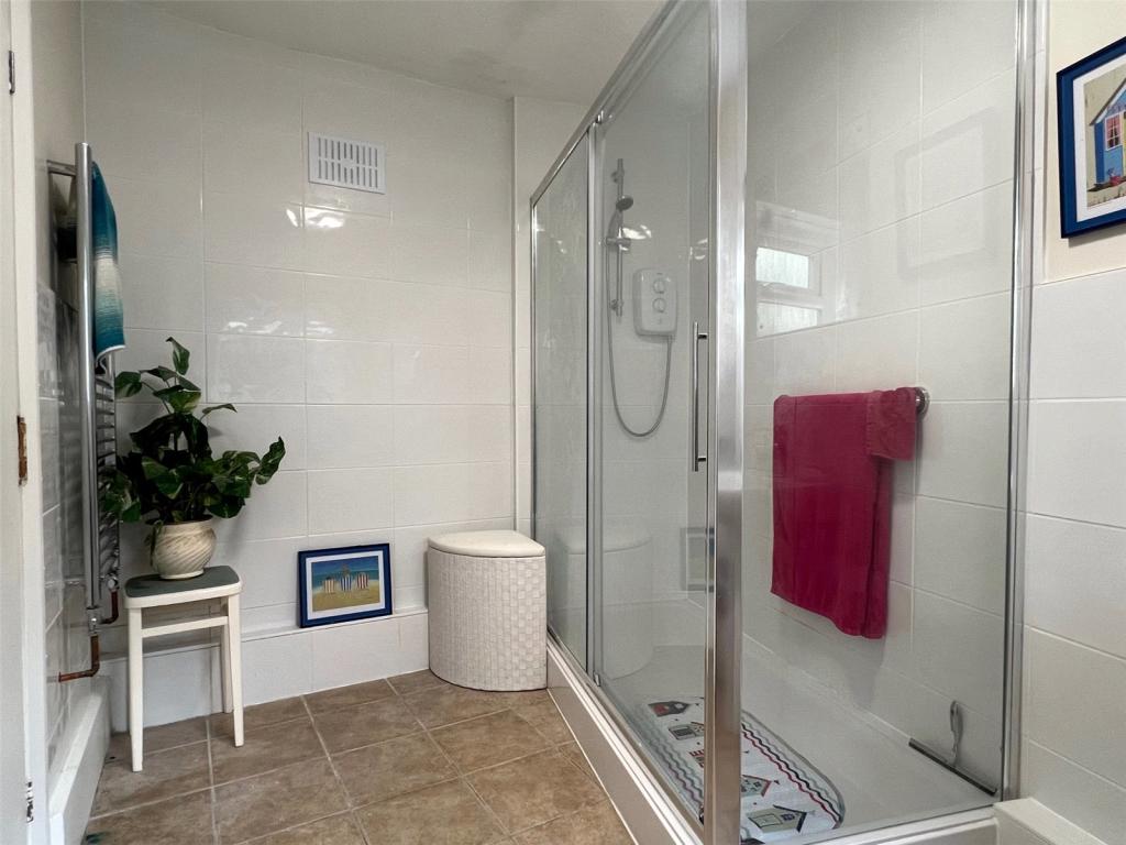
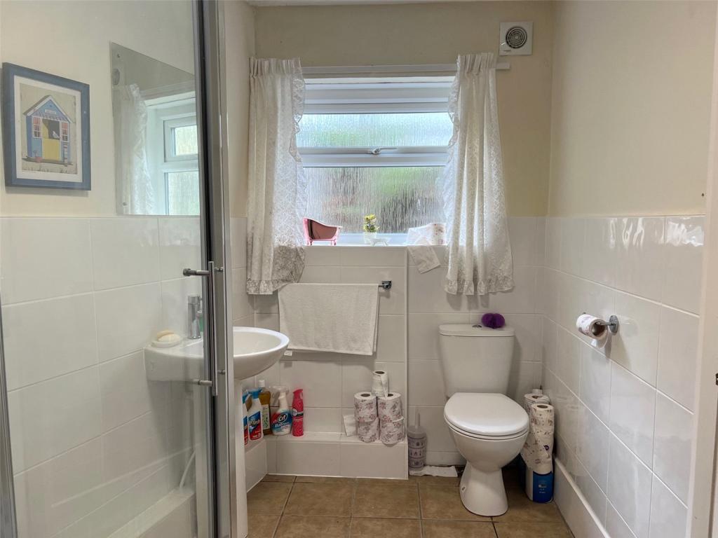
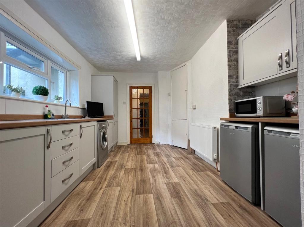
The apartment comprises; entrance hallway, good sized living room with a gas fireplace to the front of the property, large double bedroom, spacious kitchen which has recently been fitted and a good sized modern shower room with walk in shower.
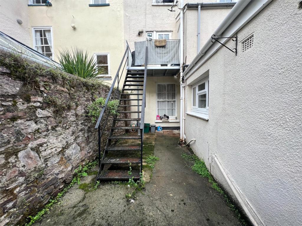
Additionally, the property benefits from a shared courtyard accessed via the kitchen, Gas Central Heating and high ceilings. The bathroom and kitchen have recently been modernised and offers ample storage space throughout.
This property is an ideal first time buy or long term investment with room for improvement.
*DEVON COVERNANT APPLIES*
EPC Exempt.
Please note appliances have not been tested.
Dartmouth, once home to the Royal Navy, is one of the most popular and picturesque areas in Devon. The port town is located on the west bank of the River Dart, approximately fourteen miles by road from the market towns of Totnes and Kingsbridge. Famous for its local shops, restaurants, and art galleries, Dartmouth, due to its geographical and beautiful location has inevitably made it a magnet for the yachting fraternity but the town also has a vibrant all year round local community with numerous attractions, clubs, societies and things to do.
Listed by
Dartmouth
Countrywide UK Sales - Connells
Reference: 128694623
EPC Rating & Upgrade Cost
Fetching EPC data… Refresh this page in a moment.
Flood risk
Zone: 1
Risk: Low
Job (default Low)
Floorplans
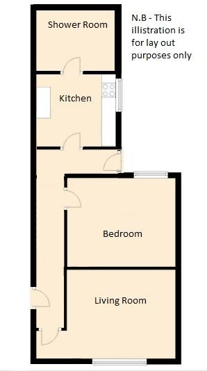
Floorplan
Price history
| Event | Date | Price | % change |
|---|---|---|---|
| Sold | 27/07/2023 (2 years ago) | £132,500 | — |
Source: HM Land Registry Price Paid Data. Crown copyright.
Sold Comparables
Same street and nearby sales within 0.25 miles (last 5 years). Data from Land Registry Price Paid.
| Address | Price | Date | Type |
|---|---|---|---|
| HEMBOROUGH VICARAGE HILL, DARTMOUTH, SOUTH HAMS, DEVON, TQ6 9EW | £650,000 | 16/12/2022 | Flat |
| SKERRIES VICARAGE HILL, DARTMOUTH, SOUTH HAMS, DEVON, TQ6 9EW | £515,000 | 27/09/2022 | Flat |
| BRENT APARTMENT VICARAGE HILL, DARTMOUTH, SOUTH HAMS, DEVON, TQ6 9EW | £455,000 | 12/08/2022 | Flat |
| WESTWATER COURT, 53 FLAT 7 VICTORIA ROAD, DARTMOUTH, SOUTH HAMS, DEVON, TQ6 9DF | £320,000 | 04/02/2022 | Flat |
| Same street 63 GROUND FLOOR FLAT VICTORIA ROAD, DARTMOUTH, SOUTH HAMS, DEVON, TQ6 9RX | £178,000 | 10/12/2021 | Flat |
| COTTERBURY VICARAGE HILL, DARTMOUTH, SOUTH HAMS, DEVON, TQ6 9EW | £525,000 | 15/06/2021 | Flat |
Street average: £178,000 (1 sale)
Area average: £493,000 (5 sales)
Capital growth trend
Land Registry outcode average: last 12 months vs 5y and 10y ago (from sold prices).
House Price Index (HM Land Registry — official index, not sold-price averages): South Hams. Series: Flats and maisonettes. As of March 2026.
Rental Range
Estimated market rent for South Hams. Low = conservative, Realistic = average, Optimistic = best case.
Based on Local Authority from postcode lookup → South Hams.
LHA (30th percentile) floor for South Devon: £504/mo (Apr 2025 – Mar 2026)
Location
Nearby
Nearest stations, universities and amenities (distance from property).
| Type | Name | Distance |
|---|---|---|
| Bus stop | Bowling Green | 0.0 miles |
| Shop | Spar | 0.2 miles |
| Shop | Unknown | 0.2 miles |
| Bus stop | Wilsdene | 0.2 miles |
| Hospital | Dartmouth and Kingswear Hospital | 0.3 miles |
| Train station | Kingswear | 0.5 miles |
| Train station | Greenway Halt | 2.5 miles |
| Hospital | Brixham Hospital | 4.1 miles |
Street-level crime
| Category | Count |
|---|---|
| Violence and sexual offences | 21 |
| Other theft | 4 |
| Anti-social behaviour | 3 |
| Criminal damage and arson | 3 |
| Burglary | 1 |
| Public order | 1 |
| Shoplifting | 1 |
| Total incidents | 34 |
Within 1 mile during Apr 2026. Source: data.police.uk (England & Wales).
Schools nearby
Nearest open schools with Ofsted ratings (England). Closed schools are not shown. Data from Get Information about Schools and Ofsted.
| Name | Type | Distance | Ofsted |
|---|---|---|---|
| Dartmouth Academy | Other | 0.6 miles | Good — 14 Jun 2023 |
| St John the Baptist Roman Catholic Primary School, Dartmouth | Primary | 0.7 miles | Good — 10 Feb 2010 |
| Stoke Fleming Community Primary School | Primary | 2.0 miles | Good — 26 May 2022 |
| Galmpton Church of England Primary School | Primary | 3.1 miles | Outstanding — 20 May 2024 |
| Churston Ferrers Grammar School Academy | Secondary | 3.3 miles | Good — 4 Dec 2022 |
Rental Comparables
Loading rental comparables for this postcode. Refresh in a few minutes.
Rent-driven metrics
Based on Area rent estimate.
- Rent ratio — Monthly rent ÷ purchase price (1% rule). 1%+ = strong, 0.8–1% = okay, <0.8% = weak for cashflow.
- Max investor price — Rent ÷ 0.8%; the price at which rent would be 0.8% of price (Stoke-style target).
- Target investor price — Rent ÷ 1%; the price at which rent would be 1% of price (strong cashflow band).
- Gross yield — Annual rent as % of purchase price (no costs).