1 DOON AVENUE
DERBY, CITY OF DERBY DE22 3YT
£1,750 pcm
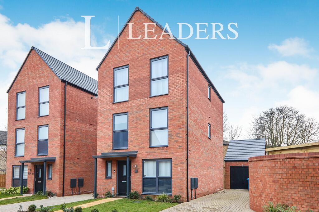


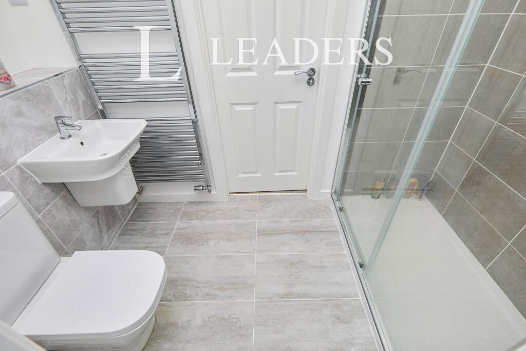
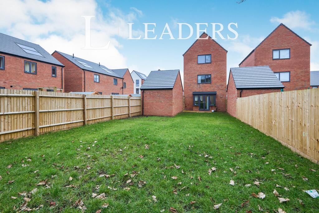
Photo 1 Photo 2 Photo 3 Photo 4 Photo 5 Photo 6 Photo 7 Photo 8 Photo 9 Photo 10
/ 10
Property details
Floor area
107 m²
Street crime
393 incidents within 1 mile (Apr 2026)
Key features
- BRAND NEW DETACHED FAMILY HOME
- PRESENTED OVER THREE FLOORS
- OPEN PLAN LIVING
- DOUBLE BEDROOMS
- THREE BATHROOMS
- ENSUITE
- CLOSE TO ROYAL DERBY HOSPITAL
Additional details
- Parking
- Yes
- Garden
- Yes
Description
EPC Rating: B
Council Tax Grade: D
A holding deposit of £403.84, based on the advertised rent, is required to reserve the property. Deposit payable is £2019.23 or this property is available with our No Deposit Option. Please contact us for further information or visit our website.
Minimum term: 12 months
*Rent excludes tenancy deposit and any other permitted payment*
Listed by
Derby
Leaders and Romans Group
Reference: 159028064
EPC Rating & Upgrade Cost
Fetching EPC data… Refresh this page in a moment.
Flood risk
Zone: 1
Risk: Low
Job (default Low)
Floorplans
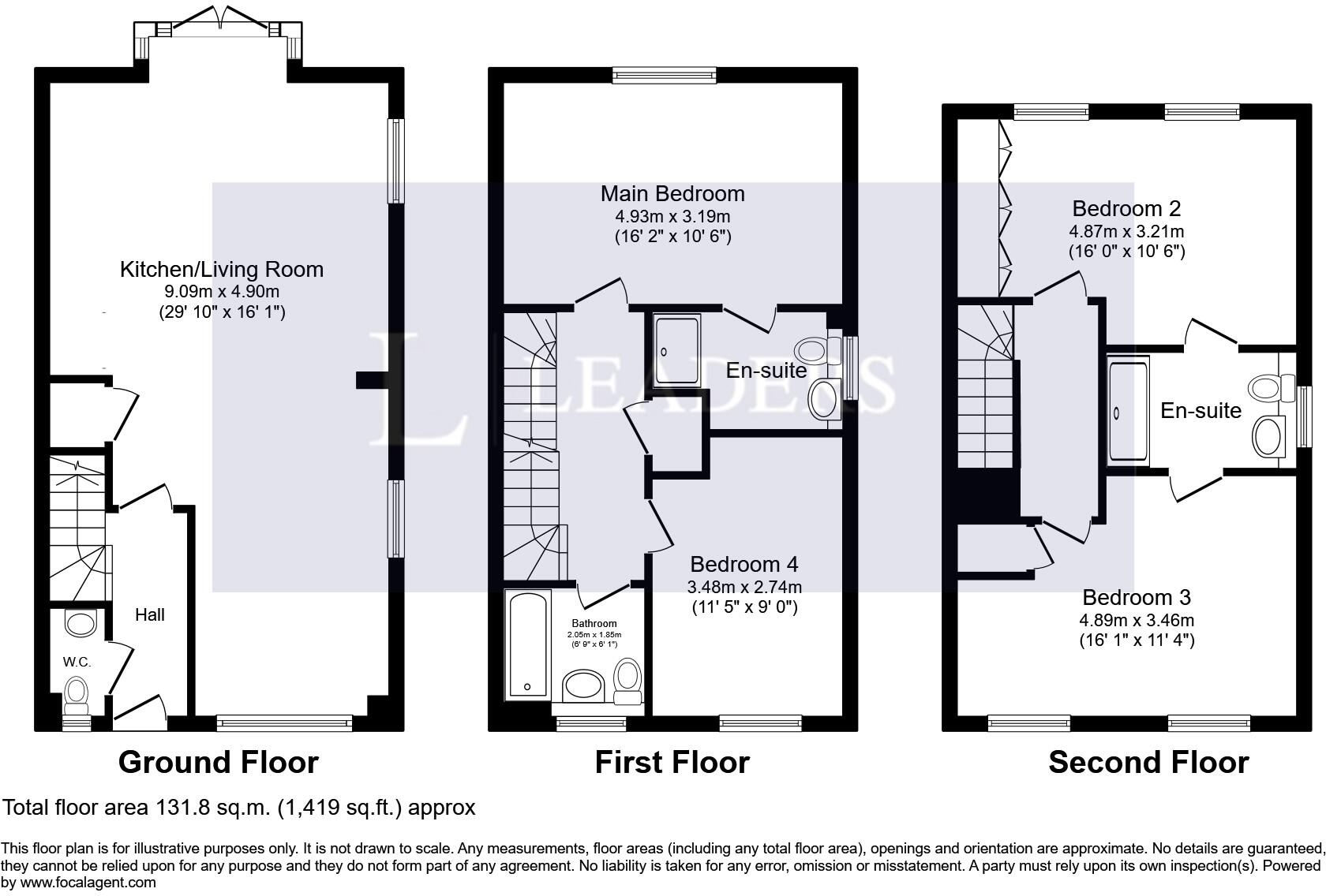
Floorplan 1
Rental Range
Estimated market rent for East Midlands. Low = conservative, Realistic = average, Optimistic = best case.
Based on Postcode area DE → East Midlands.
LHA (30th percentile) floor for Derby: £932/mo (Apr 2025 – Mar 2026)
Location
Nearby
Nearest stations, universities and amenities (distance from property).
| Type | Name | Distance |
|---|---|---|
| Bus stop | Ring Road | 0.1 miles |
| Bus stop | Royal Derby Hospital | 0.1 miles |
| Shop | League of Friends Corridor Shop | 0.3 miles |
| Shop | League of Friends | 0.3 miles |
| University | University of Derby | 1.7 miles |
| Train station | Peartree | 2.1 miles |
| Train station | Derby | 2.1 miles |
| Hospital | Babington Hospital | 7.3 miles |
| Hospital | Outwood Site | 8.9 miles |
Street-level crime
| Category | Count |
|---|---|
| Violence and sexual offences | 160 |
| Public order | 55 |
| Anti-social behaviour | 53 |
| Criminal damage and arson | 38 |
| Shoplifting | 28 |
| Other theft | 16 |
| Vehicle crime | 10 |
| Burglary | 6 |
| Drugs | 6 |
| Other crime | 6 |
| Robbery | 6 |
| Possession of weapons | 5 |
| Bicycle theft | 2 |
| Theft from the person | 2 |
| Total incidents | 393 |
Within 1 mile during Apr 2026. Source: data.police.uk (England & Wales).
Schools nearby
Nearest open schools with Ofsted ratings (England). Closed schools are not shown. Data from Get Information about Schools and Ofsted.
| Name | Type | Distance | Ofsted |
|---|---|---|---|
| Wren Park Primary School | Primary | 0.5 miles | Requires improvement — 30 Mar 2023 |
| The Bemrose School | Other | 0.5 miles | Good — 6 May 2024 |
| St Clare's School | Other | 0.5 miles | Outstanding — 6 Feb 2013 |
| St Peter's Church of England Aided Junior School | Primary | 0.7 miles | — (Inspected (no overall grade)) |
| Brackensdale Spencer Academy | Primary | 0.7 miles | — (Inspected (no overall grade)) |
Rental Comparables
Residential lets from OpenRent and Rightmove for the area (same bedroom count). Use to validate rent estimates. Student lets are excluded.
| Title | Rent | Beds | Distance | As seen on |
|---|---|---|---|---|
| 4 Bed Semi-Detached House, Radbourne Street, DE22 | £2,167/mo | 4 | 0.88 miles | OpenRent |
Average rent: £2,167/mo (1 listing)