THE BELFY
ST THOMAS'S CHURCH, 9A, ST THOMAS STREET, LONDON, GREATER LONDON SE1 9RY
£4,000 pcm
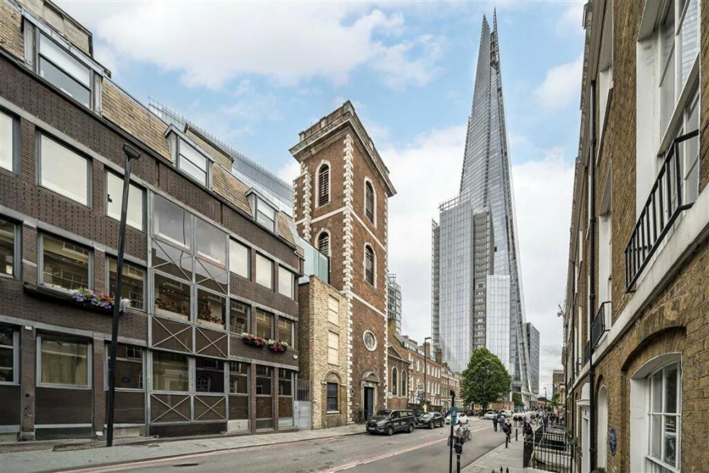
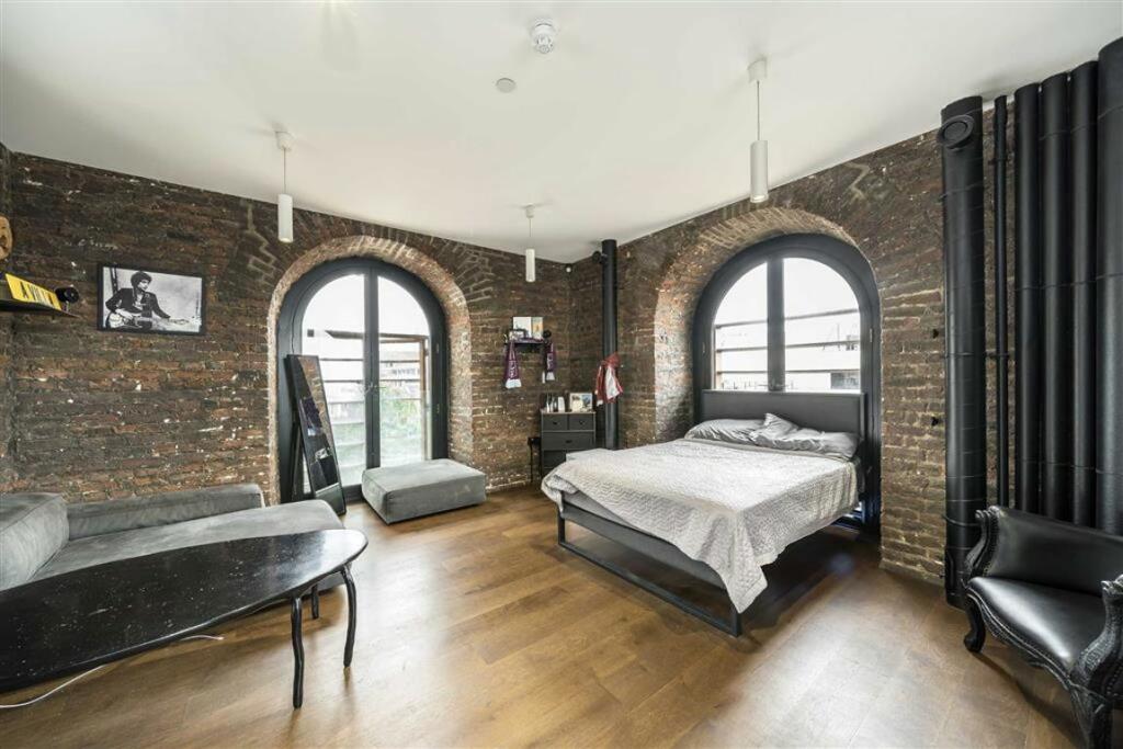
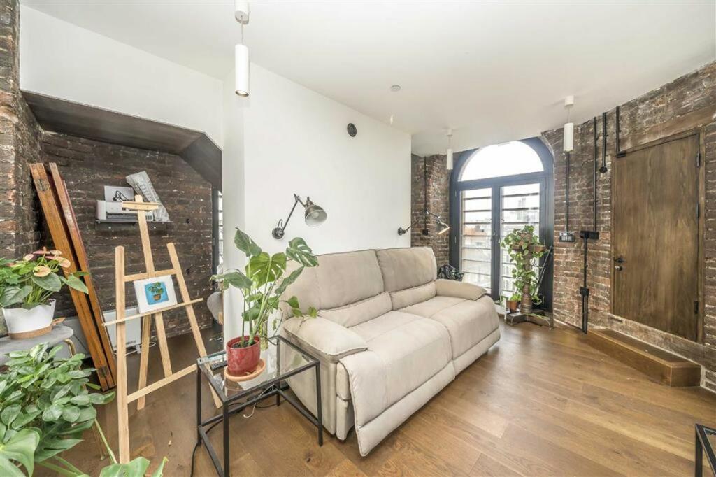
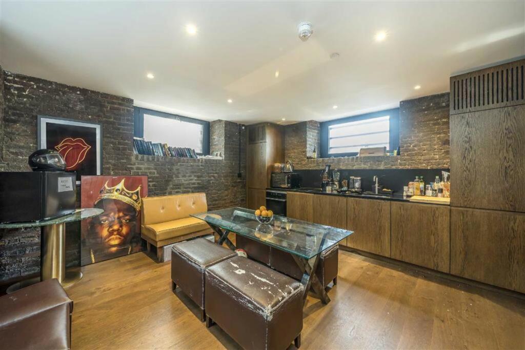
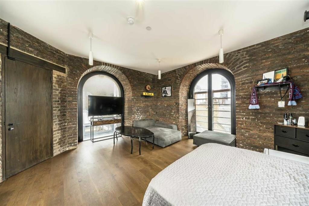
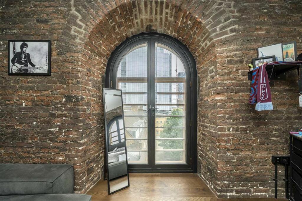
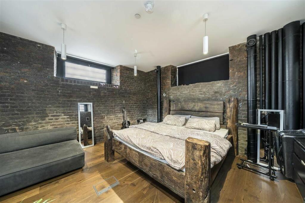
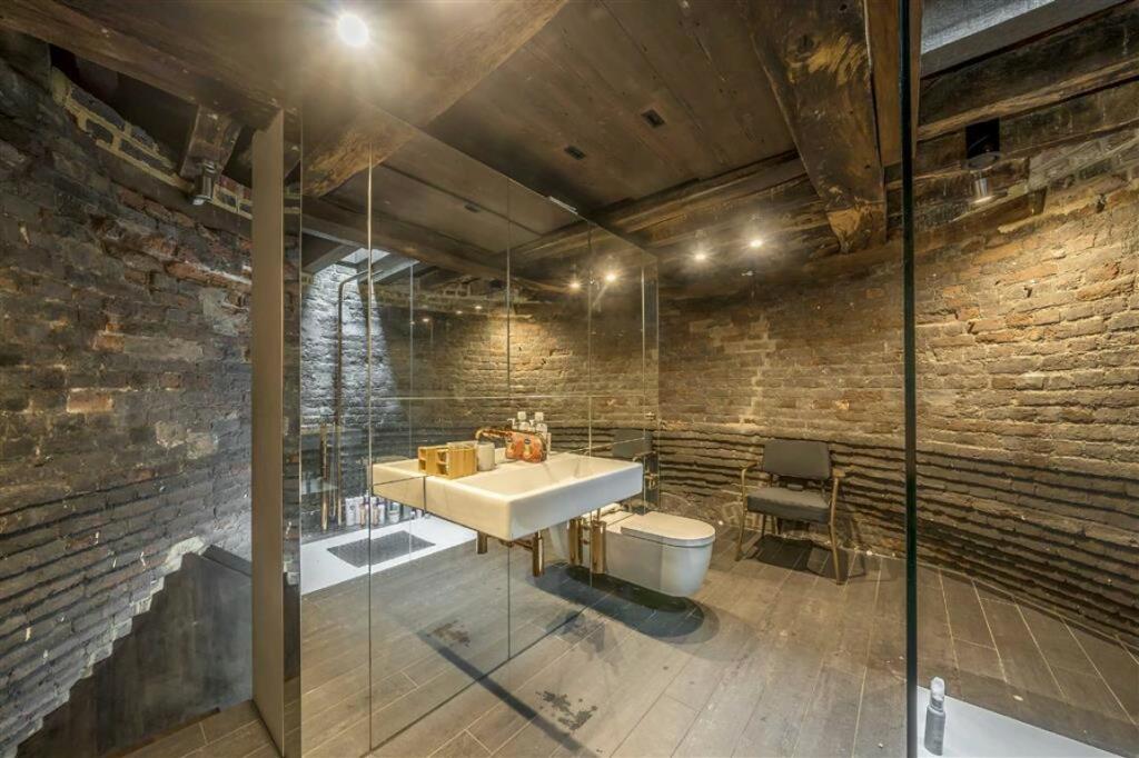
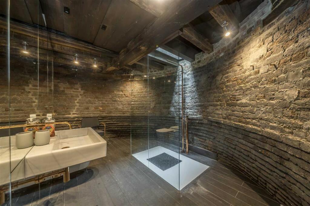
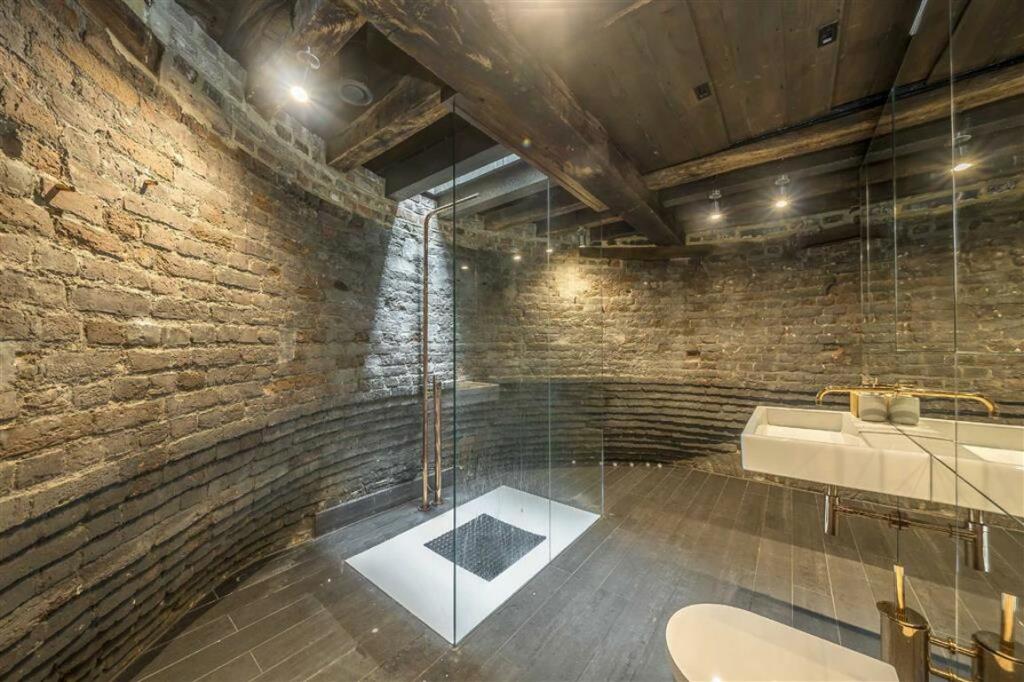
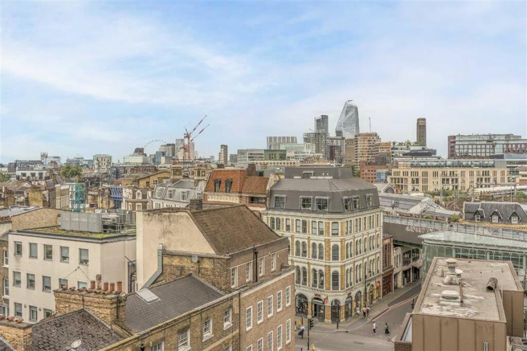
Photo 1 Photo 2 Photo 3 Photo 4 Photo 5 Photo 6 Photo 7 Photo 8 Photo 9 Photo 10 Photo 11
/ 11
Property details
Deprivation
Decile 4 (11,498 of 33,755)
Street crime
2276 incidents within 1 mile (Apr 2026)
Key features
- Amazing Views
- Church Tower Conversion
- Split Over Five Floors
- Over 1000sqft
- One of a Kind Apartment
- Fantastic Location
Description
This truly one of a kind converted apartment is superbly located opposite London Bridge Stations and The Shard, on an adjacent road to Borough High Street and Borough Market, a short walk from Bermondsey Street and around 100m as the crow flies to the River.
Security Deposit: £5,769
Council Tax Band: Not yet available
Information contained within this listing is for guidance only and should be checked and confirmed (prior to proceeding).
Listed by
London Bridge
Dexters
Reference: 156078677
EPC Rating & Upgrade Cost
Fetching EPC data… Refresh this page in a moment.
Flood risk
Zone: 1
Risk: Low
Job (default Low)
Floorplans
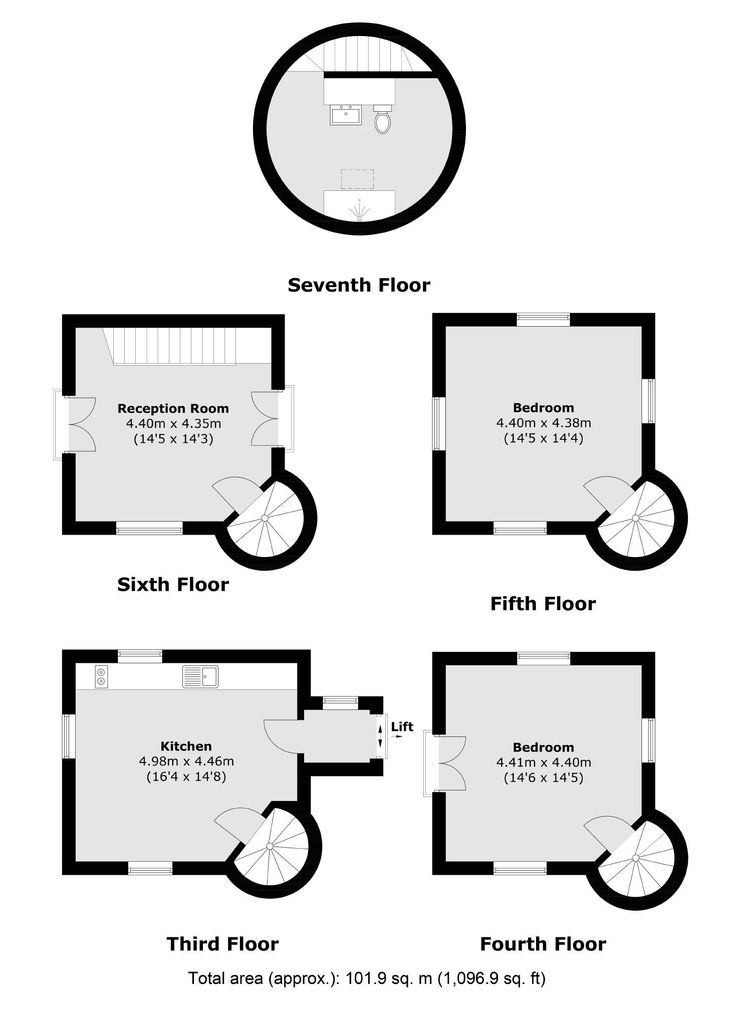
Floorplan 1
EPC Graphs
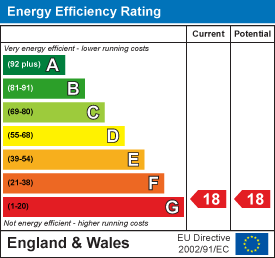
EPC 1
Company ownership
Registered legal owner is a company.
Company: ST THOMAS'S CHURCH LLP (OC328023)
Rental Range
Estimated market rent for Southwark. Low = conservative, Realistic = average, Optimistic = best case.
Based on Local Authority from postcode lookup → Southwark.
LHA (30th percentile) floor for Inner South East London: £1,546/mo (Apr 2025 – Mar 2026)
Location
Address
9a St. Thomas Street
Nearby
Nearest stations, universities and amenities (distance from property).
| Type | Name | Distance |
|---|---|---|
| Train station | London Bridge | 0.0 miles |
| Shop | Borough Kitchen | 0.0 miles |
| Bus stop | London Bridge Station | 0.0 miles |
| Shop | Igloo Flowers | 0.1 miles |
| University | London School of Commerce | 0.1 miles |
| University | King's College London, Guy's Campus | 0.1 miles |
| Hospital | London Bridge Hospital | 0.1 miles |
| Hospital | Guy's Hospital | 0.2 miles |
Street-level crime
| Category | Count |
|---|---|
| Theft from the person | 466 |
| Other theft | 413 |
| Anti-social behaviour | 319 |
| Violence and sexual offences | 315 |
| Shoplifting | 197 |
| Public order | 109 |
| Robbery | 87 |
| Burglary | 86 |
| Drugs | 85 |
| Criminal damage and arson | 71 |
| Vehicle crime | 53 |
| Bicycle theft | 47 |
| Other crime | 17 |
| Possession of weapons | 11 |
| Total incidents | 2276 |
Within 1 mile during Apr 2026. Source: data.police.uk (England & Wales).
Schools nearby
Nearest open schools with Ofsted ratings (England). Closed schools are not shown. Data from Get Information about Schools and Ofsted.
| Name | Type | Distance | Ofsted |
|---|---|---|---|
| Saint Joseph's Catholic Primary School, the Borough | Primary | 0.3 miles | Good — 1 Feb 2014 |
| The Cathedral School of St Saviour and St Mary Overie | Primary | 0.3 miles | Outstanding — 30 Jan 2023 |
| Beormund Primary School | Other | 0.3 miles | Outstanding — 10 Sep 2024 |
| Snowsfields Primary School | Primary | 0.3 miles | Good — 14 Sep 2023 |
| London Christian School | Other | 0.4 miles | — (No rating) |
Rental Comparables
Residential lets from OpenRent and Rightmove for the area (same bedroom count). Use to validate rent estimates. Student lets are excluded.
| Title | Rent | Beds | Distance | As seen on |
|---|---|---|---|---|
| 2 Bed Flat, Duchess Walk, SE1 | £4,150/mo | 2 | 0.5 miles | OpenRent |
| 2 Bed Flat, Tooley St, SE1 | £2,750/mo | 2 | 0.52 miles | OpenRent |
Average rent: £3,450/mo (2 listings)