Cranbrook Road
Redland, BS6 7DB
£1,000 pcm
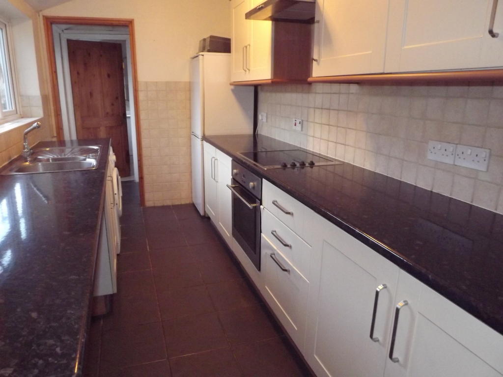
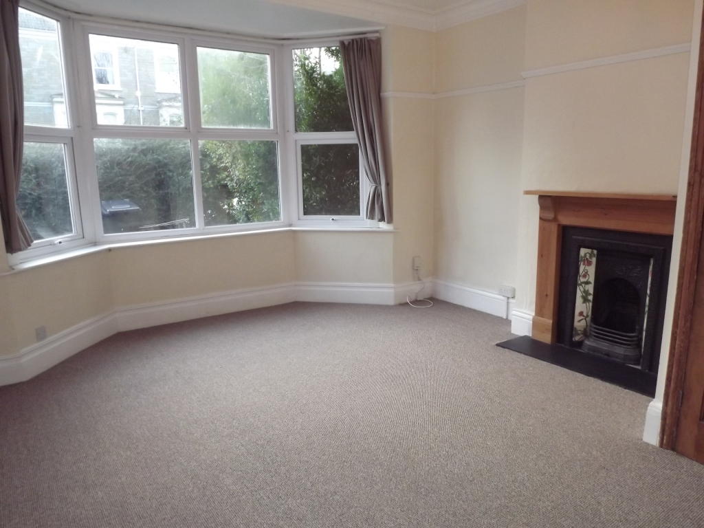
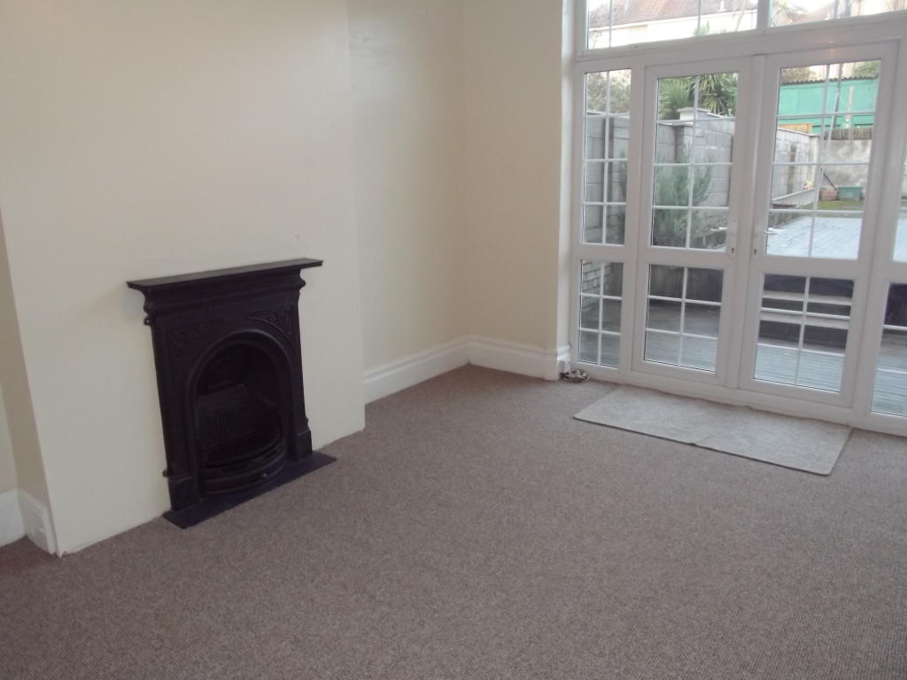
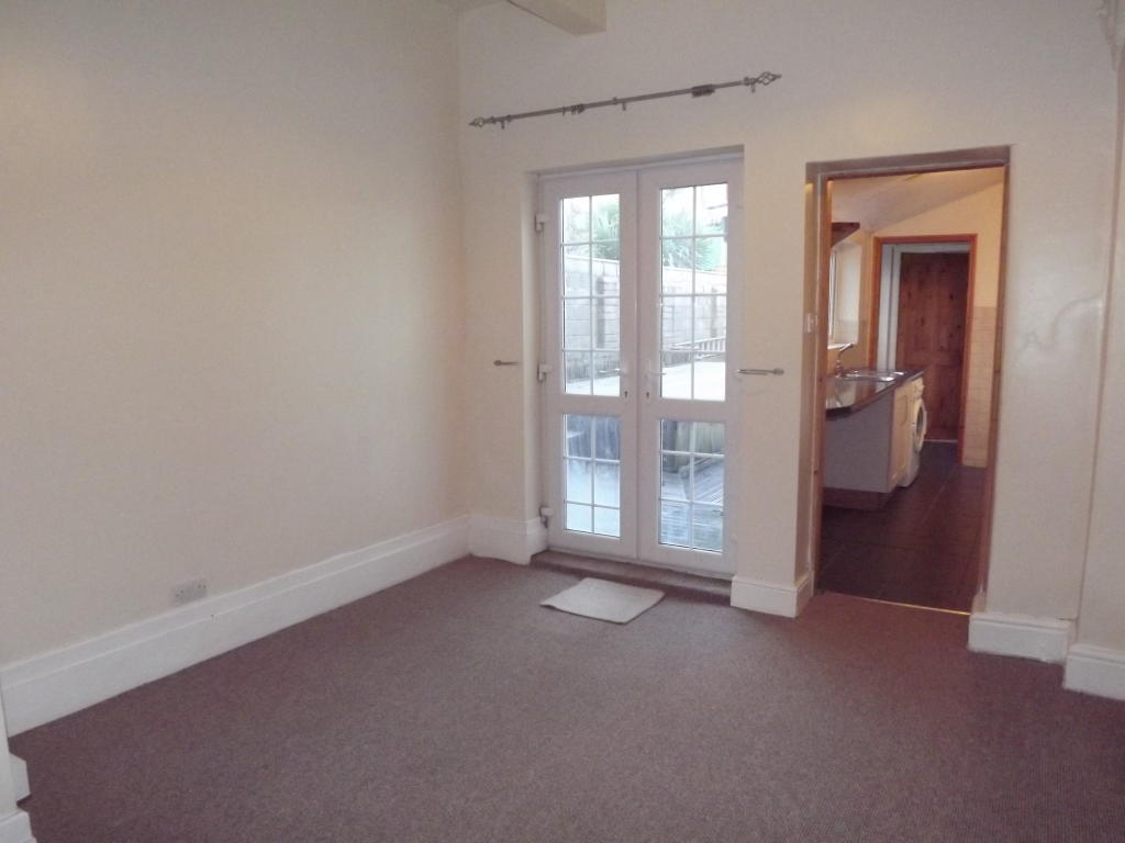
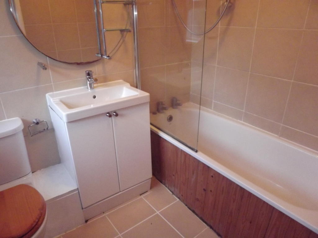
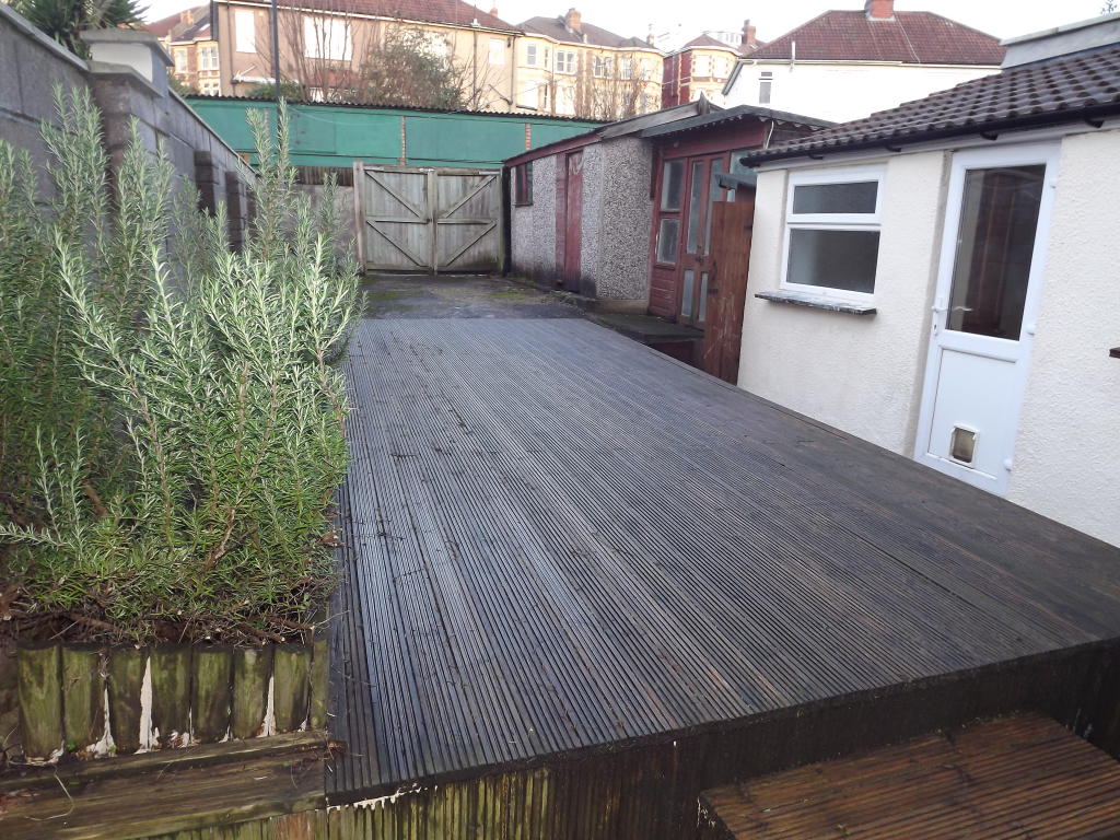
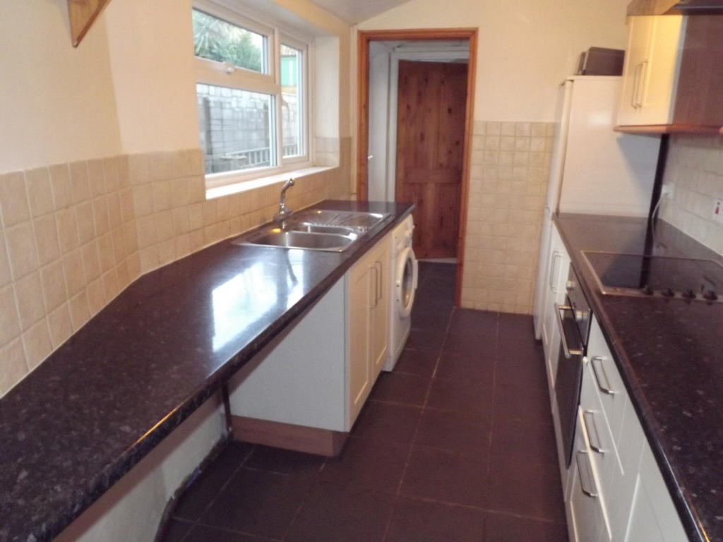
Photo 1 Photo 2 Photo 3 Photo 4 Photo 5 Photo 6 Photo 7
/ 7
Property details
Deprivation
Decile 10 (32,903 of 33,755)
Street crime
634 incidents within 1 mile (Apr 2026)
Key features
- available now
- garden flat
- off street parking at rear and garage
- 1 /2 bedrooms
- 1 /2 receptions
- French doors to garden
- bathroom with shower over bath
- ensuite WC in bedroom 1
- electric heating
- suitable for a professional couple or sharers
Additional details
- Parking
- Yes
- Garden
- Yes
Description
There flat comes with an off street parking space to the rear of the property, garage and a decked garden. There is also a BT and a Virgin connection into the flat.
For more information or to arrange a viewing please contact the Chappell and Matthews office.
Listed by
Bristol
Countrywide UK Lettings - Connells
Reference: 57357517
EPC Rating & Upgrade Cost
Fetching EPC data… Refresh this page in a moment.
Flood risk
Zone: 1
Risk: Low
Job (default Low)
FENSA Certificates
This property has 1 FENSA certificate(s) on record, indicating window/door installations by FENSA-approved installers.
FENSA Certificate #7901521
Property Details
Street: 98 Cranbrook Road
Town: BRISTOL
Postcode: BS6 7DB
Installation Details
Items: 7 windows
Certificate Issued: 17/01/2011
Work Completed: 10/12/2010
This certificate data was retrieved from FENSA's database
What is FENSA? FENSA (Fenestration Self-Assessment Scheme) is a government-authorised scheme that monitors building regulation compliance for replacement windows and doors. Certificates indicate that work was completed by FENSA-approved installers.
Rental Range
Estimated market rent for Bristol, City of. Low = conservative, Realistic = average, Optimistic = best case.
Based on Local Authority from postcode lookup → Bristol, City of.
LHA (30th percentile) floor for Gloucester: £723/mo (Apr 2025 – Mar 2026)
Location
Address
98 Cranbrook Road
Nearby
Nearest stations, universities and amenities (distance from property).
| Type | Name | Distance |
|---|---|---|
| Bus stop | Kersteman Road | 0.0 miles |
| Shop | The Centre For Better Grooves | 0.3 miles |
| Shop | EG Bishopston Services Gas Refill | 0.3 miles |
| Train station | Redland | 0.4 miles |
| Train station | Montpelier | 0.6 miles |
| Hospital | St Michael's Hospital | 1.0 miles |
| University | 5 Priory Road, Life Sciences | 1.1 miles |
| Hospital | The Chesterfield | 1.6 miles |
| University | dBs Institute Bristol Campus | 1.6 miles |
Street-level crime
| Category | Count |
|---|---|
| Violence and sexual offences | 180 |
| Shoplifting | 111 |
| Anti-social behaviour | 70 |
| Vehicle crime | 56 |
| Burglary | 47 |
| Public order | 44 |
| Other theft | 42 |
| Criminal damage and arson | 37 |
| Robbery | 16 |
| Bicycle theft | 14 |
| Other crime | 10 |
| Drugs | 3 |
| Theft from the person | 3 |
| Possession of weapons | 1 |
| Total incidents | 634 |
Within 1 mile during Apr 2026. Source: data.police.uk (England & Wales).
Schools nearby
Nearest open schools with Ofsted ratings (England). Closed schools are not shown. Data from Get Information about Schools and Ofsted.
| Name | Type | Distance | Ofsted |
|---|---|---|---|
| Redland Green School | Secondary | 0.2 miles | Good — 23 Jan 2024 |
| St Bonaventure's Catholic Primary School | Primary | 0.3 miles | Good — 4 Jul 2013 |
| Bishop Road Primary School | Primary | 0.5 miles | Outstanding — 12 Dec 2023 |
| Cotham Gardens Primary School | Primary | 0.5 miles | — (Inspected (no overall grade)) |
| E-Act Montpelier High School | Secondary | 0.5 miles | Inadequate — 16 Jun 2022 |
Rental Comparables
Rental comparables are temporarily unavailable while listing-site fetches are paused. Try again later.