Yorton Heath
Shrewsbury, Shropshire SY4, SY4 3EU
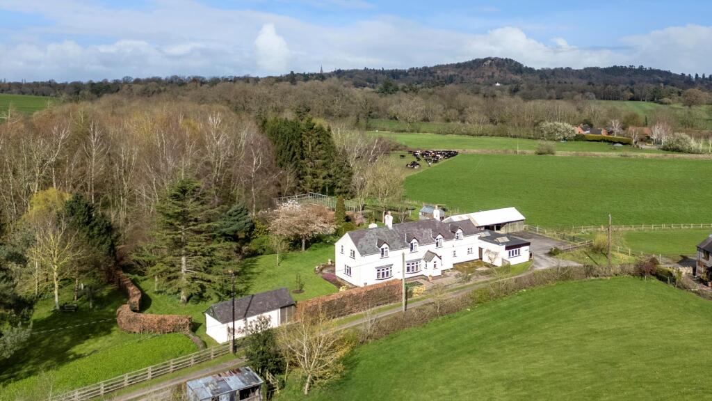
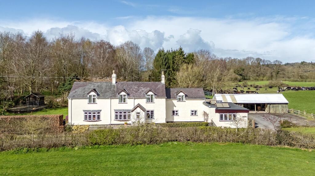
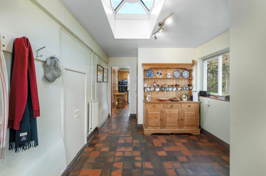
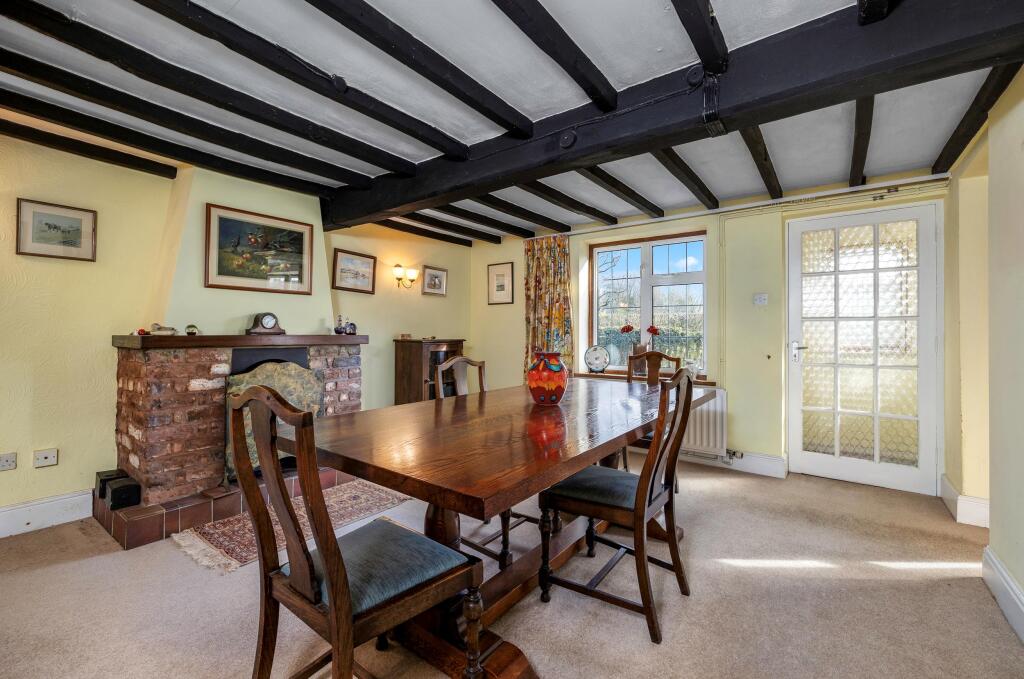
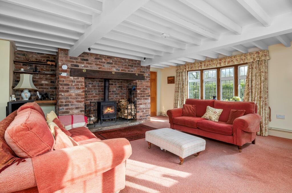
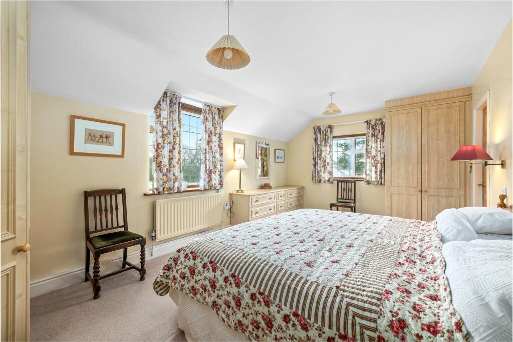
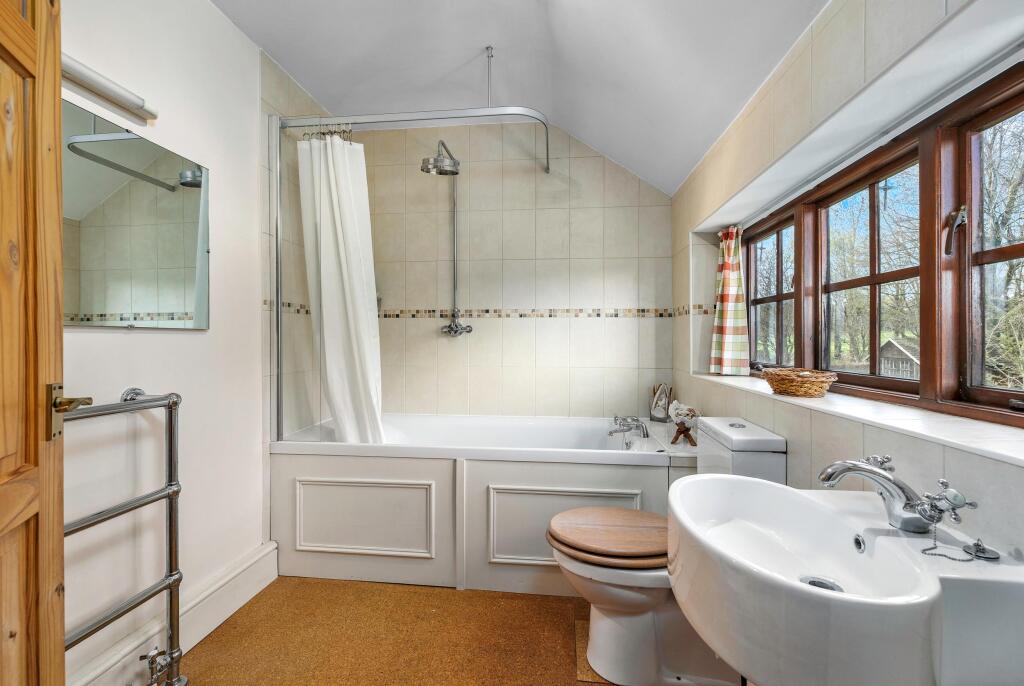
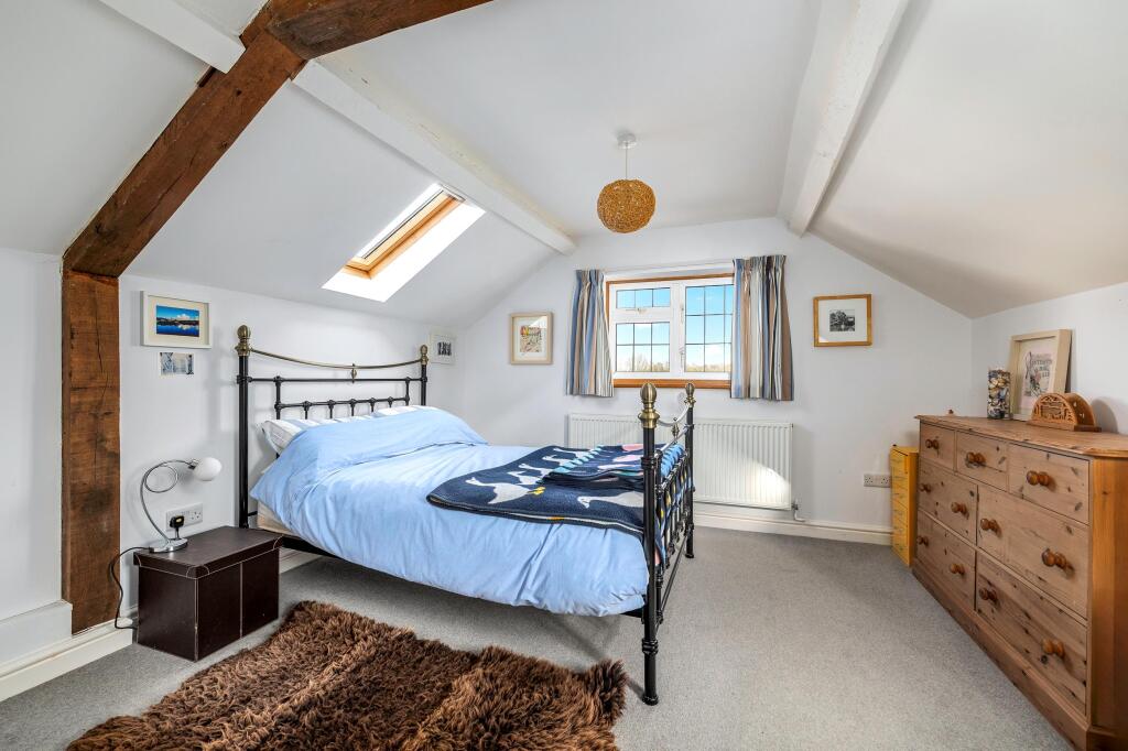
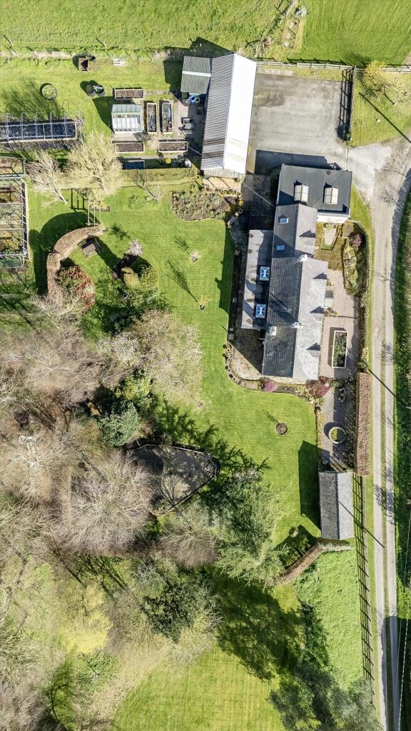
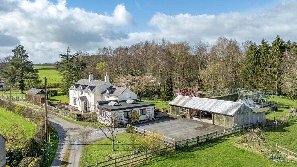
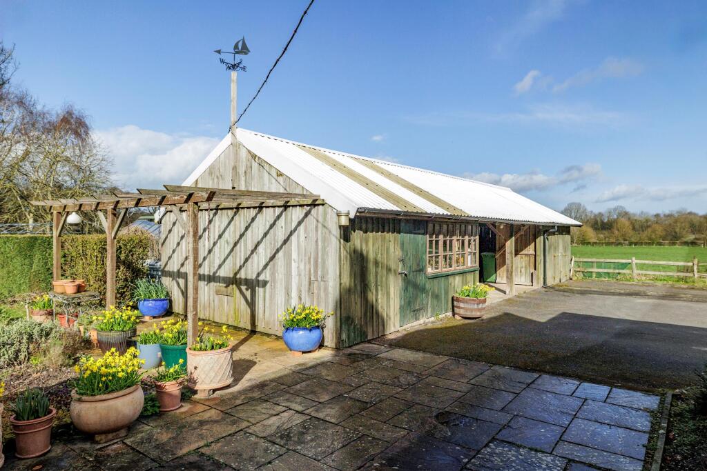
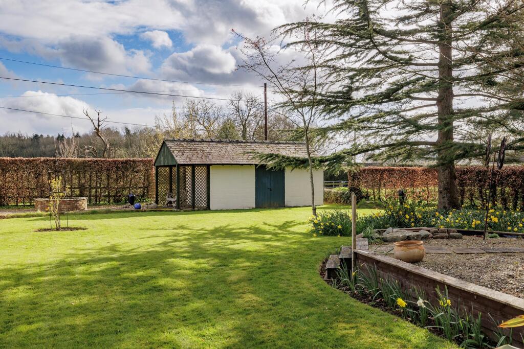
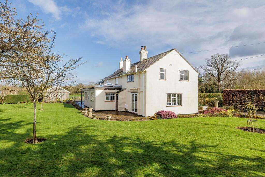
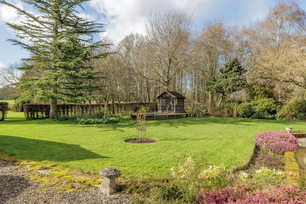
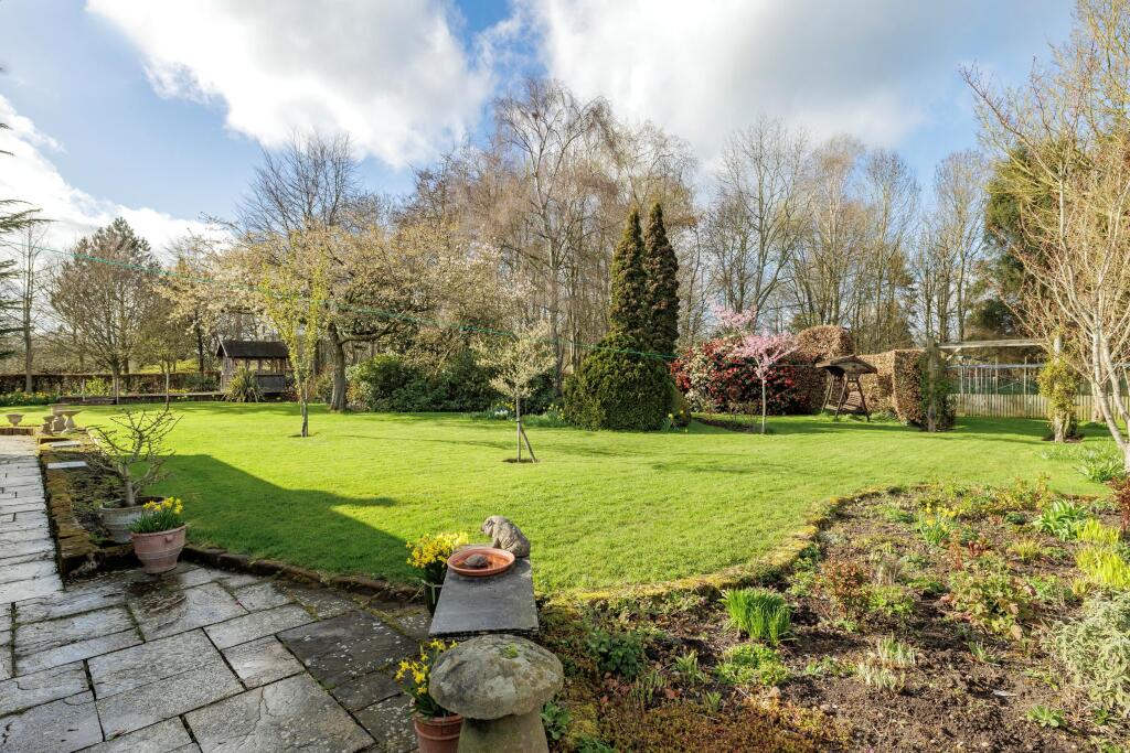
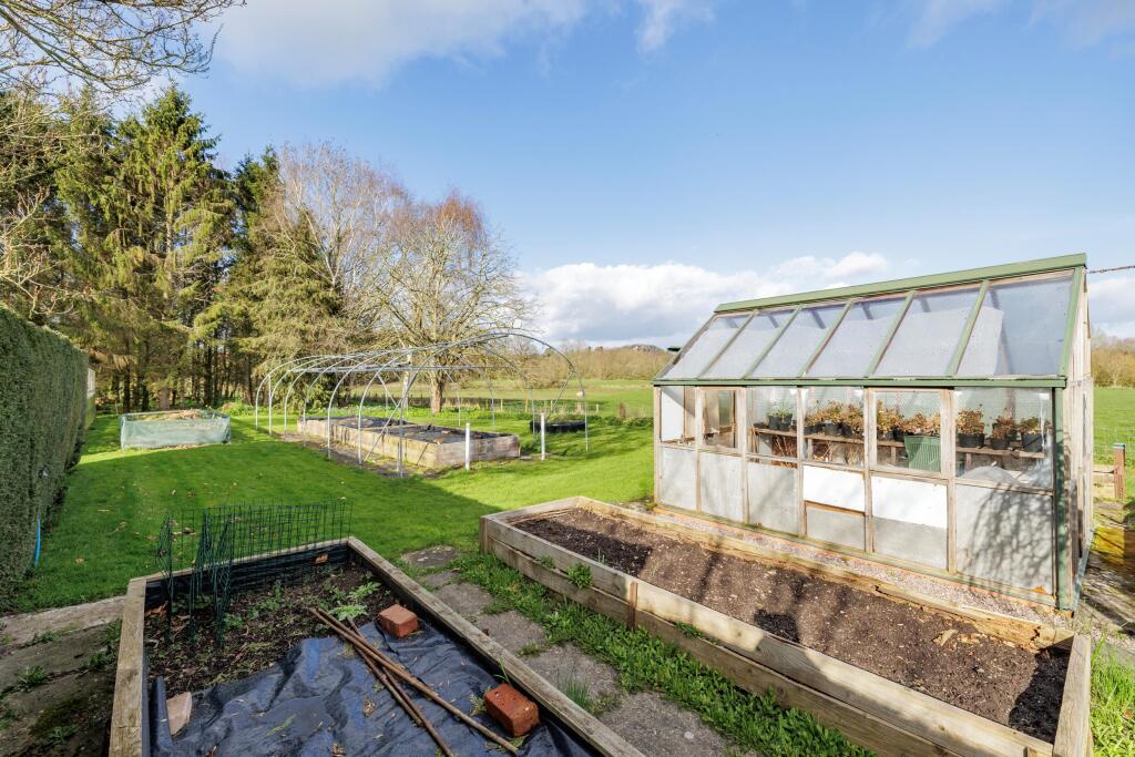
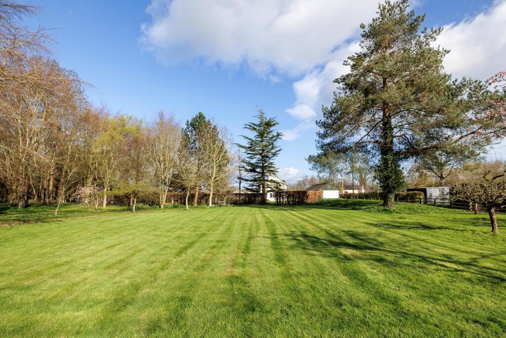
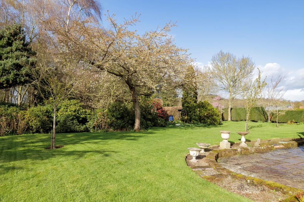
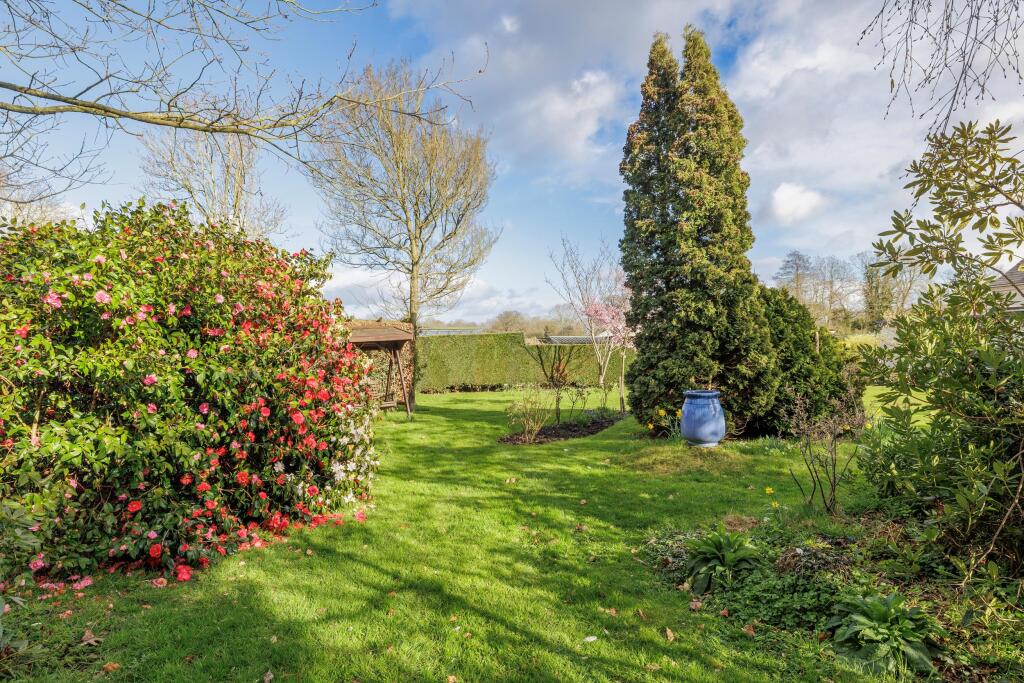
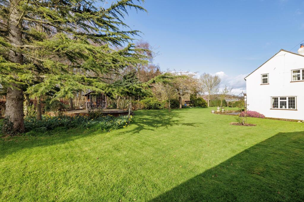
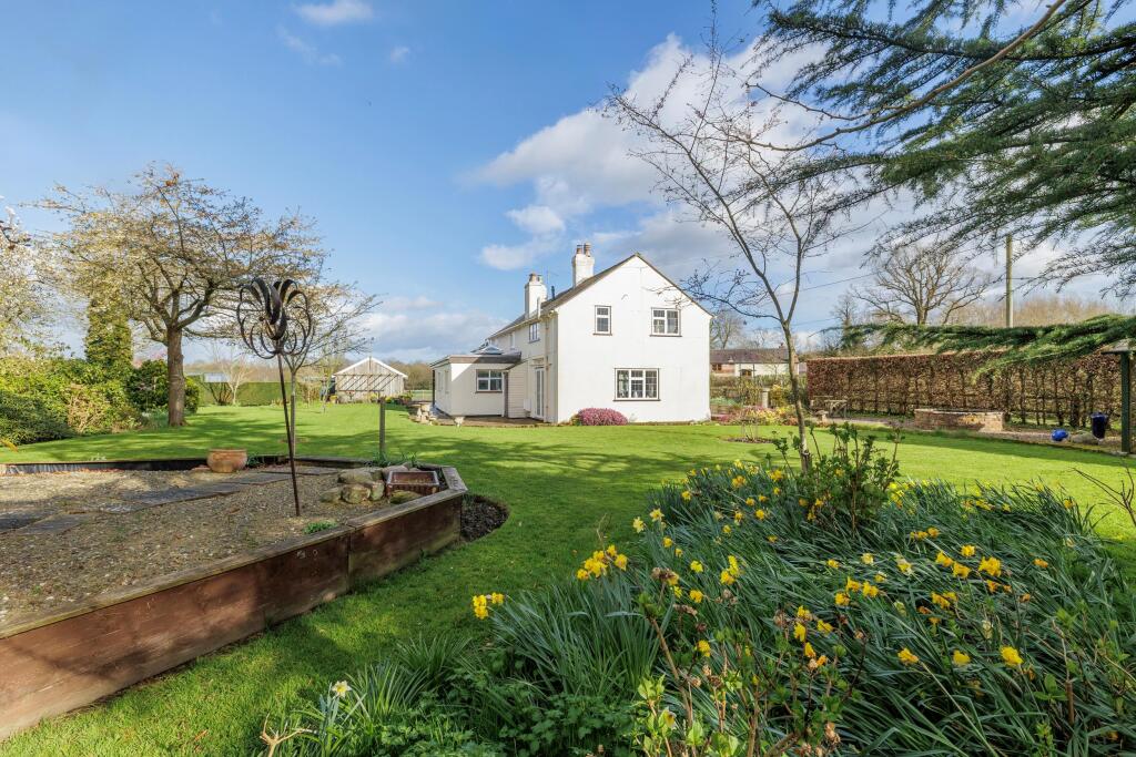
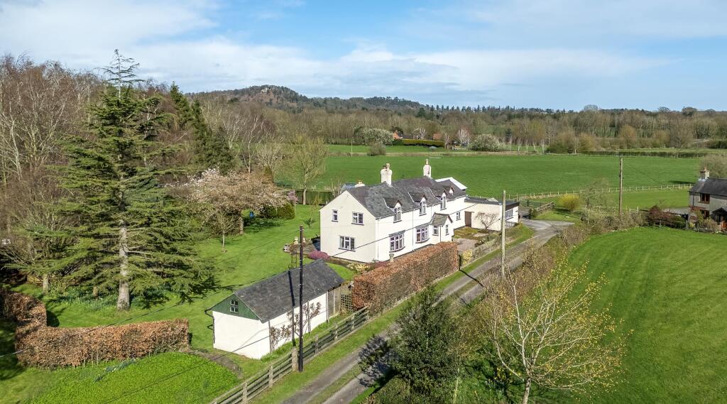
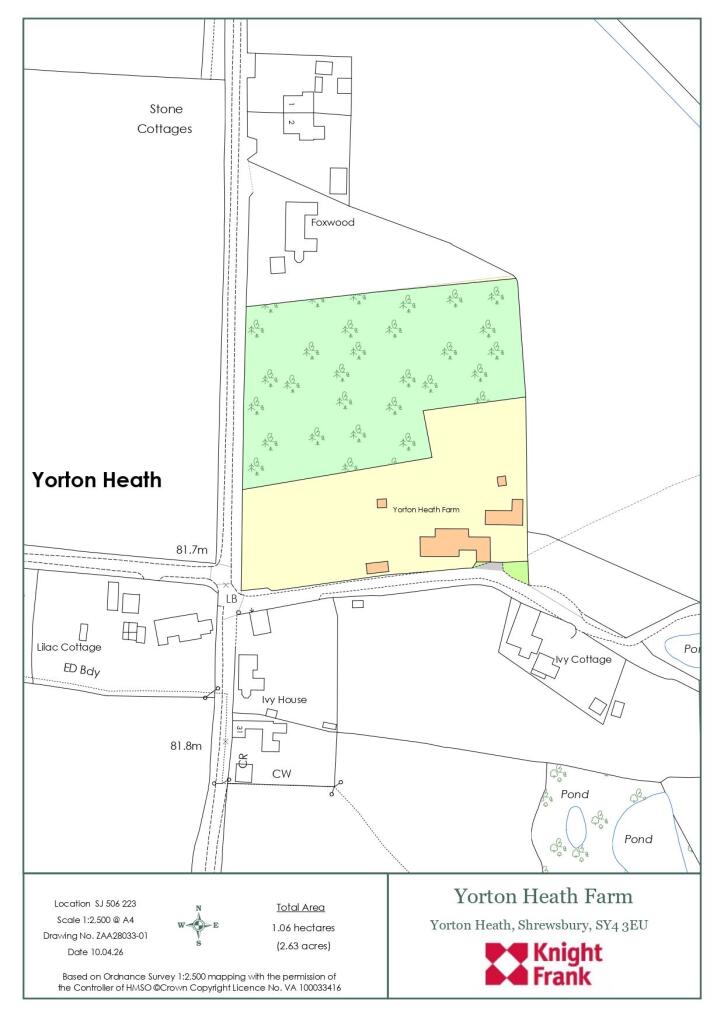
Photo 1 Photo 2 Photo 3 Photo 4 Photo 5 Photo 6 Photo 7 Photo 8 Photo 9 Photo 10 Photo 11 Photo 12 Photo 13 Photo 14 Photo 15 Photo 16 Photo 17 Photo 18 Photo 19 Photo 20 Photo 21 Photo 22 Photo 23 Photo 24
/ 24
Property details
Tenure
FREEHOLD
Council tax band
F
Local average
£389,864 (+92.4%)
Deprivation
Decile 6 (19,265 of 33,755)
Street crime
2 incidents within 1 mile (Mar 2026)
Key features
- 4 bedrooms
- 4 reception rooms
- 3 bathrooms
- Outbuildings
- Detached
- Garden
- Cottage
Additional details
- Parking
- Yes
- Garden
- Yes
- Listed property
- No
Description
Combined with the extensive grounds and outbuildings it offers a complete set up for rural living yet just 7 miles from central Shrewsbury.
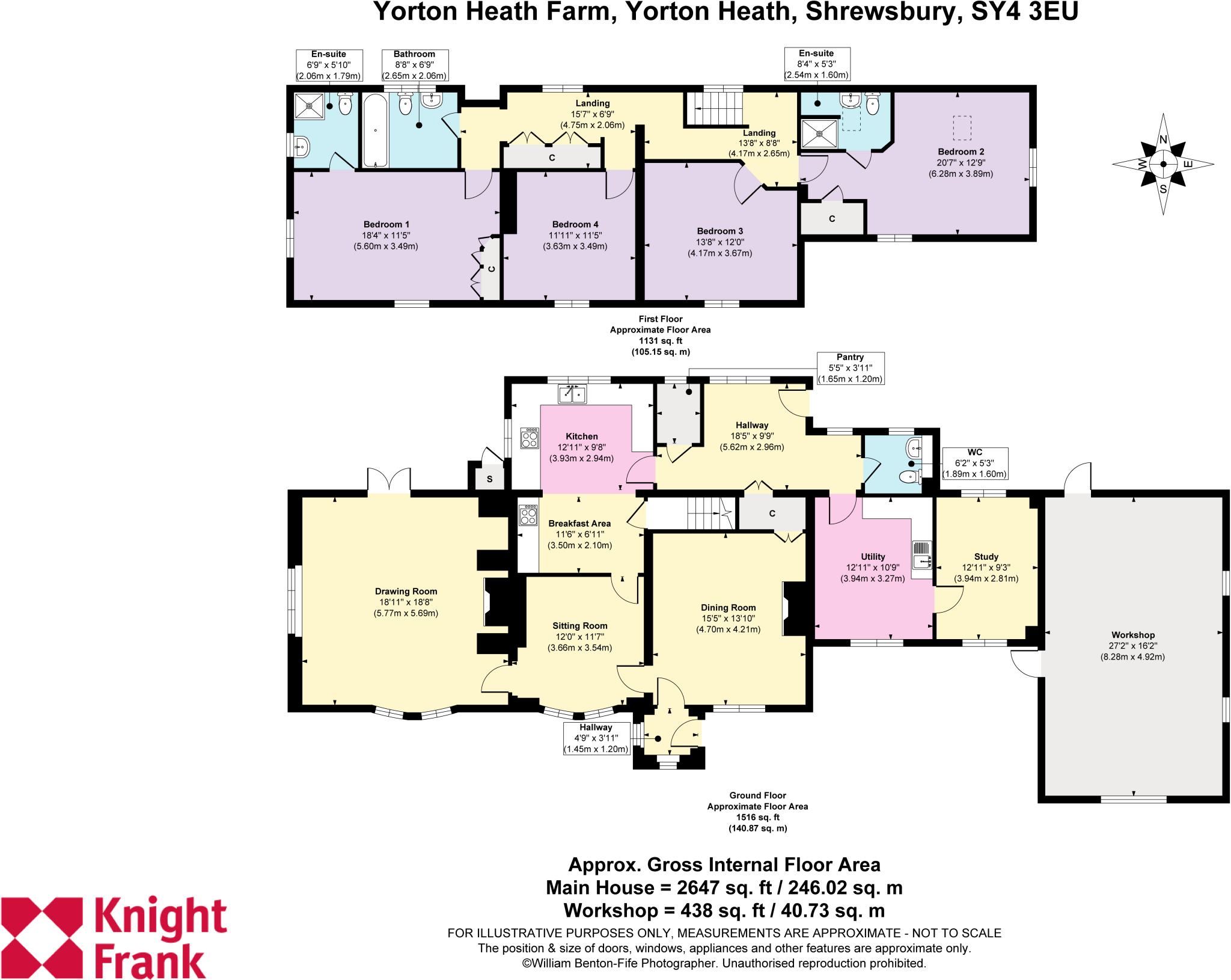
To the ground floor the drawing room is triple aspect and has a feature brick inglenook style fireplace with a wood burning stove. There is a second sitting room and large formal dining room with open fireplace. The kitchen/breakfast room is fitted with oak fronted units and includes a fitted electric oven and grill, an integrated dishwasher and a gas fired Esse stove. Beyond the kitchen is a rear hallway, cloakroom, useful pantry, large utility/boot room and study.
On the first floor are four double bedrooms all accessed from a landing. The master bedroom is double aspect with fitted wardrobes and an ensuite shower room. There is a further large double bedroom with exposed feature beam and an ensuite shower room. Two further double bedrooms and a bathroom including a shower over bath complete the first floor.
Gardens & Outside
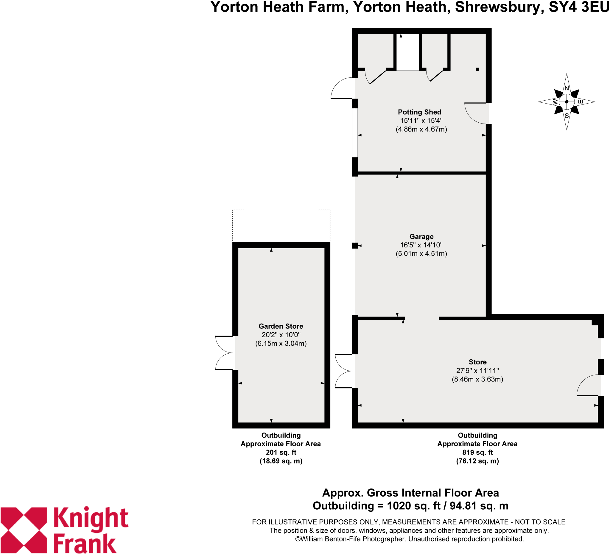
The property is approached over a tarmacadam driveway with parking for several cars leading to the workshop entrance and further timber outbuilding comprising of large store, open bay double garaging and a potting shed. A paved patio leads to the rear door and hallway. Beyond is a further paved patio area accessed from the drawing room.
Yorton Heath Farm benefits from a level lawn area immediately to the rear with a central rose bed and planted with a mix of mature shrubs and trees adjacent to a timber summerhouse. A further garden store can be found at the front of the plot. Beyond the hedge is a further large area of lawn, formerly a paddock with a number of apple trees. The kitchen garden is made of several raised beds including an asparagus bed, polytunnel cage, fruit cage and greenhouse. The woodland to the rear of the grounds offers privacy and is planted with a mix of native species. All in about 2.6 acres. The boundaries are marked by a mix of post and rail fencing, stock fencing, and hedgerow.
Agents Note: Please note a footpath crosses the very top corner of the drive boundary on the south eastern side.
Services: Mains electricity, water and gas. Private drainage. Fibre Broadband.Yorton Heath Farm is situated in the small hamlet of Yorton Heath just north of Shrewsbury and less than 2 miles from the village of Clive.
Situated in picturesque countryside and surrounded by farmland of predominantly the Sansaw Estate it offers easy vehicular access to facilities in the nearby villages of Clive, Myddle and Wem.
Yorton station provides direct links to Crewe for fast trains to London as well as direct trains to Shrewsbury, Hereford, and Cardiff.
Directions:
From Shrewsbury take the A528 Ellesmere Road, north passing through Albrighton and Preston Gubbals. After about 5 miles turn right signposted Hadnall. Proceed along the lane and take the second left then continue until you reach Yorton Heath. Take your first right turn into the private road (opposite the end of Chapel Lane) and Yorton Heath Farm is situated on the left-hand side.
Distances:
-Yorton Railway Station 1 .1 miles
-Shrewsbury Centre 7 miles,
-Telford 19 miles
-Birmingham 51 miles
(Distances and time approximate).
What3words: shin.cosmic.campers
Listed by
Shrewsbury
Knight Frank
Reference: 174308321
EPC ratings on this postcode
We don't have a matched EPC for this property yet. Below are efficiency scores and details for other addresses on this postcode.
| Address | Current | Potential | Floor area | Age band | Type |
|---|---|---|---|---|---|
| 31, Yorton Heath, SHREWSBURY | 59 | 90 | 110 m² | England and Wales: before 1900 | Detached |
| Archway Cottage, Yorton Heath, SHREWSBURY | 55 | 82 | 211 m² | England and Wales: before 1900 | Detached |
| Foxfields, Yorton Heath, SHREWSBURY | 25 | 73 | 250 m² | England and Wales: 1950-1966 | Detached |
| Foxwood, Yorton Heath, SHREWSBURY | 54 | 91 | 141 m² | England and Wales: 1950-1966 | Detached |
| Ivy House, Yorton Heath, SHREWSBURY | 51 | 92 | 145 m² | — | Detached |
| The Old Chapel, Yorton Heath, SHREWSBURY | 59 | 94 | 145 m² | England and Wales: before 1900 | Detached |
| Woodside, Yorton Heath, SHREWSBURY | 42 | 80 | 159 m² | England and Wales: 1950-1966 | Detached |
| Yorton Heath Farm, Yorton Heath, SHREWSBURY | 66 | 76 | 224 m² | England and Wales: before 1900 | Detached |
Flood risk
Zone: 1
Risk: Low
Job (default Low)
Floorplans
Yorton Heath Farm, Y
Yorton Heath Farm, Y
EPC Graphs

EPC - valid until De
Price history
| Event | Date | Price | % change |
|---|---|---|---|
| Listed for sale | — | £750,000 | — |
Source: HM Land Registry Price Paid Data. Crown copyright.
Sold Comparables
Same street and nearby sales within 0.25 miles (last 5 years). Data from Land Registry Price Paid.
| Address | Price | Date | Type |
|---|---|---|---|
| 7 CHAPEL LANE, YORTON HEATH, SHREWSBURY, SHROPSHIRE, SY4 3EY | £575,000 | 15/12/2022 | Detached |
| CHAPEL CROFT, YORTON HEATH, SHREWSBURY, SHROPSHIRE, SY4 3EU | £555,000 | 20/09/2021 | Detached |
Area average: £565,000 (2 sales)
Capital growth trend
Land Registry outcode average: last 12 months vs 5y and 10y ago (from sold prices).
House Price Index (HM Land Registry — official index, not sold-price averages): Shropshire. Series: Detached. As of February 2026.
Rental Range
Estimated market rent for Shropshire. Low = conservative, Realistic = average, Optimistic = best case.
Based on Local Authority from postcode lookup → Shropshire.
LHA (30th percentile) floor for Shropshire: £972/mo (Apr 2025 – Mar 2026)
Location
Address
Chapel Lane
Nearby
Nearest stations, universities and amenities (distance from property).
| Type | Name | Distance |
|---|---|---|
| Train station | Yorton | 0.9 miles |
| Shop | Pimhill Farm Shop | 1.2 miles |
| Shop | Unknown | 1.4 miles |
| Bus stop | The New Inn | 1.8 miles |
| Bus stop | White Lodge Park | 3.1 miles |
| Train station | Wem | 4.2 miles |
| Hospital | The Uplands | 6.0 miles |
| Hospital | Severn Hospice Shrewsbury | 6.0 miles |
Street-level crime
| Category | Count |
|---|---|
| Burglary | 1 |
| Violence and sexual offences | 1 |
| Total incidents | 2 |
Within 1 mile during Mar 2026. Source: data.police.uk (England & Wales).
Schools nearby
Nearest open schools with Ofsted ratings (England). Closed schools are not shown. Data from Get Information about Schools and Ofsted.
| Name | Type | Distance | Ofsted |
|---|---|---|---|
| Clive CofE Primary School | Primary | 1.2 miles | Good — 27 Jun 2014 |
| Access School | Other | 1.5 miles | Good — 9 Jun 2024 |
| Hadnall Church of England Primary School | Primary | 1.9 miles | Good — 11 Sep 2019 |
| Myddle CofE Primary School | Primary | 2.5 miles | Good — 20 May 2013 |
| Bomere Heath CofE Primary School | Primary | 2.7 miles | Good — 6 Oct 2022 |
Rental Comparables
Loading rental comparables for this postcode. Refresh in a few minutes.
Rent-driven metrics
Based on Area rent estimate.
- Rent ratio — Monthly rent ÷ purchase price (1% rule). 1%+ = strong, 0.8–1% = okay, <0.8% = weak for cashflow.
- Max investor price — Rent ÷ 0.8%; the price at which rent would be 0.8% of price (Stoke-style target).
- Target investor price — Rent ÷ 1%; the price at which rent would be 1% of price (strong cashflow band).
- Gross yield — Annual rent as % of purchase price (no costs).
Enter House Number
Enter the house number to help us retrieve more accurate pricing history and property data.
Please log in to submit or correct the house number for this listing.
Log in to continue