852 KINGSTANDING ROAD
BIRMINGHAM, WEST MIDLANDS B44 9RT
£675 pcm
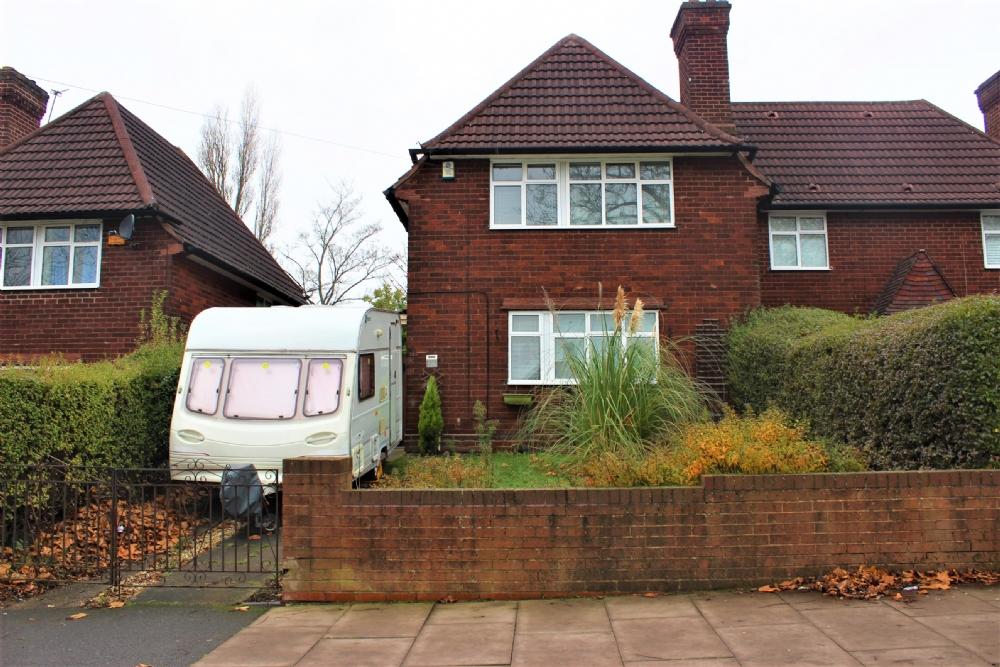
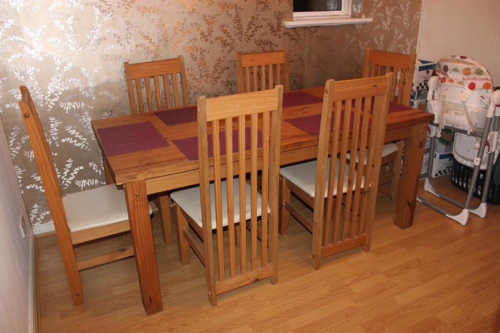
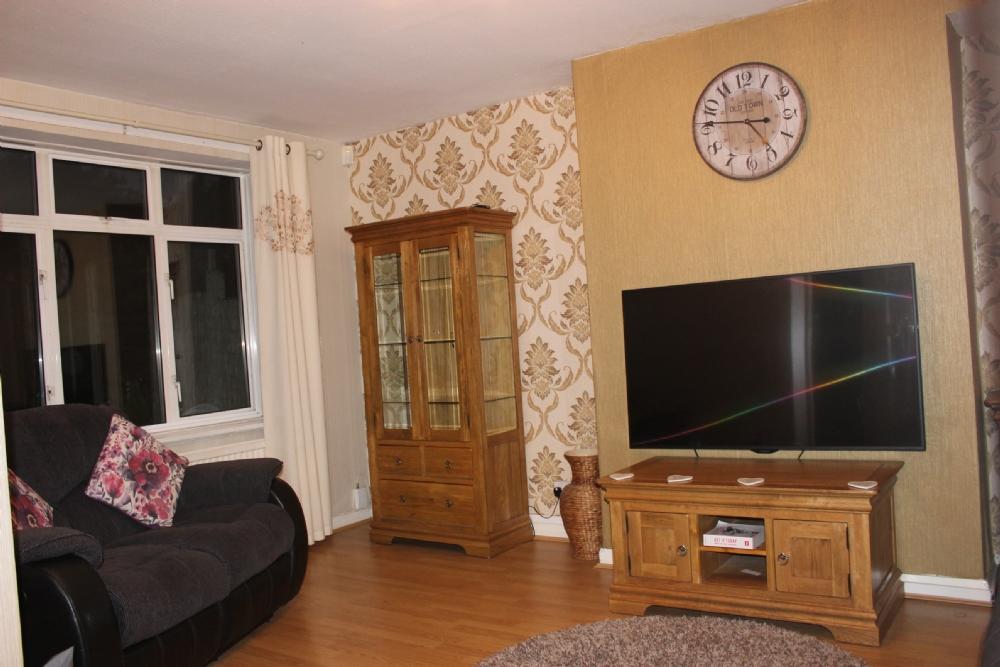
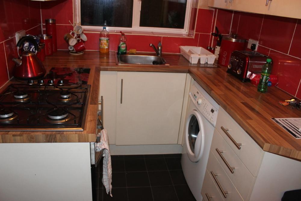
Photo 1 Photo 2 Photo 3 Photo 4
/ 4
Property details
Floor area
89 m²
Deprivation
Decile 4 (10,424 of 33,755)
Street crime
300 incidents within 1 mile (Apr 2026)
Key features
- 2 Reception Rooms
- 3 large bedrooms
- Family bathroom with shower
- Double Glazed
- modern kitchen
- driveway
- front & rear gardens
- new boiler
- avaiable december
Additional details
- Parking
- Yes
- Garden
- Yes
Description
Listed by
Great Barr
Springers (Great Barr) Limited
Reference: 62704795
EPC Rating & Upgrade Cost
Fetching EPC data… Refresh this page in a moment.
Flood risk
Zone: 2
Risk: In flood risk area
Environment Agency Flood Risk Areas (APSFR)
Rental Range
Estimated market rent for Birmingham. Low = conservative, Realistic = average, Optimistic = best case.
Based on Local Authority from postcode lookup → Birmingham.
LHA (30th percentile) floor for Birmingham: £823/mo (Apr 2025 – Mar 2026)
Location
Nearby
Nearest stations, universities and amenities (distance from property).
| Type | Name | Distance |
|---|---|---|
| Shop | Sci Tech Planet | 0.0 miles |
| Shop | Home & Hardware | 0.0 miles |
| Bus stop | KL | 0.0 miles |
| Bus stop | KM | 0.1 miles |
| University | Maryvale Institute | 0.5 miles |
| Train station | Wylde Green | 2.3 miles |
| Train station | Hamstead | 2.5 miles |
| University | BIMM University Birmingham | 5.4 miles |
| Hospital | Sir Robert Peel Community Hospital | 8.2 miles |
| Hospital | Brian Oliver Centre | 8.2 miles |
Street-level crime
| Category | Count |
|---|---|
| Violence and sexual offences | 122 |
| Criminal damage and arson | 32 |
| Vehicle crime | 27 |
| Other theft | 23 |
| Shoplifting | 18 |
| Burglary | 15 |
| Anti-social behaviour | 14 |
| Public order | 14 |
| Other crime | 10 |
| Possession of weapons | 10 |
| Drugs | 9 |
| Robbery | 5 |
| Theft from the person | 1 |
| Total incidents | 300 |
Within 1 mile during Apr 2026. Source: data.police.uk (England & Wales).
Schools nearby
Nearest open schools with Ofsted ratings (England). Closed schools are not shown. Data from Get Information about Schools and Ofsted.
| Name | Type | Distance | Ofsted |
|---|---|---|---|
| Kingsland Primary School (NC) | Primary | 0.3 miles | Good — 8 Mar 2023 |
| The Bridge School | Other | 0.4 miles | Good — 10 Dec 2013 |
| Sutton Park Primary | Primary | 0.4 miles | Good — 9 May 2024 |
| Cardinal Wiseman Catholic School | Secondary | 0.4 miles | Good — 7 Nov 2016 |
| Aspire AP School 2 | Other | 0.5 miles | Good — 1 Feb 2022 |
Rental Comparables
Residential lets from OpenRent and Rightmove for the area (same bedroom count). Use to validate rent estimates. Student lets are excluded.
| Title | Rent | Beds | Distance | As seen on |
|---|---|---|---|---|
| 3 Bed Terraced House, Kings Road, B44 | £1,300/mo | 3 | 0.47 miles | OpenRent |
| 3 Bed Semi-Detached House, Sidcup Road, B44 | £1,150/mo | 3 | 0.55 miles | OpenRent |
Average rent: £1,225/mo (2 listings)