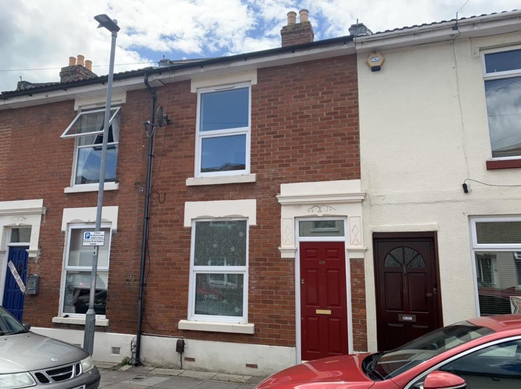
118 GUILDFORD ROAD
PORTSMOUTH, PORTSMOUTH, PORTSMOUTH PO1 5EB
£900 pcm
Property details
Floor area
82 m²
Deprivation
Decile 3 (7,968 of 33,755)
Street crime
986 incidents within 1 mile (Apr 2026)
Key features
- Downstairs WC
- Close Proximity to Local Amenities
- Recently Refurbished
Additional details
- Garden
- Yes
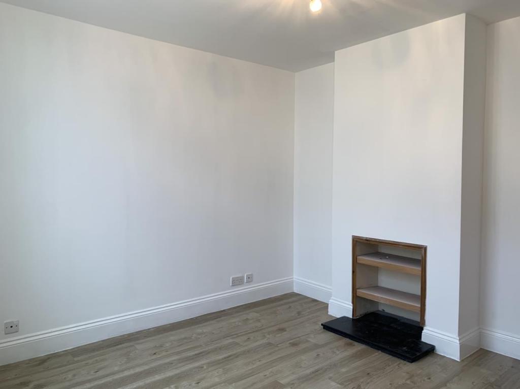
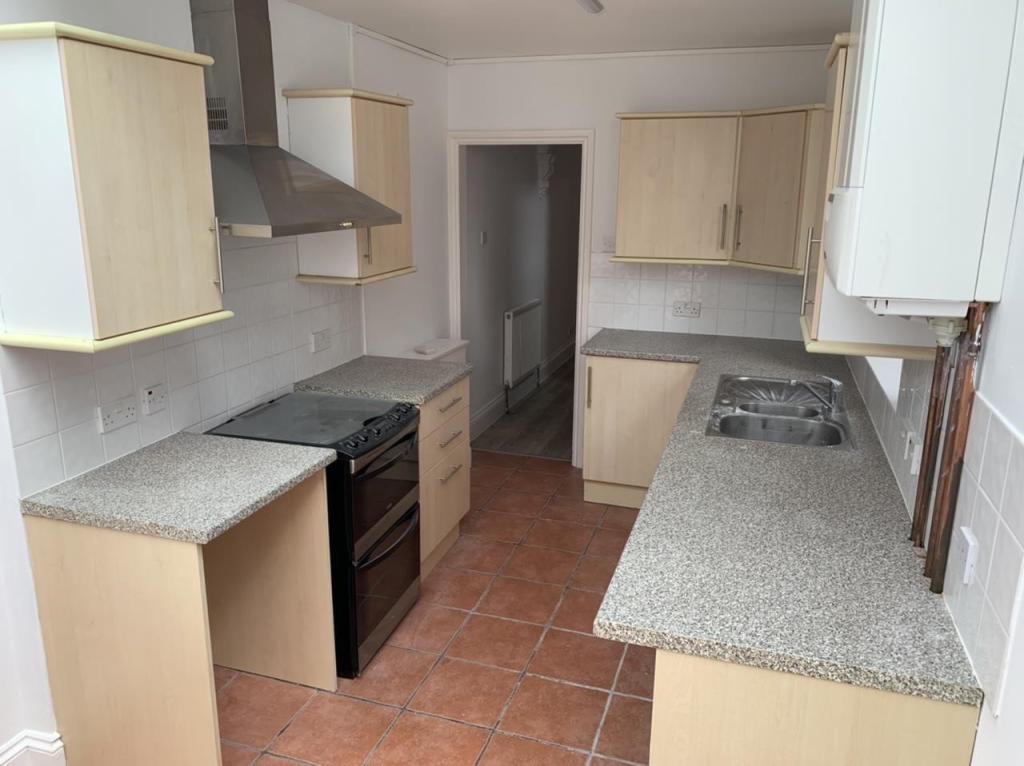
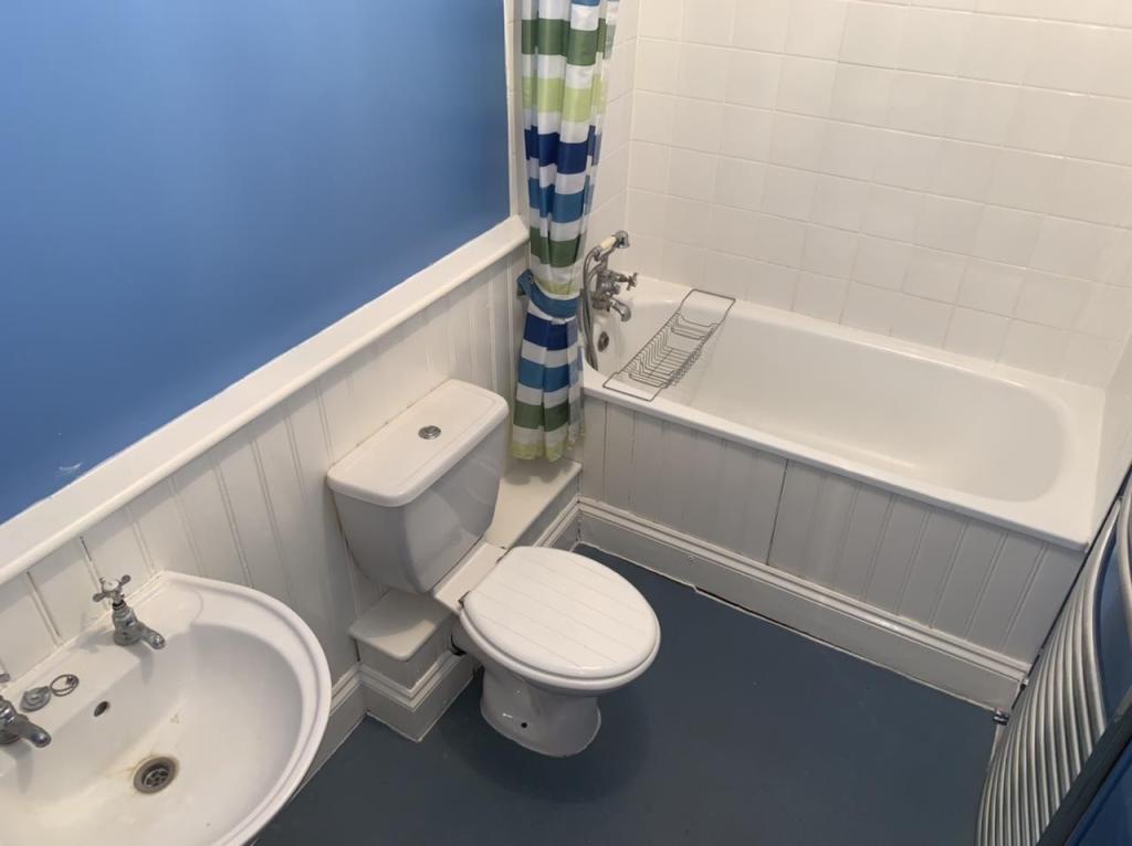
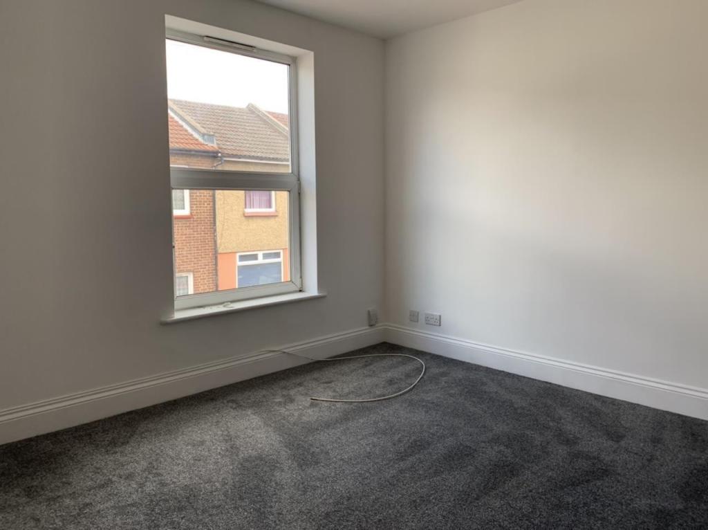
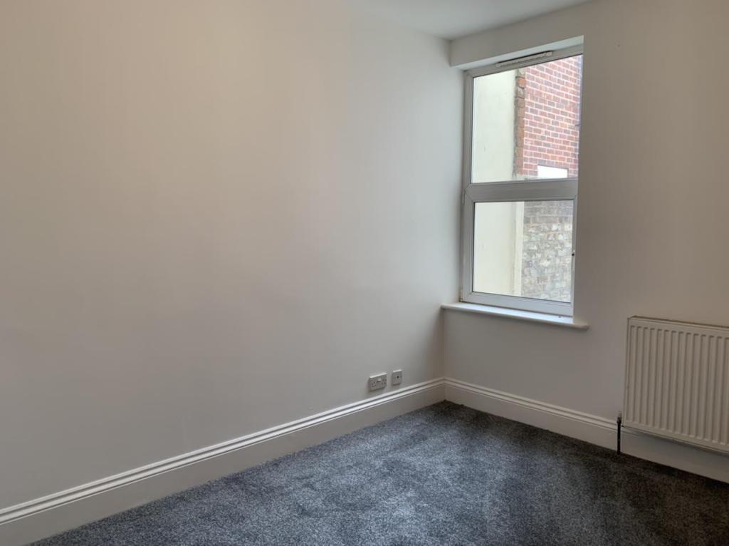
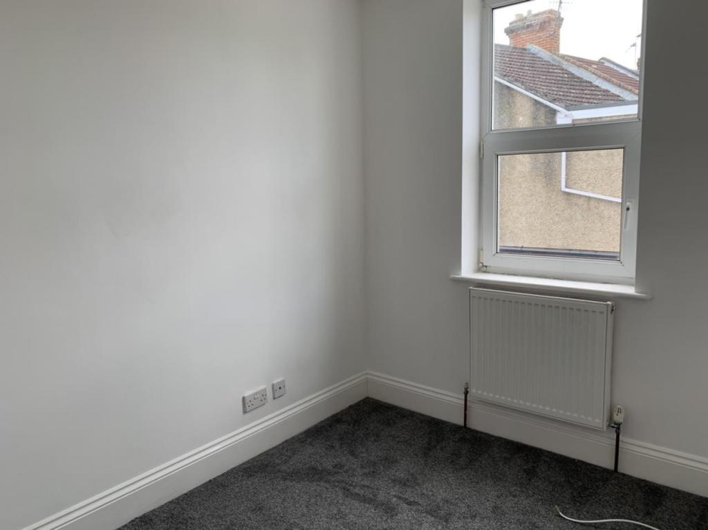
Description
Reception 1
Reception 2
Kitchen
Bedroom 1
Bedroom 2
Bedroom 3
Bathroom
Listed by
Portsmouth
ECM Management Ltd
Reference: 71689149
EPC Rating & Upgrade Cost
Fetching EPC data… Refresh this page in a moment.
Flood risk
Zone: 1
Risk: Low
Job (default Low)
EPC Graphs

EPC Graph
Rental Range
Estimated market rent for Portsmouth. Low = conservative, Realistic = average, Optimistic = best case.
Based on Local Authority from postcode lookup → Portsmouth.
LHA (30th percentile) floor for Portsmouth: £997/mo (Apr 2025 – Mar 2026)
Location
Nearby
Nearest stations, universities and amenities (distance from property).
| Type | Name | Distance |
|---|---|---|
| Shop | Handy Stores | 0.1 miles |
| Shop | Penhale News | 0.1 miles |
| Bus stop | Arundel Street | 0.1 miles |
| Train station | Fratton | 0.2 miles |
| Train station | Portsmouth and Southsea | 0.8 miles |
| University | Careers and Employability Service | 0.9 miles |
| University | St Andrew's Court Information Centre | 1.0 miles |
| Hospital | Forton Medical Centre | 3.0 miles |
| Hospital | Elmleigh Hospital | 5.9 miles |
Street-level crime
| Category | Count |
|---|---|
| Violence and sexual offences | 361 |
| Anti-social behaviour | 129 |
| Shoplifting | 99 |
| Public order | 81 |
| Other theft | 63 |
| Criminal damage and arson | 59 |
| Drugs | 57 |
| Vehicle crime | 51 |
| Other crime | 18 |
| Possession of weapons | 16 |
| Burglary | 14 |
| Robbery | 14 |
| Bicycle theft | 13 |
| Theft from the person | 11 |
| Total incidents | 986 |
Within 1 mile during Apr 2026. Source: data.police.uk (England & Wales).
Schools nearby
Nearest open schools with Ofsted ratings (England). Closed schools are not shown. Data from Get Information about Schools and Ofsted.
| Name | Type | Distance | Ofsted |
|---|---|---|---|
| Penbridge Infant School & Nursery | Primary | 0.1 miles | Good — 10 Sep 2013 |
| The Portsmouth Academy | Secondary | 0.3 miles | Good — 23 May 2017 |
| Priory School | Secondary | 0.4 miles | Good — 15 Jan 2023 |
| Arundel Court Primary Academy and Nursery | Primary | 0.4 miles | Good — 10 Jul 2015 |
| St John's Cathedral Catholic Primary School | Primary | 0.4 miles | Good — 21 Sep 2022 |
Rental Comparables
Residential lets from OpenRent and Rightmove for the area (same bedroom count). Use to validate rent estimates. Student lets are excluded.
| Title | Rent | Beds | Distance | As seen on |
|---|---|---|---|---|
| 3 Bed Flat, Gunwharf Quays, PO1 | £3,100/mo | 3 | 1.34 miles | OpenRent |
Average rent: £3,100/mo (1 listing)