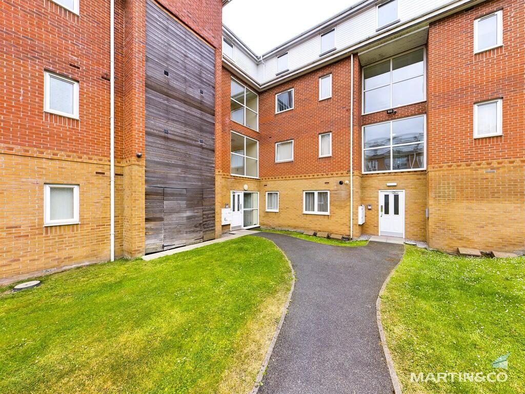
The Grange
Rock Ferry, CH42 4PE
£650 pcm
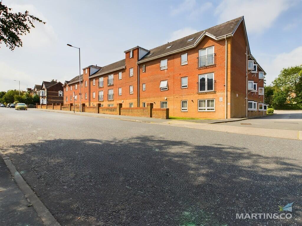
Property details
Council tax band
A
Deprivation
Decile 1 (2,271 of 33,755)
Street crime
254 incidents within 1 mile (Apr 2026)
Key features
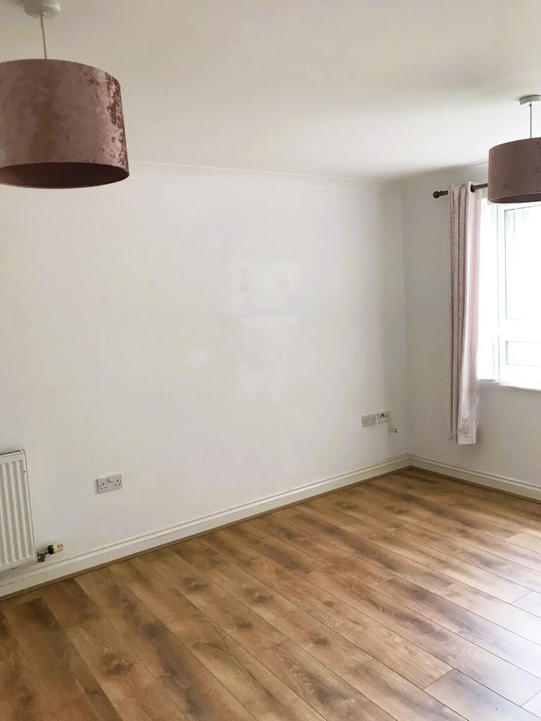
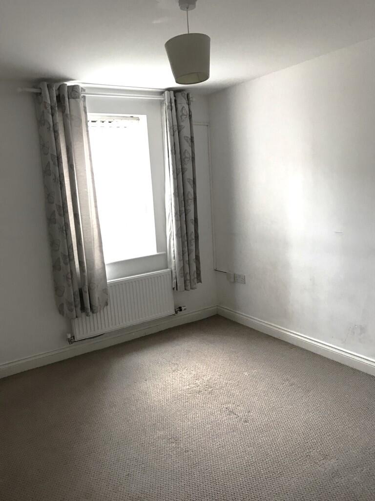
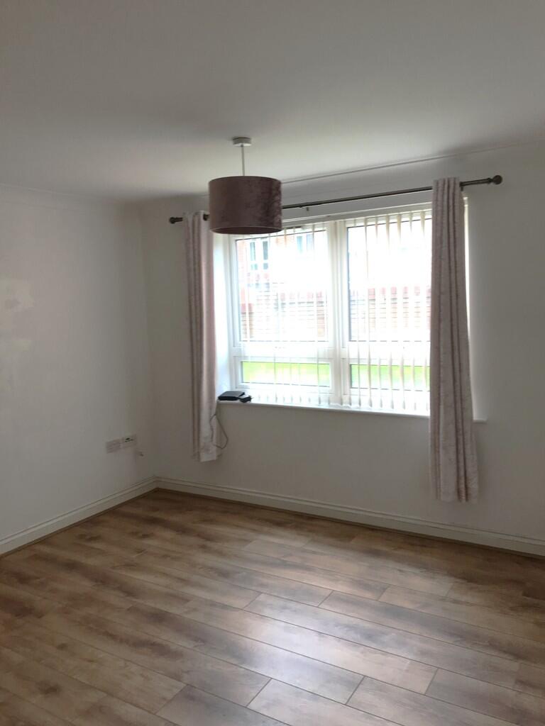
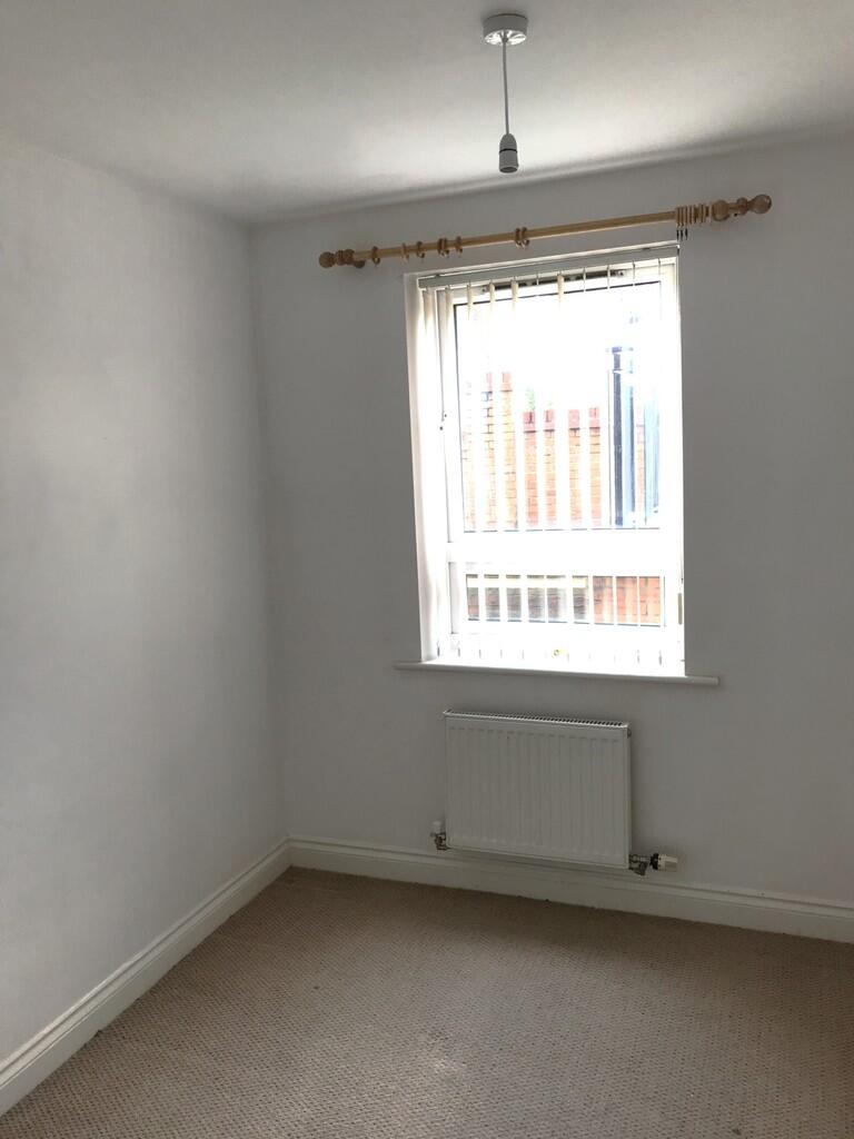
- Ground Floor 2 Bedroom Apartment
- Spacious Lounge/Dining Room
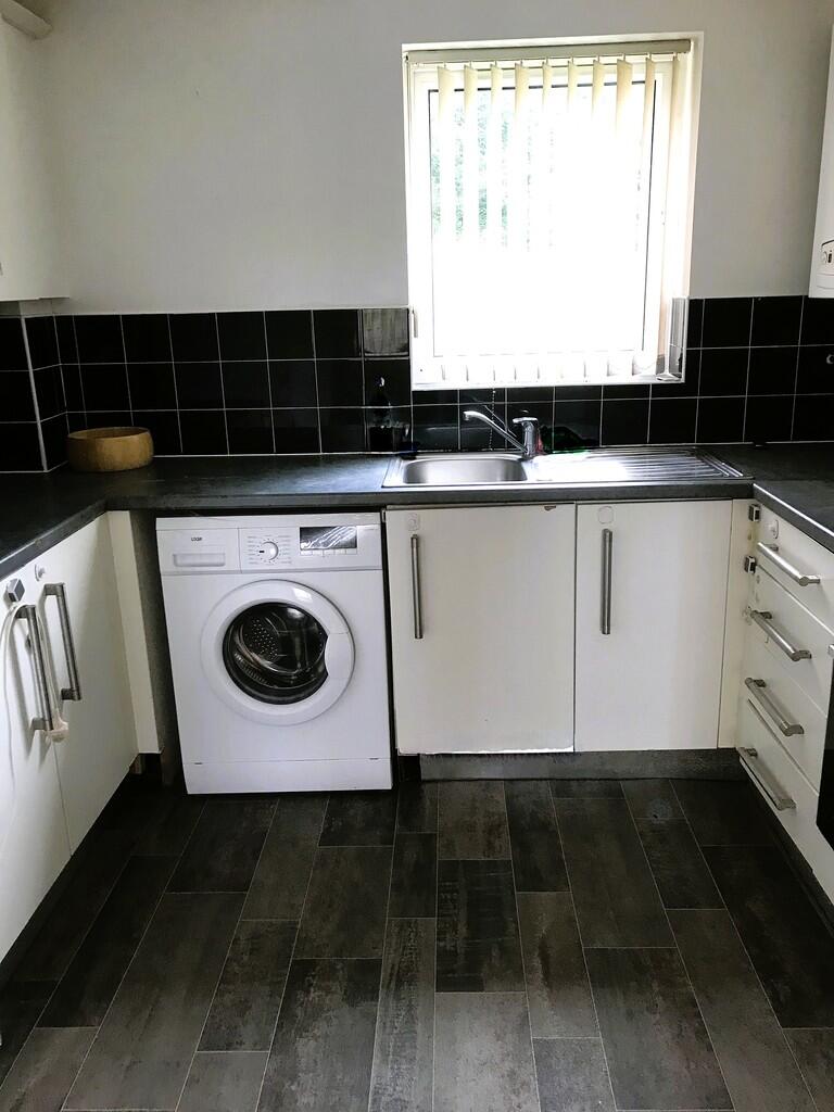
- Fitted Kitchen with appliances
- Fridge / Freezer - Washer / Dryer
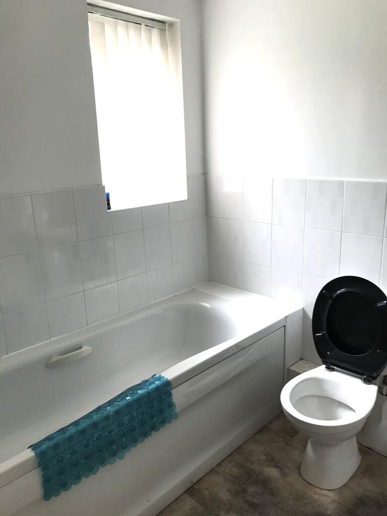
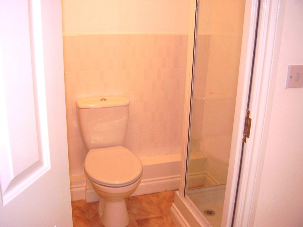
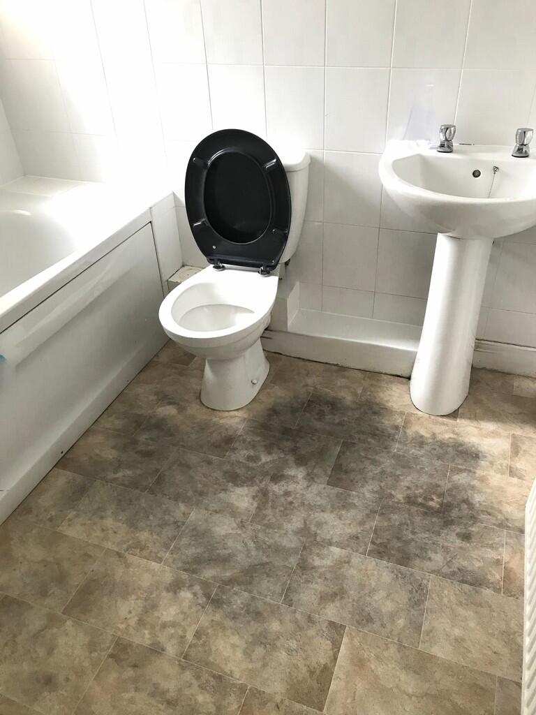
- Separate Bathroom
- Master Bed with En-suite Shower Room
- Will be Red-Decorated throughout before Move In.
- C/T Band A £1587.78 Deposit £750.00
- Car Parking to Rear of Building
- Communal Parking, Communal Gardens
Additional details
- Electricity
- Mains supply
- Water
- Mains supply
- Sewerage
- Mains supply
- Heating
- Gas central
- Parking
- Off street
Description
Located just a few minutes walk to local amenities, shops, bars and restaurants and excellent public transport routes all close by.
Council Tax Band 1 £1587.78 Deposit £750.00
Listed by
Wirral Bebington
The Property Franchise Group
Reference: 174235628
EPC ratings on this postcode
We don't have a matched EPC for this property yet. Below are efficiency scores and details for other addresses on this postcode.
| Address | Current | Potential | Floor area | Age band | Type |
|---|---|---|---|---|---|
| 486a Old Chester Road, ROCK FERRY | 77 | 79 | 53 m² | England and Wales: 1900-1929 | Flat |
| 486b Old Chester Road, ROCK FERRY | 79 | 79 | 57 m² | England and Wales: 1900-1929 | Flat |
| Flat 1 The Grange, 506, Old Chester Road, BIRKENHEAD | 77 | 91 | 56 m² | England and Wales: 2007-2011 | Detached |
| Flat 1, The Grange, 506 Old Chester Road, BIRKENHEAD | 78 | 93 | 57 m² | England and Wales: 2007-2011 | Detached |
| Flat 10 The Grange, 506, Old Chester Road, BIRKENHEAD | 82 | 82 | 60 m² | England and Wales: 2007-2011 | Flat |
| Flat 11 The Grange, 506, Old Chester Road, BIRKENHEAD | 81 | 82 | 61 m² | England and Wales: 2003-2006 | Flat |
| Flat 12 The Grange, 506, Old Chester Road, BIRKENHEAD | 81 | 81 | 57 m² | England and Wales: 1996-2002 | Flat |
| Flat 14 The Grange, 506, Old Chester Road, BIRKENHEAD | 79 | 79 | 61 m² | England and Wales: 2003-2006 | Flat |
| Flat 15 The Grange, 506, Old Chester Road, BIRKENHEAD | 81 | 81 | 59 m² | England and Wales: 2007-2011 | Flat |
| Flat 16 The Grange, 506, Old Chester Road, BIRKENHEAD | 79 | 79 | 57 m² | England and Wales: 2003-2006 | Flat |
| Flat 17 The Grange, 506, Old Chester Road, BIRKENHEAD | 80 | 82 | 59 m² | England and Wales: 2003-2006 | Flat |
| Flat 17, The Grange, BIRKENHEAD | 81 | 81 | 50 m² | England and Wales: 2003-2006 | Flat |
| Flat 19 The Grange, 506, Old Chester Road, BIRKENHEAD | 82 | 82 | 56 m² | England and Wales: 2007-2011 | Flat |
| Flat 2 The Grange, 506, Old Chester Road, BIRKENHEAD | 79 | 79 | 59 m² | England and Wales: 1996-2002 | Flat |
| Flat 2, 486 Old Chester Road, Birkenhead | 79 | 79 | 57 m² | England and Wales: 1900-1929 | Flat |
Flood risk
Zone: 1
Risk: Low
Job (default Low)
Floorplans

Floorplan 1
Rental Range
Estimated market rent for Wirral. Low = conservative, Realistic = average, Optimistic = best case.
Based on Local Authority from postcode lookup → Wirral.
LHA (30th percentile) floor for Wirral: £524/mo (Apr 2025 – Mar 2026)
Location
Address
Birkett Road
Nearby
Nearest stations, universities and amenities (distance from property).
| Type | Name | Distance |
|---|---|---|
| Bus stop | OLD CHESTER RD/BIRKETT RD | 0.0 miles |
| Bus stop | Old Chester Rd/Green Lawn | 0.0 miles |
| Shop | Boilercare | 0.1 miles |
| Shop | The Wheelbase | 0.2 miles |
| Train station | Rock Ferry | 0.4 miles |
| Hospital | Parkfield Medical Centre | 0.7 miles |
| Train station | Bebington | 0.9 miles |
| Hospital | St Catherines | 0.9 miles |
| University | Liverpool Hope University - Aigburth Park | 2.7 miles |
| University | Liverpool Institute for Performing Arts | 2.8 miles |
Street-level crime
| Category | Count |
|---|---|
| Violence and sexual offences | 113 |
| Criminal damage and arson | 36 |
| Anti-social behaviour | 35 |
| Other theft | 18 |
| Public order | 18 |
| Drugs | 10 |
| Vehicle crime | 6 |
| Burglary | 5 |
| Shoplifting | 5 |
| Other crime | 4 |
| Bicycle theft | 2 |
| Possession of weapons | 2 |
| Total incidents | 254 |
Within 1 mile during Apr 2026. Source: data.police.uk (England & Wales).
Schools nearby
Nearest open schools with Ofsted ratings (England). Closed schools are not shown. Data from Get Information about Schools and Ofsted.
| Name | Type | Distance | Ofsted |
|---|---|---|---|
| St Anne's Catholic Primary School | Primary | 0.2 miles | Good — 11 Jul 2016 |
| Bedford Drive Primary School | Primary | 0.4 miles | Good — 16 Jan 2023 |
| Rock Ferry Primary School | Primary | 0.4 miles | Good — 20 Jun 2011 |
| Prenton High School for Girls | Secondary | 0.5 miles | Good — 6 May 2014 |
| Well Lane Primary School | Primary | 0.5 miles | Inadequate — 13 Sep 2023 |
Rental Comparables
Residential lets from OpenRent and Rightmove for the area (same bedroom count). Use to validate rent estimates. Student lets are excluded.
| Title | Rent | Beds | Distance | As seen on |
|---|---|---|---|---|
| 2 Bed Terraced House, Old Chester Road, CH42 | £995/mo | 2 | 0.1 miles | OpenRent |
| 2 Bed Terraced House, Beaconsfield Road, CH62 | £850/mo | 2 | 1.16 miles | OpenRent |
Average rent: £923/mo (2 listings)
Enter House Number
Enter the house number to help us retrieve more accurate pricing history and property data.
Please log in to submit or correct the house number for this listing.
Log in to continue