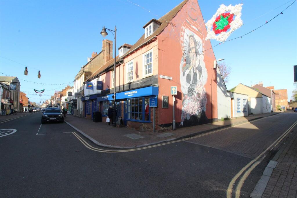
A Flat Above The High Street
Stony Stratford, Milton Keynes, MK11 1AQ
Property details
Council tax band
B
Deprivation
Decile 6 (19,638 of 33,755)
Street crime
69 incidents within 1 mile (Apr 2026)
Additional details
- Electricity
- Mains supply
- Water
- Mains supply
- Sewerage
- Mains supply
- Heating
- Electric
Description
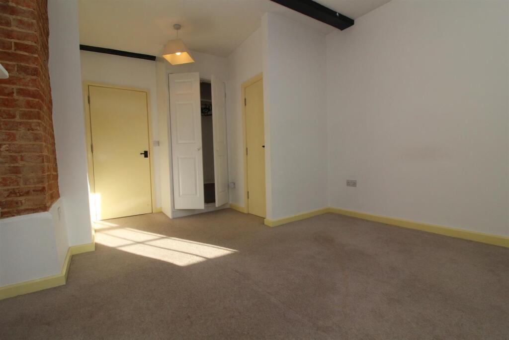
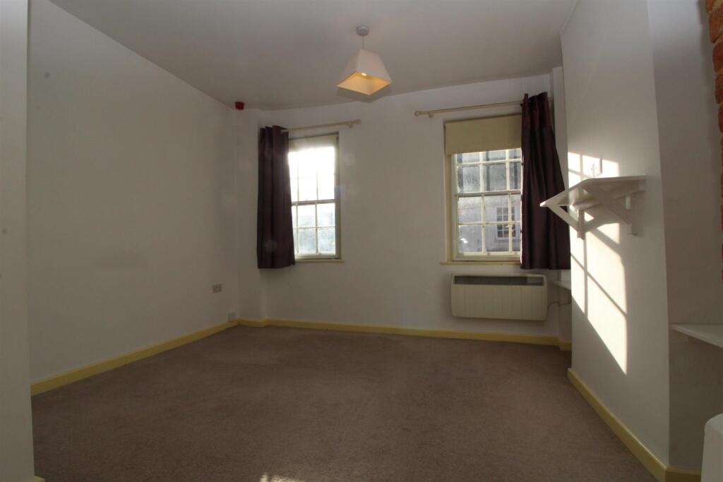
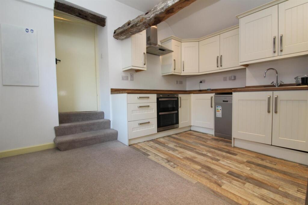
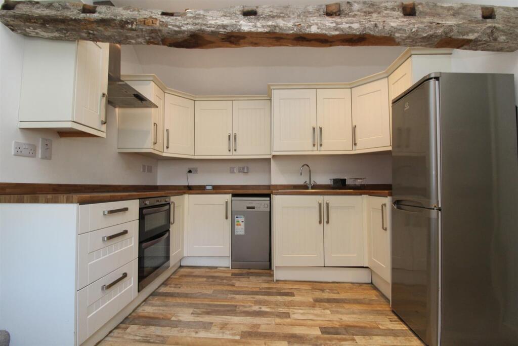
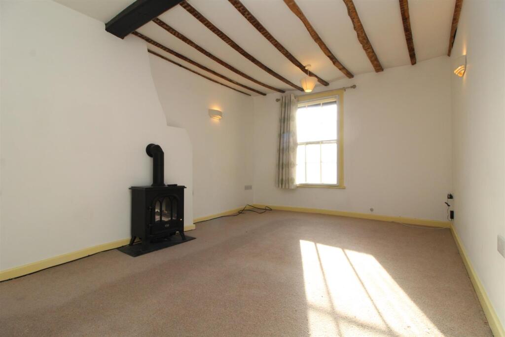
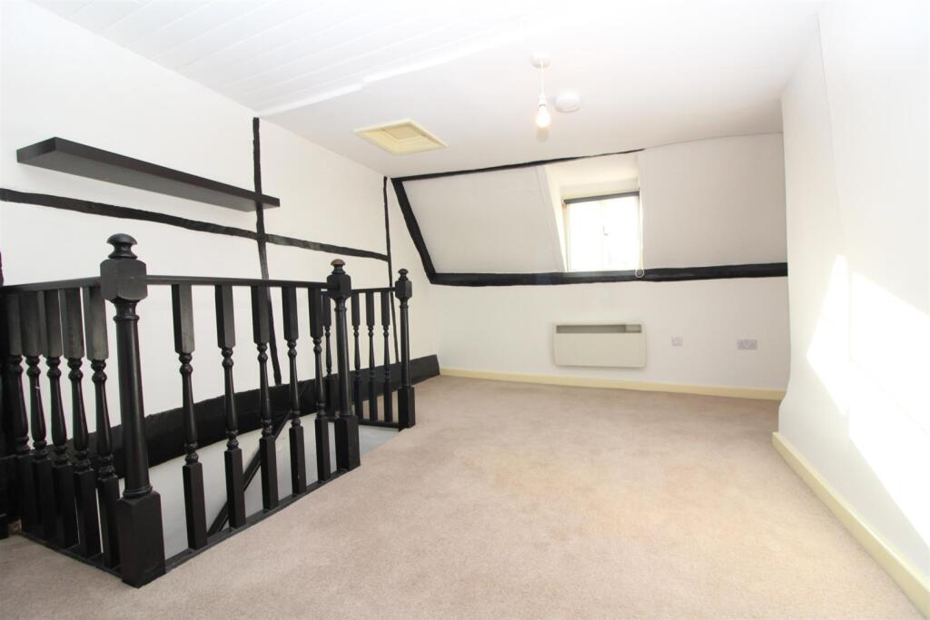
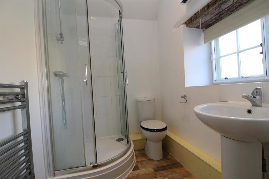
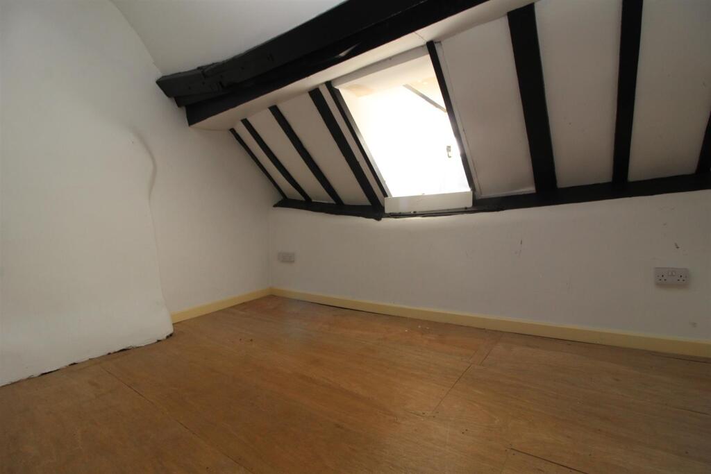
Comprising a stairway entrance, double bedroom, lounge with electric fire, kitchen/diner and shower room with 3pc suite
2 additional rooms, suitable for use as an office or dressing room only.
Available Mid-December
Suitable for a single professional, or couple.
No pets, smokers, HMOs or company lets please.
Listed by
Stony Stratford
Carters Estate Agents
Reference: 169753097
EPC ratings on this postcode
We don't have a matched EPC for this property yet. Below are efficiency scores and details for other addresses on this postcode.
| Address | Current | Potential | Floor area | Age band | Type |
|---|---|---|---|---|---|
| 42a High Street, Stony Stratford, MILTON KEYNES | 46 | 65 | 97 m² | England and Wales: before 1900 | Flat |
| 42a High Street, Stony Stratford, MILTON KEYNES | 12 | 69 | 112 m² | England and Wales: 1900-1929 | Flat |
| 46 High Street, STONY STRATFORD | 18 | 48 | 76 m² | England and Wales: before 1900 | Flat |
| 46a High Street, Stony Stratford, Milton Keynes | 45 | 57 | 68 m² | England and Wales: before 1900 | Flat |
Flood risk
Zone: 1
Risk: Low
Job (default Low)
Rental Range
Estimated market rent for Milton Keynes. Low = conservative, Realistic = average, Optimistic = best case.
Based on Local Authority from postcode lookup → Milton Keynes.
LHA (30th percentile) floor for Milton Keynes: £773/mo (Apr 2025 – Mar 2026)
Location
Address
New Street
Nearby
Nearest stations, universities and amenities (distance from property).
| Type | Name | Distance |
|---|---|---|
| Shop | Crome Interiors | 0.0 miles |
| Shop | Coral | 0.0 miles |
| Bus stop | Unknown | 0.1 miles |
| Bus stop | Wolverton Road | 0.1 miles |
| Train station | Wolverton | 2.1 miles |
| Hospital | PJ Care Mallard House Neurological Care Centre | 3.0 miles |
| Train station | Milton Keynes Central | 3.7 miles |
| University | University of Bedfordshire Milton Keynes Campus | 4.1 miles |
| Hospital | Willen Hospice | 5.6 miles |
| University | Vinson Building | 7.3 miles |
Street-level crime
| Category | Count |
|---|---|
| Violence and sexual offences | 18 |
| Burglary | 12 |
| Anti-social behaviour | 11 |
| Criminal damage and arson | 7 |
| Public order | 7 |
| Vehicle crime | 6 |
| Other theft | 3 |
| Drugs | 2 |
| Other crime | 2 |
| Shoplifting | 1 |
| Total incidents | 69 |
Within 1 mile during Apr 2026. Source: data.police.uk (England & Wales).
Schools nearby
Nearest open schools with Ofsted ratings (England). Closed schools are not shown. Data from Get Information about Schools and Ofsted.
| Name | Type | Distance | Ofsted |
|---|---|---|---|
| Russell Street School | Primary | 0.1 miles | Outstanding — 8 Nov 2023 |
| St Mary and St Giles Church of England School | Primary | 0.2 miles | Good — 24 Apr 2024 |
| Old Stratford Primary School | Primary | 0.8 miles | Good — 26 Mar 2018 |
| St Mary Magdalene Catholic Primary School | Primary | 1.1 miles | Outstanding — 11 Nov 2013 |
| Slated Row School | Other | 1.2 miles | Outstanding — 19 Dec 2013 |
Rental Comparables
Rental listings exist nearby, but none matched the 1-bedroom count for this property.
Enter House Number
Enter the house number to help us retrieve more accurate pricing history and property data.
Please log in to submit or correct the house number for this listing.
Log in to continue