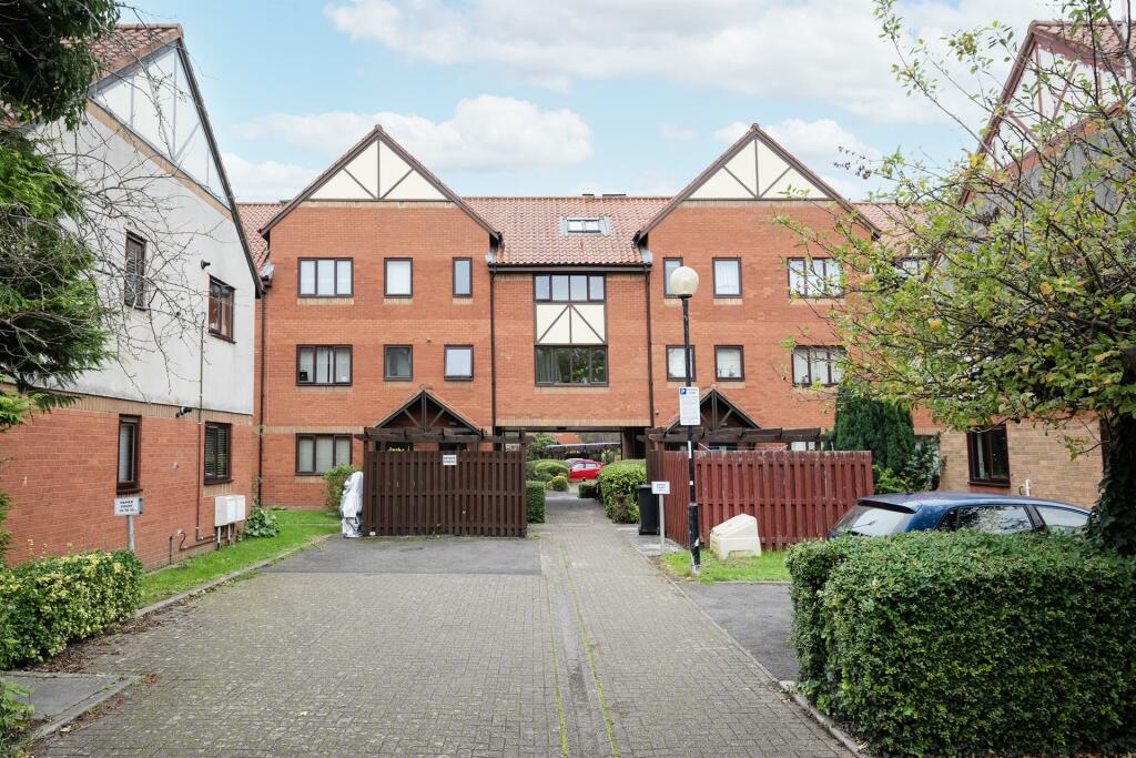
Flat 30
NAPIER COURT, GEFLE CLOSE, BRISTOL, BRISTOL, CITY OF BRISTOL BS1 6XY
£1,350 pcm
Property details
Floor area
56 m²
Council tax band
C
Deprivation
Decile 7 (20,414 of 33,755)
Street crime
905 incidents within 1 mile (Apr 2026)
Key features
- ALLOCATED PARKING SPACE.
- Two double bedroom part furnished top floor flat.
- Holding deposit GBP276.00.
Additional details
- Parking
- Yes
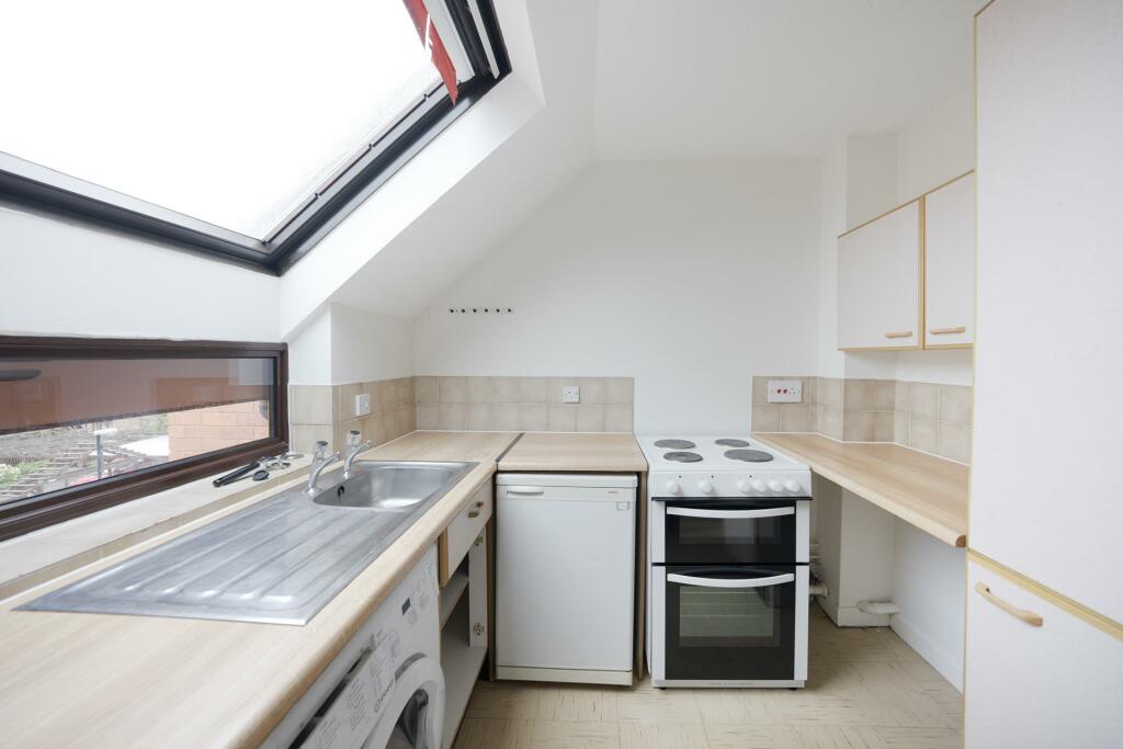
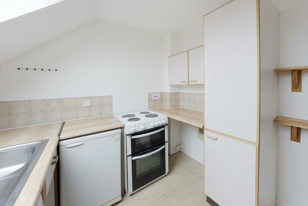
Description
ALLOCATED PARKING SPACE.
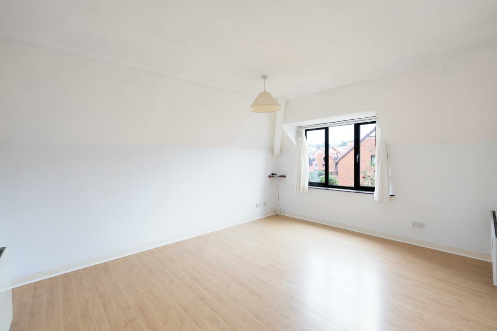
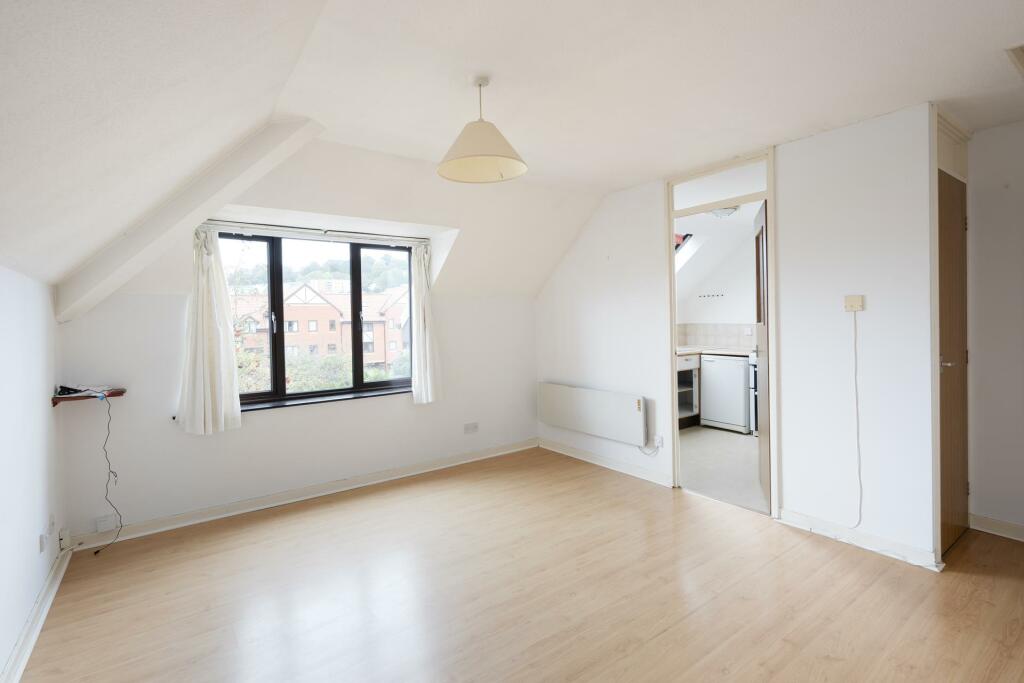
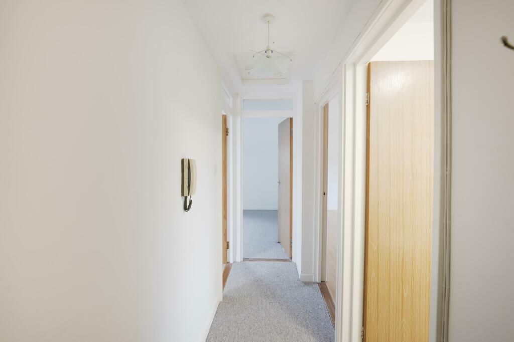
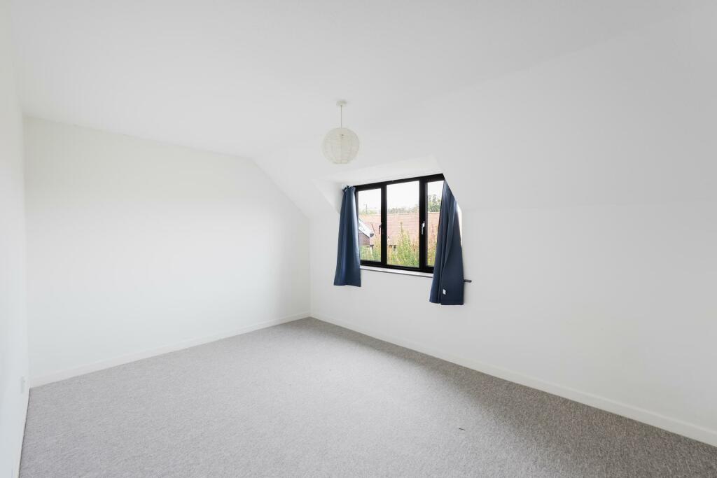
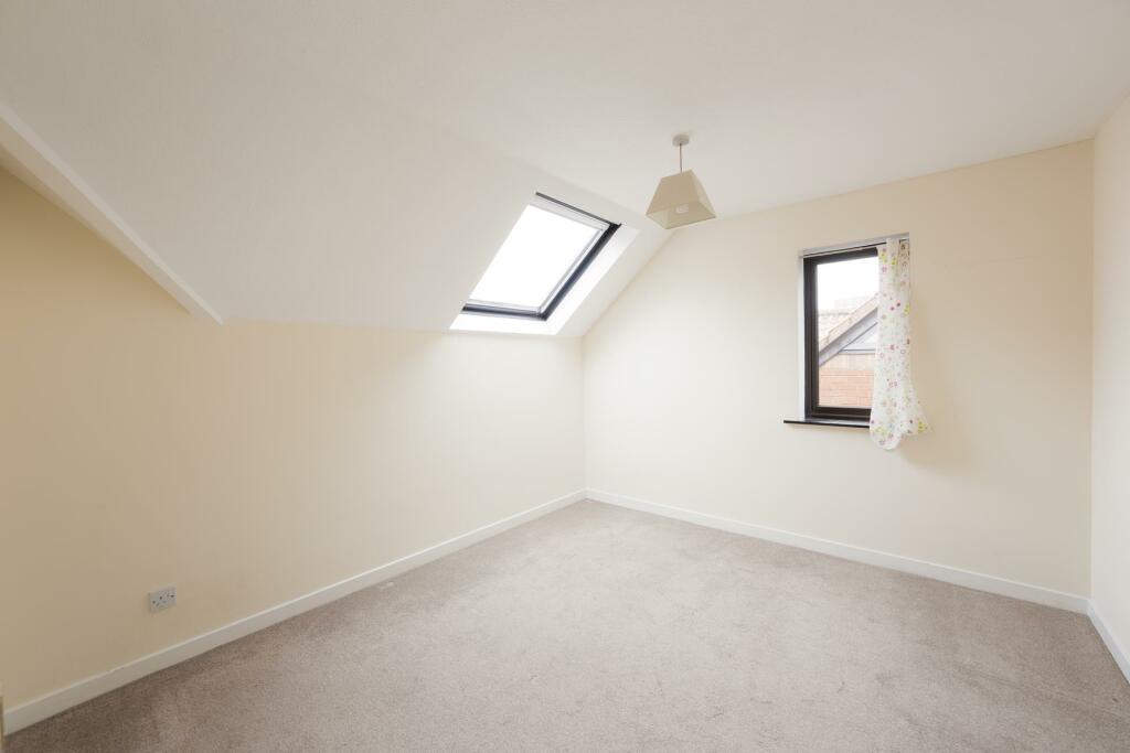
Two double bedroom top floor flat within a popular harbourside development.
Offered on a unfurnished basis.
Living/dining room.
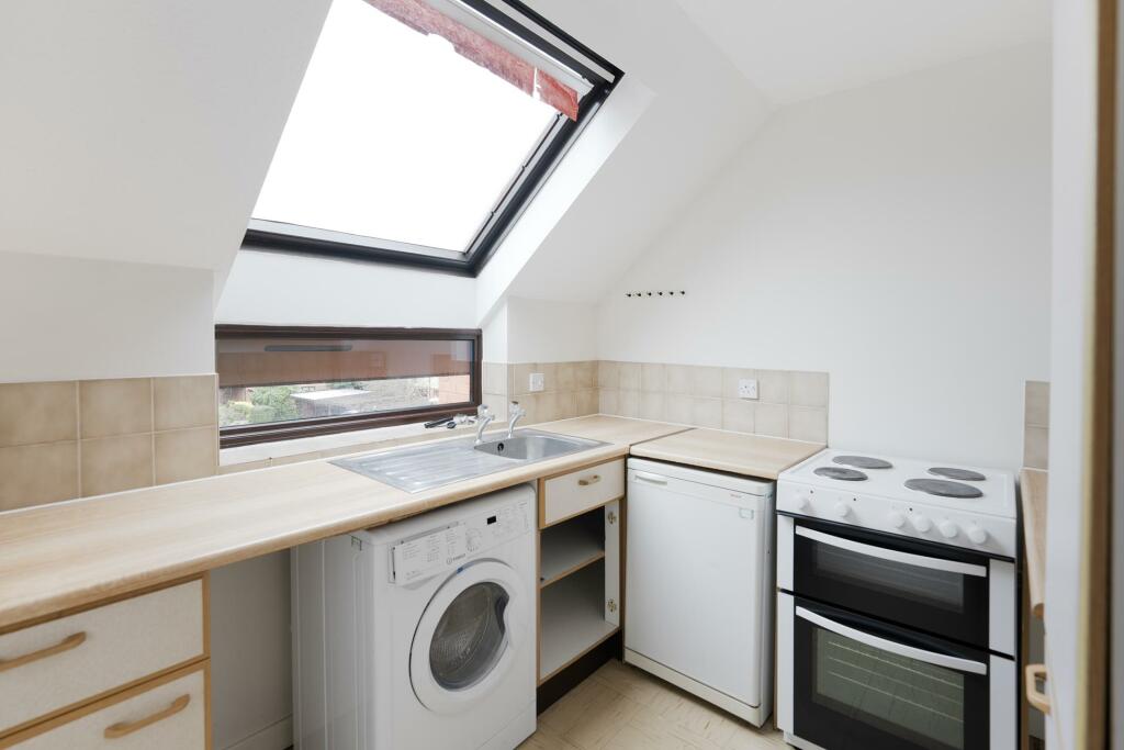
Separate kitchen with electric cooker, fridge with freezer compartment and washer/dryer.
Two double bedrooms.
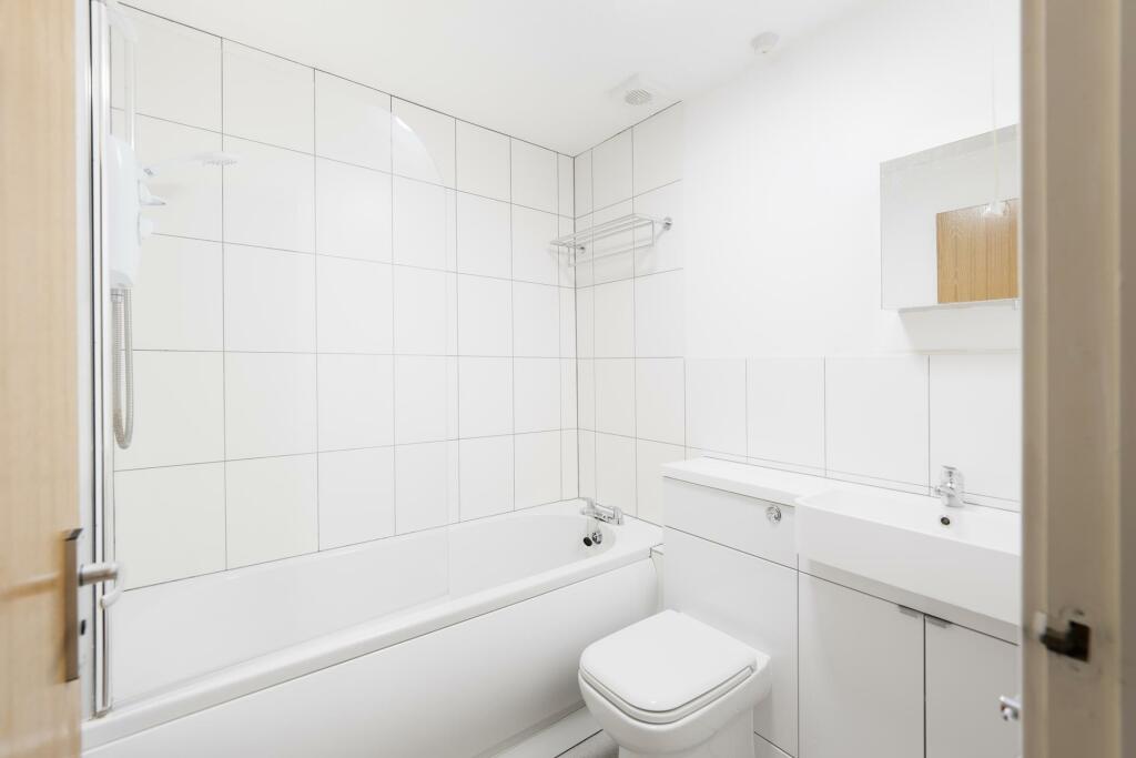
Bathroom with shower over bath.
Electric heating.
Great for a single professional, couple or two professional sharers.
Holding deposit GBP311.00.
Five weeks damage deposit GBP1557.00.
Listed by
Bristol
Sarah Kenny Residential Lettings
Reference: 141275459
EPC ratings on this postcode
We don't have a matched EPC for this property yet. Below are efficiency scores and details for other addresses on this postcode.
| Address | Current | Potential | Floor area | Age band | Type |
|---|---|---|---|---|---|
| FLAT 1, NAPIER COURT, BRISTOL | 50 | 78 | 67 m² | England and Wales: 1983-1990 | Flat |
| Flat 11, Napier Court, Gefle Close, BRISTOL | 74 | 75 | 47 m² | England and Wales: 1967-1975 | Flat |
| Flat 12 Napier Court, Gefle Close, BRISTOL | 53 | 77 | 47 m² | England and Wales: 1967-1975 | Flat |
| Flat 13, Napier Court, Gefle Close, BRISTOL | 74 | 76 | 26 m² | England and Wales: 1983-1990 | Flat |
| Flat 14 Napier Court, Gefle Close, BRISTOL | 56 | 78 | 27 m² | England and Wales: 1983-1990 | Flat |
| Flat 15 Napier Court, Gefle Close, BRISTOL | 81 | 84 | 37 m² | England and Wales: 1976-1982 | Flat |
| Flat 15, Napier Court, Gefle Close, BRISTOL | 75 | 83 | 38 m² | England and Wales: 1983-1990 | Flat |
| Flat 16, Napier Court, Gefle Close, BRISTOL | 80 | 82 | 55 m² | England and Wales: 1983-1990 | Flat |
| Flat 17 Napier Court, Gefle Close, BRISTOL | 69 | 78 | 43 m² | England and Wales: 1983-1990 | Flat |
| Flat 17, Napier Court, Gefle Close, BRISTOL | 70 | 80 | 38 m² | England and Wales: 1983-1990 | Flat |
| Flat 18, Napier Court, Gefle Close, BRISTOL | 51 | 67 | 55 m² | England and Wales: 1976-1982 | Flat |
| Flat 19 Napier Court, Gefle Close, BRISTOL | 72 | 81 | 38 m² | England and Wales: 1983-1990 | Flat |
| Flat 19, Napier Court, Gefle Close, BRISTOL | 55 | 79 | 38 m² | England and Wales: 1983-1990 | Flat |
| Flat 21 Napier Court, Gefle Close, BRISTOL | 77 | 85 | 50 m² | England and Wales: 1983-1990 | Flat |
| FLAT 22, NAPIER COURT, GEFLE CLOSE, BRISTOL | 77 | 82 | 38 m² | England and Wales: 1983-1990 | Flat |
Flood risk
Zone: 1
Risk: Low
Job (default Low)
Floorplans
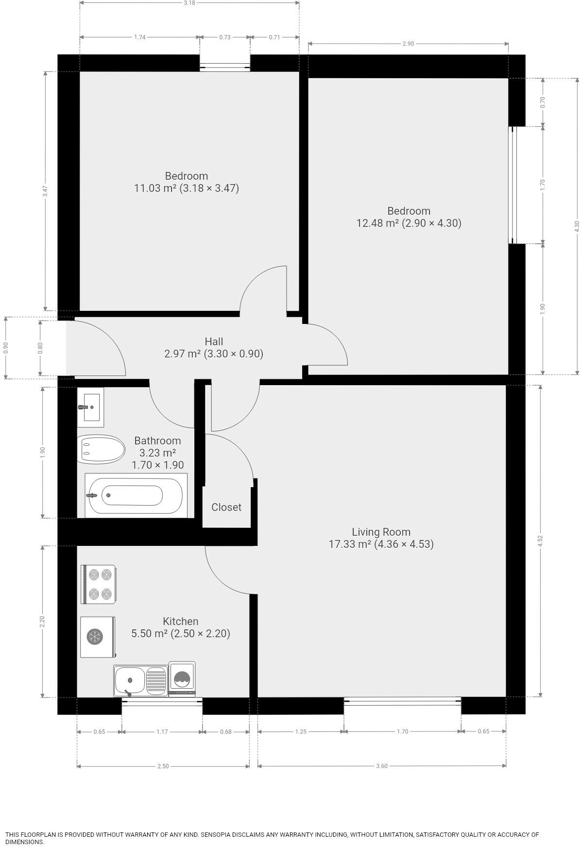
Floorplan 1
EPC Graphs
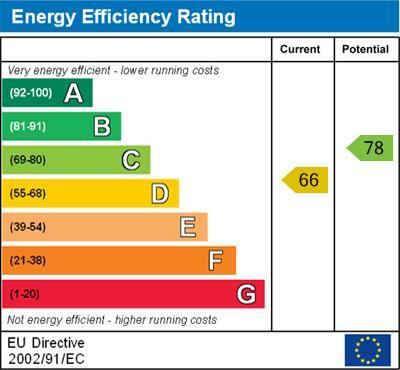
Energy Efficiency
Rental Range
Estimated market rent for Bristol, City of. Low = conservative, Realistic = average, Optimistic = best case.
Based on Local Authority from postcode lookup → Bristol, City of.
LHA (30th percentile) floor for Shropshire: £593/mo (Apr 2025 – Mar 2026)
Location
Address
Napier Court
Nearby
Nearest stations, universities and amenities (distance from property).
| Type | Name | Distance |
|---|---|---|
| Bus stop | SS Great Britain | 0.0 miles |
| Shop | Channel Yacht Sales | 0.2 miles |
| Shop | Brunel's Great Britain Ticket Office | 0.3 miles |
| Train station | SS Great Britain | 0.3 miles |
| Train station | Butterfly Junction | 0.3 miles |
| University | 5 Priory Road, Life Sciences | 0.9 miles |
| Hospital | South West Regional Laboratories | 1.0 miles |
| University | dBs Institute Bristol Campus | 1.1 miles |
| Hospital | Spire Bristol | 1.7 miles |
Street-level crime
| Category | Count |
|---|---|
| Violence and sexual offences | 270 |
| Anti-social behaviour | 147 |
| Other theft | 95 |
| Burglary | 69 |
| Criminal damage and arson | 69 |
| Shoplifting | 60 |
| Public order | 55 |
| Vehicle crime | 47 |
| Bicycle theft | 22 |
| Theft from the person | 22 |
| Robbery | 20 |
| Drugs | 18 |
| Possession of weapons | 7 |
| Other crime | 4 |
| Total incidents | 905 |
Within 1 mile during Apr 2026. Source: data.police.uk (England & Wales).
Schools nearby
Nearest open schools with Ofsted ratings (England). Closed schools are not shown. Data from Get Information about Schools and Ofsted.
| Name | Type | Distance | Ofsted |
|---|---|---|---|
| Ashton Gate Primary School | Primary | 0.3 miles | Outstanding — 30 Apr 2024 |
| City of Bristol College | Other | 0.4 miles | — (No rating) |
| Southville Primary School | Primary | 0.5 miles | Good — 24 Oct 2012 |
| Hotwells Primary School | Primary | 0.5 miles | Good — 13 Nov 2022 |
| Queen Elizabeth's Hospital | Other | 0.6 miles | — (No rating) |
Rental Comparables
Residential lets from OpenRent and Rightmove for the area (same bedroom count). Use to validate rent estimates. Student lets are excluded.
| Title | Rent | Beds | Distance | As seen on |
|---|---|---|---|---|
| 2 Bed Flat, Ashton, BS3 | £3,369/mo | 2 | 0.49 miles | OpenRent |
Average rent: £3,369/mo (1 listing)
Enter House Number
Enter the house number to help us retrieve more accurate pricing history and property data.
Please log in to submit or correct the house number for this listing.
Log in to continue