Wendover Road
Manchester, M23 9FH
Property details
Tenure
FREEHOLD
Council tax band
C
Local average
£506,167 (-13.1%)
Deprivation
Decile 2 (6,270 of 33,755)
Street crime
0 incidents within 1 mile (Apr 2026)
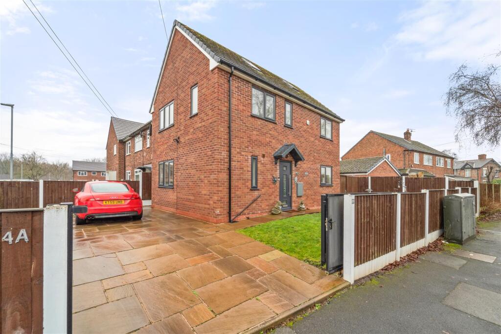
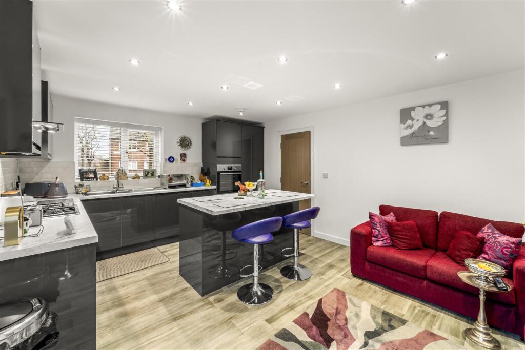
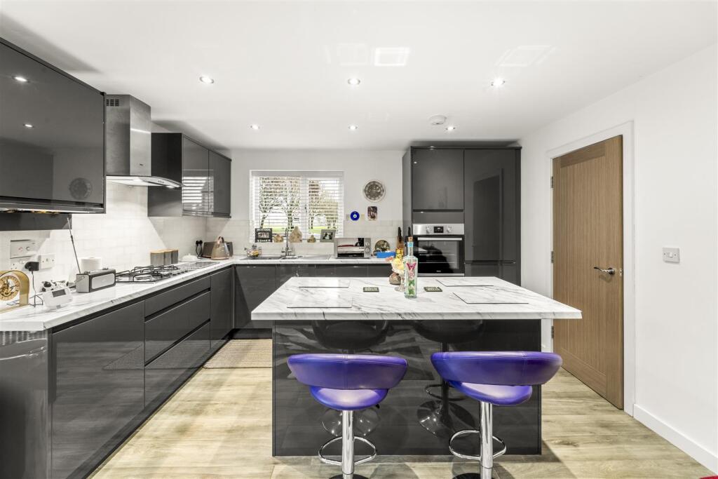
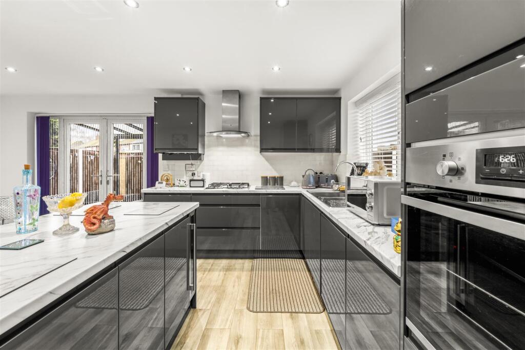
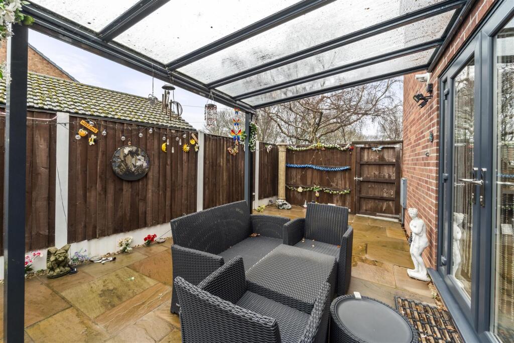
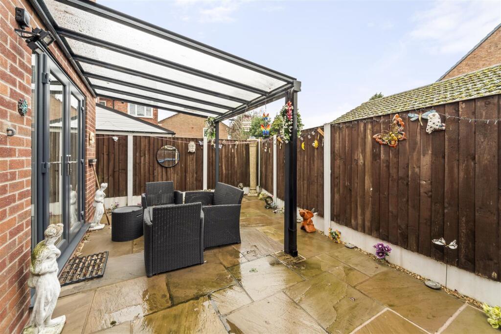
Key features
- Constructed in 2019
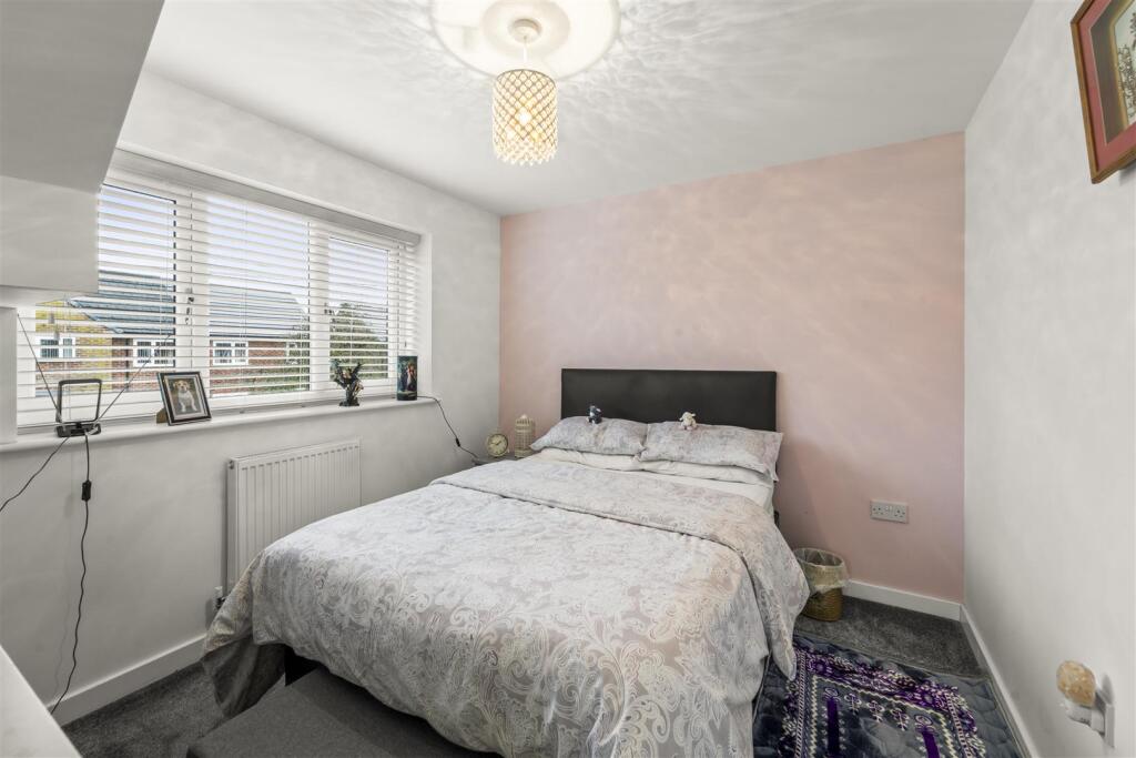
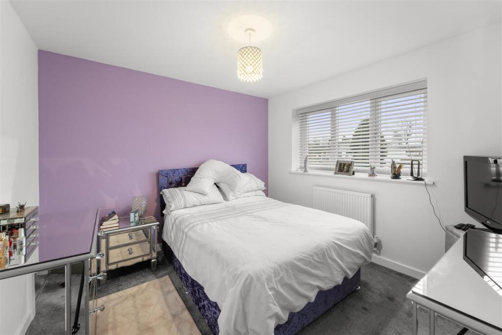
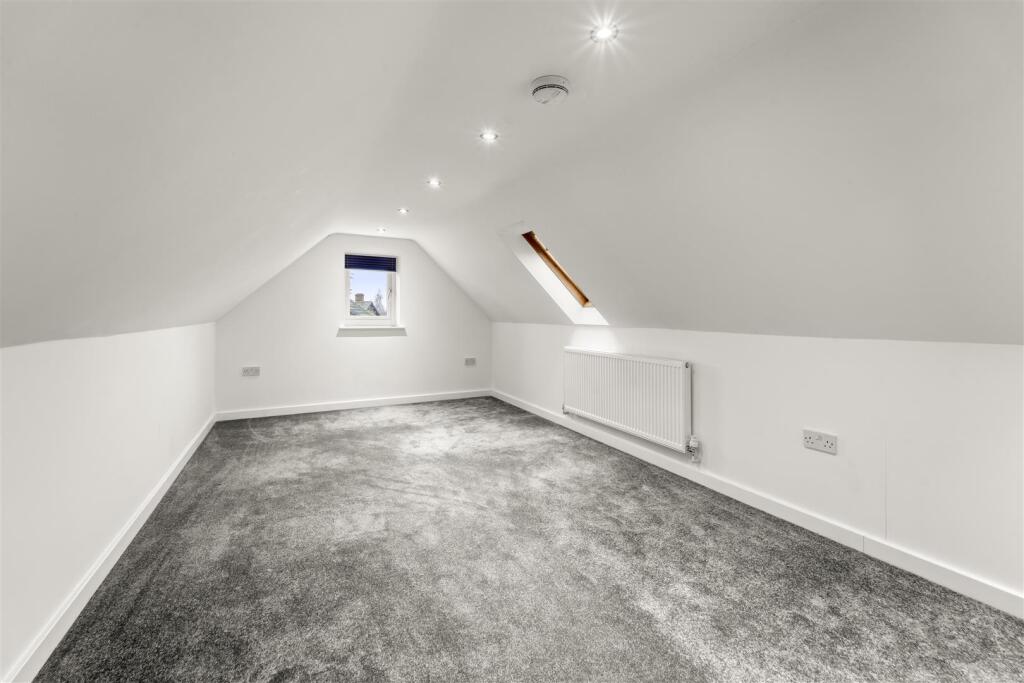
- Four double bedroom detached property
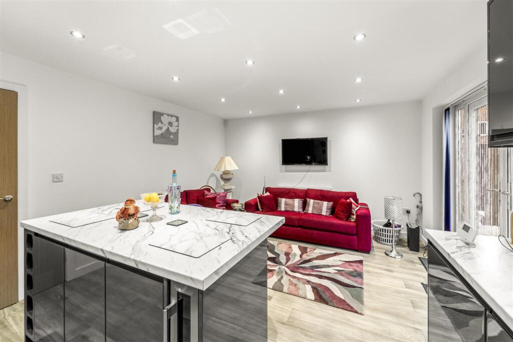
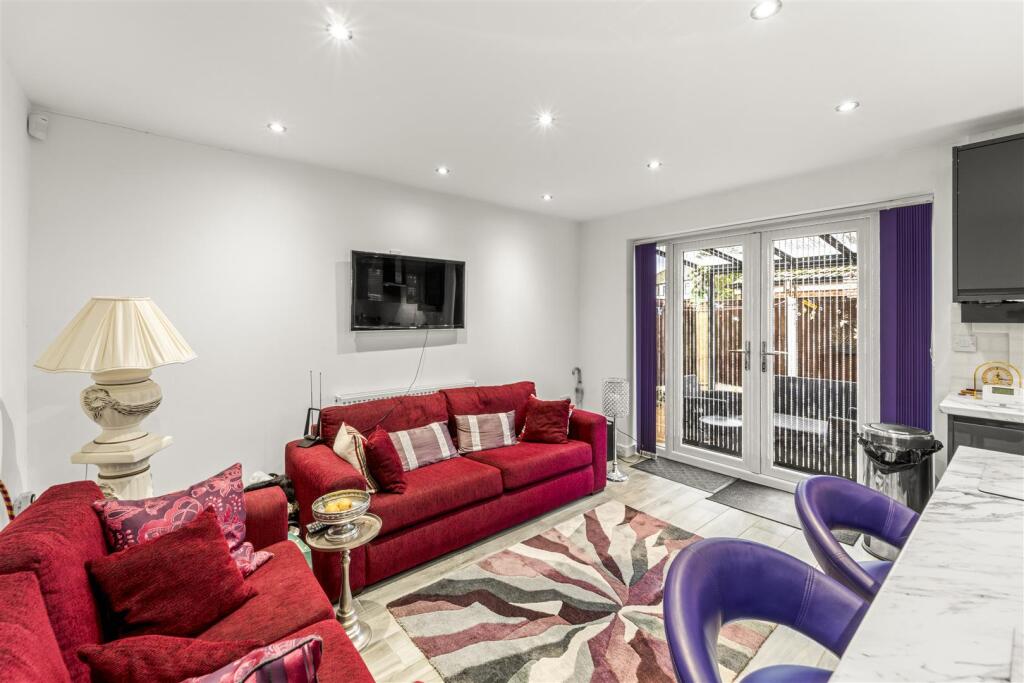
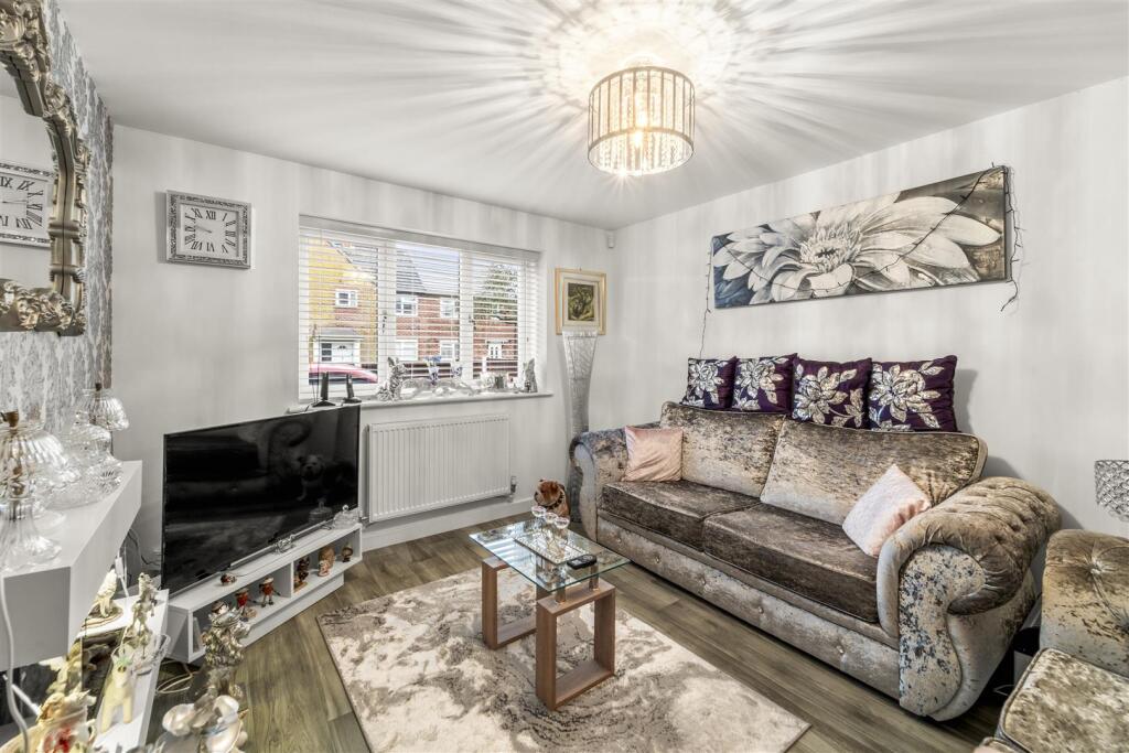
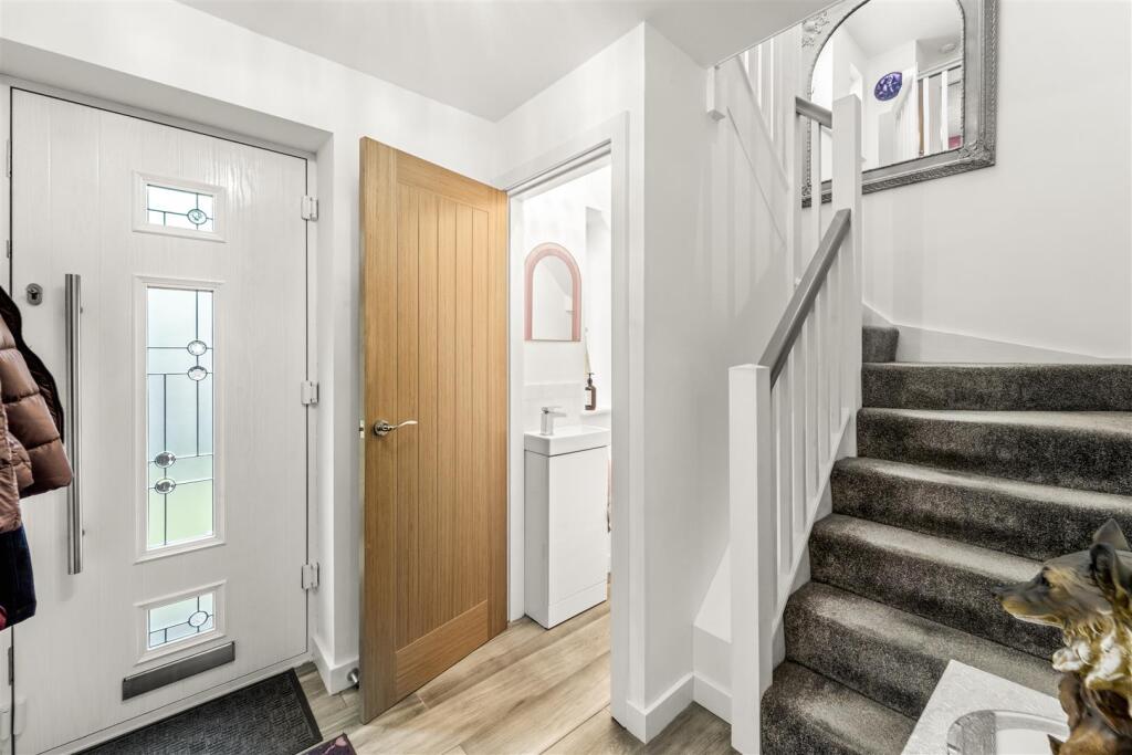
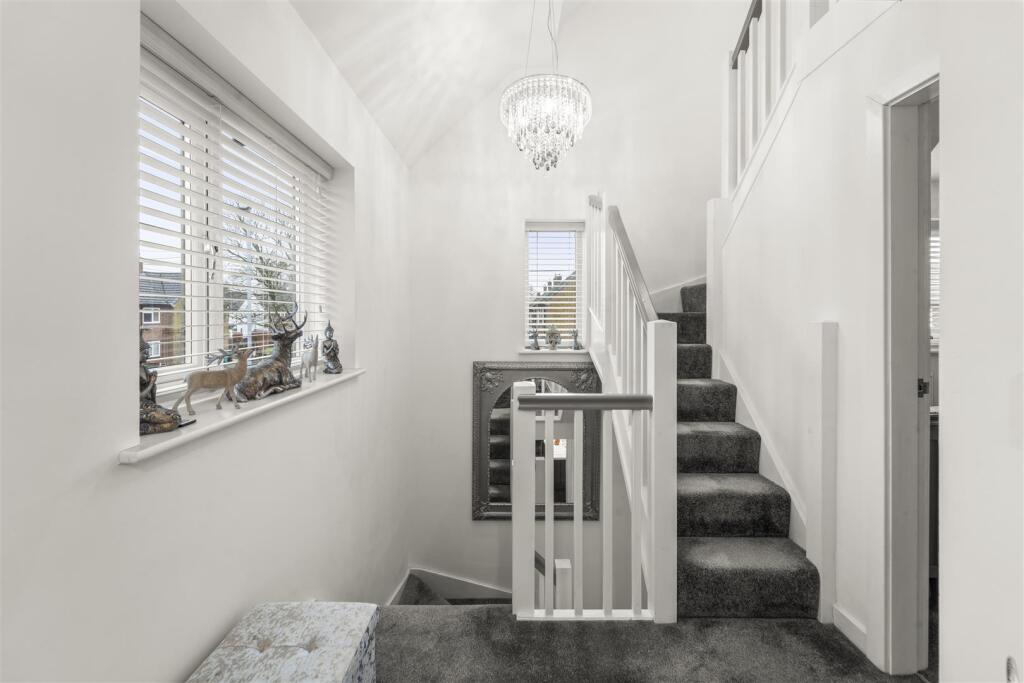
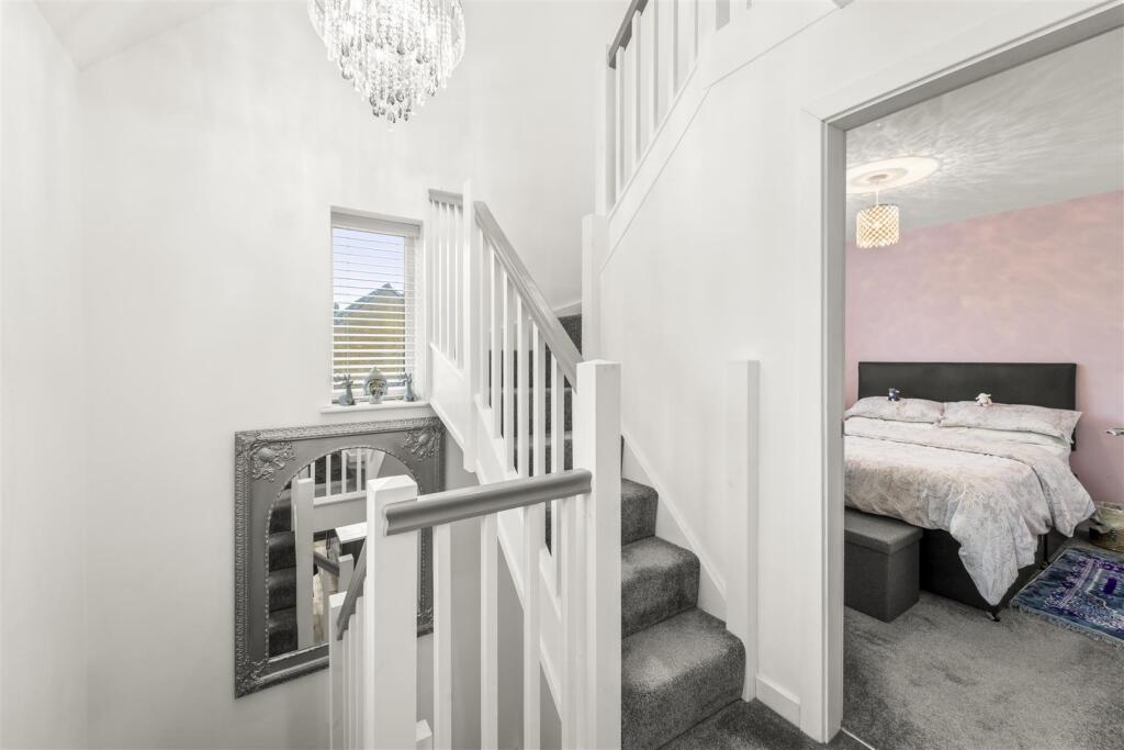
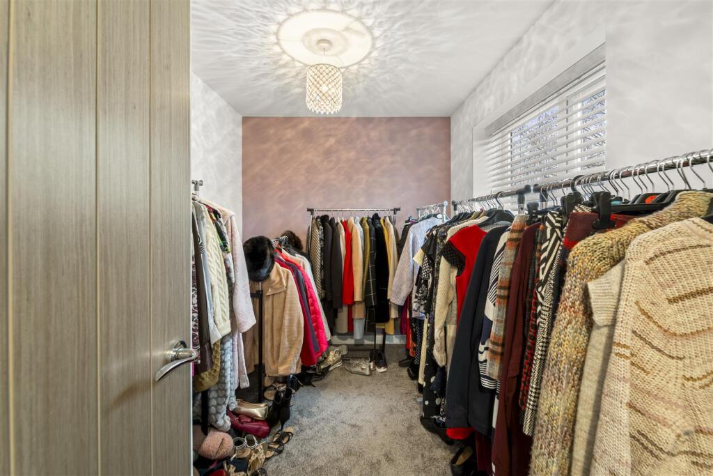
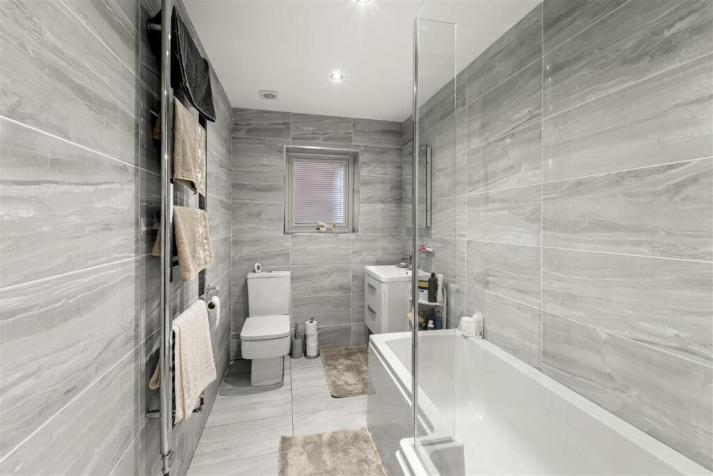
- Immaculately presented throughout
- Off road parking for multiple vehicles
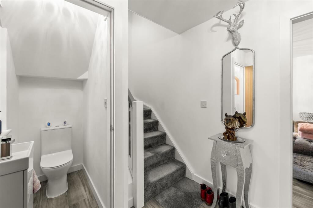
- Useful downstairs WC
- Secure electric gates
- Landscaped gardens
- Freehold
Additional details
- Parking
- Yes
- Garden
- Yes
Description
CALL NOW TO ARRANGE YOUR VIEWING!
Aml - In order to comply with Anti-Money Laundering Regulations, all prospective purchasers will be required to provide proof of identification and proof of funds. A third-party electronic verification check will also be carried out, for which there is a charge of £36 (£30+VAT) per person purchasing the property. Please note that this fee is non-refundable.
Listed by
Sale
Ashworth Holme
Reference: 171043196
EPC ratings on this postcode
We don't have a matched EPC for this property yet. Below are efficiency scores and details for other addresses on this postcode.
| Address | Current | Potential | Floor area | Age band | Type |
|---|---|---|---|---|---|
| 10, Wendover Road, MANCHESTER | 65 | 81 | 88 m² | England and Wales: 1950-1966 | Terraced |
| 10, Wendover Road, MANCHESTER | 58 | 78 | 87 m² | England and Wales: 1950-1966 | Terraced |
| 12 WENDOVER ROAD, MANCHESTER | 72 | 88 | 76 m² | England and Wales: 1950-1966 | Terraced |
| 12, Wendover Road, MANCHESTER | 67 | 80 | 84 m² | England and Wales: 1950-1966 | Terraced |
| 12, Wendover Road, MANCHESTER | 62 | 84 | 84 m² | England and Wales: 1930-1949 | Terraced |
| 14 Wendover Road, MANCHESTER | 73 | 86 | 86 m² | England and Wales: 1967-1975 | Terraced |
| 16 Wendover Road, MANCHESTER | 72 | 86 | 84 m² | England and Wales: 1950-1966 | Terraced |
| 16, Wendover Road, MANCHESTER | 68 | 83 | 84 m² | England and Wales: 1930-1949 | Terraced |
| 18 WENDOVER ROAD, MANCHESTER, MANCHESTER | 67 | 82 | 92 m² | England and Wales: 1950-1966 | Terraced |
| 18, Wendover Road, MANCHESTER | 70 | 84 | 83 m² | England and Wales: 1930-1949 | Terraced |
| 2, Wendover Road, MANCHESTER | 63 | 80 | 92 m² | England and Wales: 1950-1966 | Detached |
| 20 WENDOVER ROAD, MANCHESTER | 67 | 81 | 91 m² | England and Wales: 1950-1966 | Terraced |
| 20 Wendover Road, MANCHESTER | 71 | 85 | 92 m² | England and Wales: 1950-1966 | Terraced |
| 20, Wendover Road, MANCHESTER | 68 | 81 | 84 m² | England and Wales: 1950-1966 | Detached |
| 20, Wendover Road, MANCHESTER | 69 | 83 | 91 m² | England and Wales: 1930-1949 | Terraced |
Flood risk
Zone: 1
Risk: Low
Job (default Low)
Floorplans
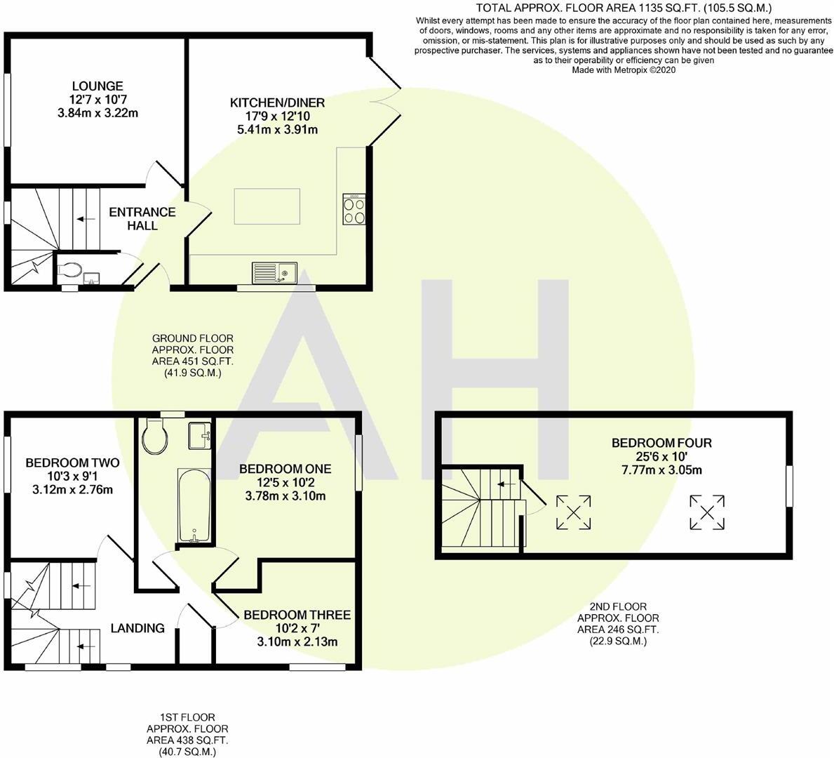
Floorplan 1
EPC Graphs
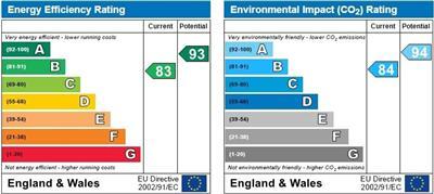
EPC 1
Price history
| Event | Date | Price | % change |
|---|---|---|---|
| Listed for sale | — | £440,000 | — |
Source: HM Land Registry Price Paid Data. Crown copyright.
Sold Comparables
Same street and nearby sales within 0.25 miles (last 5 years). Data from Land Registry Price Paid.
| Address | Price | Date | Type |
|---|---|---|---|
| 13 PENRYN AVENUE, SALE, MANCHESTER, GREATER MANCHESTER, M33 3PG | £490,000 | 24/08/2023 | Detached |
| 3 MAPLE ROAD, MANCHESTER, GREATER MANCHESTER, M23 9RL | £587,500 | 27/10/2022 | Detached |
| 12 PENRYN AVENUE, SALE, MANCHESTER, GREATER MANCHESTER, M33 3PG | £359,000 | 16/05/2022 | Detached |
| 22 WOODLANDS DRIVE, SALE, MANCHESTER, GREATER MANCHESTER, M33 3PQ | £520,000 | 13/04/2022 | Detached |
| 10 PENRYN AVENUE, SALE, MANCHESTER, GREATER MANCHESTER, M33 3PG | £367,665 | 14/01/2022 | Detached |
| 6 EMSWORTH DRIVE, SALE, MANCHESTER, GREATER MANCHESTER, M33 3PR | £510,000 | 08/11/2021 | Detached |
| 6 ASHSTEAD ROAD, SALE, MANCHESTER, GREATER MANCHESTER, M33 3PX | £510,000 | 18/06/2021 | Detached |
Area average: £477,738 (7 sales)
Capital growth trend
Land Registry outcode average: last 12 months vs 5y and 10y ago (from sold prices).
House Price Index (HM Land Registry — official index, not sold-price averages): Manchester. Series: Detached. As of March 2026.
Rental Range
Estimated market rent for Manchester. Low = conservative, Realistic = average, Optimistic = best case.
Based on Local Authority from postcode lookup → Manchester.
LHA (30th percentile) floor for Southern Greater Manchester: £1,396/mo (Apr 2025 – Mar 2026)
Location
Address
Wendover Road
Nearby
Nearest stations, universities and amenities (distance from property).
| Type | Name | Distance |
|---|---|---|
| Bus stop | Brooklands, Maple Road / opposite Stancross Road | 0.1 miles |
| Bus stop | Brooklands, Wendover Road / opposite Swanage Avenue | 0.1 miles |
| Shop | Co-op Food | 0.2 miles |
| Shop | Nasa's Gents Barbers Shop | 0.4 miles |
| Hospital | Wythenshawe Hospital | 1.4 miles |
| Train station | Navigation Road | 1.7 miles |
| Hospital | Northenden Group Practice | 1.8 miles |
| Train station | Altrincham | 2.1 miles |
| University | University Academy 92 | 3.7 miles |
| University | University of Manchester | 4.4 miles |
Street-level crime
| Category | Count |
|---|---|
| Total incidents | 0 |
Within 1 mile during Apr 2026. Source: data.police.uk (England & Wales).
Schools nearby
Nearest open schools with Ofsted ratings (England). Closed schools are not shown. Data from Get Information about Schools and Ofsted.
| Name | Type | Distance | Ofsted |
|---|---|---|---|
| Sandilands Primary School | Primary | 0.3 miles | Good — 18 Sep 2013 |
| Sale High School | Secondary | 0.5 miles | Good — 3 Jul 2015 |
| Dixons Brooklands Academy | Secondary | 0.6 miles | — (Inspected (no overall grade)) |
| Heyes Lane Primary School | Primary | 0.7 miles | Good — 7 Feb 2013 |
| Lime Tree Primary Academy | Primary | 0.8 miles | — (Inspected (no overall grade)) |
Rental Comparables
Loading rental comparables for this postcode. Refresh in a few minutes.
Rent-driven metrics
Based on Area rent estimate.
- Rent ratio — Monthly rent ÷ purchase price (1% rule). 1%+ = strong, 0.8–1% = okay, <0.8% = weak for cashflow.
- Max investor price — Rent ÷ 0.8%; the price at which rent would be 0.8% of price (Stoke-style target).
- Target investor price — Rent ÷ 1%; the price at which rent would be 1% of price (strong cashflow band).
- Gross yield — Annual rent as % of purchase price (no costs).
Enter House Number
Enter the house number to help us retrieve more accurate pricing history and property data.
Please log in to submit or correct the house number for this listing.
Log in to continue