13 OXFORD STREET
LOUGHBOROUGH, LEICESTERSHIRE LE11 5DP
£468 pcm
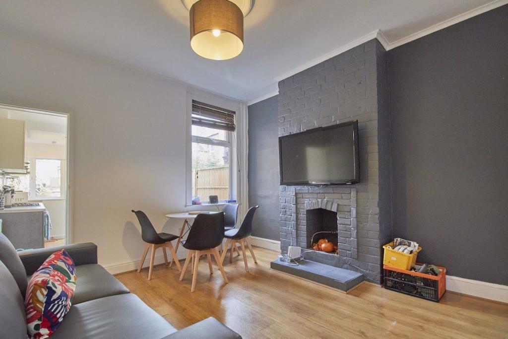
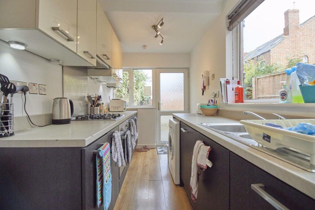
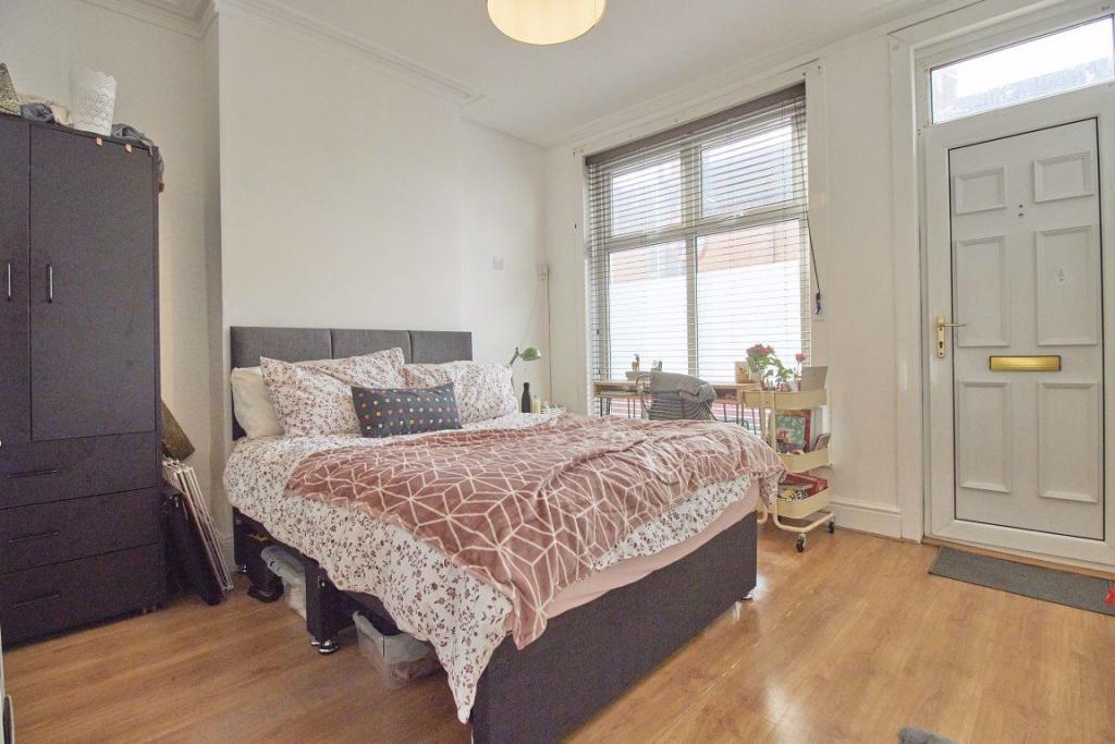
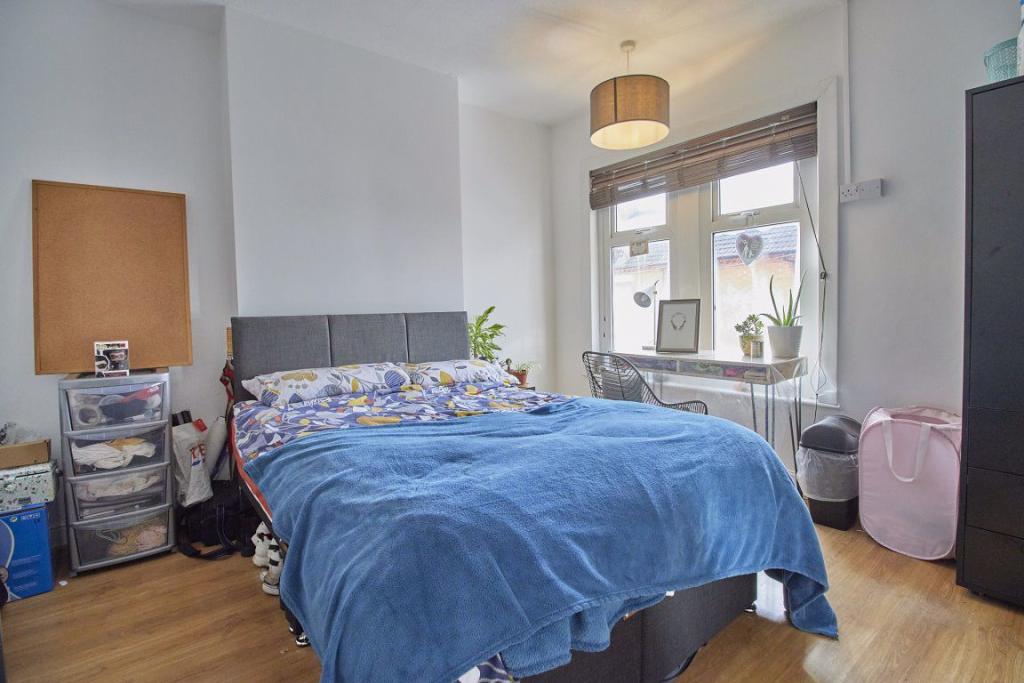
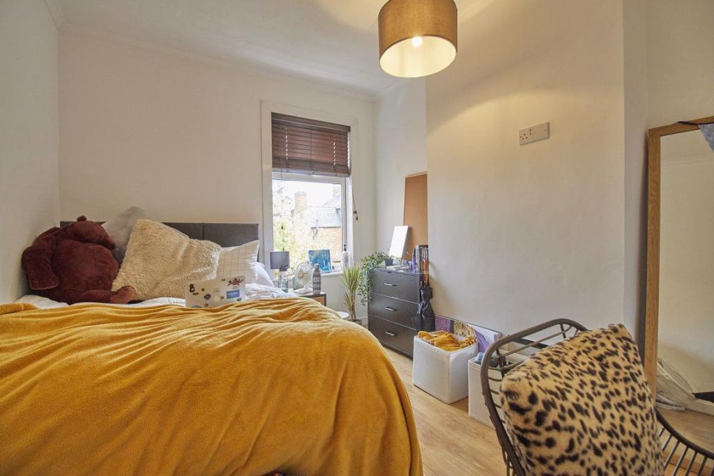
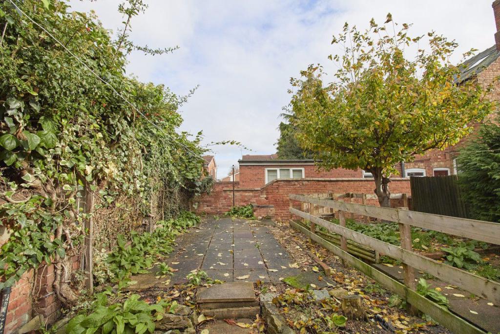
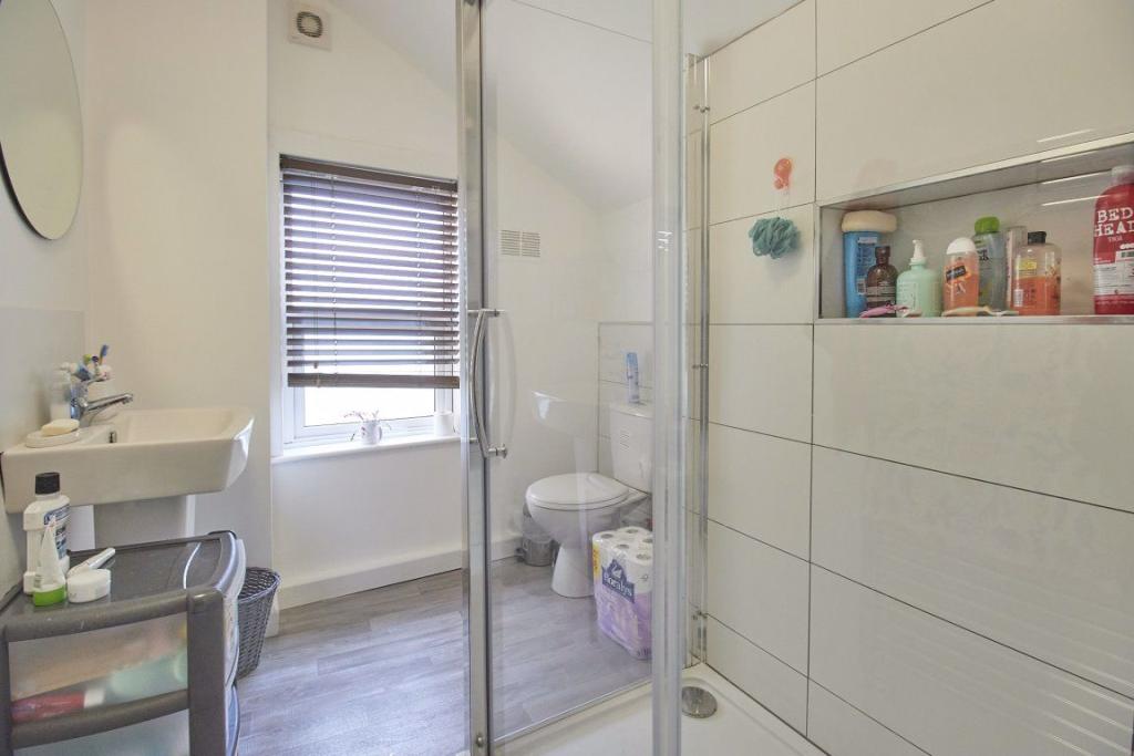
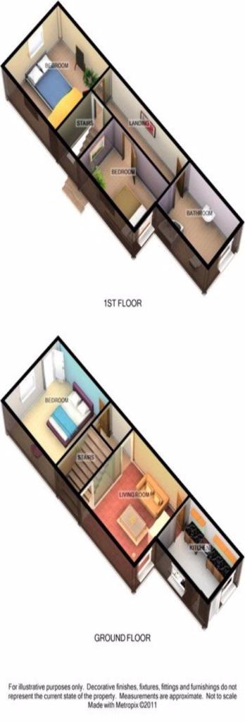
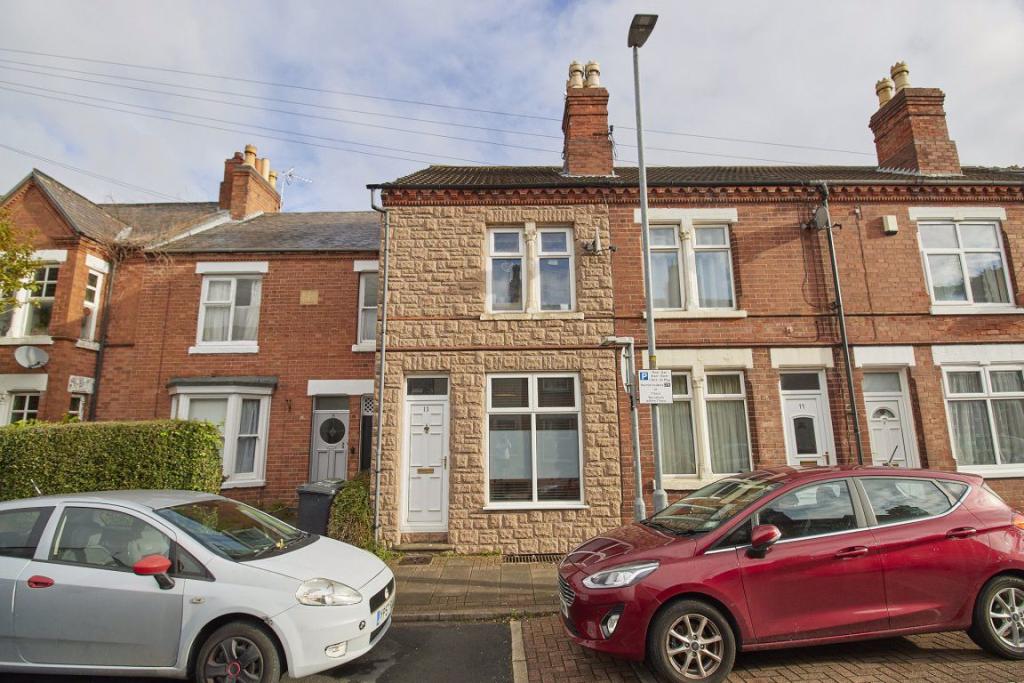
Photo 1 Photo 2 Photo 3 Photo 4 Photo 5 Photo 6 Photo 7 Photo 8 Photo 9
/ 9
Property details
Floor area
71 m²
Last sold
£140,000 Jan 2016
Local average
£633,625 (-99.9%)
Deprivation
Decile 7 (21,178 of 33,755)
Street crime
427 incidents within 1 mile (Apr 2026)
Key features
- 3 Bedrooms
- House
- Golden Triangle
- Furnished Property
- Rear Access
- Three Bedrooms
- 10 Minutes Walk To University
- Student
Additional details
- Parking
- Yes
Description
3 bedrooms available for the 2023/2024 academic year
Rent, Fees and Terms
Weekly Rent £108.00 per person per week / £5400.00 per person per annum excluding bills 50 weeks All inclusive package is available. Please contact the office for more details.
Available 1st July 2023
Deposit £540.00 per person
Inclusive of personal contents insurance*
Location This property is located less than a 10 minute walk from the University and the town centre
Living/Kitchen Living / dining room and large galley kitchen
Bedrooms This property consists of 3 bedrooms. All of the bedrooms are bright and airy and include a double bed, wardrobe, chest of drawers, desk and chair.
Bathrooms One first floor shower room
Parking Two on road parking permits available
Energy Performance Rating Grade E
*Terms & Conditions apply
Listed by
Loughborough
White Kite Holdings TA Nick Humphreys
Reference: 129540119
EPC Rating & Upgrade Cost
Fetching EPC data… Refresh this page in a moment.
Flood risk
Zone: 1
Risk: Low
Job (default Low)
EPC Graphs
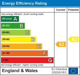
EPC 1
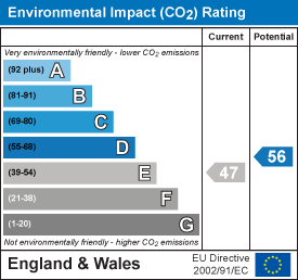
EPC 2
Price history
24% since 2011
| Event | Date | Price | % change |
|---|---|---|---|
| Sold | 08/01/2016 (10 years ago) | £140,000 | +23.9% |
| Sold | 20/04/2011 (15 years ago) | £113,000 | — |
Source: HM Land Registry Price Paid Data. Crown copyright.
Sold Comparables
Same street and nearby sales within 0.25 miles (last 5 years). Data from Land Registry Price Paid.
| Address | Price | Date | Type |
|---|---|---|---|
| 93 ASHBY ROAD, LOUGHBOROUGH, CHARNWOOD, LEICESTERSHIRE, LE11 3AB | £160,000 | 24/01/2024 | Other |
| 57 BROAD STREET, LOUGHBOROUGH, CHARNWOOD, LEICESTERSHIRE, LE11 5AB | £190,000 | 18/07/2022 | Other |
| Same street 67 OXFORD STREET, LOUGHBOROUGH, CHARNWOOD, LEICESTERSHIRE, LE11 5DP | £157,500 | 08/04/2022 | Terraced |
| Same street 37 OXFORD STREET, LOUGHBOROUGH, CHARNWOOD, LEICESTERSHIRE, LE11 5DP | £160,000 | 21/02/2022 | Terraced |
| 57 ASHBY ROAD, LOUGHBOROUGH, CHARNWOOD, LEICESTERSHIRE, LE11 3AA | £262,500 | 26/10/2021 | Other |
| Same street 35 OXFORD STREET, LOUGHBOROUGH, CHARNWOOD, LEICESTERSHIRE, LE11 5DP | £229,000 | 18/06/2021 | Terraced |
Street average: £182,167 (3 sales)
Area average: £204,167 (3 sales)
Capital growth trend
Land Registry outcode average: last 12 months vs 5y and 10y ago (from sold prices).
House Price Index (HM Land Registry — official index, not sold-price averages): Charnwood. Series: All dwelling types. As of March 2026.
Rental Range
Estimated market rent for Charnwood. Low = conservative, Realistic = average, Optimistic = best case.
Based on Local Authority from postcode lookup → Charnwood.
LHA (30th percentile) floor for Leicester: £773/mo (Apr 2025 – Mar 2026)
Location
Nearby
Nearest stations, universities and amenities (distance from property).
| Type | Name | Distance |
|---|---|---|
| Shop | Currys | 0.1 miles |
| Shop | ScS | 0.1 miles |
| Bus stop | Storer Road | 0.1 miles |
| Hospital | Loughborough Hospital | 0.4 miles |
| Hospital | Loughborough Health Centre | 0.5 miles |
| University | Unknown | 0.9 miles |
| Train station | Loughborough Central | 0.9 miles |
| Train station | Loughborough | 0.9 miles |
| University | Loughborough University | 1.2 miles |
Street-level crime
| Category | Count |
|---|---|
| Violence and sexual offences | 111 |
| Shoplifting | 85 |
| Anti-social behaviour | 66 |
| Criminal damage and arson | 36 |
| Public order | 36 |
| Other theft | 24 |
| Burglary | 14 |
| Vehicle crime | 13 |
| Drugs | 12 |
| Bicycle theft | 10 |
| Possession of weapons | 7 |
| Robbery | 5 |
| Theft from the person | 5 |
| Other crime | 3 |
| Total incidents | 427 |
Within 1 mile during Apr 2026. Source: data.police.uk (England & Wales).
Schools nearby
Nearest open schools with Ofsted ratings (England). Closed schools are not shown. Data from Get Information about Schools and Ofsted.
| Name | Type | Distance | Ofsted |
|---|---|---|---|
| Saint Mary's Catholic Primary School, Loughborough | Primary | 0.1 miles | Good — 19 Oct 2012 |
| Loughborough Church of England Primary School | Primary | 0.3 miles | Good — 5 Dec 2012 |
| Sense College Loughborough | Other | 0.3 miles | — (No rating) |
| Limehurst Academy | Secondary | 0.4 miles | Good — 22 May 2013 |
| ASPIRE: Lifeskills | Other | 0.4 miles | Good — 31 Jul 2022 |
Rental Comparables
Rental listings exist nearby, but none matched the 3-bedroom count for this property.
Rent-driven metrics
Based on Area rent estimate.
- Rent ratio — Monthly rent ÷ purchase price (1% rule). 1%+ = strong, 0.8–1% = okay, <0.8% = weak for cashflow.
- Max investor price — Rent ÷ 0.8%; the price at which rent would be 0.8% of price (Stoke-style target).
- Target investor price — Rent ÷ 1%; the price at which rent would be 1% of price (strong cashflow band).
- Gross yield — Annual rent as % of purchase price (no costs).