14B
ST MARGARETS ROAD, OXFORD, OXFORDSHIRE OX2 6RU
£1,850 pcm
Property details
Council tax band
C
Deprivation
Decile 10 (33,049 of 33,755)
Street crime
173 incidents within 1 mile (Mar 2026)
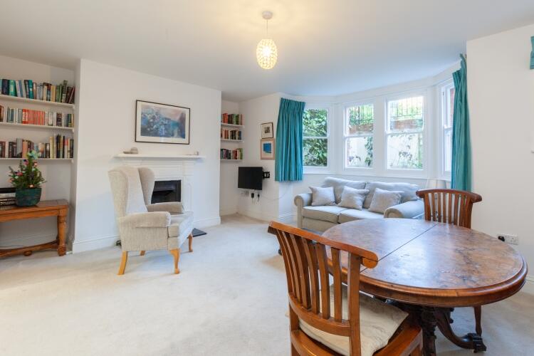
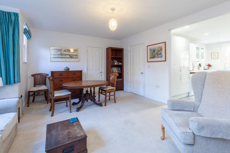
Key features
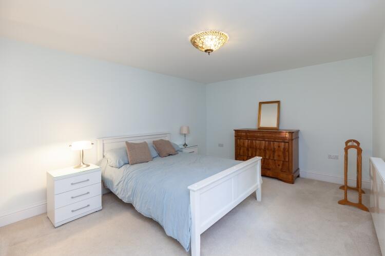
- Double bedroom
- Shower room
- Living room
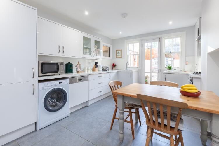
- Kitchen/dining room with appliances
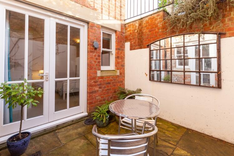
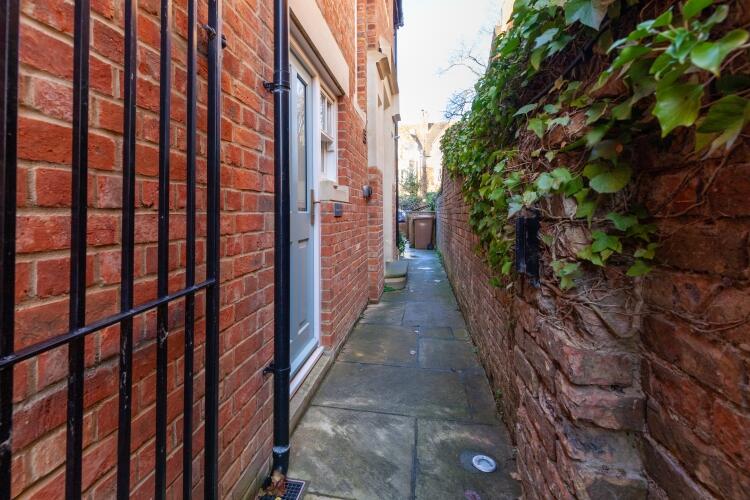
- Private terrace area. Eligible for on-street parking permit
Additional details
- Parking
- Permit
- Garden
- Terrace
- Listed property
- No
- Restrictions
- No
- Rights of way
- No
- Flooded in last 5 years
- No
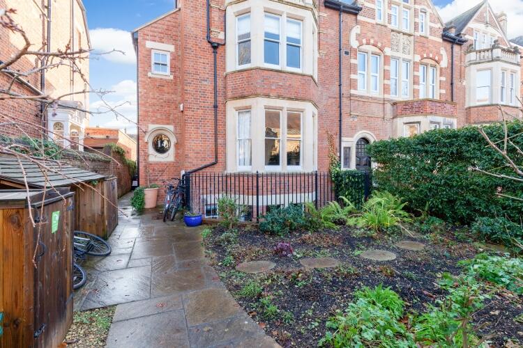
Description
North Oxford is a suburban area stretching from St. Giles in the south to the northern bypass, encompassing some of the most popular places to live in Oxford including Jericho, Summertown, Wolvercote and Cutteslowe. North Oxford is renowned for its independent schools, including the Dragon School, Summer Fields, St. Edward’s School and the Oxford High School for girls. The area is also home to many of the University colleges and departments attracting a richly diverse cultural environment. Since opening in 2015, Oxford Parkway railway station has regular trains to Bicester and London Marylebone. To check broadband and mobile phone coverage please visit Ofcom here ofcom.org.uk/phones-telecoms-and-internet/advice-for-consumers/advice/ofcom-checker
Listed by
North Oxford
Countrywide Hamptons Lettings - Connells
Reference: 172716344
EPC Rating & Upgrade Cost
Fetching EPC data… Refresh this page in a moment.
Flood risk
Zone: 1
Risk: Low
Job (default Low)
Floorplans
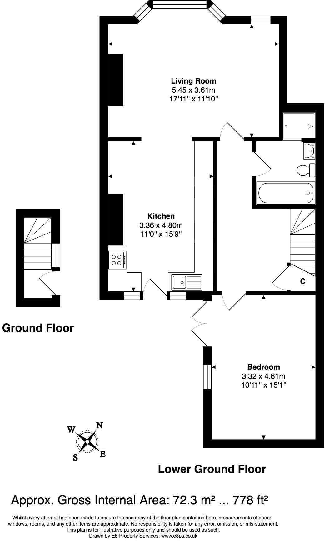
00028010
EPC Graphs

Energy Performanc...
Rental Range
Estimated market rent for Oxford. Low = conservative, Realistic = average, Optimistic = best case.
Based on Local Authority from postcode lookup → Oxford.
Location
Nearby
Nearest stations, universities and amenities (distance from property).
| Type | Name | Distance |
|---|---|---|
| Shop | Aladdin | 0.1 miles |
| Shop | The Hayfield Deli | 0.1 miles |
| Bus stop | St Margarets Road West | 0.1 miles |
| Bus stop | Canterbury Road | 0.1 miles |
| University | St Hugh's College | 0.2 miles |
| University | St Antony's College | 0.3 miles |
| Train station | Oxford | 0.9 miles |
| Hospital | John Radcliffe Hospital | 2.1 miles |
| Hospital | Warneford Hospital | 2.3 miles |
| Train station | Oxford Parkway | 2.6 miles |
Street-level crime
| Category | Count |
|---|---|
| Violence and sexual offences | 53 |
| Anti-social behaviour | 21 |
| Public order | 19 |
| Other theft | 17 |
| Shoplifting | 17 |
| Bicycle theft | 16 |
| Criminal damage and arson | 7 |
| Drugs | 7 |
| Vehicle crime | 7 |
| Theft from the person | 5 |
| Burglary | 1 |
| Other crime | 1 |
| Possession of weapons | 1 |
| Robbery | 1 |
| Total incidents | 173 |
Within 1 mile during Mar 2026. Source: data.police.uk (England & Wales).
Schools nearby
Nearest open schools with Ofsted ratings (England). Closed schools are not shown. Data from Get Information about Schools and Ofsted.
| Name | Type | Distance | Ofsted |
|---|---|---|---|
| St Aloysius' Catholic Primary School | Primary | 0.1 miles | Good — 15 Dec 2016 |
| St Philip and James' Church of England Aided Primary School Oxford | Primary | 0.2 miles | Good — 26 Oct 2012 |
| Wychwood School | Other | 0.3 miles | — (No rating) |
| Dragon School | Other | 0.5 miles | — (No rating) |
| St Barnabas' Church of England Aided Primary School | Primary | 0.5 miles | Requires improvement — 16 May 2023 |
Rental Comparables
Loading rental comparables for this postcode. Refresh in a few minutes.