FLAT 53
FORASTERO HOUSE, 24, FARINE AVENUE, HAYES, GREATER LONDON UB3 4GE
Property details
Floor area
39 m²
Council tax band
TBC
Street crime
471 incidents within 1 mile (May 2026)
Additional details
- Parking
- Yes
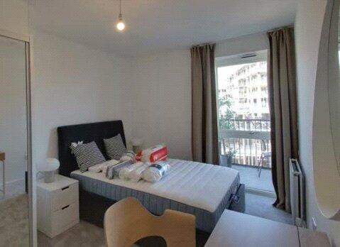
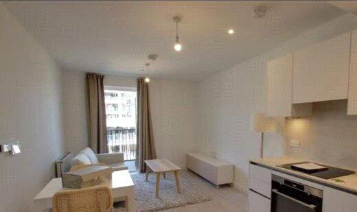
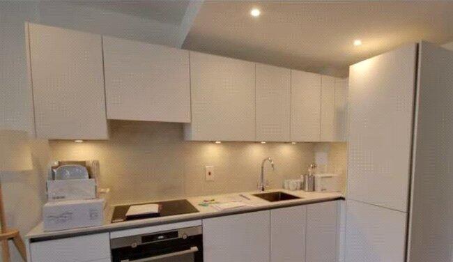
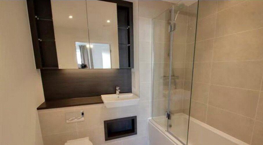
Description
Parking is NOT included
Fully Furnished. 420 Sq Ft. Council Tax Band - C. EPC Rating - B.
1 Week’ Rent as Holding Deposit. 5 Weeks' Rent as Security Deposit. Subject to Contract.
Utilities Bills such as Electricity, Water, Heating, Broadband are not included in the rent.
Listed by
London
CHENG GONG REAL ESTATE LIMITED
Reference: 164807897
EPC Rating & Upgrade Cost
Fetching EPC data… Refresh this page in a moment.
Flood risk
Zone: 1
Risk: Low
Job (default Low)
Rental Range
Estimated market rent for London. Low = conservative, Realistic = average, Optimistic = best case.
Based on Postcode area UB → London.
LHA (30th percentile) floor for South West Herts: £947/mo (Apr 2025 – Mar 2026)
Location
Address
14 Nestle's Avenue
Nearby
Nearest stations, universities and amenities (distance from property).
| Type | Name | Distance |
|---|---|---|
| Train station | Hayes and Harlington | 0.2 miles |
| Shop | Unknown | 0.2 miles |
| Bus stop | Harold Avenue | 0.2 miles |
| Shop | Tesco Express | 0.2 miles |
| Train station | Southall | 1.6 miles |
| Hospital | The Broadway Health Centre | 1.7 miles |
| Hospital | Hillingdon Hospital | 2.6 miles |
| University | Faraday Complex | 3.1 miles |
| University | Chepstow Hall | 3.2 miles |
Street-level crime
| Category | Count |
|---|---|
| Violence and sexual offences | 143 |
| Anti-social behaviour | 106 |
| Shoplifting | 50 |
| Vehicle crime | 43 |
| Other theft | 32 |
| Public order | 20 |
| Theft from the person | 19 |
| Robbery | 18 |
| Drugs | 13 |
| Bicycle theft | 10 |
| Burglary | 10 |
| Other crime | 6 |
| Possession of weapons | 1 |
| Total incidents | 471 |
Within 1 mile during May 2026. Source: data.police.uk (England & Wales).
Schools nearby
Nearest open schools with Ofsted ratings (England). Closed schools are not shown. Data from Get Information about Schools and Ofsted.
| Name | Type | Distance | Ofsted |
|---|---|---|---|
| Botwell House Catholic Primary School | Primary | 0.5 miles | Good — 5 Nov 2014 |
| Cranford Park Academy | Primary | 0.5 miles | Good — 12 Jul 2013 |
| Global Academy | Secondary | 0.6 miles | Good — 10 Jun 2019 |
| Minet Junior School | Primary | 0.7 miles | Good — 12 Oct 2015 |
| Minet Infant and Nursery School | Primary | 0.7 miles | Good — 13 Jan 2014 |
Rental Comparables
Residential lets from OpenRent and Rightmove for the area (same bedroom count). Use to validate rent estimates. Student lets are excluded.
| Title | Rent | Beds | Distance | As seen on |
|---|---|---|---|---|
| Studio Flat, Vantage Building, UB3 | £1,375/mo | 1 | 0.24 miles | OpenRent |
| Studio Flat, Station Road, UB3 | £1,375/mo | 1 | 0.27 miles | OpenRent |
| 1 Bed Flat, Gramophone Lane, UB3 | £1,500/mo | 1 | 0.54 miles | OpenRent |
| 1 Bed Flat, Station Road, UB3 | £1,250/mo | 1 | 0.6 miles | OpenRent |
| Studio Flat, Shepiston Lane, UB3 | £1,250/mo | 1 | 0.73 miles | OpenRent |
| 1 Bed Flat, Harlington, UB3 | £1,100/mo | 1 | 1.03 miles | OpenRent |
| Studio Flat, Carnarvon Drive, UB3 | £1,200/mo | 1 | 1.17 miles | OpenRent |
Average rent: £1,293/mo (7 listings)