1 WHITEHALL COURT
SITTINGBOURNE, KENT ME10 4ED
£225,000
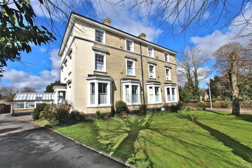
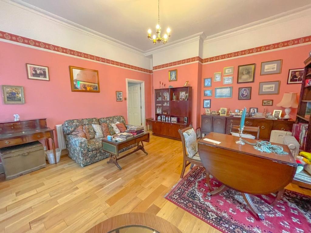
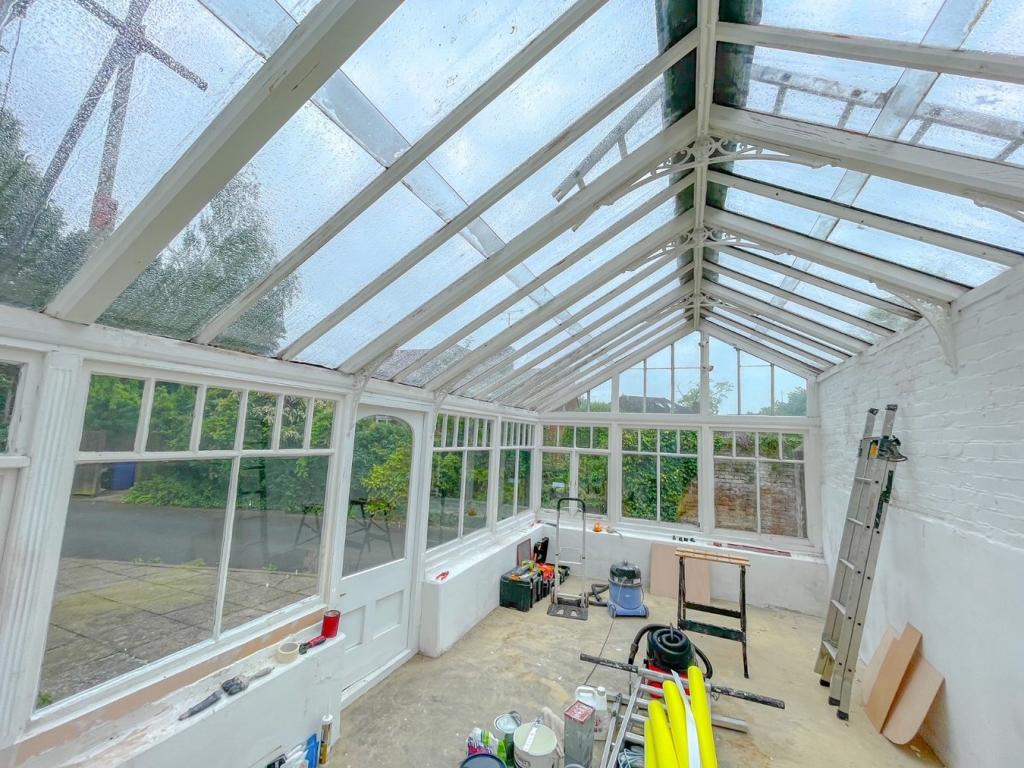
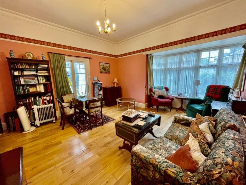
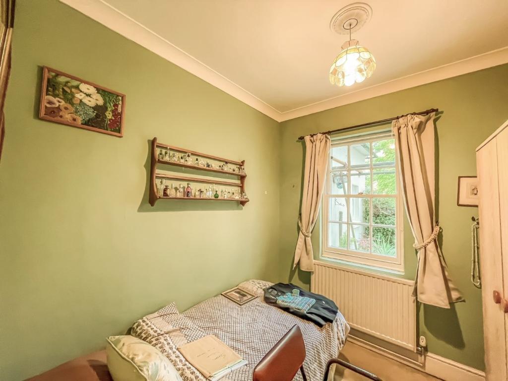
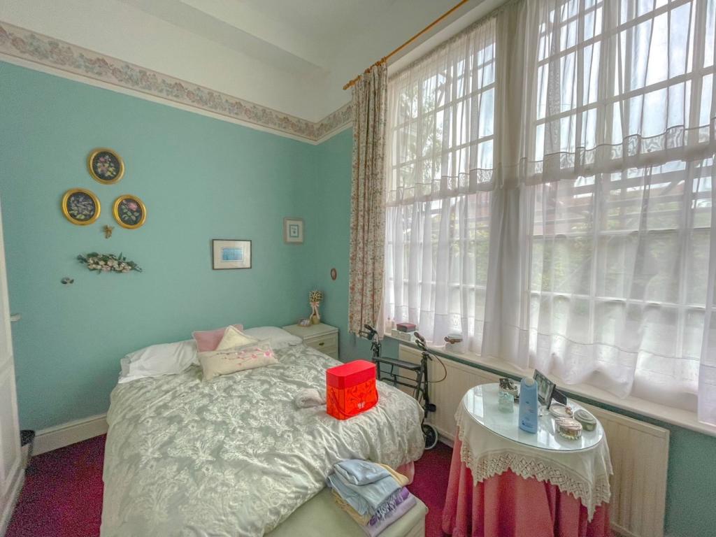
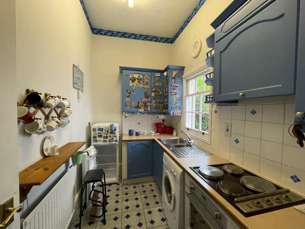
Photo 1 Photo 2 Photo 3 Photo 4 Photo 5 Photo 6 Photo 7
/ 7
Property details
Tenure
LEASEHOLD
Floor area
49 m²
Year built
England and Wales: 1900-1929
Last sold
£207,000 Jun 2022
Price per m²
£4,592/m²
Local average
£151,531 (+48.5%)
Deprivation
Decile 6 (19,148 of 33,755)
Street crime
281 incidents within 1 mile (Apr 2026)
Key features
- STUNNING 2 BEDROOM GROUNDFLOOR APARTMENT
- LARGE CONSERVATORY
- ALLOCATED PARKING
- PRESTIGIOUS LOCATION
- VACANT POSSESSION
Additional details
- Parking
- Yes
Description
Situated in a prestigious development, this charming apartment offers spacious living accommodation with the benefit of a huge conservatory that is currently being restored to it's former glory.
Whitehall Court is an extremely popular development and is situated in an extremely convenient location with a local parade of shops and just a short walk away from Sittingbourne town centre that is in the middle of an exciting regeneration scheme.
Allocated parking for 2 vehicles and communal gardens.
Listed by
Sittingbourne
Buckey & Ward
Reference: 114644768
EPC Rating & Upgrade Cost
Fetching EPC data… Refresh this page in a moment.
Flood risk
Zone: 1
Risk: Low
Job (default Low)
Floorplans

Floorplan 1
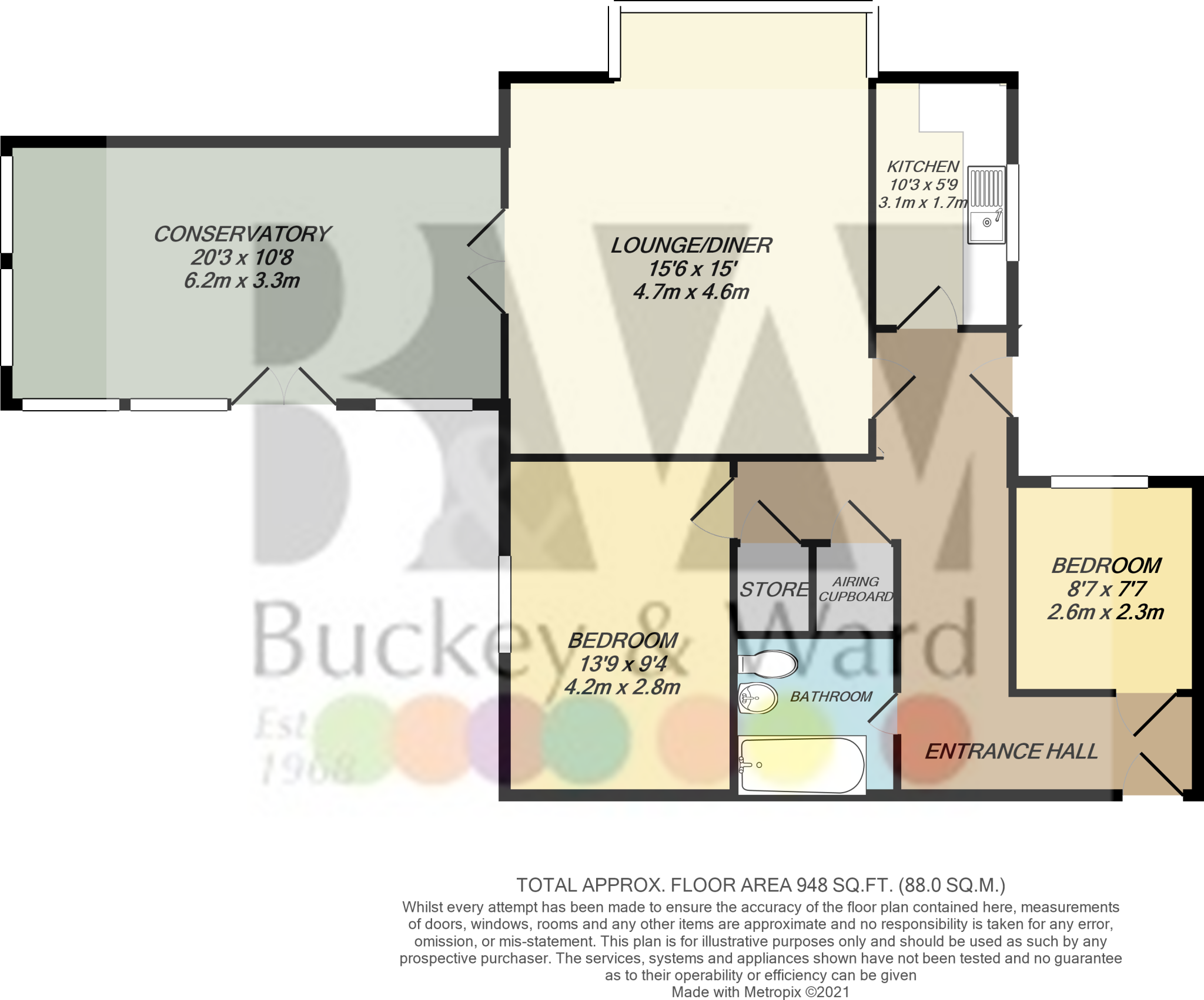
Floorplan
Price history
| Event | Date | Price | % change |
|---|---|---|---|
| Sold | 24/06/2022 (3 years ago) | £207,000 | — |
Source: HM Land Registry Price Paid Data. Crown copyright.
Sold Comparables
Same street and nearby sales within 0.25 miles (last 5 years). Data from Land Registry Price Paid.
| Address | Price | Date | Type |
|---|---|---|---|
| 49 CAPEL ROAD, SITTINGBOURNE, SWALE, KENT, ME10 4EP | £167,000 | 17/12/2025 | Flat |
| 35 CAPEL ROAD, SITTINGBOURNE, SWALE, KENT, ME10 4EP | £176,000 | 22/10/2021 | Flat |
| Same street 10 WHITEHALL COURT, SITTINGBOURNE, SWALE, KENT, ME10 4ED | £145,000 | 29/09/2021 | Flat |
| 151 LOWER FLAT PARK ROAD, SITTINGBOURNE, SWALE, KENT, ME10 1EW | £170,000 | 27/08/2021 | Flat |
| Same street 2 WHITEHALL COURT, SITTINGBOURNE, SWALE, KENT, ME10 4ED | £145,000 | 24/08/2021 | Flat |
Street average: £145,000 (2 sales)
Area average: £171,000 (3 sales)
Capital growth trend
Land Registry outcode average: last 12 months vs 5y and 10y ago (from sold prices).
House Price Index (HM Land Registry — official index, not sold-price averages): Swale. Series: Flats and maisonettes. As of March 2026.
Rental Range
Estimated market rent for Swale. Low = conservative, Realistic = average, Optimistic = best case.
Based on Local Authority from postcode lookup → Swale.
LHA (30th percentile) floor for Medway & Swale: £848/mo (Apr 2025 – Mar 2026)
Location
Nearby
Nearest stations, universities and amenities (distance from property).
| Type | Name | Distance |
|---|---|---|
| Hospital | Sittingbourne Memorial Hospital | 0.1 miles |
| Shop | Unknown | 0.1 miles |
| Shop | League of Friends Shop | 0.1 miles |
| Bus stop | Community Hospital | 0.1 miles |
| Bus stop | Fulston Manor and Highsted Schools | 0.2 miles |
| Train station | Sittingbourne | 0.6 miles |
| Train station | Sittingbourne Viaduct | 0.8 miles |
| Hospital | Unknown | 2.0 miles |
| University | Canterbury Christ Church University | 5.2 miles |
| University | UCA Maidstone Studios | 8.8 miles |
Street-level crime
| Category | Count |
|---|---|
| Violence and sexual offences | 95 |
| Anti-social behaviour | 53 |
| Shoplifting | 47 |
| Criminal damage and arson | 26 |
| Other theft | 15 |
| Drugs | 13 |
| Public order | 9 |
| Vehicle crime | 9 |
| Other crime | 5 |
| Bicycle theft | 4 |
| Burglary | 2 |
| Robbery | 2 |
| Theft from the person | 1 |
| Total incidents | 281 |
Within 1 mile during Apr 2026. Source: data.police.uk (England & Wales).
Schools nearby
Nearest open schools with Ofsted ratings (England). Closed schools are not shown. Data from Get Information about Schools and Ofsted.
| Name | Type | Distance | Ofsted |
|---|---|---|---|
| Highsted Grammar School | Secondary | 0.1 miles | Good — 19 Mar 2023 |
| Fulston Manor School | Secondary | 0.2 miles | Requires improvement — 11 Jan 2024 |
| ALP Sittingbourne | Other | 0.2 miles | Good — 9 Oct 2023 |
| Borden Grammar School | Secondary | 0.2 miles | Good — 4 Dec 2013 |
| The Oaks Infant School | Primary | 0.4 miles | Good — 19 Jul 2011 |
Rental Comparables
Residential lets from OpenRent and Rightmove for the area (same bedroom count). Use to validate rent estimates. Student lets are excluded.
| Title | Rent | Beds | Distance | As seen on |
|---|---|---|---|---|
| 2 Bed Flat, High St, ME10 | £1,100/mo | 2 | 0.42 miles | OpenRent |
Average rent: £1,100/mo (1 listing)
Rent-driven metrics
Based on OpenRent comparables.
- Rent ratio — Monthly rent ÷ purchase price (1% rule). 1%+ = strong, 0.8–1% = okay, <0.8% = weak for cashflow.
- Max investor price — Rent ÷ 0.8%; the price at which rent would be 0.8% of price (Stoke-style target).
- Target investor price — Rent ÷ 1%; the price at which rent would be 1% of price (strong cashflow band).
- Gross yield — Annual rent as % of purchase price (no costs).
- Cost-to-rent — Price ÷ annual rent (from OpenRent comparables). Under 14× = strong, 14–16× = acceptable, 17×+ = compressed.
- Cashflow — Rent minus mortgage, 10% maintenance, £25/mo compliance. Assumes 75% LTV, 3.95% APR (5yr fixed), 25yr term.
- ROI — Annual profit ÷ cash in (deposit + 4% purchase costs).