5 THORNBOROUGH CLOSE
STOCKTON-ON-TEES, STOCKTON-ON-TEES, STOCKTON-ON-TEES TS18 5PA
£149,950
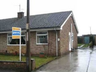
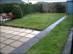
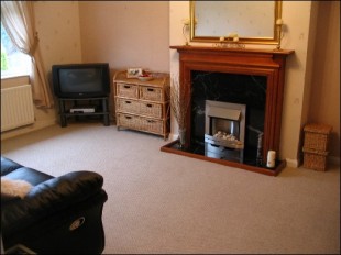
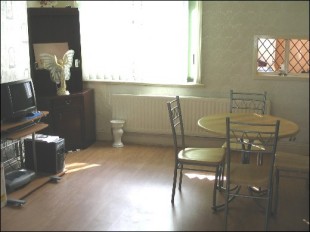

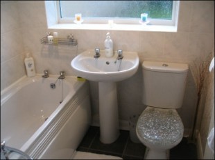
Photo 1 Photo 2 Photo 3 Photo 4 Photo 5 Photo 6
/ 6
Property details
Last sold
£139,995 Aug 2004
Local average
£248,136 (-39.6%)
Deprivation
Decile 8 (23,852 of 33,755)
Street crime
72 incidents within 1 mile (Apr 2026)
Description
Dimensions
Bedroom 1:
Bedroom 2:
Reception 1:
Kitchen:
12 3x9 7
9 8x9 3
17 3x11 6
11 1x8 11
Listed by
Stockton-on-Tees
SMITH & FRIENDS ESTATE AGENTS LTD
Reference: 13635662
EPC Rating & Upgrade Cost
Fetching EPC data… Refresh this page in a moment.
Flood risk
Zone: 1
Risk: Low
Job (default Low)
FENSA Certificates
This property has 2 FENSA certificate(s) on record, indicating window/door installations by FENSA-approved installers.
FENSA Certificate #3180258
Property Details
Street: 5 Thornbrough Close
Town: STOCKTON-ON-TEES
Postcode: TS18 5PA
Installation Details
Items: 1 door
Certificate Issued: 07/11/2005
Work Completed: 21/09/2005
This certificate data was retrieved from FENSA's database
FENSA Certificate #2305500
Property Details
Street: 5 Thornbrough Close
Town: STOCKTON-ON-TEES
Postcode: TS18 5PA
Installation Details
Items: 5 windows and 1 door
Certificate Issued: 13/12/2004
Work Completed: 11/11/2004
This certificate data was retrieved from FENSA's database
What is FENSA? FENSA (Fenestration Self-Assessment Scheme) is a government-authorised scheme that monitors building regulation compliance for replacement windows and doors. Certificates indicate that work was completed by FENSA-approved installers.
Price history
| Event | Date | Price | % change |
|---|---|---|---|
| Sold | 27/08/2004 (21 years ago) | £139,995 | — |
Source: HM Land Registry Price Paid Data. Crown copyright.
Sold Comparables
Same street and nearby sales within 0.25 miles (last 5 years). Data from Land Registry Price Paid.
| Address | Price | Date | Type |
|---|---|---|---|
| 25 FLEETHAM GROVE, STOCKTON-ON-TEES, TS18 5LH | £295,000 | 10/12/2025 | Detached |
| 9 WELBURY CLOSE, STOCKTON-ON-TEES, TS18 5LJ | £189,000 | 24/10/2025 | Detached |
| 31 ARRATHORNE ROAD, STOCKTON-ON-TEES, TS18 5PD | £235,000 | 03/11/2023 | Detached |
| 2 THORNBOROUGH CLOSE, STOCKTON-ON-TEES, TS18 5PA | £200,000 | 04/05/2023 | Detached |
| 30 AINDERBY GROVE, STOCKTON-ON-TEES, TS18 5PJ | £242,000 | 30/09/2022 | Detached |
| 4 HALLGATE CLOSE, STOCKTON-ON-TEES, TS18 5NT | £161,000 | 10/06/2022 | Detached |
| 7 WELBURY CLOSE, STOCKTON-ON-TEES, TS18 5LJ | £180,000 | 11/03/2022 | Detached |
| 11 BELLERBY ROAD, STOCKTON-ON-TEES, TS18 5JN | £208,000 | 10/02/2022 | Detached |
| 6 AINDERBY GROVE, STOCKTON-ON-TEES, TS18 5PJ | £176,000 | 03/09/2021 | Detached |
| 31 FLEETHAM GROVE, STOCKTON-ON-TEES, TS18 5LH | £140,000 | 02/07/2021 | Detached |
Area average: £202,600 (10 sales)
Capital growth trend
Land Registry outcode average: last 12 months vs 5y and 10y ago (from sold prices).
House Price Index (HM Land Registry — official index, not sold-price averages): Stockton-on-Tees. Series: Detached. As of March 2026.
Rental Range
Estimated market rent for Stockton-on-Tees. Low = conservative, Realistic = average, Optimistic = best case.
Based on Local Authority from postcode lookup → Stockton-on-Tees.
LHA (30th percentile) floor for Teesside: £474/mo (Apr 2025 – Mar 2026)
Location
Nearby
Nearest stations, universities and amenities (distance from property).
| Type | Name | Distance |
|---|---|---|
| Bus stop | Hackforth Road | 0.1 miles |
| Shop | One Stop | 0.2 miles |
| Shop | Family Shopper | 0.3 miles |
| Train station | Tees Small Gauge Railway | 1.4 miles |
| Train station | Eaglescliffe | 1.7 miles |
| Hospital | Butterwick Hospice | 1.8 miles |
| Hospital | North Tees Hospital | 2.0 miles |
| University | Durham University, Queen's Campus | 2.6 miles |
| University | Teesside University | 5.1 miles |
Street-level crime
| Category | Count |
|---|---|
| Violence and sexual offences | 21 |
| Shoplifting | 17 |
| Anti-social behaviour | 12 |
| Vehicle crime | 10 |
| Criminal damage and arson | 2 |
| Possession of weapons | 2 |
| Public order | 2 |
| Robbery | 2 |
| Burglary | 1 |
| Drugs | 1 |
| Other crime | 1 |
| Other theft | 1 |
| Total incidents | 72 |
Within 1 mile during Apr 2026. Source: data.police.uk (England & Wales).
Schools nearby
Nearest open schools with Ofsted ratings (England). Closed schools are not shown. Data from Get Information about Schools and Ofsted.
| Name | Type | Distance | Ofsted |
|---|---|---|---|
| Holy Trinity Rosehill CofE Voluntary Aided Primary School | Primary | 0.4 miles | Good — 26 Sep 2023 |
| Ian Ramsey Church of England Academy | Secondary | 0.6 miles | Good — 23 Jan 2023 |
| Hartburn Primary School | Primary | 0.7 miles | Good — 6 Feb 2014 |
| Fairfield Primary School | Primary | 0.9 miles | Good — 21 Nov 2011 |
| St Patrick's Catholic Primary School, Stockton | Primary | 0.9 miles | Good — 6 May 2024 |
Rental Comparables
Rental listings exist nearby, but none matched the 2-bedroom count for this property.
Rent-driven metrics
Based on Area rent estimate.
- Rent ratio — Monthly rent ÷ purchase price (1% rule). 1%+ = strong, 0.8–1% = okay, <0.8% = weak for cashflow.
- Max investor price — Rent ÷ 0.8%; the price at which rent would be 0.8% of price (Stoke-style target).
- Target investor price — Rent ÷ 1%; the price at which rent would be 1% of price (strong cashflow band).
- Gross yield — Annual rent as % of purchase price (no costs).