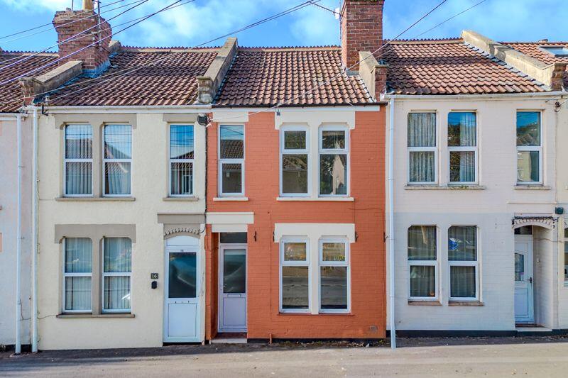
15 BIRDWELL ROAD
BRISTOL, LONG ASHTON, NORTH SOMERSET BS41 9BA
Property details
Tenure
FREEHOLD
Floor area
77 m²
Council tax band
B
EPC rating
C
Year built
England and Wales: 1900-1929
Last sold
£285,500 Mar 2026
Price per m²
£3,831/m²
Local average
£447,563 (-34.1%)
Deprivation
Decile 9 (28,882 of 33,755)
Street crime
26 incidents within 1 mile (Apr 2026)
Key features
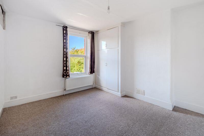
- Two Bedroom Victorian Terraced House
- NO ONWARD CHAIN
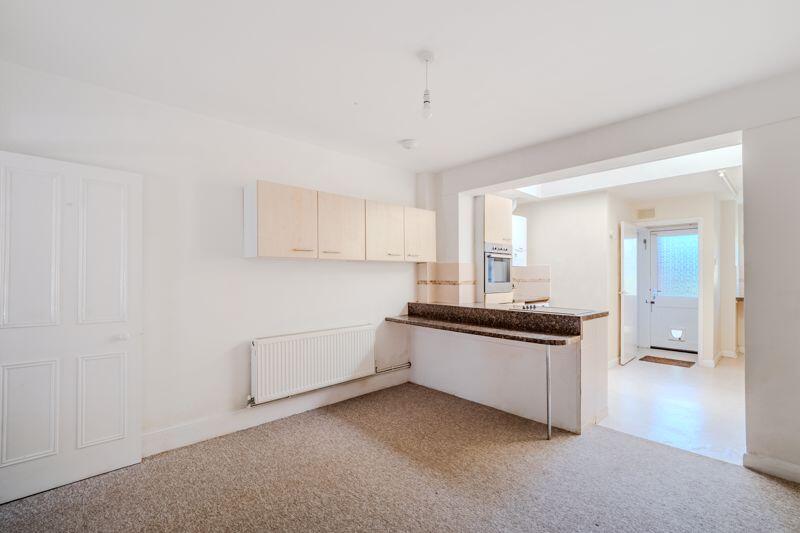
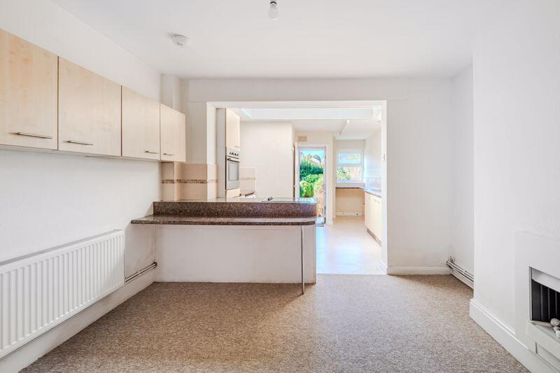
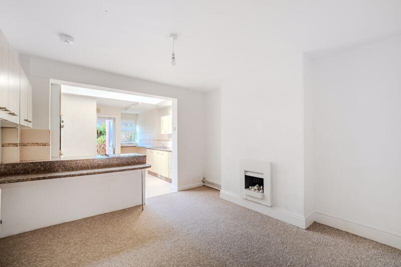
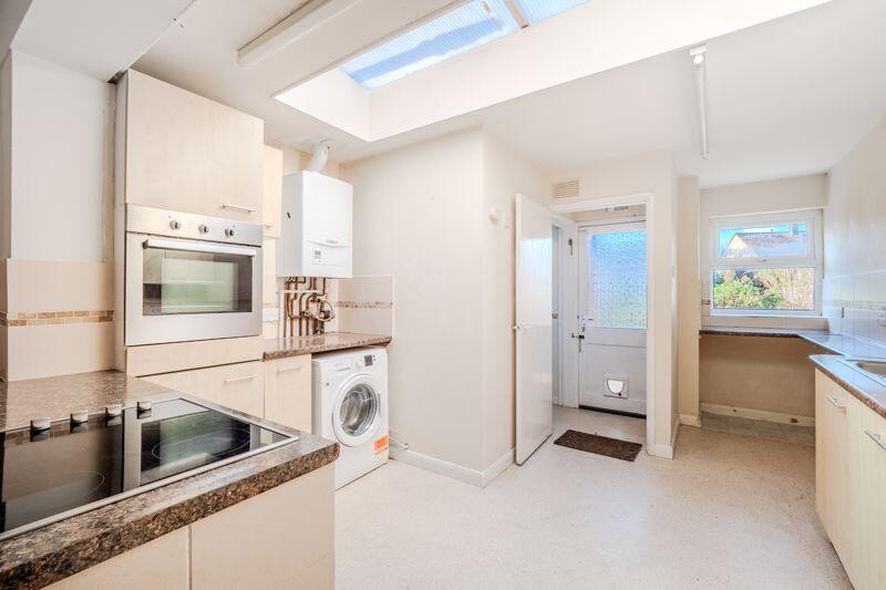
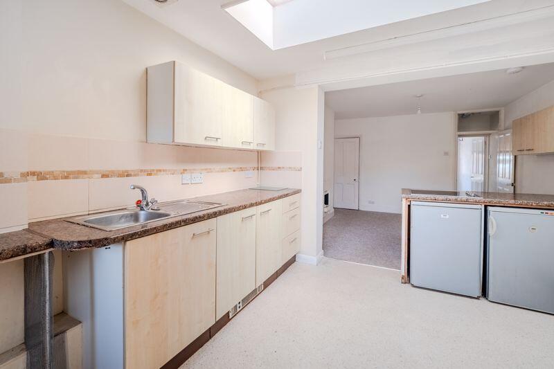
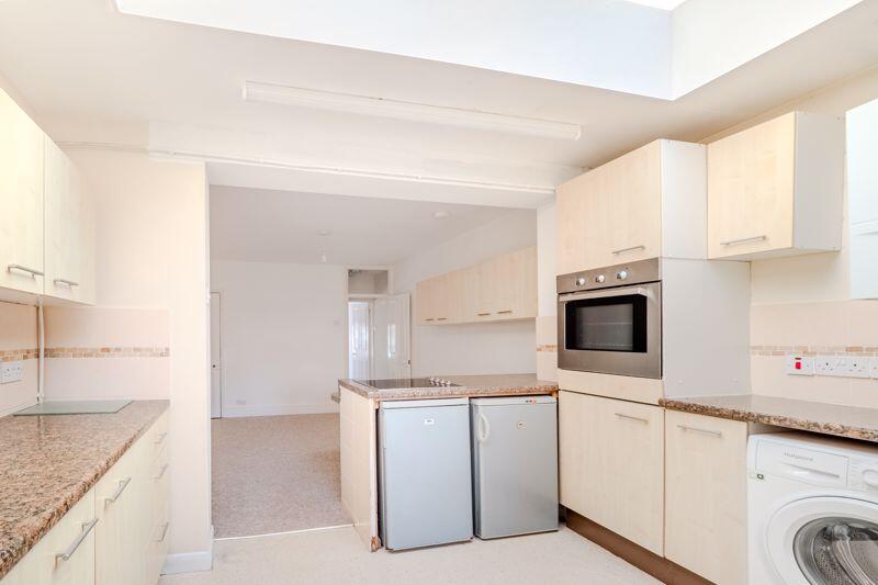
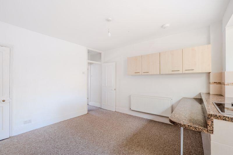
- Open Plan Kitchen / Dining Area
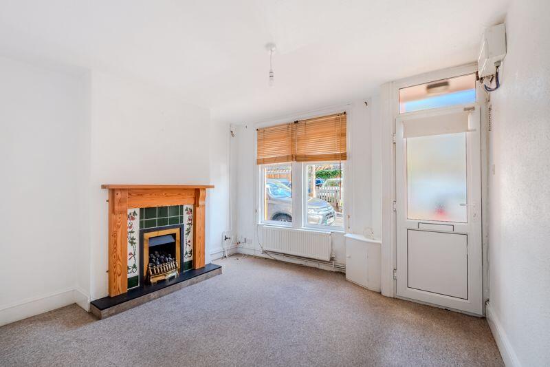
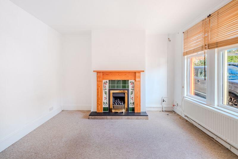
- Sitting Room with Gas Fireplace
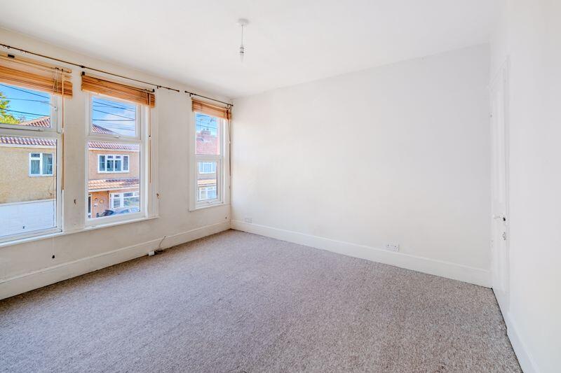
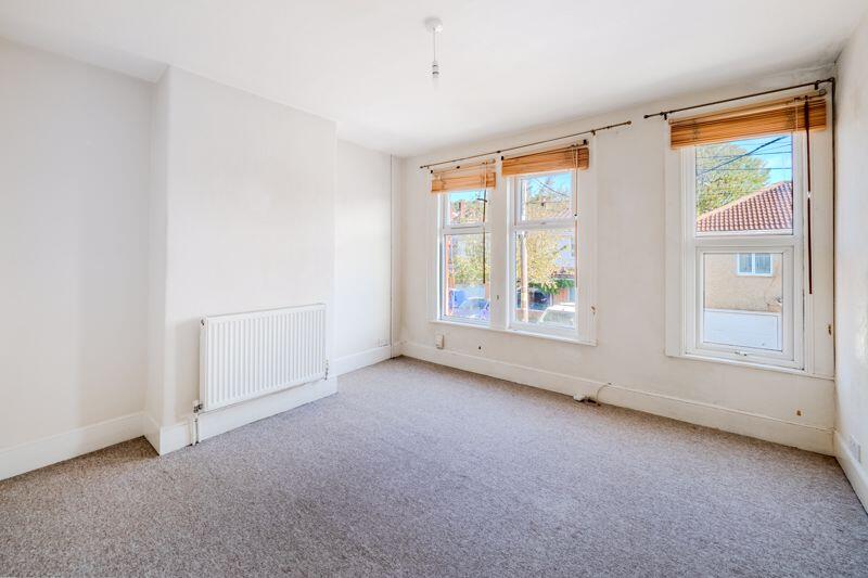
- Two Double Bedrooms with Built in Storage
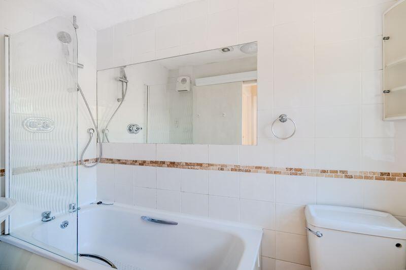
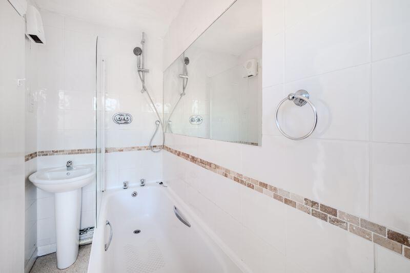
- Family Bathroom
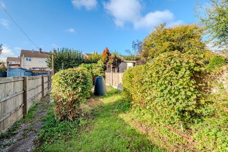
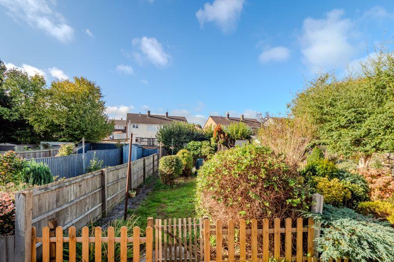
- South West Facing Garden
- Close Proximity to Village Amenities
- Short Walk to Birdwell Primary School
Additional details
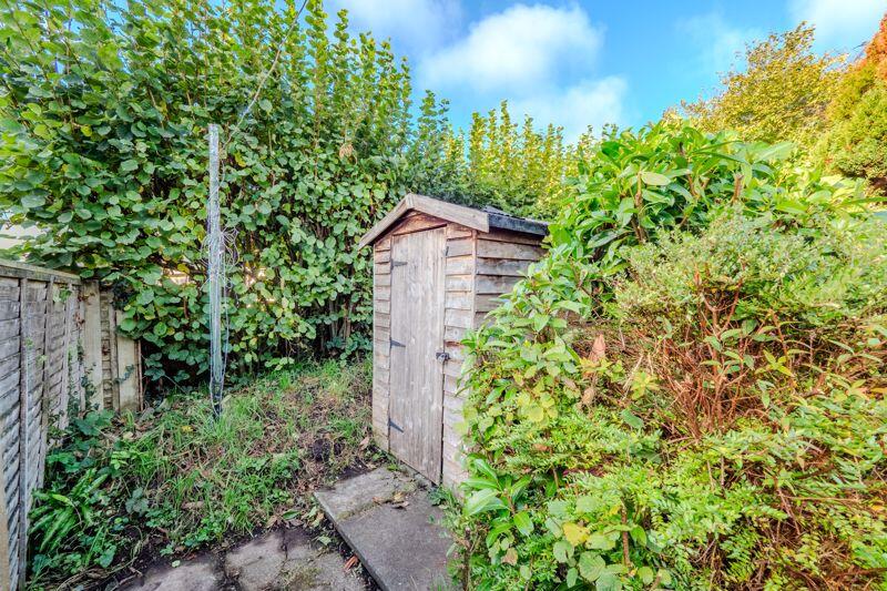
- Garden
- Yes
Description
Listed by
Bristol
Alexander May Property Limited
Reference: 167973119
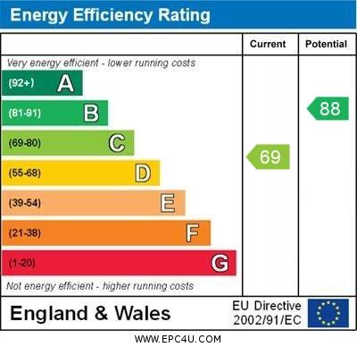
EPC Rating & Upgrade Cost
Current rating: C
Potential rating: B
Inspection date: 04/08/2023
Expiry date: 03/08/2033
Current heating cost: £1,085/year
Potential heating cost: £711/year
Est. upgrade cost to C: £25,675
Recommendations
- Flat roof or sloping ceiling insulation (£850 - £1,500)
- Cavity wall insulation (£500 - £1,500)
- 50 mm internal or external wall insulation (£4,000 - £14,000)
- Floor insulation (solid floor) (£4,000 - £6,000)
- Solar water heating (£4,000 - £6,000)
- Solar photovoltaic panels, 2.5 kWp (£3,500 - £5,500)
Flood risk
Zone: 1
Risk: Low
Job (default Low)
Floorplans
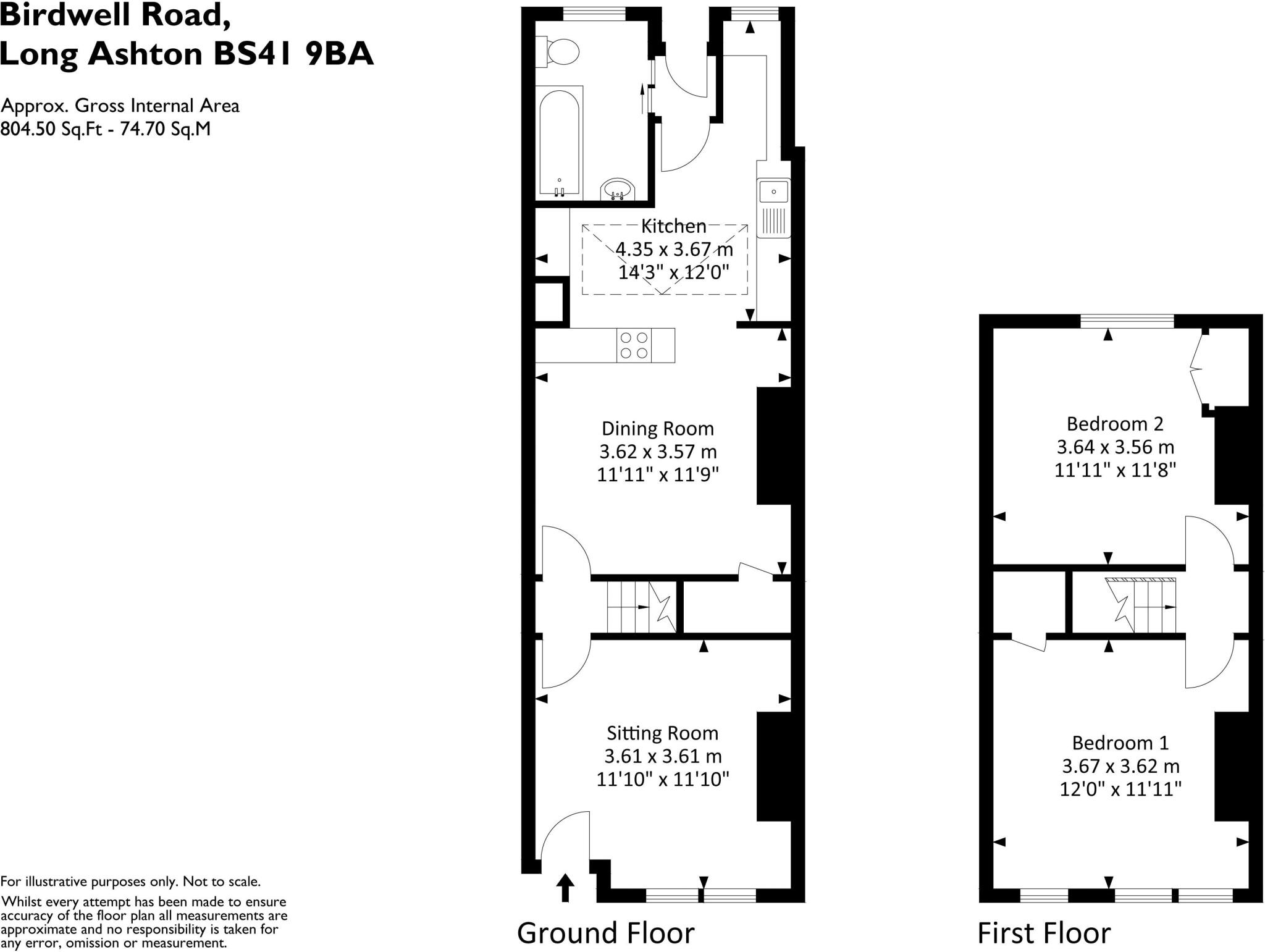
Floorplan 1
EPC Graphs
EPC GRAPH
FENSA Certificates
This property has 1 FENSA certificate(s) on record, indicating window/door installations by FENSA-approved installers.
FENSA Certificate #14742808 Recent
Property Details
Street: 15 Birdwell Road
Town: Long Ashton
Postcode: BS41 9BA
Installation Details
Items: 2 windows
Certificate Issued: 15/08/2021
Work Completed: 28/07/2021
This certificate data was retrieved from FENSA's database
What is FENSA? FENSA (Fenestration Self-Assessment Scheme) is a government-authorised scheme that monitors building regulation compliance for replacement windows and doors. Certificates indicate that work was completed by FENSA-approved installers.
Price history
507% since 1996
| Event | Date | Price | % change |
|---|---|---|---|
| Sold | 06/03/2026 (3 months ago) | £285,500 | +507.4% |
| Sold | 29/11/1996 (29 years ago) | £47,000 | — |
Source: HM Land Registry Price Paid Data. Crown copyright.
Sold Comparables
Same street and nearby sales within 0.25 miles (last 5 years). Data from Land Registry Price Paid.
| Address | Price | Date | Type |
|---|---|---|---|
| Same street 23 BIRDWELL ROAD, LONG ASHTON, BRISTOL, NORTH SOMERSET, BS41 9BA | £400,000 | 20/11/2025 | Terraced |
| 11 RAYMORE RISE, LONG ASHTON, BRISTOL, NORTH SOMERSET, BS41 9AP | £324,000 | 28/04/2023 | Terraced |
| Same street 4 BIRDWELL ROAD, LONG ASHTON, BRISTOL, NORTH SOMERSET, BS41 9BA | £320,000 | 07/10/2022 | Terraced |
| 43 LAMPTON ROAD, LONG ASHTON, BRISTOL, NORTH SOMERSET, BS41 9AL | £390,000 | 28/06/2021 | Terraced |
Street average: £360,000 (2 sales)
Area average: £357,000 (2 sales)
Capital growth trend
Land Registry outcode average: last 12 months vs 5y and 10y ago (from sold prices).
House Price Index (HM Land Registry — official index, not sold-price averages): North Somerset. Series: Terraced. As of March 2026.
Rental Range
Estimated market rent for North Somerset. Low = conservative, Realistic = average, Optimistic = best case.
Based on Local Authority from postcode lookup → North Somerset.
LHA (30th percentile) floor for Bristol: £1,092/mo (Apr 2025 – Mar 2026)
Location
Nearby
Nearest stations, universities and amenities (distance from property).
| Type | Name | Distance |
|---|---|---|
| Shop | The Co-operative Food | 0.0 miles |
| Shop | Bikesmiths | 0.1 miles |
| Bus stop | Birdwell Lane | 0.1 miles |
| University | University of Bristol | 1.1 miles |
| University | E | 1.8 miles |
| Train station | Unknown | 2.0 miles |
| Train station | Butterfly Junction | 2.4 miles |
| Hospital | The Chesterfield | 2.8 miles |
| Hospital | Penny Brohn Cancer Care | 3.5 miles |
Street-level crime
| Category | Count |
|---|---|
| Violence and sexual offences | 10 |
| Burglary | 5 |
| Vehicle crime | 4 |
| Public order | 3 |
| Anti-social behaviour | 2 |
| Criminal damage and arson | 2 |
| Total incidents | 26 |
Within 1 mile during Apr 2026. Source: data.police.uk (England & Wales).
Schools nearby
Nearest open schools with Ofsted ratings (England). Closed schools are not shown. Data from Get Information about Schools and Ofsted.
| Name | Type | Distance | Ofsted |
|---|---|---|---|
| Birdwell Primary School | Primary | 0.2 miles | Good — 8 Dec 2011 |
| Northleaze Church of England Primary School | Primary | 0.7 miles | Good — 18 Jul 2012 |
| Ashton Vale Primary School | Primary | 1.8 miles | Requires improvement — 4 Dec 2022 |
| Ashton Park School | Secondary | 1.8 miles | Good — 15 Jan 2023 |
| Flax Bourton Church of England Primary School | Primary | 1.8 miles | Outstanding — 20 Apr 2015 |
Rental Comparables
Rental listings exist nearby, but none matched the 2-bedroom count for this property.
Rent-driven metrics
Based on Area rent estimate.
- Rent ratio — Monthly rent ÷ purchase price (1% rule). 1%+ = strong, 0.8–1% = okay, <0.8% = weak for cashflow.
- Max investor price — Rent ÷ 0.8%; the price at which rent would be 0.8% of price (Stoke-style target).
- Target investor price — Rent ÷ 1%; the price at which rent would be 1% of price (strong cashflow band).
- Gross yield — Annual rent as % of purchase price (no costs).