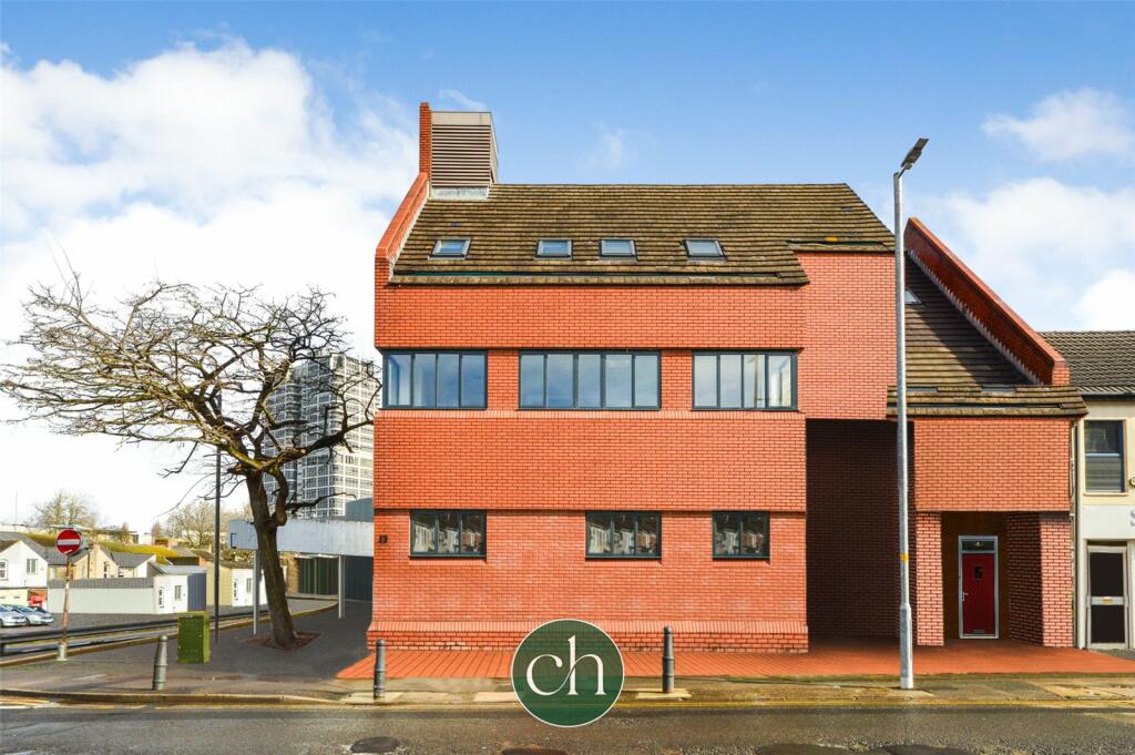
FLAT 1
BANK BUILDING, 84 - 86, COMMERCIAL ROAD, SWINDON, SWINDON SN1 5FE
Property details
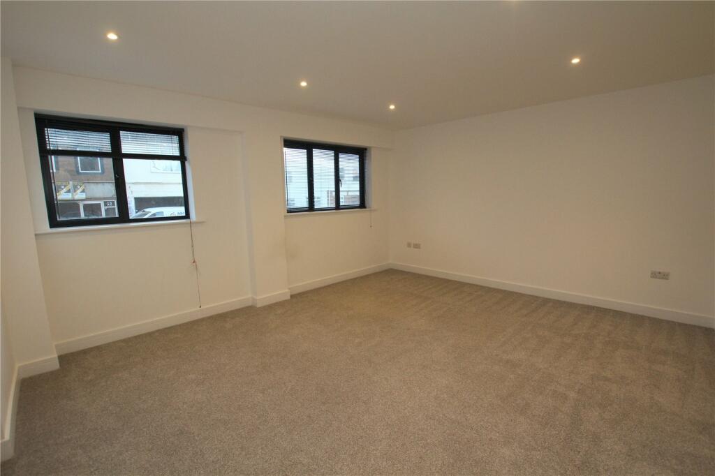
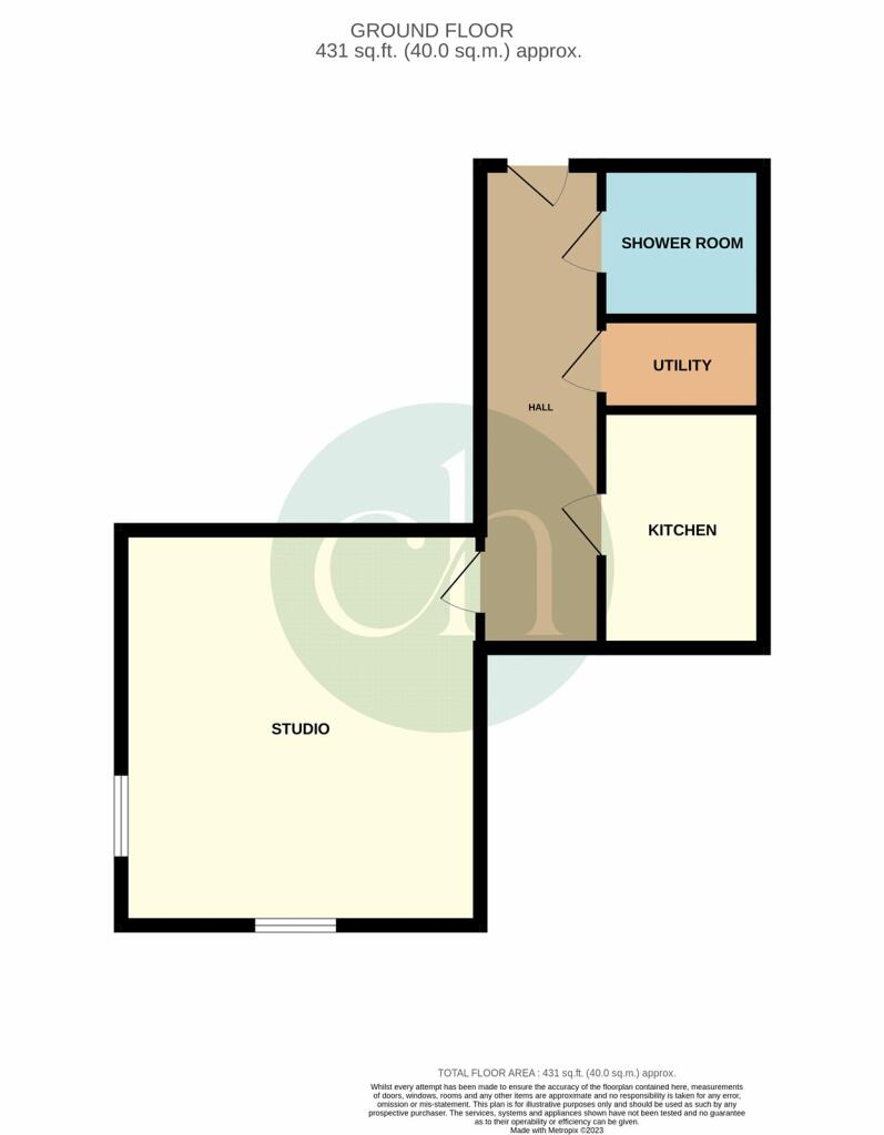
Floor area
39 m²
Council tax band
TBC
EPC rating
C
Street crime
740 incidents within 1 mile (Apr 2026)
Key features
- Newly converted apartment building
- Long 999 year lease and low maintenace charges
- Built to high specification
- 10 Year Warranty
- Built in appliances
- AVAILBLE NOW
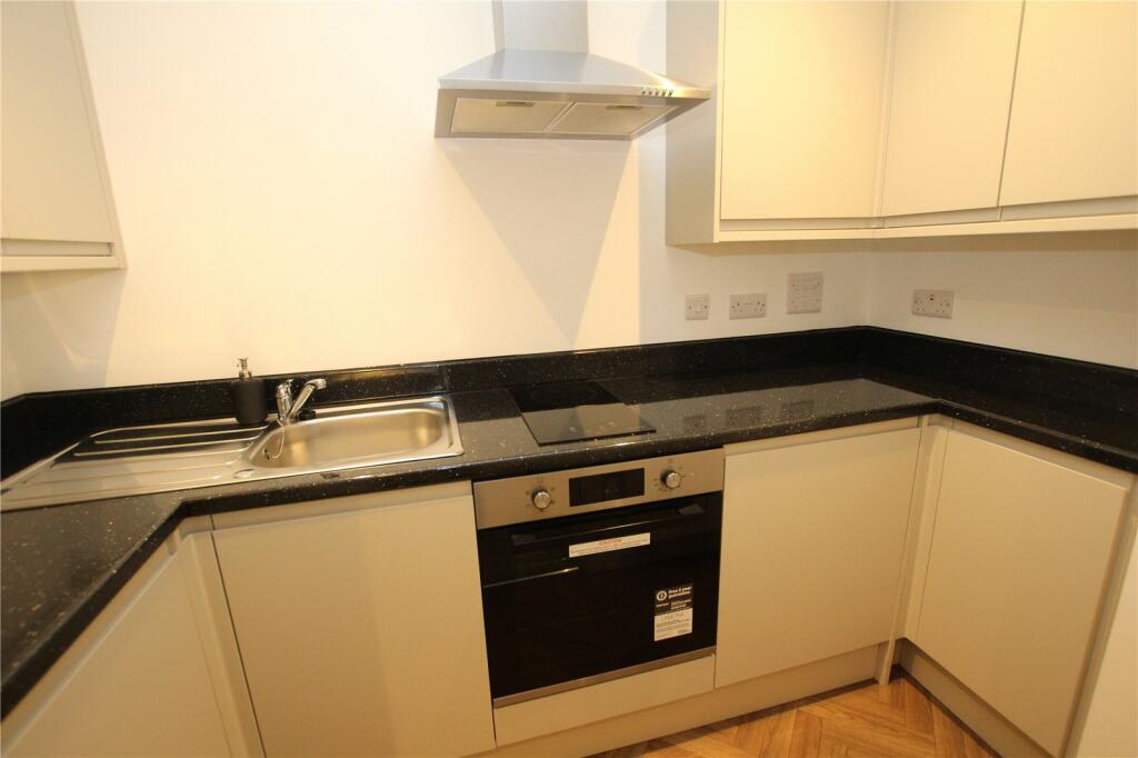
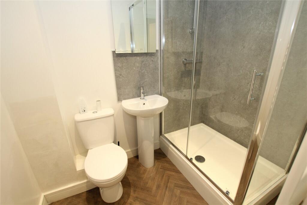
Description
AVAILABLE NOW - Newly converted ground floor studio apartment located in the heart of Swindon Town Centre. High specification throughout. The property comprises of studio reception room, shower room and kitchen fully equipped with white goods. The property is fully electric. Unfurnished. EPC RATING C, COUNCIL TAX BAND A
Listed by
Swindon
Charles Harding Estate Agents
Reference: 154500563
EPC Rating & Upgrade Cost
Current rating: C
Potential rating: C
Inspection date: 19/07/2023
Expiry date: 18/07/2033
Current heating cost: £949/year
Potential heating cost: £949/year
Flood risk
Zone: 1
Risk: Low
Job (default Low)
Company ownership
Registered legal owner is a company.
Company: MCCALLUM PROPERTY LTD (13824525)
Rental Range
Estimated market rent for South West. Low = conservative, Realistic = average, Optimistic = best case.
Based on Postcode area SN → South West.
LHA (30th percentile) floor for Swindon: Apr 2025 – Mar 2026
Location
Address
84-86 Commercial Road
Nearby
Nearest stations, universities and amenities (distance from property).
| Type | Name | Distance |
|---|---|---|
| Shop | StudioBrows | 0.0 miles |
| Shop | Inspire Hair & Beauty | 0.0 miles |
| Bus stop | Commercial Road | 0.1 miles |
| Bus stop | Farnsby Street | 0.1 miles |
| University | Royal Agricultural University (Cultural Heritage Institute) | 0.3 miles |
| Train station | Swindon | 0.5 miles |
| Hospital | Marlborough House | 0.8 miles |
| University | Oxford Brookes University - Swindon Campus | 1.3 miles |
| Train station | Richard Jefferies Halt | 2.1 miles |
| Hospital | The Ridgeway Hospital | 2.3 miles |
Street-level crime
| Category | Count |
|---|---|
| Violence and sexual offences | 239 |
| Anti-social behaviour | 141 |
| Shoplifting | 83 |
| Public order | 61 |
| Criminal damage and arson | 58 |
| Vehicle crime | 51 |
| Other theft | 35 |
| Drugs | 16 |
| Robbery | 14 |
| Bicycle theft | 13 |
| Other crime | 9 |
| Burglary | 8 |
| Possession of weapons | 7 |
| Theft from the person | 5 |
| Total incidents | 740 |
Within 1 mile during Apr 2026. Source: data.police.uk (England & Wales).
Schools nearby
Nearest open schools with Ofsted ratings (England). Closed schools are not shown. Data from Get Information about Schools and Ofsted.
| Name | Type | Distance | Ofsted |
|---|---|---|---|
| Holy Rood Catholic Primary School | Primary | 0.3 miles | Good — 30 Jun 2022 |
| UTC Swindon | Secondary | 0.4 miles | Requires improvement — 25 Jun 2024 |
| King William Street Church of England Primary School | Primary | 0.5 miles | Good — 13 Nov 2019 |
| Robert Le Kyng Primary School | Primary | 0.5 miles | Good — 12 Oct 2011 |
| Drove Primary School | Primary | 0.6 miles | Good — 23 Jul 2024 |
Rental Comparables
Residential lets from OpenRent and Rightmove for the area. Bedroom counts vary — use the Beds column to compare like-for-like lets. Student lets are excluded.
| Title | Rent | Beds | Distance | As seen on |
|---|---|---|---|---|
| 2 Bed Terraced House, Crombey St, SN1 | £1,050/mo | 2 | 0.09 miles | OpenRent |
Average rent: £1,050/mo (1 listing)