Osprey Park
Thornbury, BS35, BS35 1LY
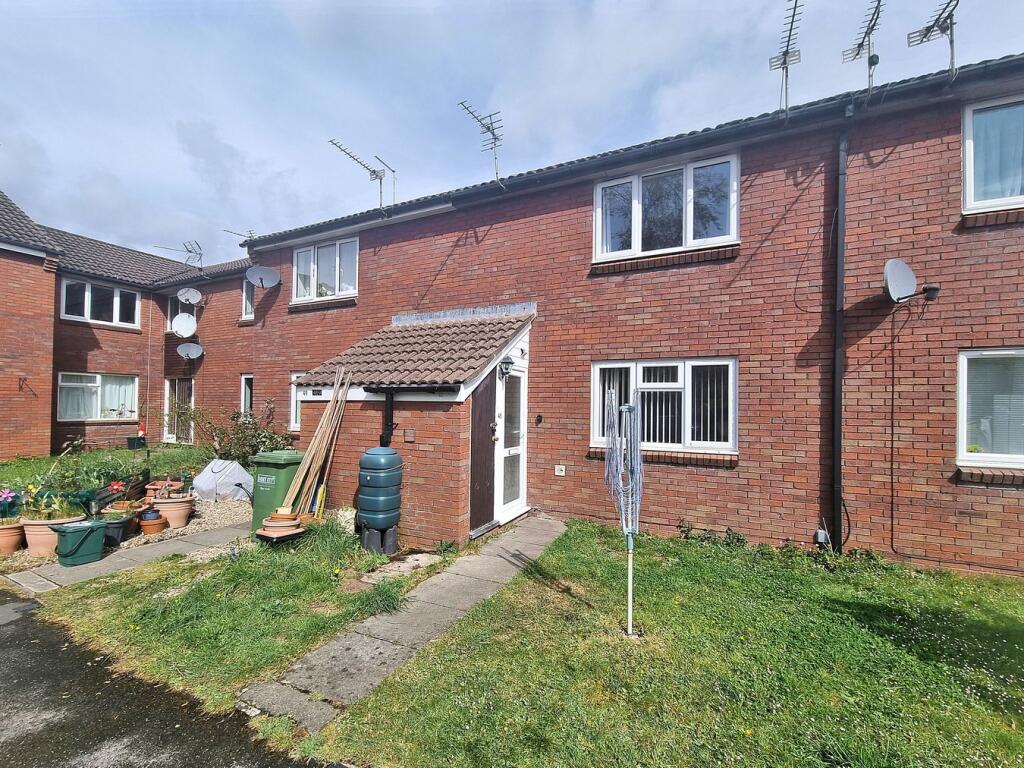
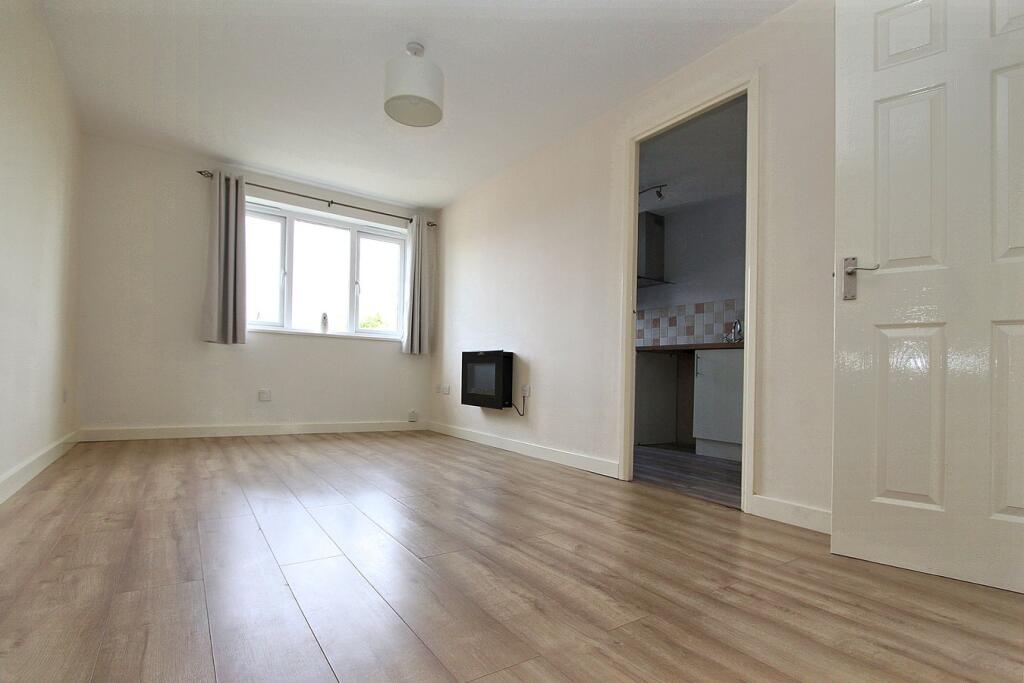
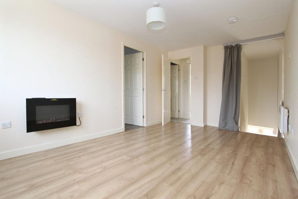
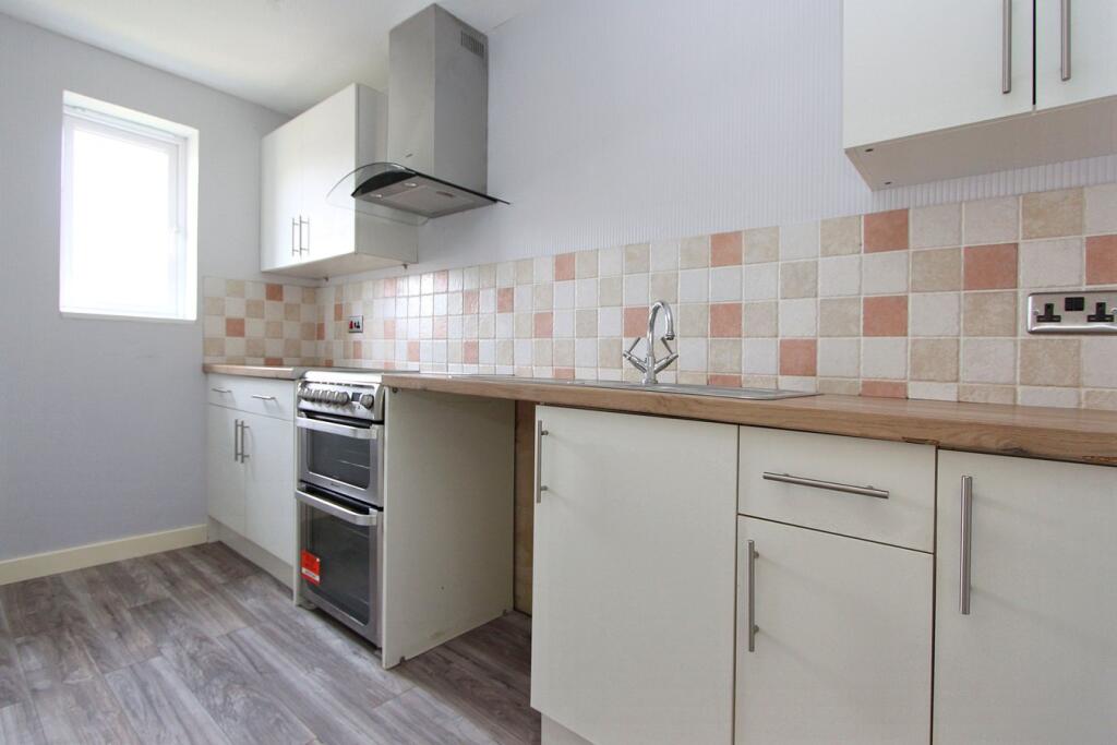
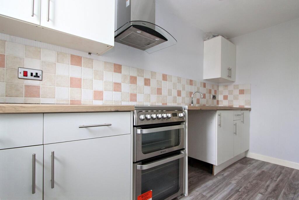
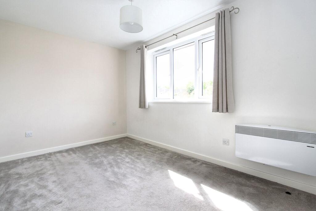
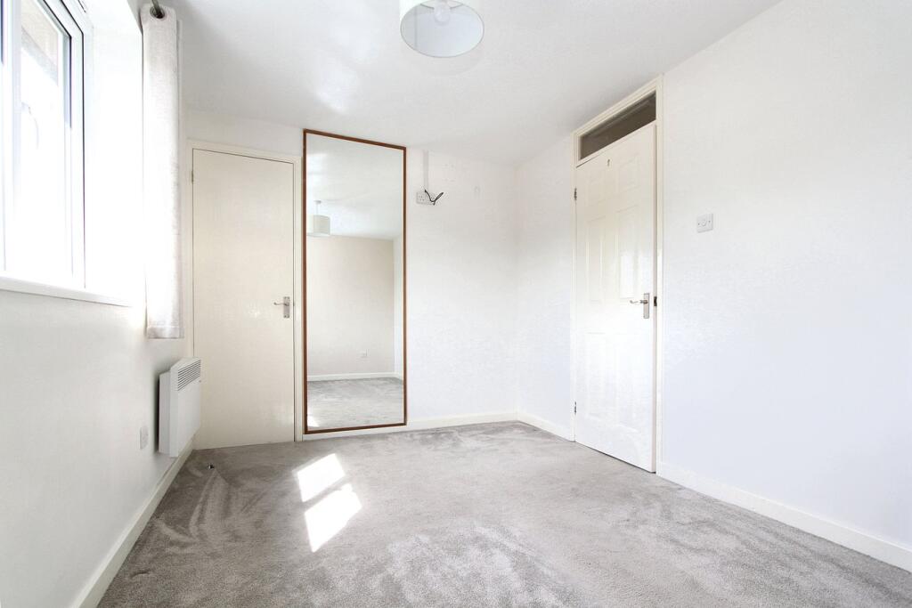
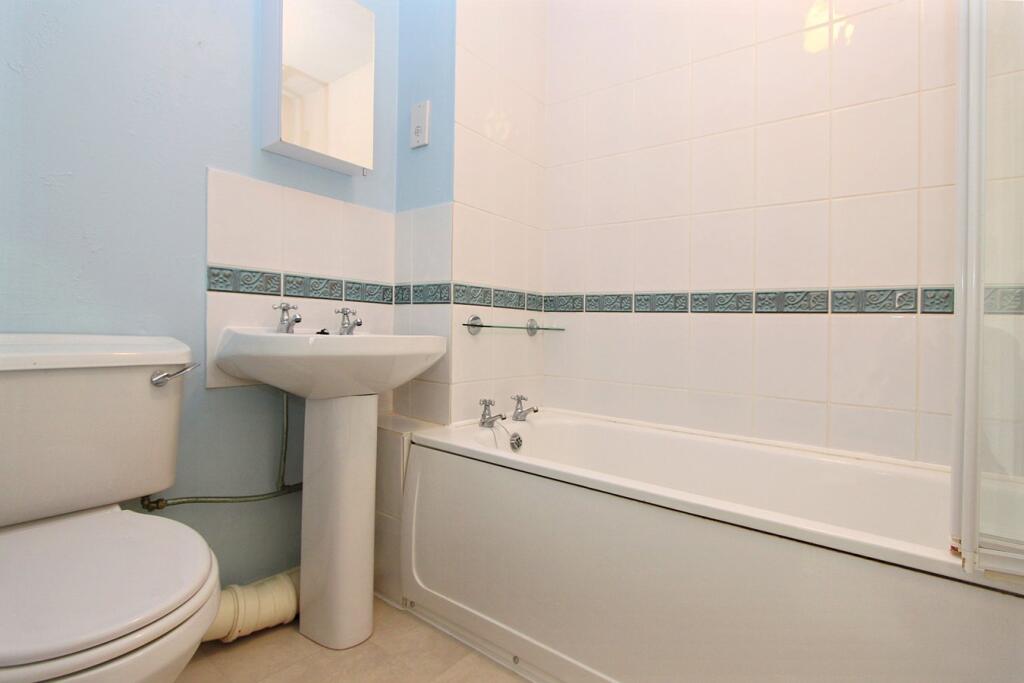
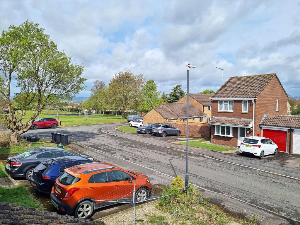
Photo 1 Photo 2 Photo 3 Photo 4 Photo 5 Photo 6 Photo 7 Photo 8 Photo 9
/ 9
Property details
Tenure
LEASEHOLD
Council tax band
A
Last sold
£149,000
Local average
£188,563 (-17.8%)
Deprivation
Decile 5 (14,269 of 33,755)
Street crime
101 incidents within 1 mile (Mar 2026)
Key features
- One Bedroom Self Contained First Floor Flat With Private Entry
- Double Bedroom With Built In Storage
- Bright And Airy Lounge
- Fitted Kitchen With Freestanding Double Oven And Hob
- Fitted Bathroom With Shower Over Bath
- UPVC Double Glazing And Electric Heating
- Allocated Parking
- No Chain
Additional details
- Parking
- Yes
- Garden
- Yes
- Listed property
- No
- Restrictions
- No
- Required access
- No
- Rights of way
- No
- Flooded in last 5 years
- No
- Flood defences
- No
Description
Thornbury is a thriving market town to the north of the City of Bristol and the M4/M5 interchange, with excellent commuting links via the motorway network and by rail from Bristol Parkway Station (Paddington/South Wales). The pedestrianised High Street offers a wide variety of shops, cafes, pubs and restaurants. Other facilities include the leisure centre, golf course and library, plus open community spaces, parks and sports grounds/clubs. The town is blessed with a number of primary and junior schools, plus The Castle secondary school (www.the castleschool.org.uk) which is situated close to Thornburys Tudor Castle, a luxury hotel.
Listed by
Thornbury
Milburys Estate Agents
Reference: 160801049
EPC Rating & Upgrade Cost
Fetching EPC data… Refresh this page in a moment.
Flood risk
Zone: 1
Risk: Low
Job (default Low)
Floorplans
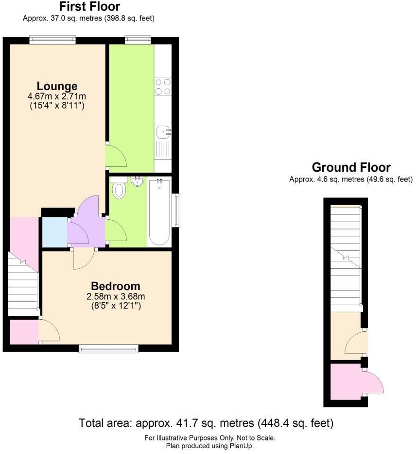
Floorplan 1
EPC Graphs
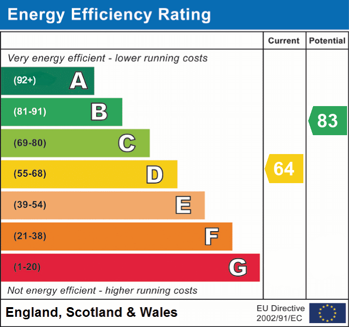
EPC 1
Price history
442% since 1996
| Event | Date | Price | % change |
|---|---|---|---|
| Sold | 01/01/2026 (5 months ago) | £149,000 | +23.1% |
| Sold | 01/01/2020 (6 years ago) | £121,000 | +340% |
| Sold | 01/01/1996 (30 years ago) | £27,500 | — |
Source: HM Land Registry Price Paid Data. Crown copyright.
Sold Comparables
Same street and nearby sales within 0.25 miles (last 5 years). Data from Land Registry Price Paid.
| Address | Price | Date | Type |
|---|---|---|---|
| Same street 71 OSPREY PARK, THORNBURY, BRISTOL, SOUTH GLOUCESTERSHIRE, BS35 1LY | £260,000 | 16/01/2026 | Terraced |
| Same street 48 OSPREY PARK, THORNBURY, BRISTOL, SOUTH GLOUCESTERSHIRE, BS35 1LY | £149,000 | 16/01/2026 | Flat |
| Same street 48 OSPREY PARK, THORNBURY, BRISTOL, SOUTH GLOUCESTERSHIRE, BS35 1LY | £149,000 | 16/01/2026 | Other |
| Same street 69 OSPREY PARK, THORNBURY, BRISTOL, SOUTH GLOUCESTERSHIRE, BS35 1LY | £255,000 | 13/01/2026 | Terraced |
| 9 FOX CLOSE, THORNBURY, BRISTOL, SOUTH GLOUCESTERSHIRE, BS35 1AF | £74,000 | 11/06/2025 | Flat |
| 73 OSPREY PARK, THORNBURY, BRISTOL, SOUTH GLOUCESTERSHIRE, BS35 1LZ | £75,000 | 31/05/2023 | Flat |
| 76 OSPREY PARK, THORNBURY, BRISTOL, SOUTH GLOUCESTERSHIRE, BS35 1LZ | £80,000 | 31/03/2023 | Flat |
| Same street 71 OSPREY PARK, THORNBURY, BRISTOL, SOUTH GLOUCESTERSHIRE, BS35 1LY | £236,500 | 13/03/2023 | Terraced |
| Same street 37 OSPREY PARK, THORNBURY, BRISTOL, SOUTH GLOUCESTERSHIRE, BS35 1LY | £350,000 | 16/08/2022 | Semi-detached |
| 95 OSPREY PARK, THORNBURY, BRISTOL, SOUTH GLOUCESTERSHIRE, BS35 1LZ | £210,000 | 27/07/2022 | Flat |
| 25 OSPREY PARK, THORNBURY, BRISTOL, SOUTH GLOUCESTERSHIRE, BS35 1LX | £160,000 | 01/03/2022 | Flat |
| 26 OSPREY PARK, THORNBURY, BRISTOL, SOUTH GLOUCESTERSHIRE, BS35 1LX | £138,500 | 09/12/2021 | Flat |
| 140 BADGER ROAD, THORNBURY, BRISTOL, SOUTH GLOUCESTERSHIRE, BS35 1AD | £73,000 | 03/12/2021 | Flat |
| 5 FOX CLOSE, THORNBURY, BRISTOL, SOUTH GLOUCESTERSHIRE, BS35 1AF | £60,000 | 31/08/2021 | Flat |
| Same street 69 OSPREY PARK, THORNBURY, BRISTOL, SOUTH GLOUCESTERSHIRE, BS35 1LY | £218,000 | 13/08/2021 | Terraced |
Street average: £231,071 (7 sales)
Area average: £108,813 (8 sales)
Capital growth trend
Land Registry outcode average: last 12 months vs 5y and 10y ago (from sold prices).
House Price Index (HM Land Registry — official index, not sold-price averages): South Gloucestershire. Series: Flats and maisonettes. As of March 2026.
Rental Range
Estimated market rent for South Gloucestershire. Low = conservative, Realistic = average, Optimistic = best case.
Based on Local Authority from postcode lookup → South Gloucestershire.
LHA (30th percentile) floor for Bristol: £898/mo (Apr 2025 – Mar 2026)
Location
Address
56-63 Osprey Park
Nearby
Nearest stations, universities and amenities (distance from property).
| Type | Name | Distance |
|---|---|---|
| Bus stop | Osprey Park | 0.1 miles |
| Shop | Your Coop Food | 0.1 miles |
| Shop | One Stop | 0.3 miles |
| Hospital | Thornbury Health Centre | 0.5 miles |
| Train station | Yate | 6.2 miles |
| Train station | Pilning | 6.5 miles |
| Hospital | Chepstow Community Hospital | 7.7 miles |
| University | School of Architecture and Environment | 8.2 miles |
| University | University of the West of England (Frenchay Campus) | 8.2 miles |
Street-level crime
| Category | Count |
|---|---|
| Violence and sexual offences | 53 |
| Public order | 14 |
| Anti-social behaviour | 10 |
| Shoplifting | 7 |
| Other theft | 6 |
| Burglary | 3 |
| Criminal damage and arson | 3 |
| Other crime | 2 |
| Robbery | 2 |
| Vehicle crime | 1 |
| Total incidents | 101 |
Within 1 mile during Mar 2026. Source: data.police.uk (England & Wales).
Schools nearby
Nearest open schools with Ofsted ratings (England). Closed schools are not shown. Data from Get Information about Schools and Ofsted.
| Name | Type | Distance | Ofsted |
|---|---|---|---|
| Christ The King Catholic Primary School, Thornbury | Primary | 0.4 miles | Good — 20 Jun 2022 |
| Manorbrook Primary School | Primary | 0.4 miles | Good — 20 May 2013 |
| New Siblands School | Other | 0.5 miles | Outstanding — 28 Apr 2024 |
| Crossways Junior School | Primary | 0.5 miles | Good — 8 Sep 2024 |
| Crossways Infant School | Primary | 0.5 miles | Requires improvement — 20 Nov 2023 |
Rental Comparables
Residential lets from OpenRent and Rightmove for the area (same bedroom count). Use to validate rent estimates. Student lets are excluded.
| Title | Rent | Beds | Distance | As seen on |
|---|---|---|---|---|
| 1 Bed Detached House, Severn Drive, BS35 | £900/mo | 1 | 0.58 miles | OpenRent |
| 1 Bed Flat, Spey Close, BS35 | £950/mo | 1 | 0.78 miles | OpenRent |
| 1 Bed Terraced House, St. John Street, BS35 | £1,075/mo | 1 | 0.8 miles | OpenRent |
| 1 Bed Flat, Tamar Close, BS35 | £975/mo | 1 | 1.03 miles | OpenRent |
Average rent: £975/mo (4 listings)
Rent-driven metrics
Based on OpenRent comparables.
- Rent ratio — Monthly rent ÷ purchase price (1% rule). 1%+ = strong, 0.8–1% = okay, <0.8% = weak for cashflow.
- Max investor price — Rent ÷ 0.8%; the price at which rent would be 0.8% of price (Stoke-style target).
- Target investor price — Rent ÷ 1%; the price at which rent would be 1% of price (strong cashflow band).
- Gross yield — Annual rent as % of purchase price (no costs).
- Cost-to-rent — Price ÷ annual rent (from OpenRent comparables). Under 14× = strong, 14–16× = acceptable, 17×+ = compressed.
- Cashflow — Rent minus mortgage, 10% maintenance, £25/mo compliance. Assumes 75% LTV, 3.95% APR (5yr fixed), 25yr term.
- ROI — Annual profit ÷ cash in (deposit + 4% purchase costs).