Baytree
LEICESTER ROAD, SWADLINCOTE, MEASHAM, LEICESTERSHIRE DE12 7JG
£550 pcm
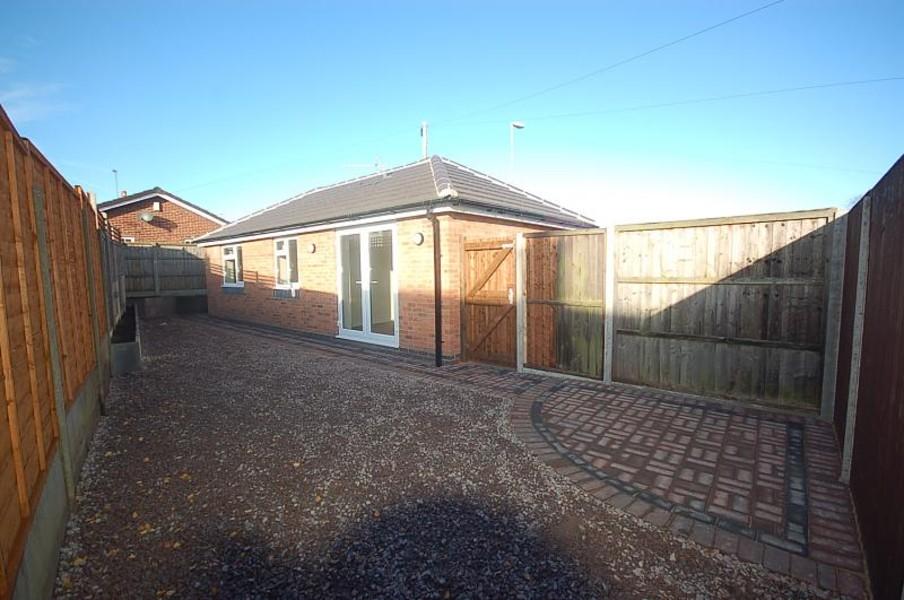
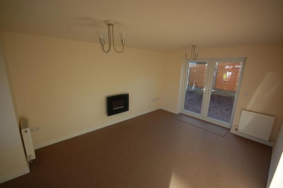
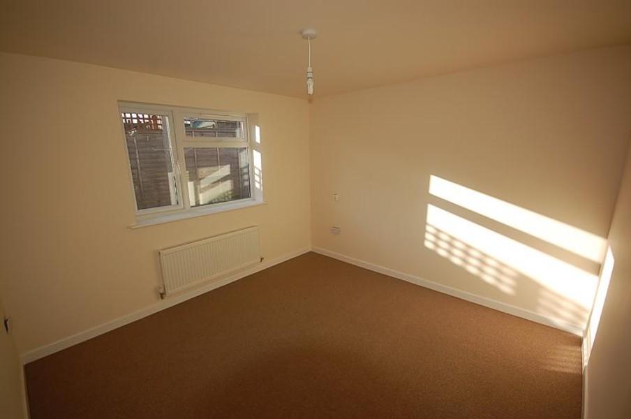
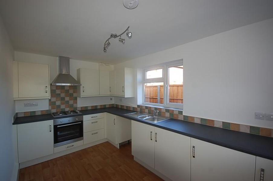
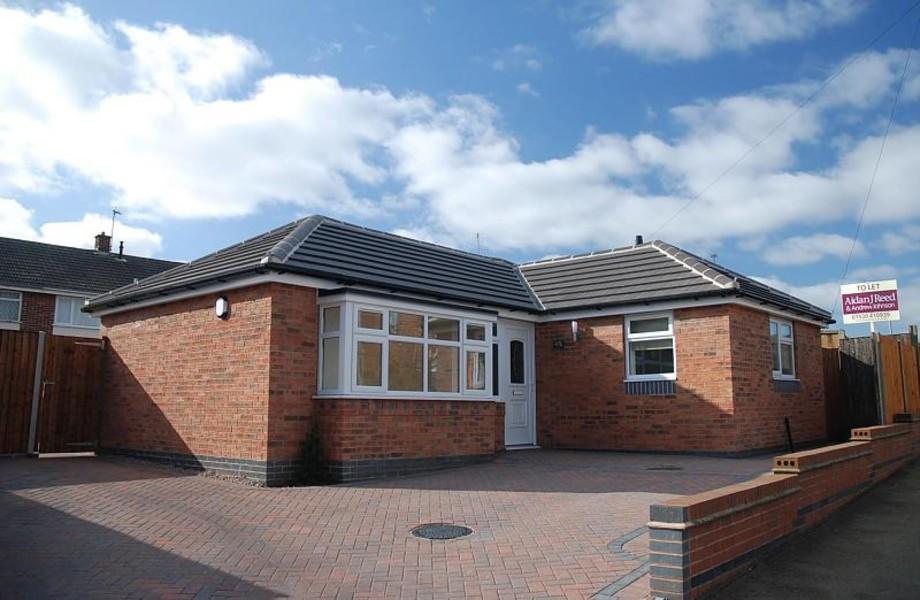
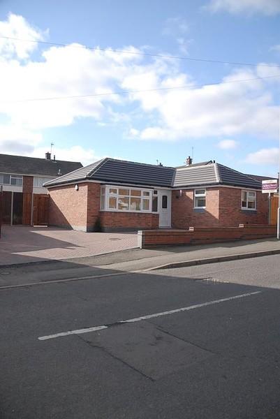
Photo 1 Photo 2 Photo 3 Photo 4 Photo 5 Photo 6
/ 6
Property details
Floor area
51 m²
Deprivation
Decile 9 (27,440 of 33,755)
Street crime
23 incidents within 1 mile (Apr 2026)
Key features
- Brand New Detached Bungalow
- Lounge and Kitchen with cooker and hob
- Two Double Bedrooms
- Shower Room
- Enclosed Rear Garden and Off Street Parking
- Unfurnished
- No Pets, Smokers or Sharers
- Available Now
Additional details
- Parking
- Yes
- Garden
- Yes
Description
Listed by
Ashby-de-la-Zouch - Lettings
Andrew Johnson & Co
Reference: 32354263
EPC ratings on this postcode
We don't have a matched EPC for this property yet. Below are efficiency scores and details for other addresses on this postcode.
| Address | Current | Potential | Floor area | Age band | Type |
|---|---|---|---|---|---|
| 1, Leicester Road, Measham, SWADLINCOTE | 35 | 72 | 101 m² | England and Wales: 1900-1929 | Detached |
| 101, Leicester Road, Measham, SWADLINCOTE | 90 | 95 | 88 m² | England and Wales: 1967-1975 | Detached |
| 107 Leicester Road, Measham, SWADLINCOTE | 70 | 87 | 78 m² | England and Wales: 1900-1929 | Terraced |
| 107 LEICESTER ROAD, MEASHAM, SWADLINCOTE | 64 | 83 | 77 m² | England and Wales: 1900-1929 | Terraced |
| 107, Leicester Road, Measham, SWADLINCOTE | 49 | 85 | 80 m² | England and Wales: 1900-1929 | Terraced |
| 111 Leicester Road, Measham, SWADLINCOTE | 63 | 87 | 72 m² | England and Wales: before 1900 | Terraced |
| 119, Leicester Road, Measham, SWADLINCOTE | 48 | 82 | 88 m² | England and Wales: 1900-1929 | Detached |
| 12, Leicester Road, Measham, SWADLINCOTE | 92 | 103 | 92 m² | England and Wales: 1950-1966 | Detached |
| 121 Leicester Road, Measham, SWADLINCOTE | 69 | 85 | 119 m² | England and Wales: 1900-1929 | Detached |
| 123 LEICESTER ROAD, MEASHAM, SWADLINCOTE | 61 | 84 | 92 m² | England and Wales: 1900-1929 | Detached |
| 125, Leicester Road, Measham, SWADLINCOTE | 48 | 85 | 87 m² | England and Wales: 1900-1929 | Detached |
| 135, Leicester Road, Measham, SWADLINCOTE | 64 | 87 | 73 m² | England and Wales: 1900-1929 | Terraced |
| 135, Leicester Road, Measham, SWADLINCOTE | 52 | 86 | 73 m² | England and Wales: 1900-1929 | Terraced |
| 15 Leicester Road, Measham, SWADLINCOTE | 69 | 76 | 89 m² | England and Wales: 1976-1982 | Terraced |
| 16, Leicester Road, Measham, SWADLINCOTE | 66 | 89 | 70 m² | England and Wales: before 1900 | Terraced |
Flood risk
Zone: 1
Risk: Low
Job (default Low)
Rental Range
Estimated market rent for North West Leicestershire. Low = conservative, Realistic = average, Optimistic = best case.
Based on Local Authority from postcode lookup → North West Leicestershire.
LHA (30th percentile) floor for Eastern Staffordshire: £598/mo (Apr 2025 – Mar 2026)
Location
Address
Bosworth Road
Nearby
Nearest stations, universities and amenities (distance from property).
| Type | Name | Distance |
|---|---|---|
| Bus stop | Woodfield | 0.0 miles |
| Shop | Unknown | 0.1 miles |
| Bus stop | The Swan | 0.2 miles |
| Shop | Fireplace by Design | 0.2 miles |
| Train station | Waterside Station | 2.8 miles |
| Train station | Discovery Station | 3.0 miles |
| Hospital | Whitwick Health Centre | 6.4 miles |
| Hospital | Coalville Community Hospital | 6.5 miles |
| University | Loughborough University Science and Enterprise Park | 11.1 miles |
| University | Loughborough University | 11.7 miles |
Street-level crime
| Category | Count |
|---|---|
| Violence and sexual offences | 7 |
| Anti-social behaviour | 6 |
| Criminal damage and arson | 3 |
| Burglary | 2 |
| Other theft | 2 |
| Other crime | 1 |
| Public order | 1 |
| Vehicle crime | 1 |
| Total incidents | 23 |
Within 1 mile during Apr 2026. Source: data.police.uk (England & Wales).
Schools nearby
Nearest open schools with Ofsted ratings (England). Closed schools are not shown. Data from Get Information about Schools and Ofsted.
| Name | Type | Distance | Ofsted |
|---|---|---|---|
| St Charles Catholic Primary Voluntary Academy | Primary | 0.1 miles | Good — 27 Sep 2013 |
| Measham Church of England Primary School | Primary | 0.2 miles | — (Inspected (no overall grade)) |
| Oakthorpe Primary School | Primary | 1.0 miles | Good — 26 Nov 2019 |
| Donisthorpe Primary School | Primary | 1.5 miles | Good — 14 Mar 2013 |
| Snarestone Church of England School | Primary | 1.8 miles | Requires improvement — 23 Jun 2020 |
Rental Comparables
Rental comparables are temporarily unavailable while listing-site fetches are paused. Try again later.
Enter House Number
Enter the house number to help us retrieve more accurate pricing history and property data.
Please log in to submit or correct the house number for this listing.
Log in to continue