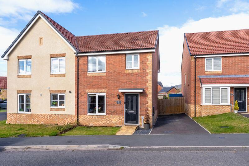
Valentine Drive
Shrewsbury, SY2 5WX
Property details
Tenure
FREEHOLD
Council tax band
C
Last sold
£417,500
Local average
£238,590 (+17.4%)
Deprivation
Decile 8 (26,932 of 33,755)
Street crime
79 incidents within 1 mile (Mar 2026)
Key features
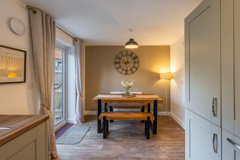
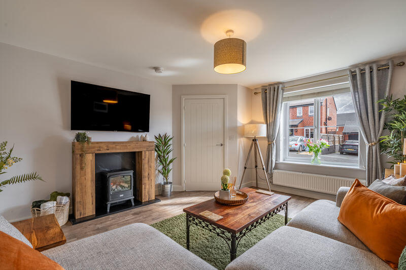
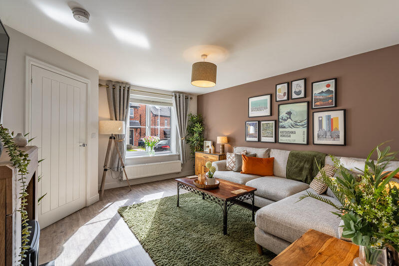
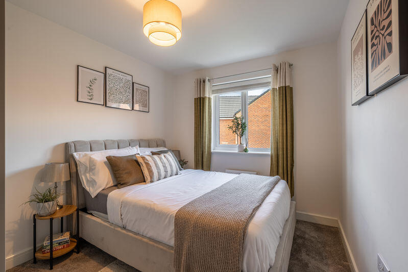
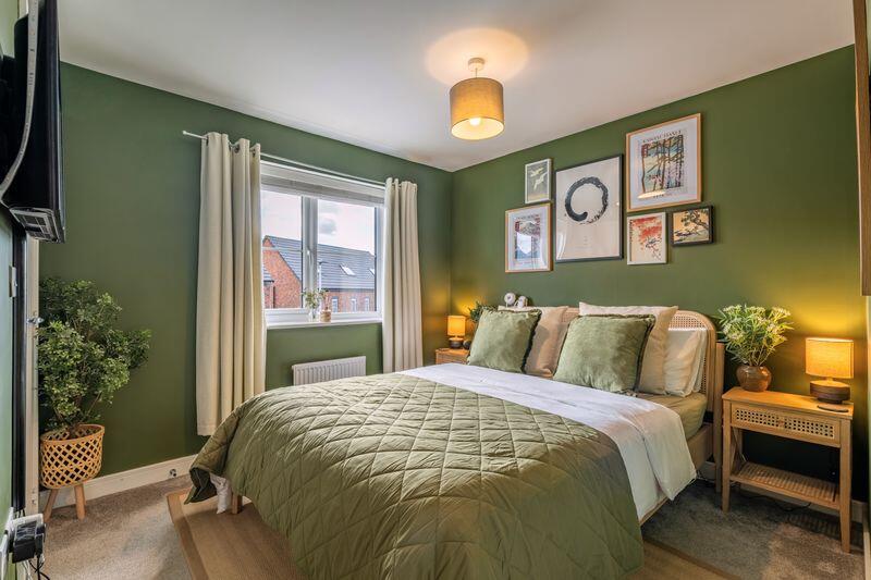
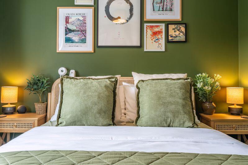
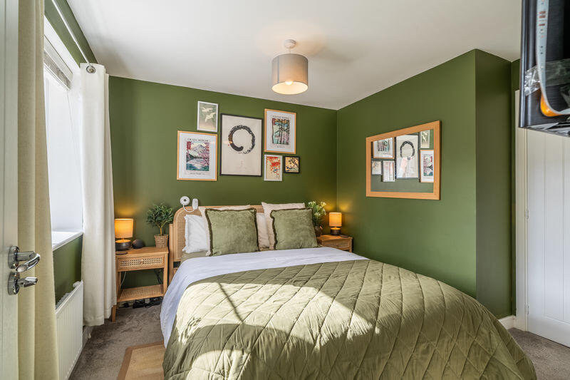
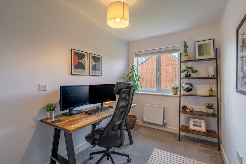
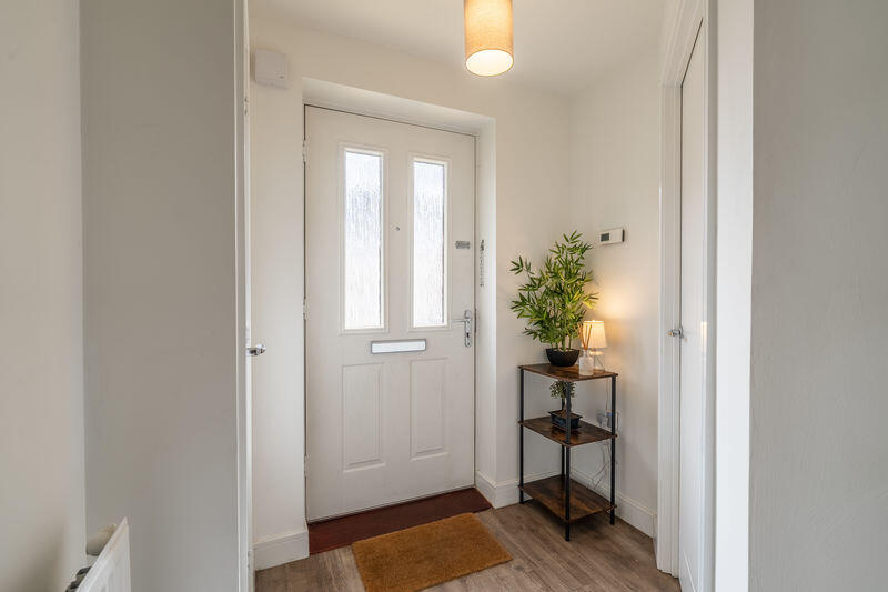
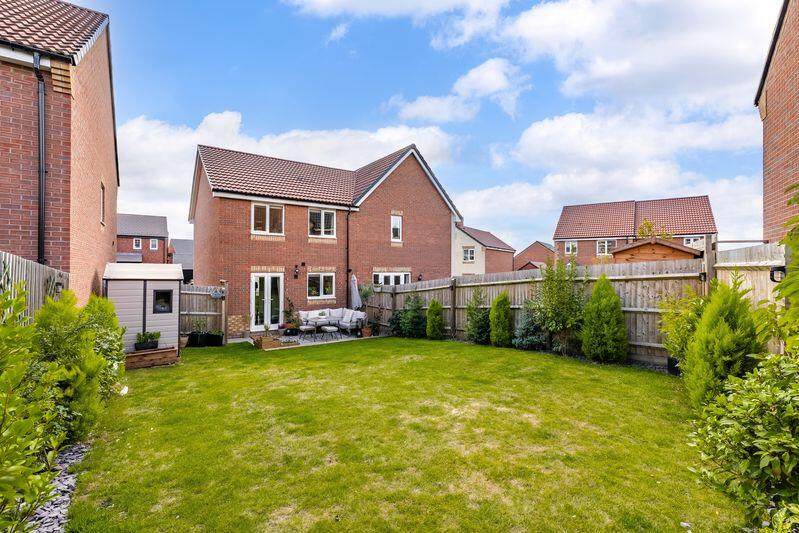
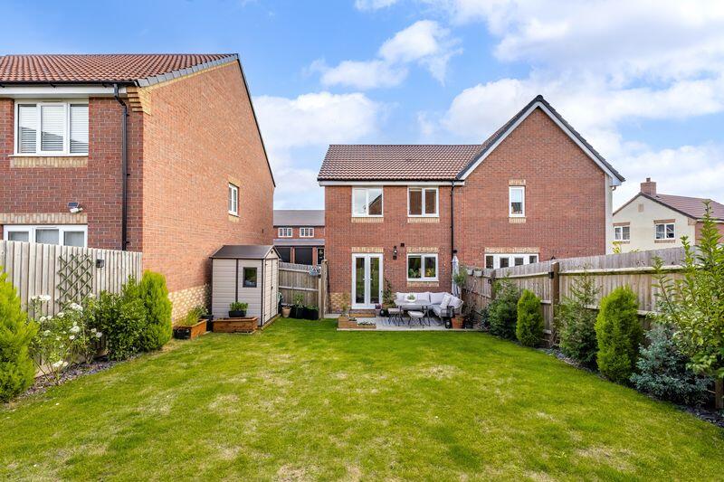
- Presented to the highest of standards, this three bedroom residence is a fine example of its type
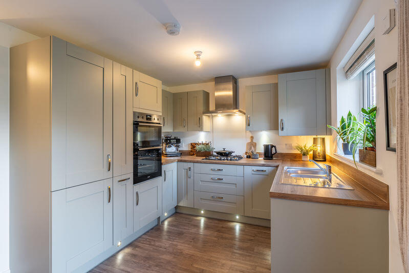
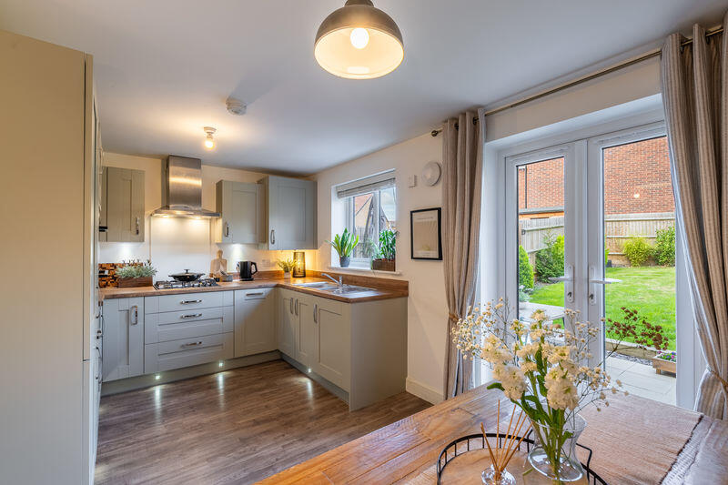
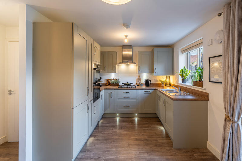
- Upgraded high quality kitchen with contemporary units, integrated fridge/freezer, dishwasher and washing machine
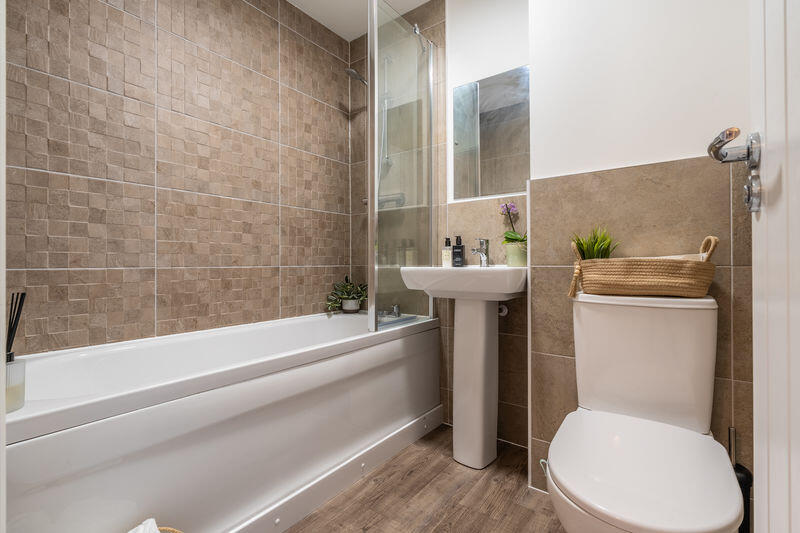
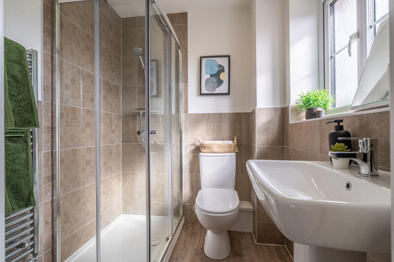
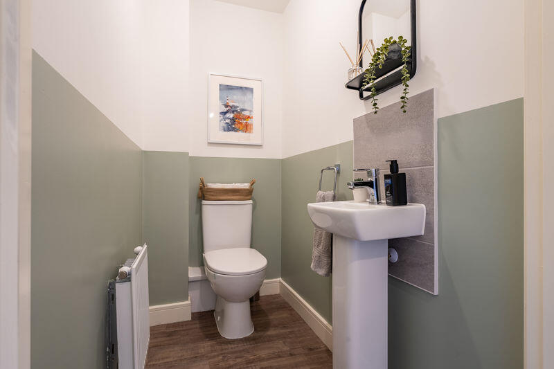
- Luxury family bathroom and separate en-suite featuring high end fittings, excellent sanitary ware and stylish tiling
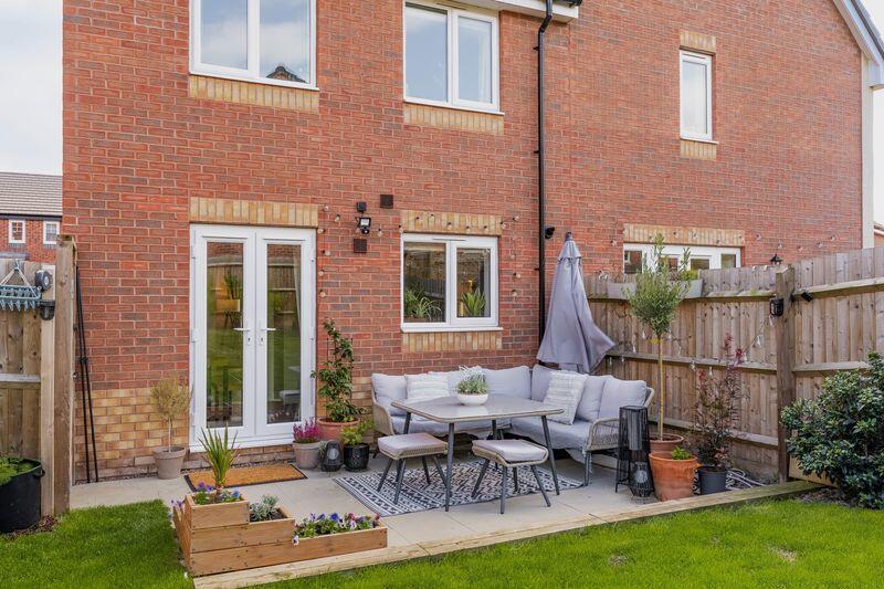
- Thoughtfully landscaped rear garden with perimeter fencing and superb patio area
- LVT feature karndean floor coverings
- Driveway to the front proving parking for numerous vehicles
Additional details
- Parking
- Yes
- Garden
- Yes
Description
Listed by
Shrewsbury
Spencer Jakeman Ltd
Reference: 170180243
EPC ratings on this postcode
We don't have a matched EPC for this property yet. Below are efficiency scores and details for other addresses on this postcode.
| Address | Current | Potential | Floor area | Age band | Type |
|---|---|---|---|---|---|
| 10 Eyton Drive, Shrewsbury | 85 | 95 | 114 m² | — | Detached |
| 12 Eyton Drive, SHREWSBURY | 84 | 93 | 139 m² | — | Detached |
| 14 Eyton Drive, SHREWSBURY | 84 | 95 | 89 m² | — | Detached |
| 16 Eyton Drive, SHREWSBURY | 84 | 95 | 89 m² | — | Detached |
| 18 Eyton Drive, SHREWSBURY | 84 | 93 | 139 m² | — | Detached |
| 2 Eyton Drive, SHREWSBURY | 86 | 93 | 182 m² | — | Detached |
| 20 Eyton Drive, SHREWSBURY | 84 | 93 | 139 m² | — | Detached |
| 22 Eyton Drive, SHREWSBURY | 84 | 95 | 89 m² | — | Detached |
| 24 Eyton Drive, SHREWSBURY | 85 | 95 | 114 m² | — | Detached |
| 4 Eyton Drive, SHREWSBURY | 85 | 94 | 127 m² | — | Detached |
| 6 Eyton Drive, Lily Hay, Shrewsbury | 84 | 94 | 100 m² | — | Detached |
| 8 Eyton Drive, SHREWSBURY | 85 | 94 | 127 m² | — | Detached |
Flood risk
Zone: 1
Risk: Low
Job (default Low)
Floorplans
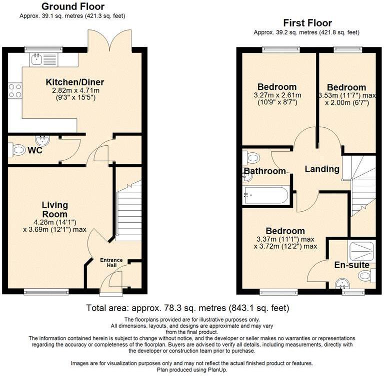
Floorplan 1
Price history
| Event | Date | Price | % change |
|---|---|---|---|
| Sold | 01/01/2023 (3 years ago) | £417,500 | — |
Source: HM Land Registry Price Paid Data. Crown copyright.
Sold Comparables
Same street and nearby sales within 0.25 miles (last 5 years). Data from Land Registry Price Paid.
| Address | Price | Date | Type |
|---|---|---|---|
| 19 HOWEY CLOSE, SHREWSBURY, SHROPSHIRE, SY2 5WF | £96,000 | 11/12/2025 | Semi-detached |
| 10 HARRIES WAY, SHREWSBURY, SHROPSHIRE, SY2 5WW | £268,000 | 20/10/2023 | Semi-detached |
| 8 HARRIES WAY, SHREWSBURY, SHROPSHIRE, SY2 5WW | £265,000 | 30/06/2023 | Semi-detached |
| 5 HARRIES WAY, SHREWSBURY, SHROPSHIRE, SY2 5WW | £265,000 | 29/06/2023 | Semi-detached |
| 3 HARRIES WAY, SHREWSBURY, SHROPSHIRE, SY2 5WW | £265,000 | 28/06/2023 | Semi-detached |
| 17 HOWEY CLOSE, SHREWSBURY, SHROPSHIRE, SY2 5WF | £130,650 | 04/11/2022 | Semi-detached |
| 19 HOWEY CLOSE, SHREWSBURY, SHROPSHIRE, SY2 5WF | £130,650 | 04/11/2022 | Semi-detached |
| 33 HOWEY CLOSE, SHREWSBURY, SHROPSHIRE, SY2 5WF | £252,500 | 20/05/2022 | Semi-detached |
| 31 HOWEY CLOSE, SHREWSBURY, SHROPSHIRE, SY2 5WF | £252,500 | 20/05/2022 | Semi-detached |
| 32 DAVISON DRIVE, SHREWSBURY, SHROPSHIRE, SY2 5WE | £130,650 | 07/02/2022 | Semi-detached |
| 34 DAVISON DRIVE, SHREWSBURY, SHROPSHIRE, SY2 5WE | £130,650 | 07/02/2022 | Semi-detached |
| 26 HOWEY CLOSE, SHREWSBURY, SHROPSHIRE, SY2 5WF | £244,000 | 14/01/2022 | Semi-detached |
| 24 HOWEY CLOSE, SHREWSBURY, SHROPSHIRE, SY2 5WF | £244,000 | 07/01/2022 | Semi-detached |
| 20 HOWEY CLOSE, SHREWSBURY, SHROPSHIRE, SY2 5WF | £244,000 | 21/12/2021 | Semi-detached |
| 22 HOWEY CLOSE, SHREWSBURY, SHROPSHIRE, SY2 5WF | £244,000 | 20/12/2021 | Semi-detached |
| 12 DAVISON DRIVE, SHREWSBURY, SHROPSHIRE, SY2 5WE | £229,950 | 29/10/2021 | Semi-detached |
| 14 DAVISON DRIVE, SHREWSBURY, SHROPSHIRE, SY2 5WE | £229,950 | 29/10/2021 | Semi-detached |
Area average: £213,088 (17 sales)
Capital growth trend
Land Registry outcode average: last 12 months vs 5y and 10y ago (from sold prices).
House Price Index (HM Land Registry — official index, not sold-price averages): Shropshire. Series: Semi-detached. As of March 2026.
Rental Range
Estimated market rent for Shropshire. Low = conservative, Realistic = average, Optimistic = best case.
Based on Local Authority from postcode lookup → Shropshire.
LHA (30th percentile) floor for Shropshire: £723/mo (Apr 2025 – Mar 2026)
Location
Address
Eyton Drive
Nearby
Nearest stations, universities and amenities (distance from property).
| Type | Name | Distance |
|---|---|---|
| Bus stop | London Road (south bound) | 0.3 miles |
| Bus stop | London Road (north bound) | 0.3 miles |
| Shop | Unknown | 0.5 miles |
| Shop | ACT | 0.5 miles |
| Train station | Shrewsbury | 1.6 miles |
| Hospital | The Shropshire Nuffield Hospital | 2.3 miles |
| Hospital | Royal Shrewsbury Hospital | 3.2 miles |
| Train station | Yorton | 7.6 miles |
| University | Unknown | 11.6 miles |
Street-level crime
| Category | Count |
|---|---|
| Violence and sexual offences | 32 |
| Shoplifting | 13 |
| Anti-social behaviour | 11 |
| Criminal damage and arson | 6 |
| Other crime | 5 |
| Other theft | 5 |
| Drugs | 3 |
| Public order | 3 |
| Possession of weapons | 1 |
| Total incidents | 79 |
Within 1 mile during Mar 2026. Source: data.police.uk (England & Wales).
Schools nearby
Nearest open schools with Ofsted ratings (England). Closed schools are not shown. Data from Get Information about Schools and Ofsted.
| Name | Type | Distance | Ofsted |
|---|---|---|---|
| Mereside Church of England Primary Academy | Primary | 0.5 miles | Good — 9 Jul 2014 |
| Prestfelde School | Other | 0.5 miles | — (No rating) |
| St Giles CofE Primary School | Primary | 0.6 miles | Good — 30 Nov 2023 |
| Belvidere School | Secondary | 0.7 miles | Outstanding — 12 Dec 2013 |
| Crowmoor Primary School | Primary | 0.8 miles | — (No rating) |
Rental Comparables
Residential lets from OpenRent and Rightmove for the area (same bedroom count). Use to validate rent estimates. Student lets are excluded.
| Title | Rent | Beds | Distance | As seen on |
|---|---|---|---|---|
| 3 Bed Terraced House, Longden Coleham, SY3 | £1,300/mo | 3 | 1.24 miles | OpenRent |
Average rent: £1,300/mo (1 listing)
Rent-driven metrics
Based on OpenRent comparables.
- Rent ratio — Monthly rent ÷ purchase price (1% rule). 1%+ = strong, 0.8–1% = okay, <0.8% = weak for cashflow.
- Max investor price — Rent ÷ 0.8%; the price at which rent would be 0.8% of price (Stoke-style target).
- Target investor price — Rent ÷ 1%; the price at which rent would be 1% of price (strong cashflow band).
- Gross yield — Annual rent as % of purchase price (no costs).
- Cost-to-rent — Price ÷ annual rent (from OpenRent comparables). Under 14× = strong, 14–16× = acceptable, 17×+ = compressed.
- Cashflow — Rent minus mortgage, 10% maintenance, £25/mo compliance. Assumes 75% LTV, 3.95% APR (5yr fixed), 25yr term.
- ROI — Annual profit ÷ cash in (deposit + 4% purchase costs).
Enter House Number
Enter the house number to help us retrieve more accurate pricing history and property data.
Please log in to submit or correct the house number for this listing.
Log in to continue