16 - 17
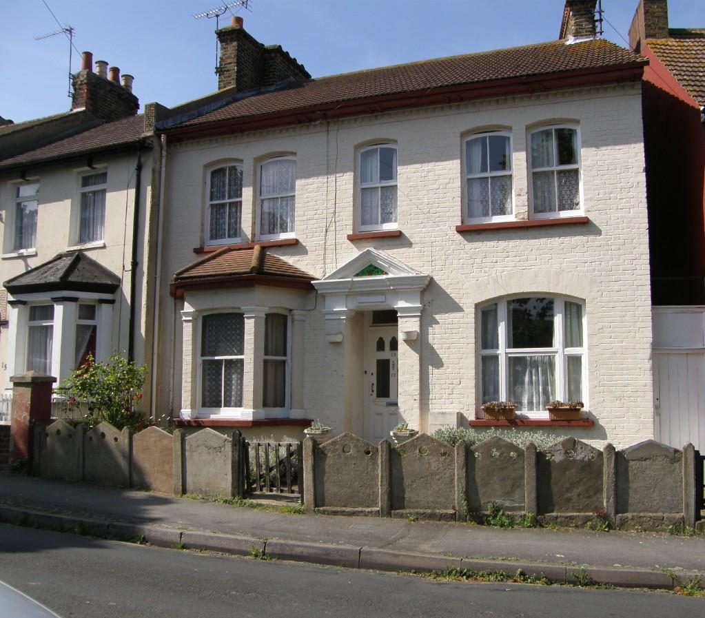
PROSPECT GROVE, GRAVESEND, KENT DA12 2SA
£159,950
Property details
Last sold
£161,000 Jul 2009
Local average
£328,227 (-51.3%)
Deprivation
Decile 3 (7,498 of 33,755)
Street crime
337 incidents within 1 mile (Apr 2026)
Key features
- Spacious 4 Bedroom End Terrace House
- 3 Receptions
- Cloakroom
- In need of refurbishment
- Mature 60' long Rear Garden
- Retaining Some Period Features
- Close to Canal Basin
- Under a mile to Town Centre
- NO FORWARD CHAIN
Additional details
- Garden
- Yes
Description
ENTRANCE HALL: 23'2 x 5'5 narrowing to 3'4
SITTING ROOM: 14' x 11'4
SECOND RECEPTION ROOM: 14' x 9'2 (average)
KITCHEN: 11' x 7'6 (average)
THIRD RECEPTION ROOM: 13'7 x 9'5
LOBBY, CLOAKROOM
FIRST FLOOR LANDING
BATHROOM: 7'7 x 6'6
FOUR BEDROOMS: 14'6 x 11'4, 11'6 x 11'4, 13'9 x 9'4, 13'7 x 7'7
REAR GARDEN: 60'x 18'8
Listed by
Gravesend
Walker Jarvis Estate Agents and Chartered Surveyors
Reference: 25696739
EPC Rating & Upgrade Cost
Fetching EPC data… Refresh this page in a moment.
Flood risk
Zone: 1
Risk: Low
Job (default Low)
Price history
| Event | Date | Price | % change |
|---|---|---|---|
| Sold | 08/07/2009 (16 years ago) | £161,000 | — |
Source: HM Land Registry Price Paid Data. Crown copyright.
Sold Comparables
Same street and nearby sales within 0.25 miles (last 5 years). Data from Land Registry Price Paid.
| Address | Price | Date | Type |
|---|---|---|---|
| 42 RAPHAEL ROAD, GRAVESEND, GRAVESHAM, KENT, DA12 2PW | £291,000 | 03/07/2025 | Terraced |
| 3 SUFFOLK ROAD, GRAVESEND, GRAVESHAM, KENT, DA12 2SW | £245,000 | 06/10/2023 | Terraced |
| 47 RAPHAEL ROAD, GRAVESEND, GRAVESHAM, KENT, DA12 2PN | £292,000 | 21/09/2023 | Terraced |
| 59 RAPHAEL ROAD, GRAVESEND, GRAVESHAM, KENT, DA12 2PN | £300,000 | 04/08/2023 | Terraced |
| 93 RAPHAEL ROAD, GRAVESEND, GRAVESHAM, KENT, DA12 2PN | £211,000 | 28/04/2023 | Terraced |
| 63 SUFFOLK ROAD, GRAVESEND, GRAVESHAM, KENT, DA12 2SW | £305,000 | 29/03/2023 | Terraced |
| 9 SUFFOLK ROAD, GRAVESEND, GRAVESHAM, KENT, DA12 2SW | £271,000 | 14/12/2022 | Terraced |
| 34 HAIG GARDENS, GRAVESEND, GRAVESHAM, KENT, DA12 1NE | £326,000 | 24/11/2022 | Terraced |
| 83 RAPHAEL ROAD, GRAVESEND, GRAVESHAM, KENT, DA12 2PN | £223,000 | 24/11/2022 | Terraced |
| 37 RUSSELL ROAD, GRAVESEND, GRAVESHAM, KENT, DA12 2RT | £207,500 | 15/11/2022 | Terraced |
| Same street 25 PROSPECT GROVE, GRAVESEND, GRAVESHAM, KENT, DA12 2SA | £250,000 | 25/10/2022 | Terraced |
| Same street 15 PROSPECT GROVE, GRAVESEND, GRAVESHAM, KENT, DA12 2SA | £165,000 | 14/10/2022 | Terraced |
| 61 SUFFOLK ROAD, GRAVESEND, GRAVESHAM, KENT, DA12 2SW | £305,000 | 14/10/2022 | Terraced |
| 11 ST JOHNS ROAD, GRAVESEND, GRAVESHAM, KENT, DA12 2SB | £315,000 | 21/09/2022 | Terraced |
| 5 RAPHAEL ROAD, GRAVESEND, GRAVESHAM, KENT, DA12 2PN | £278,000 | 12/08/2022 | Terraced |
| 16 RUSSELL ROAD, GRAVESEND, GRAVESHAM, KENT, DA12 2RT | £300,500 | 25/07/2022 | Terraced |
| 31 HAIG GARDENS, GRAVESEND, GRAVESHAM, KENT, DA12 1NE | £210,000 | 01/07/2022 | Terraced |
| 28 RAPHAEL ROAD, GRAVESEND, GRAVESHAM, KENT, DA12 2PW | £287,000 | 20/05/2022 | Terraced |
| 44 ALANBROOKE, GRAVESEND, GRAVESHAM, KENT, DA12 1NA | £310,000 | 11/04/2022 | Terraced |
| 20 RAPHAEL ROAD, GRAVESEND, GRAVESHAM, KENT, DA12 2PW | £286,000 | 31/03/2022 | Terraced |
| 27 SUFFOLK ROAD, GRAVESEND, GRAVESHAM, KENT, DA12 2SW | £348,000 | 04/02/2022 | Terraced |
| 18 SUFFOLK ROAD, GRAVESEND, GRAVESHAM, KENT, DA12 2SN | £260,000 | 28/01/2022 | Terraced |
Street average: £207,500 (2 sales)
Area average: £278,550 (20 sales)
Capital growth trend
Land Registry outcode average: last 12 months vs 5y and 10y ago (from sold prices).
House Price Index (HM Land Registry — official index, not sold-price averages): Gravesham. Series: Terraced. As of March 2026.
Rental Range
Estimated market rent for Gravesham. Low = conservative, Realistic = average, Optimistic = best case.
Based on Local Authority from postcode lookup → Gravesham.
LHA (30th percentile) floor for North West Kent: £1,446/mo (Apr 2025 – Mar 2026)
Location
Nearby
Nearest stations, universities and amenities (distance from property).
| Type | Name | Distance |
|---|---|---|
| Bus stop | Church Walk | 0.1 miles |
| Shop | Premier CJC Convenience Store | 0.1 miles |
| Shop | Milton Road Newsagents | 0.1 miles |
| Train station | Gravesend | 0.7 miles |
| Hospital | Gravesham Community Hospital | 0.8 miles |
| Train station | Tilbury Town | 2.0 miles |
| Hospital | Thurrock Community Hospital | 4.4 miles |
| University | University of Greenwich | 4.9 miles |
| University | Unknown | 7.0 miles |
Street-level crime
| Category | Count |
|---|---|
| Violence and sexual offences | 126 |
| Anti-social behaviour | 67 |
| Criminal damage and arson | 42 |
| Other theft | 23 |
| Vehicle crime | 17 |
| Shoplifting | 15 |
| Public order | 12 |
| Drugs | 11 |
| Robbery | 7 |
| Burglary | 6 |
| Other crime | 4 |
| Possession of weapons | 4 |
| Bicycle theft | 2 |
| Theft from the person | 1 |
| Total incidents | 337 |
Within 1 mile during Apr 2026. Source: data.police.uk (England & Wales).
Schools nearby
Nearest open schools with Ofsted ratings (England). Closed schools are not shown. Data from Get Information about Schools and Ofsted.
| Name | Type | Distance | Ofsted |
|---|---|---|---|
| Gravesend Grammar School | Secondary | 0.2 miles | Outstanding — 17 Jul 2015 |
| Chantry Community Primary School | Primary | 0.2 miles | Good — 20 Jan 2017 |
| St John's Catholic Primary School, Gravesend | Primary | 0.3 miles | Good — 10 Sep 2014 |
| Holy Trinity Church of England Primary School | Primary | 0.3 miles | Good — 17 Oct 2018 |
| St John's Catholic Comprehensive | Secondary | 0.4 miles | Good — 4 Dec 2014 |
Rental Comparables
Loading rental comparables for this postcode. Refresh in a few minutes.
Rent-driven metrics
Based on Area rent estimate.
- Rent ratio — Monthly rent ÷ purchase price (1% rule). 1%+ = strong, 0.8–1% = okay, <0.8% = weak for cashflow.
- Max investor price — Rent ÷ 0.8%; the price at which rent would be 0.8% of price (Stoke-style target).
- Target investor price — Rent ÷ 1%; the price at which rent would be 1% of price (strong cashflow band).
- Gross yield — Annual rent as % of purchase price (no costs).