8 RECTORY ROAD
MANCHESTER, MANCHESTER, GREATER MANCHESTER M8 5EA
£550 pcm
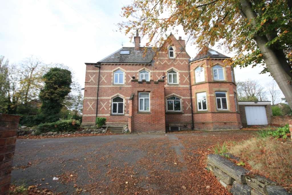

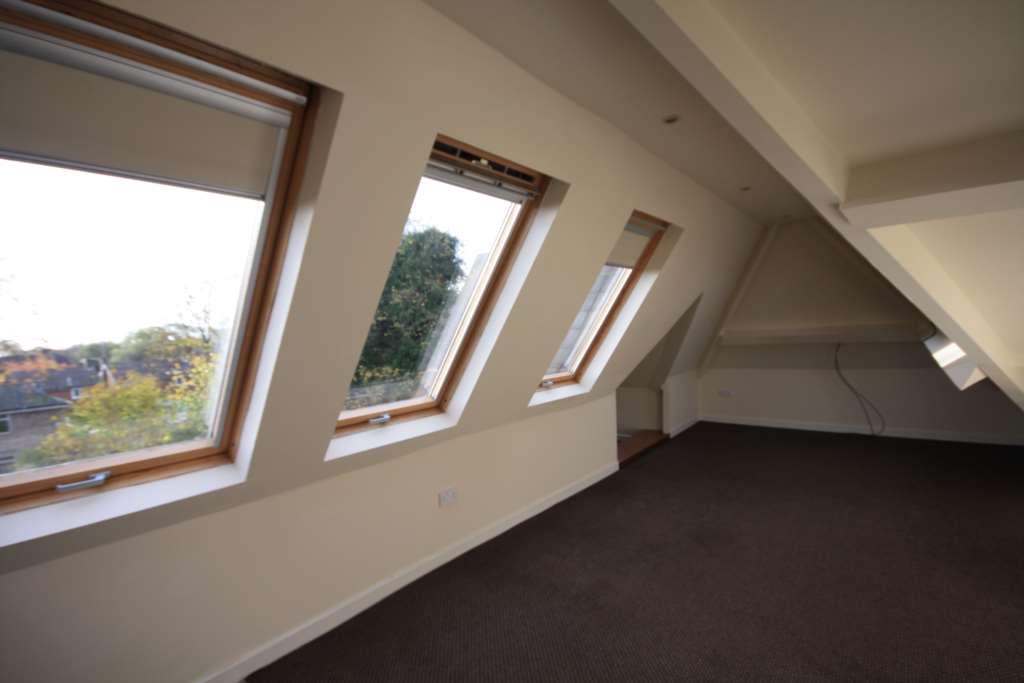
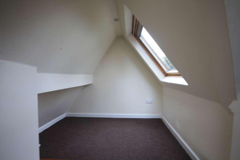
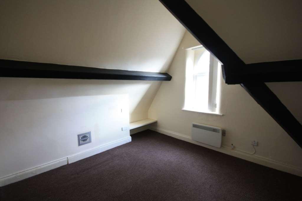
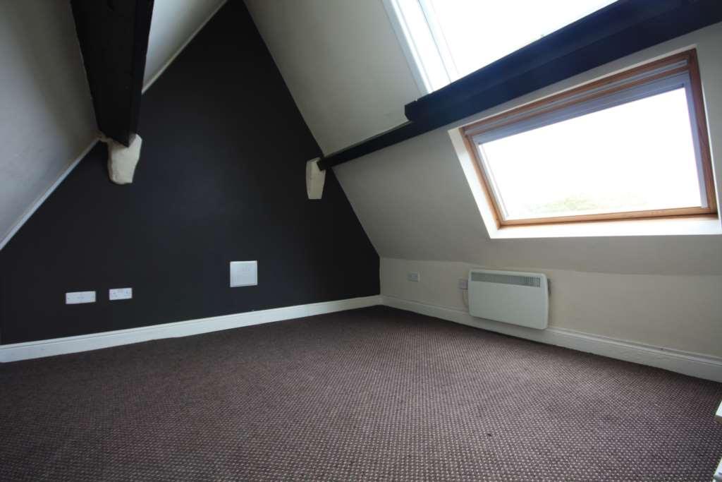
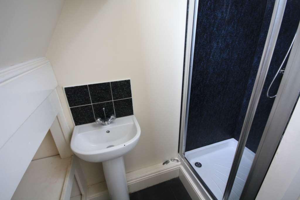
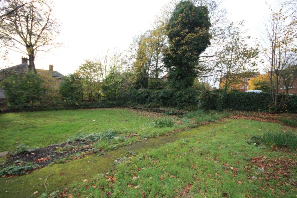
Photo 1 Photo 2 Photo 3 Photo 4 Photo 5 Photo 6 Photo 7 Photo 8 Photo 9
/ 9
Property details
Floor area
117 m²
Year built
England and Wales: 1900-1929
Deprivation
Decile 1 (1,025 of 33,755)
Street crime
2 incidents within 1 mile (Apr 2026)
Key features
- Two bedroom
- Top floor apartment
- Exposed beams
- Lovely views
- Open plan kitchen and lounge
- Excellent location
Additional details
- Parking
- Yes
- Garden
- Yes
Description
This two bedroom apartment is a good size on the top floor, with exposed beams, velux windows and a great light to the lounge area. The lounge and kitchen are open plan and enjoys lovely views, there is a small den area from the lounge. There are two double sized bedrooms, each with exposed beams adding lots of charcter and a bathroom with walk in shower.
Notice
All photographs are provided for guidance only.
Listed by
Manchester
Manchester City Sales and Lettings
Reference: 48949601
EPC Rating & Upgrade Cost
Fetching EPC data… Refresh this page in a moment.
Flood risk
Zone: 1
Risk: Low
Job (default Low)
Rental Range
Estimated market rent for Manchester. Low = conservative, Realistic = average, Optimistic = best case.
Based on Local Authority from postcode lookup → Manchester.
LHA (30th percentile) floor for West Pennine: £449/mo (Apr 2025 – Mar 2026)
Location
Nearby
Nearest stations, universities and amenities (distance from property).
| Type | Name | Distance |
|---|---|---|
| Bus stop | Station Rd/Crumpsall Tram Stop | 0.1 miles |
| Shop | Warners | 0.1 miles |
| Bus stop | Higher Crumpsall, Crumpsall Lane / Crumpsall Metrolink Stop | 0.1 miles |
| Shop | Spar | 0.1 miles |
| Hospital | North Manchester General Hospital | 0.6 miles |
| University | UCEN Manchester (City Campus) | 1.9 miles |
| Train station | Manchester Victoria | 2.0 miles |
| University | Unknown | 2.4 miles |
| Train station | Salford Central | 2.4 miles |
| Hospital | Prestwich Hospital (Edenfield Centre) | 2.6 miles |
Street-level crime
| Category | Count |
|---|---|
| Violence and sexual offences | 2 |
| Total incidents | 2 |
Within 1 mile during Apr 2026. Source: data.police.uk (England & Wales).
Schools nearby
Nearest open schools with Ofsted ratings (England). Closed schools are not shown. Data from Get Information about Schools and Ofsted.
| Name | Type | Distance | Ofsted |
|---|---|---|---|
| The King David High School | Secondary | 0.1 miles | Requires improvement — 17 Jul 2023 |
| Cravenwood Primary Academy | Primary | 0.2 miles | Good — 25 Apr 2017 |
| King David Primary School | Primary | 0.2 miles | Outstanding — 8 Apr 2016 |
| Crumpsall Lane Primary School | Primary | 0.2 miles | Good — 8 Nov 2023 |
| St Anne's RC Primary School Crumpsall Manchester | Primary | 0.3 miles | Good — 24 Jul 2023 |
Rental Comparables
Residential lets from OpenRent and Rightmove for the area (same bedroom count). Use to validate rent estimates. Student lets are excluded.
| Title | Rent | Beds | Distance | As seen on |
|---|---|---|---|---|
| 2 Bed Semi-Detached House, Herristone Road, M8 | £1,150/mo | 2 | 0.46 miles | OpenRent |
| 2 Bed Semi-Detached House, Herristone Road, M8 | £1,150/mo | 2 | 0.46 miles | OpenRent |
| 2 Bed Terraced House, Cleveland Road, M8 | £1,300/mo | 2 | 0.62 miles | OpenRent |
Average rent: £1,200/mo (3 listings)