Linden Close
Newcastle-Under-Lyme, ST5, ST5 9LL
£1,000 pcm
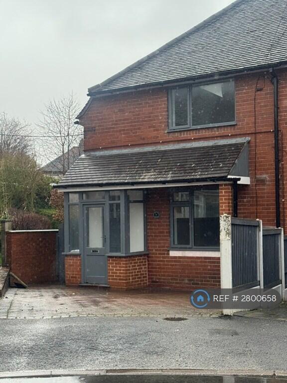
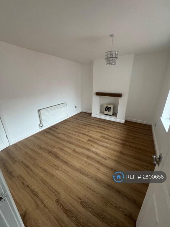
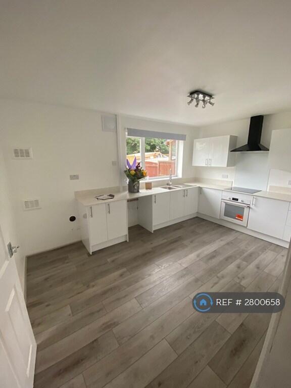
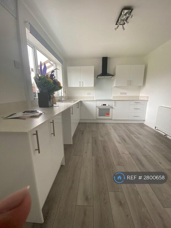
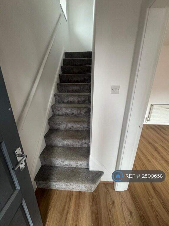
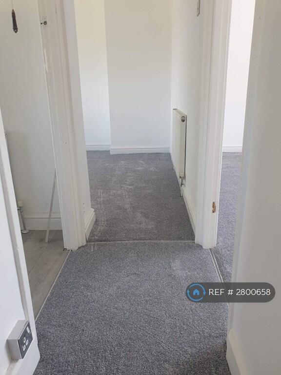
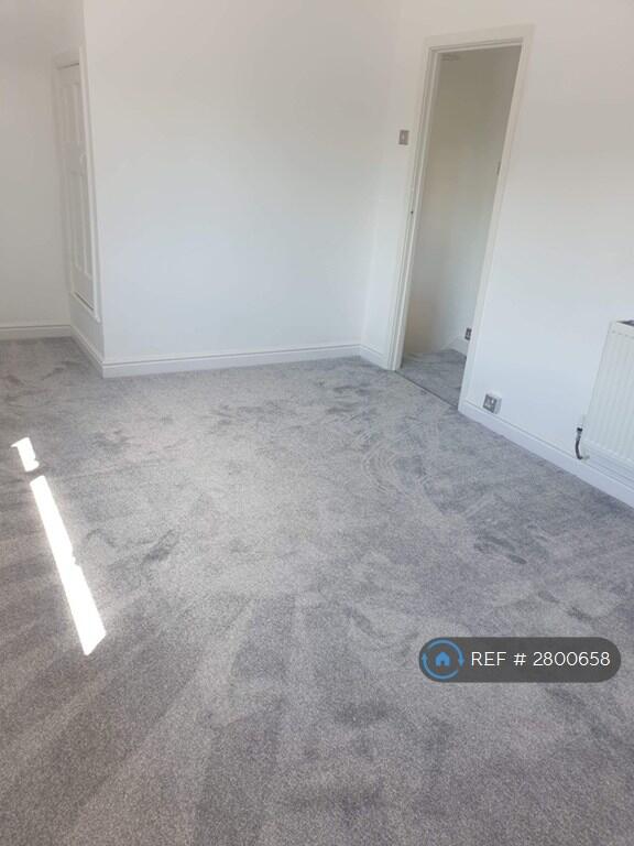
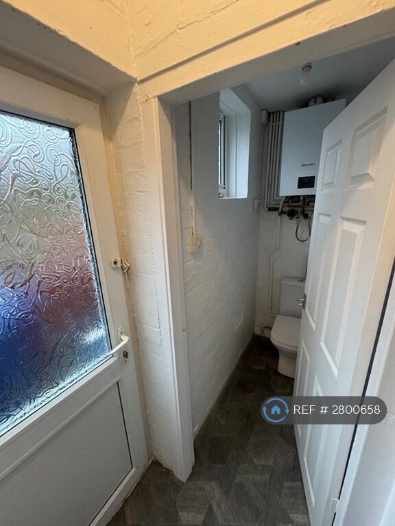
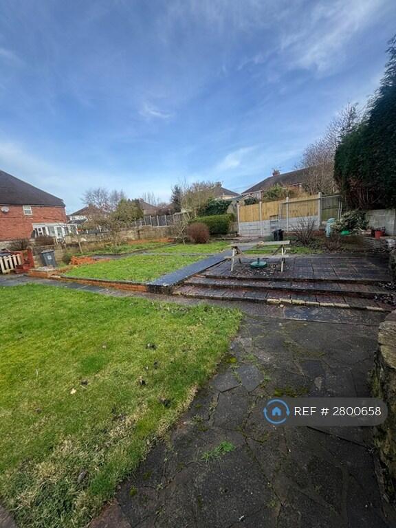
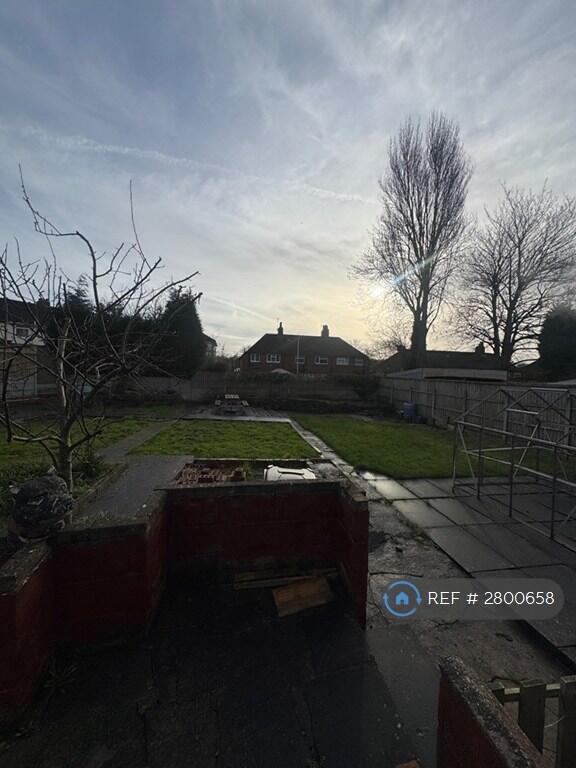
Photo 1 Photo 2 Photo 3 Photo 4 Photo 5 Photo 6 Photo 7 Photo 8 Photo 9 Photo 10
/ 10
Property details
Deprivation
Decile 4 (10,529 of 33,755)
Street crime
418 incidents within 1 mile (Mar 2026)
Key features
- No Agent Fees
- Property Reference Number: 2800658
Additional details
- Parking
- Private
- Garden
- Private garden
Description
A lovely two-bedroom home available to rent in a quiet residential cul-de-sac on Linden Close. This home is perfect for a small family or professional couple looking for space, convenience and a great school catchment area.
Property Features:
• Two good-sized double bedrooms
• Spacious sitting room
• Fitted kitchen
• Downstairs WC
• Full family bathroom upstairs
• Large corner plot garden
• Driveway parking for up to two cars
• Quiet, family-friendly location
Fantastic Location
• Just a street away from Hempstalls Primary school
• Walking distance to Orme Academy, St John Fisher high school and Newcastle college.
• Excellent commuter links just off the A34 and onto the A500
• Close to local shops and amenities
This home is available to rent immediately having just been recently renovated.
Pets make a home, therefore pets are allowed.
Summary & Exclusions:
- Rent Amount: £1,000.00 per month (£230.77 per week)
- Deposit / Bond: £1,000.00
- 2 Bedrooms
- 2 Bathrooms
- Property comes unfurnished
- Available to move in from 01 March 2026
- Minimum tenancy term is 12 months
- Maximum number of tenants is 4
- DSS enquiries welcome
- No Students
- Pets considered / by arrangement
- No Smokers
- Family Friendly
- Bills not included
- Property has parking
- Property has garden access
- EPC Rating: C
If calling, please quote reference: 2800658
Fees:
You will not be charged any admin fees.
Contact today to book a viewing and have the landlord show you round!
Request Details form responded to 24/7, with phone bookings available 9am-9pm, 7 days a week.
Listed by
London
Techbeard Ltd
Reference: 172570025
EPC ratings on this postcode
We don't have a matched EPC for this property yet. Below are efficiency scores and details for other addresses on this postcode.
| Address | Current | Potential | Floor area | Age band | Type |
|---|---|---|---|---|---|
| 1, Linden Close, NEWCASTLE | 68 | 84 | 70 m² | England and Wales: 1930-1949 | Detached |
| 14 Linden Close, NEWCASTLE | 73 | 79 | 69 m² | England and Wales: 1967-1975 | Terraced |
| 14 Linden Close, NEWCASTLE | 65 | 81 | 69 m² | England and Wales: 1930-1949 | Terraced |
| 15 Linden Close, NEWCASTLE | 71 | 87 | 71 m² | England and Wales: 1950-1966 | Terraced |
| 16 Linden Close, NEWCASTLE | 60 | 80 | 77 m² | — | Terraced |
| 21 LINDEN CLOSE, NEWCASTLE UNDER LYME, NEWCASTLE UNDER LYME | 68 | 83 | 70 m² | England and Wales: 1930-1949 | Terraced |
| 3, Linden Close, NEWCASTLE | 69 | 88 | 73 m² | England and Wales: 1930-1949 | Terraced |
| 3, Linden Close, NEWCASTLE | 70 | 88 | 55 m² | England and Wales: 1930-1949 | Terraced |
Flood risk
Zone: 1
Risk: Low
Job (default Low)
Rental Range
Estimated market rent for Newcastle-under-Lyme. Low = conservative, Realistic = average, Optimistic = best case.
Based on Local Authority from postcode lookup → Newcastle-under-Lyme.
LHA (30th percentile) floor for Staffordshire North: £479/mo (Apr 2025 – Mar 2026)
Location
Address
Linden Close
Nearby
Nearest stations, universities and amenities (distance from property).
| Type | Name | Distance |
|---|---|---|
| Bus stop | St Michaels Church | 0.1 miles |
| Bus stop | Swift House | 0.2 miles |
| Shop | Betd | 0.4 miles |
| Shop | Argos | 0.6 miles |
| Train station | Longport | 1.4 miles |
| Hospital | Royal Stoke University Hospital | 1.5 miles |
| Train station | Silverdale | 1.7 miles |
| University | University of Staffordshire Stoke Campus | 2.2 miles |
| University | Keele University | 2.3 miles |
| Hospital | North Staffordshire Nuffield Hospital | 2.5 miles |
Street-level crime
| Category | Count |
|---|---|
| Violence and sexual offences | 169 |
| Anti-social behaviour | 86 |
| Public order | 37 |
| Other theft | 22 |
| Shoplifting | 22 |
| Criminal damage and arson | 21 |
| Vehicle crime | 21 |
| Drugs | 10 |
| Other crime | 10 |
| Burglary | 9 |
| Possession of weapons | 5 |
| Robbery | 3 |
| Bicycle theft | 2 |
| Theft from the person | 1 |
| Total incidents | 418 |
Within 1 mile during Mar 2026. Source: data.police.uk (England & Wales).
Schools nearby
Nearest open schools with Ofsted ratings (England). Closed schools are not shown. Data from Get Information about Schools and Ofsted.
| Name | Type | Distance | Ofsted |
|---|---|---|---|
| Hempstalls Primary School | Primary | 0.1 miles | — (Inspected (no overall grade)) |
| Merryfields School | Other | 0.2 miles | Good — 30 Apr 2014 |
| The Orme Academy | Secondary | 0.4 miles | Good — 9 Jul 2024 |
| St John Fisher Catholic College | Secondary | 0.5 miles | Requires improvement — 5 Mar 2024 |
| May Bank Infants' School | Primary | 0.6 miles | Good — 21 Jan 2024 |
Rental Comparables
Residential lets from OpenRent and Rightmove for the area (same bedroom count). Use to validate rent estimates. Student lets are excluded.
Average rent: £838/mo (42 listings)
Enter House Number
Enter the house number to help us retrieve more accurate pricing history and property data.
Please log in to submit or correct the house number for this listing.
Log in to continue