Grove Road
Stone, ST15, ST15 0DW
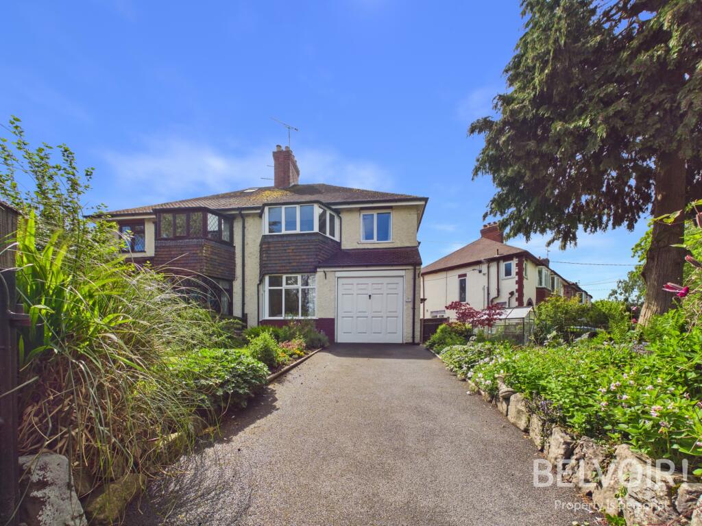
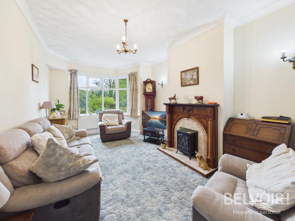
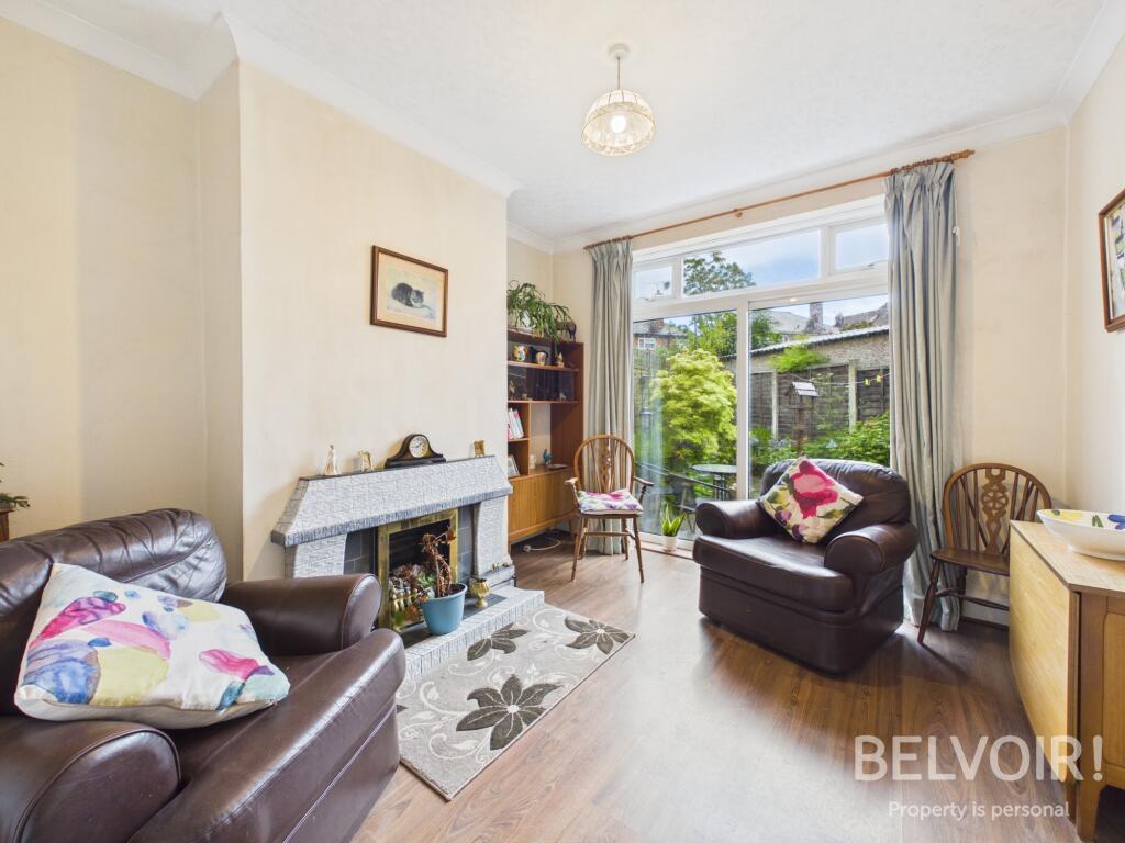
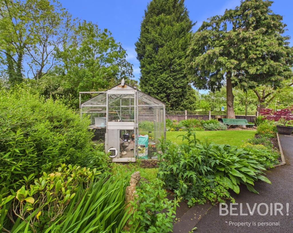
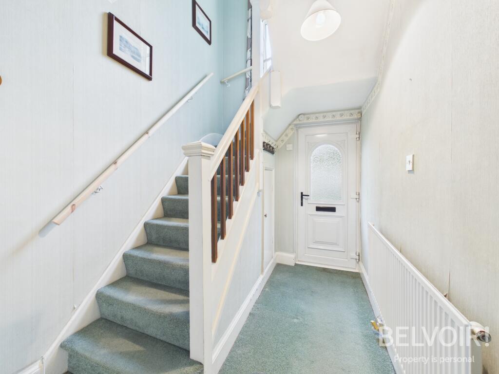
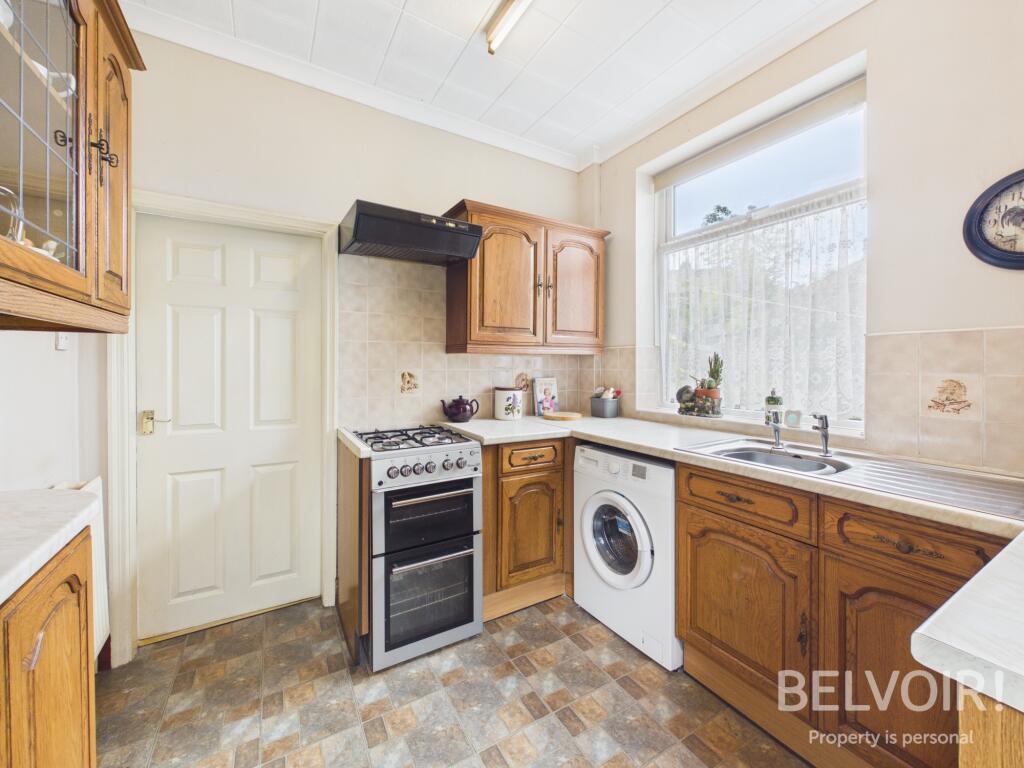
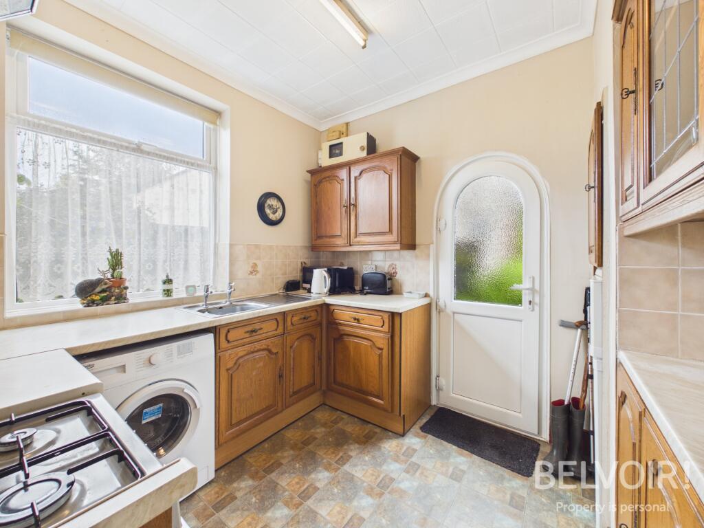
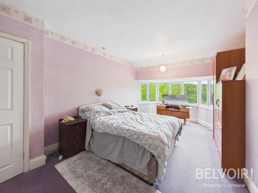
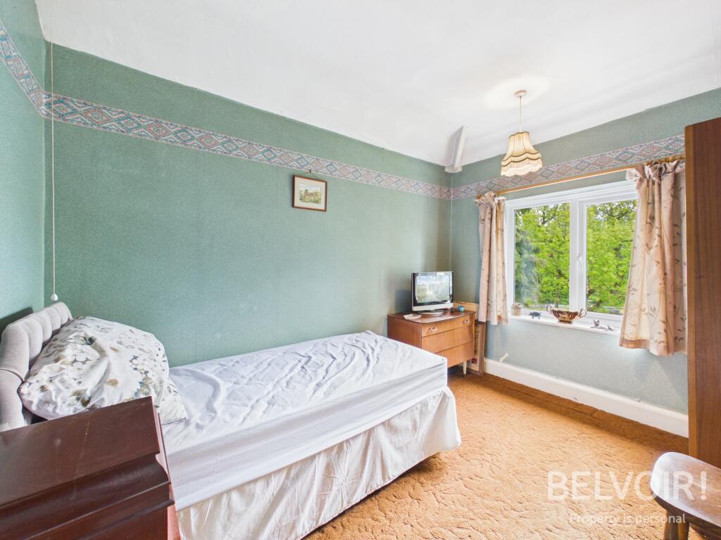
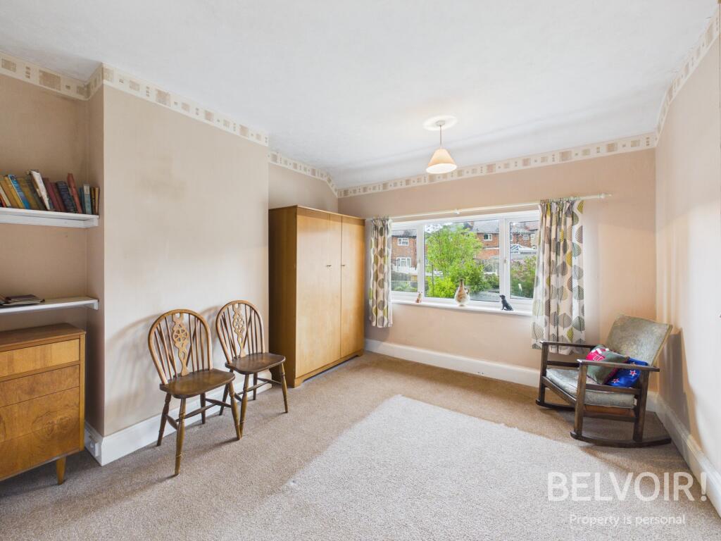
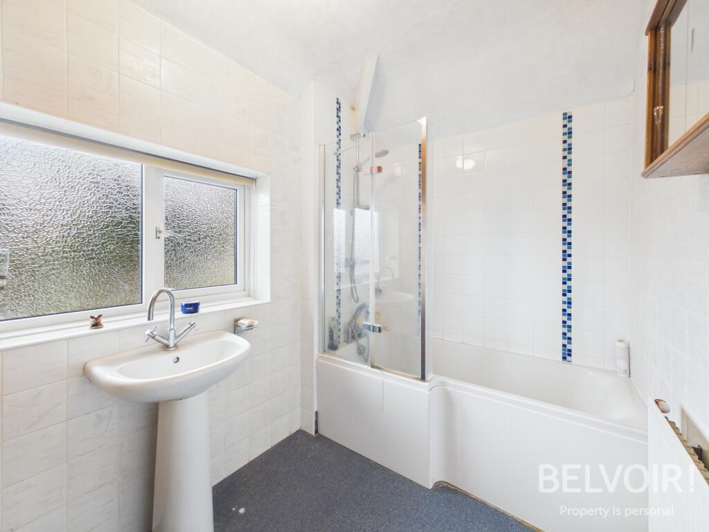
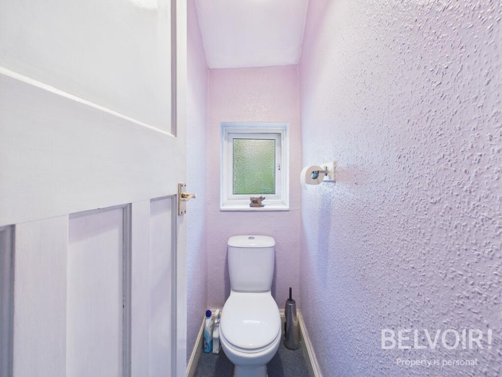
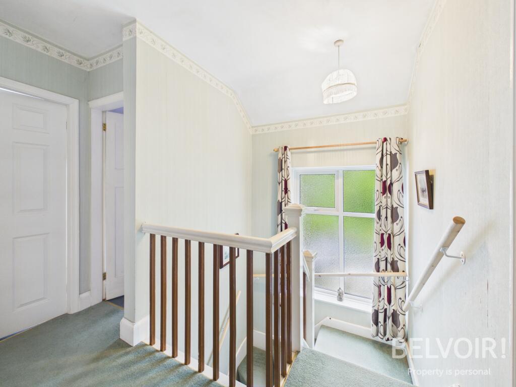
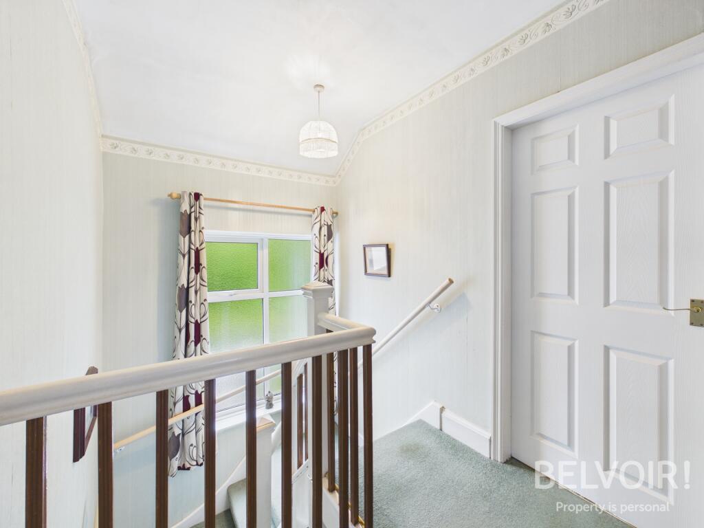
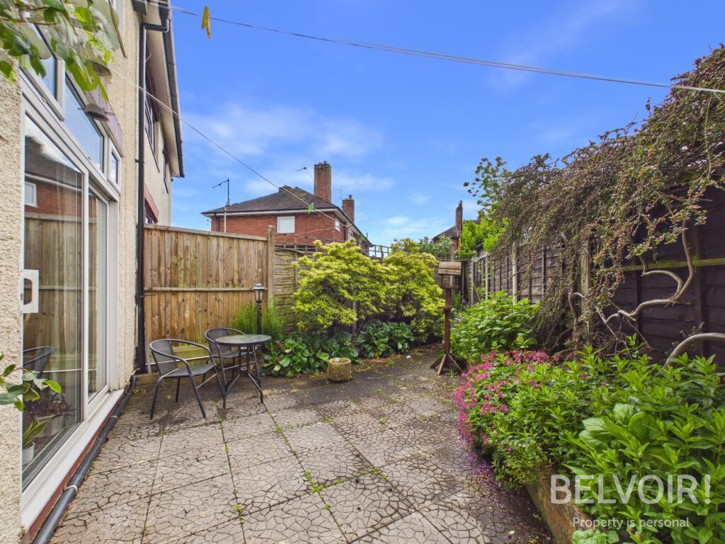
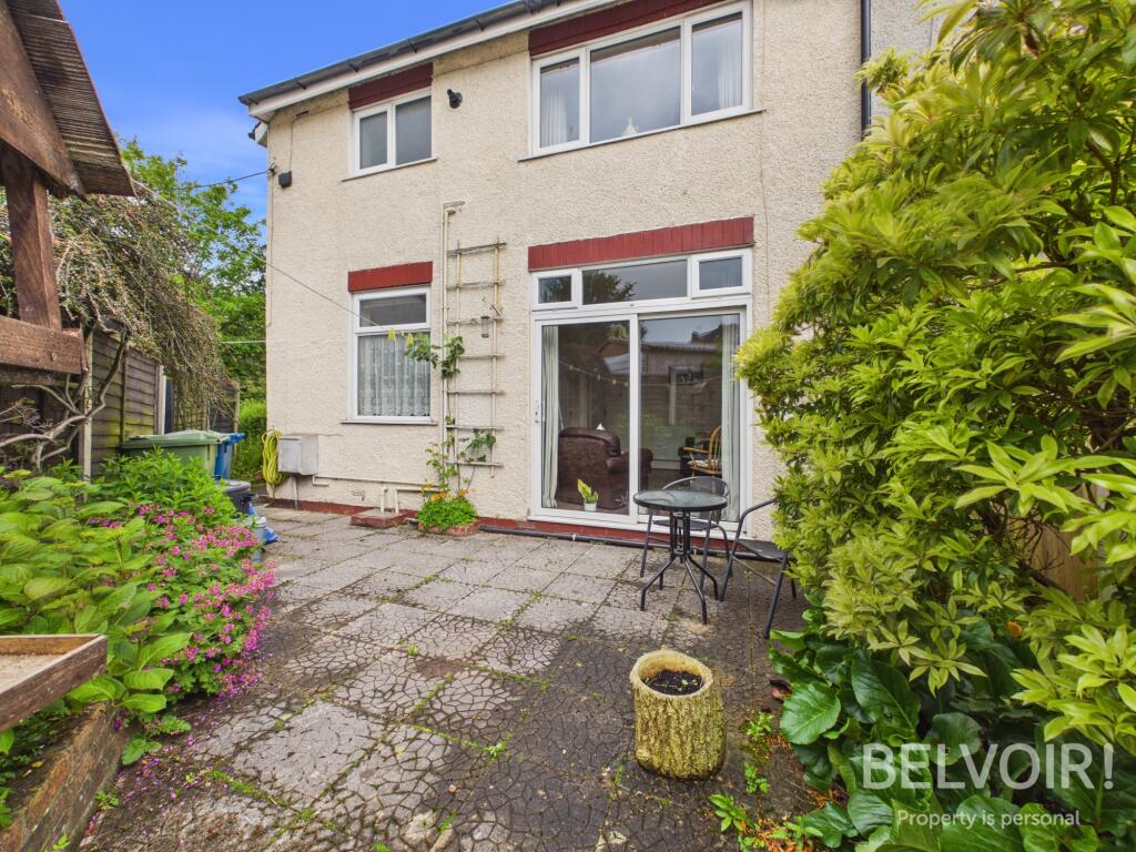
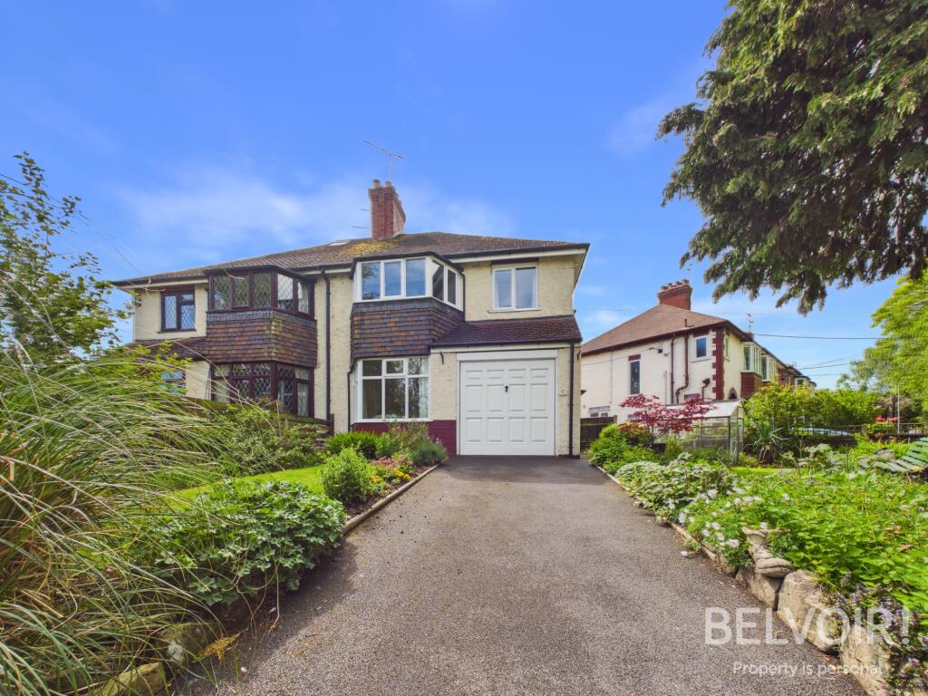
Photo 1 Photo 2 Photo 3 Photo 4 Photo 5 Photo 6 Photo 7 Photo 8 Photo 9 Photo 10 Photo 11 Photo 12 Photo 13 Photo 14 Photo 15 Photo 16 Photo 17
/ 17
Property details
Tenure
FREEHOLD
Council tax band
C
Local average
£228,623 (+9.4%)
Deprivation
Decile 5 (15,949 of 33,755)
Street crime
95 incidents within 1 mile (Apr 2026)
Key features
- Traditional 1930's Semi Detached Property
- Three Bedrooms
- Two Reception Rooms
- Fitted Kitchen
- Family Bathroom with Separate WC
- Corner Plot
- Gated Driveway & Single Garage
- Enclosed Gardens to Rear, Front & Side
- uPVC Double Glazing & GCH
- No Upward Chain!
Additional details
- Heating
- Gas central
- Parking
- Garage
- Garden
- Private garden
- Listed property
- No
- Required access
- No
- Rights of way
- No
- Flood defences
- No
Description
Accommodation:
Entrance Hall: With under stairs storage, stairs to the first floor
Living Room: With feature inset electric fire in hearth with surround, coving, uPVC double glazed bay window to the front
Dining Room: With feature coal effect gas fire and surround, coving, uPVC double glazed sliding doors opening onto the garden
Fitted Kitchen: With a range of base and wall units, worktops, stainless steel sink and drainer, space for freestanding appliances, uPVC double glazed window to the rear and arched door opening to the side of the property
Landing: With uPVC double glazed frosted window, loft access
Master Bedroom: With uPVC double glazed bay window to the front
Bedroom Two: With uPVC double glazed window to the rear
Bedroom Three: With uPVC double glazed window to the front
Family Bathroom: Fully tiled with P shaped bath and shower over, pedestal wash hand basin, airing cupboard housing GCH boiler, uPVC double glazed frosted window to the rear
WC: With WC, uPVC double glazed frosted window
Externally: Well established, mature and fully stocked gardens to the front, side and rear. The rear garden is low maintenance with paving ideal for dining and entertaining. To the side and front there are gardens laid to lawn with borders and greenhouse. A gated driveway provides off road parking.
Single Garage: With up and over door to the front
EPC Asset Rating: TBC
Viewings: Contact selling agent
Tenure: We are advised that the tenure is Freehold. Any interested parties are advised to confirm the details with solicitors before proceeding.
Services: All mains services are connected in accordance with normal terms of supply, telephone subject to normal terms and conditions. The gas and electrical appliances mentioned have not been tested by us and purchasers are therefore advised to undertake their own tests should they consider this necessary. All interested parties should obtain verification through their solicitor or surveyor before entering a legal commitment to purchase.
Tenure: Freehold, Planning permissions: not known Mobile signal information: usual providers
Listed by
Stafford
The Property Franchise Group
Reference: 88475490
EPC ratings on this postcode
We don't have a matched EPC for this property yet. Below are efficiency scores and details for other addresses on this postcode.
| Address | Current | Potential | Floor area | Age band | Type |
|---|---|---|---|---|---|
| 11 Grove Road, STONE | 68 | 80 | 92 m² | England and Wales: 1930-1949 | Detached |
| 11, Grove Road, STONE | 52 | 82 | 93 m² | England and Wales: 1930-1949 | Detached |
| 13, Grove Road, STONE | 67 | 80 | 104 m² | England and Wales: 1930-1949 | Detached |
| 14, Grove Road, STONE | 56 | 83 | 109 m² | England and Wales: 1950-1966 | Detached |
| 17, Grove Road, STONE | 54 | 83 | 97 m² | England and Wales: 1930-1949 | Detached |
| 18, Grove Road, STONE | 59 | 83 | 97 m² | England and Wales: 1900-1929 | Terraced |
| 19 Grove Road, STONE | 66 | 82 | 92 m² | England and Wales: 1930-1949 | Detached |
| 20 Grove Road, STONE | 80 | 82 | 114 m² | — | Detached |
| 20, Grove Road, Stone | 66 | 83 | 95 m² | England and Wales: 1930-1949 | Detached |
| 21, Grove Road, STONE | 56 | 75 | 111 m² | England and Wales: 1930-1949 | Detached |
| 8 Grove Road, STONE | 67 | 78 | 131 m² | England and Wales: 1950-1966 | Detached |
Flood risk
Zone: 1
Risk: Low
Job (default Low)
Floorplans
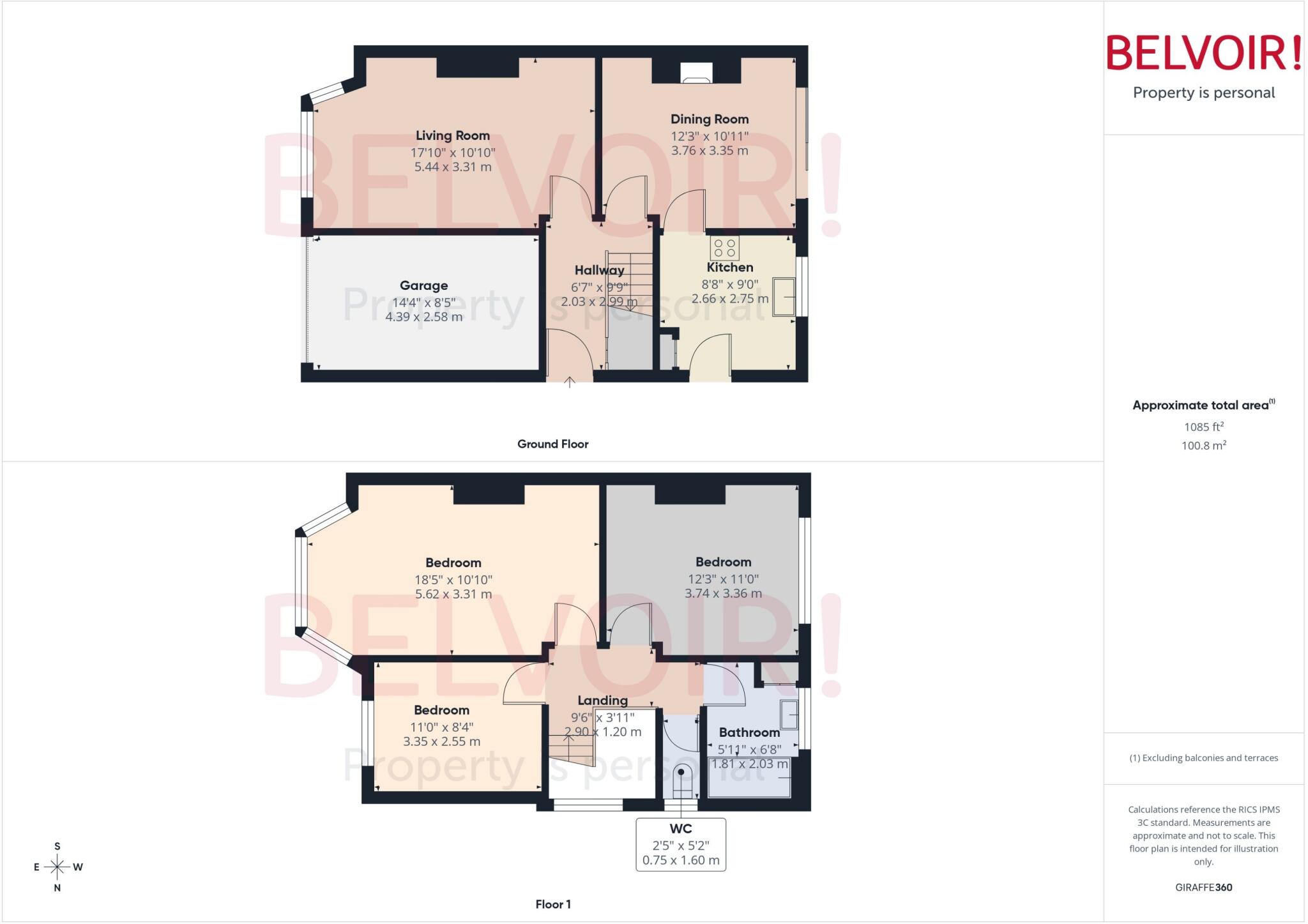
Floorplan
Price history
| Event | Date | Price | % change |
|---|---|---|---|
| Listed for sale | — | £250,000 | — |
Source: HM Land Registry Price Paid Data. Crown copyright.
Sold Comparables
Same street and nearby sales within 0.25 miles (last 5 years). Data from Land Registry Price Paid.
| Address | Price | Date | Type |
|---|---|---|---|
| 92 THE FILLYBROOKS, STONE, STAFFORD, STAFFORDSHIRE, ST15 0DL | £188,000 | 12/11/2025 | Semi-detached |
| 131 TYLER GROVE, STONE, STAFFORD, STAFFORDSHIRE, ST15 0JA | £144,500 | 24/11/2023 | Semi-detached |
| 28 LONGFIELD AVENUE, STONE, STAFFORD, STAFFORDSHIRE, ST15 0DN | £270,000 | 27/10/2023 | Semi-detached |
| 78 ST VINCENT ROAD, STONE, STAFFORD, STAFFORDSHIRE, ST15 0DU | £220,000 | 11/09/2023 | Semi-detached |
| 41 WOODLANDS AVENUE, STONE, STAFFORD, STAFFORDSHIRE, ST15 0DT | £263,000 | 14/07/2023 | Semi-detached |
| 2 PARK AVENUE, STONE, STAFFORD, STAFFORDSHIRE, ST15 0DS | £255,000 | 26/04/2023 | Semi-detached |
| 32 LONGFIELD AVENUE, STONE, STAFFORD, STAFFORDSHIRE, ST15 0DN | £260,000 | 16/12/2022 | Semi-detached |
| 48 THE FILLYBROOKS, STONE, STAFFORD, STAFFORDSHIRE, ST15 0DL | £266,000 | 24/11/2022 | Semi-detached |
| Same street 19 GROVE ROAD, STONE, STAFFORD, STAFFORDSHIRE, ST15 0DW | £245,000 | 04/11/2022 | Semi-detached |
| 29 WOODLANDS CLOSE, STONE, STAFFORD, STAFFORDSHIRE, ST15 0DX | £220,000 | 16/09/2022 | Semi-detached |
| 56 LONGFIELD AVENUE, STONE, STAFFORD, STAFFORDSHIRE, ST15 0DN | £247,500 | 02/09/2022 | Semi-detached |
| 52 THE FILLYBROOKS, STONE, STAFFORD, STAFFORDSHIRE, ST15 0DL | £265,000 | 05/08/2022 | Semi-detached |
| 163 BROOKSIDE LANE, STONE, STAFFORD, STAFFORDSHIRE, ST15 0HZ | £200,000 | 20/07/2022 | Semi-detached |
| 32 LONGFIELD AVENUE, STONE, STAFFORD, STAFFORDSHIRE, ST15 0DN | £194,500 | 12/07/2022 | Semi-detached |
| 135 TYLER GROVE, STONE, STAFFORD, STAFFORDSHIRE, ST15 0JA | £160,000 | 20/05/2022 | Semi-detached |
| 69 ST VINCENT ROAD, STONE, STAFFORD, STAFFORDSHIRE, ST15 0DU | £185,000 | 05/05/2022 | Semi-detached |
| 64 ST VINCENT ROAD, STONE, STAFFORD, STAFFORDSHIRE, ST15 0DU | £180,000 | 08/04/2022 | Semi-detached |
| 92 MANOR RISE, STONE, STAFFORD, STAFFORDSHIRE, ST15 0HY | £221,000 | 01/04/2022 | Semi-detached |
| 20 LONGFIELD AVENUE, STONE, STAFFORD, STAFFORDSHIRE, ST15 0DN | £160,000 | 01/03/2022 | Semi-detached |
| 56 LONGFIELD AVENUE, STONE, STAFFORD, STAFFORDSHIRE, ST15 0DN | £161,500 | 25/10/2021 | Semi-detached |
| 42 LONGFIELD AVENUE, STONE, STAFFORD, STAFFORDSHIRE, ST15 0DN | £187,500 | 08/10/2021 | Semi-detached |
Street average: £245,000 (1 sale)
Area average: £212,425 (20 sales)
Capital growth trend
Land Registry outcode average: last 12 months vs 5y and 10y ago (from sold prices).
House Price Index (HM Land Registry — official index, not sold-price averages): Stafford. Series: Semi-detached. As of March 2026.
Rental Range
Estimated market rent for Stafford. Low = conservative, Realistic = average, Optimistic = best case.
Based on Local Authority from postcode lookup → Stafford.
LHA (30th percentile) floor for Staffordshire North: £593/mo (Apr 2025 – Mar 2026)
Location
Address
Park Avenue
Nearby
Nearest stations, universities and amenities (distance from property).
| Type | Name | Distance |
|---|---|---|
| Bus stop | Park Avenue | 0.1 miles |
| Bus stop | Playground | 0.3 miles |
| Shop | Tim Toft Violins | 0.4 miles |
| Shop | Brydon's Butcher | 0.4 miles |
| Train station | Stone | 0.5 miles |
| Train station | Unknown | 4.2 miles |
| Hospital | North Staffordshire Nuffield Hospital | 6.6 miles |
| Hospital | County Hospital | 6.7 miles |
| University | Staffordshire University Blackheath Lane Site | 7.0 miles |
| University | Keele University | 8.4 miles |
Street-level crime
| Category | Count |
|---|---|
| Violence and sexual offences | 42 |
| Anti-social behaviour | 13 |
| Other theft | 8 |
| Shoplifting | 8 |
| Public order | 6 |
| Criminal damage and arson | 5 |
| Burglary | 4 |
| Vehicle crime | 3 |
| Other crime | 2 |
| Bicycle theft | 1 |
| Drugs | 1 |
| Robbery | 1 |
| Theft from the person | 1 |
| Total incidents | 95 |
Within 1 mile during Apr 2026. Source: data.police.uk (England & Wales).
Schools nearby
Nearest open schools with Ofsted ratings (England). Closed schools are not shown. Data from Get Information about Schools and Ofsted.
| Name | Type | Distance | Ofsted |
|---|---|---|---|
| Manor Hill First School | Primary | 0.3 miles | Good — 22 Oct 2012 |
| St Dominic's Catholic Primary School | Primary | 0.4 miles | Outstanding — 22 May 2022 |
| St Dominic's Priory School | Other | 0.4 miles | — (No rating) |
| Christ Church CofE First School | Primary | 0.5 miles | Good — 3 Mar 2014 |
| Pirehill First School | Primary | 0.5 miles | Good — 20 Apr 2012 |
Rental Comparables
Loading rental comparables for this postcode. Refresh in a few minutes.
Rent-driven metrics
Based on Area rent estimate.
- Rent ratio — Monthly rent ÷ purchase price (1% rule). 1%+ = strong, 0.8–1% = okay, <0.8% = weak for cashflow.
- Max investor price — Rent ÷ 0.8%; the price at which rent would be 0.8% of price (Stoke-style target).
- Target investor price — Rent ÷ 1%; the price at which rent would be 1% of price (strong cashflow band).
- Gross yield — Annual rent as % of purchase price (no costs).
Enter House Number
Enter the house number to help us retrieve more accurate pricing history and property data.
Please log in to submit or correct the house number for this listing.
Log in to continue