21 WOODVILLE DRIVE
SALE, GREATER MANCHESTER M33 6NF


Property details
Tenure
FREEHOLD
Floor area
92 m²
Council tax band
C
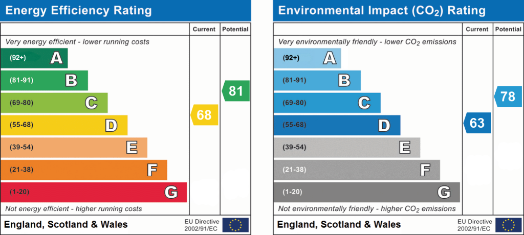
EPC rating
D
Year built
England and Wales: 1950-1966
Last sold
£380,000 Dec 2024
Price per m²
£5,272/m²
Local average
£461,133 (+5.2%)
Deprivation
Decile 7 (22,809 of 33,755)
Street crime
0 incidents within 1 mile (May 2026)
Key features
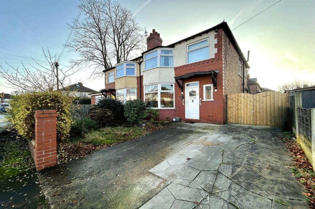
- Tucked Away In Quiet Cul-De-Sac Setting
- Tastefully Refurbished Throughout
- Beautifully Presented Semi Detached Residence
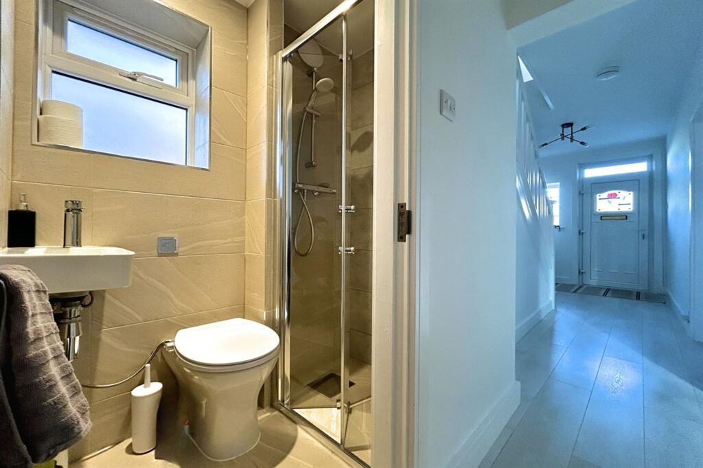
- Three Generous Bedrooms, Bathroom & Ground Floor Shower Room
- Highly Desirable Residential Area
- Within Walking Distance of Ashton on Mersey Village & Sale Town Centre & Sale Metrolink
Additional details
- Electricity
- Mains supply
- Water
- Mains supply
- Sewerage
- Mains supply
- Heating
- Gas central
- Parking
- Yes
- Garden
- Private garden
- Listed property
- No
- Restrictions
- No
- Required access
- No
- Rights of way
- No
- Flooded in last 5 years
- No
- Flood defences
- No
Description
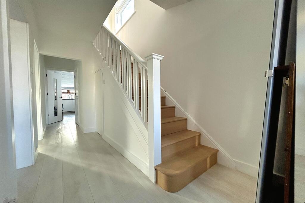
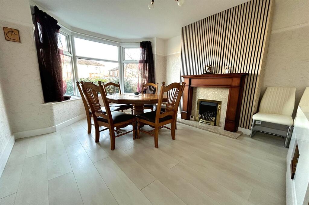
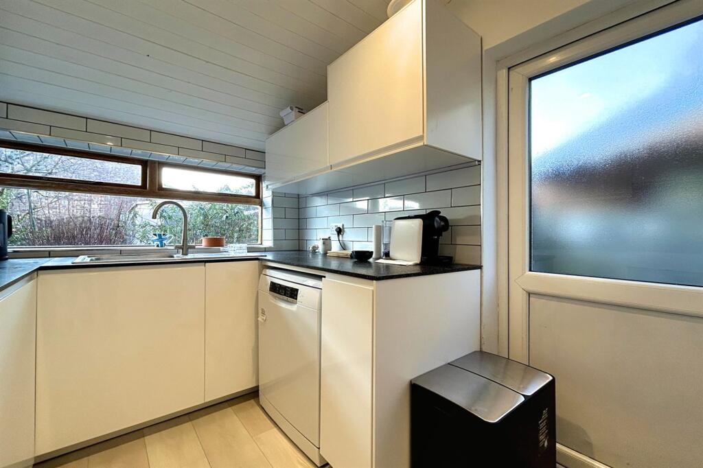
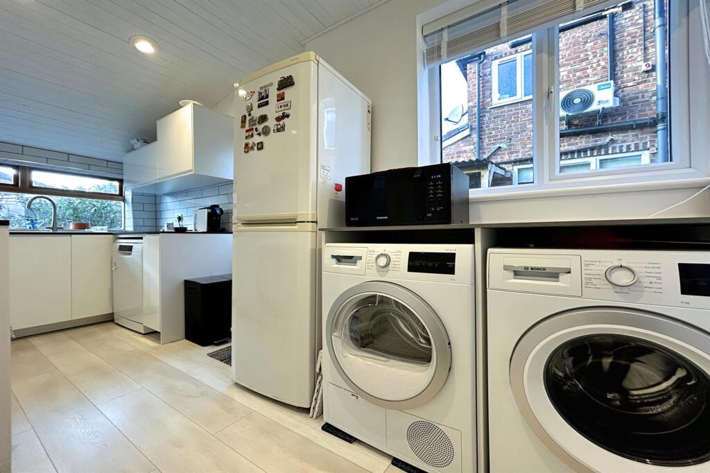
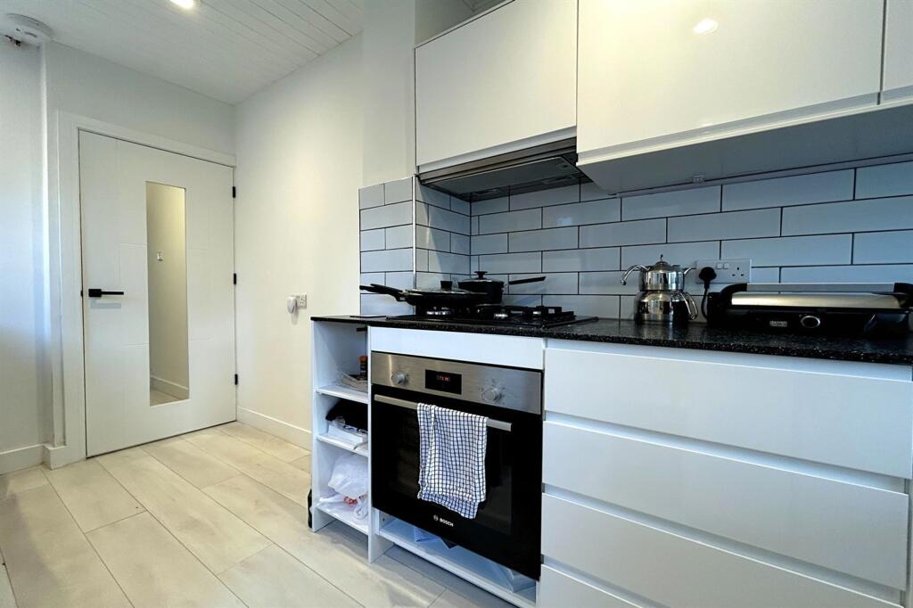
Inside, an entrance hallway leads to a dining room featuring a bay window. A bright and spacious lounge is located at the rear, accompanied by a modern kitchen. A downstairs shower room completes the ground floor living space.
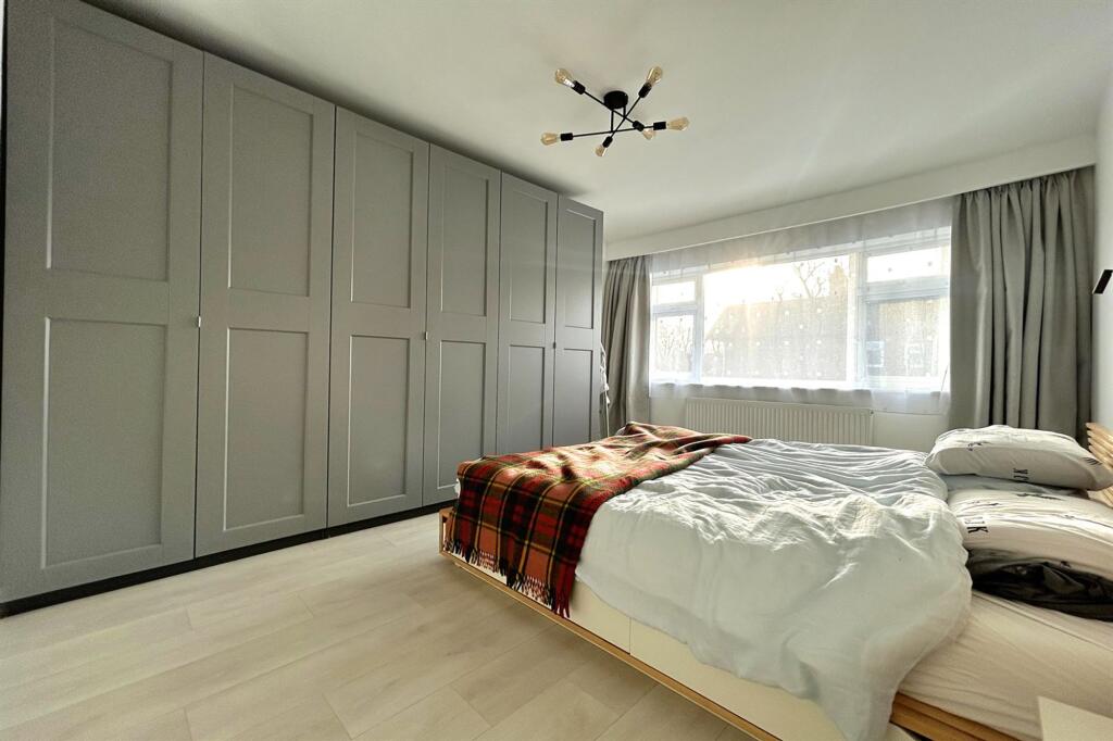
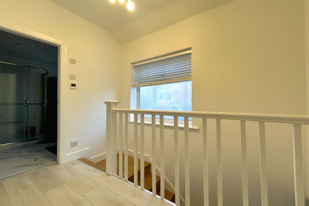
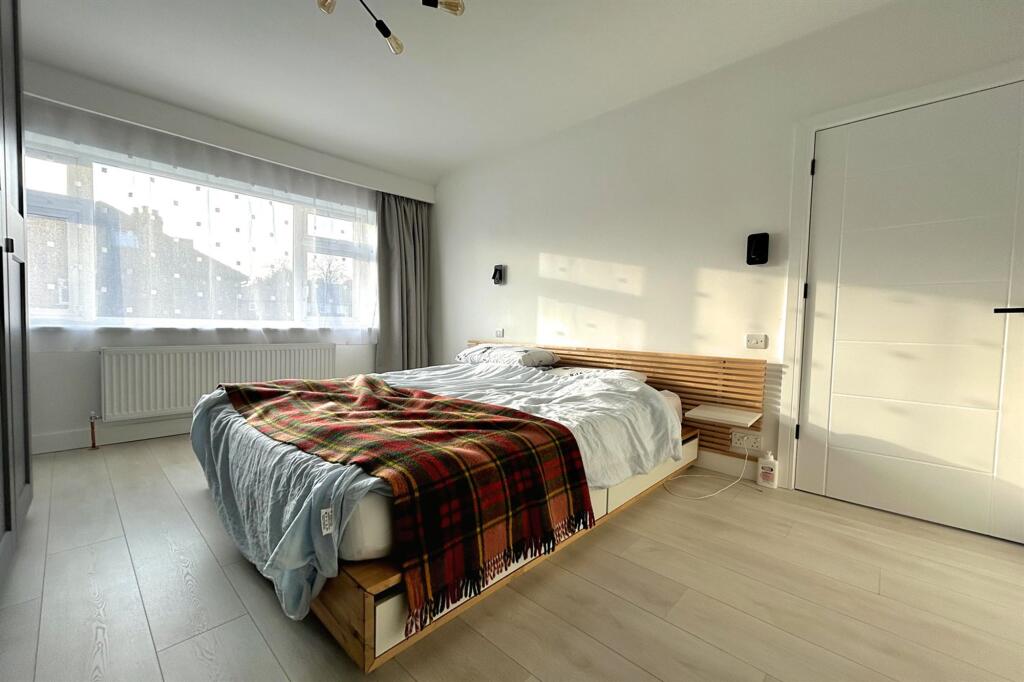
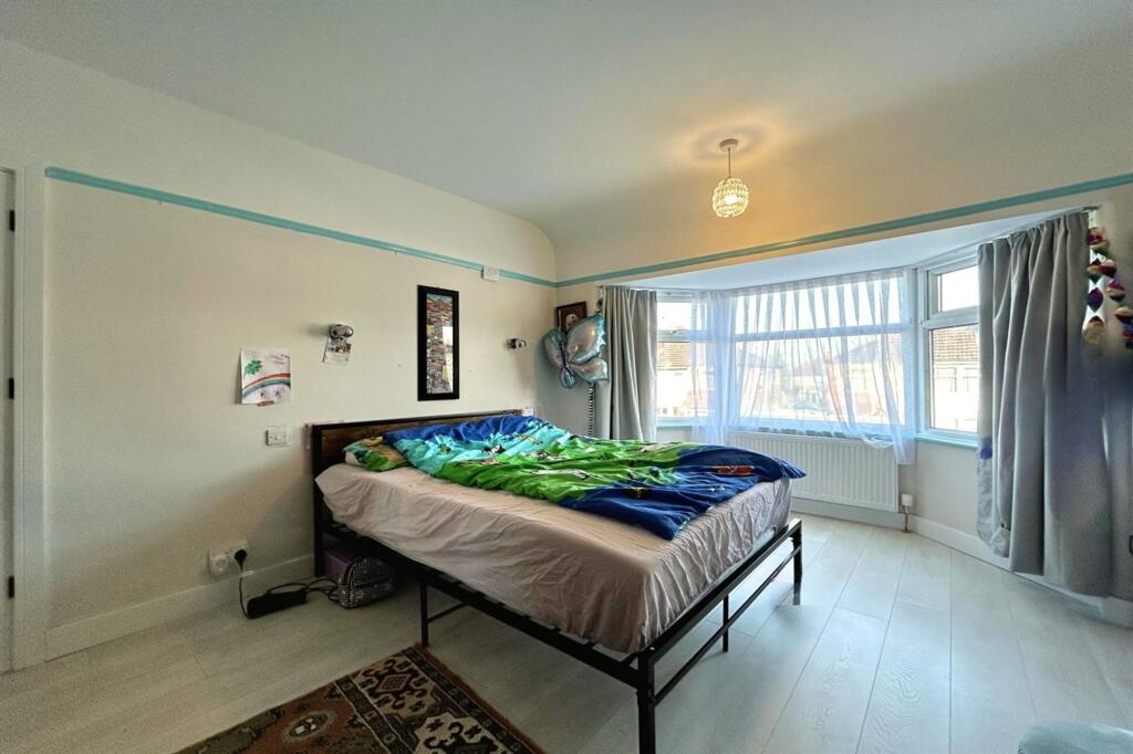
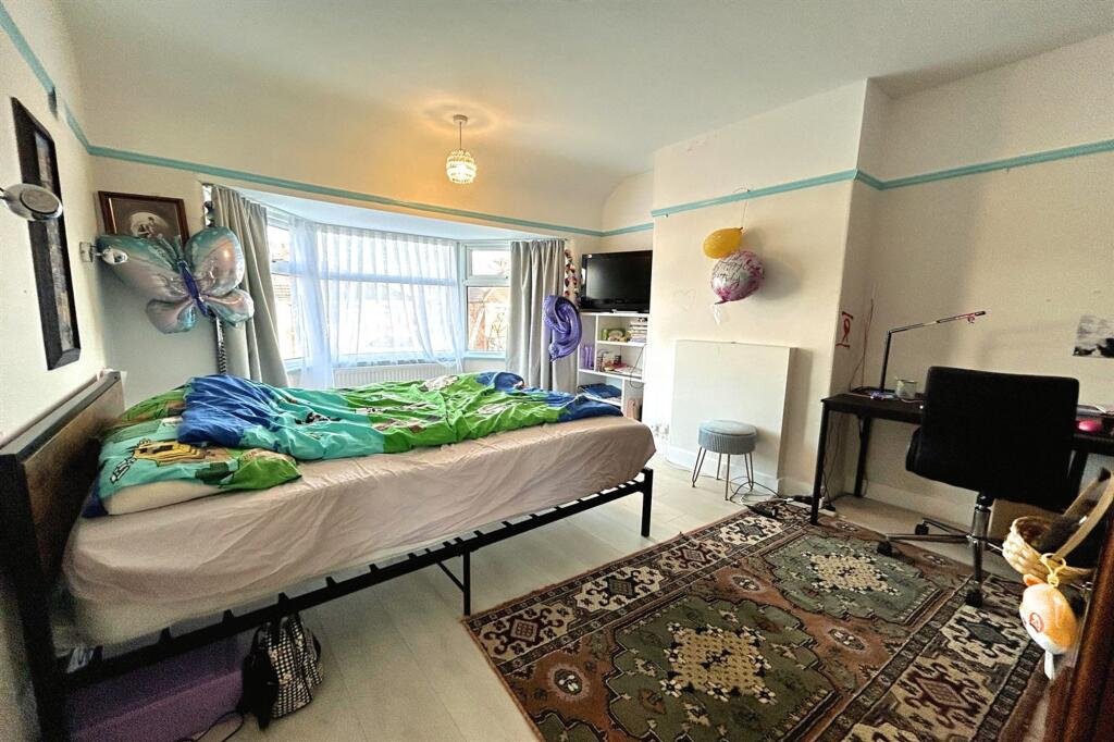
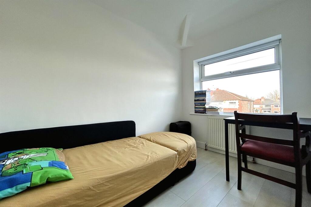
On the first floor, there is a contemporary family bathroom along with three generously sized bedrooms.
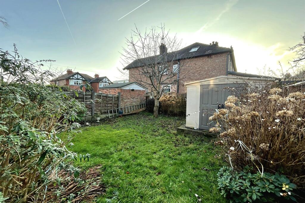
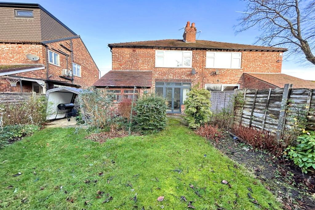
Outside, a driveway offers off-road parking, while the rear boasts a large, private, well-established garden with a patio area at the back. The property is equipped with a new heating system throughout, including underfloor heating on the ground floor.
EPC Rating: D
Listed by
Sale
Gascoigne Halman - Connells
Reference: 174768842
EPC Rating & Upgrade Cost
Current rating: D
Potential rating: B
Inspection date: 14/03/2024
Expiry date: 13/03/2034
Current heating cost: £1,083/year
Potential heating cost: £946/year
Est. upgrade cost to C: £19,500
Recommendations
- 50 mm internal or external wall insulation (£4,000 - £14,000)
- Floor insulation (suspended floor) (£800 - £1,200)
- Solar water heating (£4,000 - £6,000)
- Solar photovoltaic panels, 2.5 kWp (£3,500 - £5,500)
Flood risk
Zone: 1
Risk: Low
Job (default Low)
Floorplans
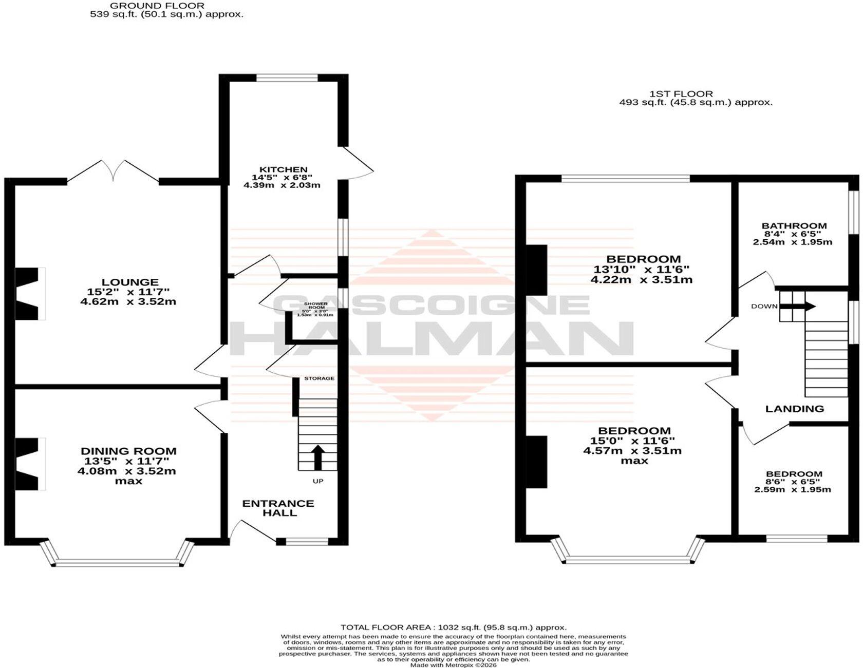
Floorplan 1
EPC Graphs
EPC 1
Price history
| Event | Date | Price | % change |
|---|---|---|---|
| Listed for sale | — | £485,000 | +27.6% |
| Sold | 12/12/2024 (1 year ago) | £380,000 | — |
Source: HM Land Registry Price Paid Data. Crown copyright.
Sold Comparables
Same street and nearby sales within 0.25 miles (last 5 years). Data from Land Registry Price Paid.
| Address | Price | Date | Type |
|---|---|---|---|
| Same street 33 WOODVILLE DRIVE, SALE, TRAFFORD, GREATER MANCHESTER, M33 6NF | £605,000 | 12/01/2026 | Semi-detached |
| 43 WHITEFIELD ROAD, SALE, TRAFFORD, GREATER MANCHESTER, M33 6NY | £320,000 | 31/10/2025 | Semi-detached |
| Same street 13 WOODVILLE DRIVE, SALE, TRAFFORD, GREATER MANCHESTER, M33 6NF | £425,000 | 10/01/2025 | Semi-detached |
| 24 PARK ROAD, SALE, TRAFFORD, GREATER MANCHESTER, M33 6WX | £446,000 | 12/06/2023 | Semi-detached |
| 28 WHITEFIELD ROAD, SALE, TRAFFORD, GREATER MANCHESTER, M33 6PH | £650,000 | 28/01/2022 | Semi-detached |
| 9 PLANT CLOSE, SALE, TRAFFORD, GREATER MANCHESTER, M33 6WR | £305,000 | 24/08/2021 | Semi-detached |
Street average: £515,000 (2 sales)
Area average: £430,250 (4 sales)
Capital growth trend
Land Registry outcode average: last 12 months vs 5y and 10y ago (from sold prices).
House Price Index (HM Land Registry — official index, not sold-price averages): Trafford. Series: Semi-detached. As of April 2026.
Rental Range
Estimated market rent for Trafford. Low = conservative, Realistic = average, Optimistic = best case.
Based on Local Authority from postcode lookup → Trafford.
LHA (30th percentile) floor for West Pennine: £504/mo (Apr 2025 – Mar 2026)
Location
Nearby
Nearest stations, universities and amenities (distance from property).
| Type | Name | Distance |
|---|---|---|
| Bus stop | Ashton upon Mersey, Ashton Lane / opposite Ashlands | 0.1 miles |
| Bus stop | Ashton upon Mersey, Ashton Lane / near Ashlands | 0.1 miles |
| Shop | R.E.Jones Funeral Directors | 0.2 miles |
| Shop | S & R News | 0.2 miles |
| Train station | Humphrey Park | 1.7 miles |
| Train station | Urmston | 1.7 miles |
| Hospital | Trafford General Hospital | 2.5 miles |
| University | University Academy 92 | 2.8 miles |
| Hospital | Altrincham Health and Wellbeing Centre | 3.0 miles |
| University | University of Salford | 3.4 miles |
Street-level crime
| Category | Count |
|---|---|
| Total incidents | 0 |
Within 1 mile during May 2026. Source: data.police.uk (England & Wales).
Schools nearby
Nearest open schools with Ofsted ratings (England). Closed schools are not shown. Data from Get Information about Schools and Ofsted.
| Name | Type | Distance | Ofsted |
|---|---|---|---|
| Park Road Sale Primary School | Primary | 0.2 miles | Outstanding — 2 May 2024 |
| St Mary's CofE Primary School | Primary | 0.2 miles | Good — 18 May 2023 |
| Forest Park Preparatory School | Other | 0.2 miles | — (No rating) |
| Wellfield Junior School | Primary | 0.3 miles | Good — 13 Feb 2014 |
| Wellfield Infant and Nursery School | Primary | 0.4 miles | Outstanding — 19 Feb 2016 |
Rental Comparables
Loading rental comparables for this postcode. Refresh in a few minutes.
Rent-driven metrics
Based on Area rent estimate.
- Rent ratio — Monthly rent ÷ purchase price (1% rule). 1%+ = strong, 0.8–1% = okay, <0.8% = weak for cashflow.
- Max investor price — Rent ÷ 0.8%; the price at which rent would be 0.8% of price (Stoke-style target).
- Target investor price — Rent ÷ 1%; the price at which rent would be 1% of price (strong cashflow band).
- Gross yield — Annual rent as % of purchase price (no costs).