13 ELDER DRIVE
CRAMLINGTON, WEST MEADOWS, NORTHUMBERLAND NE23 8FU
£469,950
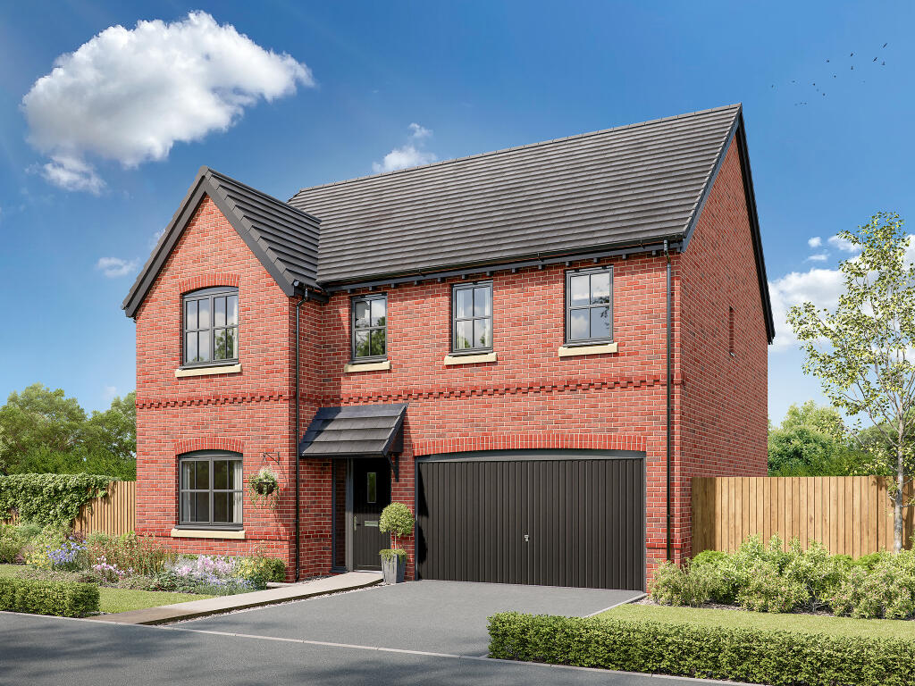
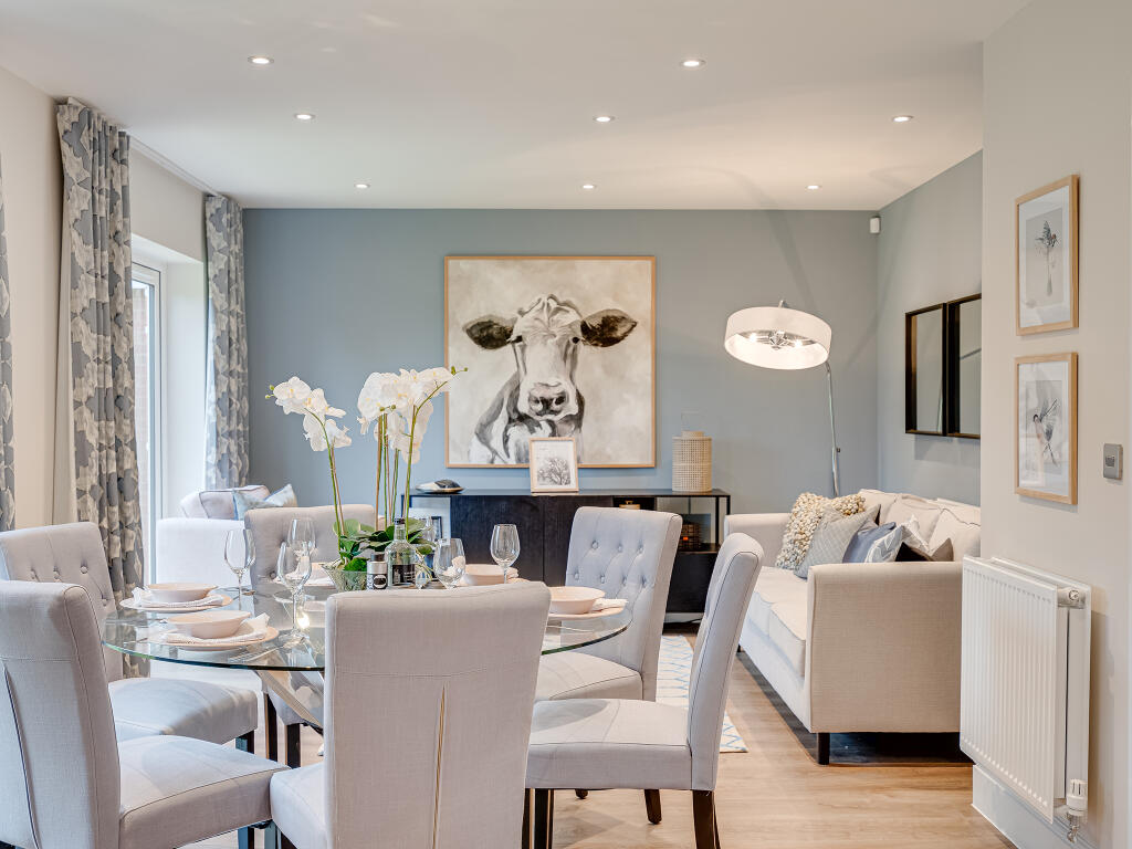
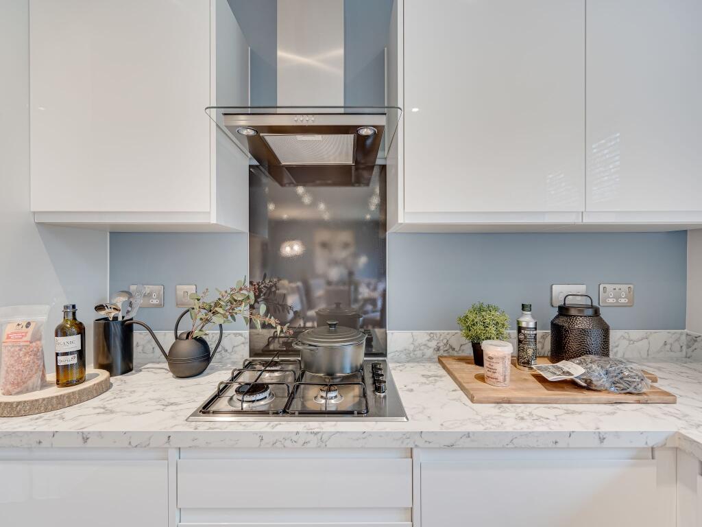
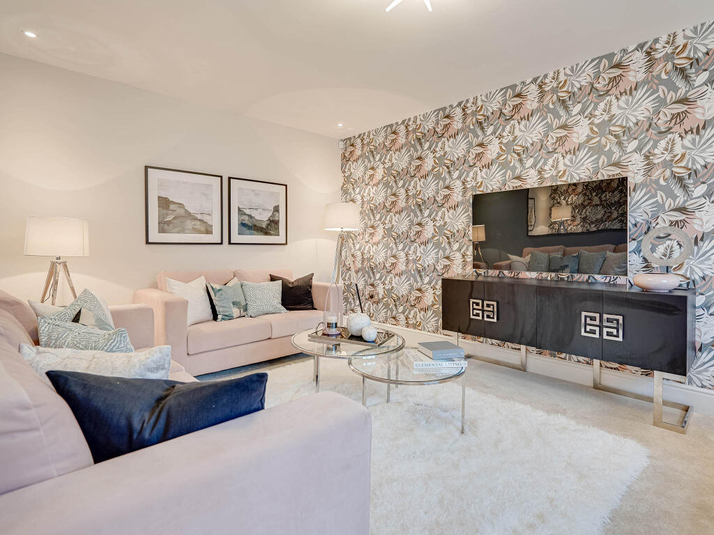
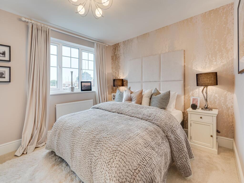
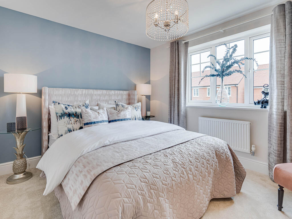
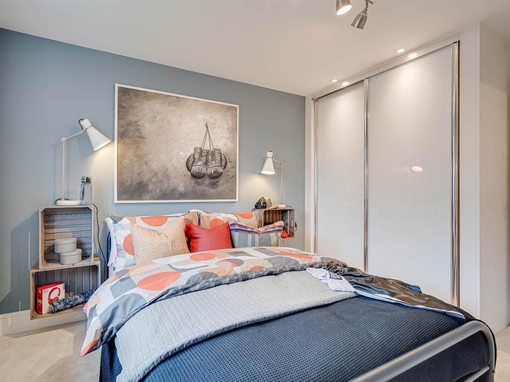
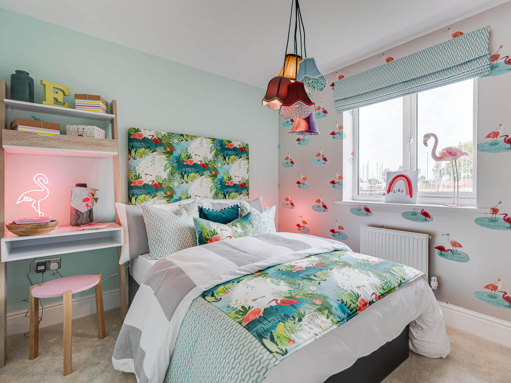
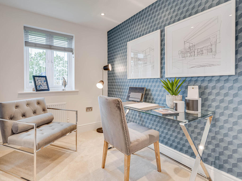
Photo 1 Photo 2 Photo 3 Photo 4 Photo 5 Photo 6 Photo 7 Photo 8 Photo 9
/ 9
Property details
Tenure
FREEHOLD
Floor area
139 m²
Last sold
£379,950 Jun 2024
Local average
£336,384 (+39.7%)
Street crime
41 incidents within 1 mile (Apr 2026)
Key features
- Open plan kitchen/dining/family room with bi-fold doors
- Dressing room to bedroom 1
- Double garage
- En suite to bedrooms 1 and 2
- Utility room with outside access
- Downstairs WC
- Energy efficient
Additional details
- Parking
- Yes
- Garden
- Yes
Description
Additional Information
Tenure: FreeholdCouncil tax band: Not made available by local authority until post-occupation
Parking - Double Garage
Room Dimensions
Ground Floor
Kitchen/Dining/Snug - 10.63 x 4.16 metreLiving room - 5.16 x 3.39 metreGround Floor 3D
First Floor
Bedroom 1 - 5.01 x 3.12 metreBedroom 2 - 4.67 x 2.96 metreBedroom 3 - 4.1 x 3.01 metreBedroom 4 - 3.39 x 3.34 metreBedroom 5 - 2.96 x 2.71 metreFirst Floor 3D
Listed by
Fairway View Phase 2
Persimmon Homes PLC
Reference: 174267305
EPC Rating & Upgrade Cost
Fetching EPC data… Refresh this page in a moment.
Flood risk
Zone: 1
Risk: Low
Job (default Low)
Floorplans
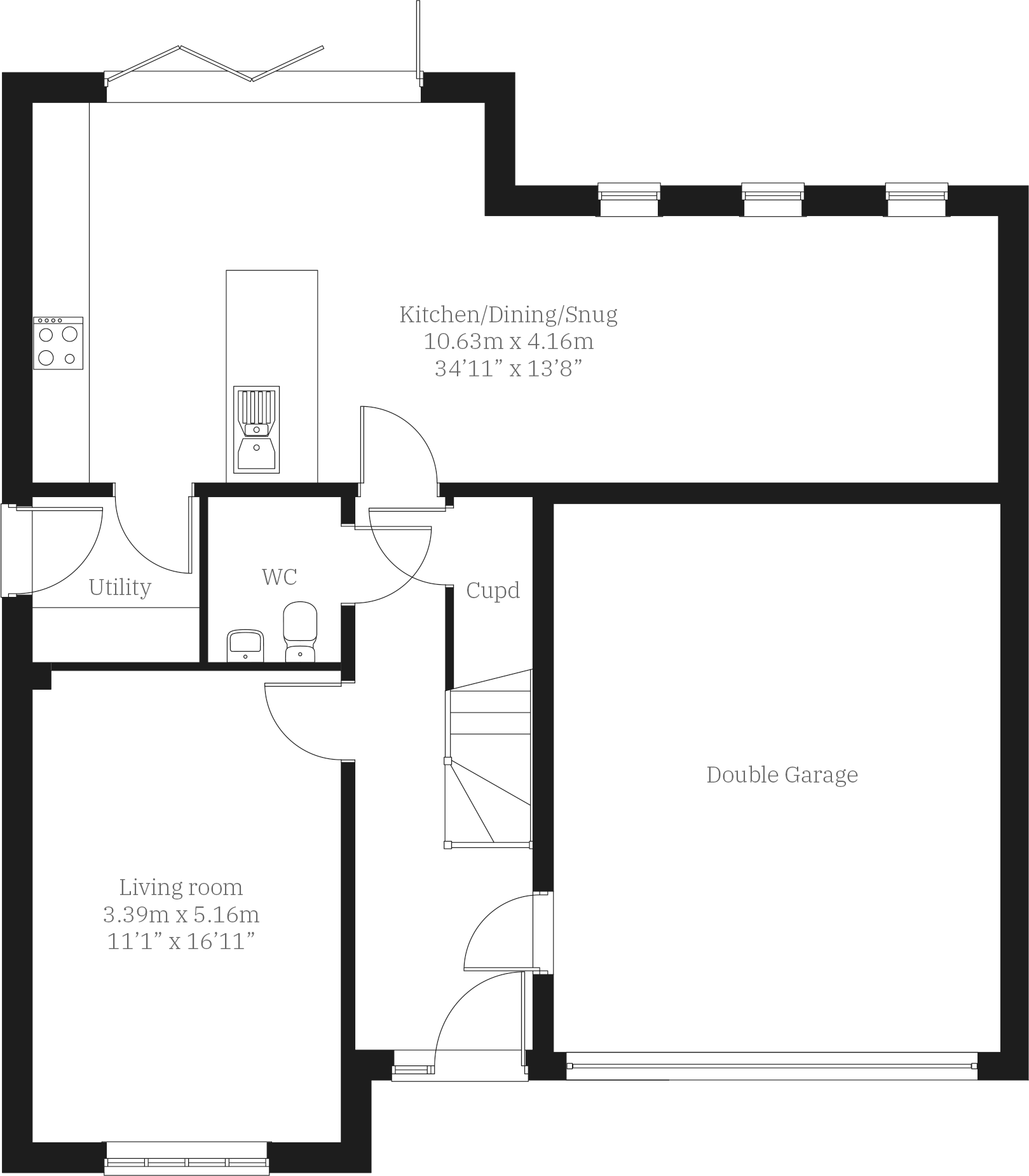
Ground Floor
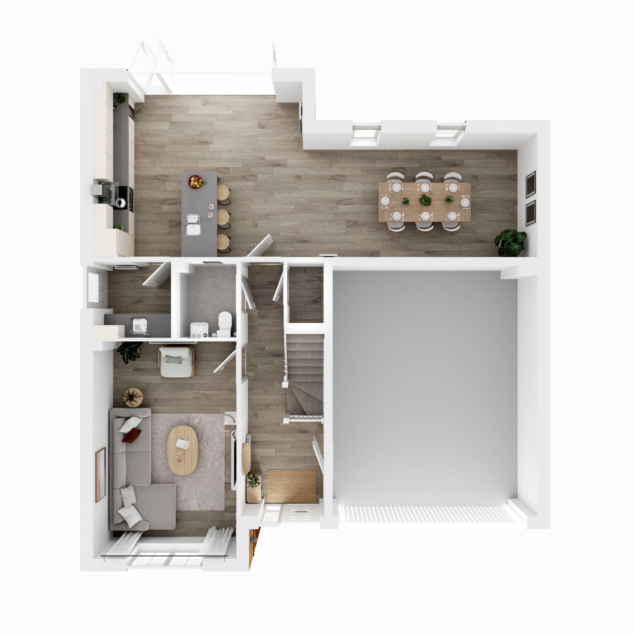
Ground Floor 3D
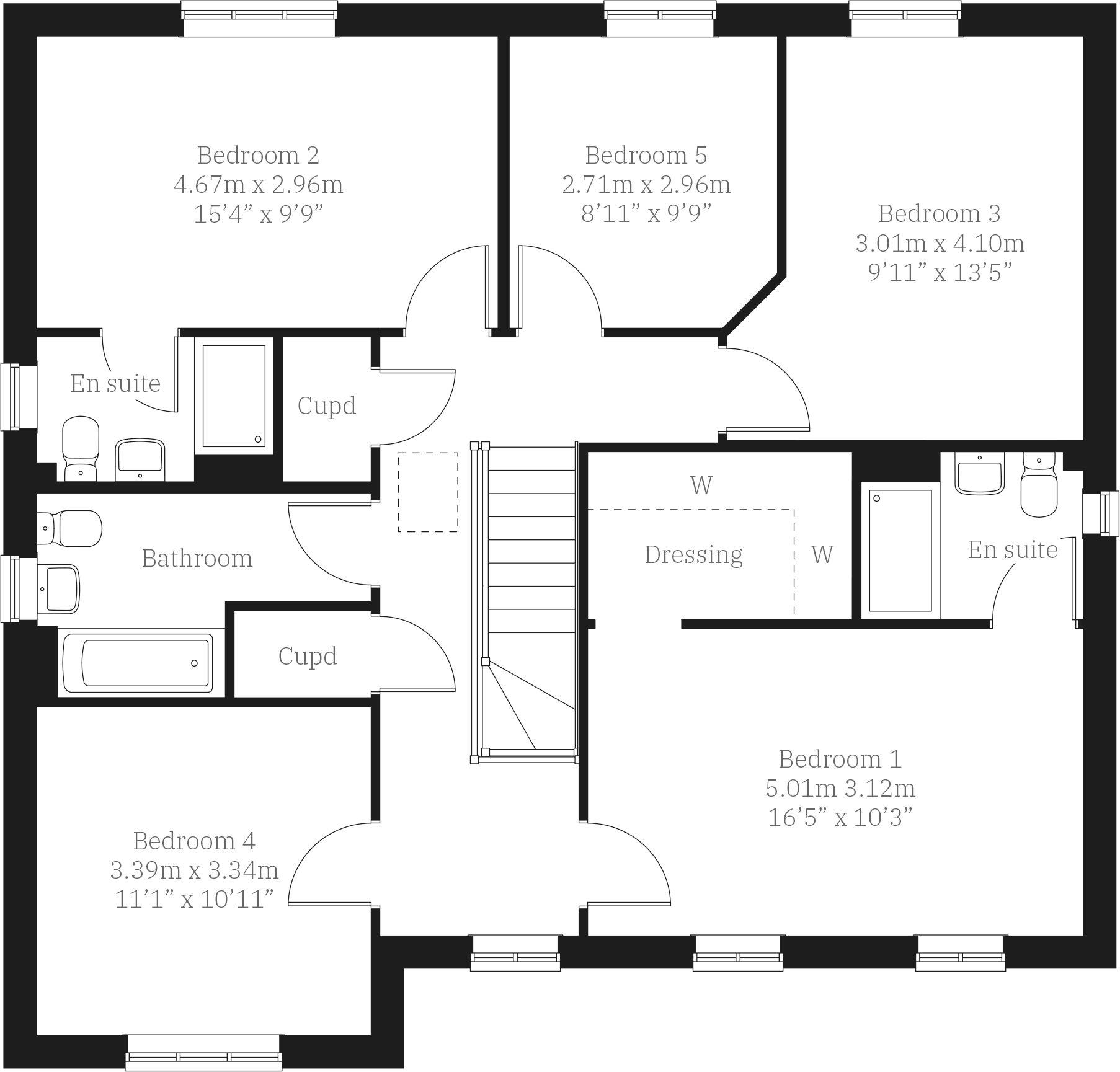
First Floor
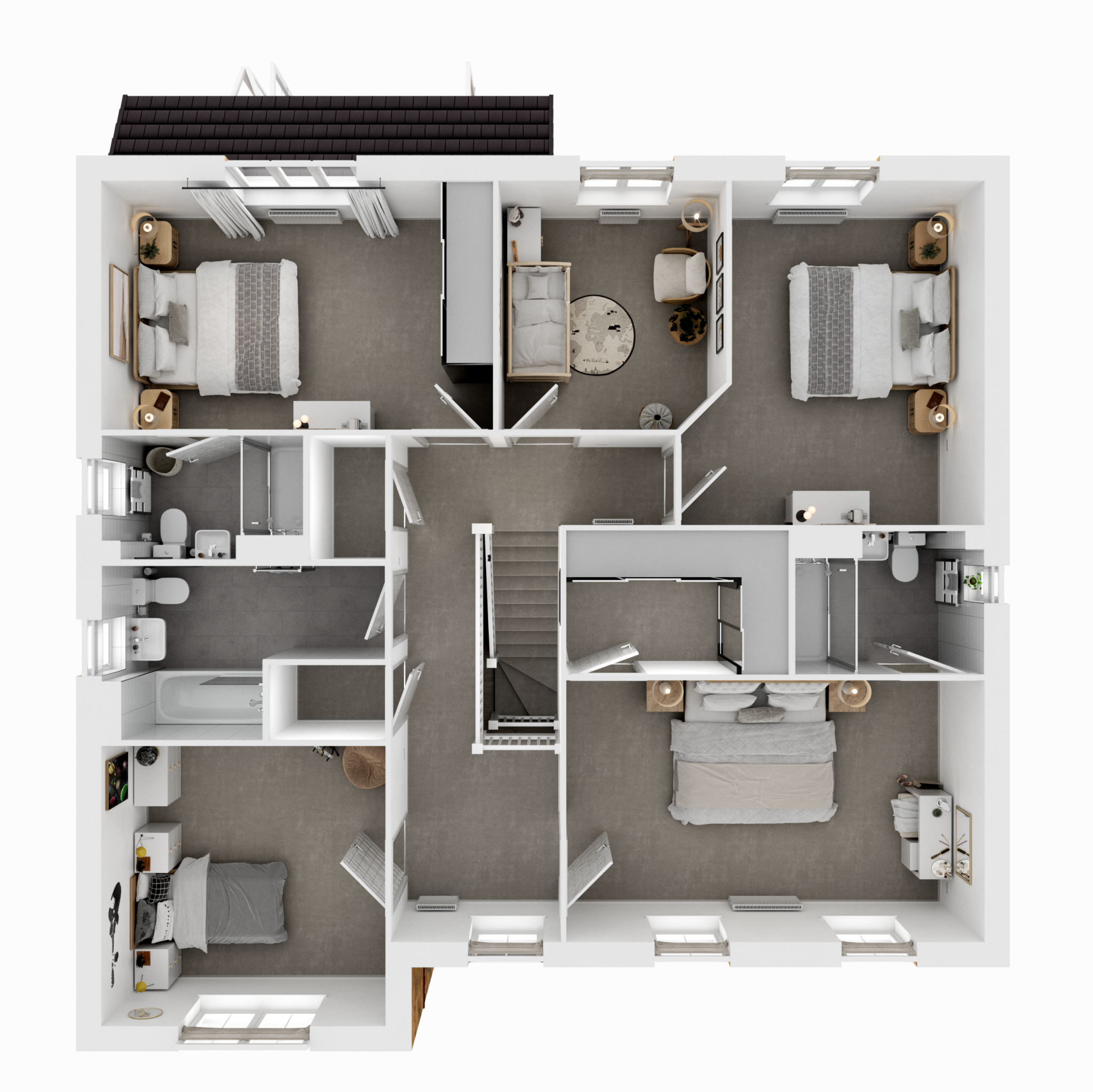
First Floor 3D
Price history
| Event | Date | Price | % change |
|---|---|---|---|
| Sold | 28/06/2024 (1 year ago) | £379,950 | — |
Source: HM Land Registry Price Paid Data. Crown copyright.
Sold Comparables
Sold comparables data is not available for this property.
Capital growth trend
Land Registry outcode average: last 12 months vs 5y and 10y ago (from sold prices).
House Price Index (HM Land Registry — official index, not sold-price averages): North East. Series: Detached. As of March 2026.
Rental Range
Estimated market rent for North East. Low = conservative, Realistic = average, Optimistic = best case.
Based on Postcode area NE → North East.
LHA (30th percentile) floor for Northumberland: £758/mo (Apr 2025 – Mar 2026)
Location
Nearby
Nearest stations, universities and amenities (distance from property).
| Type | Name | Distance |
|---|---|---|
| Bus stop | Unknown | 0.3 miles |
| Shop | Cramlington Ford | 0.6 miles |
| Train station | Cramlington | 0.9 miles |
| Shop | City Electrical Factors | 1.1 miles |
| Train station | Seaton Delaval | 3.2 miles |
| Hospital | The Rutherford Cancer Centre North East | 5.4 miles |
| University | Northumbria University Coach Lane Campus | 5.5 miles |
| University | Blyth Marine Station | 5.6 miles |
| Hospital | Wansbeck General Hospital | 7.7 miles |
Street-level crime
| Category | Count |
|---|---|
| Anti-social behaviour | 10 |
| Violence and sexual offences | 9 |
| Criminal damage and arson | 5 |
| Vehicle crime | 4 |
| Burglary | 3 |
| Public order | 3 |
| Shoplifting | 3 |
| Other crime | 1 |
| Other theft | 1 |
| Possession of weapons | 1 |
| Theft from the person | 1 |
| Total incidents | 41 |
Within 1 mile during Apr 2026. Source: data.police.uk (England & Wales).
Schools nearby
Nearest open schools with Ofsted ratings (England). Closed schools are not shown. Data from Get Information about Schools and Ofsted.
| Name | Type | Distance | Ofsted |
|---|---|---|---|
| Beaconhill Community Primary School | Primary | 0.6 miles | Good — 7 Nov 2011 |
| Cramlington Learning Village | Secondary | 1.1 miles | Good — 23 Feb 2017 |
| Hareside Primary School | Primary | 1.1 miles | Good — 16 Jan 2018 |
| Ss Peter and Paul's Catholic Primary Academy | Primary | 1.4 miles | Good — 21 Nov 2023 |
| Cramlington Shanklea Primary School | Primary | 1.5 miles | Good — 11 Nov 2013 |
Rental Comparables
Loading rental comparables for this postcode. Refresh in a few minutes.
Rent-driven metrics
Based on Area rent estimate.
- Rent ratio — Monthly rent ÷ purchase price (1% rule). 1%+ = strong, 0.8–1% = okay, <0.8% = weak for cashflow.
- Max investor price — Rent ÷ 0.8%; the price at which rent would be 0.8% of price (Stoke-style target).
- Target investor price — Rent ÷ 1%; the price at which rent would be 1% of price (strong cashflow band).
- Gross yield — Annual rent as % of purchase price (no costs).