Millbank Crescent
Bedlington, Northumberland, NE22 5QJ
£85,000


Photo 1 Photo 2 Photo 3 Photo 4 Photo 5 Photo 6 Photo 7 Photo 8 Photo 9 Photo 10 Photo 11 Photo 12 Photo 13
/ 13
Property details
Tenure
LEASEHOLD
Council tax band
A
Last sold
£73,000
Local average
£79,214 (+7.3%)
Deprivation
Decile 4 (12,076 of 33,755)
Street crime
101 incidents within 1 mile (Mar 2026)
Key features
- Upper Flat
- Three Double Bedrooms
- Very Well Presented
- Previously Used As AirB&B
Additional details
- Heating
- Gas
- Parking
- On street
Description
Offered to the market for sale is this spacious three bedroom first floor flat located in Bedlington, Northumberland. An ideal family home, first time buyer or investment property. Close to all local amenities to include shops, pubs, restaurants, schools, health centers, library, dentists & leisure facilities and transport links; making for the ideal family home. Good transport links with easy access to the A189, Newcastle, Blyth, Morpeth, Ashington, the Northumberland Coast & surrounding areas. Ideal location for commuters.
Briefly comprises of; Entrance hallway, Spacious first floor landing, three double bedrooms, Lounge, Kitchen, Bathroom.
Must be viewed to appreciate overall standard and quality this lovely flat has to offer.
Council Tax Band: A
Tenure: Leasehold
Length Of Lease: 999 from 1998
Listed by
Blyth
Pattinson Estate Agents
Reference: 146932400
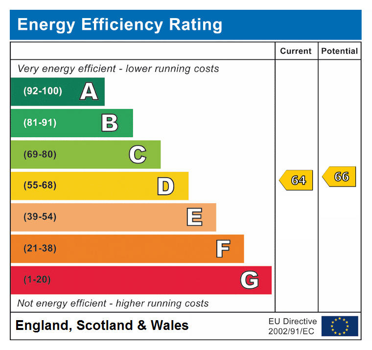
EPC ratings on this postcode
We don't have a matched EPC for this property yet. Below are efficiency scores and details for other addresses on this postcode.
| Address | Current | Potential | Floor area | Age band | Type |
|---|---|---|---|---|---|
| 1, Millbank Crescent, BEDLINGTON | 61 | 77 | 199 m² | England and Wales: 1900-1929 | Terraced |
| 1, Millbank Crescent, BEDLINGTON | 47 | 68 | 196 m² | England and Wales: 1900-1929 | Terraced |
| 11, Millbank Crescent, BEDLINGTON | 67 | 84 | 95 m² | England and Wales: 1930-1949 | Terraced |
| 15 Millbank Crescent, BEDLINGTON | 74 | 76 | 70 m² | England and Wales: 1900-1929 | Flat |
| 17 MILLBANK CRESCENT, BEDLINGTON | 73 | 77 | 75 m² | England and Wales: 1930-1949 | Flat |
| 18 MILLBANK CRESCENT, BEDLINGTON, BEDLINGTON | 74 | 77 | 74 m² | England and Wales: 1900-1929 | Flat |
| 19 MILLBANK CRESCENT, BEDLINGTON, BEDLINGTON | 59 | 75 | 73 m² | England and Wales: 1900-1929 | Flat |
| 20, Millbank Crescent, BEDLINGTON | 70 | 75 | 79 m² | England and Wales: 1900-1929 | Flat |
| 21 MILLBANK CRESCENT, BEDLINGTON | 66 | 77 | 71 m² | England and Wales: 1930-1949 | Flat |
| 3 Millbank Crescent, BEDLINGTON | 57 | 61 | 72 m² | England and Wales: 1900-1929 | Flat |
| 4, Millbank Crescent, BEDLINGTON | 66 | 75 | 73 m² | England and Wales: 1900-1929 | Flat |
| 6 Millbank Crescent, BEDLINGTON | 73 | 76 | 67 m² | England and Wales: 1900-1929 | Flat |
| 6, Millbank Crescent, BEDLINGTON | 45 | 75 | 81 m² | England and Wales: before 1900 | Flat |
| 6, Millbank Crescent, BEDLINGTON | 49 | 76 | 68 m² | England and Wales: 1900-1929 | Flat |
| 7 Millbank Crescent, BEDLINGTON | 64 | 78 | 77 m² | England and Wales: 1900-1929 | Flat |
Flood risk
Zone: 1
Risk: Low
Job (default Low)
EPC Graphs
EPC
Price history
46% since 2018
| Event | Date | Price | % change |
|---|---|---|---|
| Sold | 01/01/2023 (3 years ago) | £73,000 | +46% |
| Sold | 01/01/2018 (8 years ago) | £50,000 | — |
Source: HM Land Registry Price Paid Data. Crown copyright.
Sold Comparables
Same street and nearby sales within 0.25 miles (last 5 years). Data from Land Registry Price Paid.
| Address | Price | Date | Type |
|---|---|---|---|
| 29 SEATON AVENUE, BEDLINGTON, NORTHUMBERLAND, NE22 5AY | £35,000 | 16/12/2025 | Flat |
| 30 LILY AVENUE, BEDLINGTON, NORTHUMBERLAND, NE22 5BB | £64,950 | 15/09/2023 | Flat |
| Same street 8 MILLBANK CRESCENT, BEDLINGTON, NORTHUMBERLAND, NE22 5QJ | £75,000 | 06/03/2023 | Terraced |
| 36 LILY AVENUE, BEDLINGTON, NORTHUMBERLAND, NE22 5BB | £60,060 | 16/12/2022 | Flat |
| 5A GLADSTONE TERRACE, BEDLINGTON, NORTHUMBERLAND, NE22 5DB | £59,000 | 26/08/2022 | Flat |
| 3 ALFRED AVENUE, BEDLINGTON, NORTHUMBERLAND, NE22 5AZ | £46,000 | 12/07/2022 | Flat |
| 37 ALFRED AVENUE, BEDLINGTON, NORTHUMBERLAND, NE22 5AZ | £90,000 | 11/07/2022 | Flat |
| 4 LILY AVENUE, BEDLINGTON, NORTHUMBERLAND, NE22 5BB | £63,000 | 22/06/2022 | Flat |
| 19 LILY AVENUE, BEDLINGTON, NORTHUMBERLAND, NE22 5BB | £56,500 | 25/03/2022 | Flat |
| 20 ALFRED AVENUE, BEDLINGTON, NORTHUMBERLAND, NE22 5AZ | £68,500 | 23/03/2022 | Flat |
| Same street 16 MILLBANK CRESCENT, BEDLINGTON, NORTHUMBERLAND, NE22 5QJ | £72,000 | 26/01/2022 | Other |
| Same street 17 MILLBANK CRESCENT, BEDLINGTON, NORTHUMBERLAND, NE22 5QJ | £72,000 | 26/01/2022 | Other |
| 6 GORDON TERRACE, BEDLINGTON, NORTHUMBERLAND, NE22 5DE | £45,500 | 20/01/2022 | Flat |
| 25 LILY AVENUE, BEDLINGTON, NORTHUMBERLAND, NE22 5BB | £50,000 | 10/12/2021 | Flat |
| 38 ROSALIND AVENUE, BEDLINGTON, NORTHUMBERLAND, NE22 5BA | £60,000 | 22/10/2021 | Flat |
| Same street 18 MILLBANK CRESCENT, BEDLINGTON, NORTHUMBERLAND, NE22 5QJ | £120,000 | 08/10/2021 | Terraced |
| 22A ALLGOOD TERRACE, BEDLINGTON, NORTHUMBERLAND, NE22 5QX | £50,000 | 01/07/2021 | Flat |
Street average: £84,750 (4 sales)
Area average: £57,578 (13 sales)
Capital growth trend
Land Registry outcode average: last 12 months vs 5y and 10y ago (from sold prices).
House Price Index (HM Land Registry — official index, not sold-price averages): Northumberland. Series: Flats and maisonettes. As of March 2026.
Rental Range
Estimated market rent for Northumberland. Low = conservative, Realistic = average, Optimistic = best case.
Based on Local Authority from postcode lookup → Northumberland.
LHA (30th percentile) floor for Northumberland: £529/mo (Apr 2025 – Mar 2026)
Location
Nearby
Nearest stations, universities and amenities (distance from property).
| Type | Name | Distance |
|---|---|---|
| Bus stop | Beech Grove | 0.1 miles |
| Shop | Hair @ Zincaba | 0.2 miles |
| Shop | Vulcan Place Garage | 0.2 miles |
| Train station | Bedlington | 0.9 miles |
| Train station | Blyth Bebside | 1.3 miles |
| University | Blyth Marine Station | 3.6 miles |
| Hospital | St George's Hospital | 4.9 miles |
| Hospital | Northgate Hospital | 6.0 miles |
| University | Newcastle University | 10.8 miles |
Street-level crime
| Category | Count |
|---|---|
| Violence and sexual offences | 33 |
| Anti-social behaviour | 22 |
| Shoplifting | 17 |
| Criminal damage and arson | 11 |
| Burglary | 3 |
| Drugs | 3 |
| Other theft | 3 |
| Other crime | 2 |
| Public order | 2 |
| Theft from the person | 2 |
| Vehicle crime | 2 |
| Robbery | 1 |
| Total incidents | 101 |
Within 1 mile during Mar 2026. Source: data.police.uk (England & Wales).
Schools nearby
Nearest open schools with Ofsted ratings (England). Closed schools are not shown. Data from Get Information about Schools and Ofsted.
| Name | Type | Distance | Ofsted |
|---|---|---|---|
| Bedlington Whitley Memorial Church of England Primary School | Primary | 0.2 miles | Requires improvement — 4 Feb 2024 |
| Stead Lane Primary School | Primary | 0.5 miles | Good — 13 Jul 2023 |
| Bedlington West End Primary School | Primary | 0.6 miles | Good — 24 Apr 2024 |
| St Bede's Catholic Primary School | Primary | 0.7 miles | Requires improvement — 14 Dec 2023 |
| St Benet Biscop Catholic Academy | Secondary | 0.7 miles | Good — 8 Mar 2023 |
Rental Comparables
Rental listings exist nearby, but none matched the 3-bedroom count for this property.
Rent-driven metrics
Based on Area rent estimate.
- This street — Gross yield for this street only (Land Registry sales + rental comparables, same postcode + street).
- Rent ratio — Monthly rent ÷ purchase price (1% rule). 1%+ = strong, 0.8–1% = okay, <0.8% = weak for cashflow.
- Max investor price — Rent ÷ 0.8%; the price at which rent would be 0.8% of price (Stoke-style target).
- Target investor price — Rent ÷ 1%; the price at which rent would be 1% of price (strong cashflow band).
- Gross yield — Annual rent as % of purchase price (no costs).
Enter House Number
Enter the house number to help us retrieve more accurate pricing history and property data.
Please log in to submit or correct the house number for this listing.
Log in to continue