Flat 4
THE GRANGE, 506, OLD CHESTER ROAD, BIRKENHEAD, MERSEYSIDE CH42 4PE
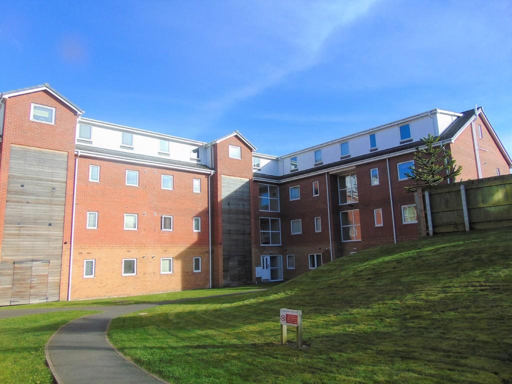
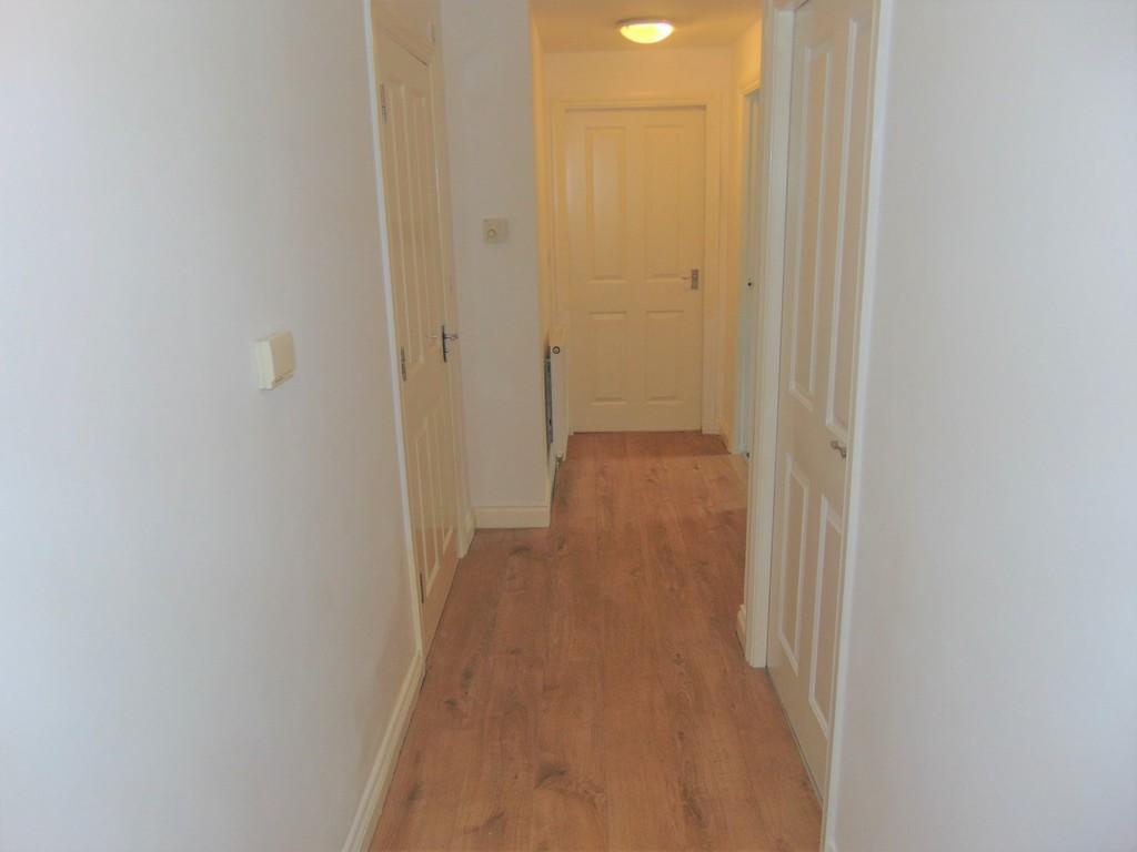
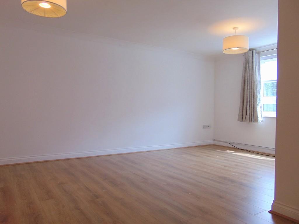
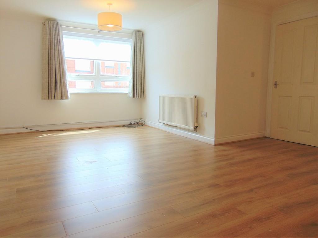
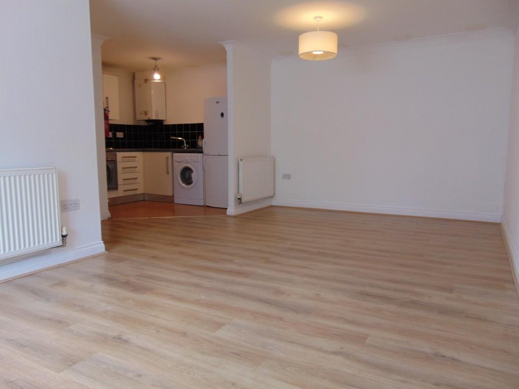
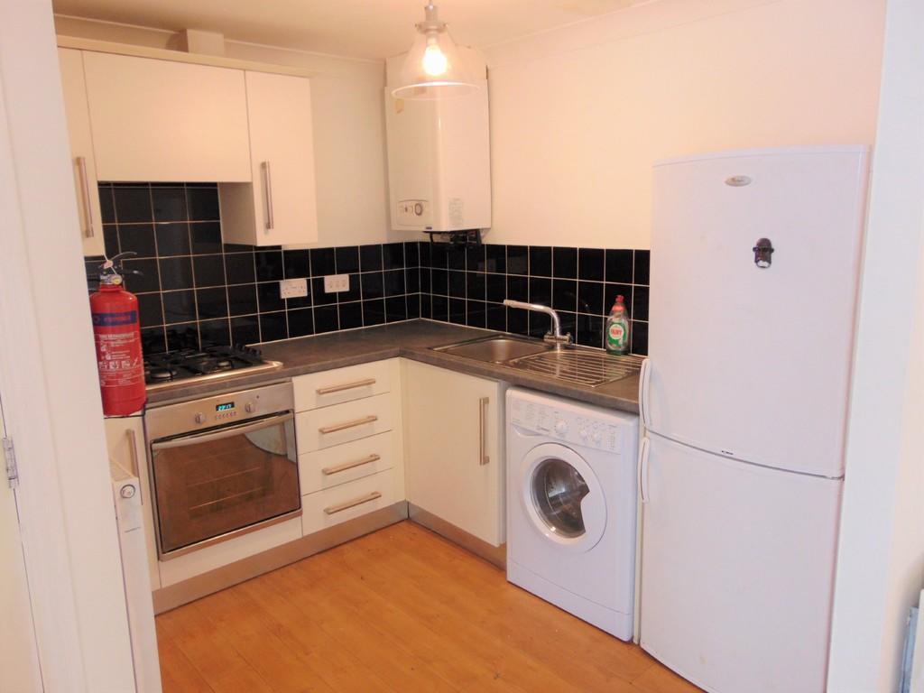
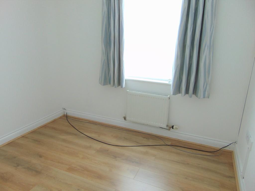
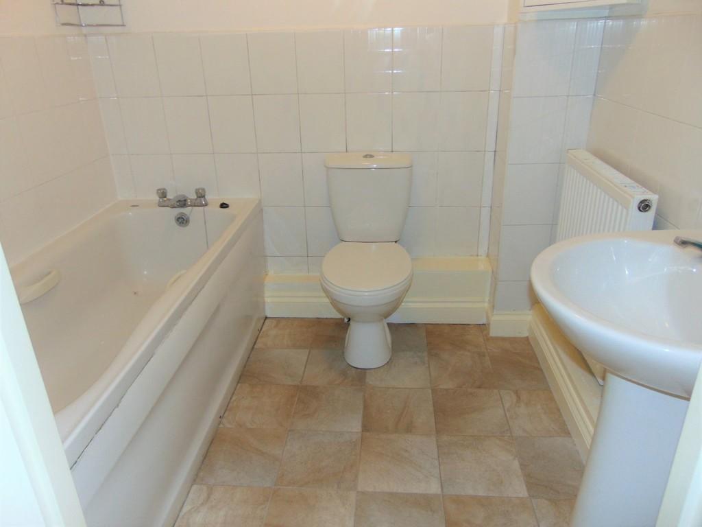
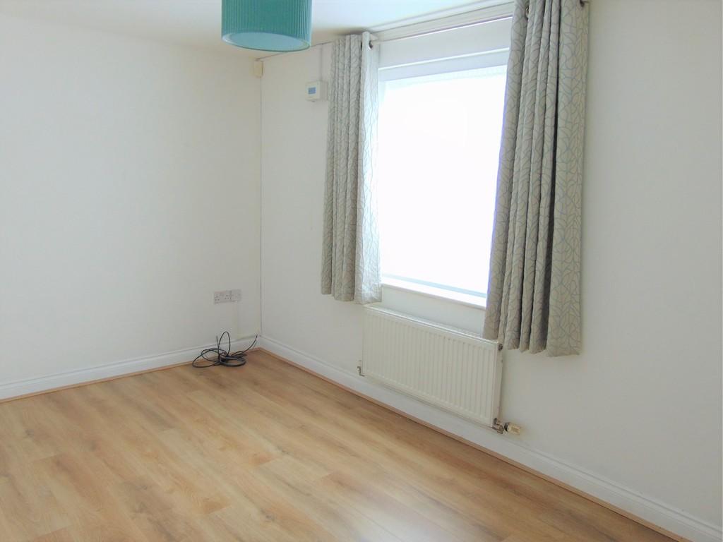
Photo 1 Photo 2 Photo 3 Photo 4 Photo 5 Photo 6 Photo 7 Photo 8 Photo 9
/ 9
Property details
Tenure
LEASEHOLD
Last sold
£56,500 Aug 2018
Local average
£92,271 (-40.4%)
Deprivation
Decile 1 (2,271 of 33,755)
Street crime
254 incidents within 1 mile (Apr 2026)
Key features
- Ground floor two bedroom apartment
- Large lounge
- Fully fitted kitchen with white goods
- Family bathroom with shower over bath
- Council tax Band A
- Fitted carpets throughout
- Vertical blinds throughout
- Gas central heating with combi boiler
- Ample car parking
Additional details
- Parking
- Yes, Off street
- Garden
- Yes
Description
Listed by
Wirral Bebington
The Property Franchise Group
Reference: 70346366
EPC ratings on this postcode
We don't have a matched EPC for this property yet. Below are efficiency scores and details for other addresses on this postcode.
| Address | Current | Potential | Floor area | Age band | Type |
|---|---|---|---|---|---|
| 486a Old Chester Road, ROCK FERRY | 77 | 79 | 53 m² | England and Wales: 1900-1929 | Flat |
| 486b Old Chester Road, ROCK FERRY | 79 | 79 | 57 m² | England and Wales: 1900-1929 | Flat |
| Flat 1 The Grange, 506, Old Chester Road, BIRKENHEAD | 77 | 91 | 56 m² | England and Wales: 2007-2011 | Detached |
| Flat 1, The Grange, 506 Old Chester Road, BIRKENHEAD | 78 | 93 | 57 m² | England and Wales: 2007-2011 | Detached |
| Flat 10 The Grange, 506, Old Chester Road, BIRKENHEAD | 82 | 82 | 60 m² | England and Wales: 2007-2011 | Flat |
| Flat 11 The Grange, 506, Old Chester Road, BIRKENHEAD | 81 | 82 | 61 m² | England and Wales: 2003-2006 | Flat |
| Flat 12 The Grange, 506, Old Chester Road, BIRKENHEAD | 81 | 81 | 57 m² | England and Wales: 1996-2002 | Flat |
| Flat 14 The Grange, 506, Old Chester Road, BIRKENHEAD | 79 | 79 | 61 m² | England and Wales: 2003-2006 | Flat |
| Flat 15 The Grange, 506, Old Chester Road, BIRKENHEAD | 81 | 81 | 59 m² | England and Wales: 2007-2011 | Flat |
| Flat 16 The Grange, 506, Old Chester Road, BIRKENHEAD | 79 | 79 | 57 m² | England and Wales: 2003-2006 | Flat |
| Flat 17 The Grange, 506, Old Chester Road, BIRKENHEAD | 80 | 82 | 59 m² | England and Wales: 2003-2006 | Flat |
| Flat 17, The Grange, BIRKENHEAD | 81 | 81 | 50 m² | England and Wales: 2003-2006 | Flat |
| Flat 19 The Grange, 506, Old Chester Road, BIRKENHEAD | 82 | 82 | 56 m² | England and Wales: 2007-2011 | Flat |
| Flat 2 The Grange, 506, Old Chester Road, BIRKENHEAD | 79 | 79 | 59 m² | England and Wales: 1996-2002 | Flat |
| Flat 2, 486 Old Chester Road, Birkenhead | 79 | 79 | 57 m² | England and Wales: 1900-1929 | Flat |
Flood risk
Zone: 1
Risk: Low
Job (default Low)
Price history
| Event | Date | Price | % change |
|---|---|---|---|
| Sold | 17/08/2018 (7 years ago) | £56,500 | — |
Source: HM Land Registry Price Paid Data. Crown copyright.
Sold Comparables
Same street and nearby sales within 0.25 miles (last 5 years). Data from Land Registry Price Paid.
| Address | Price | Date | Type |
|---|---|---|---|
| 22 FLAT 2 FARLOW ROAD, BIRKENHEAD, WIRRAL, MERSEYSIDE, CH42 4PL | £68,800 | 03/11/2025 | Flat |
| 53 EGERTON PARK, BIRKENHEAD, WIRRAL, MERSEYSIDE, CH42 4RD | £205,000 | 30/03/2023 | Flat |
| 36A HIGHFIELD CRESCENT, BIRKENHEAD, WIRRAL, MERSEYSIDE, CH42 2DR | £102,000 | 30/06/2022 | Flat |
| 8 DEVON GARDENS, BIRKENHEAD, WIRRAL, MERSEYSIDE, CH42 4RF | £85,000 | 29/06/2022 | Flat |
| 562A OLD CHESTER ROAD, BIRKENHEAD, WIRRAL, MERSEYSIDE, CH42 4PF | £45,625 | 13/06/2022 | Flat |
| Same street THE GRANGE, 506 FLAT 3 OLD CHESTER ROAD, BIRKENHEAD, WIRRAL, MERSEYSIDE, CH42 4PE | £61,000 | 29/04/2022 | Flat |
| SPENSER LODGE FLAT 13 SPENSER AVENUE, BIRKENHEAD, WIRRAL, MERSEYSIDE, CH42 2DW | £39,751 | 08/04/2022 | Flat |
| 78 FLAT D EGERTON PARK, BIRKENHEAD, WIRRAL, MERSEYSIDE, CH42 4RB | £110,000 | 04/01/2022 | Flat |
| 50A GREEN LAWN, BIRKENHEAD, WIRRAL, MERSEYSIDE, CH42 2DZ | £110,000 | 16/12/2021 | Flat |
| 55 FIRST FLOOR FLAT EGERTON PARK, BIRKENHEAD, WIRRAL, MERSEYSIDE, CH42 4RD | £99,000 | 02/11/2021 | Flat |
Street average: £61,000 (1 sale)
Area average: £96,131 (9 sales)
Capital growth trend
Land Registry outcode average: last 12 months vs 5y and 10y ago (from sold prices).
House Price Index (HM Land Registry — official index, not sold-price averages): Wirral. Series: Flats and maisonettes. As of March 2026.
Rental Range
Estimated market rent for Wirral. Low = conservative, Realistic = average, Optimistic = best case.
Based on Local Authority from postcode lookup → Wirral.
LHA (30th percentile) floor for Wirral: £524/mo (Apr 2025 – Mar 2026)
Location
Address
Birkett Road
Nearby
Nearest stations, universities and amenities (distance from property).
| Type | Name | Distance |
|---|---|---|
| Bus stop | OLD CHESTER RD/BIRKETT RD | 0.0 miles |
| Bus stop | Old Chester Rd/Green Lawn | 0.0 miles |
| Shop | Boilercare | 0.1 miles |
| Shop | The Wheelbase | 0.2 miles |
| Train station | Rock Ferry | 0.4 miles |
| Hospital | Parkfield Medical Centre | 0.7 miles |
| Train station | Bebington | 0.9 miles |
| Hospital | St Catherines | 0.9 miles |
| University | Liverpool Hope University - Aigburth Park | 2.7 miles |
| University | Liverpool Institute for Performing Arts | 2.8 miles |
Street-level crime
| Category | Count |
|---|---|
| Violence and sexual offences | 113 |
| Criminal damage and arson | 36 |
| Anti-social behaviour | 35 |
| Other theft | 18 |
| Public order | 18 |
| Drugs | 10 |
| Vehicle crime | 6 |
| Burglary | 5 |
| Shoplifting | 5 |
| Other crime | 4 |
| Bicycle theft | 2 |
| Possession of weapons | 2 |
| Total incidents | 254 |
Within 1 mile during Apr 2026. Source: data.police.uk (England & Wales).
Schools nearby
Nearest open schools with Ofsted ratings (England). Closed schools are not shown. Data from Get Information about Schools and Ofsted.
| Name | Type | Distance | Ofsted |
|---|---|---|---|
| St Anne's Catholic Primary School | Primary | 0.2 miles | Good — 11 Jul 2016 |
| Bedford Drive Primary School | Primary | 0.4 miles | Good — 16 Jan 2023 |
| Rock Ferry Primary School | Primary | 0.4 miles | Good — 20 Jun 2011 |
| Prenton High School for Girls | Secondary | 0.5 miles | Good — 6 May 2014 |
| Well Lane Primary School | Primary | 0.5 miles | Inadequate — 13 Sep 2023 |
Rental Comparables
Residential lets from OpenRent and Rightmove for the area (same bedroom count). Use to validate rent estimates. Student lets are excluded.
| Title | Rent | Beds | Distance | As seen on |
|---|---|---|---|---|
| 2 Bed Terraced House, Old Chester Road, CH42 | £995/mo | 2 | 0.1 miles | OpenRent |
| 2 Bed Terraced House, Beaconsfield Road, CH62 | £850/mo | 2 | 1.16 miles | OpenRent |
Average rent: £923/mo (2 listings)
Rent-driven metrics
Based on OpenRent comparables.
- This street — Gross yield for this street only (Land Registry sales + rental comparables, same postcode + street).
- Rent ratio — Monthly rent ÷ purchase price (1% rule). 1%+ = strong, 0.8–1% = okay, <0.8% = weak for cashflow.
- Max investor price — Rent ÷ 0.8%; the price at which rent would be 0.8% of price (Stoke-style target).
- Target investor price — Rent ÷ 1%; the price at which rent would be 1% of price (strong cashflow band).
- Gross yield — Annual rent as % of purchase price (no costs).
- Cost-to-rent — Price ÷ annual rent (from OpenRent comparables). Under 14× = strong, 14–16× = acceptable, 17×+ = compressed.
- Cashflow — Rent minus mortgage, 10% maintenance, £25/mo compliance. Assumes 75% LTV, 3.95% APR (5yr fixed), 25yr term.
- ROI — Annual profit ÷ cash in (deposit + 4% purchase costs).
Enter House Number
Enter the house number to help us retrieve more accurate pricing history and property data.
Please log in to submit or correct the house number for this listing.
Log in to continue