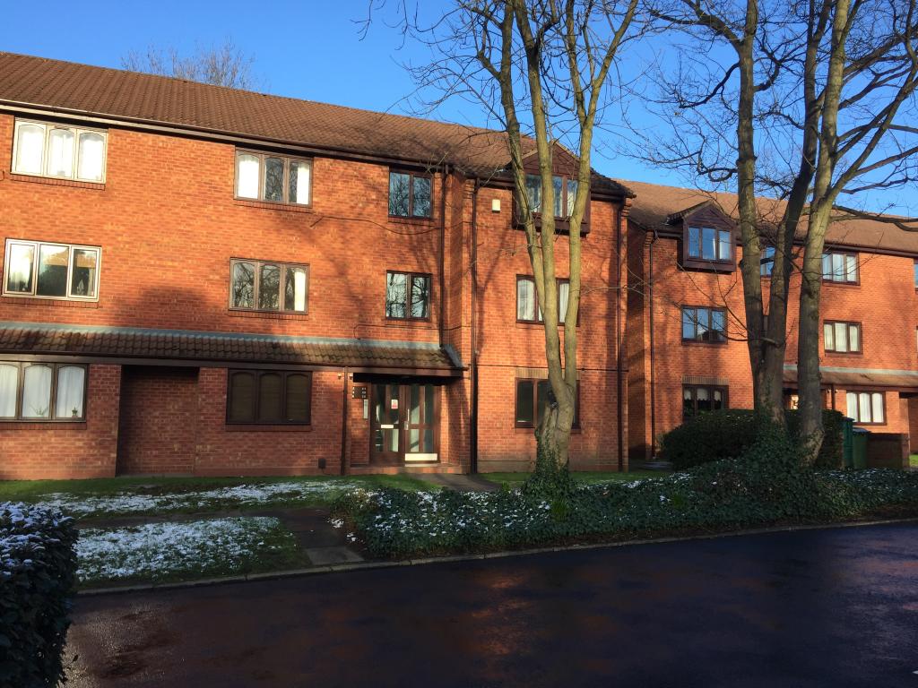
28 KNIGHTS CLOSE
BIRMINGHAM, WEST MIDLANDS B23 7NN
£650 pcm
Property details
Floor area
53 m²
EPC rating
E
Year built
England and Wales: 1991-1995
Deprivation
Decile 1 (907 of 33,755)
Street crime
493 incidents within 1 mile (Mar 2026)
Key features
- AVAILABLE END OF MARCH
- GROUND FLOOR APARTMENT
- SPACIOUS THROUGHOUT
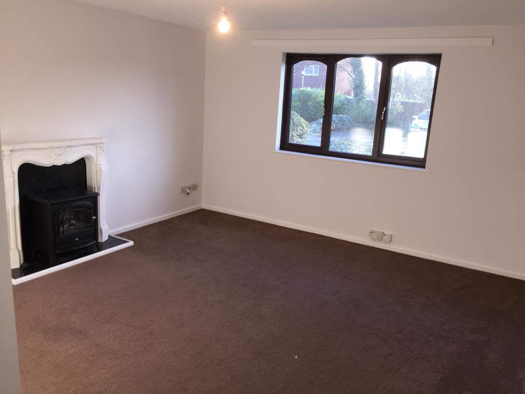
- LARGE RECEPTION ROOM
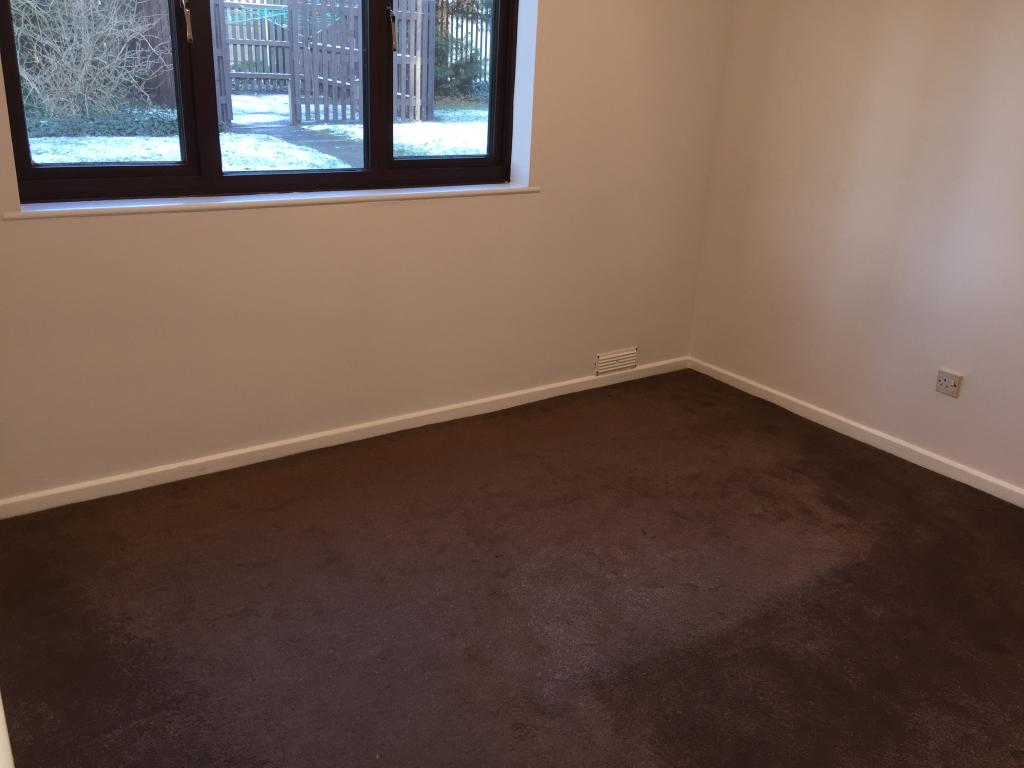
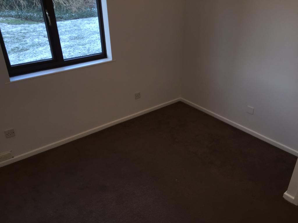
- TWO DOUBLE BEDROOMS
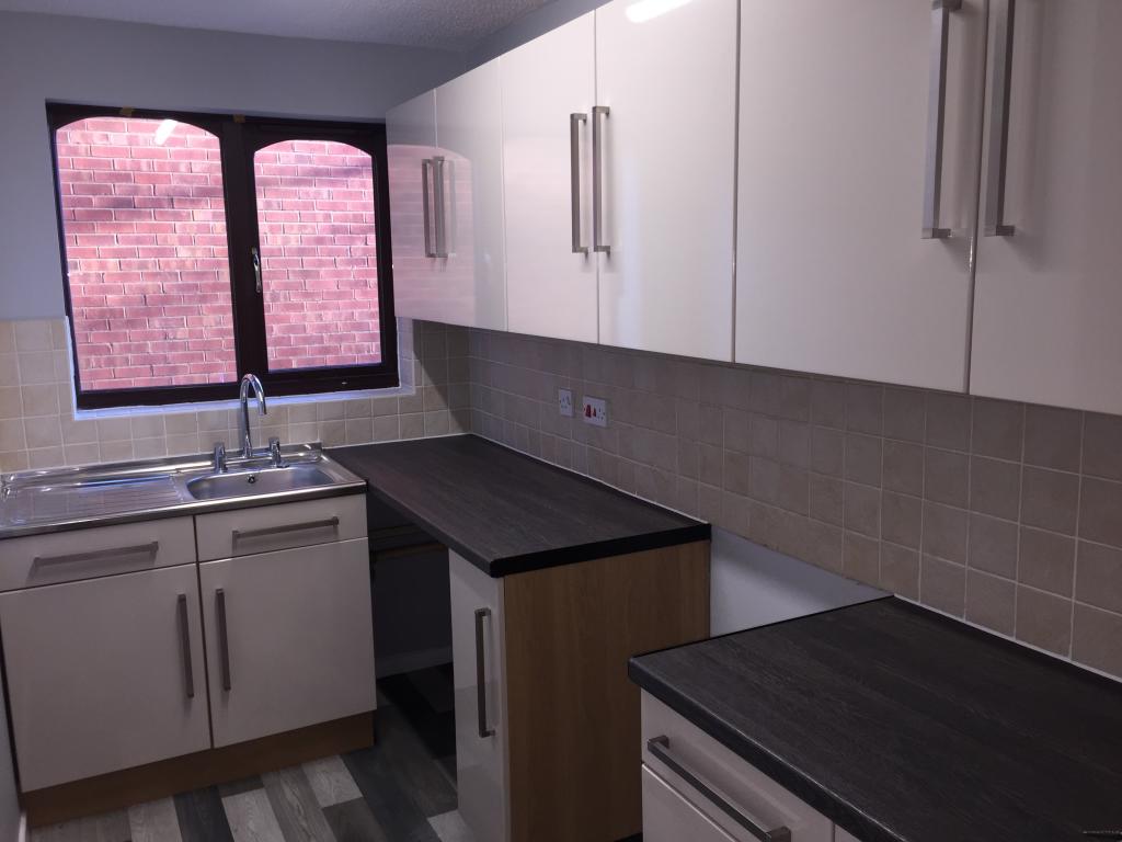
- WHITE GOODS WILL BE PROVIDED
- ALLOCATED PARKING
- CUL-DE-SAC
Additional details
- Parking
- Yes
Description
Close to good schools, motorway links, public transport and local amenities.
Benefits from an allocated parking space, central heating, new decor and a deep clean of the property throughout which has been finished to a high standard.
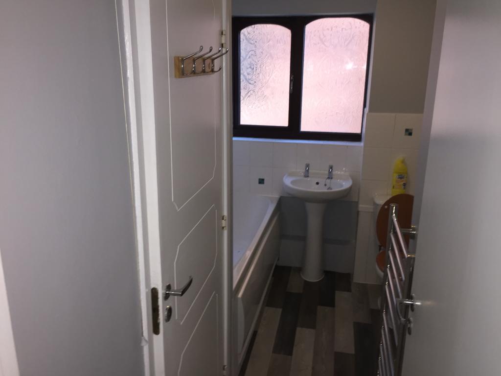
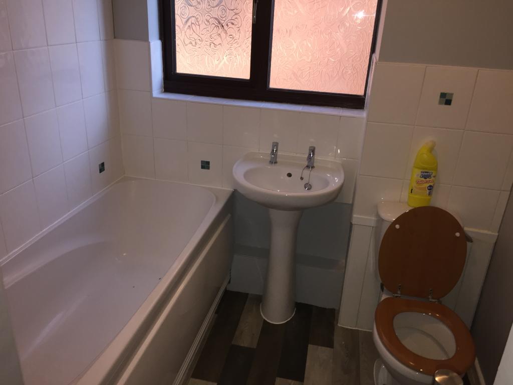
Boasts of an entrance hallway, two double bedrooms, modern fitted bathroom with over head shower and a large reception room with a modern fitted standard kitchen soon to include white goods.
Call branch today and secure your dream apartment. Once its gone...its gone! Do not miss out!
Listed by
Walsall
Countrywide UK Lettings - Connells
Reference: 103477184
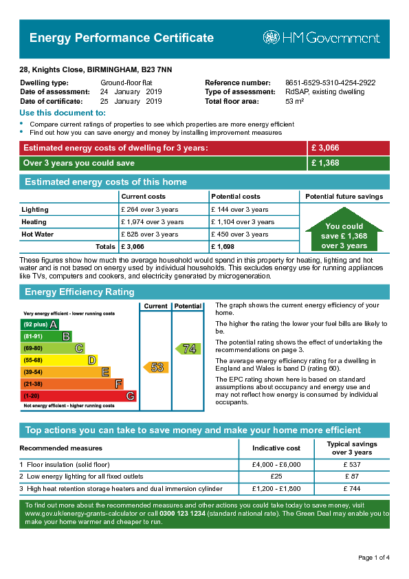
EPC Rating & Upgrade Cost
Current rating: E
Potential rating: C
Inspection date: 24/01/2019
Current heating cost: £658/year
Potential heating cost: £368/year
Recommendations
- Floor insulation (solid floor) (6,000)
- Low energy lighting for all fixed outlets (25)
- High heat retention storage heaters and dual immersion cylinder (1,800)
Flood risk
Zone: 2
Risk: In flood risk area
Environment Agency Flood Risk Areas (APSFR)
EPC Graphs
EPC Image
Rental Range
Estimated market rent for Birmingham. Low = conservative, Realistic = average, Optimistic = best case.
Based on Local Authority from postcode lookup → Birmingham.
LHA (30th percentile) floor for Birmingham: £748/mo (Apr 2025 – Mar 2026)
Location
Nearby
Nearest stations, universities and amenities (distance from property).
| Type | Name | Distance |
|---|---|---|
| Bus stop | Gravelly Hill North / Hunton Hill | 0.0 miles |
| Train station | Gravelly Hill | 0.1 miles |
| Shop | Unknown | 0.5 miles |
| Shop | Farmfoods | 0.6 miles |
| Train station | Erdington | 1.0 miles |
| University | Maryvale Institute | 2.9 miles |
| University | BIMM University Birmingham | 3.1 miles |
| Hospital | Brian Oliver Centre | 5.4 miles |
| Hospital | Sir Robert Peel Community Hospital | 9.0 miles |
Street-level crime
| Category | Count |
|---|---|
| Violence and sexual offences | 230 |
| Criminal damage and arson | 46 |
| Shoplifting | 33 |
| Other theft | 32 |
| Vehicle crime | 26 |
| Burglary | 24 |
| Drugs | 23 |
| Public order | 23 |
| Robbery | 16 |
| Possession of weapons | 15 |
| Other crime | 14 |
| Anti-social behaviour | 7 |
| Theft from the person | 3 |
| Bicycle theft | 1 |
| Total incidents | 493 |
Within 1 mile during Mar 2026. Source: data.police.uk (England & Wales).
Schools nearby
Nearest open schools with Ofsted ratings (England). Closed schools are not shown. Data from Get Information about Schools and Ofsted.
| Name | Type | Distance | Ofsted |
|---|---|---|---|
| Ss Mary & John Catholic Primary School | Primary | 0.1 miles | Good — 8 May 2023 |
| Slade Primary School | Primary | 0.4 miles | Good — 6 Jan 2019 |
| Queensbury School | Other | 0.4 miles | Good — 10 Jul 2023 |
| Oscott Manor School | Other | 0.5 miles | Inadequate — 8 Sep 2024 |
| Erdington Hall Primary School | Primary | 0.5 miles | Good — 24 Jun 2016 |
Rental Comparables
Residential lets from OpenRent and Rightmove for the area (same bedroom count). Use to validate rent estimates. Student lets are excluded.
| Title | Rent | Beds | Distance | As seen on |
|---|---|---|---|---|
| 2 Bed Flat, Erdington, B23 | £1,200/mo | 2 | 0.38 miles | OpenRent |
| 2 Bed Flat, Monastery Drive, B23 | £1,100/mo | 2 | 0.5 miles | OpenRent |
Average rent: £1,150/mo (2 listings)