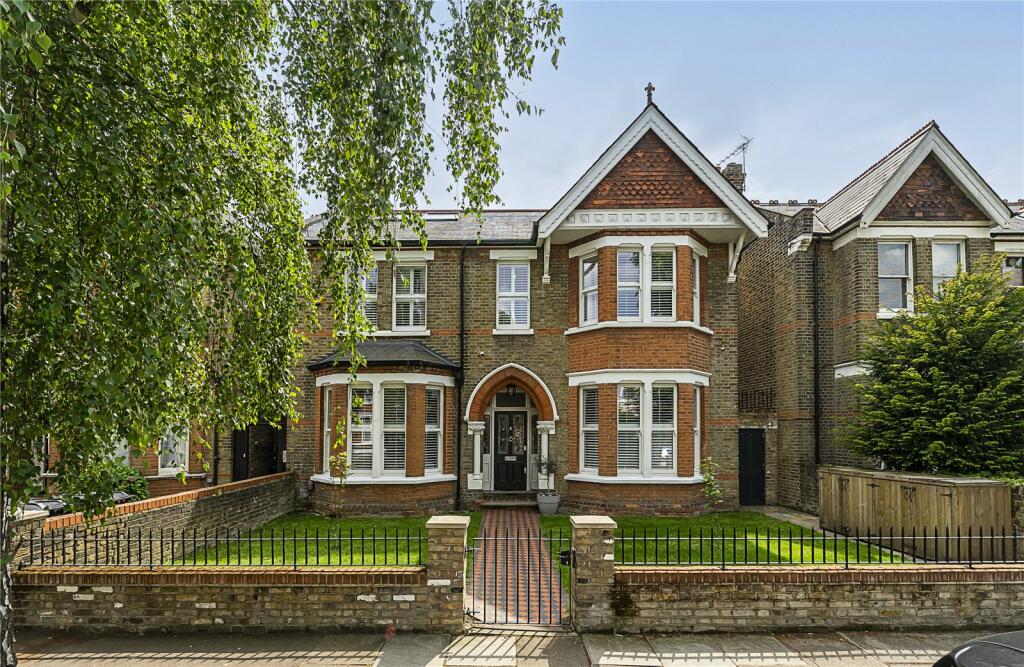
8 INGLIS ROAD
LONDON, GREATER LONDON W5 3RN

Property details
Tenure
FREEHOLD
Council tax band
G
Last sold
£2,457,500 Sep 2023
Local average
£1,772,569 (+46.7%)
Deprivation
Decile 4 (12,809 of 33,755)
Street crime
675 incidents within 1 mile (Apr 2026)
Key features
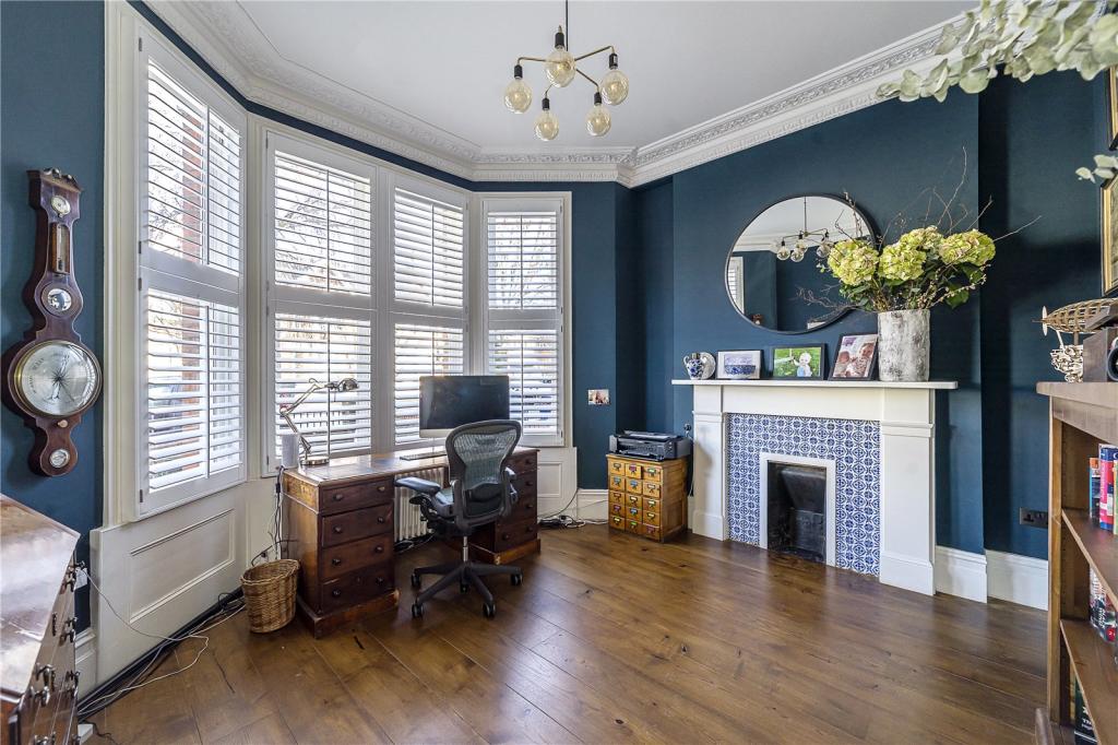
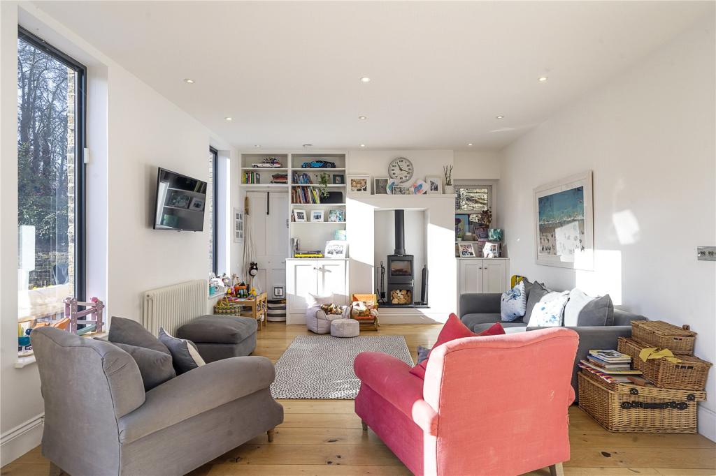
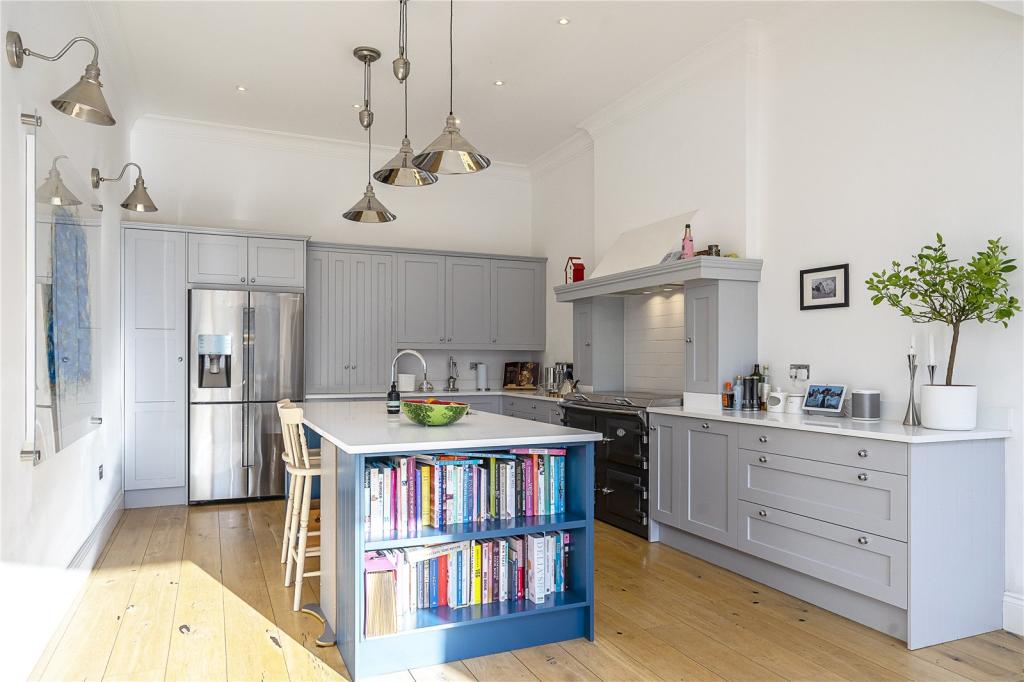
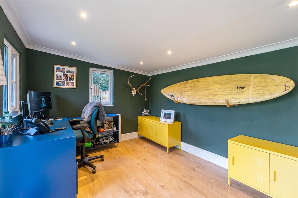
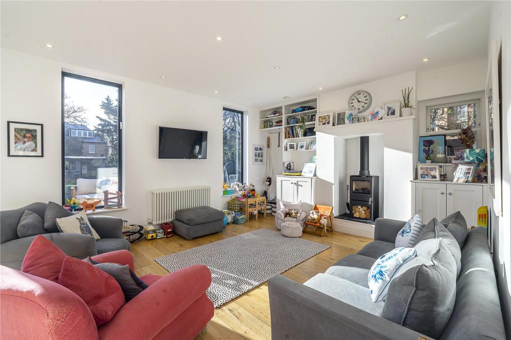
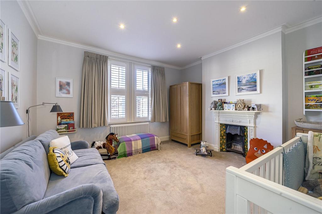
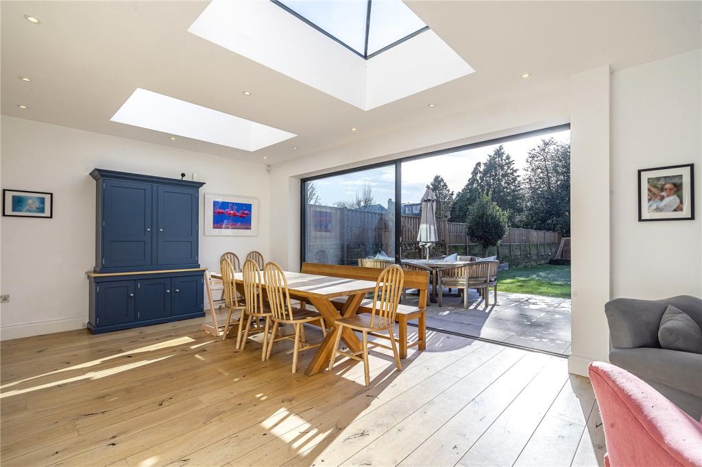
- Detached Double Fronted Family Home
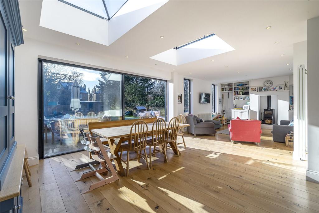
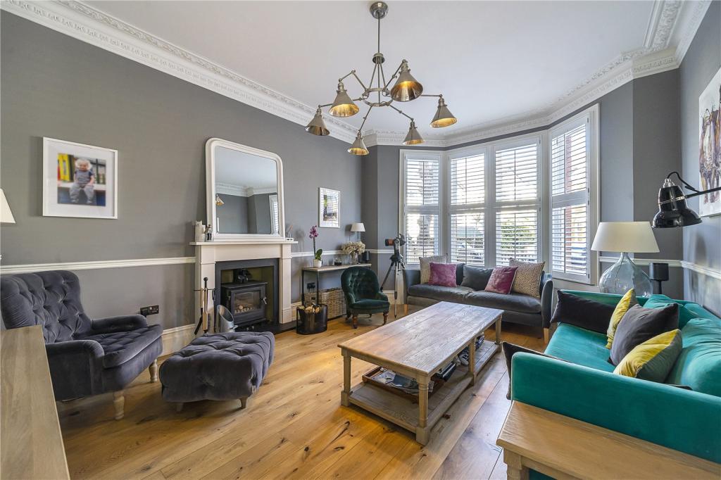
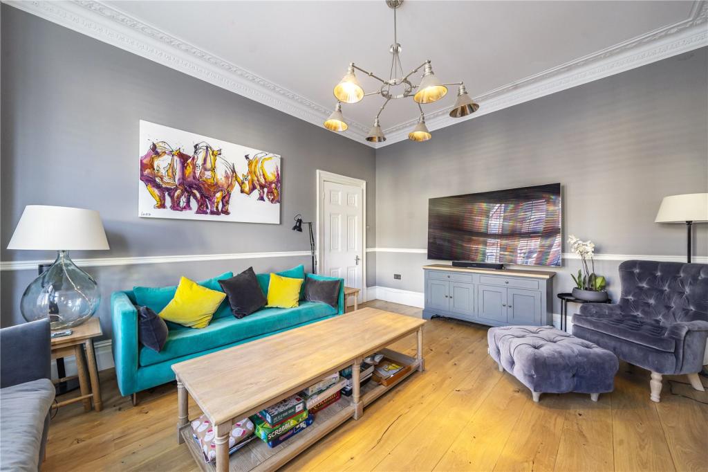
- Three Reception Areas
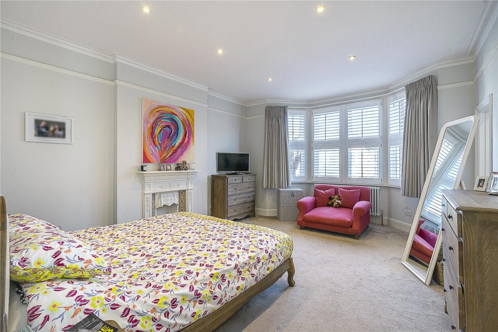
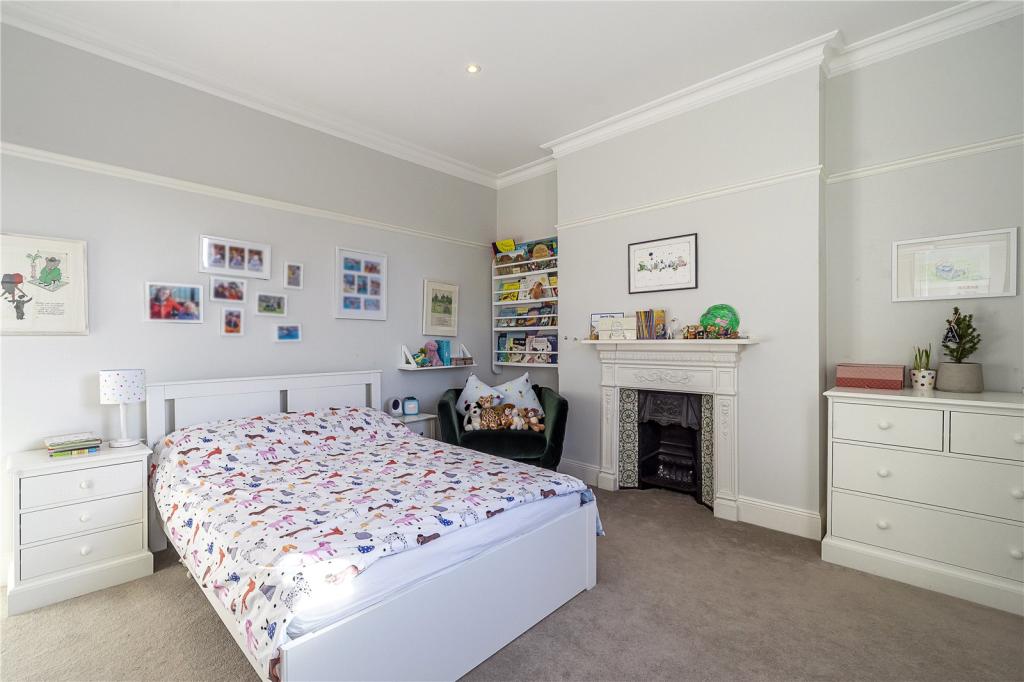
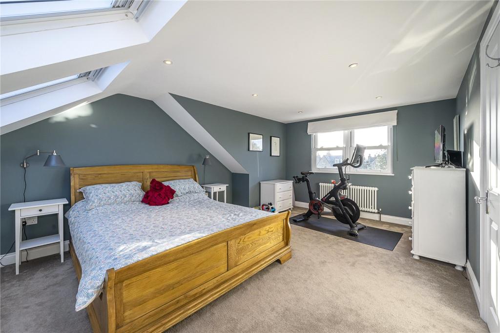
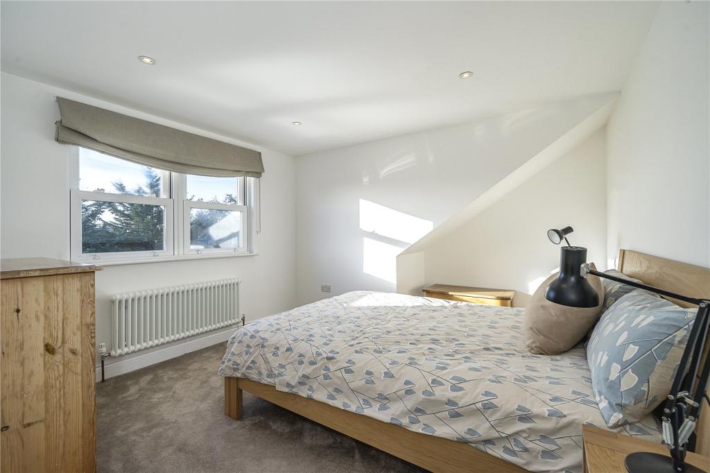
- Five Bedrooms
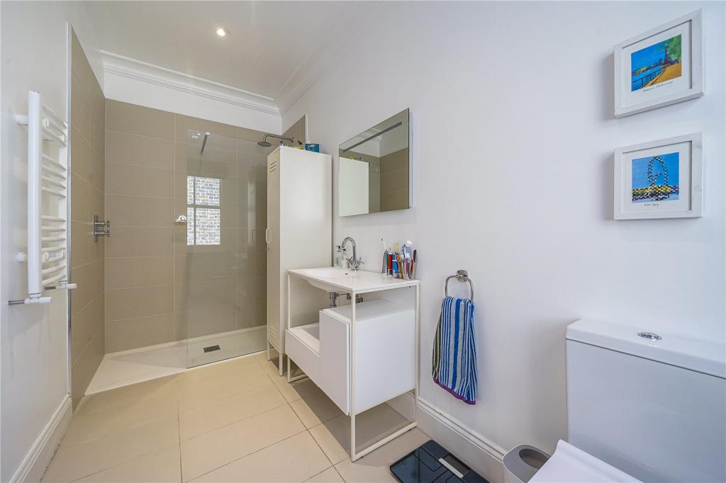
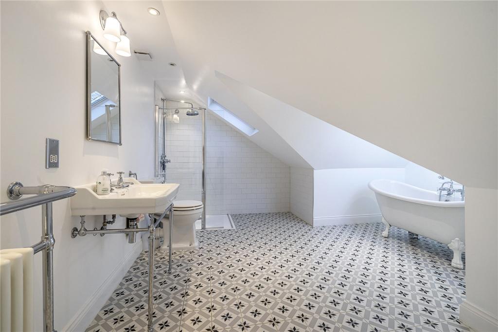
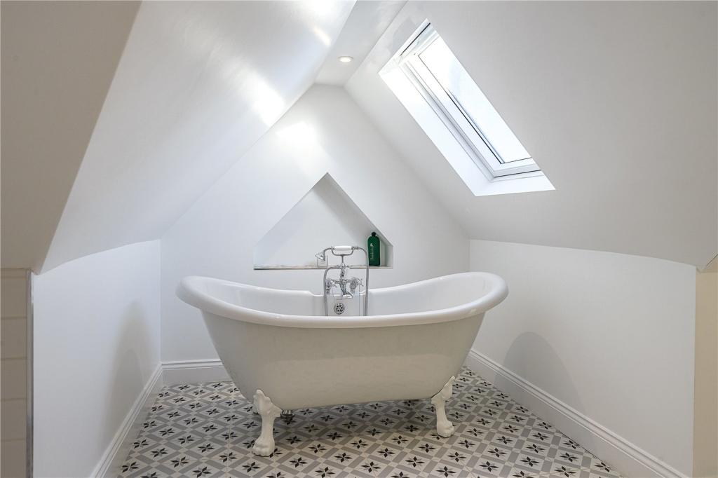
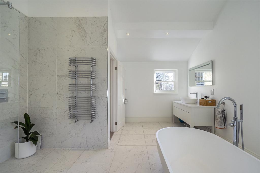
- Three Bathrooms
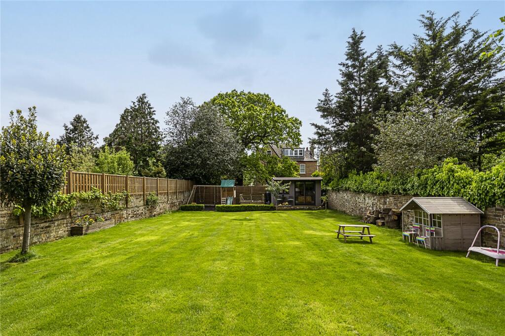
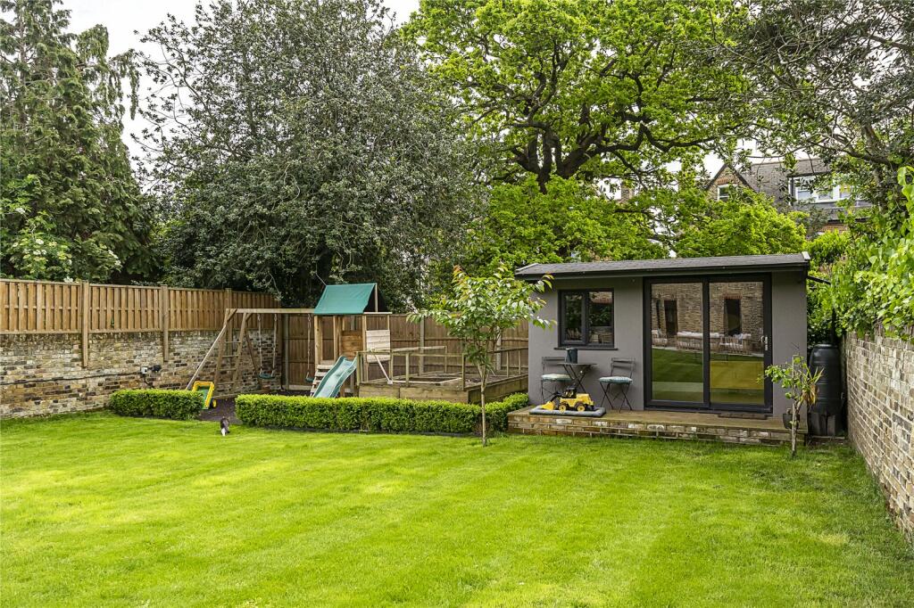
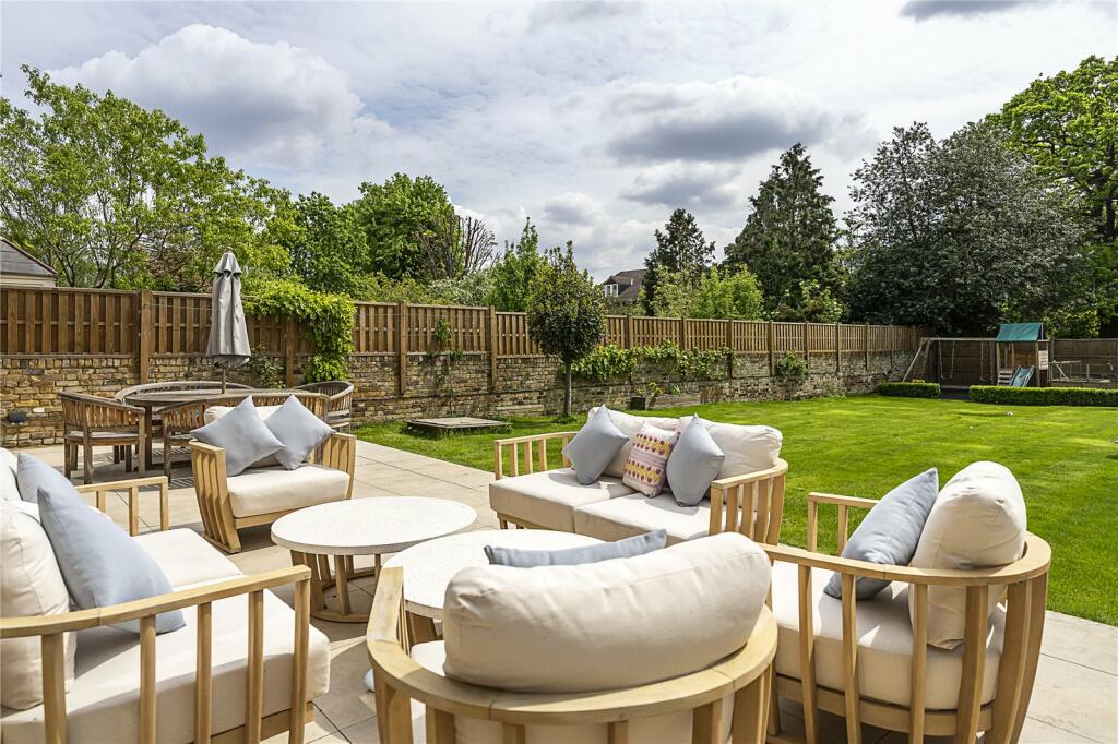
- South Facing Garden
- Ideal For Several Stations and Schools
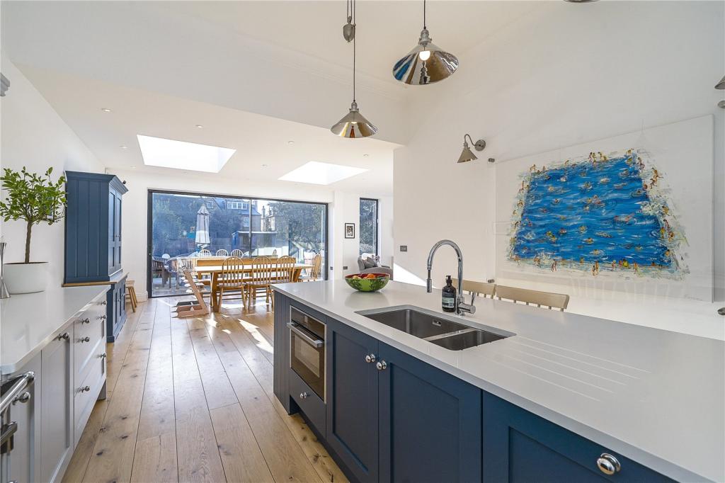
- Beautifully Presented Throughout
Additional details
- Garden
- Yes
Description
Outside
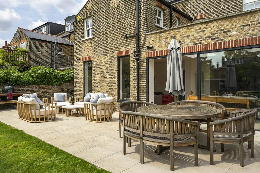
Front; walled private garden area with central tessellated tiled path leading to the front door. To the right hand side is a secure entrance leading to a storage area and the rear garden.
Rear; envious south facing walled garden which is 95ft in length. Accessed via the panoramic sliding doors of the rear family room, side door and side entrance.
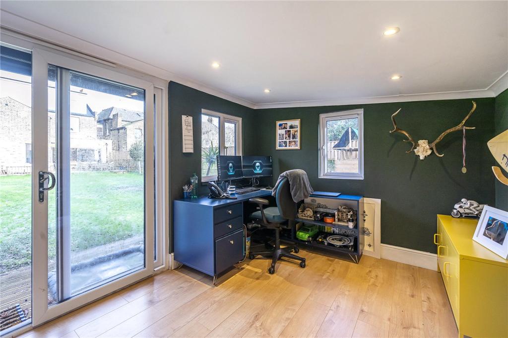
Garden Office; 12'1" x 9'0
Situation
Inglis Road is a wonderful residential location and is superbly located to take advantage of Ealing’s excellent transport system, numerous shops and several notable schools. You are within equidistance (0.4 miles) of Ealing Common and North Ealing stations (Piccadilly and District line) and just over half a mile to Ealing Broadway station which boasts the GWR (overground), Central line, District line and the brilliant Elizabeth line. The vast open spaces of Ealing Common are within a third of a mile and just a few hundred yards away is the fabulous Ealing Lawn Tennis Club with indoor and outdoor courts. For education, there are a number of Nurseries, Primary and High Schools both private and state within easy reach such as Durston House, Christ the Saviour C of E Primary School, St Augustine’s Priory, Twyford C of E, Ada Lovelace, Ellen Wilkinson and Harvington Prep.
Additional Information
Council Tax Band: G
Listed by
Ealing
Countrywide Hamptons Sales - Connells
Reference: 131634440
EPC Rating & Upgrade Cost
Fetching EPC data… Refresh this page in a moment.
Flood risk
Zone: 1
Risk: Low
Job (default Low)
Floorplans
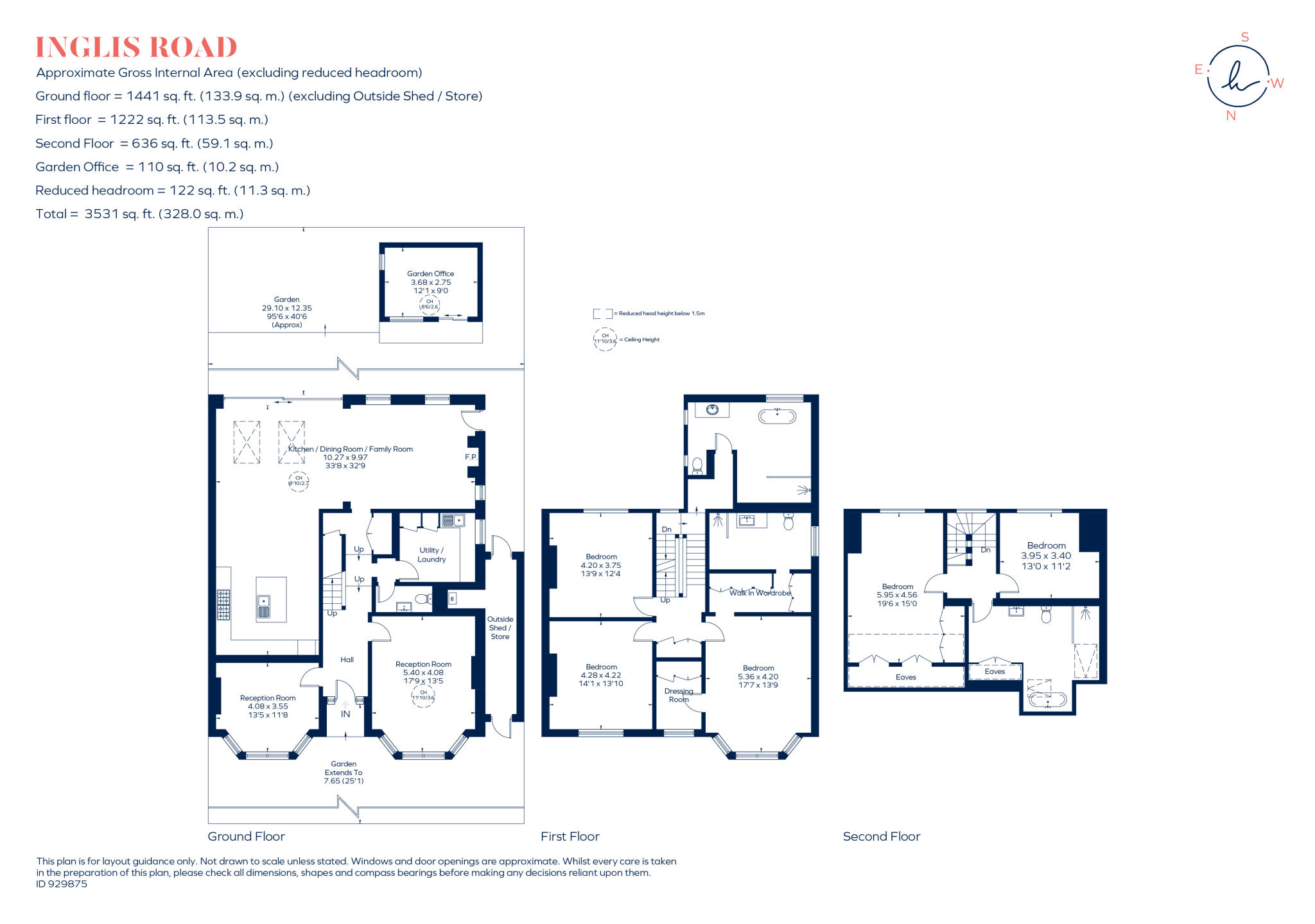
Floorplan
EPC Graphs
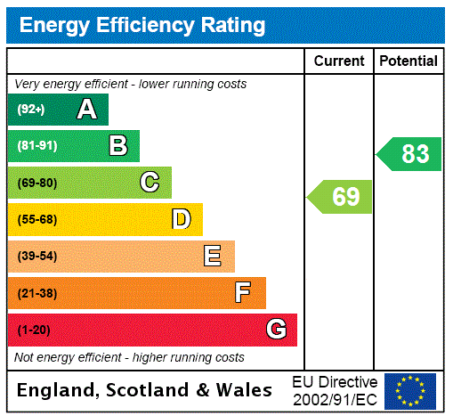
EPC Rating Graph
Price history
37% since 2017
| Event | Date | Price | % change |
|---|---|---|---|
| Sold | 29/09/2023 (2 years ago) | £2,457,500 | +36.5% |
| Sold | 31/07/2017 (8 years ago) | £1,800,000 | — |
Source: HM Land Registry Price Paid Data. Crown copyright.
Sold Comparables
Same street and nearby sales within 0.25 miles (last 5 years). Data from Land Registry Price Paid.
| Address | Price | Date | Type |
|---|---|---|---|
| Same street 16B INGLIS ROAD, LONDON, EALING, GREATER LONDON, W5 3RN | £575,000 | 14/04/2023 | Flat |
| 33 INGLIS ROAD, LONDON, EALING, GREATER LONDON, W5 3RL | £2,000,000 | 12/09/2022 | Detached |
| 16 HAMILTON ROAD, LONDON, EALING, GREATER LONDON, W5 2EH | £2,735,000 | 25/06/2021 | Detached |
Street average: £575,000 (1 sale)
Area average: £2,367,500 (2 sales)
Capital growth trend
Land Registry outcode average: last 12 months vs 5y and 10y ago (from sold prices).
House Price Index (HM Land Registry — official index, not sold-price averages): Ealing. Series: Detached. As of March 2026.
Rental Range
Estimated market rent for Ealing. Low = conservative, Realistic = average, Optimistic = best case.
Based on Local Authority from postcode lookup → Ealing.
LHA (30th percentile) floor for Inner West London: £2,543/mo (Apr 2025 – Mar 2026)
Location
Nearby
Nearest stations, universities and amenities (distance from property).
| Type | Name | Distance |
|---|---|---|
| Bus stop | Gunnersbury Avenue | 0.2 miles |
| Shop | Little Waitrose | 0.2 miles |
| Bus stop | North Ealing Station | 0.2 miles |
| Shop | The Vilage Laundrette & Dry Cleaners | 0.2 miles |
| Train station | North Ealing | 0.2 miles |
| Train station | Ealing Common | 0.3 miles |
| University | University of West London - Hellenic Institute Of Maritime Studies | 0.8 miles |
| University | University of West London | 0.9 miles |
| Hospital | Hounslow Medical Centre | 4.9 miles |
| Hospital | Bridge Lane Health Centre | 6.0 miles |
Street-level crime
| Category | Count |
|---|---|
| Anti-social behaviour | 202 |
| Violence and sexual offences | 142 |
| Vehicle crime | 60 |
| Shoplifting | 52 |
| Public order | 50 |
| Other theft | 39 |
| Criminal damage and arson | 27 |
| Drugs | 25 |
| Theft from the person | 22 |
| Burglary | 20 |
| Robbery | 11 |
| Bicycle theft | 10 |
| Possession of weapons | 8 |
| Other crime | 7 |
| Total incidents | 675 |
Within 1 mile during Apr 2026. Source: data.police.uk (England & Wales).
Schools nearby
Nearest open schools with Ofsted ratings (England). Closed schools are not shown. Data from Get Information about Schools and Ofsted.
| Name | Type | Distance | Ofsted |
|---|---|---|---|
| The Ellen Wilkinson School for Girls | Secondary | 0.2 miles | Outstanding — 27 Jun 2019 |
| Blooming Tree Primary School | Other | 0.3 miles | Outstanding — 27 Jul 2022 |
| Ada Lovelace Church of England High School | Secondary | 0.4 miles | Outstanding — 7 Mar 2023 |
| La Chouette School | Other | 0.4 miles | Good — 1 Feb 2023 |
| The Japanese School | Other | 0.4 miles | Inadequate — 27 Jul 2023 |
Rental Comparables
Loading rental comparables for this postcode. Refresh in a few minutes.
Rent-driven metrics
Based on Area rent estimate.
- Rent ratio — Monthly rent ÷ purchase price (1% rule). 1%+ = strong, 0.8–1% = okay, <0.8% = weak for cashflow.
- Max investor price — Rent ÷ 0.8%; the price at which rent would be 0.8% of price (Stoke-style target).
- Target investor price — Rent ÷ 1%; the price at which rent would be 1% of price (strong cashflow band).
- Gross yield — Annual rent as % of purchase price (no costs).