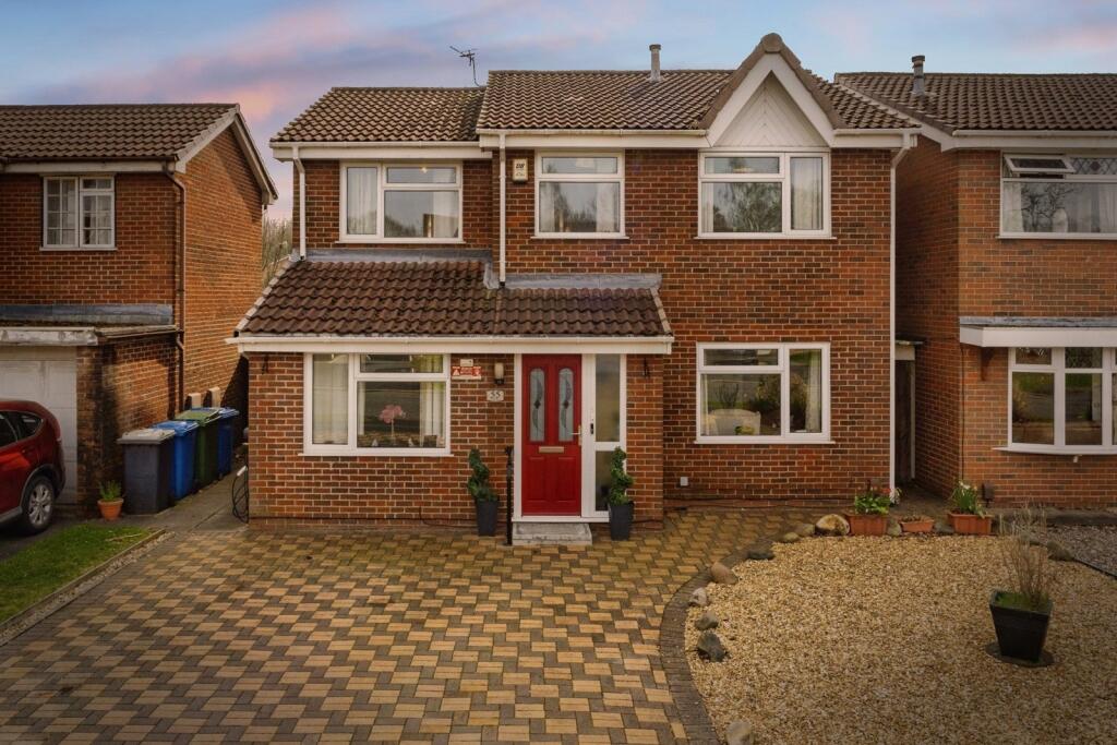
St. Asaph Drive
Callands, Warrington, Cheshire, WA5, WA5 9RA
£400,000

Property details
Tenure
FREEHOLD
Council tax band
D
Local average
£386,011 (+3.6%)
Deprivation
Decile 7 (21,897 of 33,755)
Street crime
103 incidents within 1 mile (Apr 2026)
Additional details
- Parking
- Yes
- Garden
- Yes
Description
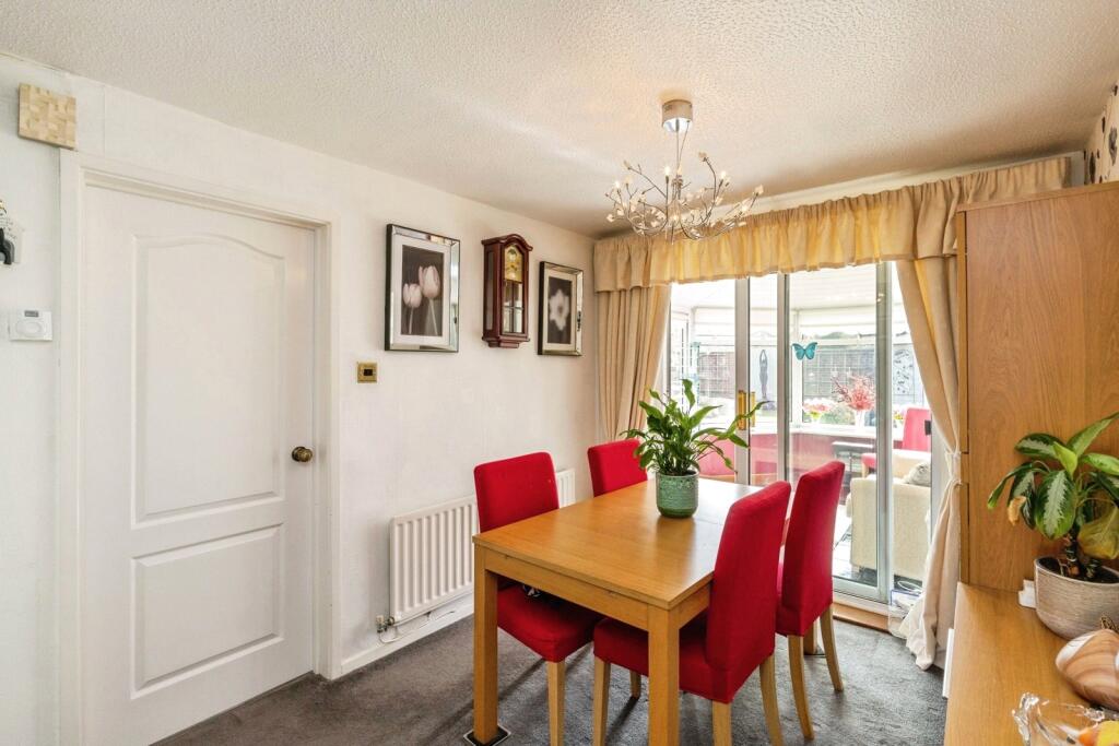
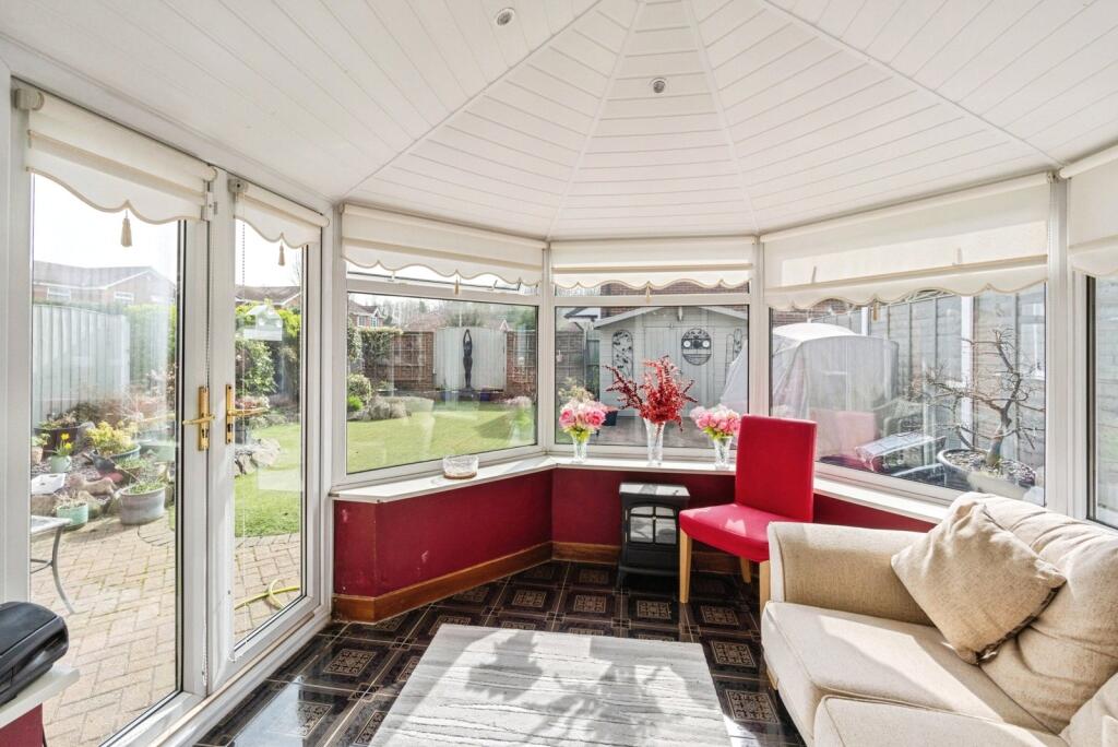
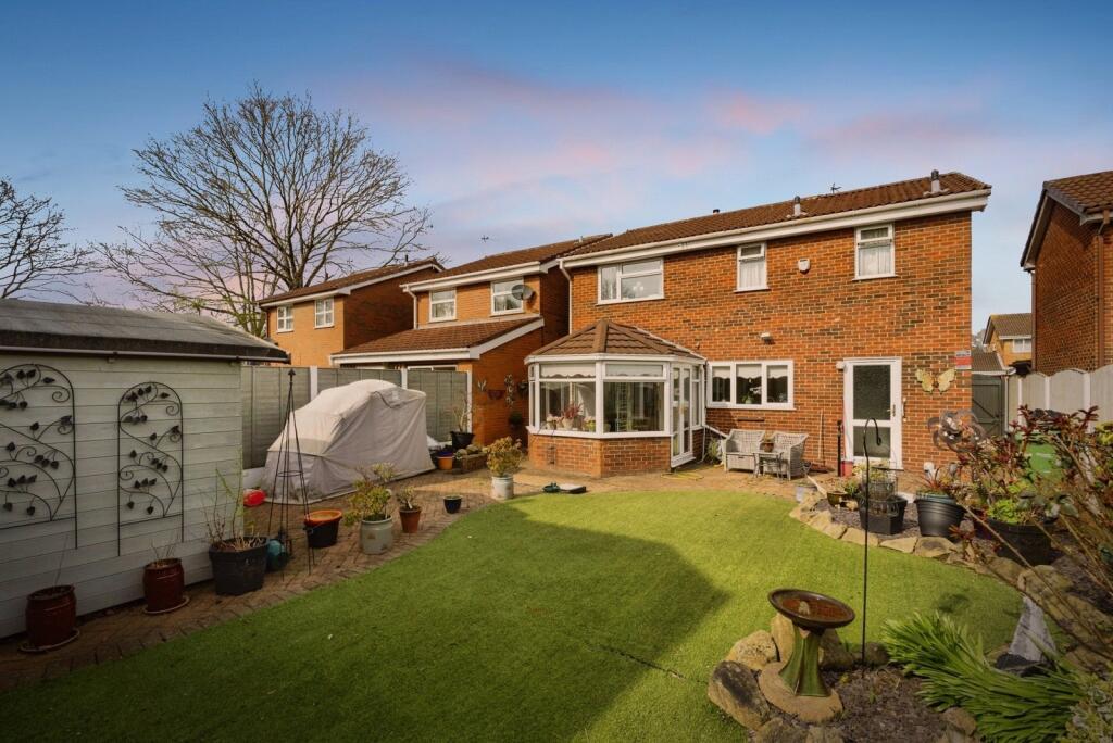
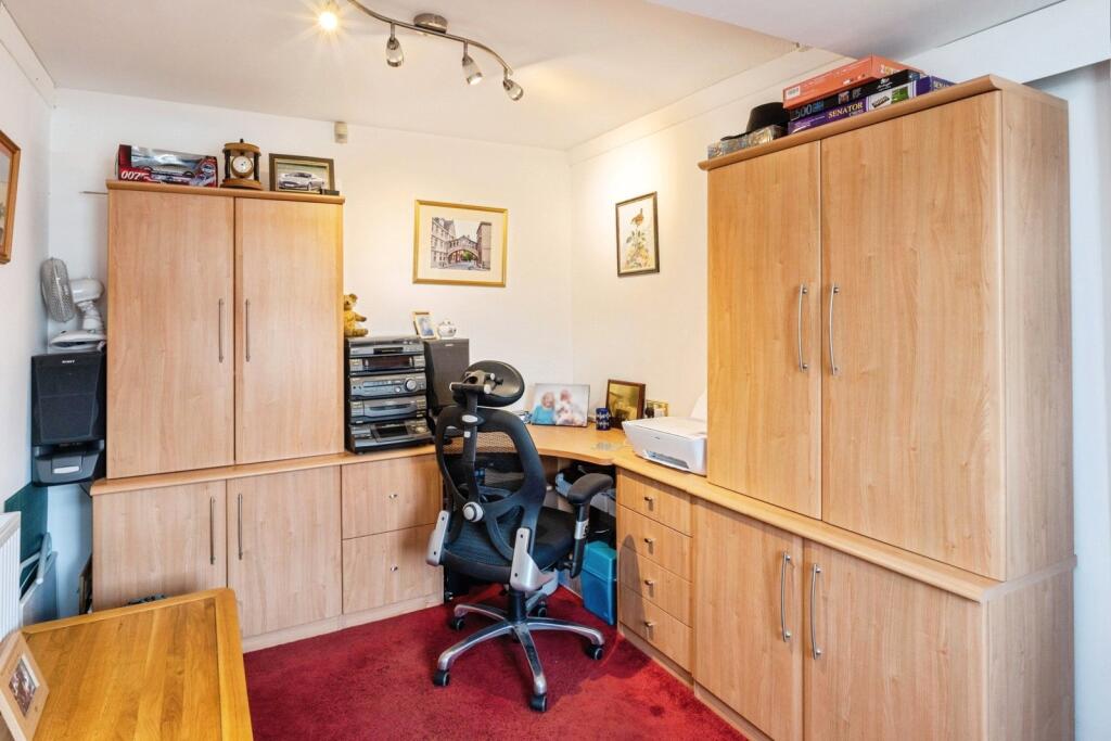
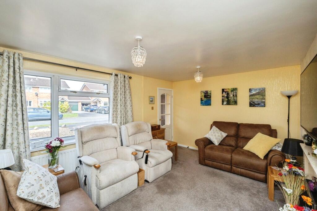
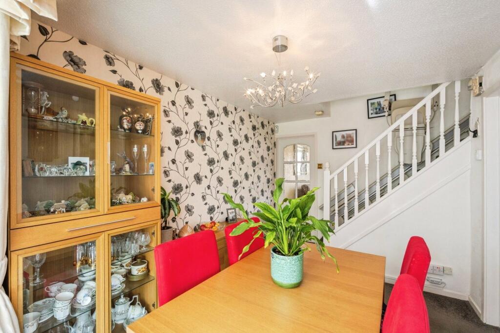
Upon entering the property, you are welcomed by an entrance porch leading into the main hallway. To the front, there is a second reception room, currently utilised as a study, providing flexibility for a home office or playroom. The principal lounge flows seamlessly through to the dining room, creating an excellent space for both relaxing and entertaining, with further access into a bright conservatory overlooking the well-maintained rear garden.
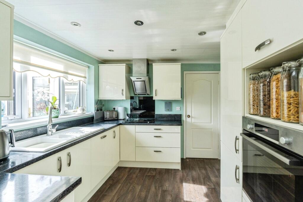
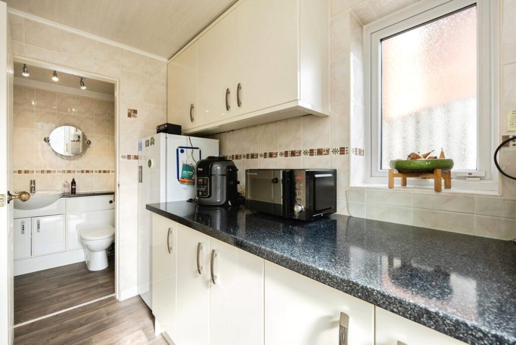
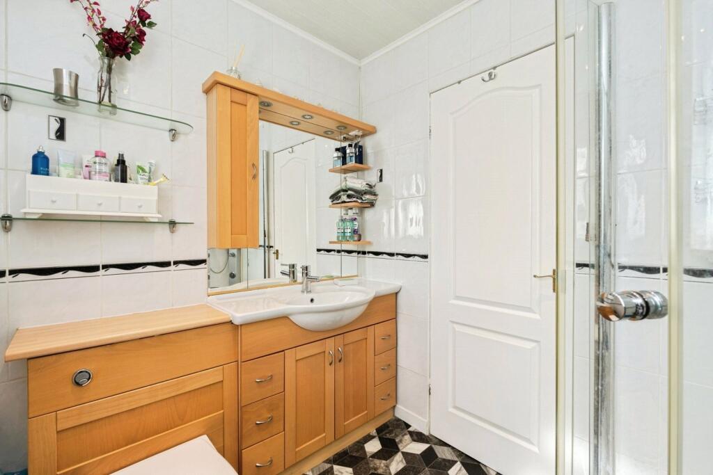
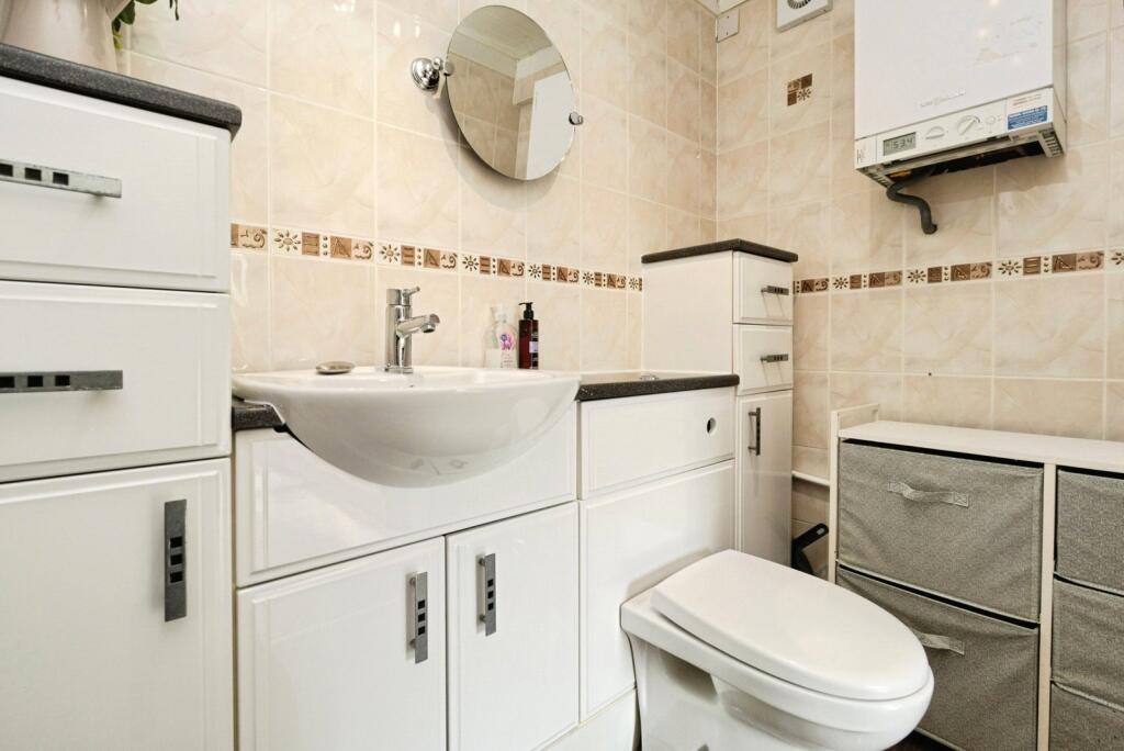
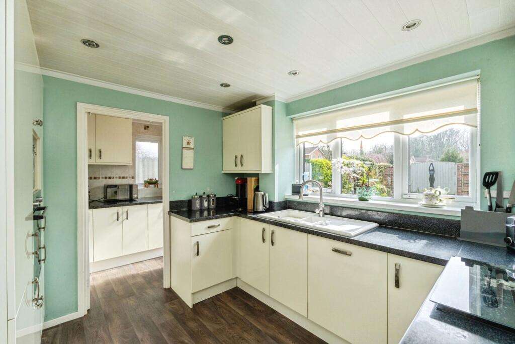
The property also benefits from a modern fitted kitchen, offering a range of wall and base units, with convenient access to a separate utility room and a downstairs WC.
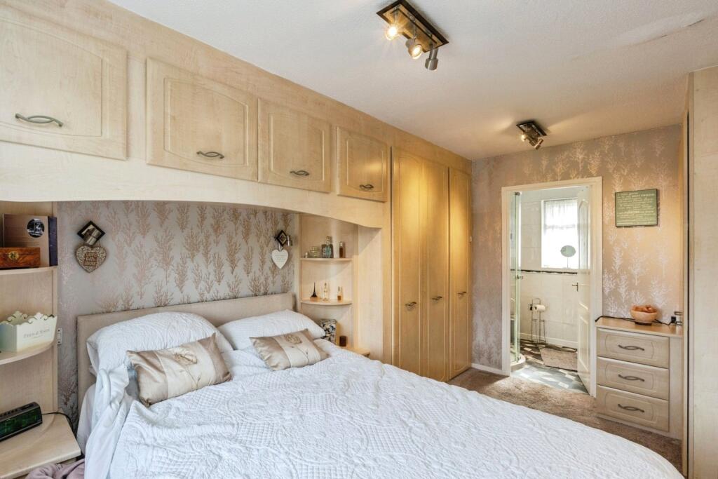
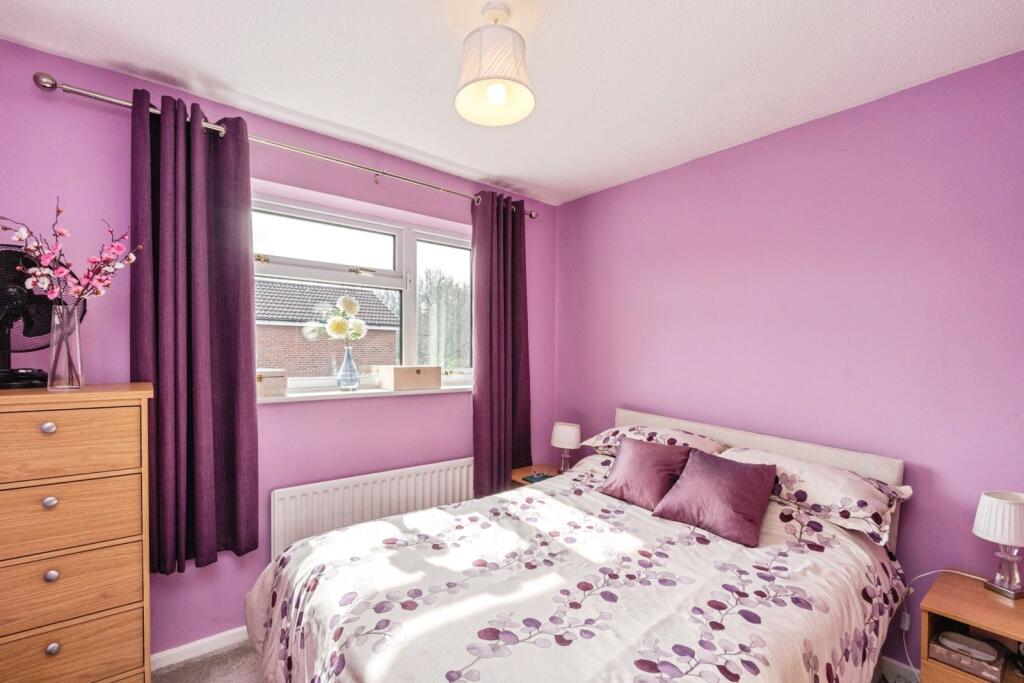
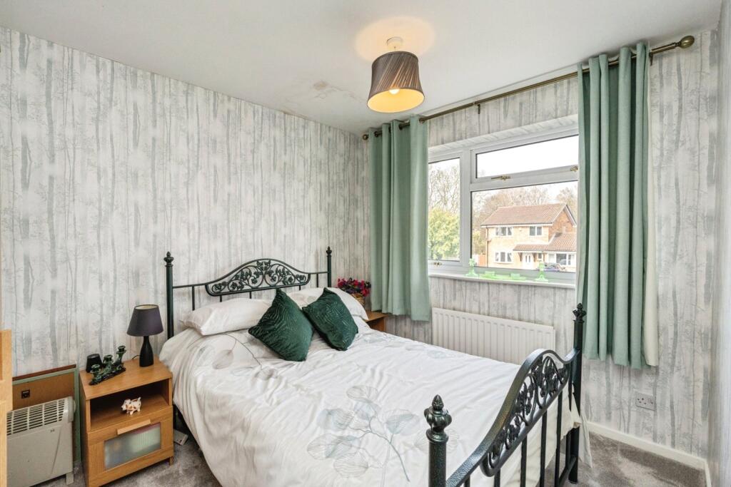
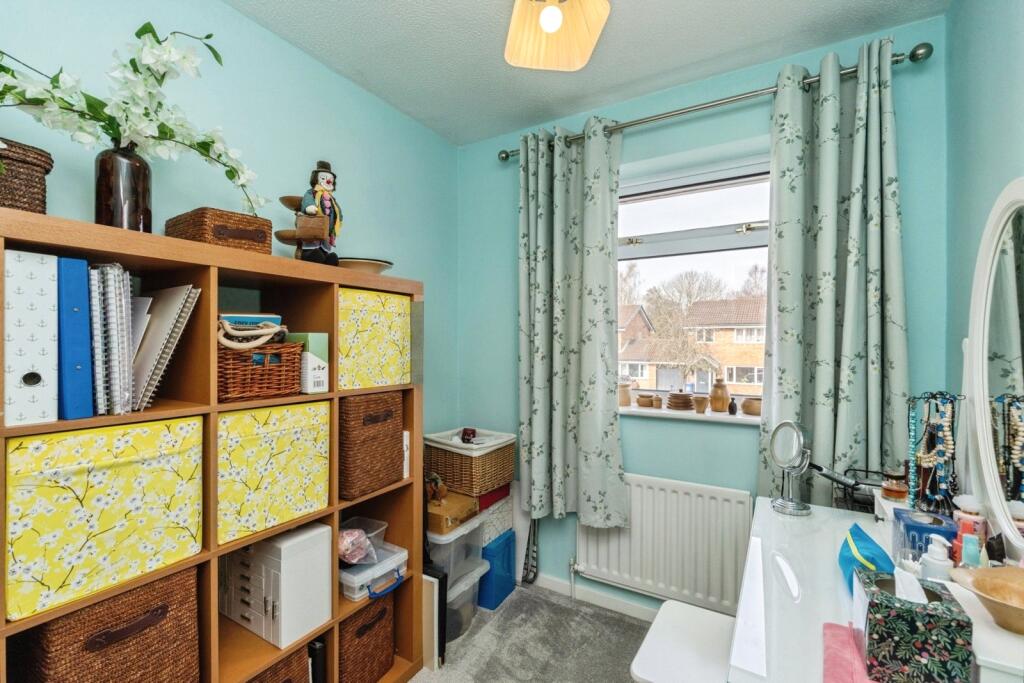
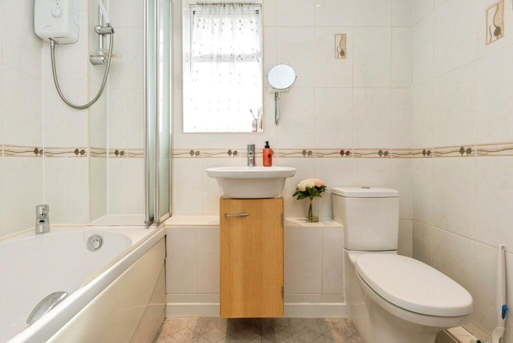
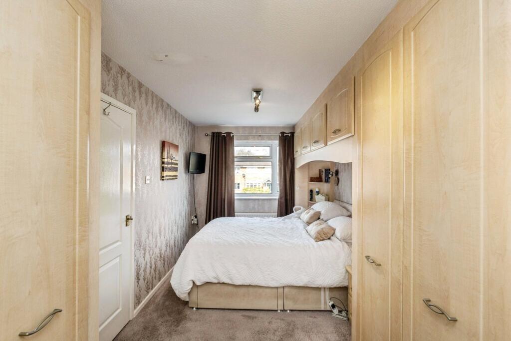
To the first floor, there are four well-proportioned bedrooms, including a master bedroom with en-suite facilities, alongside a family bathroom serving the remaining rooms.
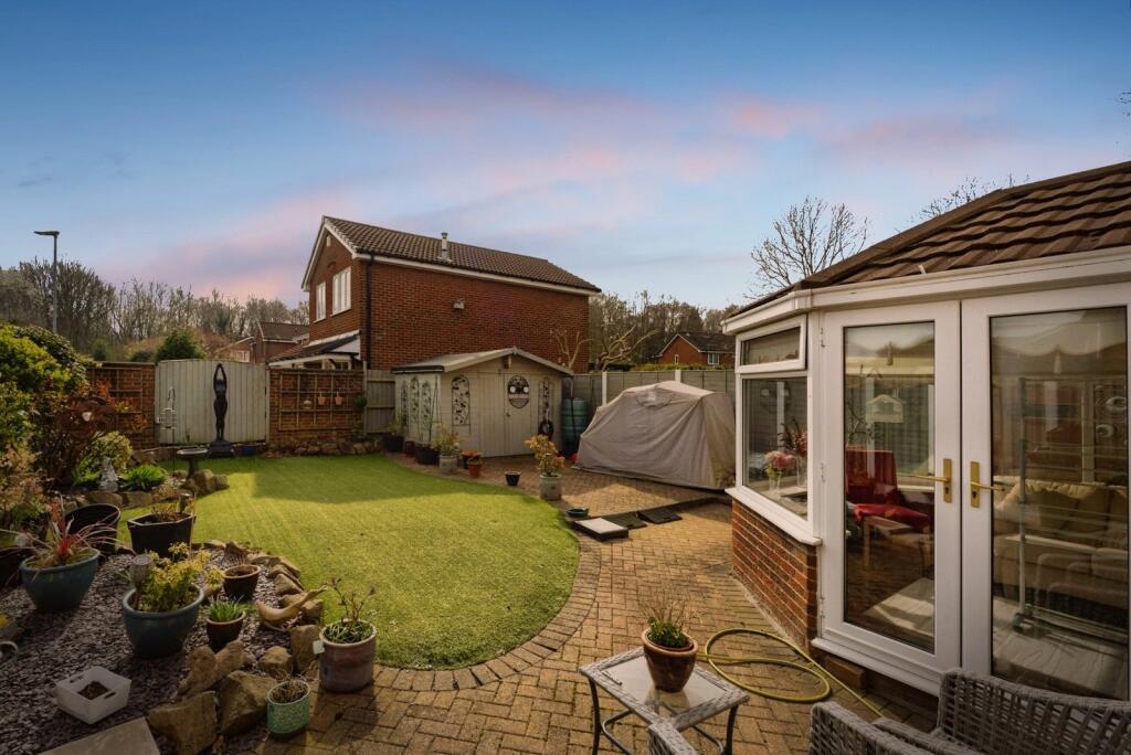
Externally, the property boasts a driveway providing ample off-road parking for multiple vehicles and a beautifully maintained rear garden, making it perfect for outdoor enjoyment.
Located close to local amenities, reputable schools, and excellent transport links into Warrington town centre, this property presents an outstanding opportunity for families seeking a home in a desirable residential area.
Listed by
Warrington
Countrywide UK Sales - Connells
Reference: 88961436
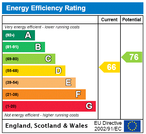
EPC ratings on this postcode
We don't have a matched EPC for this property yet. Below are efficiency scores and details for other addresses on this postcode.
| Address | Current | Potential | Floor area | Age band | Type |
|---|---|---|---|---|---|
| 11, St. Asaph Drive, Callands, WARRINGTON | 65 | 88 | 48 m² | England and Wales: 1983-1990 | Detached |
| 15, St. Asaph Drive, Callands, WARRINGTON | 65 | 88 | 48 m² | England and Wales: 1983-1990 | Detached |
| 17, St. Asaph Drive, Callands, WARRINGTON | 68 | 88 | 48 m² | England and Wales: 1976-1982 | Terraced |
| 17, St. Asaph Drive, Callands, WARRINGTON | 65 | 89 | 48 m² | England and Wales: 1983-1990 | Terraced |
| 19, St. Asaph Drive, Callands, WARRINGTON | 67 | 89 | 48 m² | England and Wales: 1983-1990 | Terraced |
| 21, St. Asaph Drive, Callands, WARRINGTON | 65 | 88 | 48 m² | England and Wales: 1983-1990 | Detached |
| 23, St. Asaph Drive, Callands, WARRINGTON | 62 | 87 | 48 m² | England and Wales: 1976-1982 | Detached |
| 23, St. Asaph Drive, Callands, WARRINGTON | 64 | 88 | 48 m² | England and Wales: 1983-1990 | Detached |
| 25, St. Asaph Drive, Callands, WARRINGTON | 67 | 89 | 47 m² | England and Wales: 1983-1990 | Detached |
| 27, St. Asaph Drive, Callands, WARRINGTON | 65 | 89 | 48 m² | England and Wales: 1983-1990 | Terraced |
| 29, St. Asaph Drive, Callands, WARRINGTON | 68 | 89 | 47 m² | England and Wales: 1983-1990 | Terraced |
| 31, St. Asaph Drive, Callands, WARRINGTON | 67 | 89 | 48 m² | England and Wales: 1983-1990 | Terraced |
| 33, St. Asaph Drive, Callands, WARRINGTON | 65 | 88 | 48 m² | England and Wales: 1983-1990 | Terraced |
| 39, St. Asaph Drive, Callands, WARRINGTON | 64 | 82 | 64 m² | England and Wales: 1983-1990 | Detached |
| 41, St. Asaph Drive, Callands, WARRINGTON | 67 | 83 | 62 m² | England and Wales: 1983-1990 | Detached |
Flood risk
Zone: 1
Risk: Low
Job (default Low)
Floorplans
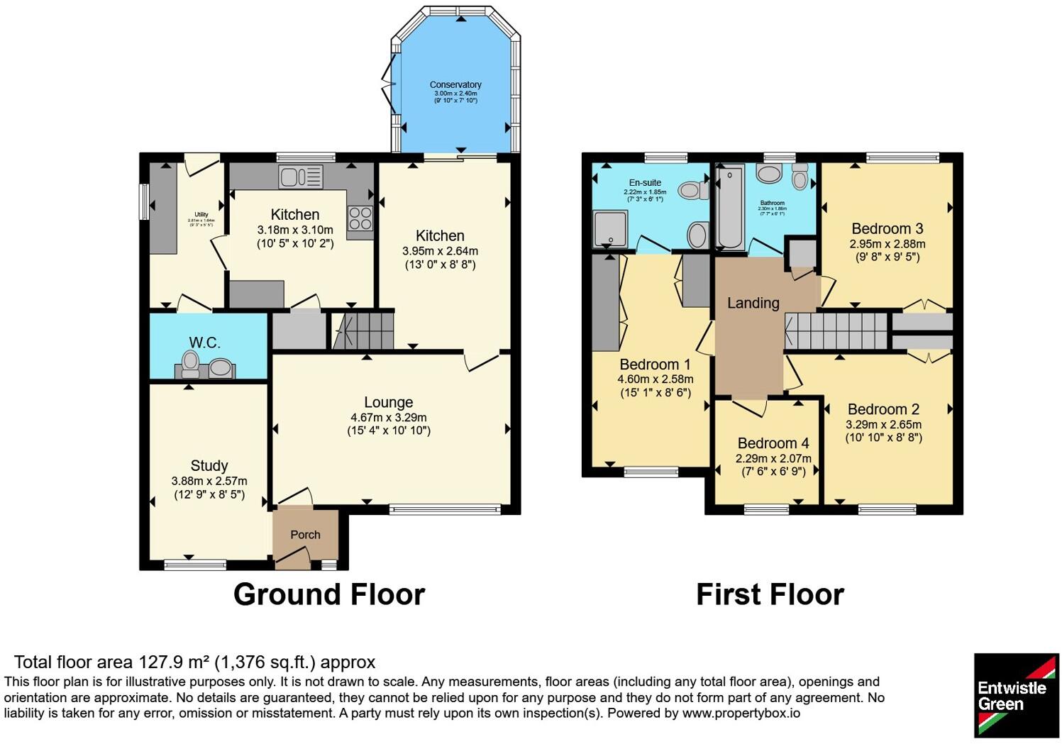
pbox-FP.jpg
EPC Graphs
EPC Rating Graph
Price history
| Event | Date | Price | % change |
|---|---|---|---|
| Listed for sale | — | £400,000 | — |
Source: HM Land Registry Price Paid Data. Crown copyright.
Sold Comparables
Same street and nearby sales within 0.25 miles (last 5 years). Data from Land Registry Price Paid.
| Address | Price | Date | Type |
|---|---|---|---|
| 19 GOLDCLIFF CLOSE, CALLANDS, WARRINGTON, WA5 9EE | £300,000 | 10/12/2025 | Detached |
| 10 NEWBOROUGH CLOSE, CALLANDS, WARRINGTON, WA5 9JG | £375,000 | 27/11/2025 | Detached |
| 40 GOLDCLIFF CLOSE, CALLANDS, WARRINGTON, WA5 9EP | £435,000 | 02/12/2022 | Detached |
| 45 GOLDCLIFF CLOSE, CALLANDS, WARRINGTON, WA5 9EE | £438,000 | 02/12/2022 | Detached |
| 21 WELSHPOOL CLOSE, CALLANDS, WARRINGTON, WA5 9YJ | £407,000 | 04/11/2022 | Detached |
| 2 NEWBOROUGH CLOSE, CALLANDS, WARRINGTON, WA5 9JG | £420,000 | 24/08/2022 | Detached |
| 6 NEWBOROUGH CLOSE, CALLANDS, WARRINGTON, WA5 9JG | £435,000 | 20/05/2022 | Detached |
| 76 GOLDCLIFF CLOSE, CALLANDS, WARRINGTON, WA5 9EP | £335,000 | 14/01/2022 | Detached |
Area average: £393,125 (8 sales)
Capital growth trend
Land Registry outcode average: last 12 months vs 5y and 10y ago (from sold prices).
House Price Index (HM Land Registry — official index, not sold-price averages): Warrington. Series: Detached. As of March 2026.
Rental Range
Estimated market rent for Warrington. Low = conservative, Realistic = average, Optimistic = best case.
Based on Local Authority from postcode lookup → Warrington.
LHA (30th percentile) floor for North Cheshire: £997/mo (Apr 2025 – Mar 2026)
Location
Address
Saint Asaph Drive
Nearby
Nearest stations, universities and amenities (distance from property).
| Type | Name | Distance |
|---|---|---|
| Bus stop | St David's Drive | 0.1 miles |
| Shop | Asda Opticians | 0.6 miles |
| Shop | Dave Pluck Bookmakers | 0.6 miles |
| Train station | Warrington West | 1.6 miles |
| Train station | Warrington Central | 1.9 miles |
| University | University of Chester - Warrington Campus | 2.9 miles |
| Hospital | St Helens Hospital | 4.5 miles |
| Hospital | Leigh Health Centre | 7.7 miles |
| University | Liverpool Hope University | 11.4 miles |
Street-level crime
| Category | Count |
|---|---|
| Violence and sexual offences | 41 |
| Shoplifting | 25 |
| Other theft | 10 |
| Public order | 8 |
| Anti-social behaviour | 4 |
| Other crime | 4 |
| Vehicle crime | 4 |
| Burglary | 3 |
| Criminal damage and arson | 3 |
| Drugs | 1 |
| Total incidents | 103 |
Within 1 mile during Apr 2026. Source: data.police.uk (England & Wales).
Schools nearby
Nearest open schools with Ofsted ratings (England). Closed schools are not shown. Data from Get Information about Schools and Ofsted.
| Name | Type | Distance | Ofsted |
|---|---|---|---|
| Callands Community Primary School | Primary | 0.2 miles | — (Inspected (no overall grade)) |
| Dallam Community Primary School | Primary | 0.6 miles | Good — 26 Jul 2023 |
| St Philip (Westbrook) CofE Aided Primary School | Primary | 0.7 miles | Good — 24 Dec 2013 |
| Westbrook Old Hall Primary School | Primary | 0.9 miles | Good — 7 Jun 2013 |
| Bewsey Lodge Primary School | Primary | 1.1 miles | Good — 21 Nov 2021 |
Rental Comparables
Residential lets from OpenRent and Rightmove for the area (same bedroom count). Use to validate rent estimates. Student lets are excluded.
| Title | Rent | Beds | Distance | As seen on |
|---|---|---|---|---|
| 4 Bed Detached House, Warrington, WA5 | £1,500/mo | 4 | 0.3 miles | OpenRent |
| 4 Bed Detached House, Coppice Green, WA5 | £1,500/mo | 4 | 0.91 miles | OpenRent |
Average rent: £1,500/mo (2 listings)
Rent-driven metrics
Based on OpenRent comparables.
- Rent ratio — Monthly rent ÷ purchase price (1% rule). 1%+ = strong, 0.8–1% = okay, <0.8% = weak for cashflow.
- Max investor price — Rent ÷ 0.8%; the price at which rent would be 0.8% of price (Stoke-style target).
- Target investor price — Rent ÷ 1%; the price at which rent would be 1% of price (strong cashflow band).
- Gross yield — Annual rent as % of purchase price (no costs).
- Cost-to-rent — Price ÷ annual rent (from OpenRent comparables). Under 14× = strong, 14–16× = acceptable, 17×+ = compressed.
- Cashflow — Rent minus mortgage, 10% maintenance, £25/mo compliance. Assumes 75% LTV, 3.95% APR (5yr fixed), 25yr term.
- ROI — Annual profit ÷ cash in (deposit + 4% purchase costs).
Enter House Number
Enter the house number to help us retrieve more accurate pricing history and property data.
Please log in to submit or correct the house number for this listing.
Log in to continue