16 HILLINGDON ROAD
MANCHESTER, STRETFORD, GREATER MANCHESTER M32 8PB
Property details
Tenure
LEASEHOLD
Floor area
117 m²
EPC rating
D
Year built
England and Wales: 1930-1949
Last sold
£384,600 Nov 2020
Price per m²
£3,205/m²
Local average
£341,250 (+9.9%)
Deprivation
Decile 8 (25,264 of 33,755)
Street crime
0 incidents within 1 mile (Apr 2026)
Key features
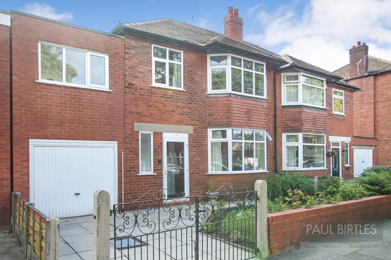
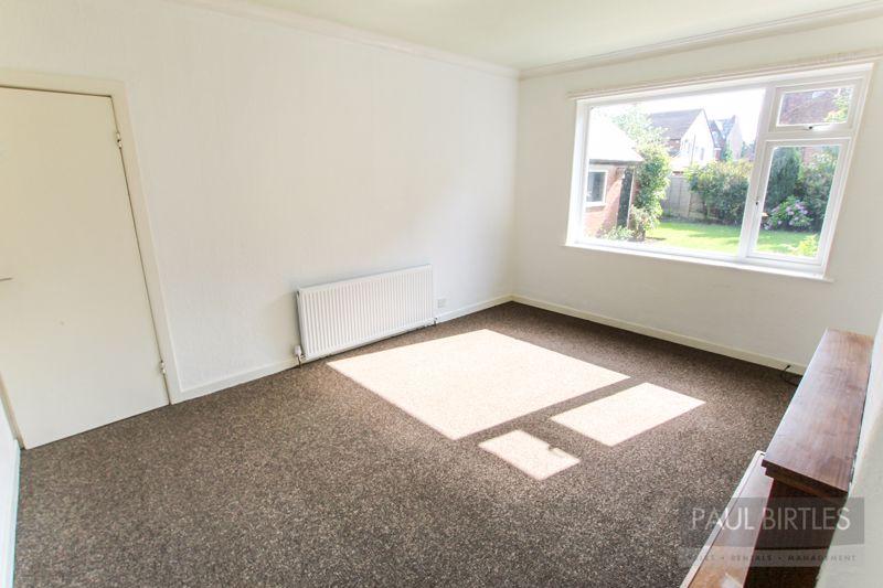
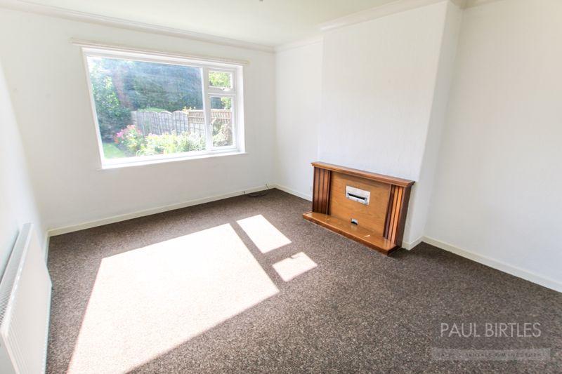
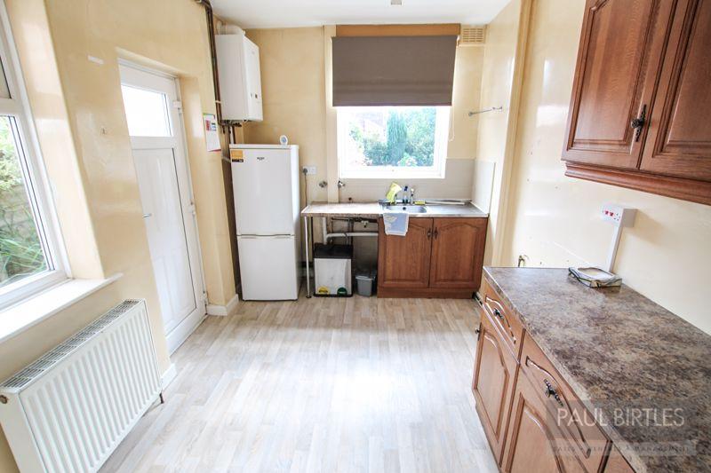
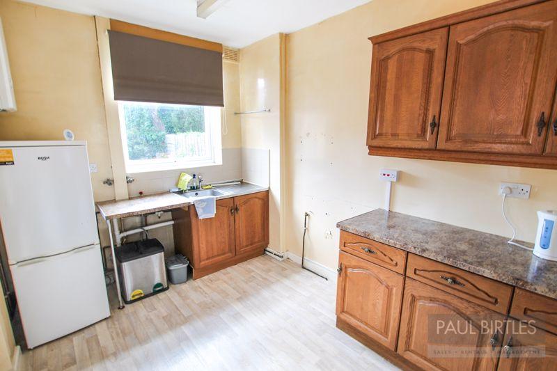
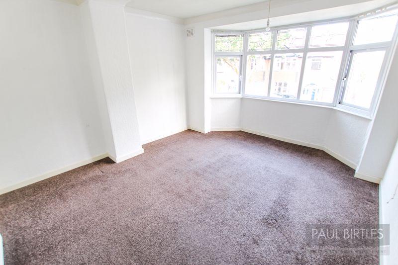
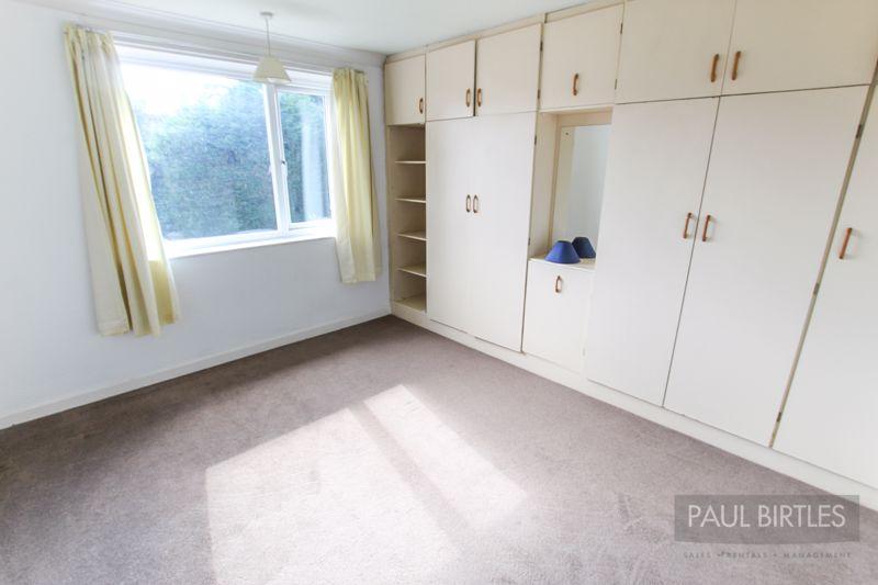
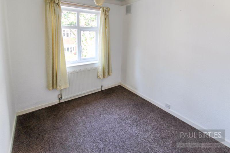
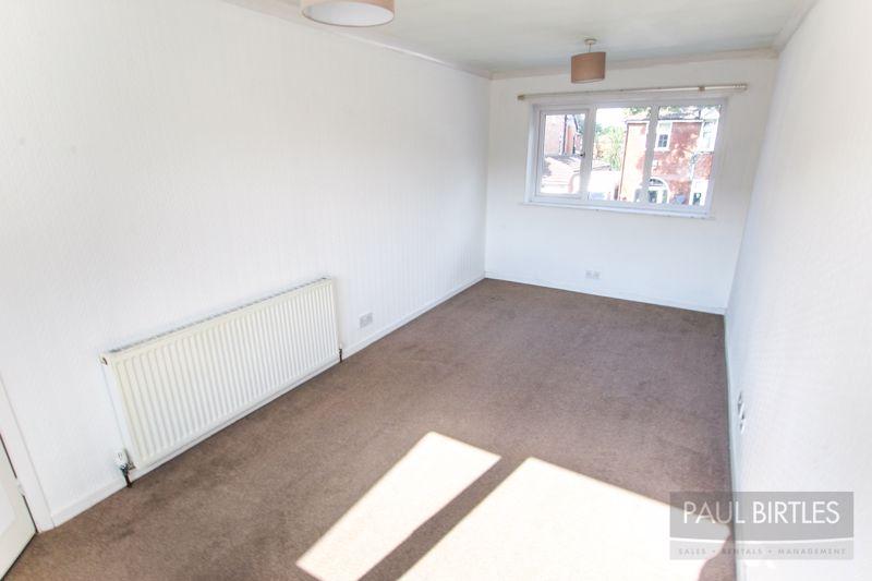
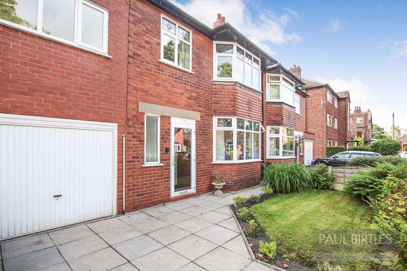
- A SPACIOUS FOUR BEDROOM SEMI-DETACHED PROPERTY
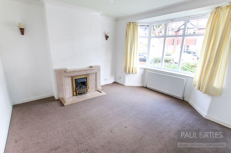
- EXCELLENT FAMILY ACCOMMODATION WITH TWO SEPARATE RECEPTION ROOMS
- OCCUPYING A HIGHLY REGARDED AND EXTREMELY CONVENIENT LOCATION
- JUST OFF EDGE LANE, CLOSE TO METROLINK STATION
- GAS CENTRAL HEATING SYSTEM AND DOUBLE GLAZING
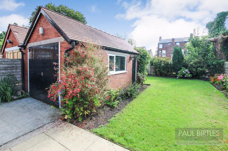
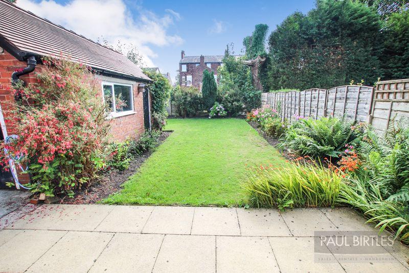
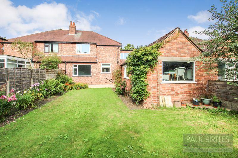
- PLEASANT GARDENS TO THE FRONT AND REAR
- INTEGRAL GARAGE PLUS ADDITIONAL BRICK GARAGE
- NO ONGOING VENDOR CHAIN
- MUST BE VIEWED TO BE APPRECIATED
Additional details
- Parking
- Yes
- Garden
- Yes
Description
Listed by
Urmston
Paul Birtles Ltd
Reference: 72570903
EPC Rating & Upgrade Cost
Current rating: D
Potential rating: B
Inspection date: 05/11/2012
Expiry date: 04/11/2022 (expired)
Current heating cost: £860/year
Potential heating cost: £571/year
Est. upgrade cost to C: £21,140
Recommendations
- Cavity wall insulation (£500 - £1,500)
- Floor insulation (£800 - £1,200)
- Low energy lighting for all fixed outlets (£40)
- Replace boiler with new condensing boiler (£2,200 - £3,000)
- Solar water heating (£4,000 - £6,000)
- Solar photovoltaic panels, 2.5 kWp (£9,000 - £14,000)
Flood risk
Zone: 1
Risk: Low
Job (default Low)
Floorplans
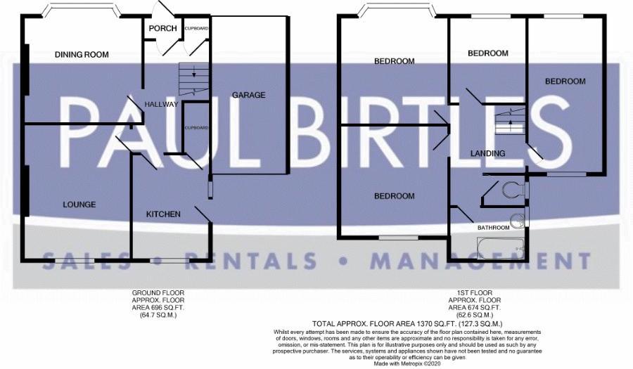
Floorplan 1
EPC Graphs

Energy Perform...
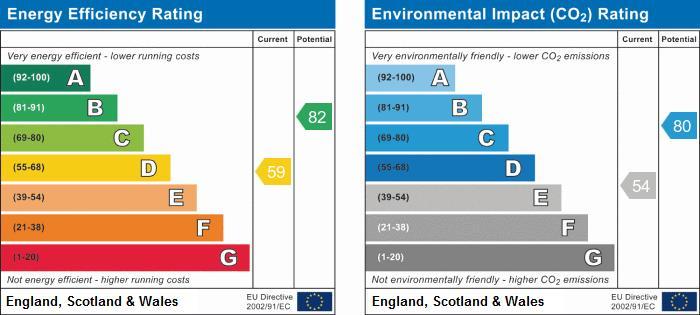
EPC Graph
FENSA Certificates
This property has 1 FENSA certificate(s) on record, indicating window/door installations by FENSA-approved installers.
FENSA Certificate #5902187
Property Details
Street: 16 Hillingdon Road
Town: Stretford
Postcode: M32 8PB
Installation Details
Items: 16 windows and 2 doors
Certificate Issued: 12/08/2008
Work Completed: 30/07/2008
This certificate data was retrieved from FENSA's database
What is FENSA? FENSA (Fenestration Self-Assessment Scheme) is a government-authorised scheme that monitors building regulation compliance for replacement windows and doors. Certificates indicate that work was completed by FENSA-approved installers.
Price history
| Event | Date | Price | % change |
|---|---|---|---|
| Sold | 13/11/2020 (5 years ago) | £384,600 | — |
Source: HM Land Registry Price Paid Data. Crown copyright.
Sold Comparables
Same street and nearby sales within 0.25 miles (last 5 years). Data from Land Registry Price Paid.
| Address | Price | Date | Type |
|---|---|---|---|
| Same street 28 HILLINGDON ROAD, STRETFORD, MANCHESTER, TRAFFORD, GREATER MANCHESTER, M32 8PB | £610,000 | 18/02/2026 | Detached |
| 53 HILLINGDON ROAD, STRETFORD, MANCHESTER, TRAFFORD, GREATER MANCHESTER, M32 8PH | £472,000 | 28/11/2025 | Semi-detached |
| 10 TRESCO AVENUE, STRETFORD, MANCHESTER, TRAFFORD, GREATER MANCHESTER, M32 8PE | £425,000 | 19/09/2025 | Semi-detached |
| 551 KINGS ROAD, STRETFORD, MANCHESTER, TRAFFORD, GREATER MANCHESTER, M32 8JG | £419,000 | 22/12/2023 | Semi-detached |
| 43 GRANBY ROAD, STRETFORD, MANCHESTER, TRAFFORD, GREATER MANCHESTER, M32 8JL | £360,000 | 18/10/2023 | Semi-detached |
| 590 KINGS ROAD, STRETFORD, MANCHESTER, TRAFFORD, GREATER MANCHESTER, M32 8JW | £375,000 | 17/10/2023 | Semi-detached |
| 20 MELFORT AVENUE, STRETFORD, MANCHESTER, TRAFFORD, GREATER MANCHESTER, M32 8JE | £355,000 | 13/10/2023 | Semi-detached |
| 3 HAPTON AVENUE, STRETFORD, MANCHESTER, TRAFFORD, GREATER MANCHESTER, M32 8JN | £205,000 | 22/09/2023 | Semi-detached |
| 530 KINGS ROAD, STRETFORD, MANCHESTER, TRAFFORD, GREATER MANCHESTER, M32 8JT | £306,000 | 10/07/2023 | Semi-detached |
| Same street 38 HILLINGDON ROAD, STRETFORD, MANCHESTER, TRAFFORD, GREATER MANCHESTER, M32 8PB | £380,000 | 05/07/2023 | Semi-detached |
| 21 GRANBY ROAD, STRETFORD, MANCHESTER, TRAFFORD, GREATER MANCHESTER, M32 8JL | £115,000 | 02/06/2023 | Semi-detached |
| 7 TRURO AVENUE, STRETFORD, MANCHESTER, TRAFFORD, GREATER MANCHESTER, M32 8PF | £380,000 | 26/09/2022 | Semi-detached |
| 3 RENNIE CLOSE, STRETFORD, MANCHESTER, TRAFFORD, GREATER MANCHESTER, M32 0ST | £285,000 | 16/09/2022 | Semi-detached |
| 11 RENNIE CLOSE, STRETFORD, MANCHESTER, TRAFFORD, GREATER MANCHESTER, M32 0ST | £285,000 | 30/08/2022 | Semi-detached |
| 56 HILLINGDON ROAD, STRETFORD, MANCHESTER, TRAFFORD, GREATER MANCHESTER, M32 8PJ | £430,000 | 17/08/2022 | Semi-detached |
| 543 KINGS ROAD, STRETFORD, MANCHESTER, TRAFFORD, GREATER MANCHESTER, M32 8JG | £525,000 | 05/08/2022 | Semi-detached |
| 9 CROMWELL ROAD, STRETFORD, MANCHESTER, TRAFFORD, GREATER MANCHESTER, M32 8GH | £340,000 | 14/07/2022 | Semi-detached |
| 21 CROMWELL ROAD, STRETFORD, MANCHESTER, TRAFFORD, GREATER MANCHESTER, M32 8GH | £476,500 | 16/06/2022 | Semi-detached |
| 12 STEPHENSON ROAD, STRETFORD, MANCHESTER, TRAFFORD, GREATER MANCHESTER, M32 0SS | £325,000 | 18/05/2022 | Semi-detached |
| 14 KENWOOD ROAD, STRETFORD, MANCHESTER, TRAFFORD, GREATER MANCHESTER, M32 8PT | £621,500 | 08/04/2022 | Semi-detached |
| 38 NORWOOD ROAD, STRETFORD, MANCHESTER, TRAFFORD, GREATER MANCHESTER, M32 8PW | £730,000 | 08/04/2022 | Semi-detached |
| 63 KENWOOD ROAD, STRETFORD, MANCHESTER, TRAFFORD, GREATER MANCHESTER, M32 8PS | £860,000 | 26/01/2022 | Semi-detached |
Street average: £495,000 (2 sales)
Area average: £414,500 (20 sales)
Capital growth trend
Land Registry outcode average: last 12 months vs 5y and 10y ago (from sold prices).
House Price Index (HM Land Registry — official index, not sold-price averages): Trafford. Series: Semi-detached. As of March 2026.
Rental Range
Estimated market rent for Trafford. Low = conservative, Realistic = average, Optimistic = best case.
Based on Local Authority from postcode lookup → Trafford.
LHA (30th percentile) floor for West Pennine: £760/mo (Apr 2025 – Mar 2026)
Location
Nearby
Nearest stations, universities and amenities (distance from property).
| Type | Name | Distance |
|---|---|---|
| Bus stop | Stretford, Edge Lane / opposite Norwood Road | 0.1 miles |
| Bus stop | Kings Road/Tresco Avenue | 0.1 miles |
| Shop | Bricktop | 0.2 miles |
| Shop | Londis | 0.3 miles |
| Train station | Trafford Park | 0.8 miles |
| University | University Academy 92 | 1.1 miles |
| Train station | Humphrey Park | 1.2 miles |
| University | University of Salford | 1.9 miles |
| Hospital | Spire Manchester Hospital | 2.4 miles |
| Hospital | Withington Community Hospital | 2.6 miles |
Street-level crime
| Category | Count |
|---|---|
| Total incidents | 0 |
Within 1 mile during Apr 2026. Source: data.police.uk (England & Wales).
Schools nearby
Nearest open schools with Ofsted ratings (England). Closed schools are not shown. Data from Get Information about Schools and Ofsted.
| Name | Type | Distance | Ofsted |
|---|---|---|---|
| Stretford Grammar School | Secondary | 0.2 miles | Good — 14 May 2015 |
| Longford Park School | Other | 0.3 miles | Requires improvement — 9 Jun 2024 |
| Victoria Park Junior School | Primary | 0.4 miles | Good — 9 May 2024 |
| St Ann's RC Primary School | Primary | 0.4 miles | Good — 17 Mar 2020 |
| Victoria Park Infant School | Primary | 0.4 miles | Good — 30 Jan 2023 |
Rental Comparables
Rental listings exist nearby, but none matched the 4-bedroom count for this property.
Rent-driven metrics
Based on Area rent estimate.
- Rent ratio — Monthly rent ÷ purchase price (1% rule). 1%+ = strong, 0.8–1% = okay, <0.8% = weak for cashflow.
- Max investor price — Rent ÷ 0.8%; the price at which rent would be 0.8% of price (Stoke-style target).
- Target investor price — Rent ÷ 1%; the price at which rent would be 1% of price (strong cashflow band).
- Gross yield — Annual rent as % of purchase price (no costs).