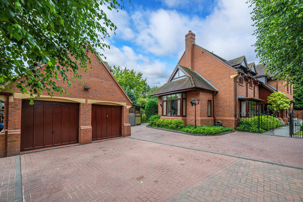
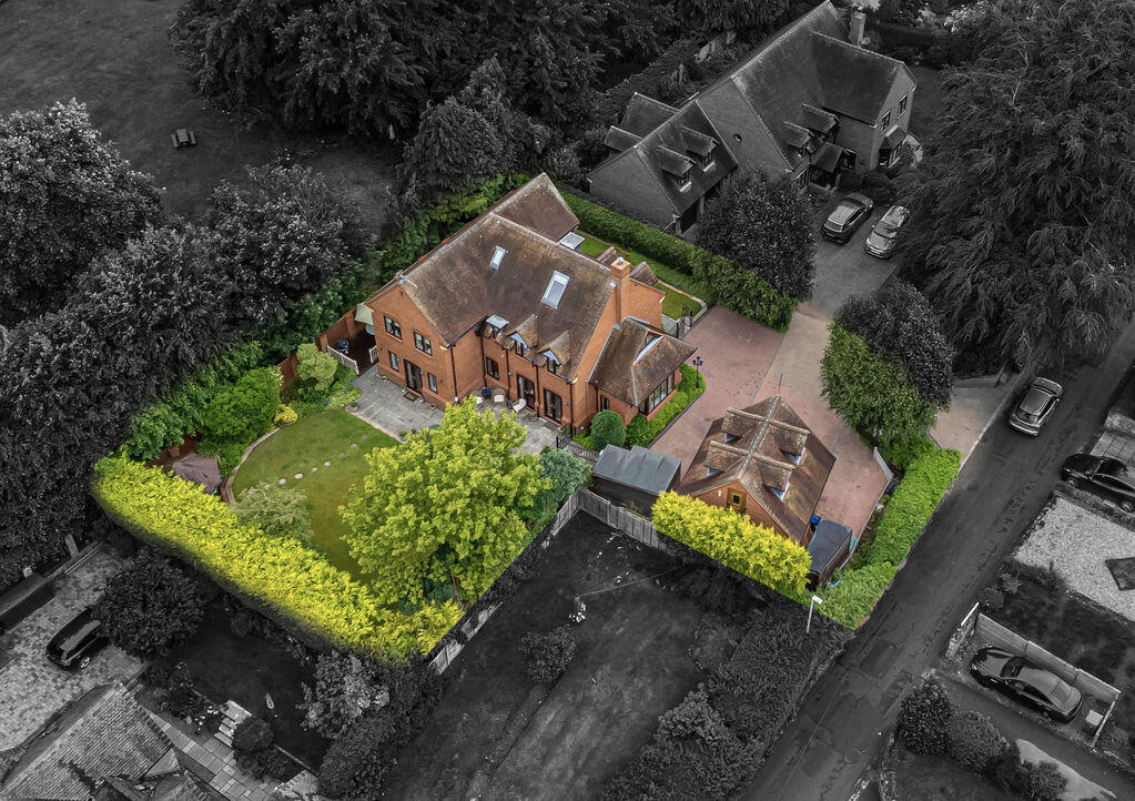
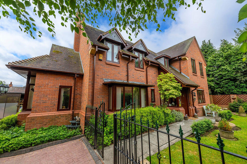
17 BARGATE LANE
STAFFORD, BREWOOD, STAFFORDSHIRE ST19 9EG
Property details
Tenure
FREEHOLD
Floor area
199 m²
Council tax band
G
EPC rating
C
Year built
England and Wales: 1996-2002
Last sold
£160,000 Aug 2000
Price per m²
£4,497/m²
Local average
£412,935 (+116.7%)
Deprivation
Decile 6 (18,855 of 33,755)
Street crime
14 incidents within 1 mile (Apr 2026)
Additional details
- Parking
- Yes
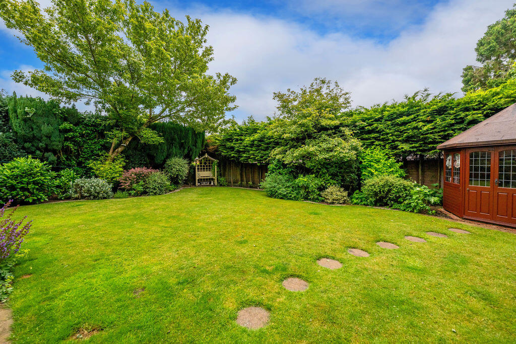
- Garden
- Yes
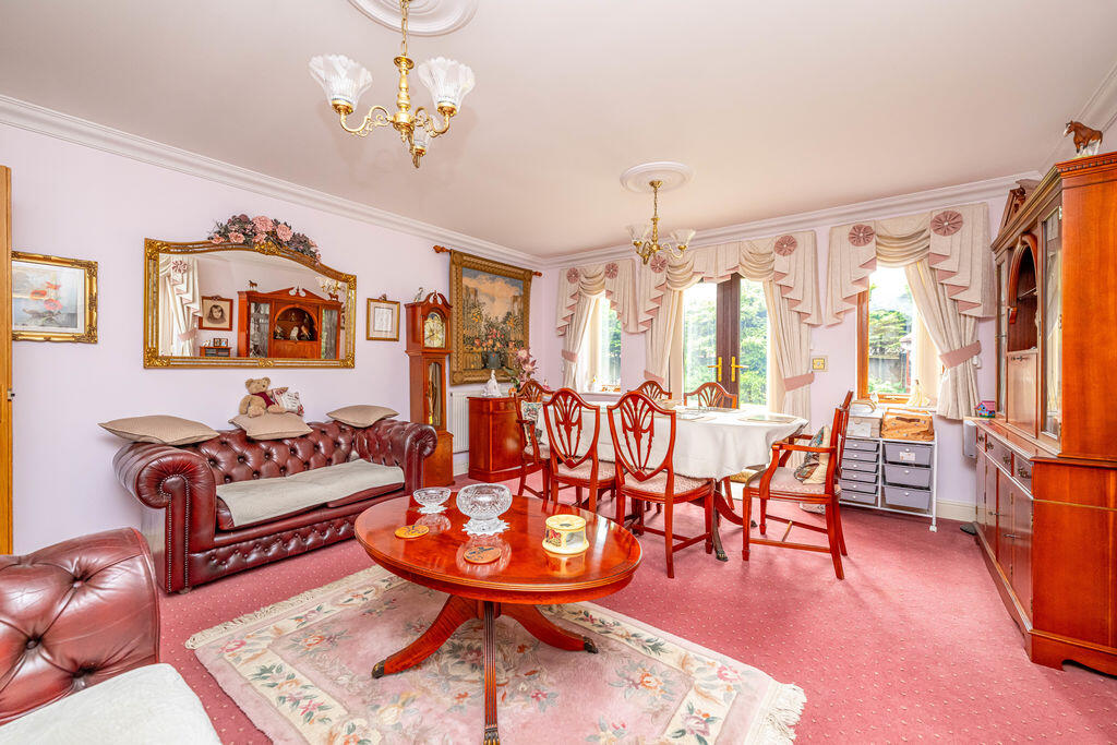
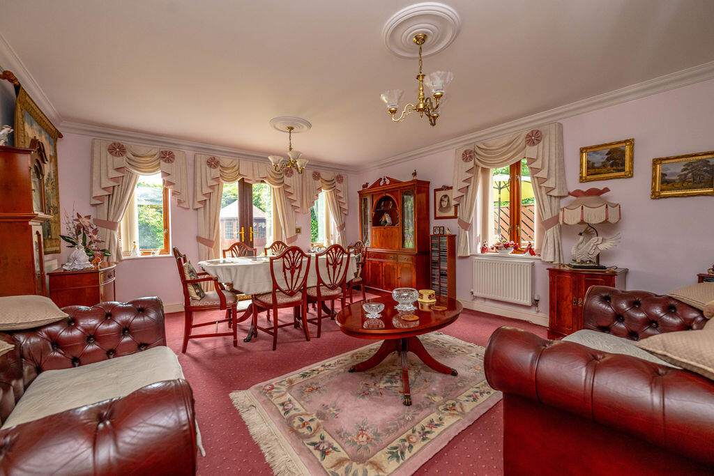
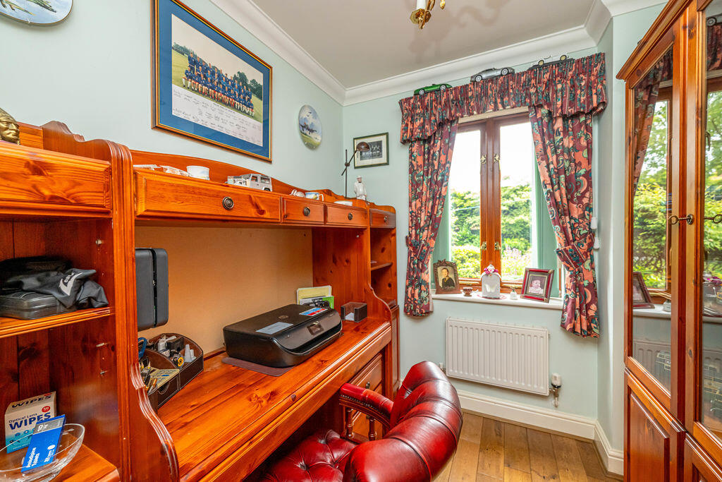
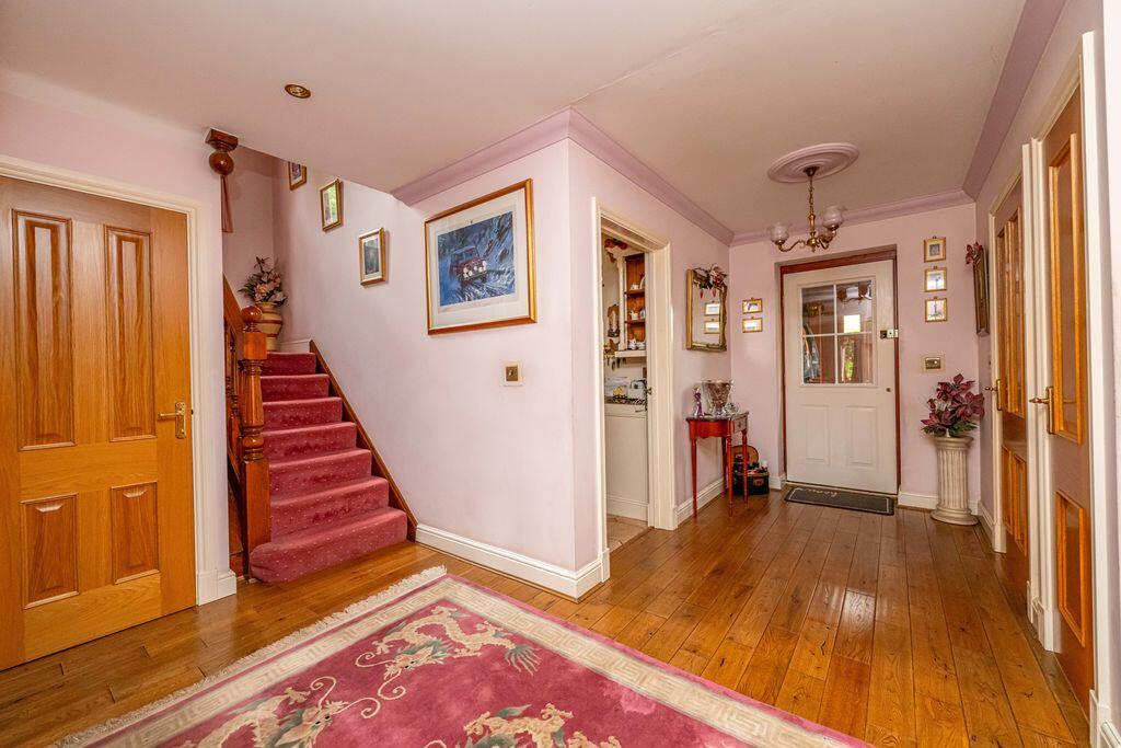
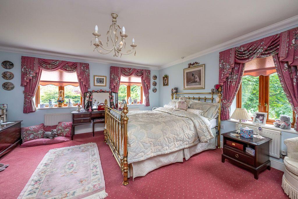
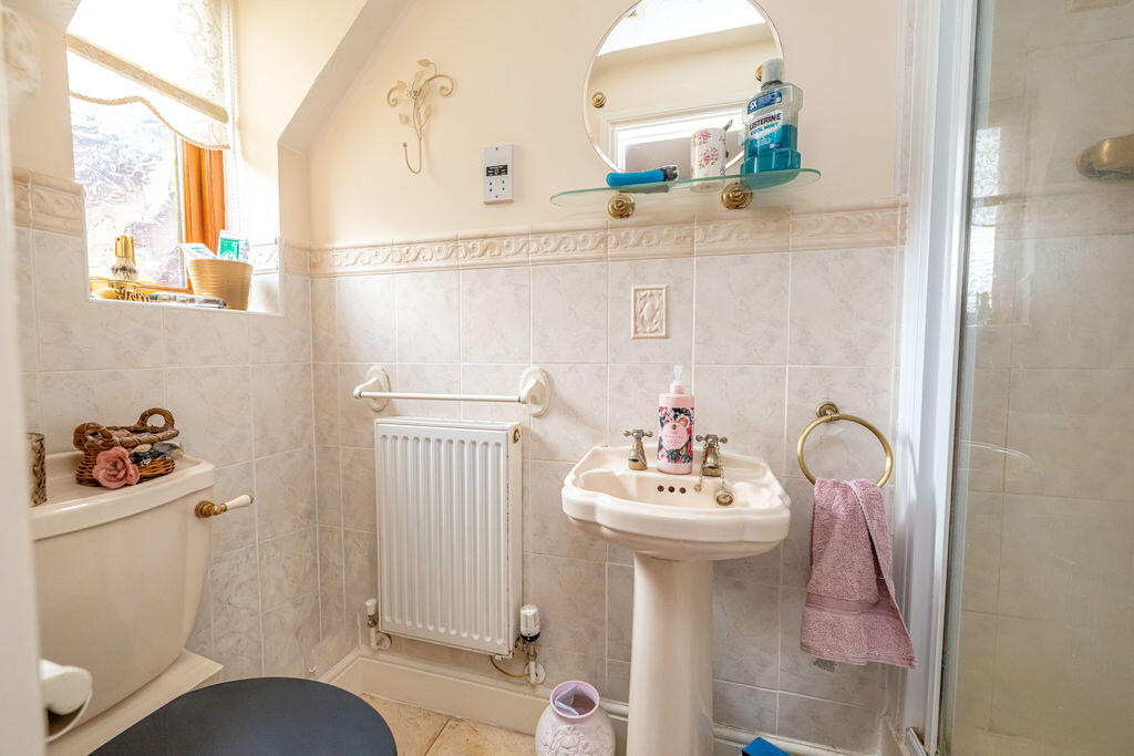
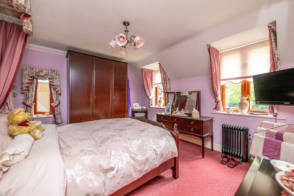
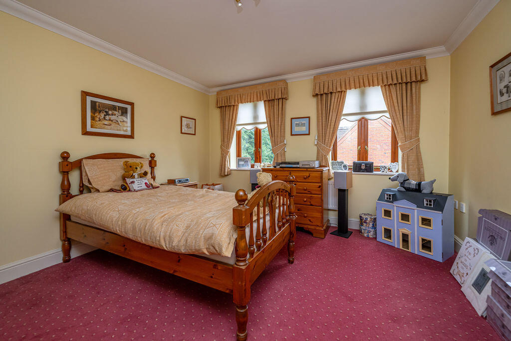
Description
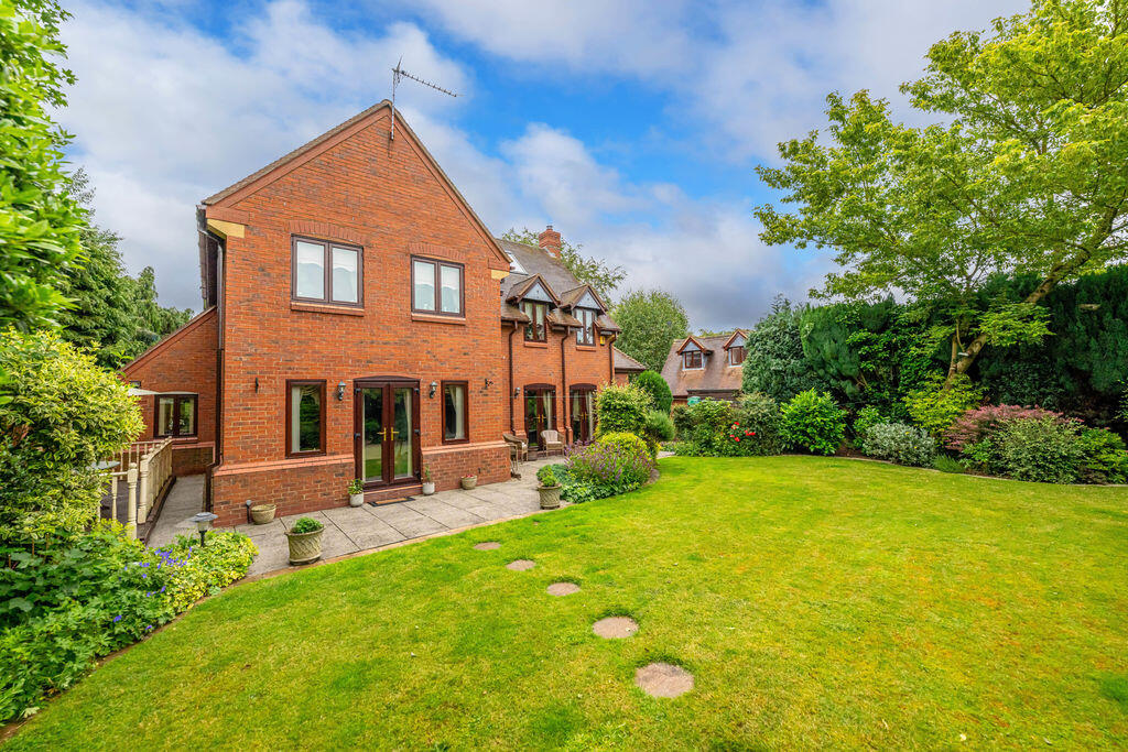
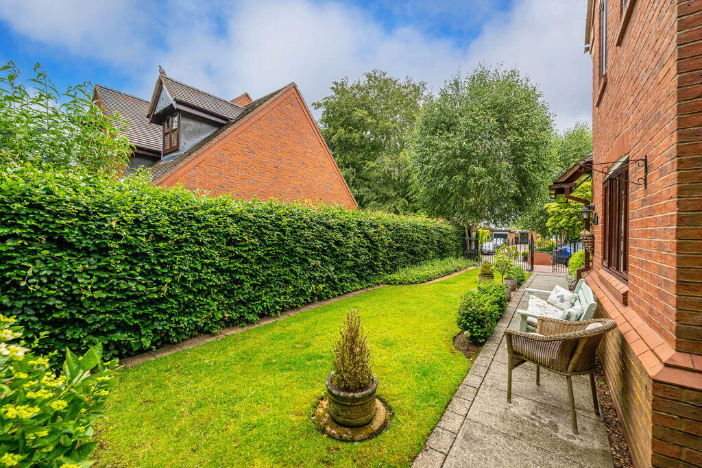
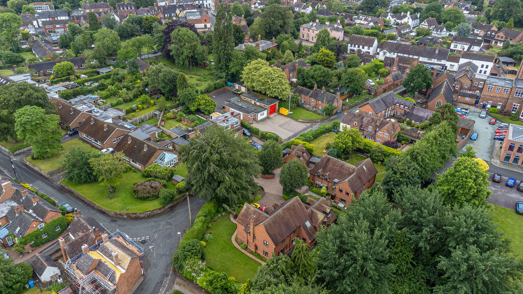
Bargate Lane enjoys a highly convenient position within the sought-after village of Brewood, placing residents within easy walking distance of a range of everyday amenities. The village centre offers a selection of independent shops, cafés, pubs, restaurants and essential services. Recreational facilities include Brewood Playing Fields, tennis courts, sports clubs and attractive countryside walks surrounding the village, creating an excellent balance of convenience and rural living. The property is also well placed for access to nearby towns including Penkridge, Stafford and Wolverhampton.
The property is particularly well positioned for families, with several well-regarded schools located within the village. Primary education is provided by St Mary and St Chad CofE First School and St Mary's Catholic Primary School, both within easy reach of the property. Secondary education is available at Brewood Middle Academy, while older pupils can access a range of highly regarded secondary schools and colleges in nearby Stafford, Codsall and Wolverhampton. The village is also home to St Dominic's Independent School, which provides education from preparatory years through to sixth form.
Brewood benefits from excellent transport connections, making it an attractive location for commuters. The property is conveniently located for the A5 and the M54 motorway, providing straightforward access to the M6, Telford, Stafford, Wolverhampton and the wider West Midlands motorway network. Regular bus services operate through the village, with nearby stops serving surrounding towns and villages. Rail services are available from nearby stations including Penkridge, Codsall, Bilbrook and Wolverhampton, offering direct connections to Birmingham, Stafford, Manchester and London.
Property Services
Tenure - Freehold
EPC - C
Council Tax Authority - South Staffordshire
Council Tax Band - G
Flood Risk - Very Low
Mobile Network Coverage
O2 - 88%
EE - 80%
Three - 65%
Vodaphone - 78%
Broadband Network Coverage
Standard - 19 Mbps
Utilities
Mains Water
Mains Electricity
Mains Gas
Mains Drainage
WhatThreeWords - ///learning.dives.tooth
Listed by
Tettenhall
Peter James Property Partnership
Reference: 89930643
EPC Rating & Upgrade Cost
Current rating: C
Potential rating: C
Inspection date: 11/06/2026
Expiry date: 10/06/2036
Current heating cost: £1,735/year
Potential heating cost: £1,754/year
Est. upgrade cost to C: £10,333
Recommendations
- Low energy lighting for all fixed outlets (£1,230 - £1,435)
- Solar photovoltaic panels, 2.5 kWp (£8,000 - £10,000)
Flood risk
Zone: 1
Risk: Low
Job (default Low)
Floorplans

Floor Plan
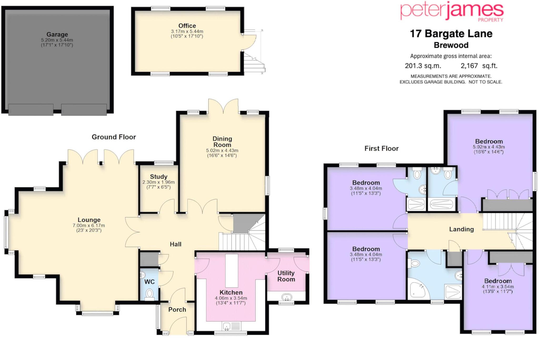
17 Bargate Lane - Floorplan
EPC Graphs

Energy Performance Certificate
Price history
| Event | Date | Price | % change |
|---|---|---|---|
| Listed for sale | — | £895,000 | +459.4% |
| Sold | 31/08/2000 (25 years ago) | £160,000 | — |
Source: HM Land Registry Price Paid Data. Crown copyright.
Sold Comparables
Same street and nearby sales within 0.25 miles (last 5 years). Data from Land Registry Price Paid.
| Address | Price | Date | Type |
|---|---|---|---|
| PEARTREE COTTAGE, 34 NEWPORT STREET, BREWOOD, STAFFORD, SOUTH STAFFORDSHIRE, STAFFORDSHIRE, ST19 9DT | £355,000 | 18/08/2023 | Detached |
| Same street BARGATE STABLES 2 BARGATE LANE, BREWOOD, STAFFORD, SOUTH STAFFORDSHIRE, STAFFORDSHIRE, ST19 9EG | £425,000 | 19/04/2023 | Detached |
| OAK APPLE HOUSE DEANSFIELD ROAD, BREWOOD, STAFFORD, SOUTH STAFFORDSHIRE, STAFFORDSHIRE, ST19 9EQ | £560,000 | 31/05/2022 | Detached |
| 5 ORAMS LANE, BREWOOD, STAFFORD, SOUTH STAFFORDSHIRE, STAFFORDSHIRE, ST19 9EA | £725,000 | 04/05/2022 | Detached |
| 32 HORSEBROOK LANE, BREWOOD, STAFFORD, SOUTH STAFFORDSHIRE, STAFFORDSHIRE, ST19 9EF | £410,000 | 31/03/2022 | Detached |
| 4 TELFORD GARDENS, BREWOOD, STAFFORD, SOUTH STAFFORDSHIRE, STAFFORDSHIRE, ST19 9ED | £450,000 | 25/03/2022 | Detached |
| 2 ORAMS LANE, BREWOOD, STAFFORD, SOUTH STAFFORDSHIRE, STAFFORDSHIRE, ST19 9EA | £385,000 | 10/12/2021 | Detached |
| 10 VICARAGE ROAD, BREWOOD, STAFFORD, SOUTH STAFFORDSHIRE, STAFFORDSHIRE, ST19 9HA | £426,000 | 29/09/2021 | Detached |
| Same street 20 BARGATE LANE, BREWOOD, STAFFORD, SOUTH STAFFORDSHIRE, STAFFORDSHIRE, ST19 9EG | £252,500 | 27/09/2021 | Semi-detached |
| 8 VICARAGE ROAD, BREWOOD, STAFFORD, SOUTH STAFFORDSHIRE, STAFFORDSHIRE, ST19 9HA | £355,000 | 16/08/2021 | Detached |
Street average: £338,750 (2 sales)
Area average: £458,250 (8 sales)
Capital growth trend
Land Registry outcode average: last 12 months vs 5y and 10y ago (from sold prices).
House Price Index (HM Land Registry — official index, not sold-price averages): South Staffordshire. Series: Detached. As of March 2026.
Rental Range
Estimated market rent for South Staffordshire. Low = conservative, Realistic = average, Optimistic = best case.
Based on Local Authority from postcode lookup → South Staffordshire.
LHA (30th percentile) floor for Mid Staffs: £992/mo (Apr 2025 – Mar 2026)
Location
Nearby
Nearest stations, universities and amenities (distance from property).
| Type | Name | Distance |
|---|---|---|
| Shop | Spar | 0.1 miles |
| Shop | Village Flowers | 0.1 miles |
| Bus stop | Post Office | 0.2 miles |
| Bus stop | Deansfield Close | 0.3 miles |
| Train station | Codsall | 3.7 miles |
| Train station | Bilbrook | 3.8 miles |
| Hospital | krishna pemmaraju | 5.9 miles |
| Hospital | Rowley Hall Hospital | 8.3 miles |
| University | Staffordshire University Blackheath Lane Site | 10.3 miles |
| University | University Of Wolverhampton (Shropshire Campus) (Business School) | 10.5 miles |
Street-level crime
| Category | Count |
|---|---|
| Violence and sexual offences | 9 |
| Anti-social behaviour | 2 |
| Other theft | 2 |
| Criminal damage and arson | 1 |
| Total incidents | 14 |
Within 1 mile during Apr 2026. Source: data.police.uk (England & Wales).
Schools nearby
Nearest open schools with Ofsted ratings (England). Closed schools are not shown. Data from Get Information about Schools and Ofsted.
| Name | Type | Distance | Ofsted |
|---|---|---|---|
| St. Dominic's Grammar School | Other | 0.1 miles | — (No rating) |
| St Mary and St Chad CofE First School | Primary | 0.2 miles | Good — 15 Feb 2011 |
| Brewood Middle CofE Academy | Primary | 0.2 miles | Good — 29 Apr 2024 |
| St Mary's Catholic Primary School | Primary | 0.3 miles | Good — 26 May 2022 |
| St Paul's CofE First School | Primary | 2.1 miles | Good — 17 Oct 2016 |
Rental Comparables
Loading rental comparables for this postcode. Refresh in a few minutes.
Rent-driven metrics
Based on Area rent estimate.
- Rent ratio — Monthly rent ÷ purchase price (1% rule). 1%+ = strong, 0.8–1% = okay, <0.8% = weak for cashflow.
- Max investor price — Rent ÷ 0.8%; the price at which rent would be 0.8% of price (Stoke-style target).
- Target investor price — Rent ÷ 1%; the price at which rent would be 1% of price (strong cashflow band).
- Gross yield — Annual rent as % of purchase price (no costs).