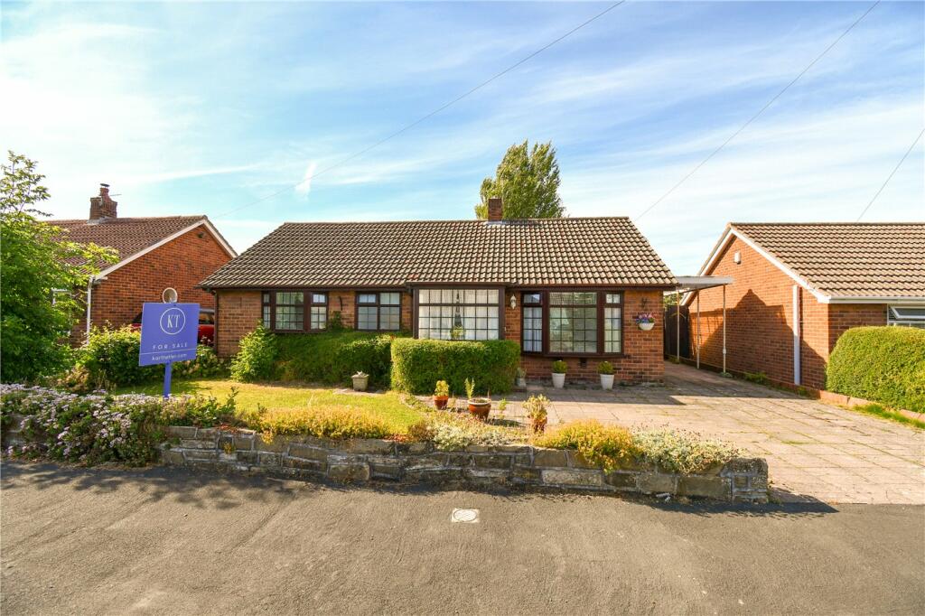
3 MEADOW WALK
WIRRAL, MERSEYSIDE CH61 6XU
£250,000
Property details
Tenure
FREEHOLD
Floor area
75 m²
Council tax band
TBC
Last sold
£240,000 Sep 2024
Local average
£456,929 (-45.3%)
Deprivation
Decile 6 (19,396 of 33,755)
Street crime
52 incidents within 1 mile (Apr 2026)
Key features
- Virtual Tour Available
- 789 Sq Ft (Approx)
- Freehold
- Council Tax Band C
- Detached Bungalow
- Sold with No Ongoing Chain
- Popular Residential Location
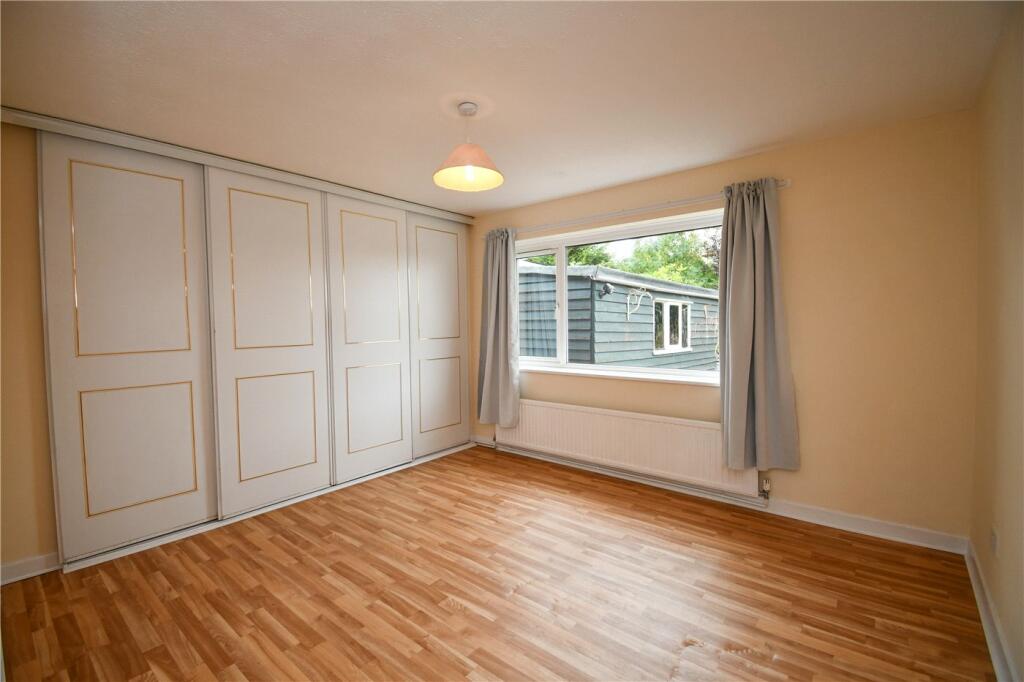
- Master Bedroom with Fitted Wardrobes
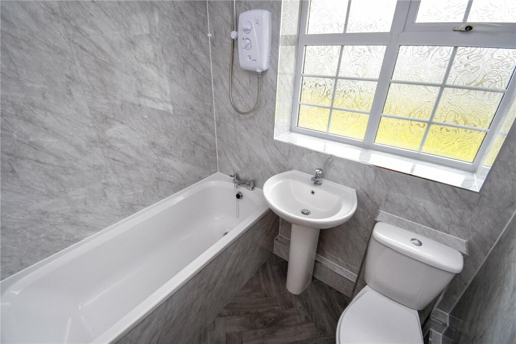
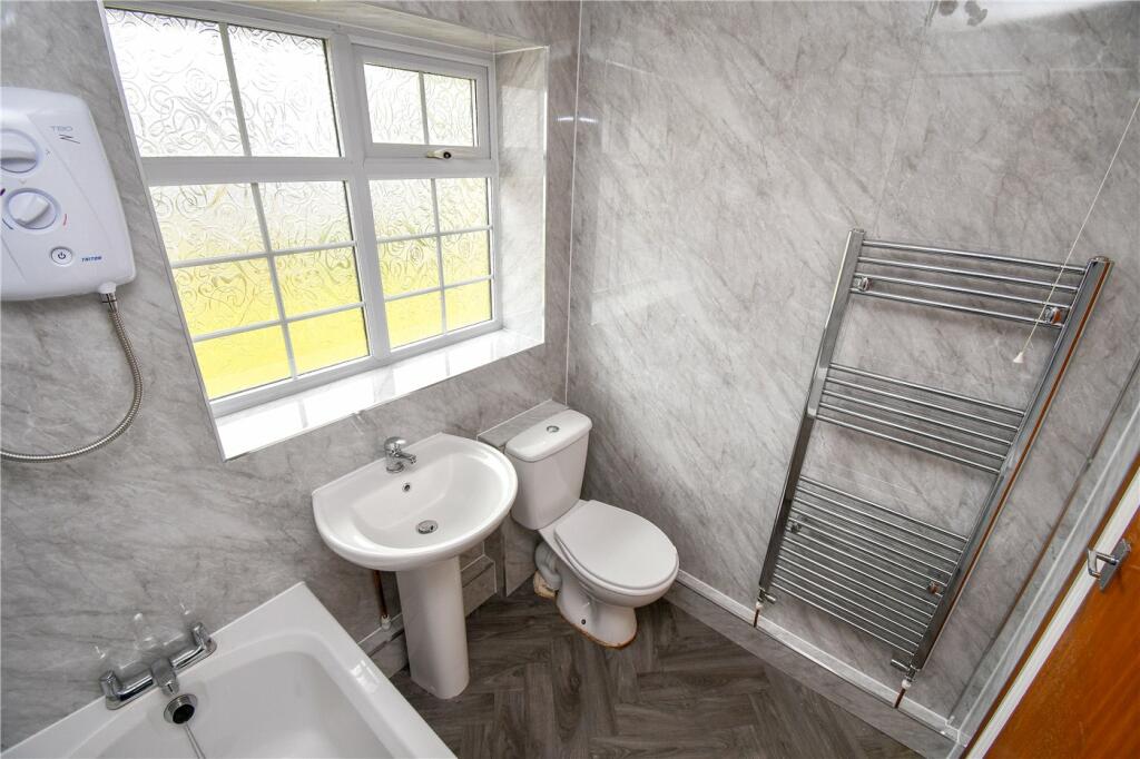
- Brand New Three Piece Bathroom
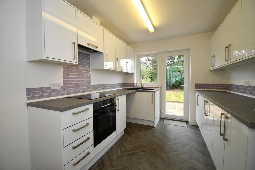
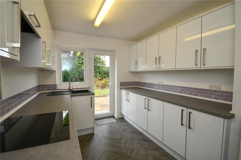
- Brand New Kitchen
Additional details
- Parking
- Yes
- Garden
- Yes
Description
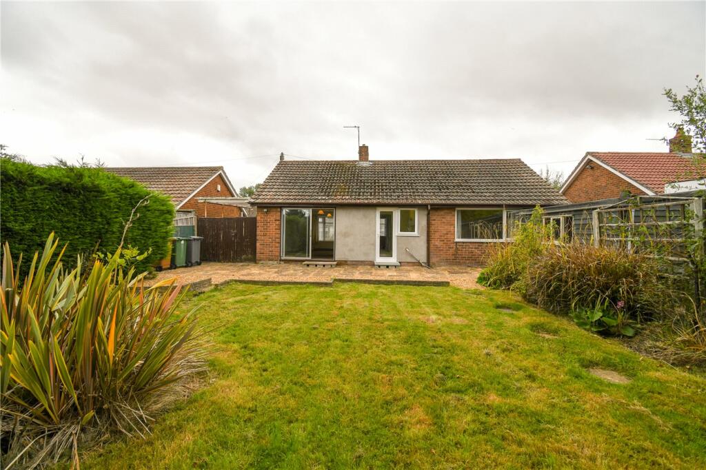
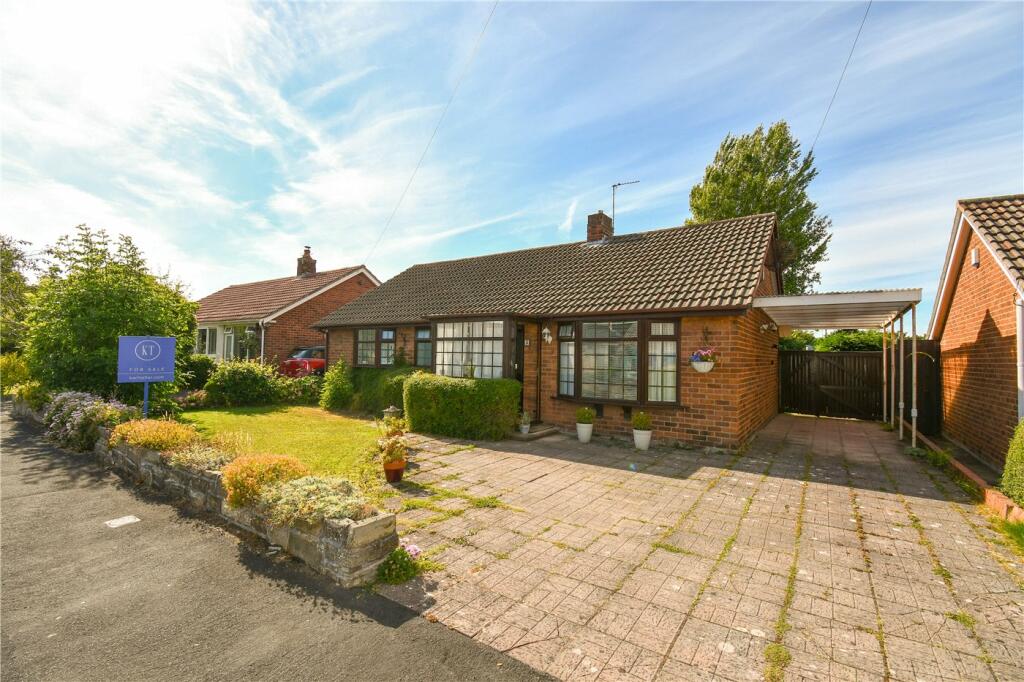
Stop your search, we have found the perfect property for you! Situated witin a popular cul-de-sac, this detached bungalow has endless potential and is being sold with no ongoing chain and comes with a brand new kitchen! A must view!
A rare opportunity to purchase a delightful detached bungalow, situated on the outskirts of Heswall.
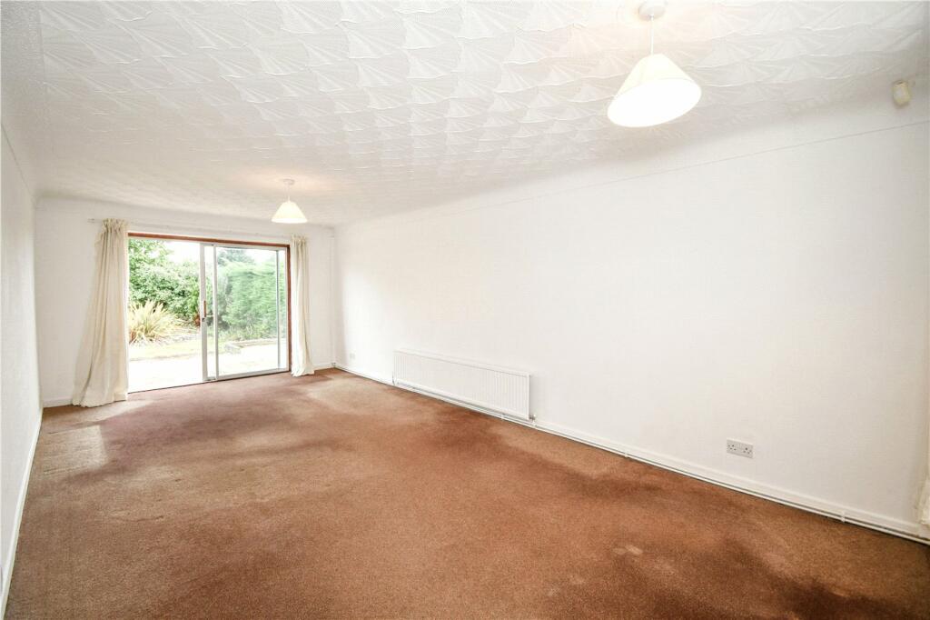
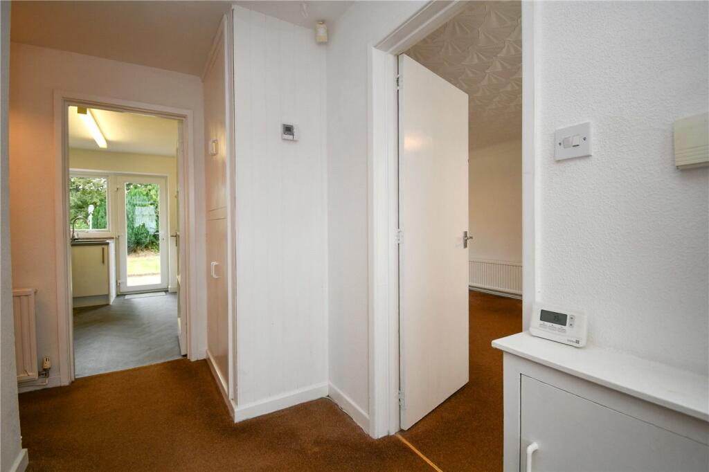
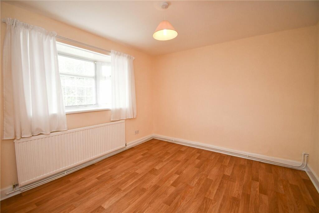
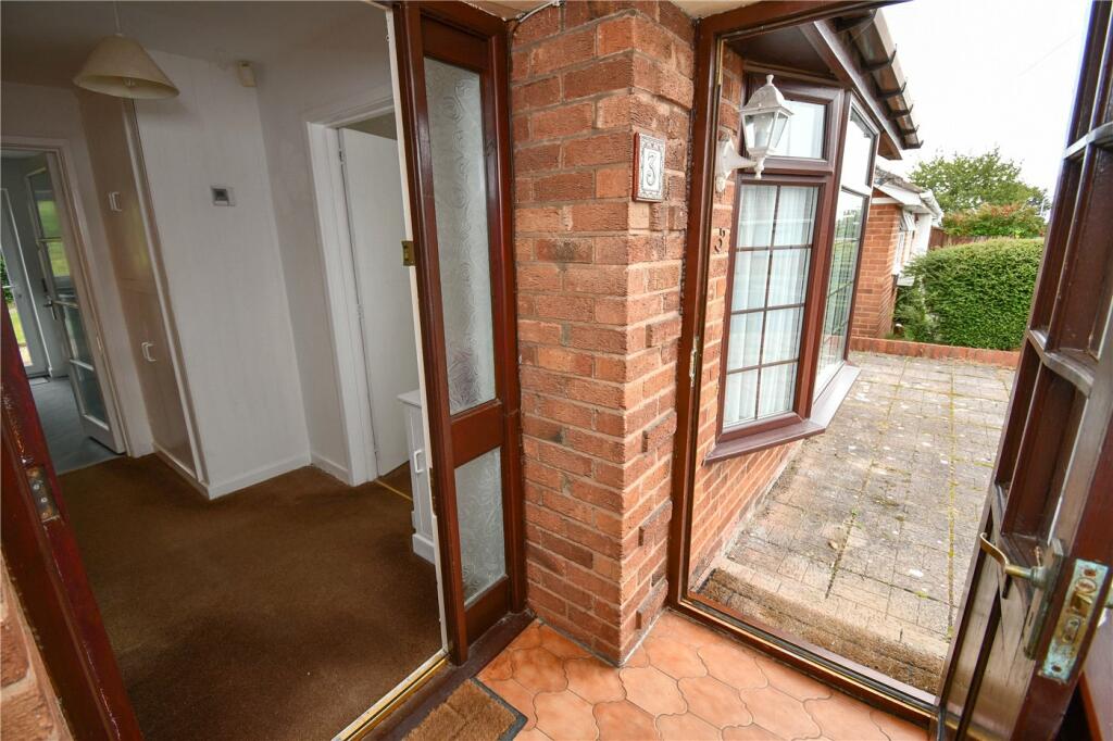
The accommodation in brief, comprises; a welcoming entrance hallway, through living dining room with a dual aspect, newly fitted modern kitchen, master bedroom with fitted wardrobes, second bedroom and a three piece bathroom.
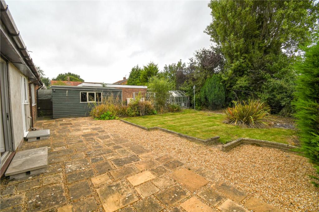
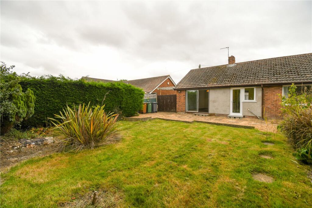
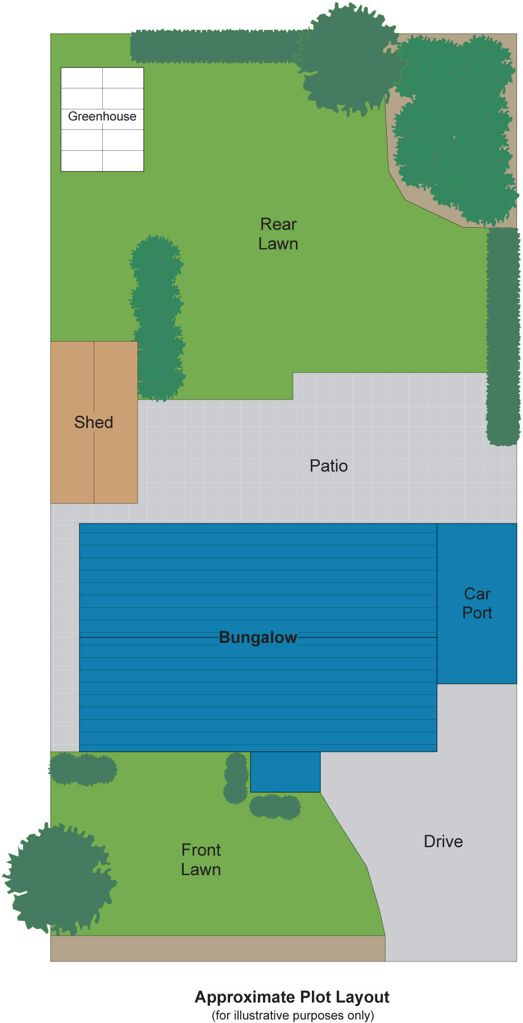
Externally, there is a private rear garden with a sunny aspect, shed & patio area, ideal for entertaining friends and family. To the front of the house, there is a large driveway, gardens and carport.
We highly recommend an internal viewing and don't hold back, this property won’t stick around for long. To book a viewing, call the Heswall Karl Tatler Team.
Listed by
Heswall
Karl Tatler
Reference: 148688180
EPC Rating & Upgrade Cost
Fetching EPC data… Refresh this page in a moment.
Flood risk
Zone: 1
Risk: Low
Job (default Low)
Floorplans
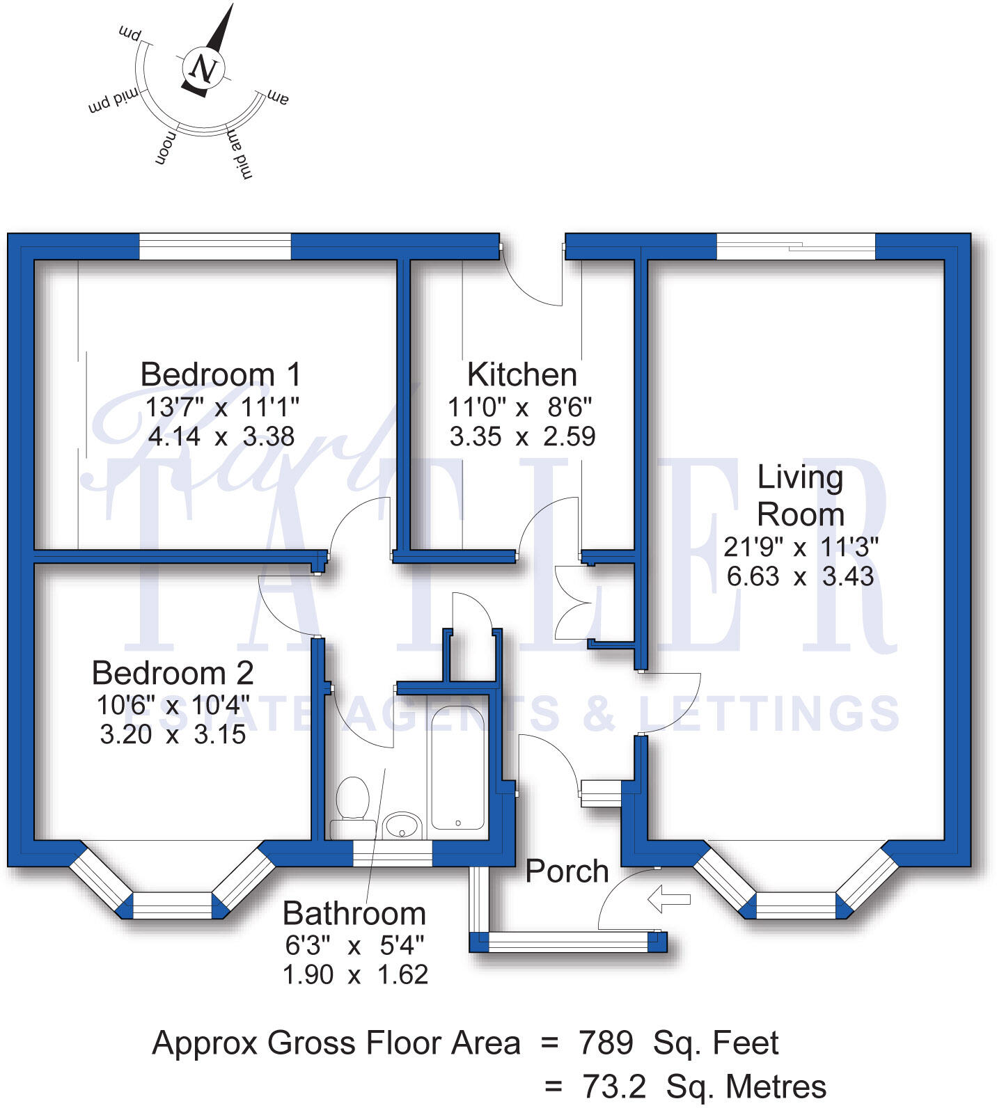
Floorplan
Floorplan
EPC Graphs
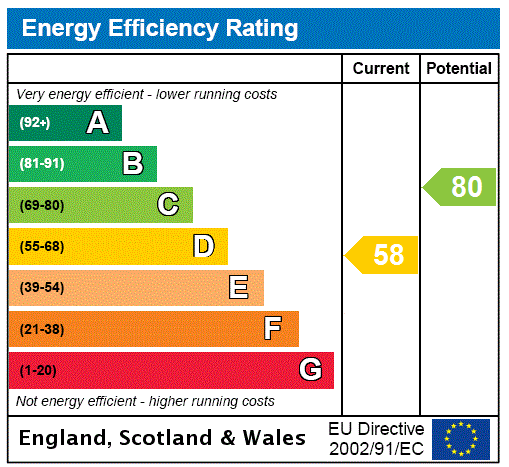
EPC Rating Graph
Price history
42% since 2009
| Event | Date | Price | % change |
|---|---|---|---|
| Sold | 03/09/2024 (1 year ago) | £240,000 | +42% |
| Sold | 22/05/2009 (17 years ago) | £169,000 | — |
Source: HM Land Registry Price Paid Data. Crown copyright.
Sold Comparables
Same street and nearby sales within 0.25 miles (last 5 years). Data from Land Registry Price Paid.
| Address | Price | Date | Type |
|---|---|---|---|
| 131 KYLEMORE DRIVE, WIRRAL, MERSEYSIDE, CH61 6XS | £330,000 | 18/12/2025 | Detached |
| 78 IRBY ROAD, WIRRAL, MERSEYSIDE, CH61 6XG | £295,000 | 30/11/2022 | Detached |
| 20A MERE LANE, WIRRAL, MERSEYSIDE, CH60 6RR | £1,000,000 | 28/11/2022 | Detached |
| Same street 6 MEADOW WALK, WIRRAL, MERSEYSIDE, CH61 6XU | £255,000 | 12/07/2022 | Detached |
| 88 IRBY ROAD, WIRRAL, MERSEYSIDE, CH61 6XG | £453,250 | 24/06/2022 | Detached |
| 22 MERE LANE, WIRRAL, MERSEYSIDE, CH60 6RR | £502,500 | 28/02/2022 | Detached |
| 8 PENSBY HALL LANE, WIRRAL, MERSEYSIDE, CH61 6XR | £280,000 | 28/01/2022 | Detached |
| 119 IRBY ROAD, WIRRAL, MERSEYSIDE, CH61 6UZ | £360,000 | 14/12/2021 | Detached |
Street average: £255,000 (1 sale)
Area average: £460,107 (7 sales)
Capital growth trend
Land Registry outcode average: last 12 months vs 5y and 10y ago (from sold prices).
House Price Index (HM Land Registry — official index, not sold-price averages): Wirral. Series: Detached. As of March 2026.
Rental Range
Estimated market rent for Wirral. Low = conservative, Realistic = average, Optimistic = best case.
Based on Local Authority from postcode lookup → Wirral.
LHA (30th percentile) floor for Wirral: £524/mo (Apr 2025 – Mar 2026)
Location
Nearby
Nearest stations, universities and amenities (distance from property).
| Type | Name | Distance |
|---|---|---|
| Bus stop | IRBY ROAD/KYLEMORE DRIVE | 0.1 miles |
| Shop | Sudio's | 0.2 miles |
| Shop | Premier | 0.2 miles |
| Hospital | Unknown | 0.7 miles |
| Hospital | Murrayfield Hospital | 1.5 miles |
| Train station | Heswall | 1.5 miles |
| Train station | Royden Park Minature Railway | 1.9 miles |
| University | University of Liverpool Leahurst Veterinary School | 4.8 miles |
| University | Liverpool Institute for Performing Arts | 6.9 miles |
Street-level crime
| Category | Count |
|---|---|
| Violence and sexual offences | 23 |
| Anti-social behaviour | 9 |
| Drugs | 6 |
| Shoplifting | 5 |
| Criminal damage and arson | 3 |
| Other theft | 3 |
| Public order | 2 |
| Other crime | 1 |
| Total incidents | 52 |
Within 1 mile during Apr 2026. Source: data.police.uk (England & Wales).
Schools nearby
Nearest open schools with Ofsted ratings (England). Closed schools are not shown. Data from Get Information about Schools and Ofsted.
| Name | Type | Distance | Ofsted |
|---|---|---|---|
| Ladymount Catholic Primary School | Primary | 0.1 miles | Good — 11 Jul 2024 |
| Pensby Primary School | Primary | 0.3 miles | Good — 4 May 2017 |
| Pensby High School | Secondary | 0.4 miles | Good — 28 Feb 2018 |
| Stanley School | Other | 0.4 miles | Good — 28 Mar 2013 |
| Heswall Primary School | Primary | 0.8 miles | Good — 29 Mar 2012 |
Rental Comparables
Loading rental comparables for this postcode. Refresh in a few minutes.
Rent-driven metrics
Based on Area rent estimate.
- Rent ratio — Monthly rent ÷ purchase price (1% rule). 1%+ = strong, 0.8–1% = okay, <0.8% = weak for cashflow.
- Max investor price — Rent ÷ 0.8%; the price at which rent would be 0.8% of price (Stoke-style target).
- Target investor price — Rent ÷ 1%; the price at which rent would be 1% of price (strong cashflow band).
- Gross yield — Annual rent as % of purchase price (no costs).