APARTMENT 411
TOBACCO WAREHOUSE, REGENT ROAD, LIVERPOOL, MERSEYSIDE L3 0BL

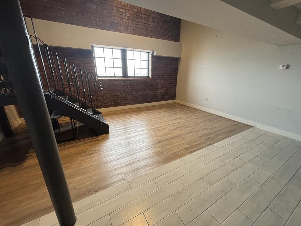


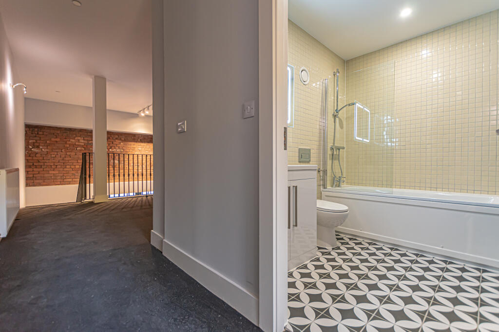


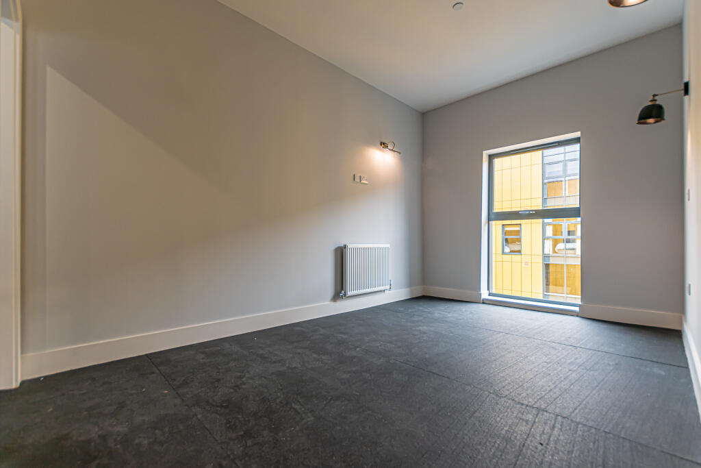
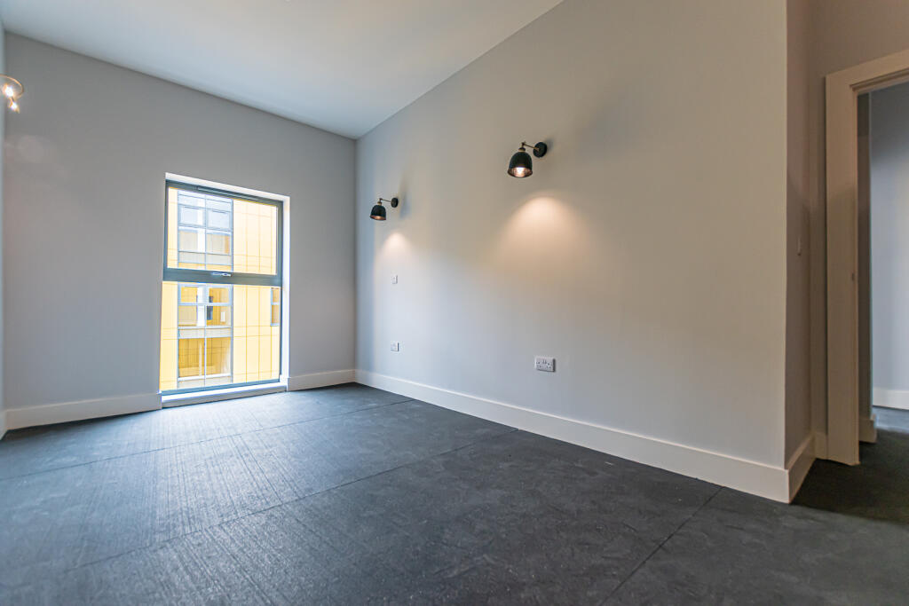
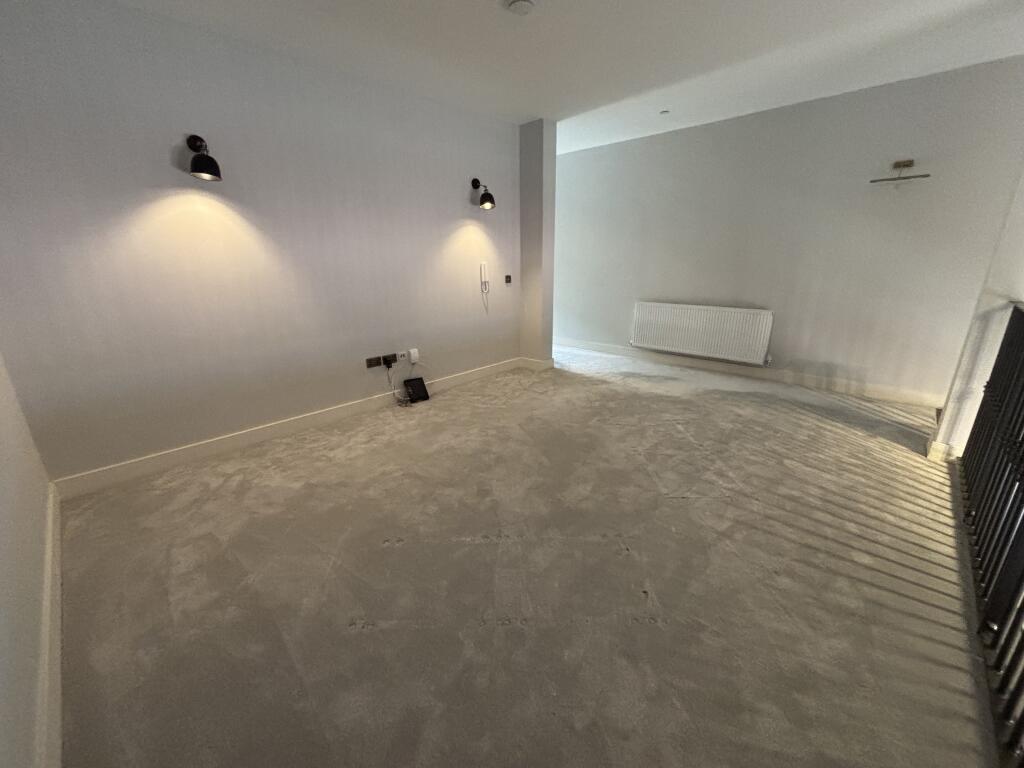


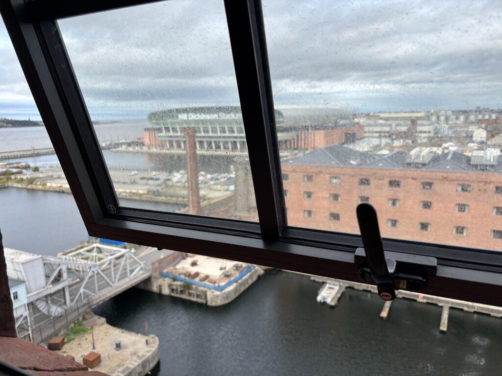
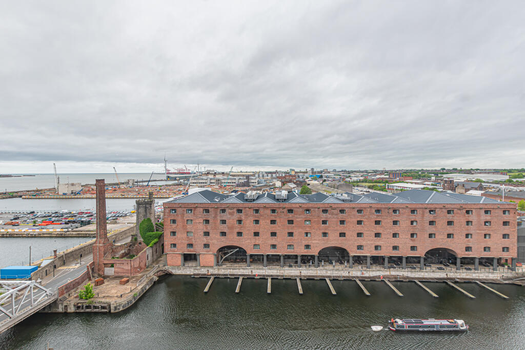


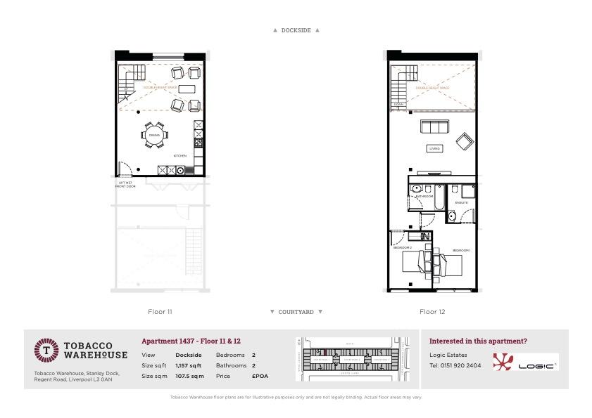
Photo 1 Photo 2 Photo 3 Photo 4 Photo 5 Photo 6 Photo 7 Photo 8 Photo 9 Photo 10 Photo 11 Photo 12 Photo 13 Photo 14 Photo 15 Photo 16 Photo 17 Photo 18 Photo 19 Photo 20 Photo 21 Photo 22
/ 22
Property details
Floor area
177 m²
Council tax band
E
Deprivation
Decile 2 (5,337 of 33,755)
Street crime
1469 incidents within 1 mile (Apr 2026)
Additional details
- Parking
- Yes
Description
*Unfurnished
*Stunning Dockside Views
*24/7 Concierge
*Allocated Private Parking Space
*Available Now
* Unfurnished
Local Authority- Liverpool Council
Council tax - TBC
Estimated Annual Cost- TBC
Conservation Area - No
Flood Risk - Low
Floor Area - 1157 sq ft
Satellite / Fibre TV Availability
BT
Sky
Virgin
(Data source from sprift)
'Unusually good at what we do'
'Straightforward Sales & Lettings'
Sell with a multi - “National award winning Estate Agent !”
Selling the Facts not the Flower
Listed by
Liverpool
Logic 1 Ltd
Reference: 165460685
EPC Rating & Upgrade Cost
Fetching EPC data… Refresh this page in a moment.
Flood risk
Zone: 1
Risk: Low
Job (default Low)
Rental Range
Estimated market rent for Liverpool. Low = conservative, Realistic = average, Optimistic = best case.
Based on Local Authority from postcode lookup → Liverpool.
LHA (30th percentile) floor for Greater Liverpool: £593/mo (Apr 2025 – Mar 2026)
Location
Address
15 Blackstock Street
Nearby
Nearest stations, universities and amenities (distance from property).
| Type | Name | Distance |
|---|---|---|
| Bus stop | VAUXHALL ROAD/PAUL STREET | 0.1 miles |
| Bus stop | Blackstock Street | 0.1 miles |
| Shop | Everydayz | 0.1 miles |
| Shop | Dofas | 0.1 miles |
| Train station | Moorfields | 0.5 miles |
| Train station | Liverpool Lime Street | 0.7 miles |
| Hospital | Greenbank Drive Surgery | 3.0 miles |
| Hospital | Rathbone Hospital | 3.1 miles |
| University | Liverpool Hope University | 4.3 miles |
| University | Edge Hill University | 11.0 miles |
Street-level crime
| Category | Count |
|---|---|
| Violence and sexual offences | 397 |
| Drugs | 278 |
| Shoplifting | 193 |
| Anti-social behaviour | 154 |
| Public order | 148 |
| Other theft | 77 |
| Criminal damage and arson | 70 |
| Burglary | 36 |
| Vehicle crime | 35 |
| Other crime | 29 |
| Theft from the person | 19 |
| Possession of weapons | 16 |
| Robbery | 11 |
| Bicycle theft | 6 |
| Total incidents | 1469 |
Within 1 mile during Apr 2026. Source: data.police.uk (England & Wales).
Schools nearby
Nearest open schools with Ofsted ratings (England). Closed schools are not shown. Data from Get Information about Schools and Ofsted.
| Name | Type | Distance | Ofsted |
|---|---|---|---|
| Holy Cross Catholic Primary School | Primary | 0.3 miles | Good — 17 Apr 2018 |
| The Trinity Catholic Academy | Primary | 0.3 miles | Inadequate — 13 May 2019 |
| Faith Primary Academy | Primary | 0.6 miles | Good — 14 Jan 2019 |
| Millstead School | Other | 0.6 miles | Outstanding — 28 Mar 2013 |
| Notre Dame Catholic Academy | Secondary | 0.8 miles | Requires improvement — 17 Jul 2022 |
Rental Comparables
Rental listings exist nearby, but none matched the 2-bedroom count for this property.