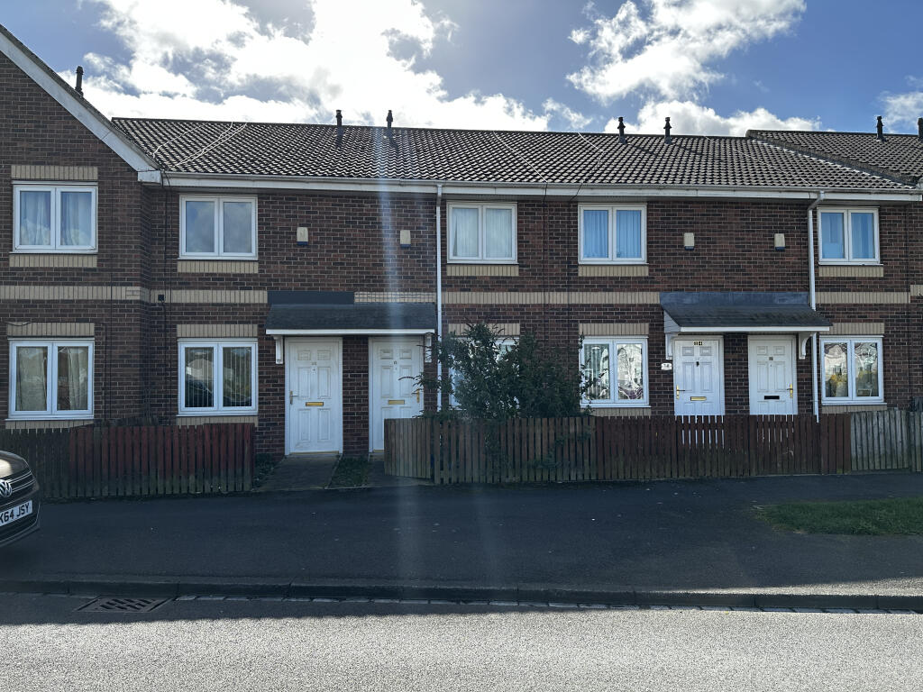
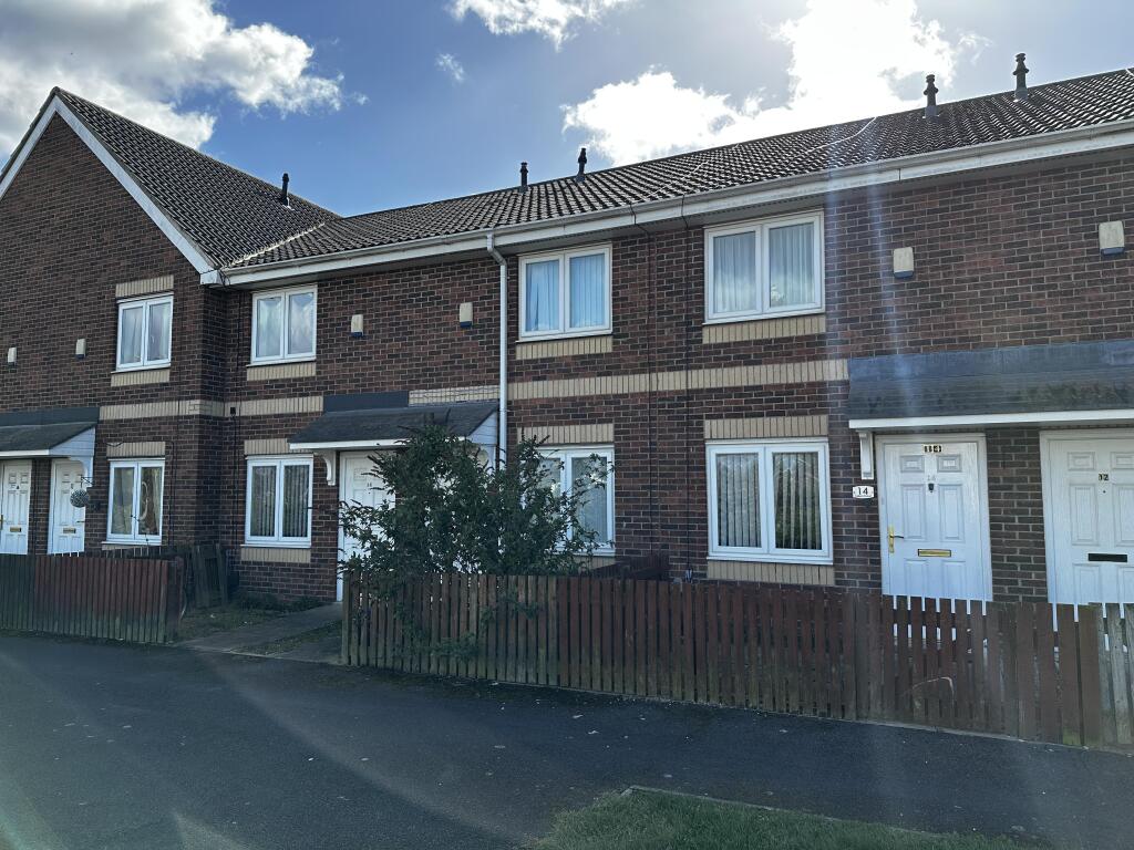
7 TALBOT STREET
STOCKTON-ON-TEES, STOCKTON-ON-TEES, STOCKTON-ON-TEES TS20 2AY
Listing type
Property details
Listing category
Auction
Tenure
FREEHOLD
Floor area
69 m²
Year built
England and Wales: 2003-2006
Last sold
£96,000 Aug 2006
Price per m²
£362/m²
Local average
£167,929 (-85.1%)
Deprivation
Decile 2 (3,874 of 33,755)
Street crime
552 incidents within 1 mile (Apr 2026)
Additional details
- Garden
- Yes
Description
Key LocationsThe property is situated on the south side of Talbot StreetThe shops and amenities of Stockton on Tees are to the southStockton station is 0.8 miles to the south west of the propertyNorton Road (A139) is to the west, leading onto the A19Portrack Park is nearby
ViewingsThe property will be open for viewing on Thursday 16th April, Monday 20th April and Thursday 23rd April between 1:15 - 1:45 p.m. These are open viewing times with no need to register.
If you cannot attend the viewing you are advised to view the images and any available virtual tour on our website before bidding.
Listed by
Auction
Allsop LLP
Reference: 174319205
EPC Rating & Upgrade Cost
Fetching EPC data… Refresh this page in a moment.
Flood risk
Zone: 1
Risk: Low
Job (default Low)
Price history
| Event | Date | Price | % change |
|---|---|---|---|
| Sold | 02/08/2006 (19 years ago) | £96,000 | — |
Source: HM Land Registry Price Paid Data. Crown copyright.
Sold Comparables
Same street and nearby sales within 0.25 miles (last 5 years). Data from Land Registry Price Paid.
| Address | Price | Date | Type |
|---|---|---|---|
| 152 NORTON ROAD, STOCKTON-ON-TEES, TS20 2BG | £286,000 | 07/11/2025 | Terraced |
| 9 TALBOT STREET, STOCKTON-ON-TEES, TS20 2AY | £60,000 | 27/03/2024 | Terraced |
| 1 TALBOT STREET, STOCKTON-ON-TEES, TS20 2AY | £72,000 | 31/03/2023 | Terraced |
| 170 NORTON ROAD, STOCKTON-ON-TEES, TS20 2BG | £82,000 | 23/03/2023 | Terraced |
| 116 NORTON ROAD, STOCKTON-ON-TEES, TS20 2AQ | £40,000 | 10/02/2023 | Terraced |
| 17 TALBOT STREET, STOCKTON-ON-TEES, TS20 2AY | £85,000 | 19/12/2022 | Terraced |
| 156 NORTON ROAD, STOCKTON-ON-TEES, TS20 2BG | £86,000 | 30/11/2022 | Terraced |
| 11 GIBSON ROAD, STOCKTON-ON-TEES, TS20 2FU | £150,000 | 16/11/2022 | Terraced |
| 16 TALBOT STREET, STOCKTON-ON-TEES, TS20 2AY | £62,300 | 27/10/2022 | Terraced |
| 34 ROUTLEDGE ROAD, STOCKTON-ON-TEES, TS20 2XA | £79,500 | 18/10/2022 | Terraced |
| 10 SMAILES CLOSE, STOCKTON-ON-TEES, TS20 2FY | £180,500 | 17/08/2022 | Terraced |
| 4 SMAILES CLOSE, STOCKTON-ON-TEES, TS20 2FY | £132,500 | 12/05/2022 | Terraced |
| 8 HASWELL COURT, STOCKTON-ON-TEES, TS20 2AZ | £67,500 | 22/04/2022 | Terraced |
| 35 GIBSON ROAD, STOCKTON-ON-TEES, TS20 2FU | £128,180 | 23/12/2021 | Terraced |
| 37 GIBSON ROAD, STOCKTON-ON-TEES, TS20 2FU | £128,181 | 23/12/2021 | Terraced |
| 33 GIBSON ROAD, STOCKTON-ON-TEES, TS20 2FU | £128,181 | 23/12/2021 | Terraced |
| 18 TALBOT STREET, STOCKTON-ON-TEES, TS20 2AY | £7,350,656 | 15/10/2021 | Terraced |
| 18 TALBOT STREET, STOCKTON-ON-TEES, TS20 2AY | £5,209,000 | 15/10/2021 | Terraced |
Area average: £795,972 (18 sales)
Capital growth trend
Land Registry outcode average: last 12 months vs 5y and 10y ago (from sold prices).
House Price Index (HM Land Registry — official index, not sold-price averages): Stockton-on-Tees. Series: Terraced. As of March 2026.
Rental Range
Estimated market rent for Stockton-on-Tees. Low = conservative, Realistic = average, Optimistic = best case.
Based on Local Authority from postcode lookup → Stockton-on-Tees.
LHA (30th percentile) floor for Teesside: £474/mo (Apr 2025 – Mar 2026)
Location
Nearby
Nearest stations, universities and amenities (distance from property).
| Type | Name | Distance |
|---|---|---|
| Bus stop | Tilery Road | 0.1 miles |
| Shop | Unknown | 0.1 miles |
| Train station | Stockton | 0.6 miles |
| University | Durham University, Queen's Campus | 1.0 miles |
| Train station | Thornaby | 1.1 miles |
| Hospital | Butterwick Hospice | 1.7 miles |
| Hospital | North Tees Hospital | 1.7 miles |
| University | Teesside University | 2.9 miles |
Street-level crime
| Category | Count |
|---|---|
| Violence and sexual offences | 219 |
| Anti-social behaviour | 83 |
| Criminal damage and arson | 49 |
| Public order | 39 |
| Shoplifting | 30 |
| Vehicle crime | 30 |
| Other theft | 26 |
| Burglary | 23 |
| Other crime | 16 |
| Drugs | 15 |
| Robbery | 13 |
| Possession of weapons | 6 |
| Theft from the person | 2 |
| Bicycle theft | 1 |
| Total incidents | 552 |
Within 1 mile during Apr 2026. Source: data.police.uk (England & Wales).
Schools nearby
Nearest open schools with Ofsted ratings (England). Closed schools are not shown. Data from Get Information about Schools and Ofsted.
| Name | Type | Distance | Ofsted |
|---|---|---|---|
| North Shore Academy | Secondary | 0.1 miles | Outstanding — 21 Sep 2021 |
| Tilery Primary School | Primary | 0.3 miles | — (Inspected (no overall grade)) |
| Norton Primary Academy | Primary | 0.6 miles | Good — 8 May 2019 |
| The Oak Tree Academy | Primary | 0.7 miles | Good — 13 Oct 2019 |
| Mill Lane Primary School | Primary | 0.8 miles | Good — 26 Jun 2023 |
Rental Comparables
Rental listings exist nearby, but none matched the 2-bedroom count for this property.
Rent-driven metrics
Based on Area rent estimate.
- Rent ratio — Monthly rent ÷ purchase price (1% rule). 1%+ = strong, 0.8–1% = okay, <0.8% = weak for cashflow.
- Max investor price — Rent ÷ 0.8%; the price at which rent would be 0.8% of price (Stoke-style target).
- Target investor price — Rent ÷ 1%; the price at which rent would be 1% of price (strong cashflow band).
- Gross yield — Annual rent as % of purchase price (no costs).