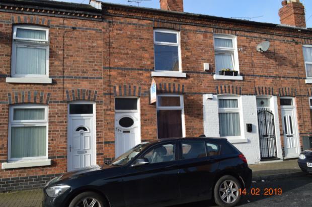
35 CHAMBERS STREET
CREWE, CREWE, CHESHIRE CW2 6HJ
£525 pcm
Property details
Floor area
66 m²
Deprivation
Decile 2 (5,873 of 33,755)
Street crime
352 incidents within 1 mile (Mar 2026)
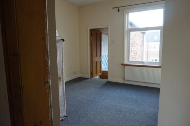
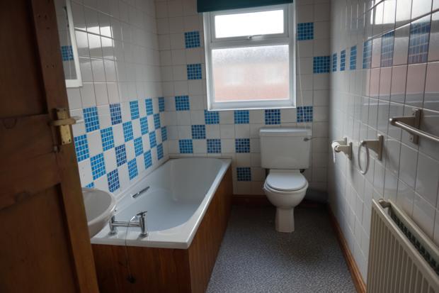
Key features
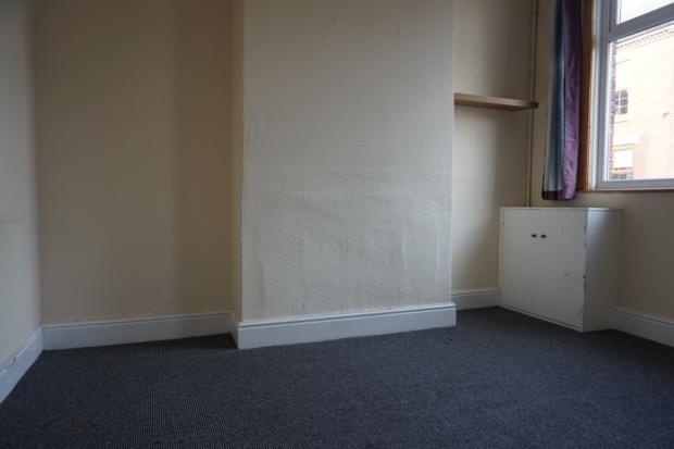
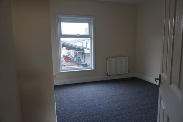
- 2 bedroom terraced property
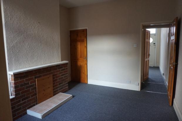
- Living room
- Reception room
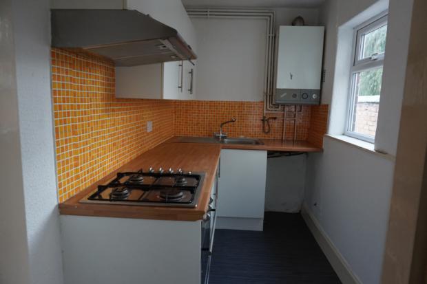
- Kitchen
- Bathroom
- Gas central heating
Additional details
- Garden
- Yes
Description
Listed by
Crewe
Homeworld Property Management Limited
Reference: 60746697
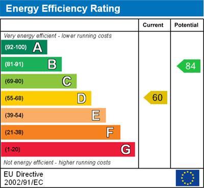
EPC Rating & Upgrade Cost
Fetching EPC data… Refresh this page in a moment.
Flood risk
Zone: 1
Risk: Low
Job (default Low)
EPC Graphs
Environmental Impact

Energy Efficiency

Energy Performance Certificate
FENSA Certificates
This property has 1 FENSA certificate(s) on record, indicating window/door installations by FENSA-approved installers.
FENSA Certificate #16556776 Recent
Property Details
Street: 35 Chambers Street
Town: CREWE
Postcode: CW2 6HJ
Installation Details
Items: 2 doors
Certificate Issued: 17/11/2024
Work Completed: 23/10/2024
This certificate data was retrieved from FENSA's database
What is FENSA? FENSA (Fenestration Self-Assessment Scheme) is a government-authorised scheme that monitors building regulation compliance for replacement windows and doors. Certificates indicate that work was completed by FENSA-approved installers.
Rental Range
Estimated market rent for Cheshire East. Low = conservative, Realistic = average, Optimistic = best case.
Based on Local Authority from postcode lookup → Cheshire East.
LHA (30th percentile) floor for South Cheshire: £573/mo (Apr 2025 – Mar 2026)
Location
Nearby
Nearest stations, universities and amenities (distance from property).
| Type | Name | Distance |
|---|---|---|
| Shop | Jay's Computer Services | 0.1 miles |
| Shop | Top Gee | 0.1 miles |
| Bus stop | Crewe, Nantwich Road / The Brunswick | 0.1 miles |
| Train station | Crewe | 0.3 miles |
| University | University of Buckingham Crewe Campus | 0.8 miles |
| Hospital | Leighton Hospital | 2.6 miles |
| Train station | Nantwich | 3.7 miles |
| Hospital | Weaver Lodge Independent Hospital | 7.4 miles |
| University | Keele University | 9.2 miles |
Street-level crime
| Category | Count |
|---|---|
| Violence and sexual offences | 128 |
| Shoplifting | 58 |
| Public order | 34 |
| Anti-social behaviour | 33 |
| Drugs | 31 |
| Criminal damage and arson | 19 |
| Other theft | 14 |
| Bicycle theft | 9 |
| Other crime | 7 |
| Vehicle crime | 6 |
| Burglary | 5 |
| Possession of weapons | 4 |
| Robbery | 3 |
| Theft from the person | 1 |
| Total incidents | 352 |
Within 1 mile during Mar 2026. Source: data.police.uk (England & Wales).
Schools nearby
Nearest open schools with Ofsted ratings (England). Closed schools are not shown. Data from Get Information about Schools and Ofsted.
| Name | Type | Distance | Ofsted |
|---|---|---|---|
| Westminster Nursery School | Nursery | 0.2 miles | Good — 26 Nov 2014 |
| Ruskin Community High School | Secondary | 0.4 miles | Good — 1 Jul 2015 |
| Pebble Brook Primary School | Primary | 0.5 miles | Good — 25 Nov 2014 |
| Cheshire College - South & West | Other | 0.6 miles | — (No rating) |
| Edleston Primary School | Primary | 0.6 miles | Good — 10 Jun 2016 |
Rental Comparables
Loading rental comparables for this postcode. Refresh in a few minutes.