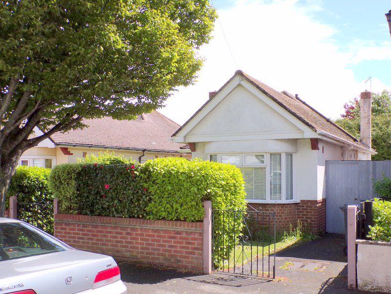
60 CLAREMONT AVENUE
BOURNEMOUTH, BOURNEMOUTH, CHRISTCHURCH AND POOLE BH9 3HB
Property details
Tenure
FREEHOLD
Floor area
68 m²
EPC rating
D
Year built
England and Wales: 1950-1966
Last sold
£329,950 Aug 2021
Price per m²
£4,852/m²
Local average
£407,294 (-19%)
Deprivation
Decile 5 (14,926 of 33,755)
Street crime
252 incidents within 1 mile (Apr 2026)
Key features
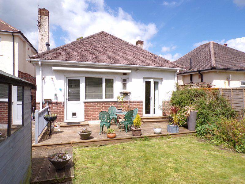
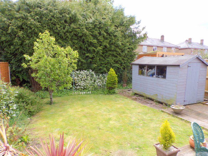
- DETCHAED BUNGALOW
- NO ONWARD CHAIN
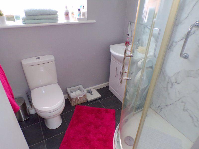
- 2 WCs
- COMBI BOILER
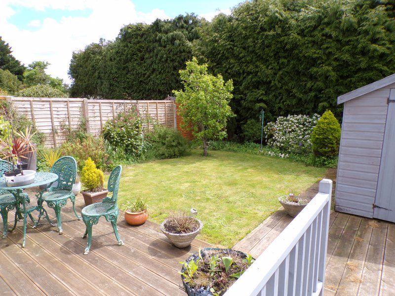
- SUNNY REAR GARDEN
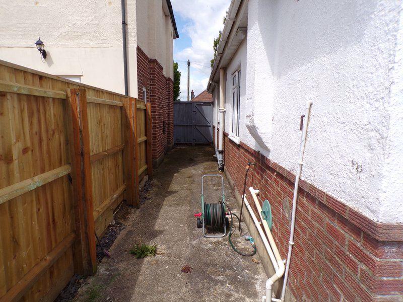
- OFF ROAD PARKING
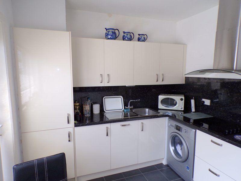
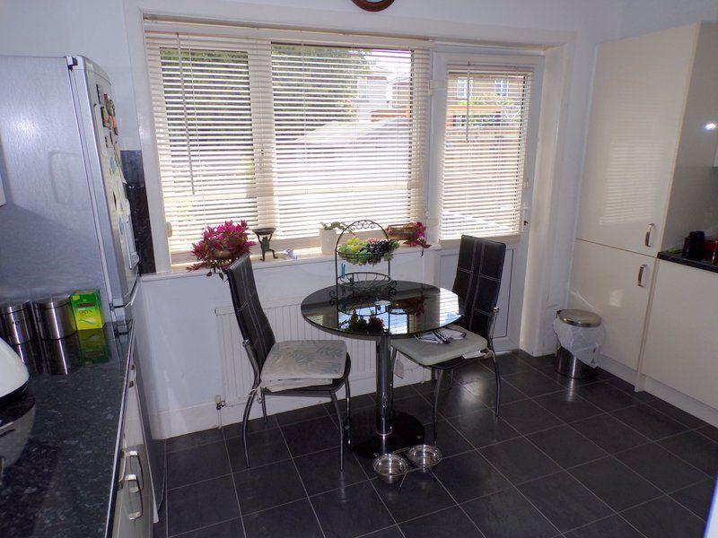
- MODERN KITCHEN
- UPVC WINDOWS
- NON ESTATE LOCATION
- SHOWER ROOM
Additional details
- Parking
- Yes
- Garden
- Yes
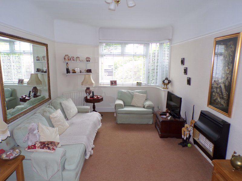
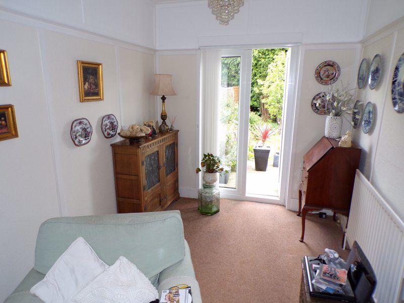
Description
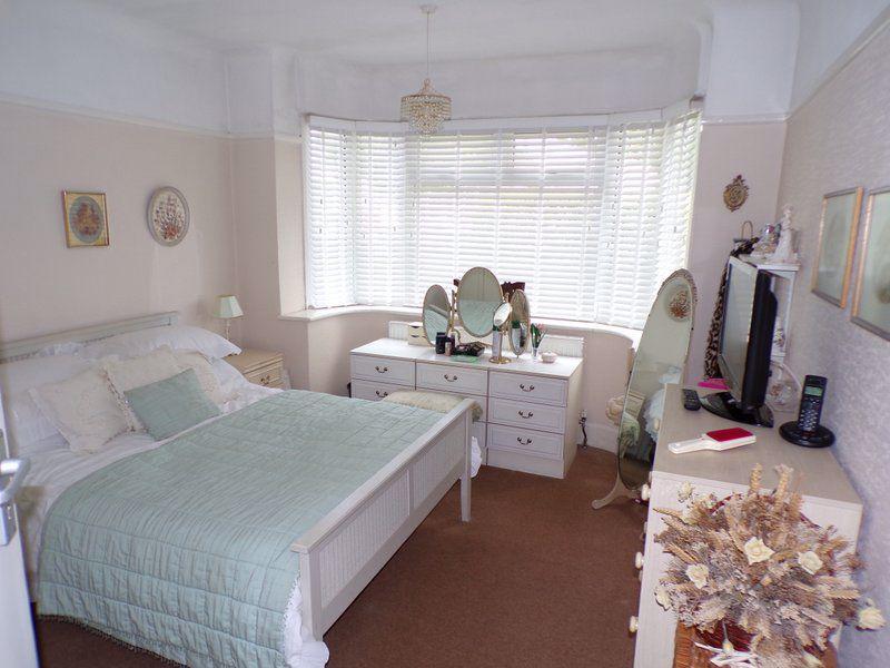
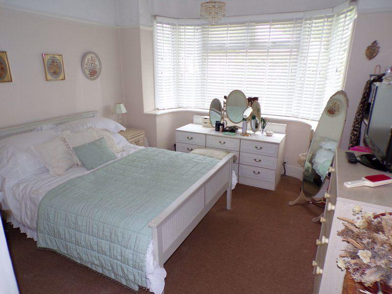
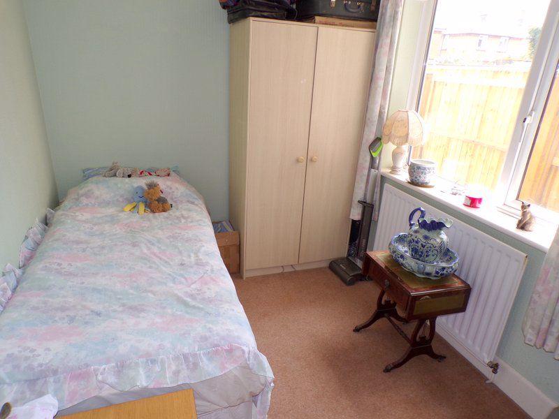
two bedroom detached bungalow with two WCs, Sunny aspect rear garden with off road parking. The property is being offered with no onward chain.
Listed by
Bournemouth
Simpsons Estate Agents
Reference: 107613728
EPC Rating & Upgrade Cost
Current rating: D
Potential rating: B
Inspection date: 27/05/2021
Expiry date: 26/05/2031
Current heating cost: £630/year
Potential heating cost: £432/year
Est. upgrade cost to C: £11,915
Recommendations
- Cavity wall insulation (£500 - £1,500)
- Floor insulation (suspended floor) (£800 - £1,200)
- Low energy lighting for all fixed outlets (£15)
- Upgrade heating controls (£350 - £450)
- Solar water heating (£4,000 - £6,000)
- Solar photovoltaic panels, 2.5 kWp (£3,500 - £5,500)
Flood risk
Zone: 1
Risk: Low
Job (default Low)
Floorplans
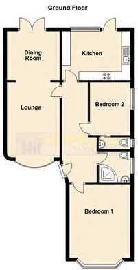
Floorplan 1
EPC Graphs

Energy Perform...
FENSA Certificates
This property has 1 FENSA certificate(s) on record, indicating window/door installations by FENSA-approved installers.
FENSA Certificate #15865158 Recent
Property Details
Street: 60 Claremont Avenue
Town: BOURNEMOUTH
Postcode: BH9 3HB
Installation Details
Items: 10 windows and 1 door
Certificate Issued: 23/07/2023
Work Completed: 18/07/2023
This certificate data was retrieved from FENSA's database
What is FENSA? FENSA (Fenestration Self-Assessment Scheme) is a government-authorised scheme that monitors building regulation compliance for replacement windows and doors. Certificates indicate that work was completed by FENSA-approved installers.
Price history
| Event | Date | Price | % change |
|---|---|---|---|
| Sold | 11/08/2021 (4 years ago) | £329,950 | — |
Source: HM Land Registry Price Paid Data. Crown copyright.
Sold Comparables
Same street and nearby sales within 0.25 miles (last 5 years). Data from Land Registry Price Paid.
| Address | Price | Date | Type |
|---|---|---|---|
| 201 CASTLE LANE WEST, BOURNEMOUTH, BOURNEMOUTH, CHRISTCHURCH AND POOLE, BH9 3LD | £425,000 | 08/01/2026 | Detached |
| 16 HUNTVALE ROAD, MOORDOWN, BOURNEMOUTH, BOURNEMOUTH, CHRISTCHURCH AND POOLE, BH9 3HP | £380,000 | 10/12/2025 | Detached |
| 5 LITTLECROFT AVENUE, BOURNEMOUTH, BOURNEMOUTH, CHRISTCHURCH AND POOLE, BH9 3HR | £465,000 | 01/07/2025 | Detached |
| 203 CASTLE LANE WEST, BOURNEMOUTH, BOURNEMOUTH, CHRISTCHURCH AND POOLE, BH9 3LD | £399,950 | 06/12/2023 | Detached |
| 96 WEST WAY, BOURNEMOUTH, BOURNEMOUTH, CHRISTCHURCH AND POOLE, BH9 3DZ | £685,000 | 26/09/2023 | Detached |
| 1 LITTLECROFT AVENUE, BOURNEMOUTH, BOURNEMOUTH, CHRISTCHURCH AND POOLE, BH9 3HR | £355,000 | 08/09/2023 | Detached |
| 23 HUNTFIELD ROAD, BOURNEMOUTH, BOURNEMOUTH, CHRISTCHURCH AND POOLE, BH9 3HN | £414,000 | 14/08/2023 | Detached |
| 68 UPLANDS ROAD, BOURNEMOUTH, BOURNEMOUTH, CHRISTCHURCH AND POOLE, BH8 9SS | £620,000 | 11/08/2023 | Detached |
| Same street 68 CLAREMONT AVENUE, BOURNEMOUTH, BOURNEMOUTH, CHRISTCHURCH AND POOLE, BH9 3HB | £315,000 | 13/01/2023 | Detached |
| 52 UPLANDS ROAD, BOURNEMOUTH, BOURNEMOUTH, CHRISTCHURCH AND POOLE, BH8 9SS | £465,000 | 16/12/2022 | Detached |
| 32 HUNTFIELD ROAD, BOURNEMOUTH, BOURNEMOUTH, CHRISTCHURCH AND POOLE, BH9 3HN | £337,500 | 16/12/2022 | Detached |
| 26 HUNTFIELD ROAD, BOURNEMOUTH, BOURNEMOUTH, CHRISTCHURCH AND POOLE, BH9 3HN | £480,000 | 09/12/2022 | Detached |
| 61 UPLANDS ROAD, BOURNEMOUTH, BOURNEMOUTH, CHRISTCHURCH AND POOLE, BH8 9SR | £775,000 | 01/12/2022 | Detached |
| 20 HUNTVALE ROAD, MOORDOWN, BOURNEMOUTH, BOURNEMOUTH, CHRISTCHURCH AND POOLE, BH9 3HP | £307,000 | 18/11/2022 | Detached |
| 12 TOWNSVILLE ROAD, BOURNEMOUTH, BOURNEMOUTH, CHRISTCHURCH AND POOLE, BH9 3HL | £215,000 | 17/10/2022 | Detached |
| 64 WEST WAY, BOURNEMOUTH, BOURNEMOUTH, CHRISTCHURCH AND POOLE, BH9 3EA | £545,000 | 14/10/2022 | Detached |
| 18 UPLANDS ROAD, BOURNEMOUTH, BOURNEMOUTH, CHRISTCHURCH AND POOLE, BH8 9SS | £582,500 | 16/09/2022 | Detached |
| 4 BROCKENHURST ROAD, BOURNEMOUTH, BOURNEMOUTH, CHRISTCHURCH AND POOLE, BH9 3ER | £390,000 | 13/09/2022 | Detached |
| 42 UPLANDS ROAD, BOURNEMOUTH, BOURNEMOUTH, CHRISTCHURCH AND POOLE, BH8 9SS | £530,000 | 26/08/2022 | Detached |
| 11 UPLANDS ROAD, BOURNEMOUTH, BOURNEMOUTH, CHRISTCHURCH AND POOLE, BH8 9SR | £805,000 | 21/07/2022 | Detached |
| 77 HAVERSTOCK ROAD, BOURNEMOUTH, BOURNEMOUTH, CHRISTCHURCH AND POOLE, BH9 3HH | £455,000 | 20/07/2022 | Detached |
Street average: £315,000 (1 sale)
Area average: £481,548 (20 sales)
Capital growth trend
Land Registry outcode average: last 12 months vs 5y and 10y ago (from sold prices).
House Price Index (HM Land Registry — official index, not sold-price averages): Bournemouth Christchurch and Poole. Series: Detached. As of March 2026.
Rental Range
Estimated market rent for Bournemouth, Christchurch and Poole. Low = conservative, Realistic = average, Optimistic = best case.
Based on Local Authority from postcode lookup → Bournemouth, Christchurch and Poole.
Location
Nearby
Nearest stations, universities and amenities (distance from property).
| Type | Name | Distance |
|---|---|---|
| Bus stop | Claremont Avenue | 0.1 miles |
| Bus stop | Broadway Co-op | 0.1 miles |
| Shop | Pets Corner | 0.2 miles |
| Shop | The Co-operative Food | 0.2 miles |
| University | Bournemouth University (Talbot Campus) | 1.7 miles |
| University | Bournemouth University | 1.7 miles |
| Hospital | Nuffield Health Bournemouth Hospital | 1.7 miles |
| Hospital | Royal Bournemouth Hospital | 1.7 miles |
| Train station | Bournemouth | 1.8 miles |
| Train station | Pokesdown | 2.2 miles |
Street-level crime
| Category | Count |
|---|---|
| Shoplifting | 90 |
| Violence and sexual offences | 64 |
| Anti-social behaviour | 43 |
| Vehicle crime | 16 |
| Burglary | 8 |
| Other theft | 8 |
| Criminal damage and arson | 5 |
| Public order | 5 |
| Robbery | 4 |
| Bicycle theft | 3 |
| Drugs | 2 |
| Other crime | 2 |
| Possession of weapons | 2 |
| Total incidents | 252 |
Within 1 mile during Apr 2026. Source: data.police.uk (England & Wales).
Schools nearby
Nearest open schools with Ofsted ratings (England). Closed schools are not shown. Data from Get Information about Schools and Ofsted.
| Name | Type | Distance | Ofsted |
|---|---|---|---|
| St. Walburga's Catholic Primary School | Primary | 0.3 miles | Good — 2 Feb 2020 |
| Bournemouth School | Secondary | 0.4 miles | Outstanding — 2 May 2024 |
| Bournemouth School for Girls | Secondary | 0.4 miles | Outstanding — 17 Jun 2024 |
| Queen's Park Academy | Primary | 0.4 miles | Outstanding — 10 Jul 2014 |
| Queen's Park Infant Academy | Primary | 0.4 miles | Good — 24 Jul 2013 |
Rental Comparables
Rental comparables are temporarily unavailable while listing-site fetches are paused. Try again later.
Rent-driven metrics
Based on Area rent estimate.
- Rent ratio — Monthly rent ÷ purchase price (1% rule). 1%+ = strong, 0.8–1% = okay, <0.8% = weak for cashflow.
- Max investor price — Rent ÷ 0.8%; the price at which rent would be 0.8% of price (Stoke-style target).
- Target investor price — Rent ÷ 1%; the price at which rent would be 1% of price (strong cashflow band).
- Gross yield — Annual rent as % of purchase price (no costs).