Warrington Road
Mere, WA16, WA16 0TF
Property details
Tenure
FREEHOLD
Council tax band
G
Local average
£865,297 (+49.7%)
Deprivation
Decile 5 (16,261 of 33,755)
Street crime
4 incidents within 1 mile (Mar 2026)
Key features
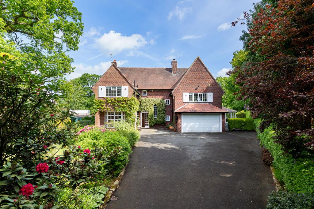
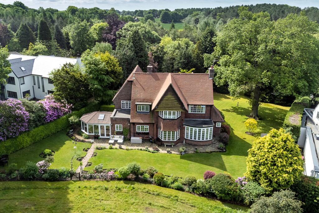
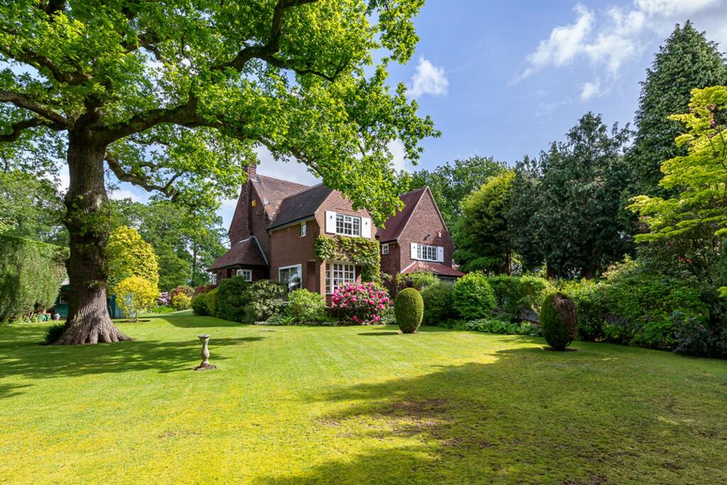
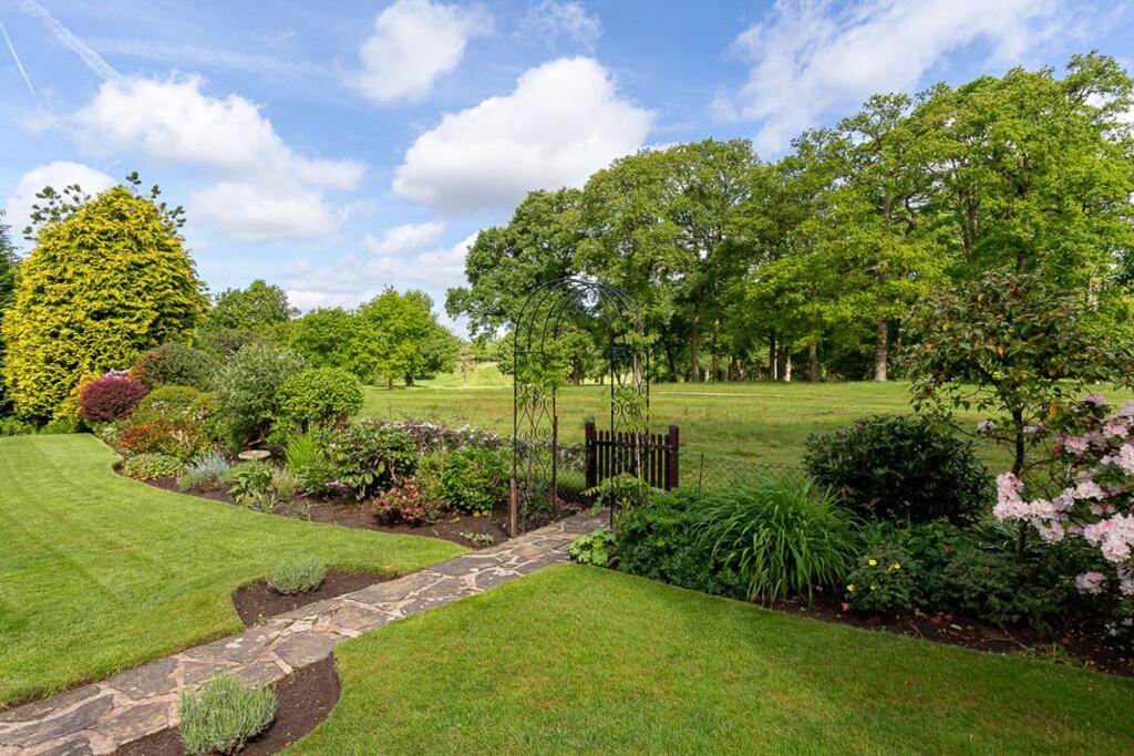
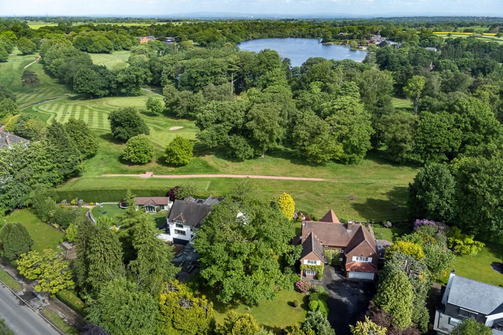
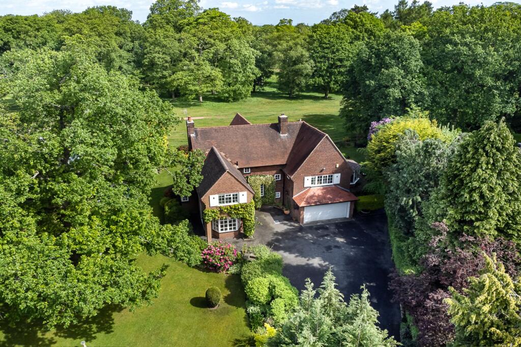
- Mature detached house in wonderful position
- Great potential for further improvement and extension (subject to planning permission)
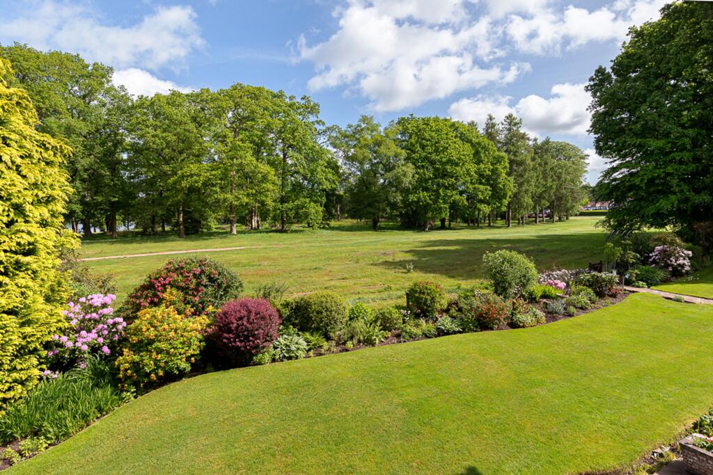
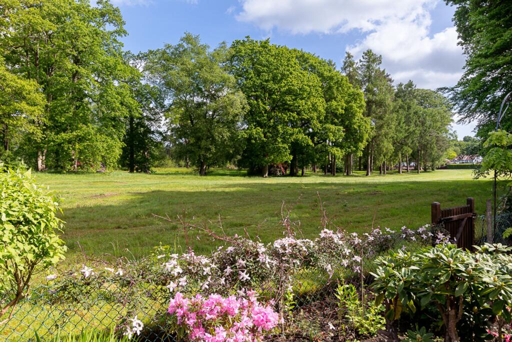
- Fabulous open aspect over the 16th hole of Mere Golf club at the rear with gated access onto the course
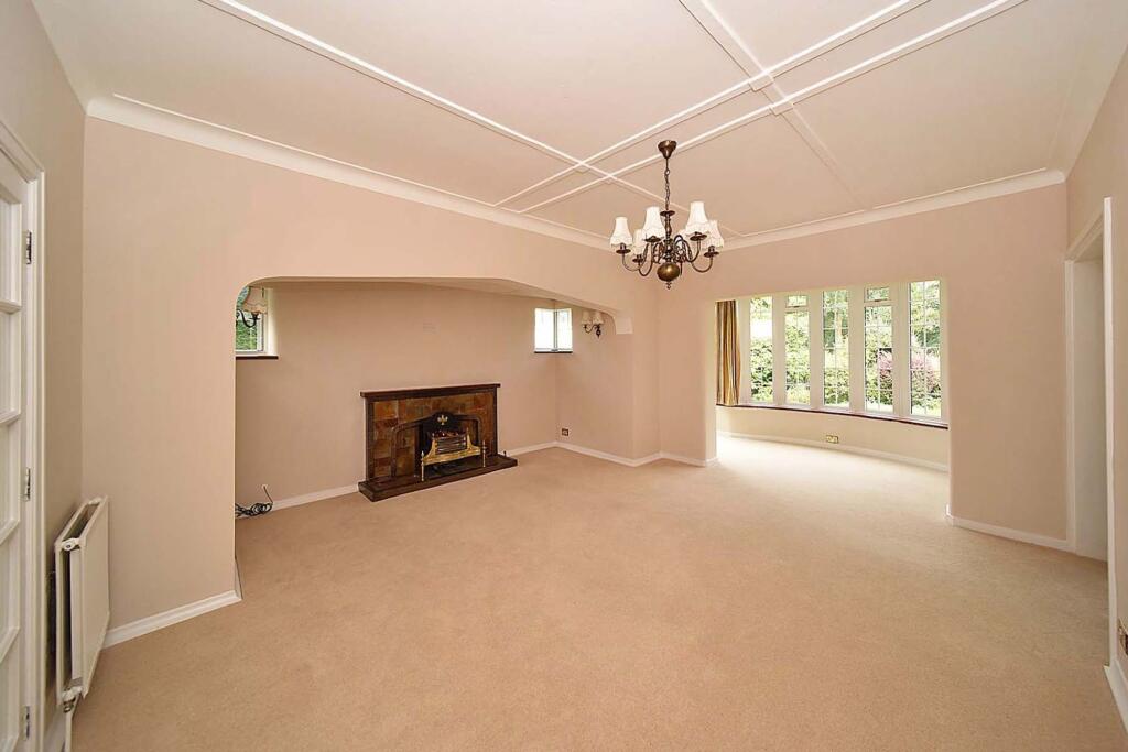
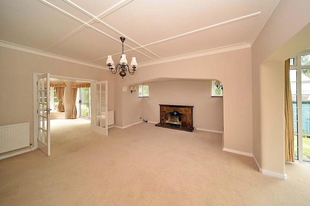
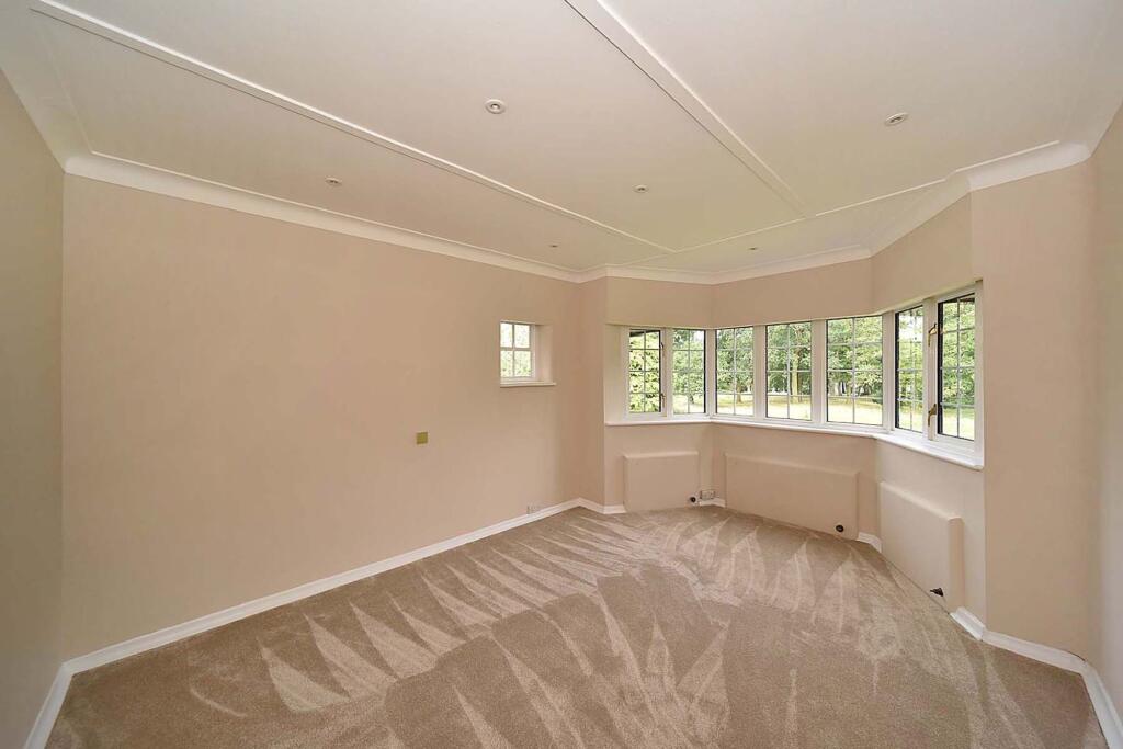
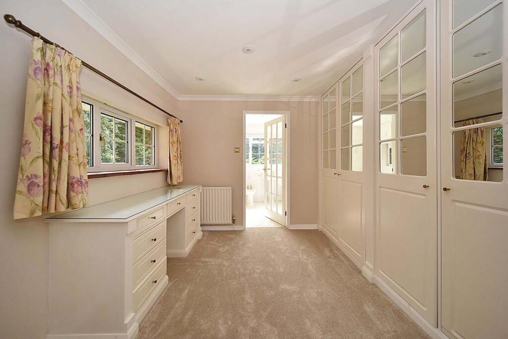
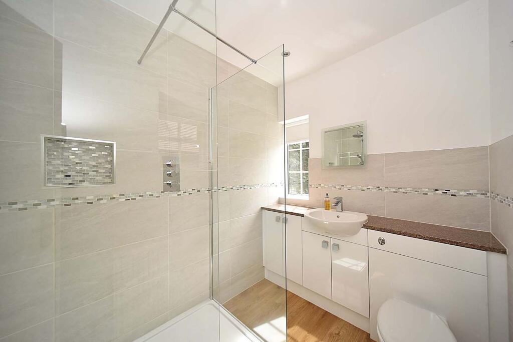
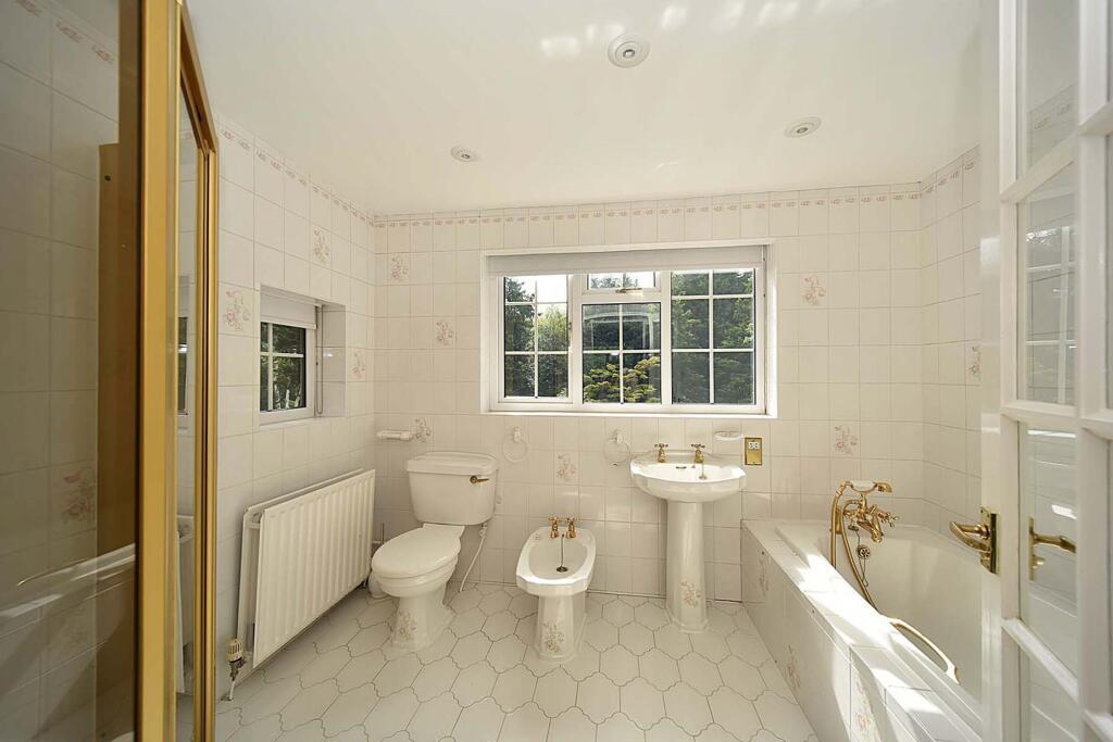
- Four reception rooms, four bedrooms and two bathrooms
Additional details
- Electricity
- Mains supply
- Water
- Mains supply
- Sewerage
- Mains supply
- Heating
- Gas central
- Parking
- Yes
- Garden
- Yes
- Listed property
- No
- Restrictions
- No
- Required access
- No
- Rights of way
- No
- Flooded in last 5 years
- No
- Flood defences
- No
Description
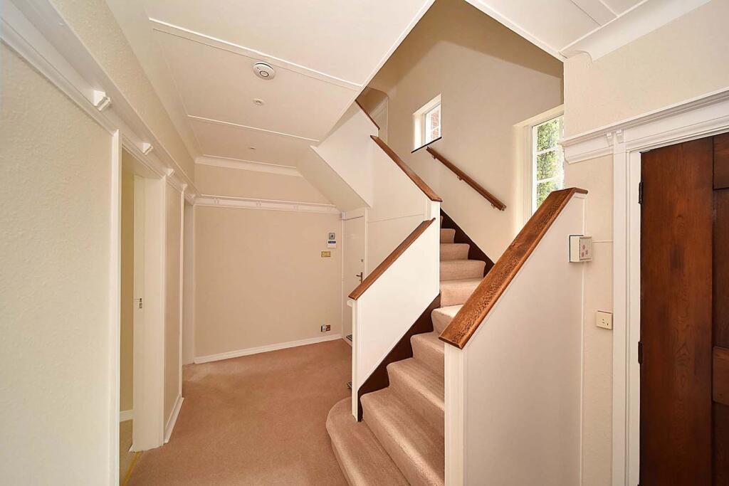
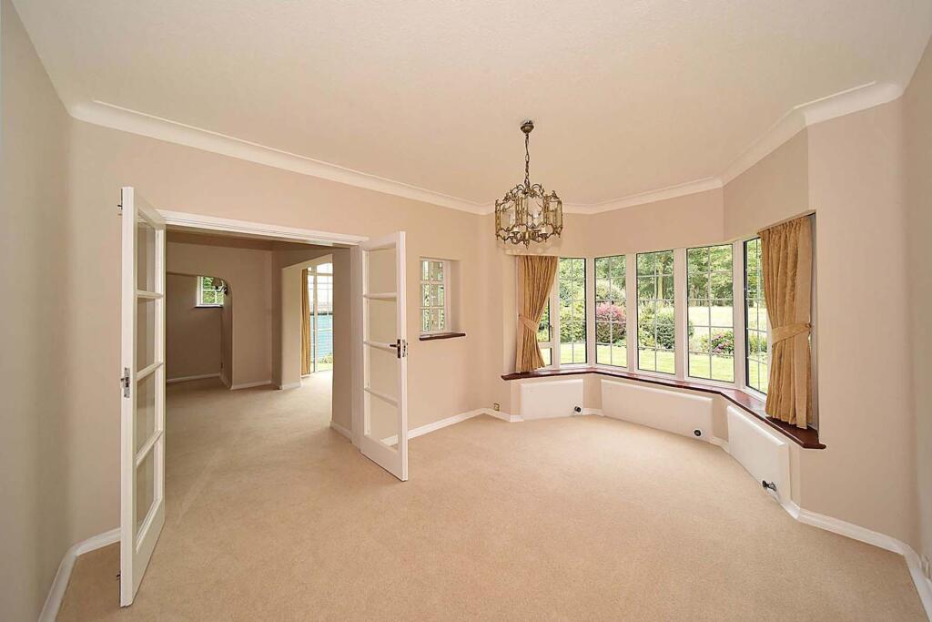
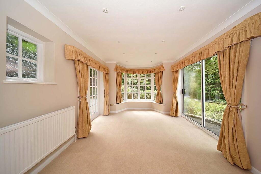
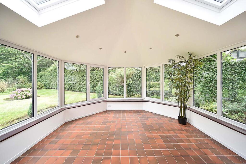
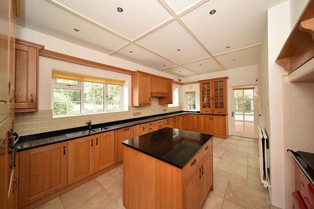
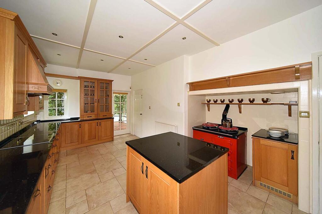
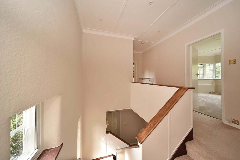
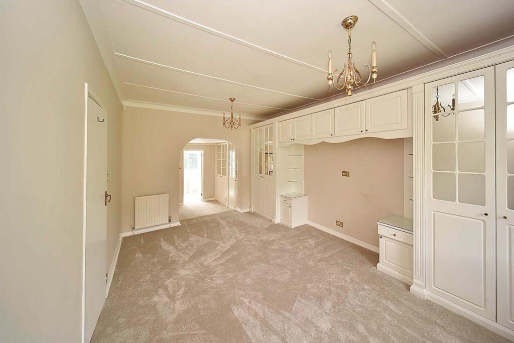
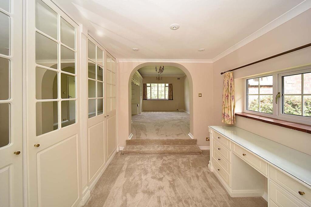
Enclosed porch, entrance hall, WC, lounge, sitting room, breakfast kitchen, dining room, conservatory/garden room, principal bedroom suite including dressing room and en-suite bathroom, 3 further bedrooms, shower room and separate WC.
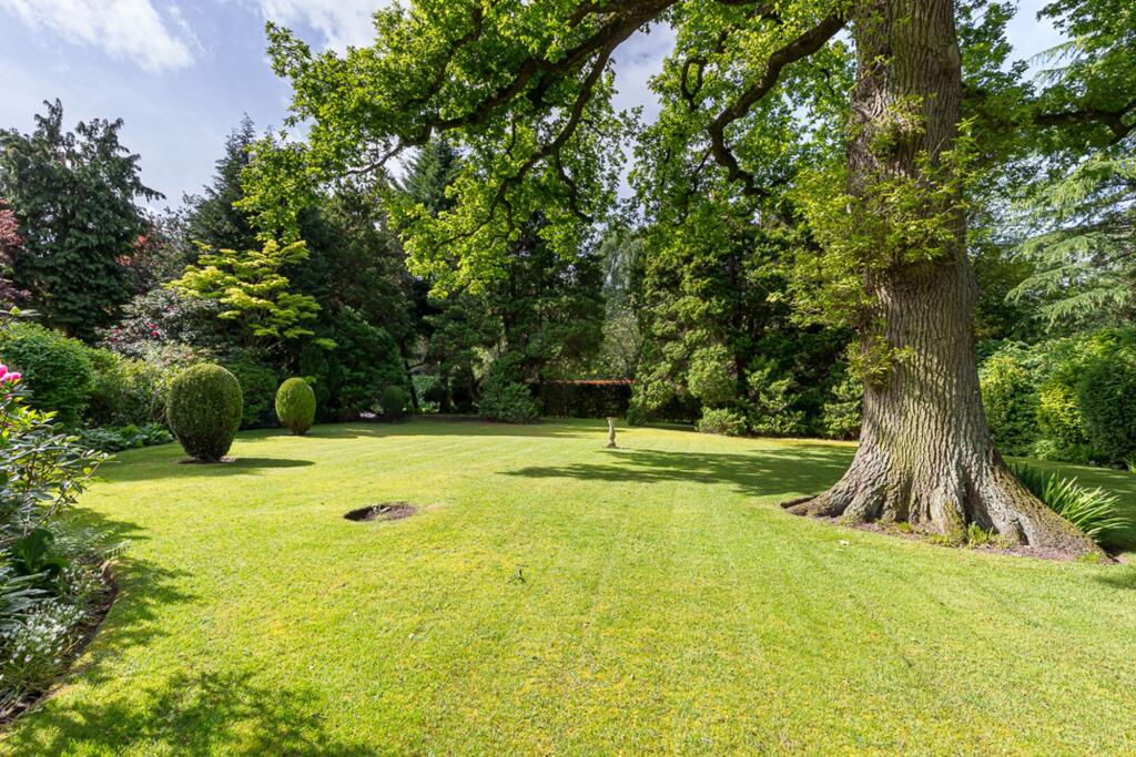
Integral double garage. Delightful mature gardens with lovely open aspect to the rear.
EPC Rating: D
Listed by
Knutsford
Stuart Rushton & Co
Reference: 159355484
EPC ratings on this postcode
We don't have a matched EPC for this property yet. Below are efficiency scores and details for other addresses on this postcode.
| Address | Current | Potential | Floor area | Age band | Type |
|---|---|---|---|---|---|
| March House, Warrington Road, Mere | 65 | 74 | 340 m² | England and Wales: 1930-1949 | House |
| Oaklands, Warrington Road, Mere | 60 | 72 | 248 m² | England and Wales: 1930-1949 | House |
| Oaklands, Warrington Road, Mere, KNUTSFORD | 60 | 72 | 248 m² | England and Wales: 1930-1949 | Detached |
| THAXTED, WARRINGTON ROAD, MERE | 56 | 80 | 392 m² | England and Wales: 1930-1949 | House |
| Thaxted, Warrington Road, Mere | 36 | 57 | 275 m² | England and Wales: 1950-1966 | House |
| THAXTED, WARRINGTON ROAD, MERE, MERE | 56 | 80 | 392 m² | England and Wales: 1930-1949 | Detached |
Flood risk
Zone: 1
Risk: Low
Job (default Low)
Floorplans
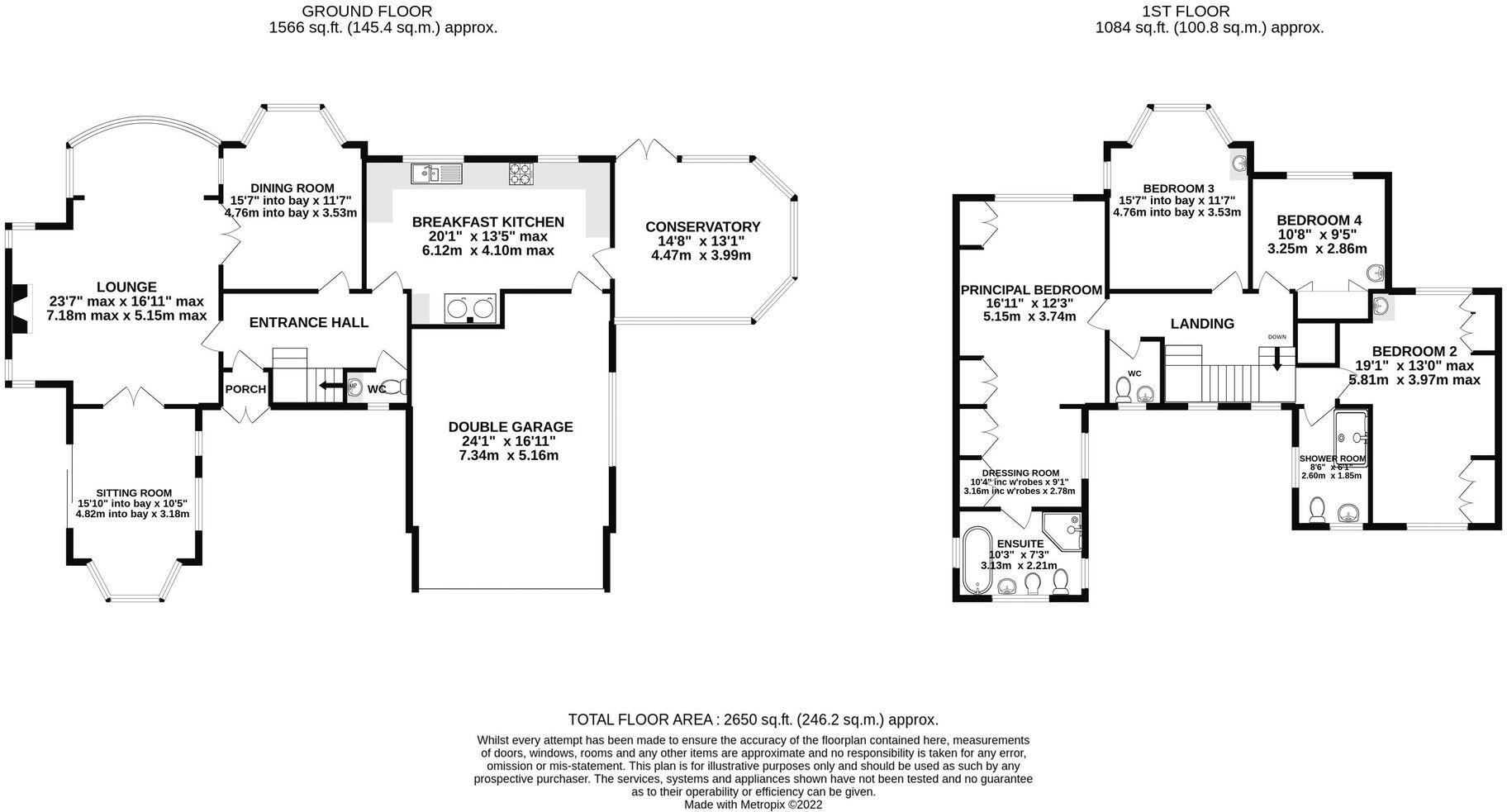
Floorplan 1
Price history
No sales history found for this property in Land Registry Price Paid data.
Sold Comparables
Same street and nearby sales within 0.25 miles (last 5 years). Data from Land Registry Price Paid.
| Address | Price | Date | Type |
|---|---|---|---|
| MAPLE HOUSE CLAMHUNGER LANE, MERE, KNUTSFORD, CHESHIRE EAST, WA16 6QG | £2,800,000 | 23/01/2026 | Detached |
| 7 STEADINGS RISE, MERE, KNUTSFORD, CHESHIRE EAST, WA16 0WB | £1,300,000 | 01/07/2024 | Detached |
| TOLL BAR MERESIDE ROAD, MERE, KNUTSFORD, CHESHIRE EAST, WA16 6QF | £1,330,000 | 08/03/2024 | Detached |
| 5 STEADINGS RISE, MERE, KNUTSFORD, CHESHIRE EAST, WA16 0WB | £1,100,000 | 31/03/2023 | Detached |
| MOSS VIEW FARM WARRINGTON ROAD, MERE, KNUTSFORD, CHESHIRE EAST, WA16 0TB | £1,350,000 | 15/11/2022 | Detached |
| ROSE COTTAGE MERESIDE ROAD, MERE, KNUTSFORD, CHESHIRE EAST, WA16 6QF | £1,010,000 | 30/09/2022 | Detached |
| RAVENSTONE CLAMHUNGER LANE, MERE, KNUTSFORD, CHESHIRE EAST, WA16 6QG | £1,620,000 | 25/03/2022 | Detached |
| EDEN HEIGHTS MERESIDE ROAD, MERE, KNUTSFORD, CHESHIRE EAST, WA16 6QF | £2,900,000 | 22/06/2021 | Detached |
| Same street THAXTED WARRINGTON ROAD, MERE, KNUTSFORD, CHESHIRE EAST, WA16 0TF | £1,685,000 | 21/06/2021 | Detached |
Street average: £1,685,000 (1 sale)
Area average: £1,676,250 (8 sales)
Capital growth trend
Land Registry outcode average: last 12 months vs 5y and 10y ago (from sold prices).
House Price Index (HM Land Registry — official index, not sold-price averages): Cheshire East. Series: Detached. As of March 2026.
Rental Range
Estimated market rent for Cheshire East. Low = conservative, Realistic = average, Optimistic = best case.
Based on Local Authority from postcode lookup → Cheshire East.
LHA (30th percentile) floor for East Lancs: £793/mo (Apr 2025 – Mar 2026)
Location
Address
Warrington Road
Nearby
Nearest stations, universities and amenities (distance from property).
| Type | Name | Distance |
|---|---|---|
| Bus stop | Mere, Warrington Road / Clamhunger Lane | 0.1 miles |
| Shop | Unknown | 0.5 miles |
| Hospital | Knutsford and District Community Hospital | 2.0 miles |
| Train station | Knutsford | 2.2 miles |
| Train station | Mobberley | 2.8 miles |
| Hospital | The Priory Hospital Altrincham | 4.1 miles |
| University | University of Chester - Warrington Campus | 8.6 miles |
| University | University Academy 92 | 10.3 miles |
Street-level crime
| Category | Count |
|---|---|
| Criminal damage and arson | 2 |
| Anti-social behaviour | 1 |
| Shoplifting | 1 |
| Total incidents | 4 |
Within 1 mile during Mar 2026. Source: data.police.uk (England & Wales).
Schools nearby
Nearest open schools with Ofsted ratings (England). Closed schools are not shown. Data from Get Information about Schools and Ofsted.
| Name | Type | Distance | Ofsted |
|---|---|---|---|
| Egerton Primary School | Primary | 2.0 miles | Good — 13 Feb 2023 |
| Knutsford Academy | Secondary | 2.0 miles | Good — 25 Nov 2011 |
| Cheshire Studio School | Secondary | 2.0 miles | Good — 3 May 2017 |
| Manor Park Primary School and Nursery | Primary | 2.3 miles | Good — 13 Sep 2023 |
| St Vincent De Paul Catholic Primary School | Primary | 2.4 miles | Good — 6 Jun 2013 |
Rental Comparables
Loading rental comparables for this postcode. Refresh in a few minutes.
Rent-driven metrics
Based on Area rent estimate.
- Rent ratio — Monthly rent ÷ purchase price (1% rule). 1%+ = strong, 0.8–1% = okay, <0.8% = weak for cashflow.
- Max investor price — Rent ÷ 0.8%; the price at which rent would be 0.8% of price (Stoke-style target).
- Target investor price — Rent ÷ 1%; the price at which rent would be 1% of price (strong cashflow band).
- Gross yield — Annual rent as % of purchase price (no costs).
Enter House Number
Enter the house number to help us retrieve more accurate pricing history and property data.
Please log in to submit or correct the house number for this listing.
Log in to continue