74 OXFORD ROAD
NEWCASTLE, BASFORD, STAFFORDSHIRE ST5 0PZ
£770 pcm
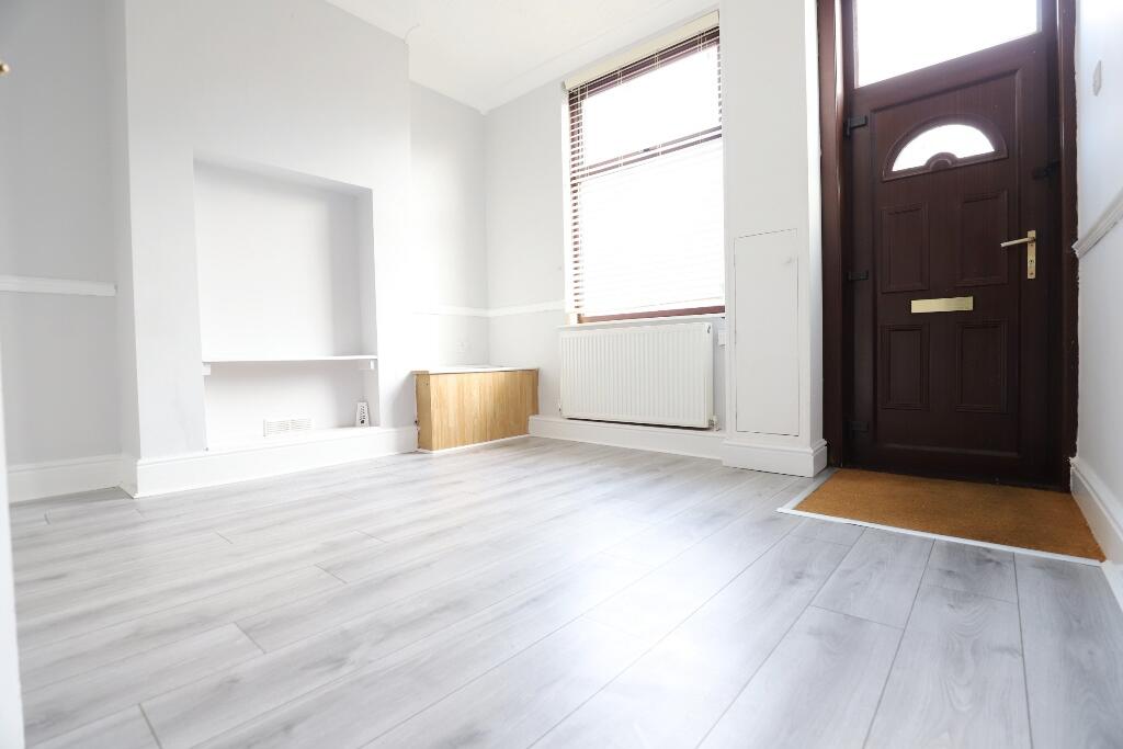
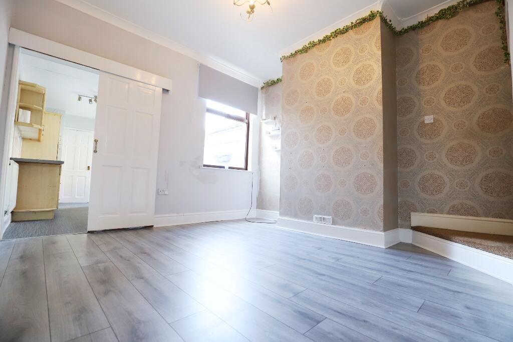
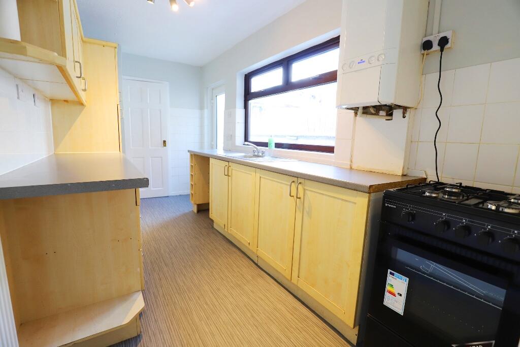
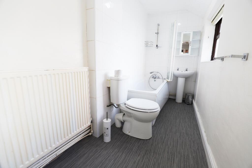
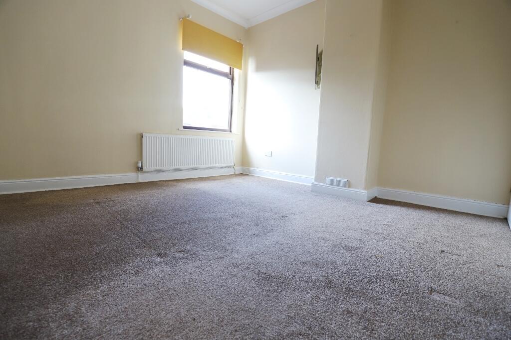
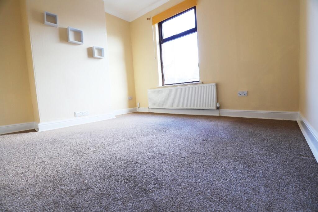
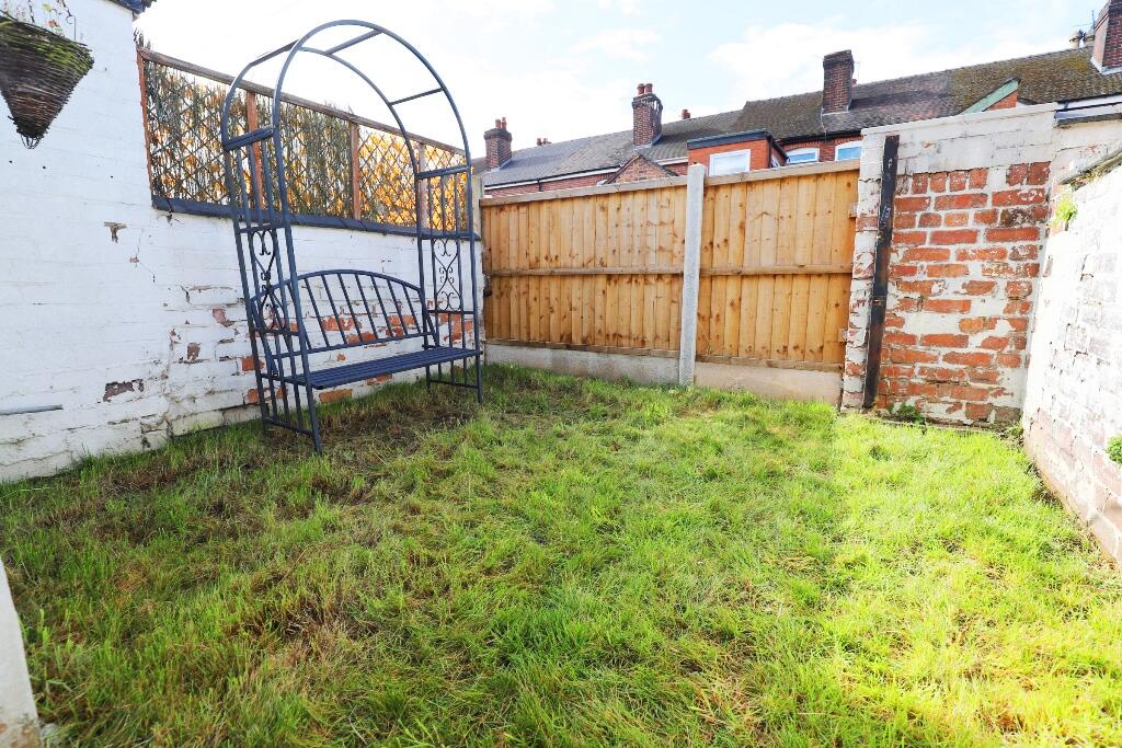
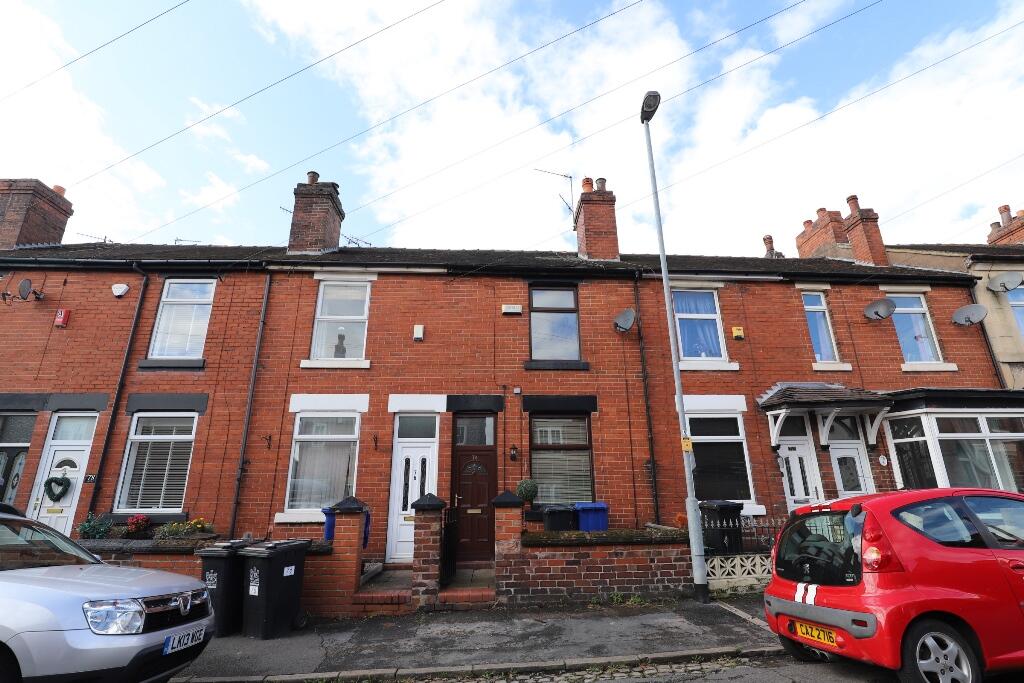
Photo 1 Photo 2 Photo 3 Photo 4 Photo 5 Photo 6 Photo 7 Photo 8
/ 8
Property details
Floor area
73 m²
Council tax band
A
EPC rating
C
Year built
England and Wales: 1900-1929
Deprivation
Decile 8 (25,661 of 33,755)
Street crime
242 incidents within 1 mile (Apr 2026)
Key features
- Two bedroom mid terrace property
- EPC: C
- Council Tax Band: A
- Short walk to The Marsh
- Within easy reach of Newcastle town centre
- Gas central heating & double glazing
- Rear garden
- Double glazing
- Shower
Additional details
- Heating
- Double glazing, Gas central
- Parking
- On street
- Garden
- Private garden
- Listed property
- No
Description
The front entrance leads you to front reception room with grey laminate flooring, decorative chimney breast. To the rear is a further reception room with grey laminate flooring, papered feature wall, space saving sliding door through to the kitchen and archway leading to the stairs.
The kitchen is fitted with beech units, doors and drawers, grey worktop, gas 4 ring cooker.
The bathroom has vinyl flooring, bath, over bath shower with folding screen, toilet and sink.
Upstairs are 2 double bedrooms, each with carpet, the rear bedroom has a built in store cupboard.
The rear garden has a lawn and seating area.
Whilst the details listed within this description are believed to be accurate and upto date you should check with the agent that any appliances listed will be present at the start of the let. Where a property is let unfurnished, should an appliance become faulty the landlord may not replace it - excluding cookers & boilers for which the landlord remains responsible. In some instances gas fires may have been disconnected where central heating systems are present. EPC rating: C.
Listed by
Newcastle-Under-Lyme
The Property Franchise Group
Reference: 172986005
EPC Rating & Upgrade Cost
Current rating: C
Potential rating: C
Inspection date: 18/03/2026
Expiry date: 17/03/2036
Current heating cost: £851/year
Potential heating cost: £710/year
Est. upgrade cost to C: £18,250
Recommendations
- 50 mm internal or external wall insulation (£7,500 - £11,000)
- Solar photovoltaic panels, 2.5 kWp (£8,000 - £10,000)
Flood risk
Zone: 1
Risk: Low
Job (default Low)
Rental Range
Estimated market rent for Newcastle-under-Lyme. Low = conservative, Realistic = average, Optimistic = best case.
Based on Local Authority from postcode lookup → Newcastle-under-Lyme.
LHA (30th percentile) floor for Staffordshire North: £479/mo (Apr 2025 – Mar 2026)
Location
Nearby
Nearest stations, universities and amenities (distance from property).
| Type | Name | Distance |
|---|---|---|
| Bus stop | Pitfield Avenue | 0.0 miles |
| Bus stop | Bleak Street | 0.1 miles |
| Shop | Morrisons Daily | 0.2 miles |
| Hospital | Hartshill Medical Centre | 0.9 miles |
| Hospital | North Staffordshire Hospital | 1.1 miles |
| Train station | Longport | 1.3 miles |
| University | University of Staffordshire Stoke Campus | 1.6 miles |
| Train station | Stoke-on-Trent | 1.7 miles |
Street-level crime
| Category | Count |
|---|---|
| Violence and sexual offences | 70 |
| Anti-social behaviour | 55 |
| Public order | 21 |
| Shoplifting | 19 |
| Criminal damage and arson | 16 |
| Other theft | 13 |
| Vehicle crime | 13 |
| Burglary | 12 |
| Drugs | 10 |
| Other crime | 5 |
| Possession of weapons | 4 |
| Robbery | 2 |
| Bicycle theft | 1 |
| Theft from the person | 1 |
| Total incidents | 242 |
Within 1 mile during Apr 2026. Source: data.police.uk (England & Wales).
Schools nearby
Nearest open schools with Ofsted ratings (England). Closed schools are not shown. Data from Get Information about Schools and Ofsted.
| Name | Type | Distance | Ofsted |
|---|---|---|---|
| May Bank Infants' School | Primary | 0.1 miles | Good — 21 Jan 2024 |
| St Wulstan's Catholic Primary School | Primary | 0.4 miles | Good — 19 Jul 2013 |
| St Margaret's CofE (VC) Junior School | Primary | 0.4 miles | Good — 1 May 2014 |
| The Orme Academy | Secondary | 0.5 miles | Good — 9 Jul 2024 |
| Merryfields School | Other | 0.6 miles | Good — 30 Apr 2014 |
Rental Comparables
Residential lets from OpenRent and Rightmove for the area (same bedroom count). Use to validate rent estimates. Student lets are excluded.
| Title | Rent | Beds | Distance | As seen on |
|---|---|---|---|---|
| Oxford Road ST5 | £750/mo | 2 | 0 miles | Rightmove |
| Cromer Street, May Bank | £775/mo | 2 | 0.09 miles | Rightmove |
| 2 Bed Terraced House, Basford Park Road, ST5 | £795/mo | 2 | 0.11 miles | OpenRent |
| 2 Bed Terraced House, Langley St, ST4 | £830/mo | 2 | 0.59 miles | OpenRent |
| Nelson Street, ST5 | £695/mo | 2 | 0.63 miles | Rightmove |
| Albert Street, Newcastle Under Lyme, Staffordshire, ST5 | £975/mo | 2 | 0.68 miles | Rightmove |
| Dimsdale Parade East, Newcastle | £775/mo | 2 | 0.72 miles | Rightmove |
| Kimberley Road, Newcastle | £800/mo | 2 | 0.77 miles | Rightmove |
| Brunswick Court, Brunswick Street, Newcastle Under Lyme, Staffordshire, ST5 | £1,495/mo | 2 | 0.78 miles | Rightmove |
| Brunswick Court, Newcastle Under Lyme, Staffordshire, ST5 | £1,095/mo | 2 | 0.78 miles | Rightmove |
| Milehouse Lane Newcastle | £750/mo | 2 | 0.78 miles | Rightmove |
| The Mill, Enderley Street, Newcastle Under Lyme, Staffordshire, ST5 | £1,295/mo | 2 | 0.81 miles | Rightmove |
| Hughes Avenue Newcastle | £625/mo | 2 | 0.83 miles | Rightmove |
| Marsh Box, Marsh Parade | £895/mo | 2 | 0.85 miles | Rightmove |
| Marsh Box, Marsh Parade, Newcastle under Lyme | £850/mo | 2 | 0.85 miles | Rightmove |
| Garnett Road East, Porthill, Newcastle | £695/mo | 2 | 0.86 miles | Rightmove |
| Clarence Street, Newcastle-Under-Lyme | £795/mo | 2 | 0.87 miles | Rightmove |
| Hassells Bridge, Hassell Street | £925/mo | 2 | 0.93 miles | Rightmove |
| Sparrow Terrace, Porthill, Newcastle-under-Lyme, ST5 | £800/mo | 2 | 0.96 miles | Rightmove |
| Dimsdale View East, Newcastle-under-Lyme | £850/mo | 2 | 0.97 miles | Rightmove |
Average rent: £876/mo (54 listings)