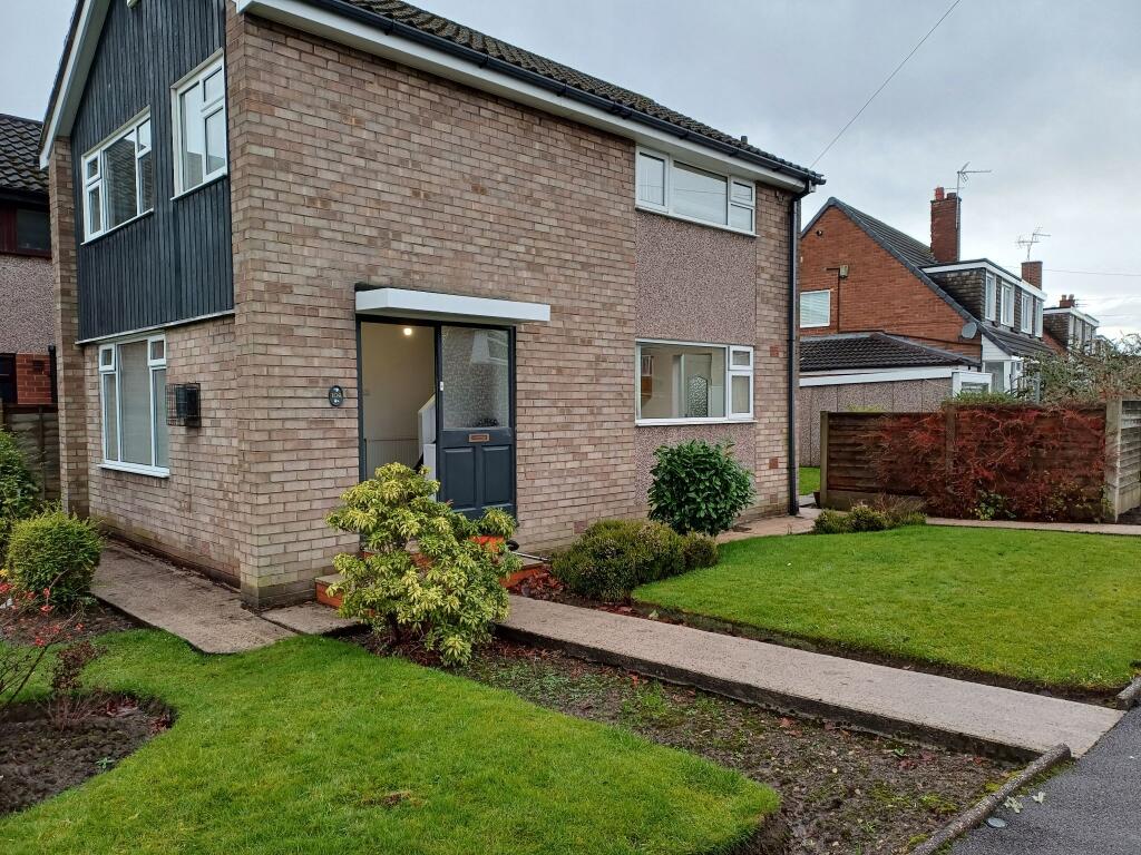
Penrhyn Crescent
Stockport, SK7, SK7 5ND
Property details
Tenure
FREEHOLD
Local average
£796,146 (-51.6%)
Deprivation
Decile 10 (30,812 of 33,755)
Street crime
4 incidents within 1 mile (May 2026)
Key features
- ***NO CHAIN***
- Ideal Investment
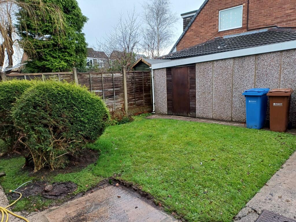
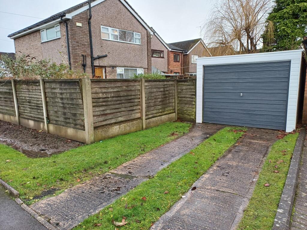
- Garage
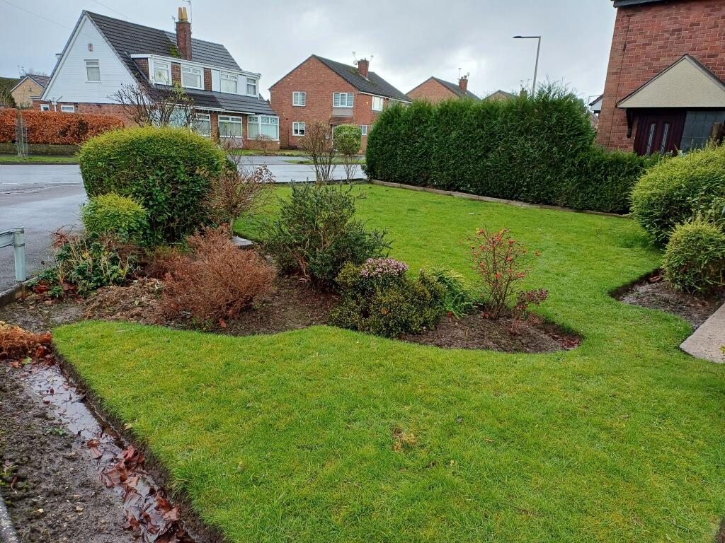
- Corner Plot
- Double Glazed
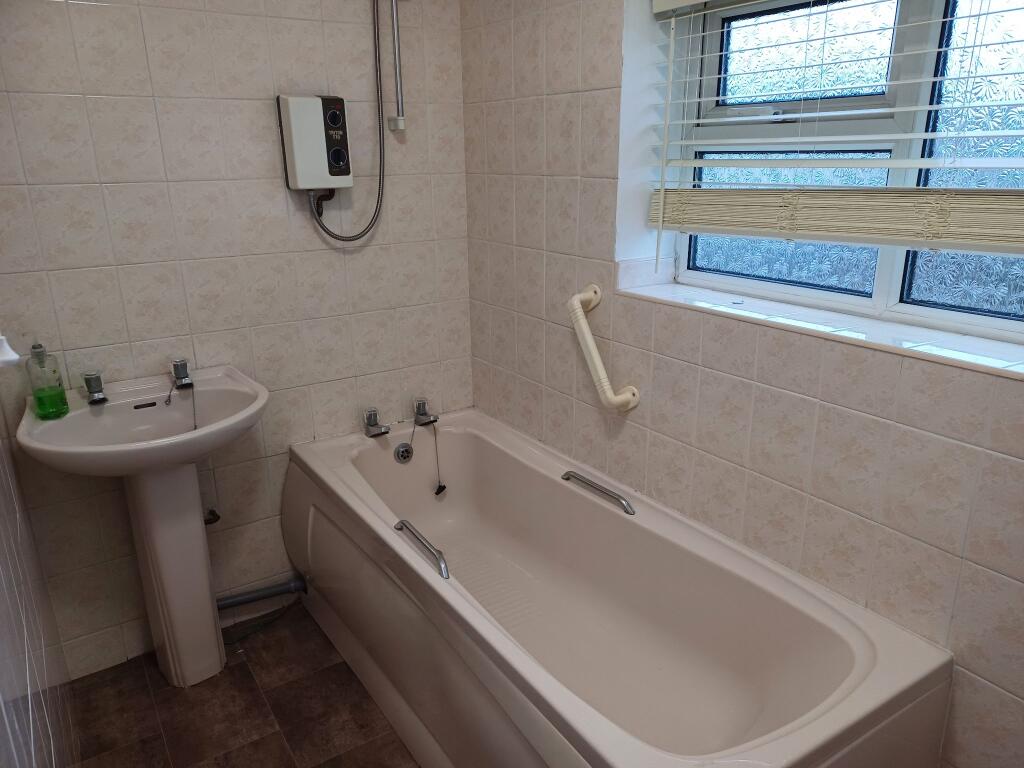
- Energy Efficiency Rating D
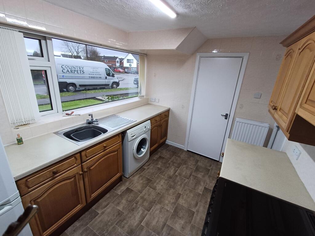
Additional details
- Water
- Mains supply
- Sewerage
- Mains supply
- Heating
- Gas central
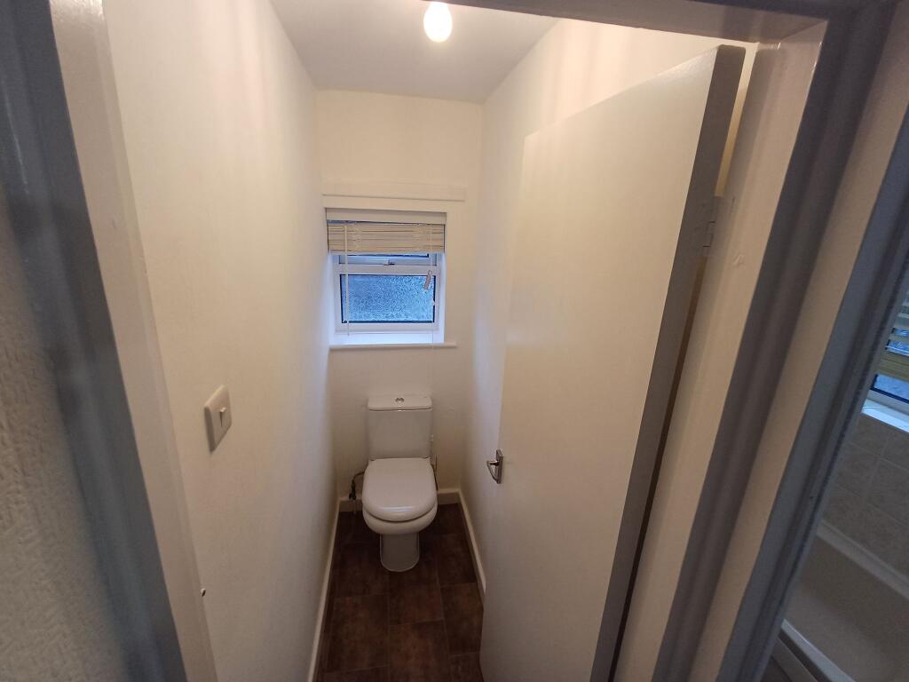
- Accessibility
- No wheelchair access
- Parking
- Garage
- Garden
- Front garden, Rear garden
- Listed property
- No
- Restrictions
- No
- Required access
- No
- Rights of way
- No
- Flooded in last 5 years
- No
- Flood defences
- No
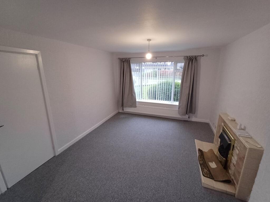
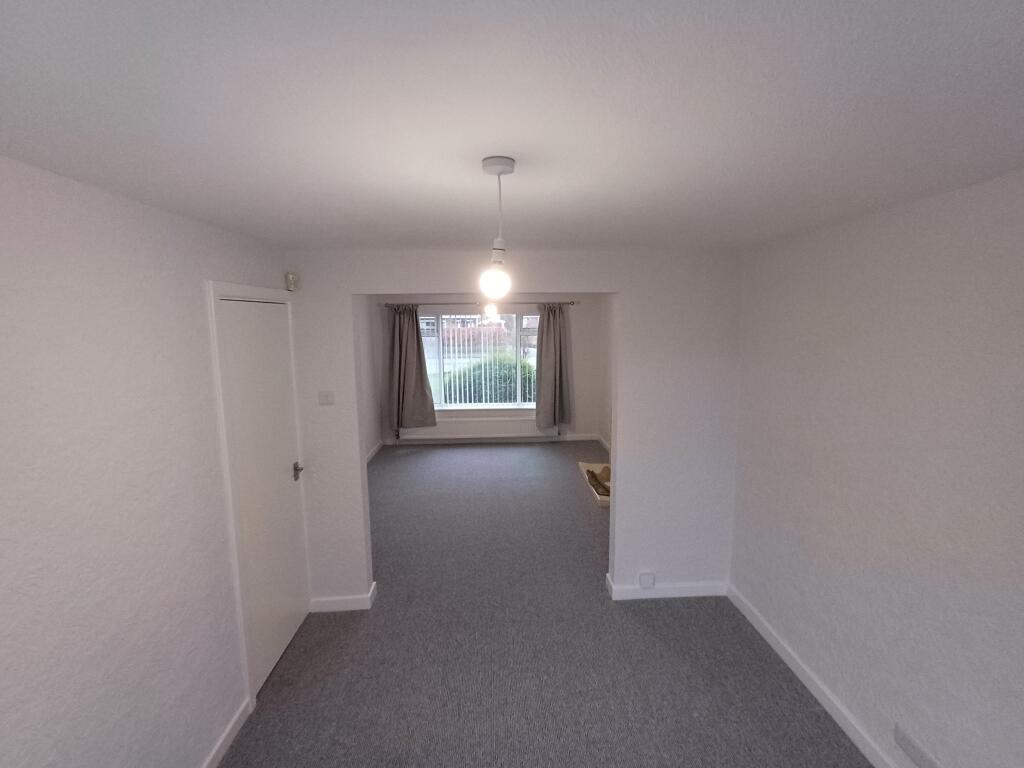
Description
Listed by
Wilmslow
Rooftops Letting & Management
Reference: 162293378
EPC ratings on this postcode
We don't have a matched EPC for this property yet. Below are efficiency scores and details for other addresses on this postcode.
| Address | Current | Potential | Floor area | Age band | Type |
|---|---|---|---|---|---|
| 100, Penrhyn Crescent, Hazel Grove | 43 | 84 | 77 m² | England and Wales: 1950-1966 | House |
| 100, Penrhyn Crescent, Hazel Grove, STOCKPORT | 43 | 84 | 77 m² | England and Wales: 1950-1966 | Detached |
| 101, Penrhyn Crescent, Hazel Grove | 53 | 85 | 91 m² | England and Wales: 1967-1975 | House |
| 101, Penrhyn Crescent, Hazel Grove, STOCKPORT | 53 | 85 | 91 m² | England and Wales: 1967-1975 | Detached |
| 102 Penrhyn Crescent, Hazel Grove | 69 | 88 | 87 m² | England and Wales: 1967-1975 | House |
| 102 Penrhyn Crescent, Hazel Grove, STOCKPORT | 69 | 88 | 87 m² | England and Wales: 1967-1975 | Detached |
| 102, Penrhyn Crescent, Hazel Grove | 53 | 86 | 75 m² | England and Wales: 1950-1966 | House |
| 102, Penrhyn Crescent, Hazel Grove, STOCKPORT | 53 | 86 | 75 m² | England and Wales: 1950-1966 | Detached |
| 103 Penrhyn Crescent, Hazel Grove | 60 | 84 | 78 m² | England and Wales: 1950-1966 | House |
| 103 Penrhyn Crescent, Hazel Grove, STOCKPORT | 60 | 84 | 78 m² | England and Wales: 1950-1966 | Detached |
| 104, Penrhyn Crescent, Hazel Grove | 67 | 82 | 94 m² | England and Wales: 1967-1975 | House |
| 104, Penrhyn Crescent, Hazel Grove, STOCKPORT | 67 | 82 | 94 m² | England and Wales: 1967-1975 | Detached |
| 105, Penrhyn Crescent, Hazel Grove | 57 | 77 | 69 m² | England and Wales: 1967-1975 | House |
| 105, Penrhyn Crescent, Hazel Grove | 59 | 87 | 63 m² | England and Wales: 1967-1975 | House |
| 105, Penrhyn Crescent, Hazel Grove, STOCKPORT | 57 | 77 | 69 m² | England and Wales: 1967-1975 | Detached |
Flood risk
Zone: 1
Risk: Low
Job (default Low)
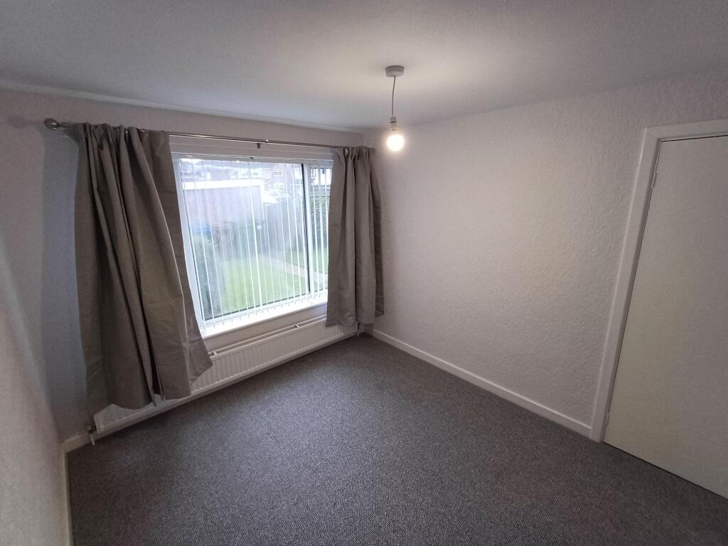
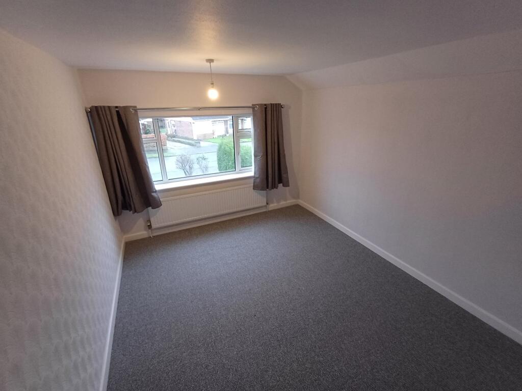
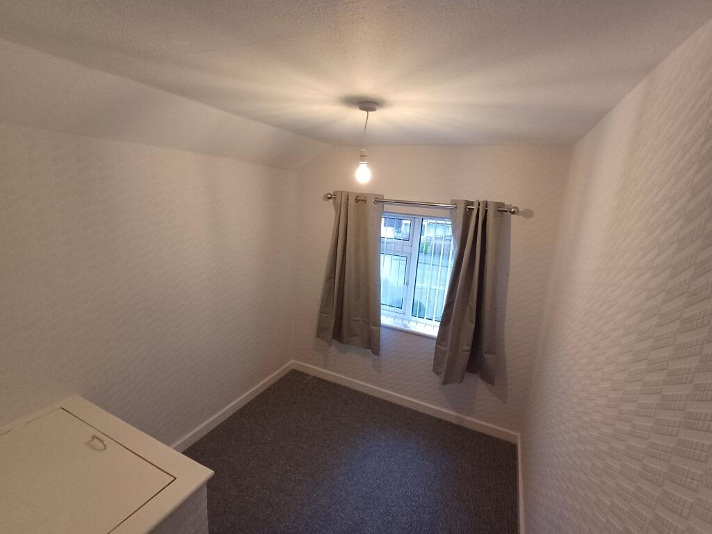
Floorplans
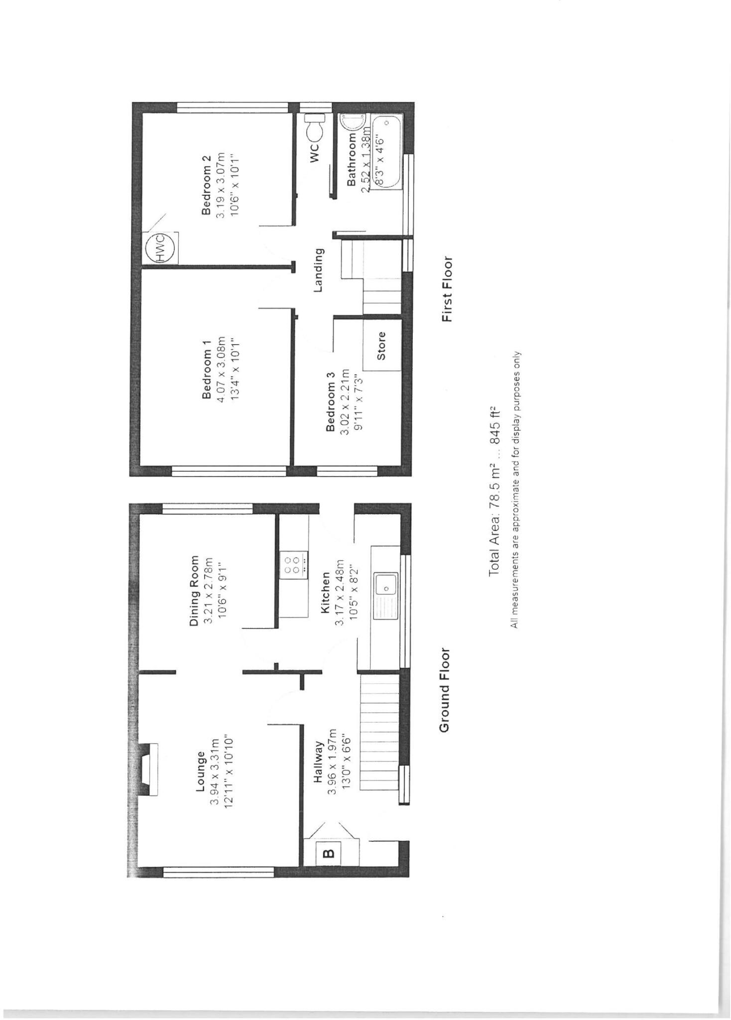
Floorplan 1
EPC Graphs
EPC 1
Price history
| Event | Date | Price | % change |
|---|---|---|---|
| Listed for sale | — | £385,000 | — |
Source: HM Land Registry Price Paid Data. Crown copyright.
Sold Comparables
Same street and nearby sales within 0.25 miles (last 5 years). Data from Land Registry Price Paid.
| Address | Price | Date | Type |
|---|---|---|---|
| 55 LYNDHURST AVENUE, HAZEL GROVE, STOCKPORT, GREATER MANCHESTER, SK7 5LT | £390,000 | 12/12/2025 | Detached |
| Same street 102 PENRHYN CRESCENT, HAZEL GROVE, STOCKPORT, GREATER MANCHESTER, SK7 5ND | £347,000 | 05/12/2025 | Semi-detached |
| Same street 71A PENRHYN CRESCENT, HAZEL GROVE, STOCKPORT, GREATER MANCHESTER, SK7 5ND | £195,000 | 28/04/2023 | Flat |
| 110 CHESTER ROAD, HAZEL GROVE, STOCKPORT, GREATER MANCHESTER, SK7 6HE | £606,000 | 31/08/2022 | Detached |
| 164 CHESTER ROAD, HAZEL GROVE, STOCKPORT, GREATER MANCHESTER, SK7 6HE | £675,000 | 08/08/2022 | Detached |
| 63 KENILWORTH DRIVE, HAZEL GROVE, STOCKPORT, GREATER MANCHESTER, SK7 5LG | £510,000 | 01/07/2022 | Detached |
| 2 FLINT CLOSE, HAZEL GROVE, STOCKPORT, GREATER MANCHESTER, SK7 5PU | £400,000 | 08/04/2022 | Detached |
| 8 BLAIR CLOSE, HAZEL GROVE, STOCKPORT, GREATER MANCHESTER, SK7 5NL | £530,000 | 24/02/2022 | Detached |
| 39 LYNDHURST AVENUE, HAZEL GROVE, STOCKPORT, GREATER MANCHESTER, SK7 5LT | £350,000 | 14/01/2022 | Detached |
| 6 BLAIR CLOSE, HAZEL GROVE, STOCKPORT, GREATER MANCHESTER, SK7 5NL | £482,500 | 09/09/2021 | Detached |
| 2 FLINT CLOSE, HAZEL GROVE, STOCKPORT, GREATER MANCHESTER, SK7 5PU | £376,000 | 27/08/2021 | Detached |
Street average: £271,000 (2 sales)
Area average: £479,944 (9 sales)
Capital growth trend
Land Registry outcode average: last 12 months vs 5y and 10y ago (from sold prices).
House Price Index (HM Land Registry — official index, not sold-price averages): Stockport. Series: Detached. As of April 2026.
Rental Range
Estimated market rent for Stockport. Low = conservative, Realistic = average, Optimistic = best case.
Based on Local Authority from postcode lookup → Stockport.
LHA (30th percentile) floor for Richmond & Hambleton: £648/mo (Apr 2025 – Mar 2026)
Location
Address
Skipton Close
Nearby
Nearest stations, universities and amenities (distance from property).
| Type | Name | Distance |
|---|---|---|
| Shop | SR Computers | 0.1 miles |
| Shop | Morrisons Daily | 0.1 miles |
| Bus stop | Jacksons Lane/Arundel Avenue | 0.2 miles |
| Train station | Hazel Grove | 0.5 miles |
| Hospital | Stepping Hill Hospital | 1.0 miles |
| Train station | Woodsmoor | 1.2 miles |
| Hospital | Devonshire Neurorehabilitation Centre | 1.5 miles |
| University | University of Manchester Fallowfield Campus | 6.1 miles |
| University | Fallowfield Reception and Richmond Amenities Building | 6.2 miles |
Street-level crime
| Category | Count |
|---|---|
| Violence and sexual offences | 3 |
| Criminal damage and arson | 1 |
| Total incidents | 4 |
Within 1 mile during May 2026. Source: data.police.uk (England & Wales).
Schools nearby
Nearest open schools with Ofsted ratings (England). Closed schools are not shown. Data from Get Information about Schools and Ofsted.
| Name | Type | Distance | Ofsted |
|---|---|---|---|
| Moorfield Primary School | Primary | 0.2 miles | Requires improvement — 12 Dec 2023 |
| St Peter's Catholic Primary School | Primary | 0.2 miles | Outstanding — 2 Oct 2013 |
| Hazel Grove High School | Secondary | 0.2 miles | Good — 2 Mar 2022 |
| Norbury Hall Primary School | Primary | 0.4 miles | Good — 2 May 2013 |
| Norbury Court School | Other | 0.7 miles | Good — 20 Jul 2021 |
Rental Comparables
Residential lets from OpenRent and Rightmove for the area (same bedroom count). Use to validate rent estimates. Student lets are excluded.
| Title | Rent | Beds | Distance | As seen on |
|---|---|---|---|---|
| 3 Bed Terraced House, Penrhyn Crescent, SK7 | £1,300/mo | 3 | 0.04 miles | OpenRent |
| 3 Bed Flat, Hazel Grove, SK7 | £1,400/mo | 3 | 0.25 miles | OpenRent |
| 3 Bed Terraced House, Bramble Way, SK7 | £600/mo | 3 | 0.83 miles | OpenRent |
Average rent: £1,100/mo (3 listings)
Rent-driven metrics
Based on OpenRent comparables.
- This street — Gross yield for this street only (Land Registry sales + rental comparables, same postcode + street).
- Rent ratio — Monthly rent ÷ purchase price (1% rule). 1%+ = strong, 0.8–1% = okay, <0.8% = weak for cashflow.
- Max investor price — Rent ÷ 0.8%; the price at which rent would be 0.8% of price (Stoke-style target).
- Target investor price — Rent ÷ 1%; the price at which rent would be 1% of price (strong cashflow band).
- Gross yield — Annual rent as % of purchase price (no costs).
- Cost-to-rent — Price ÷ annual rent (from OpenRent comparables). Under 14× = strong, 14–16× = acceptable, 17×+ = compressed.
- Cashflow — Rent minus mortgage, 10% maintenance, £25/mo compliance. Assumes 75% LTV, 3.95% APR (5yr fixed), 25yr term.
- ROI — Annual profit ÷ cash in (deposit + 4% purchase costs).
Enter House Number
Enter the house number to help us retrieve more accurate pricing history and property data.
Please log in to submit or correct the house number for this listing.
Log in to continue