FLAT D
30 KEMPSFORD GARDENS, LONDON, GREATER LONDON SW5 9LH
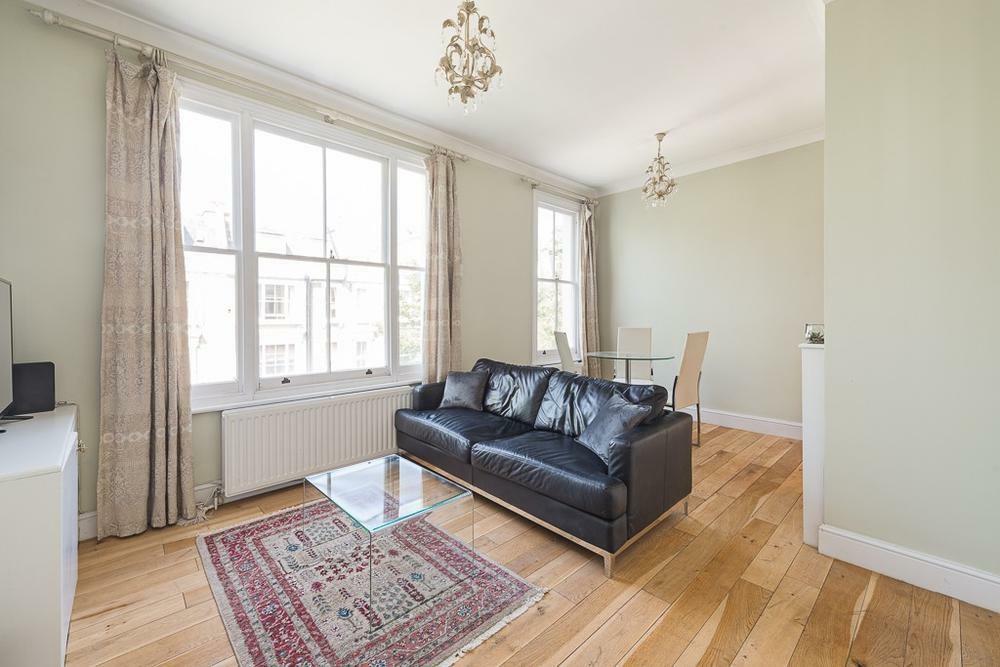
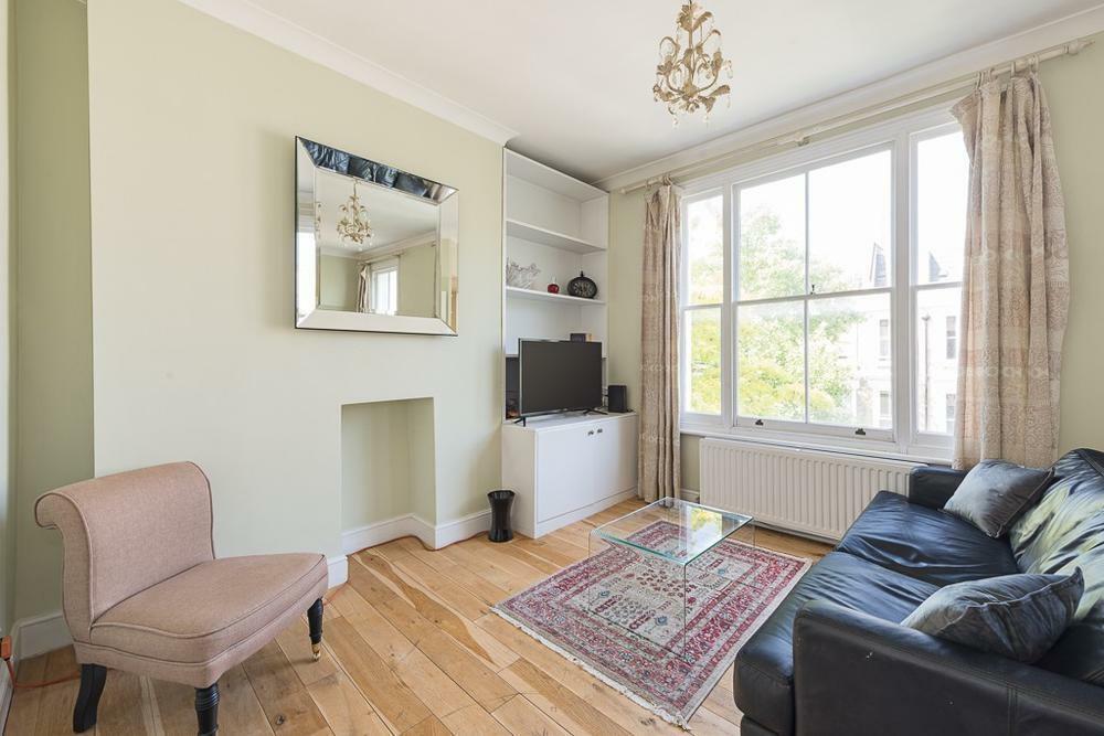
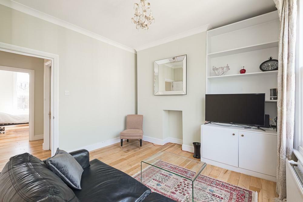
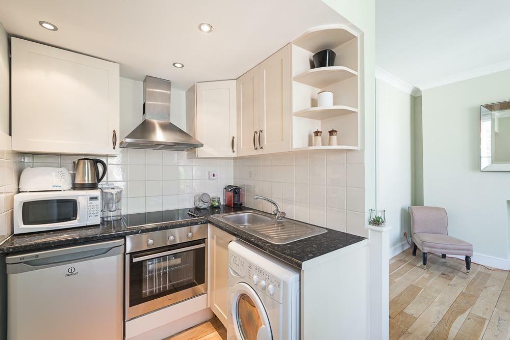
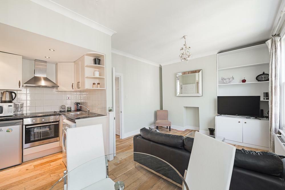
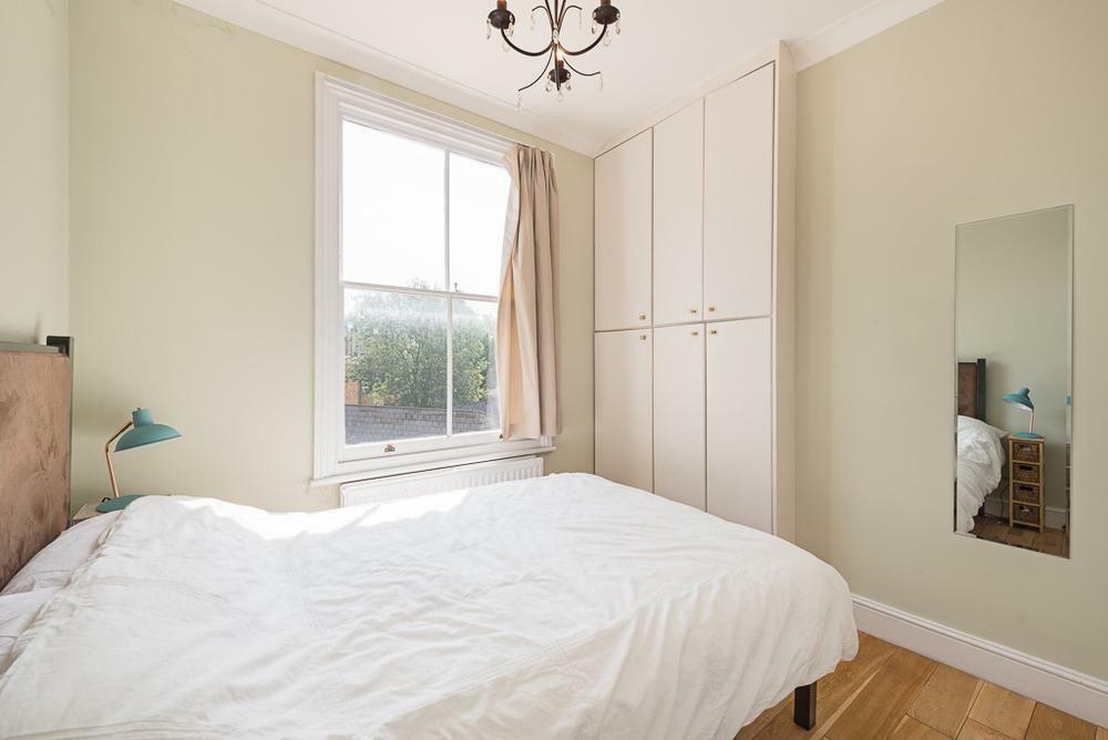
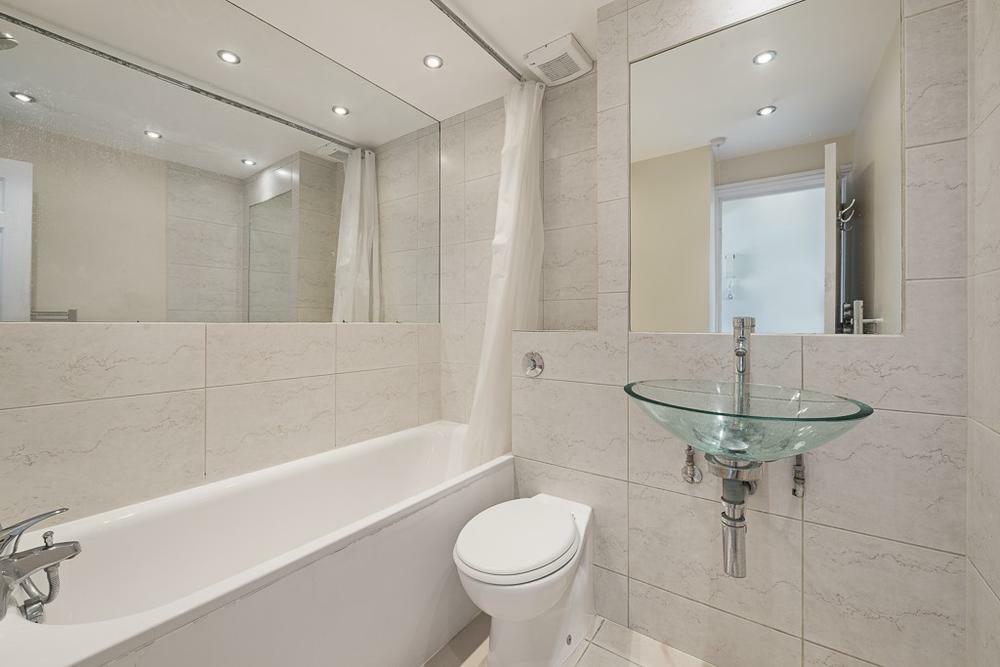
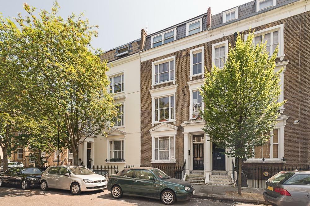
Photo 1 Photo 2 Photo 3 Photo 4 Photo 5 Photo 6 Photo 7 Photo 8
/ 8
Property details
Floor area
36 m²
EPC rating
C
Year built
England and Wales: 1900-1929
Deprivation
Decile 4 (10,480 of 33,755)
Street crime
1302 incidents within 1 mile (Apr 2026)
Key features
- One Bedroom Flat
- Second Floor Flat
- Close to Earls Court and West Brompton Station
- Nearby Local Amenities
Additional details
- Garden
- Yes
Description
Kempsford Gardens is ideally situated for access to the many amenities of Earls Court and South Kensington. West Brompton Station (District Line and London Overground) is within walking distance for journeys in and out of London.
Listed by
London
Pomp Properties
Reference: 154832117
EPC Rating & Upgrade Cost
Current rating: C
Potential rating: C
Inspection date: 20/01/2021
Expiry date: 19/01/2031
Current heating cost: £284/year
Potential heating cost: £186/year
Est. upgrade cost to C: £14,300
Recommendations
- 50 mm internal or external wall insulation (£4,000 - £14,000)
- Upgrade heating controls (£350 - £450)
- Replace single glazed windows with low-E double glazing (£3,300 - £6,500)
Flood risk
Zone: 1
Risk: Low
Job (default Low)
Floorplans
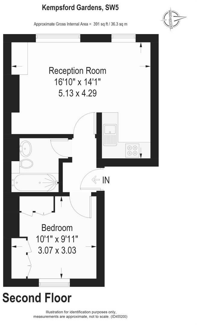
Floorplan 1
Company ownership
Registered legal owner is a company.
Rental Range
Estimated market rent for Kensington and Chelsea. Low = conservative, Realistic = average, Optimistic = best case.
Based on Local Authority from postcode lookup → Kensington and Chelsea.
LHA (30th percentile) floor for Stevenage & North Herts: £773/mo (Apr 2025 – Mar 2026)
Location
Nearby
Nearest stations, universities and amenities (distance from property).
| Type | Name | Distance |
|---|---|---|
| Bus stop | Earls Court Square | 0.0 miles |
| Shop | 202 Design | 0.1 miles |
| Shop | Framesmith Fix a Frame | 0.1 miles |
| Bus stop | West Brompton Station | 0.1 miles |
| Train station | West Brompton | 0.1 miles |
| Train station | Earl's Court | 0.2 miles |
| Hospital | Cromwell Hospital | 0.5 miles |
| Hospital | Chelsea and Westminster Hospital | 0.7 miles |
| University | BIMM Institute London | 0.7 miles |
| University | Richmond University (Kensington Campus) | 0.8 miles |
Street-level crime
| Category | Count |
|---|---|
| Anti-social behaviour | 297 |
| Violence and sexual offences | 295 |
| Other theft | 130 |
| Shoplifting | 111 |
| Vehicle crime | 96 |
| Public order | 83 |
| Burglary | 63 |
| Theft from the person | 53 |
| Criminal damage and arson | 50 |
| Drugs | 46 |
| Bicycle theft | 33 |
| Robbery | 23 |
| Other crime | 12 |
| Possession of weapons | 10 |
| Total incidents | 1302 |
Within 1 mile during Apr 2026. Source: data.police.uk (England & Wales).
Schools nearby
Nearest open schools with Ofsted ratings (England). Closed schools are not shown. Data from Get Information about Schools and Ofsted.
| Name | Type | Distance | Ofsted |
|---|---|---|---|
| St Cuthbert with St Matthias CofE Primary School | Primary | 0.1 miles | Good — 24 Nov 2016 |
| Collingham | Other | 0.4 miles | — (No rating) |
| Bousfield Primary School | Primary | 0.4 miles | Good — 24 Nov 2022 |
| Fulham Primary School | Primary | 0.4 miles | Outstanding — 20 May 2024 |
| Wetherby School, Kensington | Other | 0.4 miles | Good — 6 Jul 2018 |
Rental Comparables
Residential lets from OpenRent and Rightmove for the area (same bedroom count). Use to validate rent estimates. Student lets are excluded.
| Title | Rent | Beds | Distance | As seen on |
|---|---|---|---|---|
| 1 Bed Flat, Warwick Road, SW5 | £2,500/mo | 1 | 0.02 miles | OpenRent |
| Studio Flat, Warwick Road, SW5 | £1,547/mo | 1 | 0.04 miles | OpenRent |
Average rent: £2,024/mo (2 listings)