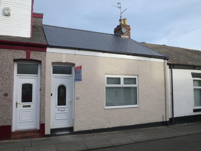
14 HOUGHTON STREET
SUNDERLAND, TYNE AND WEAR SR4 7DY
£450 pcm
Property details
Floor area
65 m²
EPC rating
D
Deprivation
Decile 2 (4,336 of 33,755)
Street crime
469 incidents within 1 mile (Apr 2026)
Key features
- NEWLY REFURBISHED
- SOUGHT AFTER AREA
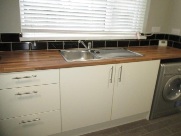
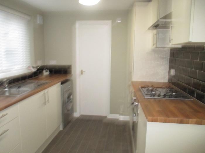
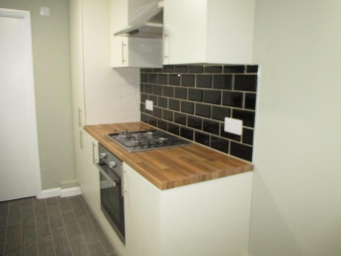
- NEWLY FITTED KITCHEN WITH BUILT IN HOB AND OVEN
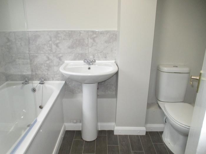
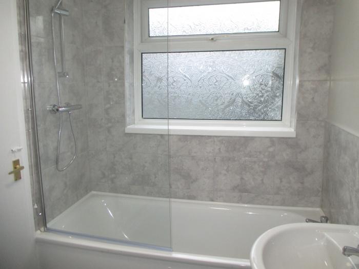
- NEWLY FITTED WHITE BATHROOM SUITE WITH SHOWER ABOVE BATH
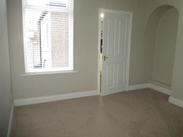
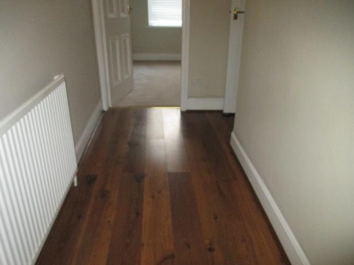
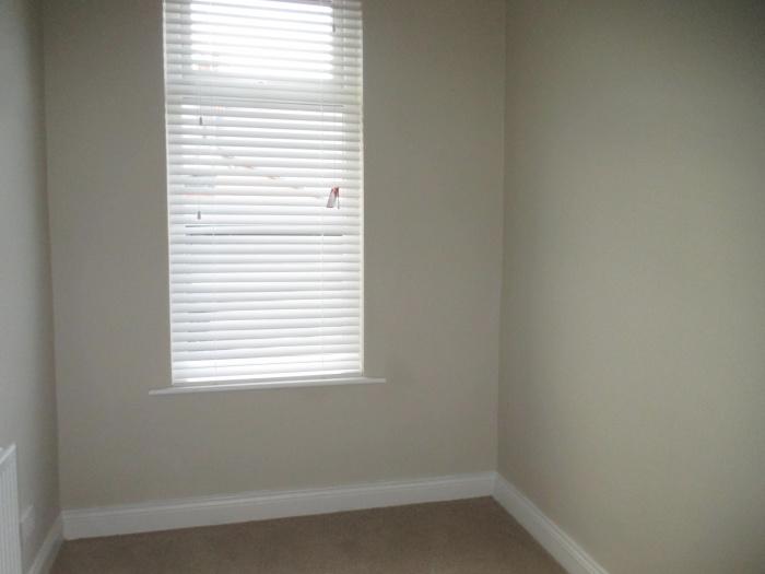
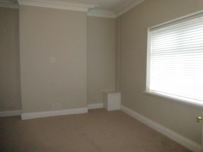
- NEWLY FITTED CARPETS AND FLOORING THROUGHOUT
- ELECTRICALLY OPERATED GARAGE DOOR
- VIEWING HIGHLY RECOMMENDED
Additional details
- Parking
- Yes
Description
The property breifly comprises:- hallway, 2 bedrooms, lounge, newly fitted kitchen with a built in gas hob and oven, extractor fan, washing machine, newly fitted white bathroom suite with shower above bath, combination boiler. The property has newly fitted carpets and flooring throughout. A viewing is highly recommeded to avoid disapointment. Available on an unfurnished basis.
Listed by
South Shields
Moody & Co
Reference: 62297053
EPC Rating & Upgrade Cost
Current rating: D
Potential rating: B
Inspection date: 15/08/2023
Expiry date: 14/08/2033
Current heating cost: £1,406/year
Potential heating cost: £954/year
Est. upgrade cost to C: £18,135
Recommendations
- Flat roof or sloping ceiling insulation (£850 - £1,500)
- Cavity wall insulation (£500 - £1,500)
- Party wall insulation (£300 - £600)
- Floor insulation (suspended floor) (£800 - £1,200)
- Floor insulation (solid floor) (£4,000 - £6,000)
- Low energy lighting for all fixed outlets (£10)
- Solar water heating (£4,000 - £6,000)
- Solar photovoltaic panels, 2.5 kWp (£3,500 - £5,500)
Flood risk
Zone: 1
Risk: Low
Job (default Low)
Rental Range
Estimated market rent for Sunderland. Low = conservative, Realistic = average, Optimistic = best case.
Based on Local Authority from postcode lookup → Sunderland.
LHA (30th percentile) floor for Sunderland: £474/mo (Apr 2025 – Mar 2026)
Location
Nearby
Nearest stations, universities and amenities (distance from property).
| Type | Name | Distance |
|---|---|---|
| Bus stop | ST MARKS ROAD-CHESTER STREET-N/B | 0.1 miles |
| Bus stop | ST MARKS ROAD-ROKEBY STREET-N/B | 0.1 miles |
| Shop | Kelly's Cycles | 0.1 miles |
| Shop | St. Marks Food Store | 0.1 miles |
| University | The Precinct | 0.2 miles |
| Train station | Millfield | 0.2 miles |
| Hospital | Sunderland Royal Hospital | 0.3 miles |
| Train station | University | 0.4 miles |
| University | University of Sunderland, City Campus | 0.4 miles |
| Hospital | Sunderland Children's Centre | 0.8 miles |
Street-level crime
| Category | Count |
|---|---|
| Violence and sexual offences | 120 |
| Anti-social behaviour | 118 |
| Shoplifting | 62 |
| Criminal damage and arson | 44 |
| Public order | 30 |
| Other theft | 28 |
| Burglary | 21 |
| Other crime | 10 |
| Vehicle crime | 10 |
| Drugs | 8 |
| Robbery | 7 |
| Theft from the person | 5 |
| Bicycle theft | 3 |
| Possession of weapons | 3 |
| Total incidents | 469 |
Within 1 mile during Apr 2026. Source: data.police.uk (England & Wales).
Schools nearby
Nearest open schools with Ofsted ratings (England). Closed schools are not shown. Data from Get Information about Schools and Ofsted.
| Name | Type | Distance | Ofsted |
|---|---|---|---|
| Diamond Hall Junior Academy | Primary | 0.4 miles | Good — 17 Dec 2014 |
| University of Sunderland | Other | 0.4 miles | — (No rating) |
| St Joseph's Catholic Primary School, Sunderland | Primary | 0.4 miles | Good — 18 Apr 2016 |
| Diamond Hall Infant Academy | Primary | 0.4 miles | Good — 12 Jul 2012 |
| St Anthony's Girls' Catholic Academy | Secondary | 0.5 miles | Good — 12 Mar 2023 |
Rental Comparables
Residential lets from OpenRent and Rightmove for the area (same bedroom count). Use to validate rent estimates. Student lets are excluded.
| Title | Rent | Beds | Distance | As seen on |
|---|---|---|---|---|
| 2 Bed Flat, Argyle Square, SR2 | £675/mo | 2 | 0.63 miles | OpenRent |
| 2 Bed Flat, Argyle Square, SR2 | £685/mo | 2 | 0.64 miles | OpenRent |
Average rent: £680/mo (2 listings)