Westmorland Close
Stoke on Trent. ST6 6UR
£950 pcm
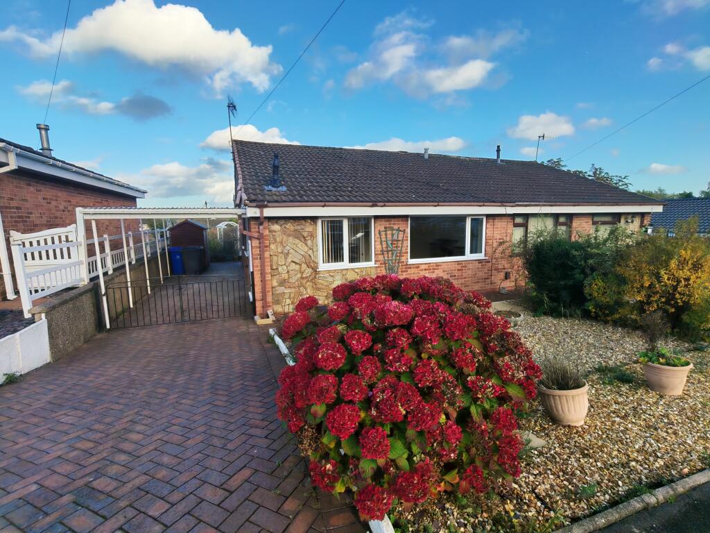
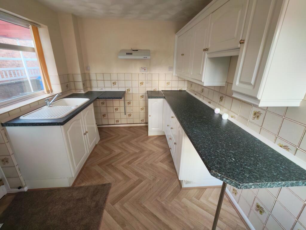
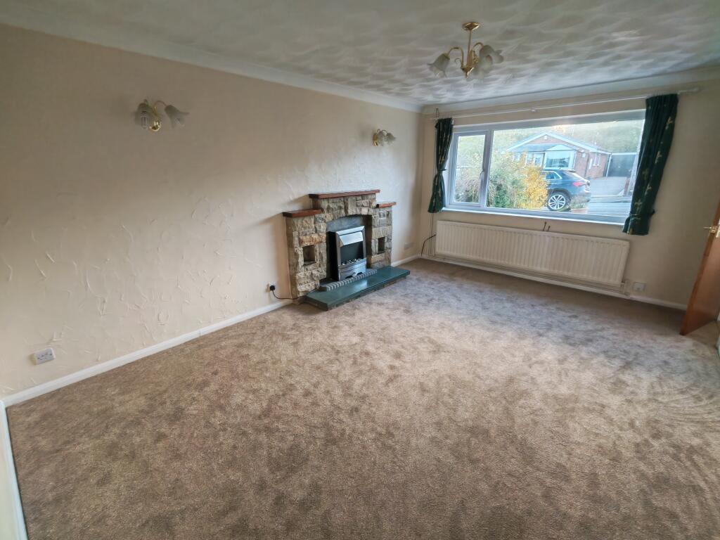
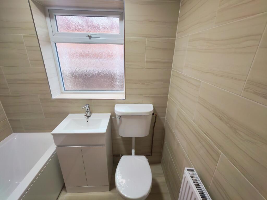
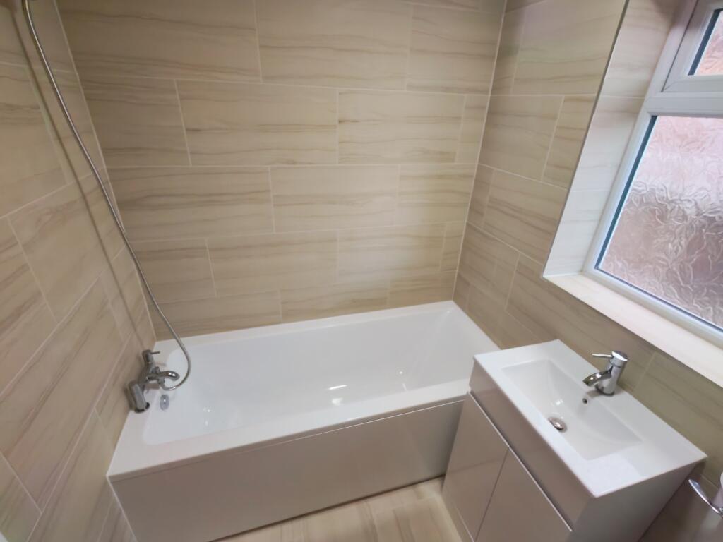
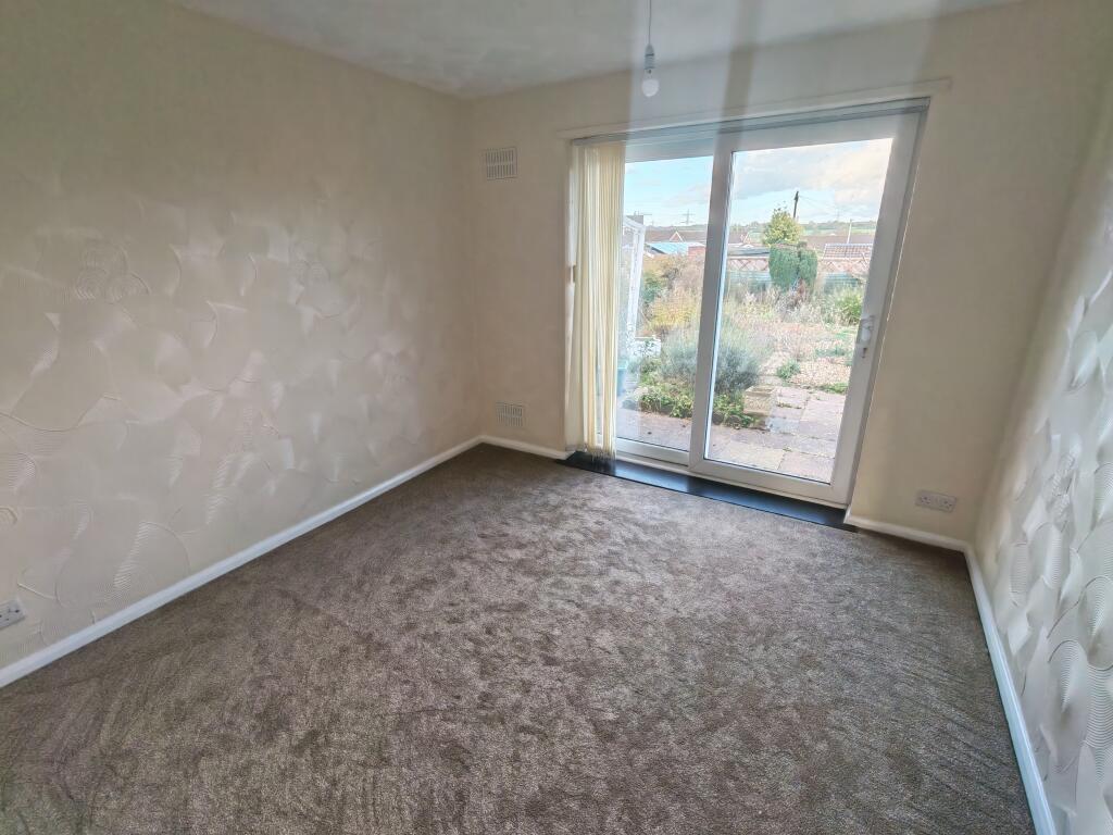
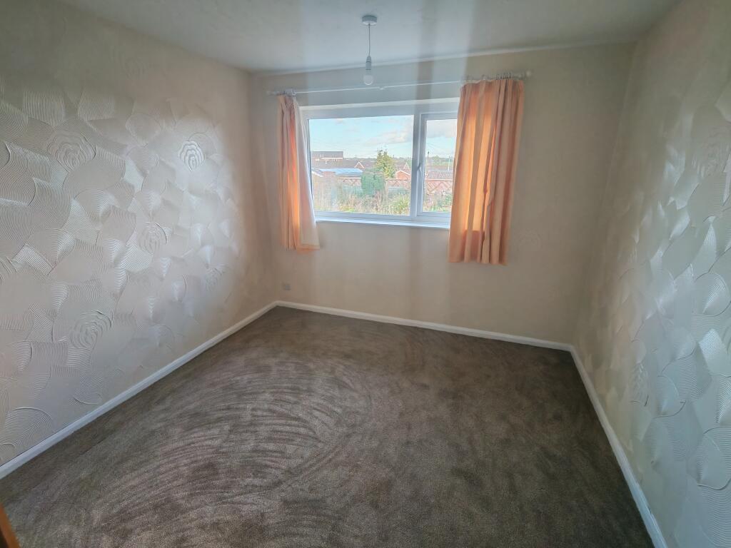
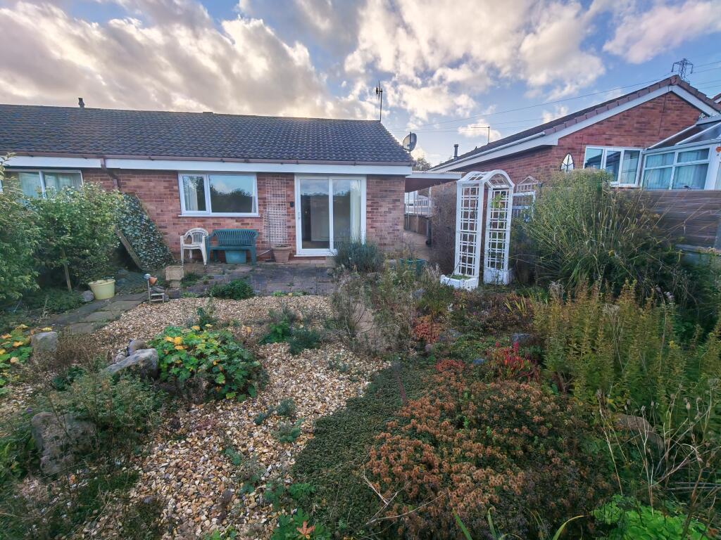
Photo 1 Photo 2 Photo 3 Photo 4 Photo 5 Photo 6 Photo 7 Photo 8
/ 8
Property details
Deprivation
Decile 2 (4,566 of 33,755)
Street crime
140 incidents within 1 mile (Aug 2026)
Key features
- Semi detached bungalow
- Two bedrooms
- Newly fitted bathroom
- Fitted kitchen with cooker
- Spacious living room
- Gas central heating
- Mature front & rear gardens
- Driveway and carport
- Available now
- Council tax B
Additional details
- Parking
- Yes
- Garden
- Yes
Description
Bridgfords lettings are pleased to offer this newly refurbished semi detached bungalow to let unfurnished, situated in a quiet cul de sac location in a popular residential area and offering excellent road access into Stoke on Trent city centre and the M6 Motorway network.
The property has been newly repainted and carpeted and benefits from a newly fitted bathroom.
The accommdation benefits from gas central heating and comprises; Fitted kitchen with range of base and wall units with cooker and space for appliances; Spacious living room with feature fireplace; Main double bedroom plus a further double room with sliding door to the rear garden; Refitted bathroom with shower over the bath.
Outside there is driveway parking for two cars leading to a carport; mature front and rear gardens.
Viewing Essential
Available Now Council Tax Band: Holding Deposit: £219.00
Listed by
Stafford
Countrywide UK Lettings - Connells
Reference: 94843902
EPC ratings on this postcode
We don't have a matched EPC for this property yet. Below are efficiency scores and details for other addresses on this postcode.
| Address | Current | Potential | Floor area | Age band | Type |
|---|---|---|---|---|---|
| 1, Westmorland Close, STOKE-ON-TRENT | 56 | 84 | 58 m² | England and Wales: 1967-1975 | Detached |
| 11, Westmorland Close, STOKE-ON-TRENT | 69 | 86 | 66 m² | England and Wales: 1967-1975 | Detached |
| 12, Westmorland Close, STOKE-ON-TRENT | 95 | 101 | 52 m² | England and Wales: 1967-1975 | Detached |
| 13 Westmorland Close, STOKE-ON-TRENT | 69 | 88 | 54 m² | England and Wales: 1976-1982 | Detached |
| 14, Westmorland Close, STOKE-ON-TRENT | 69 | 87 | 54 m² | England and Wales: 1976-1982 | Detached |
| 15 Westmorland Close, STOKE-ON-TRENT | 67 | 77 | 53 m² | England and Wales: 1976-1982 | Detached |
| 16 Westmorland Close, STOKE-ON-TRENT | 63 | 72 | 54 m² | England and Wales: 1976-1982 | Detached |
| 19, Westmorland Close, STOKE-ON-TRENT | 61 | 88 | 54 m² | England and Wales: 1967-1975 | Detached |
| 26 WESTMORLAND CLOSE, FEGG HAYES, STOKE-ON-TRENT | 66 | 83 | 71 m² | England and Wales: 1967-1975 | Detached |
| 3, Westmorland Close, STOKE-ON-TRENT | 60 | 72 | 78 m² | England and Wales: 1976-1982 | Detached |
| 32, Westmorland Close, STOKE-ON-TRENT | 90 | 100 | 54 m² | England and Wales: 1967-1975 | Detached |
| 36 Westmorland Close, STOKE-ON-TRENT | 70 | 79 | 64 m² | England and Wales: 1976-1982 | Detached |
| 36, Westmorland Close, STOKE-ON-TRENT | 63 | 85 | 53 m² | England and Wales: 1967-1975 | Detached |
| 7, Westmorland Close, STOKE-ON-TRENT | 61 | 83 | 75 m² | England and Wales: 1950-1966 | Detached |
| 7, Westmorland Close, STOKE-ON-TRENT | 54 | 69 | 76 m² | England and Wales: 1967-1975 | Detached |
Flood risk
Zone: 1
Risk: Low
Job (default Low)
Registered land (INSPIRE)
This location falls inside an HM Land Registry INSPIRE registered freehold polygon.
Plot: ~350 m² (0.09 acres)
Source: HM Land Registry INSPIRE Index Polygons.
Rental Range
Estimated market rent for Stoke-on-Trent. Low = conservative, Realistic = average, Optimistic = best case.
Based on Local Authority from postcode lookup → Stoke-on-Trent.
LHA (30th percentile) floor for Staffordshire North: £479/mo (Apr 2025 – Mar 2026)
Location
Address
Packmoor, Stoke-on-Trent, England, ST6 6UR, United Kingdom
Nearby
Nearest stations, universities and amenities (distance from property).
| Type | Name | Distance |
|---|---|---|
| Bus stop | Biddulph Road | 0.3 miles |
| Shop | Premier | 0.4 miles |
| Shop | Rococco Hair Studio | 1.2 miles |
| Hospital | Haywood Hospital Walk-in Centre | 1.6 miles |
| Train station | Kidsgrove | 2.2 miles |
| Train station | Longport | 2.8 miles |
| Hospital | Royal Stoke University Hospital | 5.4 miles |
| University | Keele University | 6.3 miles |
| University | Buxton & Leek College | 7.3 miles |
Street-level crime
| Category | Count |
|---|---|
| Anti-social behaviour | 47 |
| Violence and sexual offences | 46 |
| Vehicle crime | 8 |
| Criminal damage and arson | 7 |
| Public order | 7 |
| Drugs | 6 |
| Other theft | 6 |
| Shoplifting | 5 |
| Bicycle theft | 3 |
| Burglary | 3 |
| Other crime | 1 |
| Possession of weapons | 1 |
| Total incidents | 140 |
Within 1 mile during Aug 2026. Source: data.police.uk (England & Wales).
Schools nearby
Nearest open schools with Ofsted ratings (England). Closed schools are not shown. Data from Get Information about Schools and Ofsted.
| Name | Type | Distance | Ofsted |
|---|---|---|---|
| Whitfield Valley Primary Academy | Primary | 0.4 miles | Outstanding — 26 Sep 2024 |
| Packmoor Ormiston Academy | Primary | 0.5 miles | Good — 5 Feb 2015 |
| Ormiston Horizon Academy | Secondary | 0.5 miles | Good — 18 Jan 2024 |
| Watermill School | Other | 0.6 miles | Good — 30 May 2013 |
| St Margaret Ward Catholic Academy | Secondary | 0.8 miles | Good — 4 Mar 2013 |
Rental Comparables
Residential lets from OpenRent and Rightmove for the area (same bedroom count). Use to validate rent estimates. Student lets are excluded.
| Title | Rent | Beds | Distance | As seen on |
|---|---|---|---|---|
| Westmorland Close, Stoke on Trent. ST6 6UR | £950/mo | 2 | 0 miles | Rightmove |
| 2 Bed Terraced House, Thomas Street, ST7 | £895/mo | 2 | 0.55 miles | OpenRent |
| West Terrace, STOKE-ON-TRENT | £820/mo | 2 | 0.57 miles | Rightmove |
| Colley Road, Stoke-On-Trent | £825/mo | 2 | 0.71 miles | Rightmove |
| Chell Heath, Stoke-on-Trent, Staffordshire, ST6 | £1,000/mo | 2 | 0.85 miles | Rightmove |
| Wignall Road, Sandyford, Stoke-On-Trent | £795/mo | 2 | 1.05 miles | Rightmove |
| Wignall Road, Sandyford, ST6 | £800/mo | 2 | 1.06 miles | Rightmove |
| Williamson Avenue, Ball Green, Stoke-on-Trent, Staffordshire, ST6 | £825/mo | 2 | 1.26 miles | Rightmove |
| Furlong Road, Stoke-on-Trent, Staffordshire, ST6 | £700/mo | 2 | 1.38 miles | Rightmove |
| Bond Street, Tunstall, ST6 | £750/mo | 2 | 1.42 miles | Rightmove |
| Bond Street, Stoke-on-trent | £750/mo | 2 | 1.43 miles | Rightmove |
| Salisbury Street,Tunstall, Stoke-on-Trent | £775/mo | 2 | 1.45 miles | Rightmove |
| Machin Street, ST6 | £825/mo | 2 | 1.47 miles | Rightmove |
| The Boulevard, Stoke-on-Trent, ST6 | £595/mo | — | 1.54 miles | Rightmove |
| High Street, Stoke-on-trent | £625/mo | 2 | 1.6 miles | Rightmove |
| Endon Road, Stoke-On-Trent, ST6 | £750/mo | 2 | 1.83 miles | Rightmove |
| Leigh Street, STOKE-ON-TRENT | £800/mo | 2 | 1.91 miles | Rightmove |
| Hamil Road, Burslem | £795/mo | 2 | 1.91 miles | Rightmove |
| Hamil Road, Stoke-On-Trent, ST6 | £775/mo | 2 | 1.93 miles | Rightmove |
| Stanfield Road, ST6 | £675/mo | 2 | 1.95 miles | Rightmove |
Average rent: £763/mo (43 listings)
Enter House Number
Enter the house number to help us retrieve more accurate pricing history and property data.
Please log in to submit or correct the house number for this listing.
Log in to continue