FLAT 5F
6 CADOGAN GARDENS, LONDON, LONDON, GREATER LONDON SW3 2RS
£4,225 pcm

Property details
Council tax band
F
Deprivation
Decile 8 (25,158 of 33,755)
Street crime
1122 incidents within 1 mile (Apr 2026)
Key features
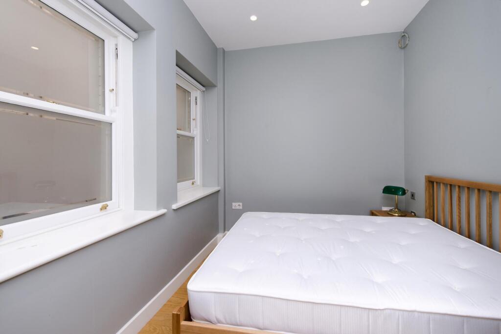
- One bedroom
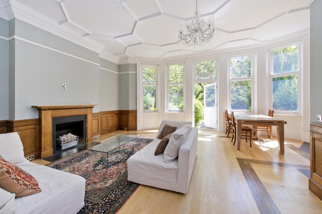
- Large reception
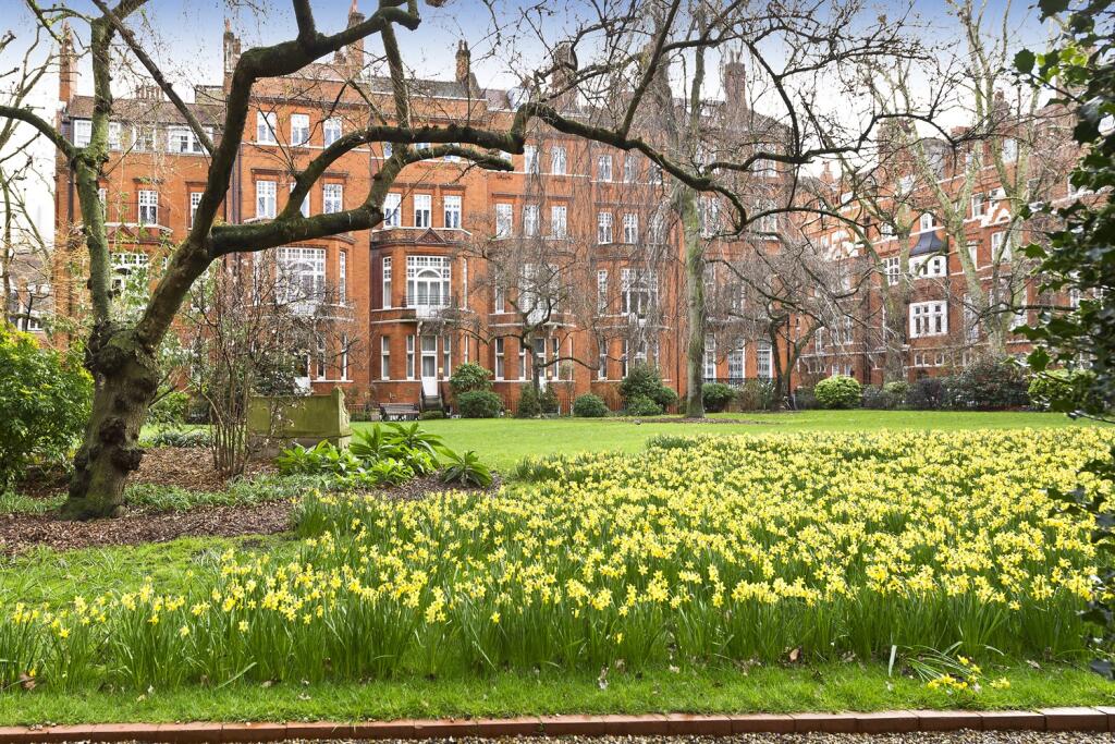
- Direct access to the communal gardens
- Walk-in wardrobe
- Porter
- Fantastic location
Additional details
- Parking
- Permit
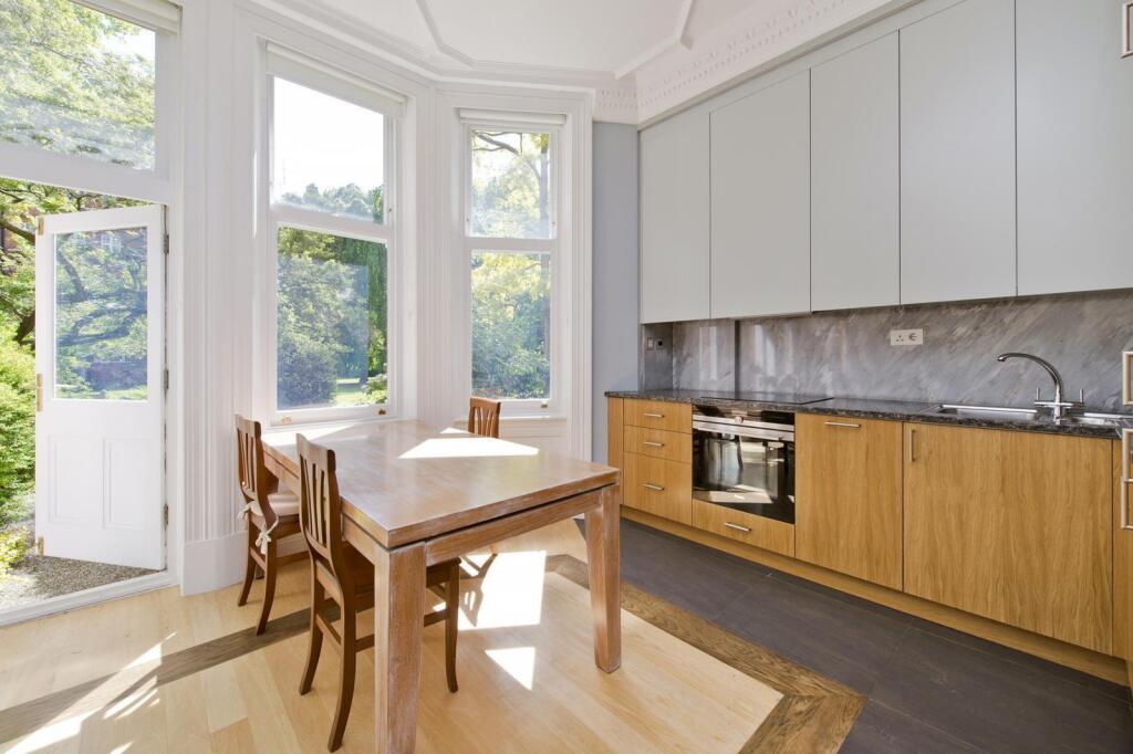
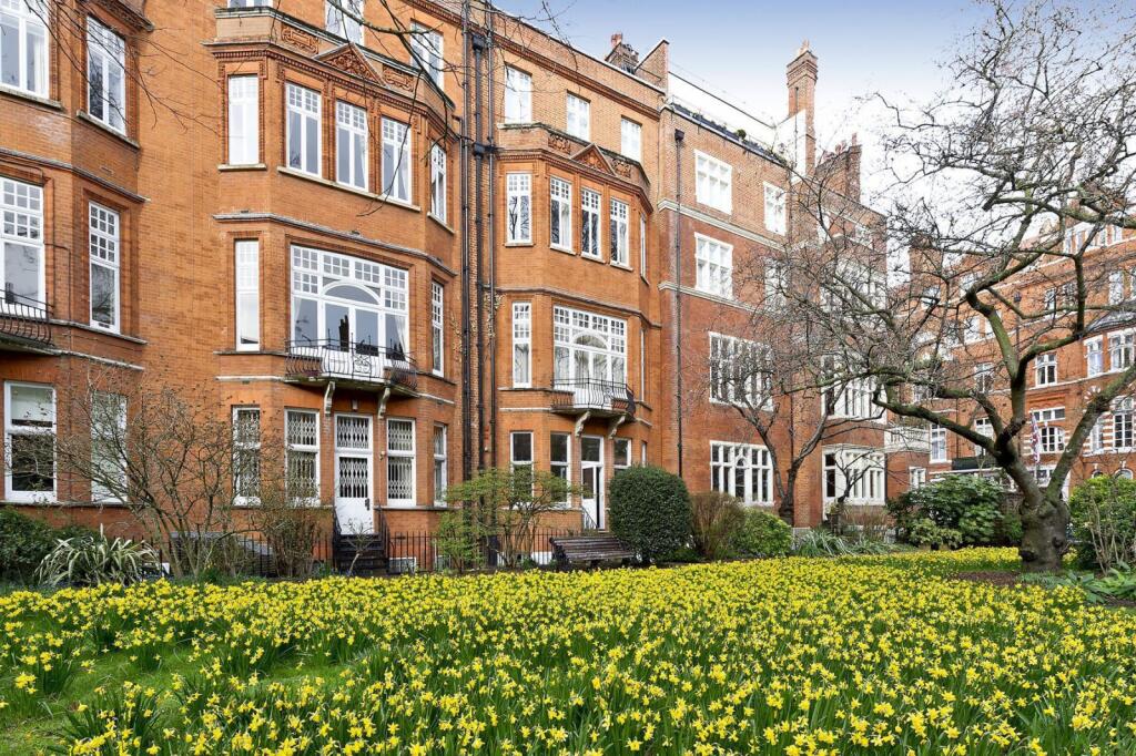
Description
Cadogan Gardens is minutes away from Sloane Square and Knightsbridge with it's array of restaurants, designer shops and tube lines to the West End.
Listed by
Kensington
Mountgrange Heritage
Reference: 167726780
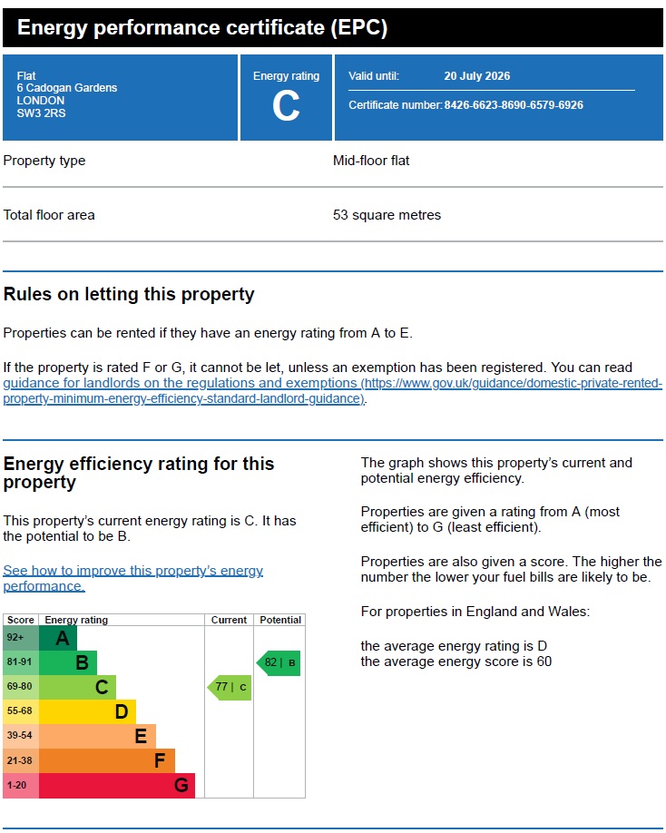
EPC Rating & Upgrade Cost
Fetching EPC data… Refresh this page in a moment.
Flood risk
Zone: 1
Risk: Low
Job (default Low)
Floorplans
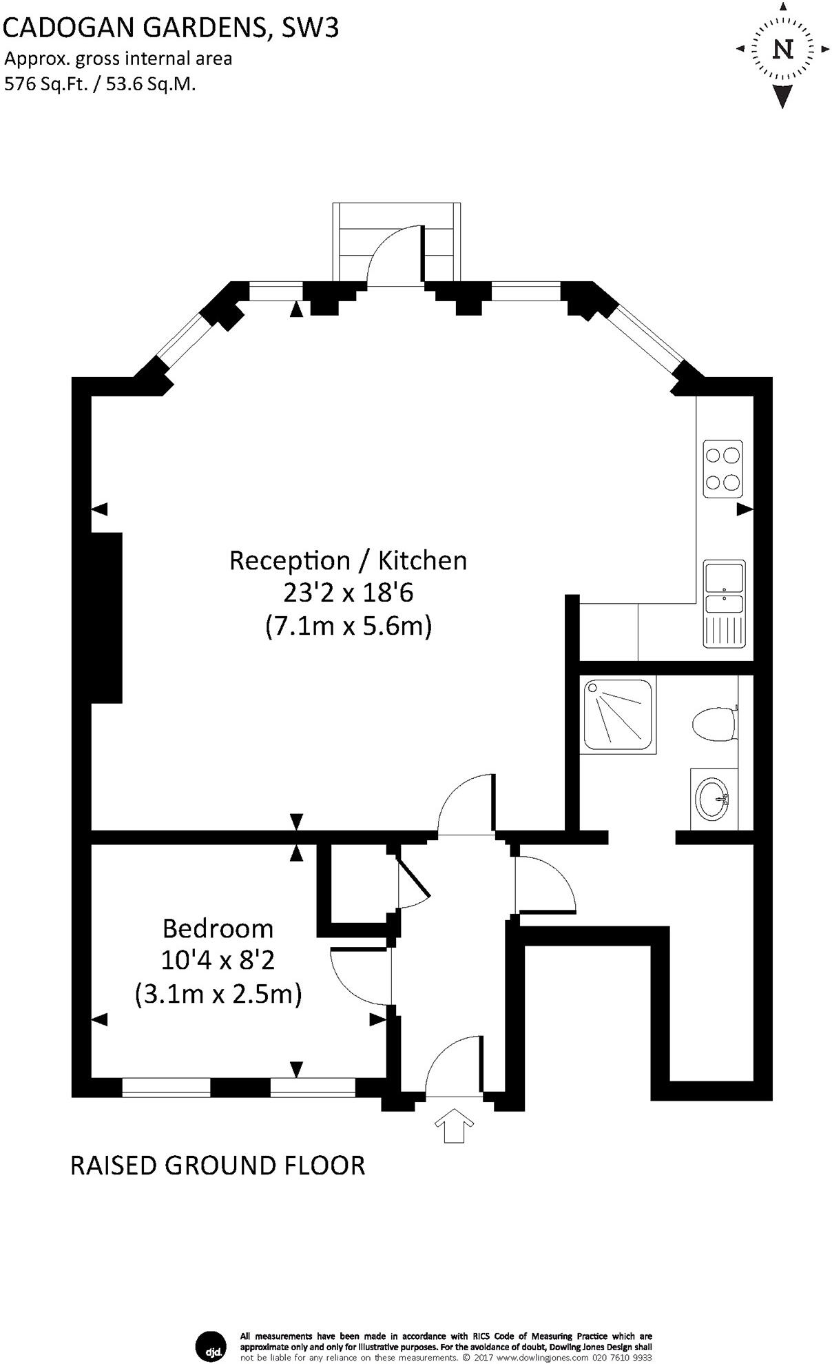
Floorplan
EPC Graphs
Other

EPC Graph
Company ownership
Registered legal owner is a company.
Rental Range
Estimated market rent for Kensington and Chelsea. Low = conservative, Realistic = average, Optimistic = best case.
Based on Local Authority from postcode lookup → Kensington and Chelsea.
LHA (30th percentile) floor for Huntingdon: £648/mo (Apr 2025 – Mar 2026)
Location
Nearby
Nearest stations, universities and amenities (distance from property).
| Type | Name | Distance |
|---|---|---|
| Shop | Hicks of Chelsea | 0.0 miles |
| Shop | Pavilion Barbers | 0.0 miles |
| Bus stop | Sloane Square Station / Symon Street | 0.1 miles |
| Bus stop | Sloane Street / Sloane Square Station | 0.1 miles |
| Train station | Sloane Square | 0.2 miles |
| Train station | Knightsbridge | 0.6 miles |
| University | National Heart and Lung Institute | 0.7 miles |
| Hospital | Bridge Lane Health Centre | 1.4 miles |
| University | University of Notre Dame | 1.6 miles |
| Hospital | Tunica Diagnostics | 1.9 miles |
Street-level crime
| Category | Count |
|---|---|
| Anti-social behaviour | 232 |
| Other theft | 176 |
| Violence and sexual offences | 170 |
| Theft from the person | 135 |
| Shoplifting | 117 |
| Vehicle crime | 85 |
| Public order | 51 |
| Criminal damage and arson | 39 |
| Burglary | 36 |
| Drugs | 26 |
| Robbery | 23 |
| Bicycle theft | 15 |
| Other crime | 12 |
| Possession of weapons | 5 |
| Total incidents | 1122 |
Within 1 mile during Apr 2026. Source: data.police.uk (England & Wales).
Schools nearby
Nearest open schools with Ofsted ratings (England). Closed schools are not shown. Data from Get Information about Schools and Ofsted.
| Name | Type | Distance | Ofsted |
|---|---|---|---|
| Sussex House School | Other | 0.1 miles | — (No rating) |
| St Joseph's Catholic Primary School | Primary | 0.1 miles | Outstanding — 12 Jun 2024 |
| St. Thomas More Language College | Secondary | 0.1 miles | Good — 21 Sep 2022 |
| Holy Trinity CofE Primary School | Primary | 0.1 miles | Good — 13 Dec 2012 |
| Eaton House School | Other | 0.2 miles | — (No rating) |
Rental Comparables
Residential lets from OpenRent and Rightmove for the area (same bedroom count). Use to validate rent estimates. Student lets are excluded.
| Title | Rent | Beds | Distance | As seen on |
|---|---|---|---|---|
| 1 Bed Flat, Sloane Avenue, SW3 | £2,817/mo | 1 | 0.34 miles | OpenRent |
Average rent: £2,817/mo (1 listing)